PIREP Submit
Pirep entry results, where to find things, current weather, flexible options, current conditions, graphical forecasts for aviation, decision support imagery, station data, where is....


Giving you a clear mind, even if it's not clear skies.
Created by pilots, for passengers.
FEAR OF FLYING? LEARN MORE

WELCOME TO MYFLIGHT FORECAST™
MyFlight Forecast™ gives you, the passenger, and access to Flying Weather Forecast data that pilots will review prior to every flight. While a pilot will review much more data, data that they've spent years learning to interpret, this site breaks down the most relevant data for the passenger to determine flight conditions, potential flight and airport delays, and most importantly, flight turbulence forecast.

Reference Weather Radar to determine the location of precipitation (Snow, Rain) and where it is located relative to your flight path. Pilot Tip - Just because you see areas of precipitation, does not mean that you will necesarily be flying through it! You might be miles above it!

Reference the Satellite page to locate clouds, or areas of decreased visibility. While clouds can generally increase the likelihood of turbulence while flying through them, keep in mind, clouds are just moisture, or water. Water is generally not that scary. Not all clouds that appear on the satellite imagery can guarantee areas of turbulence, it greatly depends on the stability of the atmosphere.

Get your Flying Weather Forecast before and during your flight - receive real time turbulence reports and discover where turbulence has been reported by aircraft currently in-flight

Type in the three letter identifier (ex. JFK, LAX, ORD) of the airports that you are travelling to and from, and get real time information on any potential airport delays due to; Wind, Visibility, Weather or delays due to volume.
Check Airport Status and Flight Delays


New!
Turbulence forecast for your flight
DEPARTURE AIRPORT
ARRIVAL AIRPORT
DEPARTURE DAY
(max 36h ahead, WHY? )
13 km resolution turbulence forecast
Chances of delays, based on wind strength.
Advertising
INTERACTIVE MAPS

Interactive turbulence map
Live flight tracker
Historical data.
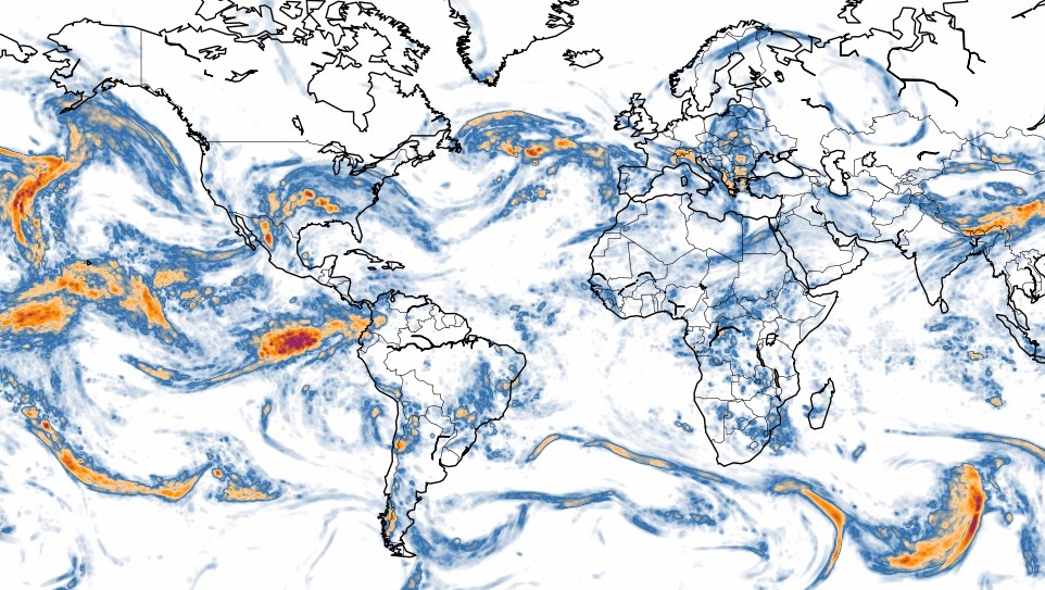
World turbulence map
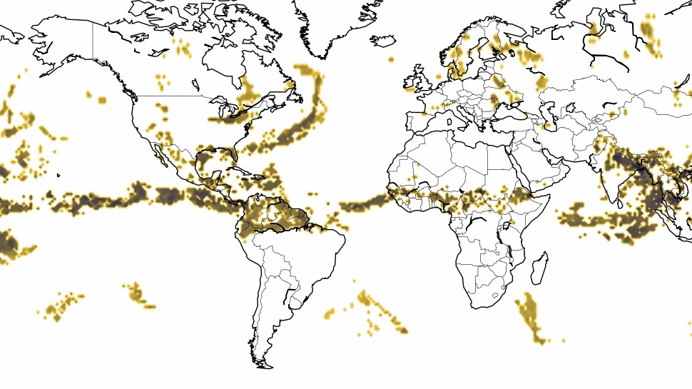
World thunderstorm map
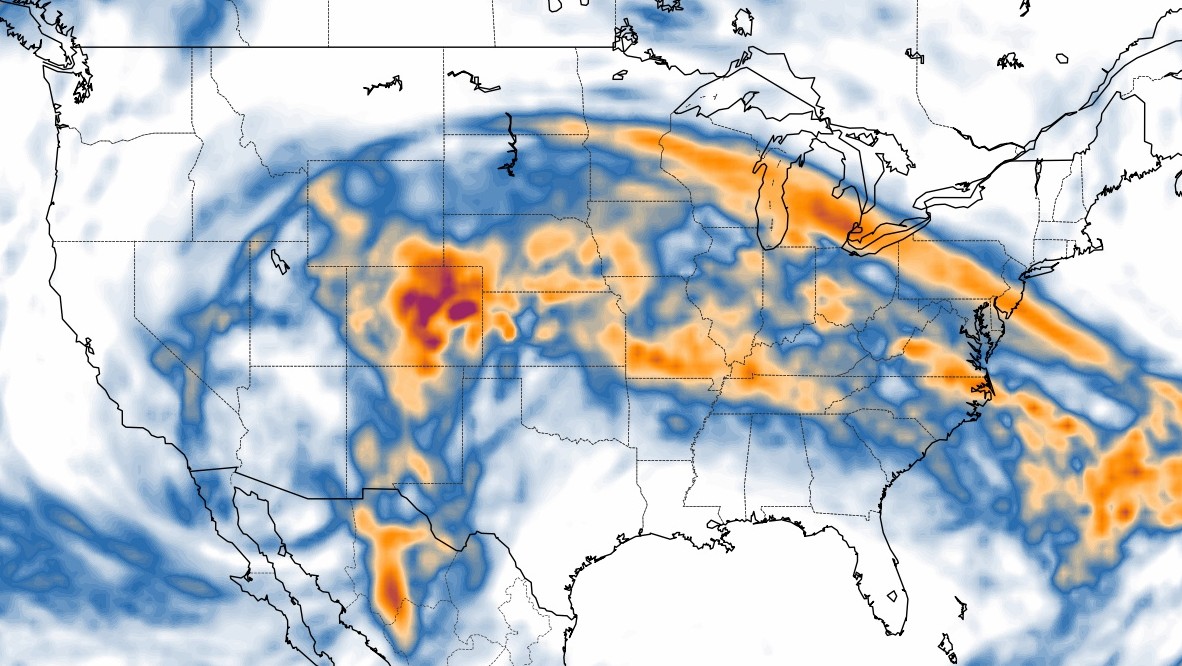
US turbulence map
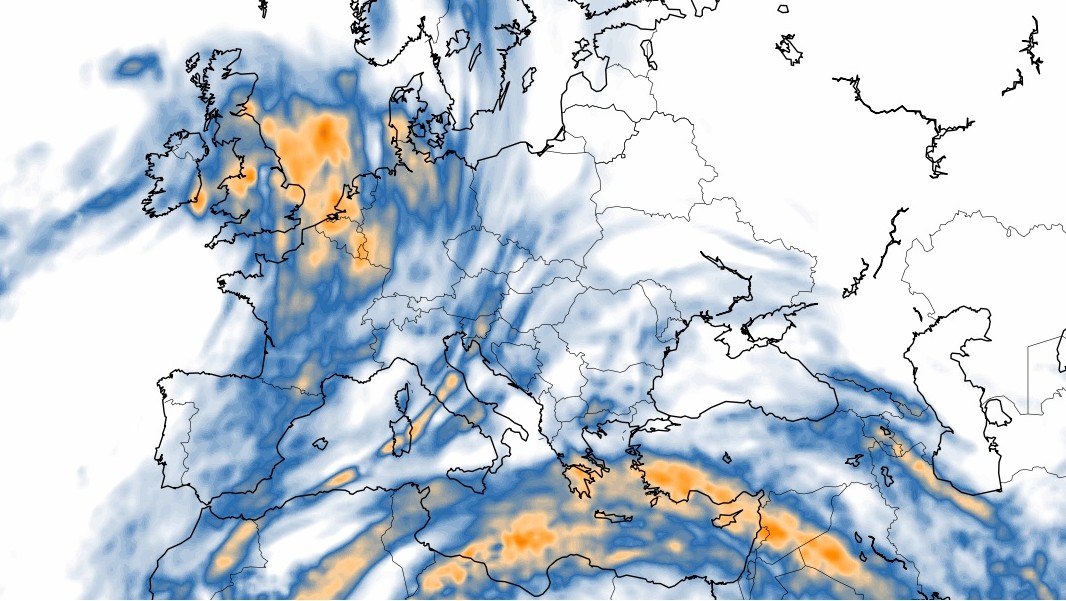
Europe turbulence map
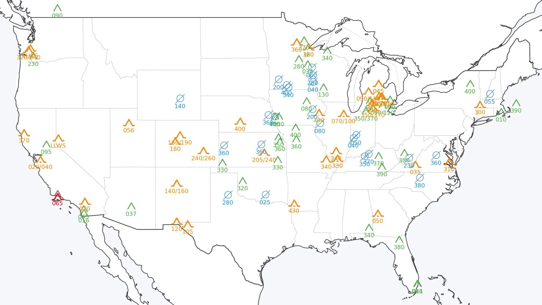
US Pilot Reports (PIREPs)

How to Cure Your Fear of Flying

The Most Important Aircraft Systems: Normal Operation and Failures

Why Carbon Passports Are a Very Bad Idea

Are Night Flights Less Turbulent? 25 Million Measurements Give the Answer

Low-Level Turbulence: Inversion Layers, Thermals and Microbursts

This site uses cookies
We use first and third-party cookies to gather statistical data on the website usage, users demographics, interests and for retargeting people with similar profiles. For more information, please access our privacy policy .
Cookie preferences
Necessary cookies
These cookies are needed for the proper and secure functioning of the site, such as remembering your privacy settings or storing security tokens.
Performance cookies
We use Google Analytics to gather anonymous statistical data on the website usage. This helps us improve the website by adapting it to our user's needs.
Targeting cookies *
We use Google Analytics Advertising Features to gather statistical data on our users demographics and interests and to send personalized advertising to people with similar profiles. This feature uses third-party cookies. * Requires performance cookies to function correctly
- Log in / Sign up
And start your weather experience
- Log in with Facebook
- Log in with Twitter
- Log in with Google+

Airport Conditions
Enter your airport
Source: Terminal Aerodrome Forecasts (TAFs)
Source: U.S. National Blend of Models, Short-Range (NBS)
Desktop Dashboard v.2024.01.21
Technology has made airplanes and navigation supremely reliable and pilots are better trained than ever. But the weather (and weather forecasts) still change rapidly, and surprises still happen. And the hard fact is that by the time the airlines tell you about major weather problems they have told hundreds or thousands of other customers, too, and everyone will be trying to reschedule together. Don't get stuck in that herd. Stay ahead of the game and keep informed on the latest airport weather risks.
How we rate the airport weather risk:
We use the "stoplight" approach to rate the weather risk - it is concise and intuitive and has proven
effective in the operations of leading forecasting centers worldwide. Our "stoplight" rating of the weather risks for any given airport is as follows:

Request a Forecast
Simple. detailed. accurate..
- Worldwide support for any airline.
- Storms and Turbulence up to 42 hours in the future.
- Updated with your actual flight path prior to departure.
- Graphical route depiction and printable PDF summary - View Sample
- Get a forecast delivered to your email in less than 5 minutes for less than $5.
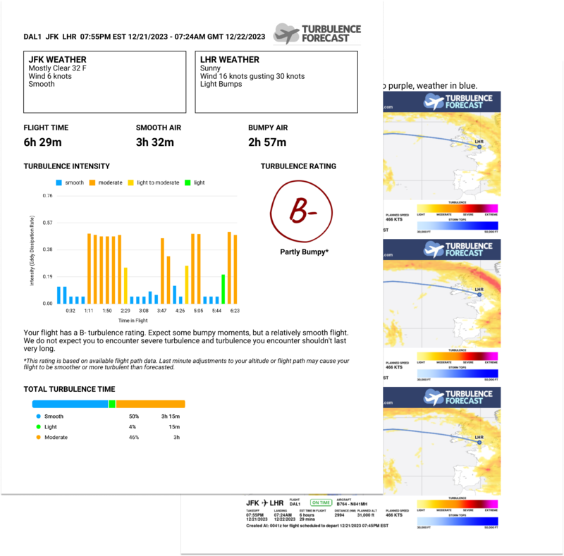
Ask the experts
Our experienced forecasters have been helping passengers understand turbulence and weather relating to their journeys since 2005. Have us sort through your flight route, relevant storms, turbulence, pressure systems and jet stream charts in order to deliver a concise description of what to expect on your flight. Starting at $59.99, satisfaction guaranteed.
- Any flight, public or private.
- Personalized to your specific needs.
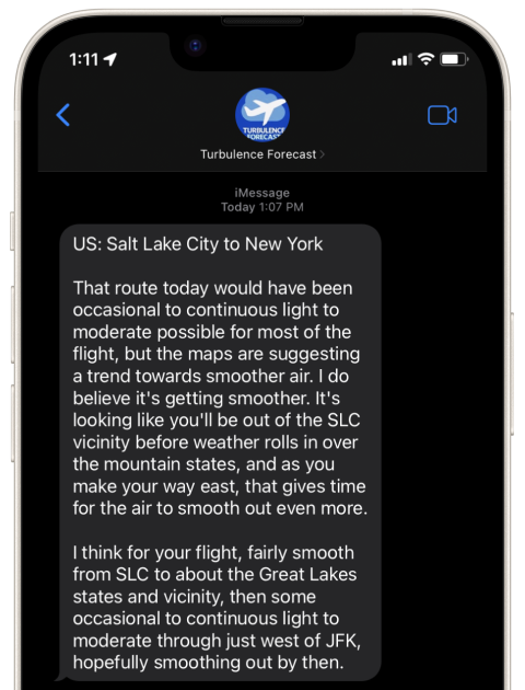
- Easy to understand forecast in plain english.
Want the best Turbulence Forecast has to offer?
- Unlimited automated forecasts
- Deep discounts on personalized forecasts
- Full World Map access up to 42 hours in the future for all cruise altitudes 24,000 - 39,000ft

Get your Turbulence Forecast
Find your flight.

Why Get A Forecast?

Knowledge is power
We’ll tell you when turbulence will happen, how bad it will be, and how long it will last

Turbulence will happen
Turbulence happens in every flight, so why not be prepared for it?

Peace of mind
Get an accurate minute by minute forecast so you can anticipate it and buckle up

World Turbulence Map
A live view of turbulence around the world right now
How Courage Works

Real time global turbulence forecast

AI Predicted Flight Path
Real Time Weather Forecast
A minute by minute accurate turbulence forecast
Our Latest Posts

Flying Solo: Exploring the World of Solo Pilots and Adventurers
Flying Solo: Exploring the World of Solo Pilots and Adventurers In the world of aviation, there exists a unique

Above and Beyond: A Guide to Emergency Preparedness for Flight Crews
Above and Beyond: A Guide to Emergency Preparedness for Flight Crews How do the airplane crew prepare for an

Story of Modern Heroes: Extraordinary Stories of Pilots’ Bravery
Story of Modern Heroes: Extraordinary Stories of Pilots’ Bravery In the world of aviation, pilots are often hailed as

Behind the Cockpit: Insights from Commercial Pilots
Behind the Cockpit: Insights from Commercial Pilots Being a Commercial Pilot has been a childhood dream to many. Flying

How Technology is Redefining Flight Safety: What Air Travel will look like in the future
How Technology is Redefining Flight Safety: What Air Travel will look like in the future Introduction: It is important

Exploring the Most Convenient Air Travel Destinations in the United States
Exploring the Most Convenient Air Travel Destinations in the United States In a country as vast and diverse as
- ForeFlight Mobile EFB
- ForeFlight on the web
- ForeFlight Dispatch
- Runway Analysis - Business
- Runway Analysis - Individuals
- Jeppesen Charts
- Military Flight Bag
- Sentry ADS-B
- Synthetic Vision
- ForeFlight Directory
- Flight Data Analysis
- Plans and Pricing
- ForeFlight Gift Certificates
- Personal Aviation
- Business Aviation
- Education & Flight Training
- Support Center
- Video Library
- Europe Webinars
- Canada Webinars
- International Support Lookup
- General Aviation Blog
- Business Aviation Blog
- About ForeFlight
- ForeFlight Careers
FOREFLIGHT MOBILE
ForeFlight Mobile features a full range of aviation weather products for comprehensive preflight planning. Access METARs and TAFs for airports, a rich library of static weather imagery, and an extensive collection of map weather overlays from radar to global icing and turbulence forecasts.

Dynamic Winds and Temperatures
View global forecast wind speed, direction, and temperatures at multiple altitudes and times using these stunning animated weather layers. Both the “Winds (Temps)” and “Winds (Speeds)” layers use colorful heat maps covering the globe to represent their primary forecast values at the selected altitude and time. Overlaid on each layer’s heat map are smoothly-flowing particle animations representing wind direction and speed, providing an intuitive view of large-scale weather patterns in relation to the layer’s primary forecast value (wind speed or temperature). Use the Time Slider to view wind forecasts in a 24+ hour period, and move the Altitude Slider to view winds from the surface up to 63,000 ft.
Both layers are included with ForeFlight Performance subscription plans.
GET PERFORMANCE PLUS
Watch the video
Weather in 3D Preview
Enable U.S. or Global Icing and Turbulence layers using the new layer selector in 3D Preview to display forecast weather along your route. 3D View depicts forecast weather as floating colored blocks that use the same color scale to represent forecast severity as the overhead map and Profile View. Use the altitude slider on the right to view weather at different altitudes, and tap the RTE button at the top of the altitude slider to only show weather at the same altitude as your route.
Weather in 3D Preview is included in ForeFlight’s Performance Plus plans.
Weather in Profile View
Enhance your route planning with a cross-sectional view of internet icing and turbulence forecasts displayed in Profile View. Profile View uses the same color scales as the overhead map to depict varying intensities for each layer at multiple altitudes in relation to your route line. ForeFlight uses your planned departure and enroute times to display weather over multiple forecast periods during which your flight will be active, providing a more accurate picture of changing conditions throughout your flight. Weather in Profile View is included in ForeFlight’s Performance plans.
Get Performance Plus
Watch the Video
Global Turbulence, Icing, & Surface Analysis Weather Layers
ForeFlight's industry-leading weather visualization capabilities are now better than ever. Five dynamic Map layers graphically depict global icing, turbulence, and surface analysis forecasts, giving you the tools you need for more informed flight planning. You can view these layers on both mobile and on the web. Check out this article for a deeper dive into these weather features.
Available in Pro Plus and Performance Plus individual plans, as well as Business Performance and MFB Performance plans.
Get Pro Plus
Daily/Hourly Forecast
Stay on top of the weather today or next week with an all-purpose hourly forecast anywhere in the world. Access the globally-supported forecast for any airport in Airports > Weather > Daily, or any other airport popup such as on the Maps or Flights views, or by tap-holding anywhere on the map and tapping “Wx” in the top-right corner of the Add to Route window to see the forecast for that location.

FLIGHT CATEGORIES
Color coded flight categories based on current weather conditions across the world.

Global animated high resolution infrared satellite imagery.

NEXRAD RADAR
Animated, high resolution NEXRAD composite radar, complete with lightning strike, rotation detection, and storm tracks.
Graphical AIR/SIGMETs & Center Weather Advisories
ForeFlight plots out and color codes global SIGMETs, U.S. AIRMETs, and Center Weather Advisories directly on the map. Toggle on/off each type of advisory when you need to declutter. Get the full textual report by tapping on AIR/SIGMET or CWA.

DEWPOINT SPREAD
Quickly see global dewpoint spread information, color coded based on the likelihood of adverse conditions.

TEMPERATURE
Color coded temperatures, plotted right on the map, based on current conditions.

Color coded visibility values, plotted right on the map, derived from latest station reports.
Global Winds Aloft
With ForeFlight’s Global Winds Engine, view winds aloft forecasts for any point on the planet up to 54,000 ft.
Learn More About Winds Aloft

SKY COVERAGE
Global sky coverage information, plotted directly on the map where the report was recorded.

CLOUD CEILINGS
Global cloud ceiling info is plotted directly on the map and color coded based on flight rule (VFR, Marginal VFR, IFR, Low IFR).


SURFACE WINDS
Global surface wind reports are viewable on the map view.

Model Output Statistics
MOS is an automated weather product that generates forecasts for over 2000 U.S. airports, including many that do not receive official TAFs. Using advanced weather prediction models, MOS forecasts surface wind, visibility, clouds, weather conditions, temperature, and dewpoint, with forecast periods up to 3 days in advance.
Learn More About MOS
In-Flight Weather
With portable receivers and avionics connectivity solutions, receive in-flight NEXRAD, METARs, TAFs, PIREPs, TFRs and more via FAA NexGen ADS-B network or SiriusXM satellite weather service.
Learn More About Connectivity

PILOT REPORTS
Forget text reports. PIREPs are pulled in from Lockheed Martin Flight Service and plotted directly on the map where the report was made, with appropriate iconography based on type. Tapping on a PIREP displays the full report.
Choose from hundreds of different weather charts from NOAA (US), NAV CANADA (Canada), and others. Quickly nagivate weather by geographic region and type. Add favorites, browse recents, email images, or save them directly to your device

Brief Before You File
A comprehensive preflight briefing is a tap away when planning on the Flights view. With current and forecast conditions, NOTAMs, and advanced weather graphics, everything you need is delivered and synced between all the devices on your account and the web. After you file your flight plan, a copy of your briefing is sent to your email.
Learn More About Filing Flight Plans Learn More About ForeFlight Briefing

Login to Your Account

- Flight Tracker
- Travel Tools
- Visa & Travel Restrictions
- Business Solutions
We provide a comprehensive range of airport information and services. Where available, you can view arrival and departure boards, airport delay information and delay maps, current weather at location, 7 day forecast for upcoming trips and even have options to pre-book your parking and taxi/limo services.
Closed Airports
- La Guardia Airport, New York, NY ( LGA )
- Santa Barbara Muni Airport, Santa Barbara, CA ( SBA )
- General Edward Lawrence Logan International Airport, Boston, MA ( BOS )
- Las Vegas McCarran International Airport, Las Vegas, NV ( LAS )
General Departure/Arrival Delays
- Dallas/Ft Worth International Airport, Dallas-Ft Worth, TX ( DFW )
- Chicago OHare International Airport, Chicago, IL ( ORD )
This information was last updated:May 9, 2024 5:05 AM GMT+0000
- Born in Chicago
- Boston Bound
- California Dreamin'
- Caribbean Cool
- London Calling
- New York State of Mind
- Permanent Vacation
- Vegas Baby!

- Skip to main content
- Keyboard shortcuts for audio player
A severe arctic storm could threaten holiday travel across the U.S.
Emily Olson
David Schaper
Ivy Winfrey

An airline passenger walks between ride share vehicles after arriving at Chicago's Midway Airport just days before a major winter storm Tuesday, Dec. 20, in Chicago. Charles Rex Arbogast/AP hide caption
An airline passenger walks between ride share vehicles after arriving at Chicago's Midway Airport just days before a major winter storm Tuesday, Dec. 20, in Chicago.
Millions of Americans may want to reconsider their holiday travel plans, as bitter cold, biting wind and heavy snow are expected across the U.S. this week, imposing treacherous conditions just days before Christmas.
A bulletin from the National Weather Service (NWS) says a "strong arctic high pressure system," was sweeping down from Canada on Tuesday and appears poised to march towards the Great Plains, the Midwest and onto the Southeast on Wednesday, Thursday and Friday, bringing life-threatening blizzard conditions and cold weather systems across 17 states.

The first day of winter arrives this week, marked by the solstice
Heavy snowfall and limited visibility caused Vancouver International Airport to temporarily shut down Tuesday, stranding scores of passengers. That could be a sign of things to come for holiday travelers in the U.S., as the frigid weather system moves across the country this week.

A man clears a driveway after a snow storm passed through northern Minnesota last week. Forecasters say another big storm is expected to hit the region this week. Holden Law/AP hide caption
A man clears a driveway after a snow storm passed through northern Minnesota last week. Forecasters say another big storm is expected to hit the region this week.
At least 250 flights into and out of the Seattle-Tacoma airport were cancelled Tuesday as heavy snow fell there, according to the tracking site Flight Aware. The Cascade Mountains in Washington state were seeing the heaviest snowfall on Tuesday, but nearby lowlands in Idaho, Montana and Wyoming could see a foot of snow, according to the NWS. The region could see another blast of snow and ice on Thursday.
The incoming arctic front will then cross over the northern Rockies, Great Basin and Northern Plains regions, sending temperatures plummeting as low as minus 30 degrees, with winds gusting at up to 60 mph.
Snow is likely to move into parts of Nebraska, Kansas, the Dakotas, Minnesota, Iowa and Wisconsin on Wednesday. By Thursday, blizzard conditions could hit the Upper Midwest and Great Lakes regions, including Chicago, potentially causing significant flight delays and cancellation at O'Hare International Airport, one of the nation's biggest airline hubs. The major travel hub cities of Denver, Salt Lake City and Minneapolis are expected to be impacted, too.
For the eastern U.S., heavy rain on Tuesday and Wednesday could result in snow or sleet in the Appalachian states on Thursday.

The National Weather Service temperature map for Tuesday. NWS hide caption
By Friday, temperatures could hit the season's lowest in what is only the first week of winter. Even northern Florida cities like Jacksonville and Tallahassee could see a chill as low as 20 F on Christmas Eve.
Most major airlines, including United, American, Delta, JetBlue and Southwest, are offering to waive change fees and fare differences for those wanting to change flights so they can travel before or after the storm, within small rebooking windows.
"That allows travelers who have tickets now and throughout the holiday week to take a look and reconsider," says Kathleen Bangs, spokesperson of the tracking site FlightAware.com. "Reconsider what day you want to go on, maybe reconsider the route if you have a connecting city, and reconsider possibly just changing that ticket to later on in the week or even banking that ticket for later use."
Her advice to all travelers this time of year:
" You really need to have a backup plan" Bangs says. "And that could mean anything from a secondary ticket on a different airline that leaves later in the day or perhaps the next morning. It means a reroute through another city where perhaps you get within a couple hundred miles of your destination and then you rent a car or you take a train."
Bangs says that in this weather there's a chance any flight could be canceled at any time, and it may be difficult to get a hold of a representative from an airline.
AAA says of the 113 million Americans traveling this holiday season, more than 90% of them will be driving. And with forecasts calling for blowing and drifting snow, as well as whiteout conditions in some parts, they should proceed with extreme caution, forecasters say.
"Low visibility will create even more dangerous travel conditions on top of snow covered roadways," the NWS says. "Additionally, the strong winds could lead to potential power outages from the Midwest to the Northeast."
"It is imperative that travelers check the latest forecast before venturing out."

Buffalo Bills fans braved chilly temperatures to sit in snow-covered seats during an NFL game in Orchard Park, N.Y., on Saturday. Adrian Kraus/AP hide caption
Buffalo Bills fans braved chilly temperatures to sit in snow-covered seats during an NFL game in Orchard Park, N.Y., on Saturday.
An outage that left 180,000 without power across New England over the weekend was resolved by Monday, but the Associated Press reported that attempts to bring extra utility workers into the state ahead of this week's storm were stymied by slick roads.

Heavy snow has left thousands without power in New England and New York
Police across New England also said they responded to hundreds of crashes and stranded vehicles, according to local media reports.
Frostbite is another risk for those trying to brave the cold, the NWS says. Subzero temperatures in some parts of the U.S. this week could lead to frostbite on exposed skin in as little as 10 minutes.
Those venturing outside should dress in layers, cover their skin and change into dry clothing as soon as possible. But, experts say, the best prevention by far is simply to stay indoors.
- winter weather
- holiday travel
- travel conditions
- Travel Planning Center
- Ticket Changes & Refunds
- Airline Partners
- Check-in & Security
- Delta Sky Club®
- Airport Maps & Locations
- Flight Deals
- Flight Schedules
- Destinations
- Onboard Experience
- Delta Cruises
- Delta Vacations
- Delta Car Rentals
- Delta Stays
- Onboard Wi-Fi
- Delta Trip Protection
- How to Earn Miles
- How to Use Miles
- Buy or Transfer Miles
- Travel with Miles
- SkyMiles Partners & Offers
- SkyMiles Award Deals
- SkyMiles Credit Cards
- SkyMiles Airline Partners
- SkyMiles Program Overview
- How to Get Medallion Status
- Benefits at Each Tier
- News & Updates
- Help Center
- Travel Planning FAQs
- Certificates & eCredits
- Accessible Travel Services
- Child & Infant Travel
- Special Circumstances
- SkyMiles Help
Delta SkyWatch TM : Weather Advisories
We want travel to be as stress free as possible, but sometimes the weather has a mind of its own. Stay up to date on any weather advisories that could affect your upcoming trip. If you do not see anything below, that means there are no active weather advisories at this time.
- Investor Relations
- Business Travel
- Travel Agents
- Comment/Complaint
- Browser Compatibility
- Accessibility
- Booking Information
- Customer Commitment
- Tarmac Delay Plan
- Sustainability
- Contract of Carriage
- Cookies, Privacy & Security
- Human Trafficking Statement (PDF)

- Rivers and Lakes
- Severe Weather
- Fire Weather
- Long Range Forecasts
- Climate Prediction
- Space Weather
- Past Weather
- Heating/Cooling Days
- Monthly Temperatures
- Astronomical Data
- Beach Hazards
- Air Quality
- Safe Boating
- Rip Currents
- Thunderstorms
- Sun (Ultraviolet Radiation)
- Safety Campaigns
- Winter Weather
- Wireless Emergency Alerts
- Weather-Ready Nation
- Cooperative Observers
- Daily Briefing
- Damage/Fatality/Injury Statistics
- Forecast Models
- GIS Data Portal
- NOAA Weather Radio
- Publications
- SKYWARN Storm Spotters
- TsunamiReady
- Service Change Notices
- Be A Force of Nature
- NWS Education Home
- Pubs/Brochures/Booklets
- NWS Media Contacts
NWS All NOAA
- Organization
- Strategic Plan
- Commitment to Diversity
- For NWS Employees
- International
- National Centers
- Social Media
- May 7, 2024: Scattered Storms Produce Swaths of Large Hail and Wind Damage, Plus an EF-0 Tornado Near Harvard
- Flood impact categories will change for Little Calumet River in Cook County, Illinois, on June 3, 2024
- April 2024 Climate Summary
Privacy Policy
Chicago, IL
Weather Forecast Office
WFO Chicago Aviation Weather page
- Experimental Graphical Hazardous Weather Outlook
- Storm and Precipitation Reports
- Submit a Storm Report
- Local Ice Accumulation Reports
- Snowfall Analysis
- Observed Precipitation
- Observations
- Local Storm Reports
- Local Snowfall Reports
- Local Current Conditions
- Local Enhanced Radar
- Local Standard Radar (low bandwidth)
- Regional Standard Radar (low bandwidth)
- Local Enhanced Radar (TORD)
- Local Enhanced Radar (TMDW)
- Hourly Forecasts
- Activity Planner
- User Defined Area Forecast
- Forecast Discussion
- Experimental Heat Risk
- National Water Prediction Service (NWPS)
- Great Lakes
- Hydrology Program
- NOAA Climate Service
- Event Summaries
- Current Conditions
- Cooperative Observer Program
- Social Media Dashboard
- Weather Event Write-Ups

Aviation weather forecasting by the National Weather Service is in support of aircraft operations at national and international airports as well as en-route forecasts of wind and weather. The Chicago National Weather Service Forecast Office provides forecasts for:
- Chicago O'Hare International Airport
- Chicago Midway International Airport
- DuPage County Airport
- Chicago/Rockford International Airport
- Gary/Chicago International Airport

- Center Weather Service Unit ZAU
- Weather Portals:
The Aviation Weather Portals are a one stop shop for local aviation weather information. Information included on the airport specific pages are TAF's, local aviation forecast discussion, surface analysis, radar and satellite imagery, AWC forecasts, TCF, and links to other aviation tools.

- Winds Aloft Forecast
- High Level Significant Weather Forecasts
- Aviation Weather Center Testbed Activities
- Current Icing Potential

- FAA Aviation Weather Research Program
- Aviation Digital Data Service (ADDS)
- Real Time Collaborative Convective Forecast Product (CCFP)

- Aviation Newsletter "The Front"
Hazards Enhanced Hazardous Weather Outlook Hazardous Weather Outlook National Briefing Skywarn Outlooks Watch/Warning/Advisory Criteria Snow Squall Warnings
Local Forecasts Text Products Aviation Marine Fire Enhanced Data Display (EDD) Great Lakes Marine Portal Lake Michigan Beach Forecast El Nino Snow and Ice Probabilities
Current Conditions Current Conditions CoCoRaHs Drought Monitor
Past Weather Climate Plots Holiday Climate Data Stormdata Weather Event Write-Ups
Education Play Time for Kids NWS Training Portal Student Opportunities Jetstream
Weather Safety Severe Weather Preparedness Rip Currents Lightning NOAA Weather Radio Winter Weather Preparedness Weather Safety (Spanish) Beach Hazards Awareness Heat Safety
US Dept of Commerce National Oceanic and Atmospheric Administration National Weather Service Chicago, IL 333 West University Drive Romeoville, IL 60446 815-834-1435 8am-8pm Comments? Questions? Please Contact Us.
Ground stops lifted at O'Hare, Midway as severe weather sweeps through Chicago area
As of tuesday afternoon, chicago o'hare international airport had canceled more than 70 flights, by nbc chicago staff • published may 7, 2024 • updated on may 7, 2024 at 4:57 pm.
UPDATE: Earlier tornado watches have mostly been canceled, with the exception of northwest Indiana. You can find the latest details here.
Earlier ground stops at both O'Hare and Midway International Airports have been lifted after severe thunderstorms made their way through the Chicago area.
Watch 24/7 free news online with NBC 5 Chicago’s stream
Strong to severe storms with damaging winds, heavy rain and hail remain possible later on Tuesday in the Chicago area, with a tornado watch in effect until 8 p.m.
Around 9 a.m., both Chicago O'Hare and Midway International Airports had issued alerts due to thunderstorms, according to the Federal Aviation Administration. At O'Hare, a ground delay was issued through 9:45 a.m. At Midway, a ground stop was issued but lifted around 9:15 a.m.
As of 1:30 p.m. 72 O'Hare flights had been canceled, with average delays close to an hour, according to FlyChicago.com .
Severe weather threat looms over Chicago area
ILLINOIS WEATHER RADAR: Track strong to severe storms headed to Chicago area

NBC 5 Responds helps suburban nonprofit recover more than $29,000 from ticketing company

Police warn residents after unlocked cars targeted by burglars in Elk Grove Village
Severe thunderstorm warnings were issued in several counties, with a tornado warning also issued in McHenry County amid an outbreak of severe weather.
The storms were causing gusty winds and large hail, leading to ground stops at both airports.
Feeling out of the loop? We'll catch you up on the Chicago news you need to know. Sign up for the weekly Chicago Catch-Up newsletter here.
Between 1 p.m. and 5 p.m., much of the Chicago area will be under a "marginal" risk of severe weather, the National Weather Service said, which ranks as level one of five. However, parts of Kankakee, Cook and Will Counties in Illinois and parts of Northwest Indiana will be at a "slight" risk of severe weather, which ranks as level two of five.
Two rounds of storms are expected today. The first round will contain a line of storms with gusty winds to 40 mph. After a break with isolated showers late morning, scattered severe storms are possible mid-afternoon. Damaging winds/hail and brief tornadoes are possible. pic.twitter.com/hVXKaylOSI — NWS Chicago (@NWSChicago) May 7, 2024
According to Roman, high temperatures Tuesday were expected in the mid 70s.
Wednesday: More storm chances
While much of Wednesday was expected to remain dry, the active weather pattern could continue Wednesday afternoon and evening, Roman said.
According to the National Weather Service, Wednesday's storms also have the potential to turn strong or severe.
Active spring weather pattern continues, with rounds of thunderstorms today through Wednesday night. Some of these storms could be severe this afternoon, and again late Wednesday into Wednesday night. Otherwise, it will remain warm into mid-week, before cooling late in the week. pic.twitter.com/WNoD6Fg0jH — NWS Chicago (@NWSChicago) May 7, 2024
Temperatures Wednesday will see a wider range, with highs in the low 70s to low 80s, the NWS said.
Thursday, more rain chances return, forecast models show. Cooler temperatures are set to end the week, Roman said.
This article tagged under:
- Latest News
- Emergencies
- Ask the Law
- GN Fun Drive
- Visa+Immigration
- Phone+Internet
- Reader Queries
- Safety+Security
- Banking & Insurance
- Dubai Airshow
- Corporate Tax
- Top Destinations
- Corporate News
- Electronics
- Home and Kitchen
- Consumables
- Saving and Investment
- Budget Living
- Expert Columns
- Community Tips
- Cryptocurrency
- Cooking and Cuisines
- Guide to Cooking
- Art & People
- Friday Partner
- Daily Crossword
- Word Search
- Philippines
- Australia-New Zealand
- Corrections
- From the Editors
- Special Reports
- Pregnancy & Baby
- Learning & Play
- Child Health
- For Mums & Dads
- UAE Success Stories
- Live the Luxury
- Culture and History
- Staying Connected
- Entertainment
- Live Scores
- Point Table
- Top Scorers
- Photos & Videos
- Course Reviews
- Learn to Play
- South Indian
- Arab Celebs
- Health+Fitness
- Gitex Global 2023
- Best Of Bollywood
- Special Features
- Investing in the Future
- Know Plan Go
- Gratuity Calculator
- Notifications
- Prayer Times
Dubai's Emirates issues travel advisory ahead of unstable weather
Passengers are advised to arrive early at the airport on May 2: Emirates

Dubai: Dubai's flagship airline, Emirates, issued a travel advisory on Wednesday ahead of the inclement weather conditions expected to hit the UAE on Thursday, May 2. Emirates has advised passengers with travel plans on Thursday to arrive early at the airport, as they can expect road delays.
Get exclusive content with Gulf News WhatsApp channel
"Heavy thunderstorms are forecast in Dubai on May 2. If you’re traveling to Dubai International Airport, you may experience road delays," said an airline spokesperson.
"We recommend adding extra travel time to reach the airport and using Dubai Metro where possible," the airline added. The UAE's National Center of Meteorology has stated that the current weather conditions are less severe than previously anticipated.
From Tuesday to Wednesday, the country is expected to experience the formation of local cumulus clouds, which may bring daytime rain and small hail to the eastern regions, extending to some interior and western areas. From April 16th to 23rd, Dubai International Airport (DXB) and airline operations were severely impacted after the UAE witnessed the heaviest rains in 75 years.
More From Aviation

AI Express fires crew members over mass 'sick leave'

McLoughlin leaves after making million dreams come true

Emirates, MSC Cruises renew partnership for 2 seasons

flydubai to split operations between DXB, DWC

GCC tourist visa to allow visitors to travel 6 nations

DWC will fly Dubai to future of aviation: Griffiths

ATM 2024: 'Digitalisation to ease Schengen travel woes'
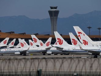
Air China's inaugural flight lands in Saudi Arabia

Watch: Middle East's first air taxi trials in Abu Dhabi
Villa woes: how do i make contractor fix the snags, time running out for sunak and tory government, help: want to shut our firm, but partner is missing, parkin's q1-24 net profit clears dh100 million.

Get Breaking News Alerts From Gulf News
We’ll send you latest news updates through the day. You can manage them any time by clicking on the notification icon.
Caitlin Clark, Indiana Fever embrace notion of using charter flights for WNBA travel
By michael marot, associated press | posted - may 8, 2024 at 4:41 p.m..
Estimated read time: 3-4 minutes
INDIANAPOLIS — Indiana Fever rookie Caitlin Clark already is one of the WNBA's most recognizable players.
So when she made her first road trip last week, the league's top overall draft pick had to adapt. Instead of loading her bag directly onto a plane and boarding, Clark found herself traversing the same lines and waits as everyone else at the Dallas airport — just like most of the league's players.
It's a hassle she wouldn't mind avoiding on future trips and now league commissioner Cathy Engelbert is working on a solution.
One day after Engelbert told a group of sports editors that she's trying to find regular charter flights for all 12 WNBA teams, Clark and her new teammates embraced the move.
"I think you just have to be aware of where you are," Clark said after Wednesday's practice. "You travel with security, which is nice. It's just different from college where you put your bag on the plane, hop on the plane and then you're off. But like (here) you're waiting at baggage claim, you've got to go through the normal security with everybody else. For me, it was my first time doing it. It wasn't terrible. I just went about my business and kept my head down."
Clark went on to score 21 points in her pro debut , a 79-76 loss.
But her star power has only fueled a debate that took center stage last season when Phoenix Suns star Brittney Griner was confronted by a man who started asking questions as she walked through an airport. The incident became so heated that the man was tackled and law enforcement was called.
League officials called the man's actions "inappropriate" and "unfortunate."
It spurred a leaguewide debate over player safety with some veteran stars asking that league officials do more, including charter flights. And now, with one of the most heralded rookie classes entering the league, Engelbert wants to take action even if she doesn't have a defined timetable for when it could happen.
Fever coach Christie Sides also remembered sleeping in an airport while working with the Chicago Sky because of several delays before the flight was eventually canceled. She said the team took a 6 a.m. flight and played later that night.
For those reasons, it can't start soon enough for those who have been around the league for years — or for Clark, who has been driving WNBA ticket sales upward after spending her last two seasons at Iowa driving a substantial increase in television ratings.
"I'm thankful at whatever point that happens, that would be great for us. It will make recovery easier, it will make travel easier," Clark said. "It just makes life a lot easier for a lot of people, but also it's just something a lot of people have deserved for years and years."
AP WNBA: https://apnews.com/hub/wnba-basketball
Most recent NBA stories
Jalen brunson returns from foot injury, sparks knicks past pacers for 2-0 lead in east semifinals, carlisle says 'small-market teams deserve a fair shot' after ejection from pacers' loss in game 2, jalen brunson returns for ny in 2nd half of game 2 vs. pacers, then anunoby exits with injury, related topics, more stories you may be interested in.

Coach Malone reminds the Nuggets they're the defending champs and asks them to play like it

Sparks move home game against Caitlin Clark and Indiana from Long Beach to downtown Los Angeles
Most viewed.
- 'Ozempic babies': Reports of surprise pregnancies raise new questions about weight loss drugs
- Report: RFK Jr. says worm 'got into my brain and ate a portion of it'
- Doctor shows emotional jurors photos of children's autopsies in Chad Daybell murder trial
- Test drive turns into 3-hour kidnapping, police say
- Box Elder County experiences multiple earthquakes
- Closure of West Valley Performing Arts Center upsets many
- Fentanyl and 20 pounds of meth seized; 2 arrested
- Driver critically injured after crashing into pole in downtown Salt Lake
- Panera to stop serving 'Charged Sips' drinks after wrongful death lawsuits
- Man allegedly shot in Salt Lake City by 16-year-old girl also arrested
ARE YOU GAME?

KSL Weather Forecast

Department of Transportation’s changes hope to ease travel burdens
CINCINNATI (WXIX) - The Department of Transportation is making some new rules they hope will hold airlines more accountable.
More than 212 million Americans plan to take a summer vacation this year, according to travel experts at The Vacationer.
Half of those travelers will head to the airport before stepping on sandy beaches.
From canceled flights to lost luggage, countless travelers have experienced a travel horror story.
Aviation analyst Jay Ratliff says it is no secret airline travel is not what it used to be.
“We no longer enjoy travel; We endure it and it’s almost a reality show of ‘how much can these people take on their journey to San Diego?’” Ratliff explains.
Passengers should soon see welcome improvements over the next few months thanks to some recent Department of Transportation rule changes.
“Right now, I think we’re kind of held captive,” says traveler Salina Messman. “I mean, if you’re delayed or you’re sitting on the tarmac for more than an hour, there’s absolutely nothing you can do.”
Among the new rule changes:
- Passengers will now be automatically entitled to a refund in the original form of payment for flights that are canceled or delayed more than three hours domestically or six hours internationally.
- You do not have to accept a travel voucher.
- That is if the bag is not delivered within 12 hours of a domestic flight arriving, or 15 to 30 hours internationally, depending on the length of the flight.
- You can get your money back on any extra services you paid for, like WiFi or seat selection, which weren’t provided.
Passengers at CVG say the rules help to level the playing field.
“I think it’s fair for the most part,” said Hunter Abramson. “That’s the least they can do for people missing their plans and missing flights.”
If an airline loses your bag, you are also entitled to compensation.
The federal government requires airlines to pay up to $3,800 for its contents on domestic flights.
“Putting a copy of your itinerary inside the bag right before you close it on your checked luggage will help the airline so that if all the tags come off, they can open up the bag and see who it belongs to, where you’re at, and then they can begin the process of reuniting you and the bag,” Ratliff explains.
If you want to take it even further, Ratliff says some tech-savvy travelers use Apple AirTags to track their baggage location.
An easy option that could lead to a less stressful and more enjoyable summer vacation.
The new rules will be rolled out over the next several months.
See a spelling or grammar error in our story? Please click here to report it .
Do you have a photo or video of a breaking news story? Send it to us here with a brief description.
Copyright 2024 WXIX. All rights reserved.

7 tornadoes hit Tri-State

Indiana campground hit by EF1 tornado, NWS confirms

Woman walking dog in Warren County makes ‘shocking, scary’ discovery

FIRST ALERT WEATHER DAY: Heavy rain, damaging winds possible Wednesday

9 confirmed tornadoes hit Tri-State on Tuesday: NWS
Latest news.

Cincinnati teachers union votes ‘no confidence’ against superintendent

Overnight Forecast

FOP posts video of teens fighting at Tri-State McDonald’s
Northern kentucky man may be paralyzed after attack with baseball bat.

Danielle Lovins’ ex-boyfriend in court on domestic violence charge
Watch CBS News
Airfares will likely be cheaper this summer — unless you're flying abroad
By Khristopher J. Brooks
May 9, 2023 / 6:05 PM EDT / MoneyWatch
Americans planning to take to the skies this summer can expect lower prices on domestic flights but pricier fares for international trips, according to travel booking app Hopper.
The average ticket price for a flight within the U.S. will be $306, down from $376 last summer, while peaking at about $349 around the July 4 holiday, Hopper forecast . By comparison, a ticket overseas will cost between $1,000 and $2,000 because more Americans are itching to visit foreign destinations like Rome, Seoul and Istanbul, Hopper said.
"Many people who couldn't travel during the pandemic decided that is the one thing they really wanted to do when lockdowns ended," Clint Henderson, managing editor at travel news website The Points Guy, told CBS MoneyWatch. "People have been saving their travel dollars — and points and miles — for several years, and they are ready to spend on seeing new places. Some folks haven't seen their families in several years and they are traveling now, too."
Much pricier to fly overseas
Airfares on international flights are projected to hit their highest level since 2019, before the pandemic grounded most vacation travel, Hopper said. Tickets to Europe and Asia alone have jumped $300 compared to last summer.
The average ticket to Europe will cost around $1,100 each, up sharply from $861 in 2019, while average prices to Asia will top $1,800 per ticket, up from $1,121 in 2019, according to Hopper. The average air ticket to Africa or the Middle East will cost around $1,454, up from $1,236 in 2019, and a trip to Australia and surrounding nations is expected to average $1,709, up from $1,128 in 2019, the app predicts.
Three reasons explain it's getting more expensive to fly overseas, said Hopper economist Hayley Berg. First, the cost of jet fuel has jumped since the pandemic, with airlines passing along some of the added cost to travelers. The cost of jet fuel this month is about $91 a barrel, compared to $15 a barrel in May 2020, according to International Air Transport Association data .
"Though fuel costs have improved considerably in the last 15 months, prices remain the highest they've been since late 2014," Berg said in a statement. "Higher fuel costs will continue to put upward pressure on airfares, especially on expensive long haul international routes."
Airlines also haven't increased seat capacity on planes despite rising demand, further pushing up prices. Finally, Berg said Americans are aching to fly overseas because 2023 marks the first full summer that international destinations will have lifted their pandemic protocols.
Khristopher J. Brooks is a reporter for CBS MoneyWatch. He previously worked as a reporter for the Omaha World-Herald, Newsday and the Florida Times-Union. His reporting primarily focuses on the U.S. housing market, the business of sports and bankruptcy.
More from CBS News

Gold vs. luxury watches: Which is the better investment?

Is a debt consolidation program a good idea?

3 strategic home equity moves to make this May

NASA simulation mimics flying into black hole's "point of no return"
Los Angeles, CA
Los Angeles
Around the Globe
Hurricane tracker, severe weather, radar & maps, news & features, winter center, health & activities.
The vast majority of flight delays and cancellations are weather related. Conditions like precipitation, wind, and fog greatly affect how safe and enjoyable flying can be. If your current location or your intended destination is experiencing bad weather, be sure to check with your airline for any delays or cancellations before heading to the airport.
- Check with your airline to be aware of any flight delays or cancellations
- Flying earlier in the day can help avoid any cascading delays from earlier flights
- Give yourself enough time between connecting flights in case of a weather delay on your first flight

Weather Near Los Angeles:
- Anaheim , CA
- Bakersfield , CA
- Long Beach , CA
We have updated our Privacy Policy and Cookie Policy .
Get AccuWeather alerts as they happen with our browser notifications.
Notifications Enabled
Thanks! We’ll keep you informed.

IMAGES
COMMENTS
HEMS Tool is now GFA-LA — all of the same features and more. Radar, satellite, METARs, and other current data on the observation map. Text Data Server has been replaced by the Data API. Raw and decoded METAR and TAF data. Public hourly forecasts are available through Weather.gov. More information. How can the Aviation Weather Center help you?
Get your Flying Weather Forecast before and during your flight - receive real time turbulence reports and discover where turbulence has been reported by aircraft currently in-flight. Type in the three letter identifier (ex. JFK, LAX, ORD) of the airports that you are travelling to and from, and get real time information on any potential airport ...
Turbli is a turbulence forecast tool for the curious or fearful flyer. Introduced in 2020, it's goal is to provide a complete coverage of all weather factors affecting flight comfort in an accessible manner. This includes turbulence forecasts, wind forecasts, thunderstorms, runway crosswinds, etc. Explore, enjoy and have a good flight!
Track the weather and extreme weather situations along your route to make every trip a safe journey, whether it's sunny, rainy, or snowing.
The National Weather Service Forecast Office in Greenville Spartanburg provides local weather forecasts, watches, warnings and statements, as well as aviation and climatological data for western North Carolina, the South Carolina upstate and northeast GA
522 SW 5th Ave. Portland, OR 97204. Version v7.0.37. See the current weather and delay conditions for airport worldwide, including forecast data for US airports.
Weather: The Last Great X-Factor in Air Travel? Technology has made airplanes and navigation supremely reliable and pilots are better trained than ever. But the weather (and weather forecasts) still change rapidly, and surprises still happen. And the hard fact is that by the time the airlines tell you about major weather problems they have told ...
Have us sort through your flight route, relevant storms, turbulence, pressure systems and jet stream charts in order to deliver a concise description of what to expect on your flight. Starting at $49.99, satisfaction guaranteed. Any flight, public or private. Personalized to your specific needs. Easy to understand forecast in plain english. Are ...
Pulls the best aviation weather data from multiple sources into one easy-to-use, comprehensive tool. Aviation specific charts and maps representing current and forecast conditions. Both local and national charts are available. Tabbed interface allows users to select their favorite charts and keep them open in individual tabs. User-selected ...
Comparison to the full forecast. The full forecasts is the one available at turbli.com main page, where you set the departure, arrival and date, and then select the flight. The full forecast and this interactive map use the same raw data, but there are differences in the post-processing of it.. Advantages. Visualization: This interactive map allows visualizing the turbulent areas that your ...
A turbulence forecast typically provides information on the expected intensity, location, and duration of turbulence along a flight route. The forecast may use different symbols or colors to indicate the level of turbulence, ranging from light to severe. Pilots and airline operations personnel are trained to interpret these forecasts and adjust ...
Air Travel. The vast majority of flight delays and cancellations are weather related. Conditions like precipitation, wind, and fog greatly affect how safe and enjoyable flying can be. If your ...
Use these tools to get aviation weather forecasts for U.S. airports, as well as to download the latest Terminal Area Forecast (TAF) report. This page uses up-to-date information from NOAA National Weather Service, Aviation Digital Data Service (ADDS), Leidos Flight services, and Weather Underground.The aviation weather information available includes icing, turbulence, convection, PIREP, METAR ...
New. Daily/Hourly Forecast. Stay on top of the weather today or next week with an all-purpose hourly forecast anywhere in the world. Access the globally-supported forecast for any airport in Airports > Weather > Daily, or any other airport popup such as on the Maps or Flights views, or by tap-holding anywhere on the map and tapping "Wx" in the top-right corner of the Add to Route window to ...
View real-time arrivals and departures at your airport. Airport Delay. See delay details for your airport. Weather. Get current airport weather details and the 7-day travel forecast for your airport. Parking. View parking availability & pricing near your airport and book online. Departure Status of U.S. and Canadian Airports.
Air Travel. The vast majority of flight delays and cancellations are weather related. Conditions like precipitation, wind, and fog greatly affect how safe and enjoyable flying can be. If your ...
A man clears a driveway after a snow storm passed through northern Minnesota last week. Forecasters say another big storm is expected to hit the region this week. At least 250 flights into and out ...
Delta SkyWatch TM: Weather Advisories. Delta SkyWatch. : Weather Advisories. We want travel to be as stress free as possible, but sometimes the weather has a mind of its own. Stay up to date on any weather advisories that could affect your upcoming trip. If you do not see anything below, that means there are no active weather advisories at this ...
Aviation weather forecasting by the National Weather Service is in support of aircraft operations at national and international airports as well as en-route forecasts of wind and weather. The Chicago National Weather Service Forecast Office provides forecasts for: Chicago O'Hare International Airport. Chicago Midway International Airport.
A travel agency collected images from Google Maps and cross-referenced them against the certified bluest shade of blue in order to find the beach with the bluest waters on Earth. One of the best ...
Flight options. If you're scheduled to fly to or from one of the airports affected, here are your options: You can reschedule your trip and we'll waive change fees and fare differences. But, your new flight must be a United flight departing between January 1, 2024 and January 12, 2024.
Air Travel. The vast majority of flight delays and cancellations are weather related. Conditions like precipitation, wind, and fog greatly affect how safe and enjoyable flying can be. If your ...
Ground stops lifted at O'Hare, Midway as severe weather sweeps through Chicago area As of Tuesday afternoon, Chicago O'Hare International Airport had canceled more than 70 flights
After years of delays, Boeing's Starliner is finally ready to fly NASA astronauts on a landmark test mission. Here's what you should know about the historic launch.
Dubai: Dubai's flagship airline, Emirates, issued a travel advisory on Wednesday ahead of the inclement weather conditions expected to hit the UAE on Thursday, May 2.
Fever coach Christie Sides also remembered sleeping in an airport while working with the Chicago Sky because of several delays before the flight was eventually canceled. She said the team took a 6 ...
From canceled flights to lost luggage, countless travelers have experienced a travel horror story. ... Evening Forecast. News. Weather. Sports. WXIX Careers. Contact the Newsroom.
Best travel deals as demand for flights to Europe rises 03:45. ... while peaking at about $349 around the July 4 holiday, Hopper forecast. By comparison, a ticket overseas will cost between $1,000 ...
Air Travel. The vast majority of flight delays and cancellations are weather related. Conditions like precipitation, wind, and fog greatly affect how safe and enjoyable flying can be. If your ...