Find your holiday on the Norfolk Broads
Holiday type, no. of guests, save our shortlists, send your shortlist to your email, boat feature information.
- Norfolk Broads Boat Hire Search
- Boating Holidays On The Broads
- Boating Holiday Special Offers
- Luxury Boating Holidays
- Norfolk Broads Budget Boating Holidays
- Pet Friendly Boating Holidays
- Hire Boats for First Timers
- Hire Boats for Seniors
- Family Boating Holidays
- Hire Boats For Groups
- Boating Holidays For Two
- New Boats for 2023 Book Ahead
- Boating and Fishing
- Wroxham Holiday Cottages On The Norfolk Broards
- Dog Friendly Cottages
- Holiday Cottages with Fishing
- New Year & Christmas Holiday Cottages with A Boat!
- Special Offers Riverside Holiday Cottages
- A guide to choosing your perfect boat
- Broads Boating Essential Videos for Hire Boats (Inc Paddle Boards)
- Boating Holidays
- Hen & Stag Parties
- The Norfolk Broads Experience
- Aerial Views Of The Norfolk Broads
- Norfolk Broads Nature & Wildlife

Norfolk Broads Map

The Norfolk Broads is one of Britain’s major tourist destinations and also Britain’s largest protected wetland, with 125 miles of water and no locks to stand in your way. The Broads are a favourite with first-time boaters as they offer the perfect combination of easy navigation thriving wildlife, fishing, birdwatching, landmark sites, shopping and picture-perfect pubs along the riverbank.
Home > The Norfolk Broads > Norfolk Broads Map
Interactive Map Of The Broads
Explore the Norfolk Broads by map, find pubs, mooring locations, toilets, bridges, villages and how long it takes to get there by boat.
Map Instructions
To expand the map of the Norfolk Broads, click in the box marked [ ] on the top right of the map , when you close the map, you will come back to this page.
To discover where you can find moorings, pubs and itineraries on the map, please use the toggle button on the top left of the map. or when the map has been expanded, tick and untick the selections offered, to only show what you need on the map. You can also click on the names of towns and mooring locations to highlight them on the map.
Norfolk Broads Boat Trip Calculator
Use the Norfolk Broads Boat Trip Calculator to find how long it will take to get from one place to another by boat.
Trip calculator
This website uses cookies to improve your experience. By continuing to use this website, you agree to our use of cookies as described in our Privacy Policy .
- Northern Ireland
- Southern England
- Northern England
- Other Regions
- Shopping Guides
- Restaurant Guides
- Historic Attractions
- Theme Parks/Adventure
- World Heritage Sites
- Top UK Attractions
- UK National Parks
- England Airports
- Scotland Airports
- Wales Airports
- Northern Ireland Airports
- UK Airport Hotels
- North America
- Travellers Tips
- UK Travel Tips & Advice
- Articles & Inspirations
- Holiday Packages
- Hotel Reservations
- Travel Tools
- UK Holidays
- Broads Attractions
- Broads TICs
- Local Events
- Broads Facts & Figures
- Travel & Transport
- Travel Videos
- Broads Weather
- Norfolk Broads Hotels
- Norwich Airport
Norfolk Broads Maps
Map of norfolk broads | local search for attractions & services, related articles, norfolk broads travel videos, norfolk broads events, norfolk broads quick facts & figures.
- Website Terms
- Site Disclaimer
- Privacy Policy
The Photo Slide Gallery consists of over 250 digital Broads images arranged as slides, which can be clicked to view the full size image. The majority of the photos were taken by myself using a variety of digital cameras, ( any images that I didn't take myself are accredited with the photographer's name .) The image resolution has been downsized to reduce loading times over the internet, but still contain high levels of detail. They average 800x600 pixels, the originals being around 2400x1800 pixels. Please feel free to copy and use any of the images ( that were taken by me), for non-commercial purposes, but if published on the web, please give this site a mention !
The Map Pages enable a Virtual Tour of the whole of the Broads area. Each map contains 'hotspots' which show 'popup text' when the mouse is over them, and then show either the photograph taken at that point, or open the web link to that company or organisation, when clicked.
The database driven Links page contains information on many companies, services, organisations and clubs of interest to Broads users. You can search and list entries by type or keyword, and each entry contains contact information and links to their website (if they have one). If any of the information is incorrect, please let me know via my email link.
The Tide Calculator page shows the actual state of the tide at the main locations within the Broads System. It initially displays in real time, but you can select any date and time from 2003 to a couple of years ahead. There is also a tide table viewer/printer function, for any start date for 2 to 60 days, with or without the graphic 'tide bands' map.
The Broads Puzzle page contains photo puzzles to test your local knowledge and observation skills.
Respect, Protect and Enjoy when you visit Norfolk

- Book Your Stay
- Things To Do
- Families & Friends
- Beaches & Coast
- History & Heritage
- Outdoors & Wildlife
- Culture & Arts
- Destinations
- Feeling Lucky?
- Food & Drink
- Natural Wonders of Norfolk
- A-Z of the Norfolk seaside
- 7 Wonders of Norfolk
- Toggle Menu
- Be Inspired
Best things to do in the Broads
Norfolk is possibly most famous for the man-made Broads, a National Park with over 125 miles of navigable lock-free waterways set in beautiful countryside and studded with charming and picturesque towns and villages.

The Broads at Acle Bridge.
The big skies and sparkling landscape of marshland fields, feathery reeds and tangled woodlands are a perfect canvas for adventure and relaxation – time to reflect, space to explore, a magical opportunity to enjoy a fabulous break.
This is the Venice of the East – in fact, the Norfolk Broads has more miles of waterway than the Italian city. It’s also got more than Amsterdam. And it’s out in the beautiful open countryside, with wonderful scenery and lots of wildlife.
The Broads National Park offers visitors an experience unlike any other, both on its rivers and lakes, and alongside them, on peaceful paths and cycle ways.
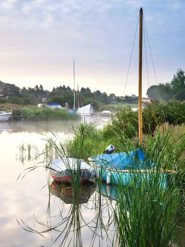
Without a doubt, the best way to discover the Broads is by boat. So much of the Broads can’t be reached by road that days – and nights – afloat become a real adventure, with hidden places, perfect fishing spots and close encounters with wildlife at every turn. The famous Broads motor cruisers have been holiday favourites since the 1930s, and today’s boats have all the comforts of home on board, so even if you prefer to visit during the quieter, cooler months, you’ll have a cosy base for your explorations. With fresh air, sparkling water and wide horizons by day, and wonderfully dark, starry nights, a boating holiday on the Broads is an unforgettable experience.
There are plenty of places along the meandering waterways for you to moor up and hop out to explore pretty villages and market towns, or to stop at a welcoming pub.
About The Broads
The Broads, which can be split into Northern Broads and Southern Broads, offers a rich mix of attractions and activities year-round for visitors of any age and any interest and is recognised globally for its wildlife and the distinct and precious character of its environment.
The UK’s largest nationally protected wetland and an important area for wildlife, the history of the Norfolk Broads is fascinating, as they are actually a man-made creation. The Broads were formed when people dug for peat in medieval times and then they were later flooded. The Victorians used them for transporting heavy loads but nowadays they are purely for pleasure.
Peat digging and climate change – how the Broads were formed
The Broads is a fragile wetland of international importance, with rare wildlife like the huge swallowtail butterfly, the booming bittern, frolicking otters and beautiful white water lilies.
Broads wildlife and top 10 Broads wildlife spots
If you want to taste the exhilaration of being afloat, the Broads offers boating and sailing holidays, as well as river cruises, sailing and motor boats, canoeing, rowing and wildlife boat trips for memorable days out. Wear a life-jacket or buoyancy aid when you are on deck, getting on and off or tying up your boat.

Broads towns and villages
Broadland isn’t just about the waterways – it has lovely market towns and villages too.

Reepham market square.
Focused around the market place, a conservation area, Reepham has a lovely Flemish influence. On the edge of the town is the former Whitwell and Reepham Station , which has cycle hire, a team room and small museum, and is the start of the Marriott’s Way, a 21-mile old trackbed which is now used by walkers, cyclists and horse riders.

Blickling Hall and Estate.
Aylsham, in the upper reaches of the River Bure, is a charming market town close to Jacobean Blickling Hall . Run by the National Trust, a walk around the gardens and estate will make your day. Look out for the mausoleum pyramid. Aylsham is also the northern terminus of the Bure Valley Railway that runs to Wroxham with stops at Brampton, Buxton and Coltishall.
Acle is a market town on the River Bure, and is on the rail line between Great Yarmouth and Norwich. Its name comes from ‘Oaks lea’, meaning a clearing in an oak forest. In Tudor times, hundreds of oaks were felled here for timber to construct the warships of Elizabeth I.

The chain ferry at Reedham.
Reedham is a pretty village that sits on the bank of the River Yare with two crossings of the water – a swing bridge for the rail line between Norwich and Great Yarmouth and a chain ferry for cars and pedestrians.

Heydon village green.
Heydon is a charming village that’s at the end of a cul-de-sac! But it’s worth a visit for the picturesque houses and cottages, the lovely pub, the Earle Arms, and to see where 1970’s The Go Between and 2005’s A Cock And Bull Story were filmed.

Row boat at Coltishall on the River Bure.
Coltishall is a captivating Broads village by the River Bure, with riverside pubs, a former RAF base where Sir Douglas Bader was a squadron commander and a station on the Bure Valley Railway . Stop off to sample some local ales and food at a riverside pub, and explore the village with its old buildings and church.
Best Broads and rivers of the Broads National Park

Wroxham day boats and paddleboat.
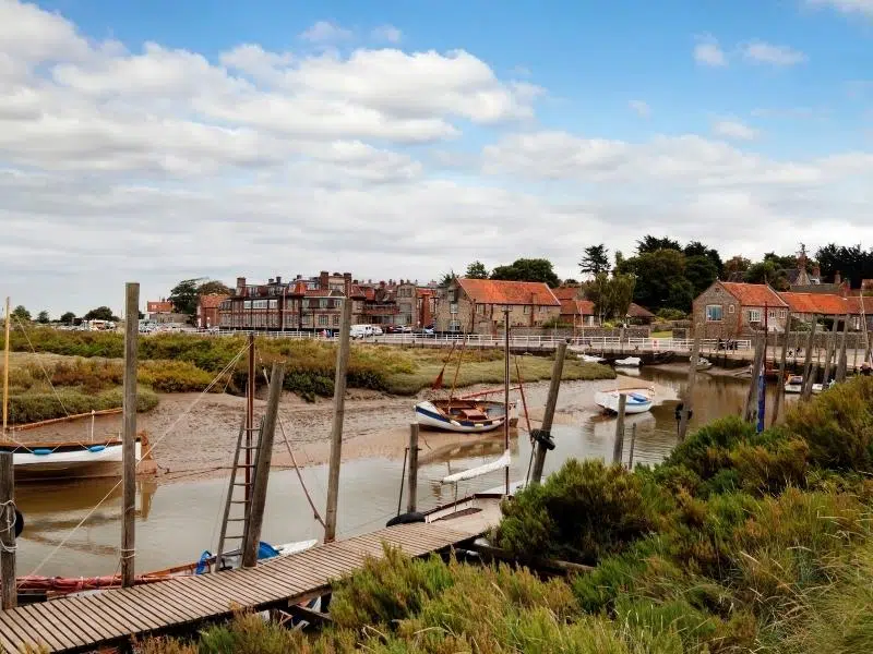
Wroxham is the term we use to refer to the connected villages of Wroxham and Hoveton, one either side of the River Bure. This is the undoubted capital of the Broads, sporting an abundance of places to eat, a terminus of the Bure Valley Railway, ‘The World’s Largest Village Store’ in Roy’s, and lots of places to hire day boats or cruisers. Close by are Wroxham Barns and BeWILDerwood family attractions.

The Fur & Feather, brewery tap for Woodforde’s Brewery.
The delightful village of Woodbastwick is well worth a visit to soak up the peace and tranquillity away from the busier towns. Having twice won the Best Kept Village Award, it is a beautiful place with a stunning medieval flint church finished with Norfolk thatching. It is also home to Woodforde’s Brewery and the brewery tap, The Fur & Feather.
At Stalham you can visit the Museum of the Broads and marvel at Hunsett Mill. The picturesque village of Horning is situated on the bank of the River Bure.

Stop at Ranworth and climb to the top of St Helen’s church.
The village of Ranworth is an excellent place to visit, where those feeling energetic can climb the winding, spiral stone staircase of the magnificent St Helen’s Church, known as the ‘Cathedral of the Broads’. Once at the top your efforts will be rewarded with spectacular views over this special landscape. The church has one of the finest examples of a medieval rood screen in the country and an exquisite 15th century illuminated songbook.

Potter Heigham bridge – mind your heads!
The town of Potter Heigham is an excellent place for boat hire. A treat is to watch sailors attempt to travel under a tiny medieval bridge, renowned for being the most difficult to navigate in the area.

St Benet’s Abbey.
St Benet’s Abbey was founded in the Anglo-Saxon period and continuing in use throughout the Middle Ages. The atmospheric site was largely abandoned after the closure of the monasteries in the 1530s because of its inaccessible location, and is still most easily visited by boat. The Bishop of Norwich remains Abbot of St Benet’s and leads a service there on the first Sunday in August.
Locations in the Broads

Privacy Overview

- Wildlife in the Broads
- Unique shopping
- Accessible visits
- Book experiences
- Entertainment and dances
- Local produce
- Parks, villages and lodges
Discover the Broads National Park
Welcome to the official website for the Broads National Park.
Find great days out, special events to enjoy and idyllic places to stay in this truly special landscape - just two hours from London by train.
Latest blog posts

- Explore some less frequented nature reserves
- 'Sport', science, food and profit
- Land of the windmills
- What's been happening?

As home to more than a quarter of Britain's rarest animals and plants the Broads is the country's wildlife national park.
- Learn more about wildlife
- Birdwatching
- Nature Reserves & Parks

With more than 125 miles of lock free waterways there are so many ways to experience this water playground.
- Learn more about boating
- Boating holidays
- Canoeing, kayaking and SUP
- Day boat hire
Where to stay

There is a perfect place to stay for everyone within the Broads National Park, whether you want a cosy lodge, luxurious hotel or an affordable campsite.
- Camping and caravanning
- Bed and breakfast
- Self-catering
Culture and heritage

A rich past has shaped the unique and special Broads of today with lots of historic and cultural sights and sounds to inspire visitors.
- Learn more about culture
- Castles and houses
- Churches, abbeys and cathedrals
- Theatre and film
Walking and cycling

The gentle landscape of the Broads with its woodland, fens, waterside trails and pretty towns and villages makes it perfect for all ages and abilities
- Learn more about going by land
Food and drink

Great local produce and fantastic restaurant locations make the Broads a foodie's paradise.
- Learn more about local produce
- Where to eat and drink
- Where to find local produce
Attractions

Whether you want a family-friendly day out or a thrill ride the Broads has it all.
- All attractions listings
- Our pick of attractions
Have you downloaded our new app yet?
We are pleased to announce the launch of our Visit The Broads Digital Pocket Guide app which is full of useful information for both visitors and locals alike!
You can use it to find things to do, places to eat, local events, places to stay and so much more. For visitors on boat trips it will show you the weather forecast, tide information, moorings listings and bridge heights, it can even give you your exact location should you need it.
Download the app from either the App Store or Google Play , and start using it today.

Visit the Broads and the Broads Authority work in partnership to give visitors all the information and inspiration they need to make their trip to the Broads perfect.
The Broads Authority looks after the national park for visitors, boaters, wildlife and its community.
Visit the Broads provides a strong unified voice for Broads tourism-related businesses, from accommodation providers to holiday boat operators, and other stakeholders with an interest in tourism activity.
Visit the Broads welcomes new members - read more information for Broads businesses →
View more maps of the Broads →
Useful links
- Getting here
- Information Centres
- Visitor Guides
- Accessible Visits
- For the Press
- Visit the Broads for Business
- Visit the Broads corporate partners
- Love the Broads
© Broads Authority 2023 | The Broads Authority Website National Parks in the UK | Cookie statement | Terms and conditions | Privacy notice | Accessibility statement Website design by Headscape
01603 782207
- Browse Our Cruisers
- Boating Holidays
- Browse Our Holiday Cottages
- Norfolk Broads Holiday Cottages
- Norfolk Broads Information
- Map of the Norfolk Broads
- River Trips and Day Boat Hire
- Norfolk Broads Fishing Holidays
- Norfolk Broads Walks
- Dog Friendly Holidays
- Norfolk Broads Nature Blog
- Plan Your Visit
- Special Offers
- Returning Customer Loyalty Scheme
- Pay Your Balance
- Day Boat Hire
Guide to The Broads
Enjoy the Norfolk Broads at your own pace from the comfort of a luxury cruiser
- Barton Broad
- Burgh Castle
- Great Yarmouth
- Oulton Broad
- Potter Heigham
- Salhouse Broad
- Somerleyton
- South Walsham
- Upper Thurne
- Wayford Bridge
- Whitlingham
- History and Culture
- Bike and Canoe Hire
- Broads Walks
- Eating Out on the Broads
- First and last night moorings
- Mooring Tips
- Sustainable Living
- Frequently Asked Questions
Guide to the Broads
We know that the best way to enjoy the Norfolk Broads is by boat. Not only the beautiful views along the banks but also the many nooks and quirks that can only be accessed by water. So, if you’re planning a Broads holiday , you are in for a treat.
We’ve put together this guide to highlight some of our favourite places to eat, walk, visit and enjoy. We’ve also included some useful tips for your safety and for Broads conservation during your visit.
If you find an attraction, walking trail, pub, cafe, restaurant or mooring spot that we haven’t included, please let us know so we can share it with everyone…unless you want to keep it for yourself!
When it comes to getting to the Broads, we highly recommend local taxi hire company Stripes Express .


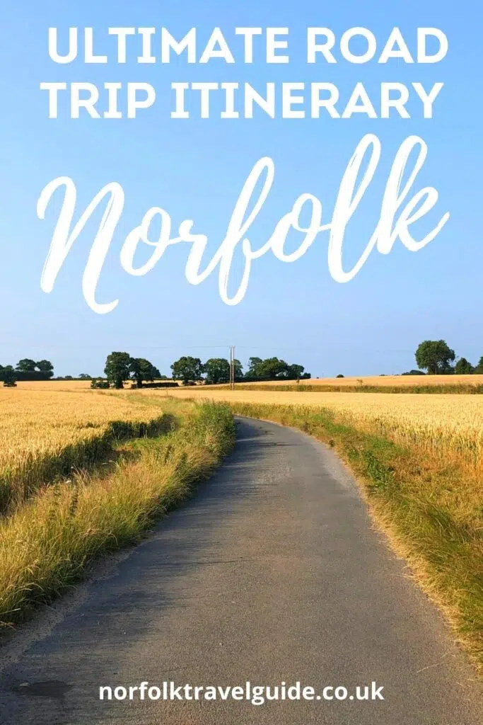
Norfolk Road Trip – Route, Map and Itinerary
Norfolk is a county that’s perfect for a road trip. Blessed with beautiful landscapes, spectacular beaches, historic towns and the gorgeous Norfolk Broads, Norfolk will captivate you.
Chuck in grand stately homes, a fantastic local gastronomy scene and loads of really great attractions, and you have the ingredients for an incredible Norfolk break .
In this Norfolk road trip planner, you’ll find a complete itinerary and road trip route that takes in all the best bits of Norfolk, with an interactive map to help you plan your trip.
We also share recommendations for places to stay where we have stayed ourselves, highlights and must-sees for each stop, and travel tips to help you make the most of your North Norfolk road trip.
About me – not Norfolk born and bred, but pretty close! I was bought up on the borders of Norfolk, spending many happy camping holidays meandering along the North Norfolk coast as a child. Now grown up, I have travelled all over the county and spend long periods of time in Norfolk with my family, who live there. Here’s my Norfolk road trip itinerary…
RELATED POST: The Ultimate Local’s Guide to Norfolk England

This post may contain affiliate links. If you book something I recommend, I make a small commission without affecting the price you pay!
The Ultimate Norfolk Road Trip
Norfolk road trip interactive map.
How to use this map – Use your fingers (or computer mouse) to zoom in and out. Click or touch the icons to get more info about a place, and click the arrow in the box top left to open the index. To add to your own Google Maps account, click the star next to the title of the map.
Our road trip starts in Norwich, taking in the historic buildings, thriving food scene and lively nature of this delightful city.
The capital of Norfolk, Norwich is the most complete medieval city in the United Kingdom today and is a feast of history and architecture. Home to cobbled streets, ancient buildings, half-timbered houses and the winding River Wensum that flows through the city centre, there is lots to see and do here.
Getting to Norwich
Norwich, Norfolk is within easy reach of the rest of the UK, with great transport links. You can get there by mainline train in less than two hours. Simply take the regular Greater Anglia service from London Liverpool Street, which leaves every hour or so.
Alternatively, fly to Norwich airport, or London Stanstead and rent a car. Car hire is easy at both airports and you can organise a one-way rental, but be sure to book in advance.
Norwich Highlights
- Shopping and feasting at 900-year-old Norwich market, one of the oldest open-air markets left in the country. Slap bang in the middle of the city and sprawling proudly at the feet of the contemporary Forum building and Norwich’s Art Deco city hall, this is a Norwich must-do .
- Visiting the Norwich Lanes, a series of mostly pedestrianised small lanes, alleyways and streets nestled between the market and the Castle Quarter, and home to the Victorian Royal Arcade, which personify the lively and independent nature of the city.
- Discovering the well-preserved Norman Norwich Cathedral and nearby medieval Tombland Alley and Cathedral Close on a self-guided walking tour of Norwich .
Where to Stay in Norwich
- A friendly B&B, 38 St Giles is full of character and quirky touches. Within a minute’s walk of Norwich market, this guesthouse is right in the centre of the lively city. Spacious and simply decorated rooms with superbly comfy beds make for a wonderful stay.
- Book a glamping yurt, converted goods wagon, shepherd’s hut, bell tent or stunning tree-house-style woodland den at the beautiful Whitlingham Broad Campsite . With all the camping amenities you need and a wonderful location on the banks of Whitlingham Broad, you can be in Norwich city centre in a few minutes by car.
RELATED POST: A Local’s Guide to Norwich Norfolk

The Norfolk Broads
Today sees you heading east from Norwich, deep into the Norfolk Broads . Huge skies, undulating landscapes and LOTS of water make up the Norfolk Broads Area of Outstanding Natural Beauty, where rivers, lakes and sea combine to create a unique and diverse place full of natural beauty, wildlife and cultural heritage.
Britain’s largest protected wetlands, the Broads are encapsulated in the Broads National Park and are home to over 125 miles of navigable waterways, and over a quarter of the UK’s rarest plant and animal species.
Take your time and relax into the slow pace of life. The Broads and their rivers are tranquil places, where boats meander slowly alongside swans, owls and otters.
Norfolk Broads Highlights
- Hiring a boat in Wroxham to appreciate the Broads from the water. Set off in a canoe on a Swallows and Amazons style adventure, or take to the helm and hire a day boat from Wroxham to explore the beauty of the Broads at your own pace. You can also take one of the skippered Broads boat trips that leave from Wroxham Bridge regularly throughout the day.
- Enjoying a steam-driven trip on the fantastic Bure Valley Railway , Norfolk’s longest narrow gauge railway, which runs between the historic market town of Aylsham and the bustling town of Wroxham. You’ll take in the lush Bure Valley countryside as you follow the meandering River Bure through meadowland and ancient pastures, dotted with sheep and cows.
- Exploring The National Wildlife Trust Hickling Broad Nature Reserve , a year-round haven for wildlife. You’ll see the common crane, barn owl, bittern and marsh harriers here, and maybe Chinese water deer and otters too, as well as the local specialities of the swallowtail butterfly and Norfolk hawker dragonfly.
Where to Stay in the Norfolk Broads
- The Kings Arms has three well-appointed award-winning garden rooms, four boutique bedrooms and a very good restaurant, serving refined pub classics and an excellent seasonal tasting menu, full of Norfolk foods .
RELATED POST: A Local’s Guide to the Norfolk Broads
Happisburgh
A key place along Norfolk’s Deep History Coast, Happisburgh (pronounced hayz ·buh·ruh) is a prime fossil-hunting beach. The Happisburgh Beach Road car park is a Deep History Coast Discovery Point, where you can learn more about the first ancient tourists to Norfolk.
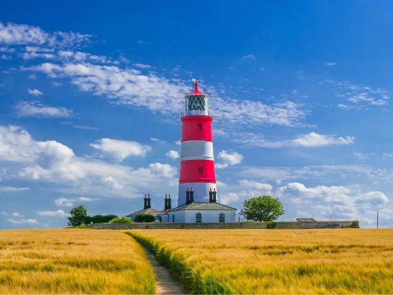
Just inland is the wonderful red and white striped Happisburgh Lighthouse, which is one of Norfolk’s most iconic and photogenic landmarks .
Happisburgh is also the start point of the coast road which stretches along the North Norfolk coast, all the way to King’s Lynn. You’ll pass through pretty villages and mesmerising landscapes, and see lots of places en route to stop for lunch, or even afternoon tea !
Happisburgh & Around Highlights
- Visiting the working lighthouse, which has open days where you can climb the 112 steps to the top for fantastic coastal views, and find out more about how the light is operated.
- Exploring the wonderful gardens at the East Ruston Old Vicarage , possibly the best gardens in Norfolk , if not the whole of East Anglia.
- Visiting the glorious Blickling Estate , which is mentioned in the Domesday Book and was the birthplace of Anne Boleyn. One of Norfolk’s top stately homes , the Jacobean house is packed full of history and outside are 55 acres of formal gardens with an orangery, kitchen garden and lake to explore.
Where to Stay in Happisburgh
- Lanterns Shepherds Hunts and Glamping offer a range of luxury glamping pods and huts, fully equipped for a self-catering glamping stay . Perfect for taking advantage of Happisburgh’s dark sky status, which promises amazing star gazing.
RELATED POST: Happisburgh: A Deep History Coast Village
Cromer is my favourite North Norfolk town! With lots to do and a traditional seaside feel, there’s a laid-back vibe to Cromer which draws me in every time I visit.
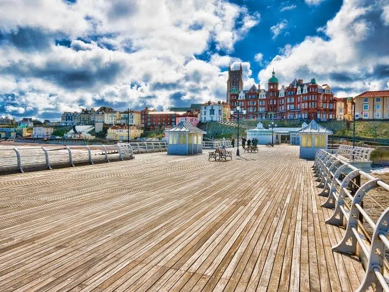
From the blue-flag beach to the spectacular Victorian pier and the beautiful surrounding countryside, there are lots of things to do in Cromer , making it a great place to base yourself for a few days on your coast road trip of Norfolk.
Cromer & Around Highlights
- Exploring Cromer Pier, a much treasured and loved heritage landmark along the Norfolk coast. You’ll find a theatre, RNLI lifeboat station and cafe perched along its 151m length. Wander along with an ice cream, fish for crabs, and enjoy the holiday feel.
- Finding out about the RNLI history in Cromer at the Pier Head lifeboat station, the old lifeboat house at the foot of the Gangway and at the RNLI Henry Blogg Museum .
- Visiting the sublime National Trust Felbrigg Hall , a 17th century English country house. The unaltered house is known for its fine Jacobean architecture and gorgeous Georgian interior, as well as its stunning gardens, some of the best in Norfolk .
- Sampling the famous Cromer crab . The brown crab is found all around the coast of the UK, but off our stretch of Cromer, in the shallow nutrient-rich waters, brown crabs are sweeter and more tender than anywhere else! There are lots of restaurants in Cromer where you can enjoy the famous Cromer crab. Crab season runs from March to October and in May every year, it’s the Cromer Crab and Lobster Festival !
- Popping along the coast to the neighbouring seaside town of Sheringham, once an old fishing village that now has a blue flag pebble beach, which is perfect for rock pooling. Sheringham is also home to the wonderful North Norfolk Railway , known as the Poppy Line, which holds themed events throughout the summer.
- Exploring the pretty Georgian town of Holt , inland from Cromer. Why not travel there on the North Norfolk Railway by steam train from Sheringham ?
Where to Stay in Cromer
- The Grove Hotel is stylish and welcoming, offering rooms and glamping. They have an excellent restaurant and open-air dining with a sea view in the summer.
- The Edwardian Grade II listed Cliftonville Hotel offers traditional seaside accommodation with period features and overlooks Cromer Beach. The popular bistro serves locally caught fresh seafood.
RELATED POST: Cromer Visitor Guide
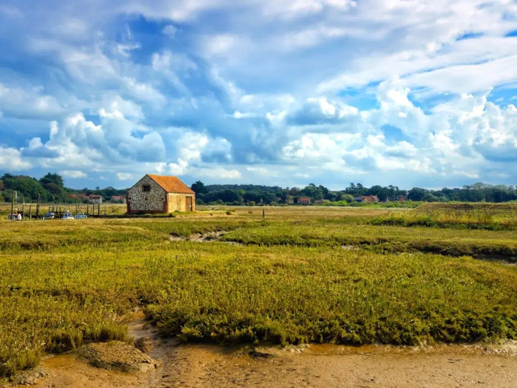
Blakeney , within the Norfolk Coast AONB, is a charming coastal village with bags of history, its very own nature reserve and an otherworldly watery landscape. Along with Blakeney Point, the Blakeney National Nature Reserve is home to England’s largest colony of Atlantic Grey seals.
The pretty village is full of traditional Norfolk flint cottages which were once home to local fishermen, and a good collection of independent gift shops and art galleries to visit. The lively quay is buzzing in the summer, with lots to do , including crabbing , boat tours and visitors enjoying the outlook across the marshes.
Blakeney & Around Highlights
- Walking the sea wall between Blakeney and Morston Quay to be blown away by sweeping views of muddy creeks, moored boats and a rich variety of seabirds.
- Taking a boat trip from Morston Quay to Blakeney Point to see the Atlantic Grey seal colony is one of the best ways to explore the Norfolk coast .
- Discovering the history at the ruined Augustinian Priory of Walsingham Abbey at Little Walsingham, a place of medieval and modern pilgrimage. The grounds are beautiful with gardens, woodlands and river walks.
- Indulging at Wiveton Hall, a farm shop that sells lots of lovely local food and produce alongside a fantastic cafe, with views over the marshes to the sea.
Where to Stay in Blakeney
- The award-winning Wiveton Bell is a traditional pub with rooms just outside Blakeney, in the pretty hamlet of Wiveton. Their six luxury rooms and a fantastic local menu showcasing the best of Norfolk produce, make this a wonderful place to stay.
- The White Horse Blakeney enjoys a prime position in the village, just up from Blakeney’s quay. The pub offers cosy, characterful and stylish rooms, alongside an excellent menu full of beautifully cooked seasonal and locally sourced produce.
RELATED POST: Blakeney Visitor Guide
Wells-next-the-Sea
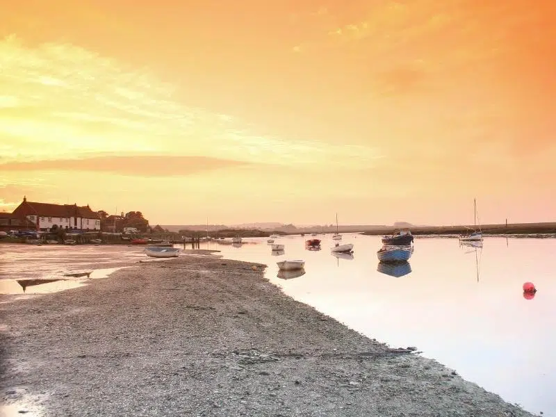
Known simply as Wells, the pretty harbour town lies between the bird sanctuary at Blakeney Point and the fabulous Holkham Bay .
With a harbour sheltered by salt marshes from the open sea, Wells was one of the great Tudor ports of East Anglia. Today, the harbour is used by sailing and crabbing boats and is watched over by a distinctive granary dating from 1904.
Set in North Norfolk’s AONB, Wells town has a fine Georgian square and a good mix of independent traditional and contemporary shops.
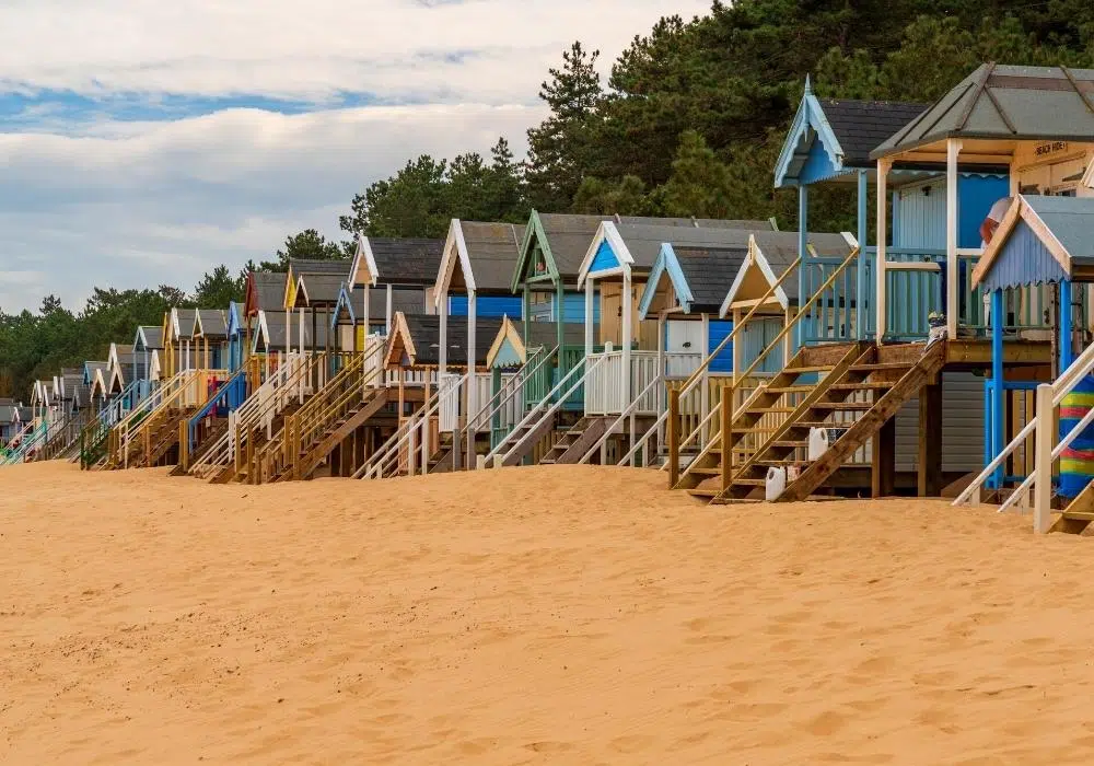
Wells is probably best known for its long line of colourful wooden beach huts, which you can find if you take a walk through the pinewoods to beautiful Wells beach .
Wells-next-the-Sea & Around Highlights
- Crabbing on Wells quay, the crabbing spot on the North Norfolk Coast. Yes, you can crab in lots of other places, but this is where you’ll get the best catch because of the abundance of estuarial and creek waters that crabs like living in. I used to crab here every summer, and my kids crabbed here too!
Crabbing Tips
If you’re new to crabbing, it involves dropping a baited line into the water and waiting for the crab to take the bait, so you can pull him/her gently up. All you need are a line, bucket, net and bait, which you can buy all over town.
- When I was a kid, the best bait was raw bacon with rind (who knew?), but anything like chicken, small fish or even dog food works. I even used a bit from inside a pie once!
- The best crabbing takes place as the tide is coming in – crabs are clever and know when the tide is heading out and bury themselves in the mud.
- If you need to hold the crab, do so on either side behind the pincers.
- Be prepared and have your bucket full of salt water with your net to hand.
- No more than three crabs to a bucket, and try and keep the bucket shady. Crabs don’t have much sun protection!
- Wait – crabbing is a game of patience and you will be rewarded, I promise!
- Don’t keep the crabs too long, and definitely don’t take them home as pets (the crabs you catch here are also not edible). Pop them back into the sea gently with thanks for being your captive!
- Visiting the small village of Holkham, which boasts the 18th century Holkham Hall stately home, the vast Holkham Beach, properly known as Holkham Gap, and the Holkham National Nature Reserve. There’s a lot going on here!
- Spending a day on award-winning Wells Beach , with endless expanses of soft, golden sand perfect for sandcastle building, raised and sheltered dunes to picnic in, space to fly a kite or play games, and the beautiful clear water of the North Sea.
- Eating fish and chips from the wrapper on the harbour wall. The best traditional fish and chips in Wells come from French’s Fish Shop , right on the quay.
- If crab (and lobster) is more your thing, the best place for fresh and local crab is Wells Crab House , a small family-run restaurant serving crab caught locally that day.
Where to Stay in Wells-next-the-Sea
The Globe has been beautifully revamped to just the right degree, meaning it’s still at the heart of local village life, but offers luxuriously elegant accommodation in a central Wells location.
RELATED POST: Wells-next-the-Sea Visitor Guide
Burnham Market
Popular Georgian Burnham Market is one of the “seven Burnhams by the sea”, which are located around the River Burn on the North Norfolk coast. The villages are all picture-perfect and unspoilt, with access to a stunning coastline made up of spectacular beaches and nature reserves.
Burnham Market is the largest Burnham and where you’ll find quirky boutiques, cool coffee shops, antique shops, galleries, delicatessens and eateries around the village green, a favourite haunt of celebrities.
Steeped in history connected to the sea and the legacy of Admiral Lord Nelson, there’s lots of interest in and around the Burnhams, with walks between the villages to take you to all the best historical spots.
Burnham Market & Around Highlights
- Visiting Dalegate Market in Burnham Deepdale, where you’ll find pop-up shops, local artisan crafts and the fantastic Deepdale Cafe , where they do a mean cooked breakfast!
- Exploring Scolt Head Island National Nature Reserve, which you can get to by ferry from the quay at Burnham Overy Staithe , or by taking an adventurous hike and crossing from Overy Cockle Strand at low tide. Find out how here .
- Taking a guided stand-up paddleboard tour with North Norfolk Paddleboards from Burnham Overy Staithe or Brancaster Staithe , along the creeks and salt marshes of the North Norfolk Coast.
- Take a tour and tasting at Burn Valley Vineyard in North Creake. All Burn Valley wines are grown, harvested, fermented and bottled on site and you can learn more about the wine-making process, and enjoy a tasting when you visit.
RELATED POST: Six Vineyards in Norfolk You Need to Know About!
Where to Stay in Burnham Market
- The Hoste overlooks Burnham Market’s picturesque central green and has been a hotel since the 1650s! The style ranges from traditional character (including Number 5 where Admiral Lord Nelson is rumoured to have stayed) to luxury overlooking the garden. There are a number of dining options from informal to brasserie and traditional. Book well in advance, this is a popular spot!
- With a tad less style and hipster vibe, The Nelson nevertheless offers seven well-appointed and comfortable rooms in a traditional and welcoming country inn overlooking Burnham Market’s village green
RELATED POST: Burnham Market – All You Need to Know Before You Go
Thornham is the perfect place to stay for a few days to explore the northwest coast of Norfolk . A small coastal village, Thornham is separated from the sea by marshes. The RSPB Bird Reserve at Titchwell is just two miles to the east and Holme Dunes one mile to the west.
An attractive year-round venue, Thornham is popular with walkers, bird watchers, photographers and artists, who flock here for the wonderful light and tranquillity of this part of Norfolk .
Thornham & Around Highlights
- Spending a day at the huge Brancaster beach , which is blessed with soft sands perfect for picnics, sandcastle building and walking the dog. It’s also a popular spot with kite surfers and kite flyers.
- Hiking the Norfolk Coast Path , which runs for 84 miles from Hunstanton to Hopton-on-Sea, via Thornham, through the breathtaking landscapes of the Norfolk Coast Area of Outstanding Natural Beauty.
- Birding at the RSPB Titchwell Marsh Nature Reserve , which is blessed with diverse habitats that include reedbeds, saltmarsh and freshwater lagoons where avocets, bearded tits and marsh harriers nest. There’s also a wide sandy beach here, with wonderful views across the Wash.
Where to Stay in Thornham
- Right in the centre of Thornham is The Orange Tree , an excellent restaurant that also has rooms. There are 17 stylish rooms dotted across the Courtyard, Old Bakery and Manor Lodge, all with their own unique features.
- The Lifeboat Inn has been a long-time favourite for a pie and a pint after a long walk through the marshes. Their rooms are super comfortable, many of them have views to the sea, and their breakfast is legendary!
RELATED POST: Thornham: A Hidden Corner in North Norfolk
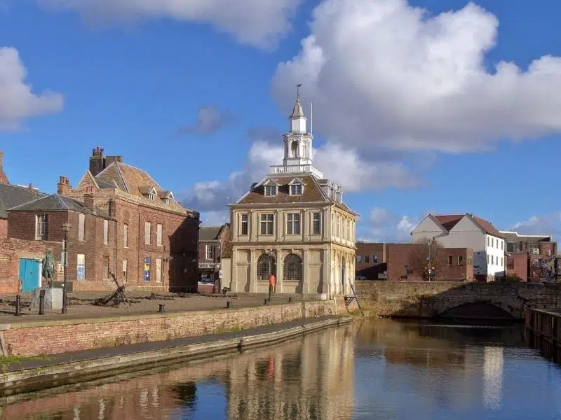
King’s Lynn
Nestled in the western corner of Norfolk is the historic port and market town of King’s Lynn. With a rich Hanseatic past, streets lined with period architecture and bustling marketplaces, King’s Lynn is a great Norfolk town to end your road trip.
Spend a couple of days here so you can explore the town and learn about its rich history as one of the most important ports in England.
Lynn, as it’s called locally, is also surrounded by stunning west Norfolk countryside and is just a stone’s throw from huge sandy beaches and some of Norfolk’s top attractions, making it a perfect stop for trips out and about.
King’s Lynn & Around Highlights
- Taking a walking tour of King’s Lynn, one of the best ways to understand the town’s architecture and story. Pick up free self-guided trail leaflets from the Tourist Information Centre in the Town Hall, or download them here . Choose from the maritime trail, Hanseatic trail, pilgrimage trail and King’s Lynn town guides, or do them all!
- Exploring the tranquil village of Castle Acre, home to the Norman ruins of Castle Acre Castle and Castle Acre Priory , one of the largest and best preserved monastic sites in England, dating back to 1090.
- Visiting the 20,000 acre Sandringham Estate close to King’s Lynn, where Queen Elizabeth II and the royal family gather for Christmas, reportedly her favourite home. Nearby, the Duke and Duchess of Cambridge, aka Wills and Kate, have their home, Anmer Hall.
- Discovering the rich history of Oxburgh Hall , a 15th century moated manor house built by Sir Edmund Bedingfield, whose ancestors still live there today. The house consists of four domestic buildings around a courtyard, built from honeyed stone, and contained within a wide moat.
- Going for a long walk on one of the nearby beaches. The shingle of Snettisham Beach is the closest beach to King’s Lynn and Norfolk’s only truly west-facing beach, perfect for watching the sunset. If you want sand, head to Hunstanton South Beach and all the holiday activities the lively seaside town of Hunstanton offers.
Where to Stay in King’s Lynn
- An elegant Georgian B&B, The Old Rectory offers light and airy rooms and a cooked to order breakfast in the heart of King’s Lynn town.
- Just outside town is Knights Hill Hotel and Spa . With everything on site from restaurants, bars and a health club including a spa and pool, this is a perfect stop to re-energise for a few nights.
RELATED POST: All the Best Things To Do in King’s Lynn Norfolk
You’ve covered well over 100 miles of Norfolk countryside – did we miss anything you loved on your Norfolk coast road trip? Let us know below and we’ll include it on our Norfolk itinerary!
Love it? Pin it!
You may also like...

North Norfolk Railway: Is It Worth It?

Blakeney Hotels: The Best Places to Stay

Accommodation Wells-next-the-Sea: 34 of the Best Places to Stay

Downham Market: West Norfolk’s Hidden Gem
Leave a comment cancel reply.
Your email address will not be published. Required fields are marked *
Information Centres

Norfolk Broads Information Centres & Tourist Information Centres (TIC)
For expert help and a friendly welcome, why not visit one of the Norfolk Broads Information Centres? Knowledgeable staff will be happy to help you make the most of your visit to this unique and beautiful part of Norfolk
The centres at Beccles, Hoveton, Ranworth and Whitlingham provide an accommodation booking service and all centres stock an extensive range of leaflets, maps, guide books, postcards and souvenirs. As well as information relating to the wildlife and fauna of this unique environment found across the wetland National Park of the Broads.
All Broads Information Centres are open daily from Good Friday or 1 April, whichever is earlier, and close at the end of October.
The centres are conveniently situated, close to moorings, at the following locations:
Beccles Library Blyburgate Beccles Suffolk, NR34 9TB
Tel: 01502 523442 [email protected] Opening Hours: 29 March to 31 May and 1-22 October - Mon-Fri 9am- 1pm and 2pm-5pm, Sat-Sun 9am- 5pm 1 June to 30 Sept and 24-31 Oct - Mon-Sun 9am- 5pm
Hoveton/Wroxham Station Road, NR12 8UR Tel 01603 756097 or 01603 782281 [email protected] Opening Hours 29 March to 31 October -Mon-Sun 9am-1pm and 1.30pm- 5pm
How Hill Ludham, Toad Hole Cottage Museum, NR29 5PG Tel: 01603 756096 or 01692 678763 [email protected] Opening Hours 29 March to 31 May and 1-31 Oct - Mon-Fri 10.30am-1pm and 1.30pm-5pm, Sat-Sun 10.30am- 5pm 1 June- 30 Sept - Mon- Sun 9.30am- 6pm
Ranworth The Staithe, NR13 6HY Tel: 01603 756095 or 01603 270453 [email protected] Opening Hours 29 March to 31 Oct - Mon-Sun 9am-5pm
Whitlingham Visitor Centre Whitlingham Lane, Trowse, Norwich NR14 8TR Tel: 01603 756094 or 01603 617332 [email protected] Opening Hours 29 March to 31 Oct - Mon-Sun 10am-2pm and 2.30pm-4pm (5pm in local school summer holidays)
For other enquiries:
Broads Authority Dragonfly House, 2 Gilders Way, Norwich NR3 1UB Tel: 01603 610734 Fax: 01603 756069 [email protected]

- Great Yarmouth
- Ormesby St Michael
- Oulton Broad
- Potter Heigham
- Somerleyton
- South Walsham
- Thorpe St Andrew
- Winterton on Sea
- Bed & Breakfast
- Caravan Parks
- Chalet and Lodge Holidays
- Disabled Friendly
- Dog & Pet Friendly Accommodation
- Glamping & Yurting
- Guest Houses
- Norfolk Broads Boat Hire
- Sailing Cruiser Hire
- Self Catering
- Touring & Motor Homes
- Boat Owners Guide
- Boating Days Out
- Boating Holidays
- Culture Days Out
- Dayboat Hire
- Dog & Pet Friendly Experiences
- Family Days Out
- Fishing and Angling
- Norfolk Broads Video & Webcams
- Pubs and Bars
- Restaurants
- Shopping Days Out
- Sports Days Out
- Walking & Biking
- What's On in the Norfolk Broads
- Download Our App!

- Testimonials
- Privacy Policy
- Sustainability
- Cancellation
© 1997 - 2020 NorfolkBroads.com - All images, copy and artwork are property of NorfolkBroads.com unless otherwise specified. Site designed and built by InnerShed Ltd .

- Free delivery on orders over £10
- 30% off OS Maps! Use code: SPRINGWALK
- OS Outdoor Kit Sale
- OS Paper Map Ranges
- OS Explorer Maps
Map of The Broads

Free standard UK delivery £10+ Free Express next day for orders over £75
The OS Explorer map of the Broads; a member of the national park family, it features the rivers: Burne, Ant, Thurne, Yare, Chet, and Waveney. The map also includes the Norfolk and Suffolk coasts, as well as the seaside towns of Great Yarmouth — renowned for its long sandy beaches, and Lowestoft the most easterly town and first place to see sunrise in the UK. Our Explorer maps come in both standard and weather proof, so you'll never get caught out in a storm. This map also comes with a free digital download, so you can access it across your devices, making for a convenient companion.
Publication Date: 22/08/2017
Three for £23 applies to standard OS Explorer and OS Landranger maps. All other maps included in this offer will be discounted at 41%. Offer excludes Custom Made, Map Sets, City & Street Maps. Cannot be used with items on sale or any other offer. Subject to availability. We reserve the right to end this offer at any time.
Multi-buy discounts Use code: MOREMAPS at checkout
Get 10% off when buying two or more OS paper maps. Discounts increase when buying 16, 31 and 61 or more . Excludes maps on sale.
50% off an OS Paper Map when you buy 2 or more
FSC Certified

100% recyclable

Sustainable packaging
Free digital download
Receive a free download with purchase of this map. Find out more at Mobile Download FAQ .
Explorer 1:25,000 Scale
Every 4cm on the map is 1km, making our leisure selection the most detailed maps; perfect for activities such as walking, running, and cycling
Be ready for anything
Find marked public rights of way, byways, trails, cycle routes, bridleways, road networks, & railway lines
Not sure which map you need?
Discover which area this map covers with the map area overview below or read more about our different types of maps
Topographic mapping
Highly detailed contour mapping highlighting variations in terrain and everything you would expect from a map
Explore local landmarks
Discover camping sites, picnic spots, tourist information, car parks, historical sites, pubs, & much more
Delivery times
- Free standard delivery on orders over £10 in up to five working days
- 1st Class delivery in 1-2 working days
- Priority Express Next Day delivery on the next working day
Custom Made map orders will take one extra day for printing. Framed and canvas products are handmade and usually take 10-12 working days to dispatch. If you order on a bank holiday we'll start on your order on the next working day.
An estimated delivery date will be shown in checkout once you enter your address and pick a delivery option. Sorry, we do not currently deliver outside of the UK.
See Full Delivery information here.
What area is covered by the map?
Use the map below to see if areas are on this map or will be on another sheet. Click on any box to see the map for the area.
Sorry, this map is out of stock
The story of your map...
Your map is the result of centuries of exploration and surveying. Take it with you and uncover every inch of the landscape. Discover the history, adventure, colour and secrets of your world.

Over 230 years in the making, your map brings together the stories, journeys and landscape changes that generations of OS surveyors have recorded. Carry that history with you as you make your own discoveries.
Find trig pillars, monuments, castles, and heritage sites across the map as you make your way through the landscape.
Amazing sights, quality time and pure enjoyment. Take your map where your sense of exploration leads… and remember it’s not just paper. Double-check where you are any time with the offline digital version.
Every inch of Great Britain is ready for you to conquer. Our maps guide you across all of the countries footpaths, brideways, National Parks and cycling routes.
The vibrancy of the outdoors comes together in the art of your map. Absorb the colour of the landscape, set your course and go see it for real.
The green and pleasant lands, the waterways, the hills and mountains. Explore the National Parks, areas of outstanding natural beauty and everything in between.
Your map is ready to unfold and lay across the table. A wonderland of details and trails to get lost in before you even set off. Grab a drink, let your curiosity take over and see what’s hidden out there.
Away from the beaten track, they're all waiting for you. Uncover spectacular viewpoints, hidden beauty spots, and a nirvana of nature.
You might also love...

Marvellous Maps

Ordnance Survey

Create Review
- birmingham canal navigations
- forth & clyde and union canals
- four counties ring
- birmingham to milton keynes
- braunston to kings langley
- milton keynes to london, london ring & the east london ring
- stoke bruerne to leicester, river soar & erewash canal
- kennet & avon canal
- lee & stort navigations
- liverpool to keighley
- foulridge to leeds, with the aire & calder and the calder & hebble navigations
- llangollen & montgomery canals
- monmouthshire & brecon canal
- oxford canal
- river thames
- shropshire union
- stourport ring
- trent & mersey canal and river trent
- warwickshire ring
- gb cruise planner
- greenways map
- milton keynes atlas
- along the thames
- in east berkshire
- three castles path
Cruising and Tourist Map
A full colour map of the Broads suitable for both waterways and leisure users.
This map gives detailed coverage of the Broads with emphasis on the waterways and information useful and relevant to users of the waterways without neglecting other leisure users. The map detail is complimented by information panels and photographs.
Our cruising and tourist map of the Broads is at 1:50000 with detailed town plans at 1:12500 for Wroxham and Hoveton, Stalham, Horning, Potter Heigham, Norwich, Brundall, Beccles, Loddon, Great Yarmouth, Reedham and Oulton Broad.
A double side map with the map on one side and boating and vistor information of the other. The map shows navigation information, visitor moorings, boatyards, boat hire centres, facilities for the boat user and shops. Tourist information includes places of interest, pubs, nature reserves, windmills, churches, long distance paths, public toilets and caravan and camp sites. The reverse side has detailed boating information including location of visitor moorings, details of facilities at boatyards and marinas, journey times, day boat hire and boat trip locations, as well as contact details and opening times for a wide selection of visitor destinations and attractions, canoe and cycle hire details and some useful waterways contact numbers. Click here to see the area covered by this map.
The Broads is Britain's largest protected wetland, covering some 300 sq km. Its rivers, broads, marshes and fens make it a unique area with some rare habitats, plants and wildlife. It was the arrival of the railways in the late 19th century that opened the area to tourism. Today it is one of the most popular inland waterways with in excess of 125 miles of lock-free navigable waterways. Other popular activities include fishing, walking, cycling and bird watching.
ISBN 978-1908851352 • Price £6.50 • 3 rd edition
The Broads map is available to buy online or by telephone from our business partner, Guidepost. Click on the logo below to visit their store.
New Edition
Click on the image above to see an extract from the map - opens in a new window
IMAGES
VIDEO
COMMENTS
An interactive map showing where in the Norfolk Broads the attractions, where to stay and what to do are located
Interactive map of the Norfolk Broads, with moorings, attractions, walks, restaurants and more. 01603 782207. Find Holidays. Boating Holidays. Browse Our Cruisers; ... To find out how long it will take you to travel between two places on the Broads we have compiled the table below. Find the journey time by selecting your starting location from ...
An Interactive Norfolk Broads Map. Just click on the interactive map of the Norfolk Broads and without leaving your armchair go on a photo tour of beautiful Broadland. A Google map of the Broads pinpointing the network of free BA moorings as well as other staithes and mooring places is just a click away. A photo tour of Broadland, just click on ...
The Norfolk Broads is the UK's largest and finest wetland landscape. This unique patchwork of rivers and lakes is not, as was first thought, a natural landscape, but a result of intensive digging of peat in the Middle Ages to provide fuel. The empty pits were soon filled by rising water levels and now form a network of over 125 miles of ...
Norfolk Broads Map . The Norfolk Broads is one of Britain's major tourist destinations and also Britain's largest protected wetland, with 125 miles of water and no locks to stand in your way. The Broads are a favourite with first-time boaters as they offer the perfect combination of easy navigation thriving wildlife, fishing, birdwatching ...
Welcome to The Premier Tourism Guide for the Norfolk Broads. Browse through our guide and discover what there is to see, do and visit in this lovely area of outstanding beauty. Click here "Explore the Norfolk Broads" or click on any of the picture boxes, or on the button at the top or bottom of the page to begin your journey.
Norfolk Broads. Type: Marsh. Description: network of rivers and lakes in the English counties of Norfolk and Suffolk. Categories: protected area, national park, marsh and body of water. Location: Norfolk, East of England, England, United Kingdom, Britain and Ireland, Europe. View on OpenStreetMap. Latitude. 52.6667° or 52° 40' north.
The Broads Authority looks after the national park for visitors, boaters, wildlife and its community. Visit the Broads provides a strong unified voice for Broads tourism-related businesses, from accommodation providers to holiday boat operators, and other stakeholders with an interest in tourism activity.
I receive many enquiries about which maps have the best coverage of the Norfolk Broads Area. I myself use three: the Ordnance Survey Explorer OL40, which has the most waterside detail at 4cm-1km scale.; The Geo 'The Broads' map at 2cm-1km scale, which comprehensively covers both waterside detail and navigational information.
Use the interactive tourist map of the Norfolk Broads to search for a range of local attractions, services and amenities. The Broads are located in both Norfolk and Suffolk in the East of England, the network of navigable lakes and rivers ensure the area is a firm favourite among boating enthusiasts from across the UK and beyond.
The Norfolk Broads are an Area of Outstanding Natural Beauty, and a unique network of navigable rivers and lakes which meet the Norfolk coast, to create a diverse landscape, perfect for an exciting outdoor holiday or trip.. There are lots of Norfolk Broads attractions to keep the whole family busy. Find adventure on the miles of tranquil waterways, enjoy games and sandcastle building on ...
The Tide Calculator page shows the actual state of the tide at the main locations within the Broads System. It initially displays in real time, but you can select any date and time from 2003 to a couple of years ahead. There is also a tide table viewer/printer function, for any start date for 2 to 60 days, with or without the graphic 'tide ...
Having twice won the Best Kept Village Award, it is a beautiful place with a stunning medieval flint church finished with Norfolk thatching. It is also home to Woodforde's Brewery and the brewery tap, The Fur & Feather. At Stalham you can visit the Museum of the Broads and marvel at Hunsett Mill. The picturesque village of Horning is situated ...
Norfolk Broads Metro Map. This map is intended to give a spatial overview of the northern Norfolk Broads. You can use it to see how you get from one place to another and how long it is going to take. If you are familiar with the London Underground map, you should have no problems reading this map!
The Broads Authority looks after the national park for visitors, boaters, wildlife and its community. Visit the Broads provides a strong unified voice for Broads tourism-related businesses, from accommodation providers to holiday boat operators, and other stakeholders with an interest in tourism activity.
Guide to the Broads. We know that the best way to enjoy the Norfolk Broads is by boat. Not only the beautiful views along the banks but also the many nooks and quirks that can only be accessed by water. So, if you're planning a Broads holiday, you are in for a treat. We've put together this guide to highlight some of our favourite places to ...
A Local's Guide to the Norfolk Broads. By Izzy / November 29, 2023. Huge skies, undulating landscapes and LOTS of water… the Norfolk Broads are an Area of Outstanding Natural Beauty in England's East Anglia region, where rivers, lakes and sea combine to create a unique and diverse place full of natural beauty, wildlife and cultural heritage.
The man-made Broads National Park is the third largest inland waterway and home to over a quarter of the rarest plants and animals in the UK. Broads villages Wroxham, Hoveton, Coltishall, Horning and Stalham are enjoyable all year round with beautiful scenery and plenty to do. Wroxham, known as the capital of the Norfolk Broads, sits on the ...
Norfolk Road Trip - Route, Map and Itinerary. By Izzy / July 26, 2023. Norfolk is a county that's perfect for a road trip. Blessed with beautiful landscapes, spectacular beaches, historic towns and the gorgeous Norfolk Broads, Norfolk will captivate you. Chuck in grand stately homes, a fantastic local gastronomy scene and loads of really ...
Dragonfly House, 2 Gilders Way, Norwich. NR3 1UB. Tel: 01603 610734. Fax: 01603 756069. [email protected]. Norfolk Broads Tourist Information Centres are located throughout the Norfolk Broads offering the visitor every assistance with maps and guides to ensure that a visit or a stay in The Norfolk Broads is wonderful experience.
Cast off on an exciting voyage of discovery along the magical waterways of the Norfolk Broads. The big skies and sparkling landscape are a perfect canvas for adventure and relaxation. Leisure time can be as relaxed or energetic as you like - river trips, cycling, walking or a spot of angling. Visit a nature reserve, a stately home or craft ...
Free standard UK delivery £10+. Free Express next day for orders over £75. The OS Explorer map of the Broads; a member of the national park family, it features the rivers: Burne, Ant, Thurne, Yare, Chet, and Waveney. The map also includes the Norfolk and Suffolk coasts, as well as the seaside towns of Great Yarmouth — renowned for its long ...
The map detail is complimented by information panels and photographs. Our cruising and tourist map of the Broads is at 1:50000 with detailed town plans at 1:12500 for Wroxham and Hoveton, Stalham, Horning, Potter Heigham, Norwich, Brundall, Beccles, Loddon, Great Yarmouth, Reedham and Oulton Broad. A double side map with the map on one side and ...