How Long Does It Take To Hike Mission Peak?
Published by abdul moeed on august 4, 2023 august 4, 2023.
Exploring the great outdoors often leads us to wonder – how long does it take to hike Mission Peak? This popular trail in Bay Area California offers a challenging yet rewarding round-trip hike of 6.2 miles, which can be daunting for beginners.
In this article, we will break down factors such as your fitness level , travel pace, and weather conditions that influence your hiking time on this adventurous route up to its 2,100-foot summit.
Get ready – we’re about guide you through all you need to know about tackling Mission Peak.

Key Takeaways
- The Mission Peak Trail is a challenging 6.2 – mile round trip hike in the Bay Area of California, with an elevation gain of 2100 feet.
- Factors that affect hiking time include individual fitness level, pace and breaks taken along the way, and weather conditions.
- On average, it takes hikers around 4-5 hours to complete the Mission Peak hike, but experienced hikers may be able to reach the summit in as little as 2-3 hours.
- Key tips for a successful hike include starting early, staying hydrated and fueled, wearing the appropriate gear, and taking breaks as needed.
Overview of the Mission Peak Trail

The Mission Peak Trail is a challenging route located in the Bay Area of California .
Distance and elevation
Planning your Mission Peak hike involves understanding the trail length and elevation. The total distance of the round trip on the Mission Peak Trailhead itself is 6.2 miles, with a portion of this being the challenging Hidden Valley Trail that stretches for about 2.3 miles.
Alongside distance, consider elevation gain, which stands at an impressive 2100 feet. Gearing up for such altitude requires proper planning and preparation to ensure you fully enjoy this popular Bay Area Ridge trail hiking destination and park’s panoramic views and avoid potential health risks like heart problems due to constant ascent.
Difficulty level
The hike to Mission Peak is considered challenging, and the climb is known for its difficulty level. With a fairly constant ascent, hikers should be prepared for a strenuous trek. The trail has an elevation gain of 2100 feet , providing a good workout for those looking to challenge themselves.
It is important to have a decent fitness level and be aware of any heart conditions or problems before attempting this hike. However, with proper preparation and pacing, hikers of different fitness levels can enjoy the rewarding experience of reaching the summit of Mission Peak.
Popular hiking destination
Mission Peak is a popular hiking destination in the Bay Area of California, known for its challenging trail and stunning views. With a total distance of 6.2 miles round trip and an elevation gain of 2100 feet, this hike attracts both experienced hikers and outdoor enthusiasts looking to immerse themselves in nature.
The average time taken to reach the summit is around 2-3 hours, making it a great option for those seeking a half-day adventure. Whether you’re camping nearby or simply wanting to enjoy the beauty of the Sierras, Mission Peak offers an unforgettable hiking experience.
Factors Affecting Hiking Time

Several key factors can affect the hiking time to complete Mission Peak, including individual fitness level, pace and breaks taken along the way, and prevailing weather conditions.
Individual fitness level
Your individual fitness level plays a significant role in determining how long it will take you to hike Mission Peak. If you are physically fit and have experience hiking, you may complete the hike more quickly compared to someone who is less active or new to hiking.
Your fitness level affects your endurance and ability to handle the challenging uphill sections of the Peak Meadow trail. Keep in mind that hikers with heart conditions or other health concerns should approach this hike with caution and consult their doctor beforehand.
Pace and breaks
The pace at which you hike and the breaks you take along the way can greatly affect how long it takes to hike Mission Peak. Some hikers prefer a faster pace, while others enjoy a more leisurely stroll.
Remember to find a pace that is comfortable for you and allows you to maintain a steady rhythm throughout the hike. Taking breaks is also important, especially if you need to catch your breath or rest tired muscles.
Listen to your body and take breaks as needed, but try not to linger too long so that you can stay on track with your estimated hiking time.
Weather conditions
Weather conditions can significantly impact the duration of your hike to Mission Peak. It is important to check the weather forecast before you embark on your journey. Extreme heat, strong winds, or heavy rain can make the hike more challenging and potentially hazardous.
Dressing appropriately for the weather and carrying necessary gear such as sunscreen , a hat, extra layers, and a rain jacket will ensure you are prepared for any changes in conditions during your hike.
Average Time to Hike Mission Peak

The average time to hike Mission Peak varies based on fitness level and pace. Keep reading to learn more about typical hiking durations for different fitness levels!
Range of hiking times
The range of hiking times to complete the Mission Peak Trail is typically between 4 and 5 hours. This duration includes both the ascent and descent of the trail, covering a total distance of 6.2 miles round trip.
However, it’s important to note that individual fitness levels and pace can influence the time taken to hike Mission Peak. Some hikers may be able to complete the trail in less than 4 hours, while others may take longer depending on the speed and breaks they choose to take along the way.
Typical duration for different fitness levels
Hiking time varies depending on your fitness level. Here’s a handy table that presents the typical duration for different fitness levels to hike Mission Peak:
Please note these times are approximate and may vary based on pace, breaks, and weather conditions. Always plan your hike according to your personal fitness level and comfort.
Tips for a Successful Hike

Start early, stay hydrated, wear appropriate gear, and take breaks as needed. These tips will ensure a safe and enjoyable hike to Mission Peak Regional Preserve. Ready to hit the Horse Heaven Trail? Keep reading to find out more.
Start early
To make the most of your Mission Peak hike, it’s important to start early. The trail takes approximately 4-5 hours to complete, so starting in the morning will give you plenty of time without feeling rushed.
Plus, starting early helps you beat the midday heat and enjoy cooler temperatures along the way. By beginning your hike with the sunrise, you’ll also have a better chance of experiencing stunning views throughout your journey north.
So set that alarm clock and get ready for an invigorating adventure on Mission Peak.
Stay hydrated and fueled
Staying hydrated and fueled is essential for a successful hike up Mission Peak. The 4-5 hour trek requires energy, especially during the challenging portions of the trail. Make sure to bring plenty of water as there are no water sources along the way.
Pack snacks and meals that provide sustained energy to keep you going throughout the hike. This will help prevent fatigue and ensure you have enough fuel to reach the summit.
Wear appropriate gear
Wearing appropriate gear is crucial for a successful hike to Mission Peak. Make sure you have sturdy hiking boots or trail shoes that provide good traction and support for challenging terrain.
Dress in layers, as the temperature can vary throughout the hike. Don’t forget to bring a hat, sunglasses, and sunscreen to protect yourself from the sun’s rays. It’s also important to carry a backpack with essentials such as water, snacks, a map or compass, a first aid kit, and a fully charged cell phone for emergencies.
By wearing the right gear, you’ll be prepared and comfortable during your hike up Mission Peak.
Take breaks as needed
Rest and rejuvenation are essential during a hike, especially on challenging trails like Mission Peak. It is important to listen to your body and take breaks as needed. Whether it’s to catch your breath, stretch your muscles, or simply enjoy the stunning views, pausing along the trail can help you maintain energy and prevent exhaustion.
By taking short breaks at regular intervals, you’ll be able to conquer the Mission Peak hike more comfortably and safely. Remember to hydrate and refuel during these breaks to keep your stamina up throughout the journey.
You can also go to Sunol regional wilderness, mill creek road, Eagle Trail, and monument peak to have some rest.
How long does it typically take to hike Mission Peak?
The average time it takes to hike Mission Peak is approximately 2-3 hours for a round trip. However, the duration can vary depending on an individual’s fitness level and hiking experience.
What factors can affect the duration of a hike up Mission Peak?
Factors that can affect the duration of a hike up Mission Peak include the hiker’s physical condition, pace, rest breaks taken along the way, weather conditions, and trail congestion.
Are there any recommended routes or trails to take when hiking Mission Peak?
There are multiple routes to reach Mission Peak, but the most popular trail is the Stanford Avenue and Trailhead.
It is advisable to research and plan your route in advance based on your preferences and abilities. You can also follow the horse haven trail or the Ohlone wilderness trail from the south bay to reach mission peak summit.
What should I bring with me for a hike up Mission Peak?
It is important to bring essentials such as plenty of water, comfortable hiking shoes, sun protection (hat/sunscreen), snacks or energy bars, a fully charged mobile phone for emergencies, and appropriate clothing layers depending on weather conditions.
In conclusion, the duration it takes to hike the top of Mission Peak can vary depending on individual fitness levels and pace. On average, it takes hikers around 4-5 hours to complete the round-trip hike.
However, some experienced hikers may be able to reach the summit in as little as 2-3 hours. It is important to plan accordingly, start early, and take breaks as needed for a successful and enjoyable hike.
So if you’re up for a challenging hike with breathtaking Santa Cruz mountains views, Mission Peak is definitely worth exploring.
- Click to share on Twitter (Opens in new window)
- Click to share on Facebook (Opens in new window)
- Click to share on LinkedIn (Opens in new window)
- Click to share on Pinterest (Opens in new window)
- Click to share on WhatsApp (Opens in new window)
Related Posts

Hiking Trails How To
How long is the hike to machu picchu.
Machu Picchu, the iconic ancient Inca city nestled high in the Andes mountains of Peru, has long captivated adventurers and history enthusiasts alike. As one of the most sought-after treks around the globe, many are Read more…

How Long Does It Take To Hike the Pacific Trail?
Embarking on a journey along the Pacific Crest Trail is an incredible adventure that many hikers dream of conquering. This formidable National Scenic Trail stretches over 2,650 miles through diverse terrains and breathtaking landscapes, offering Read more…

Guides Hiking Trails
How long is the superior hiking trail.
Hiking Made Easy – Do you know how long is the superior hiking trail? If not, then you should know that the superior hiking trail is 310 miles long. That’s it? Of course not. We Read more…


Hike Mission Peak Trail – The Ultimate Guide From A Local
By carrie green zinn.

Are you wondering if hiking the Mission Peak Trail is worth it?
Absolutely! I highly recommend the Mission Peak Trail in Fremont, CA for a ton of reasons. This is a 6.2 mile round trip trail with elevation gains of 2500 feet. And its just 40 miles from San Francisco .
This hike is easily accessible from all over the Bay Area, gives you a great workout, and the views are beyond incredible!
The Mission Peak Hike is by far one of the most popular of all Bay Area Hikes . Join your fellow hiking enthusiasts to find out why.

How to hike The Mission Peak Trail
- You can simply retrace your steps back down or descend by the Horse Haven Trail connecting to the Peak Meadow Trail which will head back to the Eucalyptus Grove as you approach the parking area.

What can you see from the top of Mission Peak?
Your reward at the top of the Mission Peak Trail, at 2517 feet is a 360 degree view of the entire Bay Area.
Not only can you see the skylines of San Francisco and San Jose , but you can capture Mt. Tamalpais in the north, Mt. Hamilton in the south, Mt. Diablo in the east, and the Santa Cruz Mountains in the west. On a clear day, look for the Sierra Nevada Mountains in the northeast.
When is the best time to hike the Mission Peak Trail?
The Mission Peak Regional Park Preserve and Fremont area can get pretty hot and super sunny in the Spring and Summer . Be prepared with sunscreen, hats, and plenty of water.
I loved this hike at Christmas time because the early morning was cool and foggy and the sun was shining by the time we got to the peak.
I recommend the Fall and Winter for temperate hiking temperatures.
How long is the Mission Peak Trail?
The Mission Peak Trail is a 6.2 mile round trip hike.
It takes approximately 4 – 5 hours to hike.
I suggest you go clockwise. This direction is the popular, well traveled route. Enjoy the benches along the way, the wildlife – cows, turkeys, and birds.
The hike is billed as c hallenging level because of the steep incline of over 2100 feet in 3 miles .
If you are in strong shape, you won’t find it that challenging, but everyone agrees that it’s a good workout! Just take your time and you’ll be fine.
Where to park to hike the Mission Peak Trail?
Tell your GPS to bring you to the Stanford Avenue Staging Area on the Mission Peak Regional Preserve . There is space for 43 cars to park. If that area is full, then park on Vineyard Avenue .
Get to the parking lot EARLY, no later than 7:00 AM – 8:00 AM on the weekend if you want to be guaranteed a spot.
The trailhead is at the end of the parking lot, through the gate with the leaf on it.
The Stanford Ave. Entrance Parking Lot is open Dec 23-Mar 31 6:30am-8:00pm, Apr 1-Dec 22 6:30am-9:00pm.
The Ohlone College Entrance Parking lot is open 6:00am-10:00pm.
Mission Peak Trail Hiking Tips
- There is a toilet facility in the Stanford parking area and at the Ohlone College parking.
- Take a photo of the trail map in the parking lot case you lose wifi, or download from your AllTrails app.
- Bring plenty of water and snacks.
- Wear a hat.
- Wear hiking boots or sneakers with some tread.
- Be prepared for some mud and cow/horse manure!
- Wear layers.
- Don’t forget the sunscreen!
- Dogs are allowed. They must be leashed 200 feet from any trail or park entrance. They must be leashed in parking lots and picnic areas.
- Drones are Prohibited!
- Don’t feed the wildlife!
- Bicycles are not allowed on the single track hiking or horseback riding trails.
- Bring your portable phone charger.
Please be Respectful and follow all the 7 Principles of Leave No Trace !© Plan Ahead and Prepare,Travel and Camp on Durable Surfaces, Dispose of Waste Properly, Leave What You Find, Minimize Campfire Impacts, Respect Wildlife, Be Considerate of Other Visitors.

How hard is it to hike to Mission Peak?
As with any hiking experience, it’s important to know your strengths and limitations.
This hike is identified as challenging because of the increase in elevation in just 3 miles.
There are no dangerous or rocky steep inclines. The entire trail is very safe.
If you feel strong and in good shape, you won’t be intimidated at all by this trek, and if you need to slow down, that works too.
Plenty of spots to rest on benches, pause for water, and pose for great pictures!

Christmas on Mission Peak
As a Christmas Eve baby, I like to enjoy a birthday hike.
Surprise! Not only were there festive wreaths on the viewing benches, but there was a Christmas tree at the Mission Peeker!
Some crazy, dedicated Bay Area hikers have been climbing this trail with a Christmas tree and decorations in tow since 2012!
They leave it up until after New Years, so get there for the pic! So fun and generous of them to keep this tradition alive.
Be sure to post #XmasOnThePeak with your pics.

The Ohlone Trailhead- An Alternate Route
There’s another popular route which is from the Ohlone College Campus parking lot which has more spaces but charges a $4.00 entrance fee.
Beginning at this trailhead adds approximately one mile to your hike. This trail route takes the Peak Trail from the parking lot.
What’s the deal with the Mission Peak Pole?
The famous “Mission Peeker” red pole at the summit of the climb was placed on December 27 in 1990 by its designer and park ranger Leonard Page.
Page created the sculpture to include tubes to look through for 360 degree binocular views of the Bay Area.
Page and team placed a time capsule underneath the pole which will be opened after 2090!
Rumor is that the 1990 capsule includes wine, and pop culture items from the time. Bart Simpson and Teenage Mutant Ninja Turtles?

Quick & Easy Links
Flights & Hotels: I recommend Expedia Vacation rentals: I recommend VRBO Car Rental: I recommend Hertz Tours: I recommend Viator Gear: Check out my Travel Stuff Create Your Travel Memory Books with MILK
Now you know why you should hike the Mission Peak Trail!
In a nutshell…
The Mission Peak Trail is one of the most popular of all the Bay Area hikes. It’s a mildly challenging hike with incredible rewards all along the way. Views for days at the top and tons of opportunities for photos of the beautiful Bay Area.
Enjoy it! I know you will.
Carrie Green Zinn is the owner and author of Carrie Green Zinn – A Travel Blog, which helps travelers become inspired to explore and step out of their comfort zones. Carrie focuses on family vacations, empty nest travel, and girlfriend getaways. Her work is informed by her life as a former dancer, therapist, and school psychologist. She brings her passion for writing, photography, and making the world a smaller place to her ever growing blogging audience.
Facebook Twitter Pinterest LinkedIn Instagram
Hi There! I’m Carrie.

I’m a native New Englander, turned New Yorker , turned California girl ! Following a dance career, working as a dance therapist, and being a school psychologist, I’m now ready to share my passion for photography and travel with you! I absolutely love seeing the world with my family and friends. I know you feel the same! Let’s go!
Happily Ever Hiker
How long does it take to hike mission peak.
Anyone interested in hiking and exploring the great outdoors that’s been around the Bay Area must have heard of Mission Peak.
This popular hiking destination offers stunning views of the San Francisco Bay Area, and it attracts hikers of all skill levels. But how long does it actually take to hike to the top?
In this article, we’re going to answer your question and give you all the information you need to plan your hike to the top of Mission Peak.
So, whether you’re a beginner or an experienced hiker, keep reading below as we are certain you’ll find something useful in this article to help you tackle the Mission Peak hike!
Table of Contents
Mission Peak: A Quick Overview
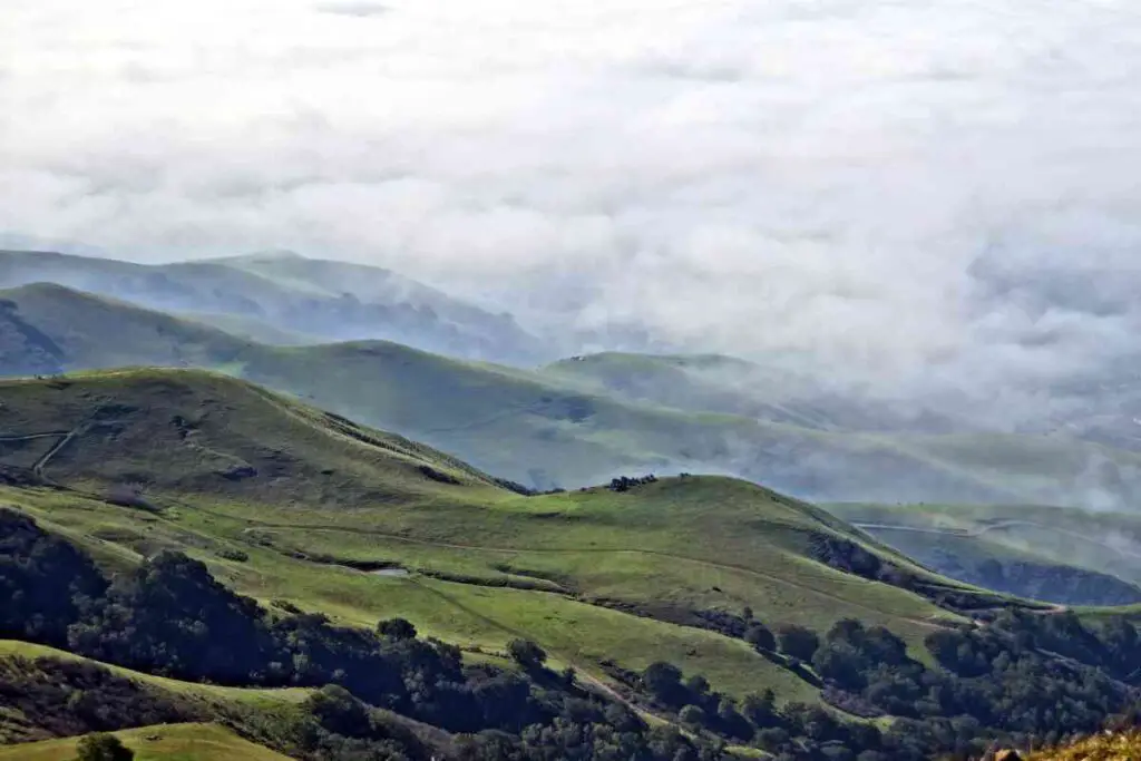
The Bay Area is quite a wide region, but Mission peak is specifically situated in Fremont.
There are a few different trailheads that lead to the peak, but the most popular one is the Stanford Avenue Staging Area and that is where most people start their hike from.
Difficulty And Length Of The Hike
The total round trip distance to the summit of Mission Peak is about 6 miles, with an elevation gain of around 2,000 feet.
The hike is rated as moderate to difficult, so it’s definitely not a leisurely stroll in the park, and the terrain is mostly rocky and uneven, with some steep inclines and declines.
Highlights Of The Hike At Mission Peak
As for notable features along the trail, there are a few that are worth mentioning, with the first one being the famous “Mission Peeker” pole that marks the halfway point of the hike which serves as a great spot to take a breather and snap some photos.
Another great place to take a breath is a grazing area for cows you’ll pass through a little later on your hike.
In case you are worried about how the cows will behave, rest assured that they’ve seen millions of hikers before you and are used to having people pass through, so they won’t bother you as long as you don’t bother them!
Finally, as you approach the summit, you’ll be rewarded with sweeping views of the Bay Area and a panoramic view of the summit. Needless to say, this is definitely worth the climb!
The answer is: it depends. That is because there are a few factors that can affect your hiking time to the top of Mission Peak.
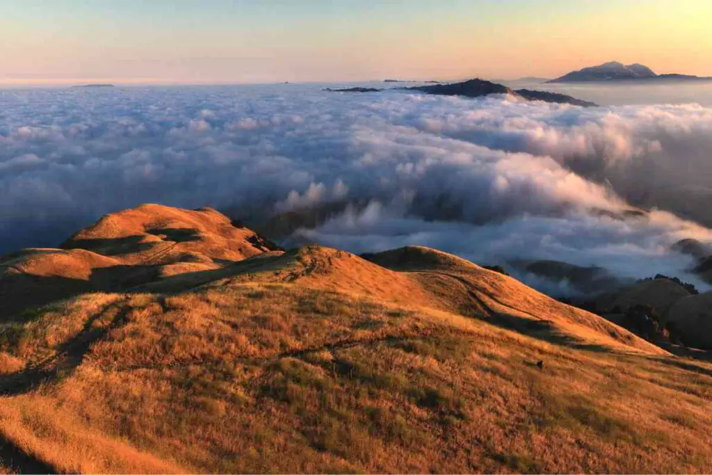
First of all, your fitness level plays a big role. If you’re an experienced hiker in great shape, you might be able to make it to the summit in under 2 hours.
On the other hand, if you’re a beginner or not used to hiking, it could take closer to 4 hours.
Other factors that can affect your hiking time include weather conditions, crowds on the trail, and time of day.
For example, on a particularly hot or windy day, you might need to take more breaks and slow down your pace.
Moreover, if there are a lot of other hikers on the trail, you might need to factor in extra time for passing and waiting, while if you start your hike later in the day, you’ll need to factor in extra time for descending before sunset.
Nevertheless, we could say that, in general, the average hiking time for Mission Peak is around 3-4 hours for a round trip, with the factors mentioned above affecting your personal time.
Tips For Hiking Mission Peak
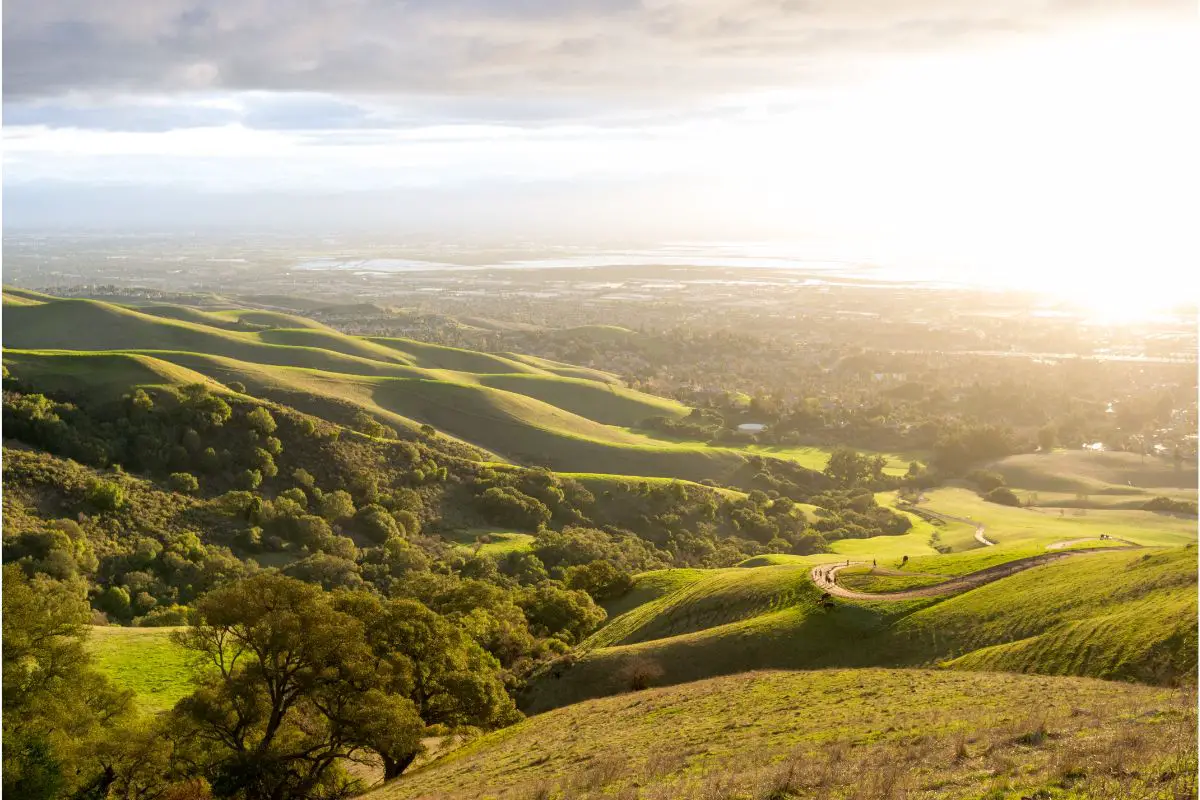
Now that we’ve covered the basics and answered the burning question of how long it takes to hike Mission Peak, let’s talk about some tips to help you make the most of your hiking experience.
Stay Hydrated And Nourished
Staying hydrated and fueling your body with snacks and water is crucial on a hike like this.
Make sure to bring plenty of water , at least 2-3 liters per person. It’s also a good idea to bring snacks like trail mix, energy bars, and fruit to keep your energy levels up, and don’t forget to pack out any trash you bring in!
Wear The Right Gear
Wearing the right gear can make all the difference on this hike.
First and foremost, wearing a pair of sturdy hiking boots with good traction is a must, while what you’ll also want to wear is breathable, moisture-wicking clothing that’s appropriate for the weather conditions.
A hat and sunglasses can also help protect you from the sun and a comfy backpack where you can carry your water, snacks, and any extra layers you might need is crucial to make sure your back won’t hurt at the end of the day.
Start Early
Starting your hike early in the day is a good idea for a few reasons. First of all, the temperatures are usually cooler in the morning, which can make for a more pleasant hiking experience.
Secondly, the trail can get crowded later in the day, especially on weekends and holidays, so starting early can help you avoid the crowds and have a more peaceful hike.
Last but not least, starting early gives you more time to complete the hike and descend before sunset, leaving time to unwind and relax with your hiking pals before calling it a day.
The Bottom Line
Hiking Mission Peak is not very challenging and won’t take you more than a day, but you still need to make sure you prepare for this hike just like you would prepare for the longer ones.
So, if you are looking for ways to get some exercise and soak in some stunning views of the Bay Area, this hiking trip can offer you the best of both worlds, and thanks to this article and all the information and tips provided, you now know how to make this experience a great one!
Leave a Reply Cancel reply
Your email address will not be published.
Save my name, email, and website in this browser for the next time I comment.
Latest from Blog

Will Snakes Cross a Rope? Debunking Common Myths
Yes, some snakes can cross ropes, especially if they’re good climbers and the rope provides enough

What to Do if You See a Deer While Hiking: Safe Wildlife Encounters
If you spot a deer while on a trail, the first step is to maintain a

Are Timberlands Good for Hiking? Evaluating Durability and Comfort
While fashion-forward individuals often sport Timberlands in urban settings, a question looms for outdoor enthusiasts: Are
How to Get Better at Hiking Uphill: Techniques for Mastery
Mastering the art of uphill hiking can transform your outdoor experiences, offering not only breathtaking views
Is Hiking Aerobic or Anaerobic: Understanding the Exercise Classification
Often, hiking is primarily an aerobic activity, especially when you engage in it over an extended
Privacy Policy


Ultimate Guide To The Mission Peak Hike in Fremont
Looking for a classic Bay Area hike for your next hangout? You need to try the Mission Peak hike in Fremont where you’ll be treated to amazing views and cow encounters along the rolling hills.
The highest point on Mission Peak is 2,520 ft tall (768 m), making this East Bay hike a popular challenge. Every weekend you’ll see many people hiking here, in an attempt to reach the top for a photo with the Mission Peak pole . This hike is known to be difficult because of its persistent steepness, making it all the more rewarding to complete.
We were looking for something to do on a long weekend, and thought maybe completing the Mission Peak hike would make us real Bay Area residents. Hence, we set off on our Mission Peak hike in anticipation of Jollibee fried chicken as our post-hike reward.
In this guide, I’ll share what we learnt through our Mission Peak hike, and show you what you can expect there. I’m hoping that this will enable you to take on this challenge with confidence.
About the Mission Peak hike
There are a few ways to get to Mission Peak , but we’ll focus on the classic route that’s recommended for a first-time hike here.
Where do you start for the Mission peak hike?
The classic route starts from the Stanford Avenue Staging Area . Parking is free, and you’ll have access to toilets and tap water. However, there are only 43 parking spots which fills up quickly during weekends and holidays. Hence, most of the time you will need to look for alternative parking in the residential area nearby.
If you absolutely do not want to spend time on finding parking, you have the option of starting at Ohlone College instead.
Trail overview

The trail is well mapped out on AllTrails , though it would be good to also pick up a paper copy of the map when you start.
Beginning at the Stanford Avenue Staging Area , I recommend heading clockwise onto Hidden Valley Trail . It then connects to Peak Trail which takes you all the way to the Mission Peak pole and summit .
Afterwards, continue along the Horse Heaven Trail and then the Peak Meadow Trail that leads you all the way down to your starting point.
- Distance : 6 miles (loop)
- Duration: 4 to 4.5 hours
- Elevation gain: 2,152 ft (656 m)
- Difficulty: Moderate to strenuous
How long does it take to hike to Mission Peak
Starting from the bottom, it takes between 2 to 2.5 hours to get to the top of Mission Peak . If you’re fitter than average, it may even take just 1.5 hours.
It’s best to take frequent breaks, maybe every 30 minutes or wherever you find a bench. After a while, you’ll get used to the incline and will be able to go at a consistent pace.
Best time to hike Mission Peak Trail

The best time to hike Mission Peak is during the cooler months in winter and spring since most of the hike is not sheltered. Although you have more rainy days at this time, it helps to wait a day or two after the rain to let the trails dry out a little. Winter time also brings clearer views as the chance of fog is lower. We went on this hike in January and the weather was perfect.
What you’ll see on this hike
On a clear day, you can see up to the Sierra Nevada mountains toward the east. Nearby, you’ll also be able to see Mount Tamalpais , Mount Diablo , and the Santa Cruz mountains across the bay.
The lower parts of the trail are covered in grass over rolling hills, so do expect to see some cows. Once you get to the top, you’ll see the Mission Peak pole which you can take a picture with against the view of the Bay Area .
I recommend downloading offline Google Maps so that you can use GPS to see where you are going and follow the correct route. This hike is a fairly straightforward loop, but it’s worth noting the various view points where you can rest.
In addition, take note of the intersections where you should keep to your trail to avoid getting lost. There will be signs along the way telling you which direction to turn for any specific trail.
You can make a copy of this Google Map for your reference. Alternatively, download the digital map from the official website.
Where to park near the Mission Peak trailhead
Since we’re starting at the classic Mission Peak Trailhead, the first place to check is Stanford Avenue Parking Area . It fills up quickly on weekends, so if you arrive after 8am, consider public parking along Vineyard Avenue and Antelope Drive . You’ll have a slightly longer distance to cover depending on where you eventually park.
Note that the rest of the streets require permit parking and are meant for the residents there, so if you have no other choice, consider parking at Ohlone College . There are 900 spots of paid parking spots there, but you’ll follow a different route to Mission Peak that’s slightly longer.
Safety on the trail

This article uses affiliate links where I make a small commission if you make a purchase through my links, at no additional cost to you. As an Amazon Associate I earn from qualifying purchases.
To make the most of your adventure, it’s essential to come prepared. Here’s a checklist to ensure you have everything you need.
Hiking essentials and comfort items
- Hiking boots or shoes : Comfortable and supportive footwear is a must so you’ll have the best experience. Waterproof boots can be useful for muddy trails.
- Hiking day pack : It should have enough space to store snacks, water, and any extra clothing. Here are some affordable hiking backpacks below $100 to consider.
- Water : Stay hydrated, especially during warmer months. Water reservoirs with up to 3-litre capacity are useful for longer hikes. In general, bring at least 0.5 litres for every hour of hiking.
- Map and navigation : Having a map adds an extra layer of security. Offline Google Maps also helps.
- Snacks : Pack energy-boosting snacks to keep you fueled throughout the hike. These could be energy bars, nuts, or some sweets.
- Sunscreen and cap : Protect yourself from the sun, especially during the open sections of the trail.
- Layered clothing : For example, bring a fleece sweater and wear a sweat-wicking base layer. Rain jackets can also act as a windbreaker.
- Phone tripod: If you’re hiking alone, having a phone tripod is great for filming shots of yourself.
- Trekking poles: Provide extra stability on uneven terrain and downhill sections.
Terrain conditions

After a period of heavy rain, the trails can become muddy especially along the Horse Heaven Trail . It’s important to wear shoes or boots that give you good traction to avoid slipping. Here is an article about the best hiking boots for women if you’re looking for a new pair.
When you’re almost at the top, you’ll find that the trail has a lot more rocks to walk over, compared to the dirt and gravel paths that led you up. It’s not exactly a rock scramble at this point, but it helps if you have good balance.
Overall, I found trekking poles to be useful for managing the rocky paths and the slippery muddy sections going downhill.

Avoid coming between a mother cow and her calf because they are known to get aggressive when trying to protect their young. Otherwise, the cows you come across are very docile and don’t bother with hikers who don’t present a threat.
I might have tried to have a conversation with a young calf because it was so cute, but quickly stopped as I remembered this safety tip.
There is also a small chance of encountering rattle snakes during warmer seasons. They tend to hide in tall grass and bushes but only strike when threatened. For your safety, stay on the trail and if you see a snake, wait for it to leave before you continue towards it. Wearing covered shoes and long pants are beneficial too.
Mission Peak Trail trip report
Parking at antelope drive.
It was a Monday holiday and we arrived at Stanford Avenue just before 9am. Needless to say the parking lot was full. Vineyard Avenue is usually the next street to get filled up, followed by Antelope Drive which still had plenty of space when we arrived so we parked there. In that case, our hike technically started at Antelope Drive. After using the toilet at the trailhead, we grabbed a physical map and started our hike.
Resting at benches and viewpoints

Given how people talk on reddit about the Mission Peak hike being difficult, I was surprised to see lots of groups and families here. The trail actually starts off quite pleasantly, with a steady incline that is manageable for most people. I’m thankful for the recent rains as it means we have green rolling hills of grass as our scenery.
The Hidden Valley Trail has about 5 benches over 2.2 miles, each overlooking the Bay Area. The first few benches we came across were occupied so we waited until we got further up to grab a bench.
Do remember to bring a snack for the hike as it will really make a difference in your energy levels. If you’re burning about 300 to 500 kcal of calories for every hour of hiking , it makes sense to have an energy bar or some nuts every hour or so. I don’t know about you, but I’m definitely motivated by snacks.
Arriving at Mission Peak
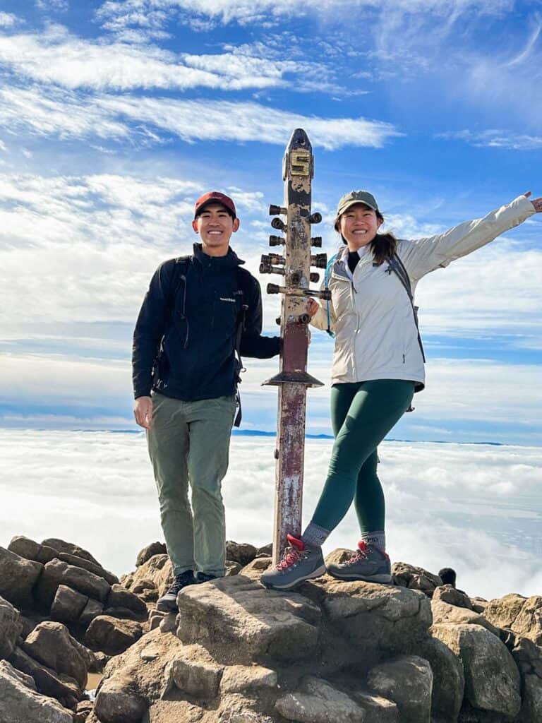
The last push was definitely the most challenging and I had to stop to catch my breath a few times on this stair master-like ascend. There were people coming down as well which made it a bit congested and we had to make way while balancing on the rocks.
Finally, we made it to the top and we were standing above the fog. The Mission Peak pole was ever so popular and people were crowding around it for photos. Still panting from the final stretch, we decided to sit by the rocks to wait out the crowd. It got cold quickly because of the wind so we put on some warm layers. Now we’re ready to snack on some blueberries.
The view from Mission Peak is really impressive and even though the fog was rolling in and out, we could see Mount Diablo towards the east and Mount Tamalpais in the north. We walked around the peak for a little bit to get better vantage points, and then came back to take the mandatory photo with the Mission Peak pole .
Descending via Horse Heaven Trail

Eventually, we made our way down as we remembered our plan to feast at Jollibee later on in Milpitas. Surprisingly, we didn’t see a lot of people taking this route. That leads me to think that most people hike out and back , which does make sense for those who parked at Ohlone College .
We usually prefer to complete the loop instead of hiking out and back so that we can enjoy a variety of views and scenery. Since the Horse Heaven Trail was emptier, we had all the benches to ourselves and didn’t have to make way for anyone. There were more shaded paths here, and we passed a few small streams which was a welcome change from the dry rocks at the peak.
There are several steep sections here which look much more difficult to climb up compared to the incline at Hidden Valley Trail . Looking back, I am glad we chose to go downhill on this route – otherwise an uphill climb here would have knocked me out.
You’ll know you’re getting close to the end when you see the grazing cows once again. The rest of the way is straightforward as you head downhill all the way back to Stanford Avenue .
Shop hiking gear
Gregory jade 28l backpack.
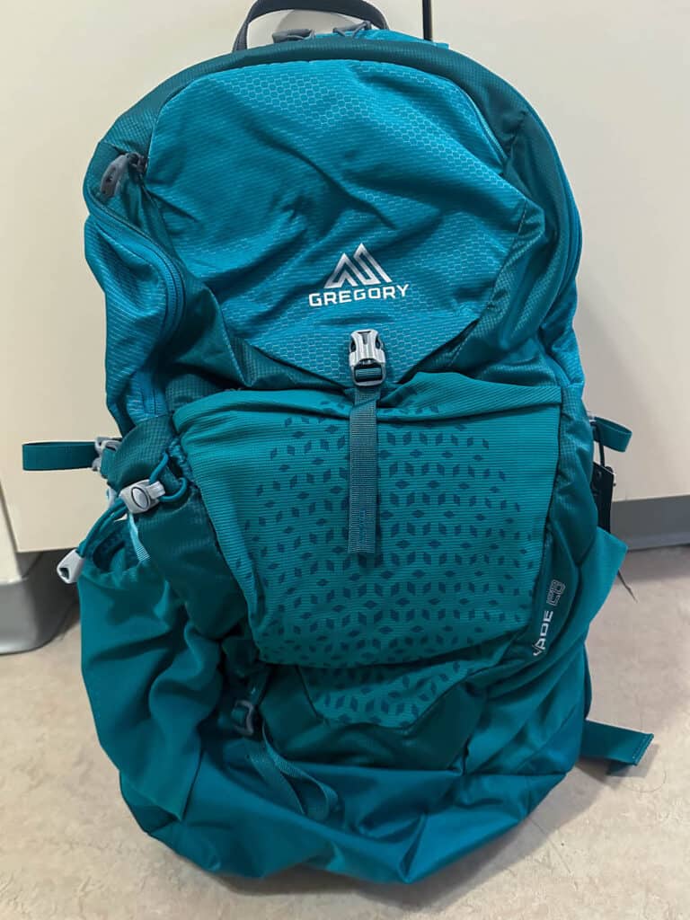
A reliable hiking day pack for carrying essentials – even comes with a rain cover.
Patagonia Down Sweater Hoody

Lightweight and warm, perfect for staying cozy in chilly weather.
Patagonia Torrentshell 3L Rain Jacket
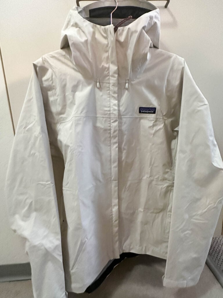
Keep dry and comfortable with a reliable waterproof jacket for unpredictable weather.
Cascade Mountain Tech Trekking Poles
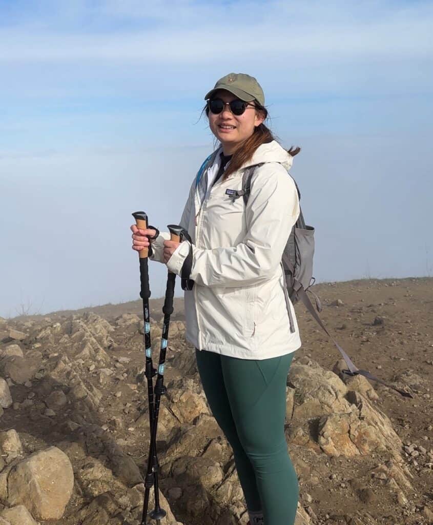
Lightweight hiking poles that support you both uphill and downhill.
Columbia Benton Springs Full Zip Fleece
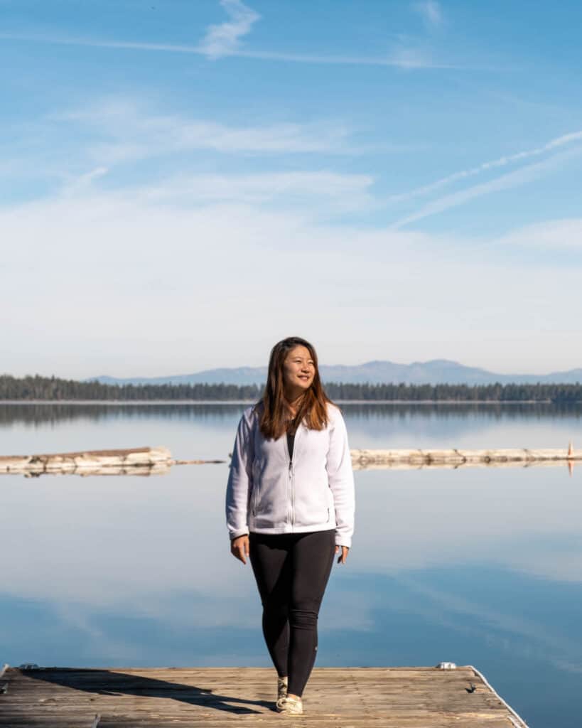
Insulating mid layer fleece that repels water and keeps you warm.
Columbia Newton Ridge Waterproof Hiking Boots

Budget-friendly waterproof hiking boots for casual hikers.
Frequently asked questions
Why is mission peak so popular.

Mission Peak is popular because of the challenge of having to hike up 2,000 ft to get to a popular art installation that is the Mission peak pole , along with the possibility of seeing the Sierra Nevada mountains .
How many calories do you burn hiking Mission Peak
For this 4 hour hike, you’ll burn around 1,200 to 1,600 kcal calories! That’s assuming you burn about 300-400 kcal per hour which is the case for me.
How steep is Mission Peak
You’ll gain 2,152 ft of elevation over 3.1 miles, with an overall 8° incline angle. It’s not surprising that people hike here as training, but nothing compares to the 45° steepness of Half Dome in Yosemite. Once you get to the top, the Mission Peak elevation is 2,520 ft (768 m) which gives you a birds’ eye view of the Bay and surrounding hills.
How do you prepare for Mission Peak
- Cardio exercises are helpful for building stamina on the uphill sections
- Strengthening your quads with single leg exercises including lunges and leg extensions will help to build muscle that can help cushion your steps when going downhill
- If you can’t reach Mission Peak the first time, try again the next time as you work up both your stamina and leg strength in a sustainable way
Is Mission Peak kid friendly
Older kids might be able to take on this trail , with the main concern being the larger rocks that make up the final push up to the peak. However, you could always bring younger kids in a carrier that you wear on your back to make it a family activity.
Can beginners hike Mission Peak
Yes! There aren’t particularly dangerous or technical sections here. Going slow and steady with frequent breaks is okay. Here’s a translation of a Chinese quote I really like – resting is for the purpose of going further. In any case, there are many people who come here to hike so you won’t be completely alone.
More of my travel guides to help you plan your classic California experience
Lassen Volcanic | Lake Tahoe | Yosemite | Point Reyes | San Francisco Day Trips | Half Moon Bay | Pescadero | Big Sur | Santa Cruz | Monterey | Carmel-by-the-Sea | Catalina Island | Death Valley | 10-day California Road Trip | Rental car tips | Bay Area Must-Visit Places
Not sure where to start? I have some ideas for your California trip!
Best stops along California’s coast | Must-go for outdoor lovers | Best winter camping | Bucket-list backpacking trips | Best SF Bay Area hikes | Best California Glamping | Best beach towns
Janice, a California-based travel writer from Singapore, discovered her love for hiking and camping during her studies in Los Angeles. Through her blog, she now shares detailed itineraries for adventures in California, Asia, and beyond. She also talks about gear recommendations and tips for beginners, hoping to inspire them to explore the great outdoors with confidence.

You May Also Like

Popular Jeju Cafes You Need To Check Out (2024)

The Ultimate 10-Day Road Trip You Need: Best Of Highway 1, Yosemite, Lake Tahoe

8-Day Itinerary In Bali – Beaches, Canyons, and Mountain Views
Leave a reply cancel reply.
Your email address will not be published. Required fields are marked *

Mission Peak

Mission Peak is a 2,517-foot summit east of the San Francisco Bay in Fremont. This steep, challenging hike gains over 2,000 feet in 3.1 miles to 360-degree views. Mount Tamalpais, Mount Diablo, Mount Hamilton, and the Santa Cruz Mountains encircle the peak on clear days. Rolling pastures in Mission Peak Regional Preserve unfold like a carpet beneath grazing cows, wild turkeys, and ground squirrels. Mission Peak is one of the most popular hikes in the Bay Area and hundreds of people hike it every weekend.
There are two main trailheads for Mission Peak: Stanford Avenue and Ohlone College. This description starts at the Stanford Avenue trailhead and is considered the “main” route. The main route is 6.2 miles roundtrip while the Ohlone College route is 6.75 miles roundtrip. The elevation gain for each is 2100 feet. Stanford Avenue has free but limited parking and a potable water source at the trailhead. The Ohlone College approach has more shade, more solitude, and more parking in the Ohlone College multi-story parking garage ($4 fee). Once you have done the Stanford Avenue route, try the Ohlone College route to help preserve the trail and cut down on foot and vehicle traffic at the Stanford Avenue trailhead. See Notes for more info.

So let’s give it a go! Start your hike at the Stanford Avenue parking lot, heading northeast on the Hidden Valley Trail. The triangular top of Mission Peak pokes out to the northeast on clear days. If you see clouds at the top, do not despair: you may just end up hiking through a cloud inversion!

In 0.1 miles, stay left at a Y-junction on the Hidden Valley Trail. To the right is the Peak Meadow Trail, which hooks up to the Horse Heaven Trail, an alternative summit route. The wide fire road winds past grassy hills that look like farm pastures, and you can usually see wild turkeys trotting around and foraging for food. At the tail end of winter and in early spring, the grass is emerald green from winter rains.

Although relatively flat for the first 0.3 miles, the trail begins climbing more steeply past a cattle grid. Climb carefully over the grid or just pass through the gate on the right. The round pipes over the ditch make it tricky for flat cow hooves to cross, and the ditch creates a perception of infinite negative space to the cattle, which discourages them from crossing too.

At the 0.75-mile mark is a bench with a shallow view west to Fremont and the San Francisco Bay—a scant preview of the views to come. There are six bench areas along the route, and you may see cattle nearby. Their grazing helps clear away debris that can be a fire hazard and helps native plants to thrive and grow by clearing out non-native plants. EBRPD recommends not touching the cows and watching out for your pup near the cows too. The cows are generally harmless, but getting too close, getting between a mama cow and her calf, and curious dogs can agitate them.

Continue northeast past the first bench, gaining a stiff 700 feet over the next 0.8 miles. Pockets of oak and California bay laurel provide scant shade on hot, clear days. A beautiful woodland spreads down the mountain to the south, and you will likely see ground squirrels and birds foraging in the grassland.

At the 1.5-mile mark, spot an unsigned trail on your right. This is the Peak Meadow Trail, which loops back to the Stanford parking lot for a 3.7-mile round-trip loop in Mission Peak Regional Preserve. Bring a map with you if you explore this route and others in the preserve. Sometimes trails can get overgrown or lack signage and a map will help orient you.

Past the Peak Meadow Trail, ascend 500 feet over the next 0.9 miles. The fire road makes a kind of “N” shape as you squiggle pass Bench 4, round a sharp bend to the north, and then head southeast over another cattle grid. As you round a sharp bend in the trail to head north again, you will pass the Grove Trail on your right. It cuts south through the preserve past a park residence to the Horse Heaven Trail.

Cresting a ridge, pass a signed junction with the Peak Trail on your left at the 2.4-mile mark. There is a pit toilet 0.1 miles down the Peak Trail, and this way also leads to a hang gliding and paragliding launch site for Wings of Rogallo , a local hang gliding club. The Peak Trail eventually leads back to Ohlone College and is the route you would take to Mission Peak if you had started from there.

Past the Peak Trail junction, the trail curves like a question mark around to the southeast, gaining 550 feet in the next 0.7 miles to Mission Peak. Although steep, views of Mount Diablo open up to the north, the beautiful rolling hills of Sunol Regional Wilderness unfold to the east, and Mission Peak is in your sights to the southeast. Bear right at a junction for the Bay Area Ridge Ridge Trail, following the “Peak” sign.

Reach the red Mission Peeker pole at the 3.1-mile mark. Congratulations, you made it! The Mission Peeker pole was erected here on December 27, 1990, created by sculptor and park ranger Leonard Page. If you look carefully through the little sight tubes, binocular-like lenses give you zoomed-in views of the surrounding 360-degree scenery. You are more likely to see people climbing on top of it for a celebratory picture.

Underneath the Mission Peeker pole are time capsules containing a bottle of 1990 zinfandel wine, a replica of an Ohlone charmstone, and pop culture images like Bart Simpson and the Teenage Mutant Ninja Turtles. The park service plans to open it in 2090 or later.

But wait, did you know that the Mission Peeker pole isn’t the true summit of Mission Peak? The true summit is 200 feet to the southeast, where a survey marker rests on a rock pile slightly higher than the rock pile where the Mission Peeker pole is. If you pick carefully among the rocks, you can find it.

Why was the Mission Peeker pole placed near the edge of the mountain, and not the true summit? The original intention for the pole was to promote environmental awareness and for people to use the sight tubes to spot landmarks. It was thought that folks could better see those landmarks from its current location at the edge of the mountain. It has evolved instead into a popular historical artifact and tourist attraction in Fremont.

No matter where you sit, the views of the mountain, Bay, and Mission Peak Regional Preserve are sweeping. To the north, you can see Sunol Peak, Pleasanton Ridge, and Mount Diablo’s telltale double peaks, to the northwest is Mount Tamalpais , to the west is the Dumbarton Bridge and familiar ridgeline of the Santa Cruz Mountains, and to the southeast is Monument Peak and Mount Hamilton. When ready, return the way you came.

- View a trail map, park info and more on the Mission Peak Regional Preserve site .
- Dogs are allowed on the trail.
- Mountain bikers and equestrians are allowed on the route with the exception of the last 0.2 miles below the summit. Consult the trail map and park website for more information.
- There are 43 spaces at the Stanford Avenue parking lot. They fill up quickly, even on weekdays. Street parking in the surrounding neighborhood is common. Learn more on the East Bay Regional Park District’s website .
- As of November 2018, Stanford Avenue hours are 6:30 a.m.-8:00 p.m. (Dec 23-March 31) and 6:30 a.m.-9:00 p.m. (April 1-December 22).
- Try the Ohlone College route for a shadier, quieter, and less crowded route to Mission Peak. The trailhead is located here and there is a kiosk with trail maps. Parking is $4 in the Ohlone College multi-story garage, but you can also park for free on Mission Boulevard, near the intersection of Mission and Pine. It is a 0.3 mile walk to the Ohlone College trailhead from there. Trail hours are 6:00 a.m.-10:00 p.m.
- Fremont police actively monitor the trailheads and hand out citations to hikers who start too early (or stay too late) on the mountain.
Tags: bay area , east bay regional park district , Fremont , mission peak , Mission Peak Regional Preserve , Ohlone Regional Wilderness Trail , san francisco , South Bay , summit
Accommodations near Mission Peak
West Coast hiker, outdoors writer, and photographer. Certified California Naturalist. Author "Moon 75 Great Hikes Seattle"

The trail is a wide fire road that transitions to a narrower dirt trail to the summit. Although easy to follow, it is a steep, challenging hike and the trail has little to no shade for the entire route. Crowds in the hundreds are common on weekends. Two liters of water, sunscreen, and a sun hat are good bets. Bring water for your pup, too.
Download GPX
Download KMZ/KML
The Eagle Spring Backpack Camp is located near Mission Peak in Mission Peak Regional Preserve. There are four campsites with the capacity for 10 people each. Campfires are not permitted. Make your reservation by calling 1-888-EBPARKS.
In Fremont, take Interstate 880 to exit 12 for Mission Boulevard East. (Northbound 880 folks will take exit 12A.) Merge onto Mission Boulevard and drive 1.3 miles east. Turn right onto Stanford Avenue and drive 0.6 miles to the end of the road and the Mission Peak Regional Preserve parking lot, also known as the Stanford Staging Area.
Driving Directions
Car-free Directions
Use the ModernHiker mobile app to download this map and complete trail description for offline access.
Download Details & Map
- Visitor Centers
- Trail Courtesy
- Alerts & Closures
- Rules & Regulations
- New Visitors
- Visitor Safety
- ADA Accessibility
- Public Meetings
- Community Meetings
- Horseback Riding
- Merry-Go-Round
- Community Outreach
- Educator Resources
- Healthy Parks Healthy People
- Naturalist Education
- Outdoor Recreation
- Registration
- Youth and Teens
- Activity Registration
- Event Venues
- Become a Member
- Park Improvements
- Regional Trails
- Future Planning
- Resource Management
- Biodiversity
- Climate Adaptation
- Pest Management
- Water Quality
- Wildfire Resilience
- Government Affairs
- Human Resources
- Board of Directors
- General Manager
- Park Advisory Committee
- RIN Activity Guide
- Social Media
- We Celebrate
- Annual Report
- Bids & RFPs
- e-Newsletter
- Interpretive Panels
- Print Publications
- Mission & Vision
- Compass Magazine
- Memberships & Donations
- Calendar of Events
- New to the Outdoors
- Register/Reserve
- Report an Incident

Mission Peak Regional Preserve
- To Reach the Park
- Attractions
Ohlone College Entrance/Parking lot: Daily, year-round 6:00am-10:00pm Stanford Ave. Entrance/Parking Lot: Dec 23-Mar 31 6:30am-8:00pm, Apr 1-Dec 22 6:30am-9:00pm
Dogs: No fee
Ohlone Entrance: 43600 Mission Blvd., Fremont Stanford Ave. Entrance: Stanford Avenue Staging Area
(510) 544-3246 Toll Free: 888-EBPARKS, (888) 327-2757, option 3, extension 4545 Camping Reservations: 1-888-EBPARKS or (888) 327-2757, option 2
Internet & Cellular Access

Check AT&T, T-Mobile & Verizon Coverage . Select 'Map Layers' and switch on 'No Data Coverage Areas'
Park Activities
Rising steeply to the east of the city of Fremont, Mission and Monument peaks form a dramatic backdrop to the South Bay. The determined and conditioned hiker who reaches the top of Mission Peak will be rewarded with views of Mount Hamilton to the south, the Santa Cruz Mountains to the west, Mt. Tamalpais to the north, and Mt. Diablo and the Sierra Nevada to the northeast. Hawks and vultures share the summit airspace with sailplanes riding the thermals, and a down-to-earth herd of feral goats roams the cliffs.
This well used park, particularly on weekends, with hundreds of visitors attempting the 3-plus-mile hike to Mission Peak. About five hours are required to reach the summit and return. This parkland's 3,023 acres are accessible from parking lots at Ohlone College (slightly longer hike, but more gradual ascent; plenty of parking on weekends) or from a small staging area at the east end of Stanford Avenue in Fremont (steep climb to the summit; parking lot is extremely congested on weekends). There is no access to the park from Mill Creek Road.
The Peak Trail from Ohlone College is an enjoyable hike to the summit that passes a horse corral and through shaded woodlands and open grasslands. This trail is part of the Bay Area Ridge Trail, a planned 550+-mile multi-use trail (currently over 330 miles are complete) along the hill and mountain ridgelines ringing the San Francisco Bay Area. The college charges a $4 parking fee. Parking lot vending machines take cash or credit cards. See the Ohlone College parking information webpage to confirm fee information.
The Stanford Avenue staging area is also the western access to the Ohlone Wilderness Trail, a 29-mile hiking and riding trail through some of southern Alameda County's most beautiful wilderness. Permits are required to hike in the Ohlone Wilderness.
Ohlone College Entrance/Parking Lot 43600 Mission Blvd., Fremont Accessible by RideShare Over 900 parking spaces Daily, year-round 6:00am - 10:00pm Stanford Ave. Accessible by RideShare Parking permit program for residents Entrance/Parking 43 parking spaces Dec 23 - Mar 31 6:30am - 8:00pm Apr 1 - Dec 22 6:30am - 9:00pm NO Public Access to Mission Peak from Mill Creek Road. Please note that hours are strictly enforced . Visitors found inside the park, entrance area, and parking lot after posted hours will be subject to citation and or arrest. Citations cost a minimum of $300
To Reach The Park
Ohlone college access.
43600 Mission Blvd., Fremont, CA. Access from Pine Street or Witherly Lane off Mission Blvd. Both the Peak Trail and the Panorama Trail lead to the Mission Peak summit.
Trails accessible by RideShare. The District thanks all park visitors who are accessing trails at Ohlone College. Transit access and parking here has reduced overflow parking at the Stanford Avenue staging area. Please continue to access trails at Ohlone College. Thank you for your cooperation.
- Effective November 1, 2017, a valid parking permit must be displayed 6am-11pm every day of the week including weekends. College observed holidays and semester breaks are excluded and will remain free.
- Parking is available in Lots E, G and H, and the new parking structure.
- There is a $4 parking fee
- Parking lot vending machines take cash or credit cards.
- Overnight parking is not allowed at Ohlone College.
- Links : Visitor Parking , Parking Fees

- Download: Printable version of the Ohlone College Parking Map (above) [PDF]
Stanford Avenue Access
Located at the east end of Stanford Avenue, off Mission Blvd., this parking lot is heavily used on weekends and holidays. Overnight parking is not allowed without a permit obtained while making camping reservations for the Ohlone Wilderness. Accessing trails from Ohlone College is strongly encouraged.
Stanford Avenue trails accessible by RideShare. As of October 1, 2016, the City of Fremont established a temporary parking permit program for residents within the Mission Peak Neighborhood (map). Restricted parking times are from Saturday at 12:01 a.m. through Sunday at 11:59 p.m. and on national holidays, including dates of observance. Parking IS allowed on non-holiday weekdays. Park visitors are encouraged to carpool, use public transportation and/or ride-sharing services, ride their bikes, or park at Ohlone College.
- Mission Peak Regional Preserve (transit, RideShare, biking, and walking directions).
Public Transit
Public Transit: Take BART to the Warm Spring BART station. From the station, it is a 15 minute RideShare to the trailhead.
Call 511 (TDD (hearing impaired line)/TTY: 1-800-448-9790) or visit Transit.511.org to confirm transit information.

Safe Hiking Tips
Every year, several dogs die of heat stroke and dehydration at Mission Peak and many hikers suffer injuries, as well. Consider these tips while hiking in the park:
Water, Water, Water!!!
- Bring at least 2 liters of water for you and your dog.
- Make sure your companions also have enough water.
- Offer water to your dog every time you drink some.
Be Sun Smart
- Wear a hat and generously re-apply sunscreen.
- Avoid hiking in the middle of the day in the summer months.
Dog Health and Safety
- Dogs are much more susceptible to heat stroke than humans. Hike with your dog only in cooler temperatures.
- Take rests and offer water frequently.
- Watch for signs of heatstroke, which include heavy panting, dry gums, weakness, and inattention.
Sturdy Footwear
- Hiking boots and athletic shoes with ankle support are recommended! [PDF]
- Thick socks help minimize blisters and absorb moisture.
- Do not wear flip-flops, sandals or high heels.
Trail Restoration
Restoration of “the scarface” continues.
The Park District continually works to remove bootleg trails and restore the natural beauty of the hillside near the Mission Peak summit, where it’s been eroded over the years due to hikers leaving the designated trail. We’ve installed fences and signs to educate the public and direct hikers to stay on the marked paths.
Please help the restoration effort by staying on the marked trails. Do not take shortcuts. Press release on restoration work, 2014.
Preserving the beauty of Mission Peak
Irvington High School student volunteers, members of the Mountain Goats bicycle club, and District staff helped restore more than ½-mile of trail in 2012 and 2013. They installed fencing, jut net blankets, eco-wattles, and grass seeds, in hopes of stabilizing the slope and preventing erosion. They also installed signs to educate visitors about the importance of staying on marked trails, and the efforts underway to protect the park’s natural beauty.

BLUE = 2012 Restoration RED = 2013 Restoration GREEN = 2014 Restoration
How can you help?
For more tips and volunteer opportunities, see " A Restoration Story " and Mission Peak Needs Your Help!
- Stay on designated trails - Avoid entering restoration areas - Avoid creating new “bootleg” trails
Other Challenging Trails
If you enjoy the challenge of the Hidden Valley Trail, try these challenging hikes .
Hiking, biking, dog walking, and horseback riding are popular activities available in the Regional Preserve.
Interpretive Hikes
The interpretive staff at Coyote Hills Regional Park leads organized hikes along the slopes and the peak. For information on these and other naturalist-led activities, call the Coyote Hills Visitor Center at (510) 544-3220 .
Backpack Camping
Eagle Spring Backpack Camp offers backpack camping opportunities. Reservation is required. All water should be treated or boiled before drinking. To make a reservation, call 1-888-EBPARKS or (888) 327-2757 , press option 2.
Radio Control (R/C) Flying
Remote-controlled aircraft can be launched at R/C Hill only. All remote-controlled pilots launching at R/C Hill must be members of South Bay Soaring Society (SBSS) and must have in their possession a current membership card. No motorized or gas-powered aircraft are allowed. No other sites within Mission Peak Regional Preserve are approved for this activity.
Hang Gliding and Paragliding
The Wings of Rogallo hang gliding club has a launch site at Mission Peak Regional Preserve to conduct hang gliding and paragliding activities.

Upcoming Events
Wildflower photo guides.
- District Wildflower Photo Guide [PDF]
- District Wild Plant Photo Guide [PDF]
- Mission Peak - Calflora Plant List
- Mission Peak - PlantID.net ID Guide
Hiking from Ohlone College - Peak and Panorama Trail
2950 Peralta Oaks Court, Oakland, CA 94605 1-888-EBPARKS, 1-888-327-2757 (Deaf or Hearing Impaired, use the TRS at 711)

How Long Does It Take to Hike Mission Peak
Mission Peak, located in California, is a popular hiking destination known for its stunning views and challenging trails. Before embarking on this hike, it is essential to understand the basics of Mission Peak. This information will help you plan and prepare for a successful hiking experience.
About Mission Peak:
Mission Peak is situated in the city of Fremont, California, and is part of the larger Mission Peak Regional Preserve. It is a prominent peak in the area, offering panoramic views of the San Francisco Bay Area.
The Elevation of Mission Peak:
Standing at an elevation of 2,517 feet (or 767 meters), Mission Peak provides a moderate-to-challenging hiking experience.
The Difficulty Level of Mission Peak Hike:
Several factors contribute to the difficulty level of the Mission Peak hike, including the terrain, distance, and elevation gain.
The Terrain:
The trail consists of a combination of paved sections, gravel paths, and steep dirt trails. It is important to be prepared for uneven surfaces and rocky sections along the way.
The Distance:
The round-trip distance to Mission Peak is approximately 6.2 miles (or 10 kilometers), making it a considerable hike that requires endurance and stamina.
The Elevation Gain:
Hikers must be prepared for an elevation gain of around 2,000 feet (or 610 meters). The steep ascent can challenge even experienced hikers.
Factors Affecting Hiking Time:
Several factors can influence the time it takes to complete the Mission Peak hike. It is important to consider these factors to plan your hike effectively.
- Fitness Level: Your physical fitness level plays a significant role in determining how long the hike will take. Regular physical exercise and cardiovascular endurance can help increase your hiking speed.
- Trail Conditions: The trail conditions, including the presence of loose rocks or slippery sections, can impact your hiking pace. It is crucial to adjust your speed accordingly to ensure safety.
- Weather: Weather conditions, such as extreme heat or cold, can affect your hiking time. It is important to check the weather forecast before starting the hike and prepare accordingly.
- Number of Breaks: The number and duration of breaks you take during the hike can affect your overall hiking time. Consider the need for breaks to rest and rehydrate but balance it with maintaining momentum.
Considering these factors, the average time to hike Mission Peak can vary based on your pace and fitness level.
In subsequent sections, we will explore the average time to complete the hike at a normal, fast, and slow pace, as well as provide tips to prepare for the Mission Peak hike, including physical fitness training, proper hiking gear, and hydration and nutrition strategies.
Key takeaway:
- Mission Peak offers a challenging hike: Its location in the San Francisco Bay Area and an elevation of 2,517 feet make it a popular hiking destination.
- Various factors affect hiking time: Fitness level, trail conditions, weather, and number of breaks all contribute to the time it takes to hike Mission Peak.
- Average hiking times at different paces: A normal pace may take around 2-3 hours, a fast pace can be completed in 1-2 hours, and a slow pace may take 3-4 hours.
About Mission Peak
Photo Credits: Jasonexplorer.Com by Bruce Clark
Tucked away in the heart of the Bay Area, Mission Peak beckons adventure seekers with its awe-inspiring beauty. As we dive into the wonders of this natural gem, we’ll uncover its whereabouts and explore the breathtaking elevation that awaits hikers. Get ready to discover the captivating allure of Mission Peak’s location and the towering heights that make it a thrilling hiking destination. So lace up your boots and join us on this exhilarating journey to Mission Peak !
The Location of Mission Peak
The location of Mission Peak , situated in Fremont, California , in the eastern part of the San Francisco Bay Area, is truly remarkable. This magnificent peak is nestled within the Mission Peak Regional Preserve , covering over 2,000 acres of breathtaking terrain.
With coordinates approximately 37.5115 N latitude and 121.8677 W longitude , Mission Peak offers unparalleled panoramic views of the Bay Area, Silicon Valley, and the enchanting Diablo Range.
What sets Mission Peak apart is its accessibility to hikers from various points in the Bay Area. This awe-inspiring location is conveniently located near major highways and boasts dedicated parking areas for easy access.
Nature enthusiasts will be captivated by the diverse surroundings of Mission Peak . From the rugged terrain to the rolling hills, this location showcases an abundance of wildlife, providing hikers with a unique fusion of natural beauty and stunning urban vistas.
For hikers planning a visit to Mission Peak , it’s advisable to check the weather conditions and dress accordingly. This location experiences temperature fluctuations throughout the day, making it essential to layer clothing and apply sunscreen. It is crucial to carry an ample supply of water, as there are no reliable water sources along the trail. By being prepared, hikers can ensure a safe and enjoyable adventure, enhancing their overall experience at this incredible location.
The Elevation of Mission Peak
Mission Peak , located in the San Francisco Bay Area , boasts an impressive elevation of 2,517 feet , which allows for breathtaking panoramic views. Taking on the hike at this elevated height presents its own set of challenges, thanks to the rocky and steep terrain that demands a good level of fitness and endurance.
The elevation of Mission Peak plays a significant role in determining the difficulty of the hike. With a gain of approximately 2,000 feet , hikers must be ready for a demanding ascent. The steep incline may necessitate frequent breaks to catch one’s breath and rest.
The elevation directly impacts the time required to complete the hike. Usually, it takes around 2-3 hours to reach the summit when maintaining a normal pace. If you go at a faster pace, you can shorten the hike to roughly 1.5-2 hours . On the other hand, a slower pace may extend the duration to 3.5-4 hours .
To prepare for trekking Mission Peak , it is crucial to enhance your physical fitness and endurance levels. Investing in appropriate gear, such as sturdy boots and layered clothing, is essential. Ensuring proper hydration and nutrition during the hike is vital.
The Difficulty Level of Mission Peak Hike
With its challenging terrain, impressive distance, and significant elevation gain, the difficulty level of hiking Mission Peak is no walk in the park. In this section, we will explore the factors that contribute to the hike’s intensity. From the rugged and diverse terrain to the grueling elevation gain, strap on your boots as we delve into what makes conquering Mission Peak a truly formidable adventure.
The Terrain
The terrain of Mission Peak is crucial when planning the hike. The trail comprises of rocky paths , steep sections , and uneven surfaces .
1. Rocky paths : Hikers should take caution while navigating the trail’s rocky sections as they require careful footing. These areas can potentially slow down their pace.
2. Steep sections : Mission Peak presents uphill sections that demand effort and endurance. Hikers should be ready for the Mount Everest hiking time .
3. Uneven surfaces : The terrain of Mission Peak encompasses uneven surfaces, including uneven terrain and loose gravel. Hikers should exercise caution to prevent slips or falls.
The challenging terrain of Mission Peak increases the difficulty level of the hike. Hikers should adequately prepare themselves both physically and with appropriate gear, while also staying hydrated and nourished during the hike. Considering the weather and trail conditions is also crucial before embarking on the hike.
Being aware of the terrain and its challenges helps hikers better prepare for the Mission Peak hike and ensures an enjoyable experience.
The Distance
The Mission Peak hike is approximately 5.6 to 6.8 miles , depending on your starting point. Starting points include the Stanford Avenue Staging Area , Ohlone College Parking Lot , and Hidden Valley Parking Lot .
Note that the distance mentioned is one way, so you must also consider the return distance if you plan to complete the entire hike.
To ensure accuracy, it is recommended to use a GPS or mapping app to track your progress during the hike. This will help you stay on track and measure the distance covered.
Before starting the Mission Peak hike, wear comfortable and supportive footwear . Be prepared for a moderate to long-distance trek as the distance may vary depending on your starting point.
The Elevation Gain
The Elevation Gain of Mission Peak is approximately 2,000 feet .
The trail ascends 2,000 feet from the starting point to the summit. It is spread out over a distance of about 3 miles , making it a moderately challenging hike.
Expect steep sections and uneven terrain .
The Elevation Gain impacts the hike’s difficulty level and the time it takes to reach the summit.
Hikers who are more physically fit may find the Elevation Gain easier to navigate.
The overall hiking time is also affected by the Elevation Gain , as it adds to the challenge and requires more effort.
Weather conditions, like heat and humidity , can further impact the difficulty.
Take breaks to rest and hydrate during the climb.
Pace yourself and enjoy the scenery while tackling the 11-mile hike .
Understanding the Elevation Gain of Mission Peak will help hikers prepare and have a successful hiking experience.
Factors Affecting Hiking Time
Photo Credits: Jasonexplorer.Com by Vincent Sanchez
When it comes to hiking Mission Peak , various factors come into play that can affect your hiking time. Your fitness level , trail conditions , weather , and the number of breaks you take along the way all contribute to how long it will take you to reach the peak. In this section, we’ll explore these key elements and discover how they can impact your hiking experience. So, lace up your boots and get ready to uncover the variables that determine your journey to the summit !
1. Fitness Level
Your fitness level plays a crucial role in determining the pace and enjoyment of your Mission Peak hike. It is important to consider the following factors:
- Aerobic Endurance: Having high aerobic endurance is essential for conquering the 5.6-mile trail. Engaging in regular aerobic exercises such as jogging, cycling, or swimming can greatly improve your endurance.
- Lower Body Strength: To tackle the trail, it is necessary to strengthen your quadriceps, hamstrings, and calves. Lunges, squats, and calf raises are effective exercises for targeting these muscles.
- Balance and Stability: The uneven and steep terrain requires good core strength, which can be enhanced through exercises like planks, bird dogs, and single-leg balances.
- Joint Flexibility: Maintaining good joint flexibility is crucial during both ascents and descents. Incorporating stretches for major muscle groups and joints can help in achieving this.
- Hydration and Nutrition: It is important to stay properly hydrated before, during, and after the hike. Drinking water and bringing energy-providing snacks like nuts, trail mix, or energy bars is recommended.
By taking your fitness level into account and adequately preparing your body, you can maximize your enjoyment of the Mission Peak hike. Don’t forget to appreciate the stunning views from the summit!
2. Trail Conditions
When hiking Mission Peak, it is important to consider the trail conditions for a safe and enjoyable experience. Here are some key points to note in relation to the trail conditions:
– It is crucial to be aware of the trail maintenance. The condition of the trail can vary depending on factors such as weather, recent maintenance efforts, and the number of hikers using it. Before embarking on your hike, make sure to check for recent reports on the hike time for the Narrows and trail conditions.
– The terrain of the trail consists of dirt, rocks, and occasional pavement . It is essential to be prepared for uneven surfaces and steep inclines, particularly near the summit . This will ensure a more comfortable and successful hike.
– Pay attention to the trail markers along the Mission Peak trail. These signs are strategically placed to guide hikers in the right direction. By staying attentive to these markers, you can avoid getting lost and stay on the correct path.
– Keep in mind that Mission Peak is a popular destination, especially on weekends. If you prefer a less crowded and more peaceful hike, it is recommended to start early in the morning. This will help you avoid congestion on the trail and enjoy a quieter hiking experience.
– The weather conditions in the Bay Area can vary greatly. Therefore, it is wise to check the forecast before your hike. Dressing appropriately according to the weather is essential for your comfort and safety. It is important to note that the summit of Mission Peak can be significantly cooler, so layering clothing is advised.
– Be aware that there may be rare instances when the trail is closed due to hazardous conditions or maintenance. To prevent disappointment, it is crucial to stay updated on any trail closures and plan accordingly.
By taking into consideration the trail conditions and planning ahead, you can ensure a safe and enjoyable hike to Mission Peak.
The weather greatly impacts the hiking experience at Mission Peak . Check the weather forecast before hiking for safety and enjoyment.
Weather conditions can change rapidly, so come prepared with extra layers of clothing, sunscreen, and sufficient water for hydration. Pay attention to the weather for a safe and enjoyable hiking experience at Mission Peak .
In history, hikers at Mission Peak encountered various weather conditions. Some enjoyed clear and sunny days, while others faced challenges with rainstorms or gusty winds. Awareness of weather and proper planning ensures a positive experience and trail safety at Mission Peak .
4. Number of Breaks
When hiking Mission Peak, it is crucial to consider the number of breaks as it significantly impacts your overall hiking time. Taking breaks allows you to rest and recover, but it also adds to the total hiking time. Finding a balance between necessary breaks and maintaining a steady pace is essential to reach the summit within a reasonable time frame.
To illustrate the average time taken to hike Mission Peak based on the number of breaks, please refer to the table below:
As you can see from the table, the more breaks you take during the hike, the longer it takes to complete. Therefore, when planning your Mission Peak hike, it is essential to consider the number of breaks you will need and allow for extra time accordingly. It is important to manage your breaks effectively to ensure an enjoyable and efficient hiking experience.
Please keep in mind that these times are averages and can vary depending on fitness levels, trail conditions, and other factors. The table serves as a general guideline to demonstrate the potential impact of breaks on hiking time.
By incorporating the factor of the number of breaks into your hike planning, you can optimize your hiking experience on Mission Peak and ensure that you have enough time to enjoy the journey.
Average Time to Hike Mission Peak
Photo Credits: Jasonexplorer.Com by Albert Mitchell
If you’re planning to hike Mission Peak , you might be wondering how long it will take you to reach the summit. Well, get ready for an adventure! In this section, we’ll be exploring the average time it takes to hike Mission Peak at different paces. From a normal pace that allows you to soak in the scenery, to a fast pace that challenges your stamina, and even a slow and leisurely stroll for those who want to savor every step. Lace up your boots and let’s dive into the time it takes to conquer this legendary peak!
Normal Pace
When hiking Mission Peak at a normal pace , it typically takes 2 to 2.5 hours . This is based on average hiking speed and the total distance of the trail, which is approximately 6 miles round trip . The normal pace allows for a comfortable and enjoyable hike, with time to appreciate the scenery and take breaks.
The duration of the hike can vary based on factors like fitness level and terrain difficulty . Trail conditions and weather can also affect the overall time. Check the latest trail updates and weather conditions before starting the hike.
Hikers can expect steep sections and rocky paths at a normal pace. It is recommended to wear appropriate hiking gear and footwear for safety and comfort. Stay hydrated and carry enough water and snacks to fuel your body along the way.
Fun Fact: Mission Peak offers stunning views of the San Francisco Bay Area , Mount Diablo , and the Santa Cruz Mountains on clear days.
Hiking Mission Peak at a brisk pace necessitates considering key factors that affect speed and experience. Your level of fitness plays a pivotal role in maintaining a quicker pace and enduring the demands of the hike. Trail conditions, such as incline and uneven terrain, may impede your progress, so it’s important to be prepared.
Weather conditions also have an impact on speed. Hot and humid weather makes hiking more challenging and can decrease your pace. It’s important to plan accordingly, bring sunscreen, and stay hydrated. Taking breaks is crucial. Despite the urge to push yourself, it’s important to listen to your body and rest to avoid exhaustion.
On average, it takes 1.5 to 2 hours to reach the summit of Mission Peak at a fast pace, depending on your fitness level and the conditions. Pace can vary, so it’s important to set realistic goals and focus on enjoying the hike .
To prepare, engage in fitness training, including cardiovascular exercises, strength training, and endurance activities. It’s important to wear appropriate hiking gear, such as sturdy shoes and comfortable clothing. Stay hydrated and nourished by bringing water and snacks.
When hiking Mission Peak at a slow pace , it is important to be conscious of your physical abilities and take your time. Slow pace hiking is well-suited for beginners or those who prefer a leisurely hike.
One crucial consideration when hiking slowly is the terrain . Mission Peak boasts steep inclines and rocky paths that can present a challenge, particularly for beginners. It is crucial to proceed slowly and cautiously to prevent accidents or injuries.
Another factor to bear in mind is the distance of the hike. Mission Peak covers approximately 6 miles round trip. Hiking slowly means it may take longer to complete the hike, so it is essential to plan accordingly and allow sufficient time.
The elevation gain is also worth considering. Mission Peak has an elevation gain of 2,000 feet. Hiking slowly allows for breaks and rest, ensuring you can manage the elevation comfortably.
To fully enjoy your slow pace hike, make sure to bring plenty of water and snacks to stay hydrated and energized. Wearing comfortable and sturdy hiking shoes is essential to prevent any discomfort or foot injuries.
Pro-tip: Take the time to savor and appreciate the scenery and beauty of Mission Peak. Slow pace hiking allows for a more immersive experience. Stay mindful of your pace and listen to your body for a safe and enjoyable hike.
Tips To Prepare For Mission Peak Hike
Thinking about hiking Mission Peak? Want to be fully prepared for the adventure that awaits? In this section, we’ll uncover some valuable tips to make sure you’re ready to conquer Mission Peak . From physical fitness training to ensuring you have the proper hiking gear, and considering your hydration and nutrition needs, we’ll cover it all. So, let’s lace up our boots and dive into these expert tips for a successful Mission Peak hike !
1. Physical Fitness Training
Physical fitness training is essential when preparing for a hike to Mission Peak . It is important to consider several key aspects:
- Cardiovascular endurance: Engaging in activities such as running, cycling, or swimming can significantly enhance your stamina and endurance for the challenging uphill sections of the hike.
- Strength training: Incorporating exercises like lunges, squats, and calf raises into your routine can effectively strengthen your leg muscles, particularly your quadriceps and calves. This will greatly assist you in tackling the steep elevation gain during the hike.
- Balance and stability: Prioritizing your balance and stability through activities like yoga or utilizing a balance board can help prevent injuries caused by the uneven and rocky terrain at Mission Peak.
- Flexibility: It is crucial to include stretching exercises in your fitness regimen to improve flexibility and minimize the risk of muscle strains or cramps. Concentrate on stretching your major muscle groups, including your legs, back, and shoulders.
- Interval training: Integrating interval training into your workout routine can simulate the varying terrain and pace experienced during the hike. This will ultimately enhance your overall level of fitness.
Pro-tip: It is vital to gradually increase both the intensity and duration of your workouts to prevent overexertion and injury. Always listen to your body and allow for adequate rest and recovery between training sessions. By properly preparing yourself physically, you will be able to fully relish the Mission Peak hike.
2. Proper Hiking Gear
When hiking up Mission Peak , it is crucial to have the proper hiking gear for a safe and enjoyable experience. Here is a comprehensive list of essential hiking gear to consider:
1. Sturdy hiking boots : It is important to invest in proper hiking boots that provide ankle support and have good grip on different terrains.
2. Moisture-wicking clothing : To stay comfortable and prevent chafing, it is recommended to choose breathable and quick-drying shirts, pants, and socks.
3. Layered clothing : It is always wise to be prepared for changing weather conditions by wearing easily removable or added layers.
4. Sun protection : Don’t forget to wear a hat, sunglasses, and sunscreen to protect yourself from the sun’s harmful rays and prevent sunburn.
5. Navigation tools : Carry essential navigation tools like a map, compass, or GPS device to ensure you stay on the right trail and navigate effectively.
6. Backpack : Select a well-fitting backpack with enough room to pack essentials such as water, snacks, a first aid kit, and extra layers.
7. Trekking poles : Use trekking poles for added stability on uneven or steep terrain, and to reduce strain on your knees.
8. Headlamp or flashlight : For early morning or late evening hikes, a reliable light source is essential for safety.
9. First aid kit : Always pack a basic first aid kit with adhesive bandages, antiseptic wipes, pain medication, and blister treatments .
Remember, having the proper hiking gear can greatly enhance your experience and help you overcome any challenges you may encounter. Always assess the conditions and terrain before each hike, and make sure you have the necessary gear to stay safe.
3. Hydration and Nutrition
To have a successful hike up Mission Peak , prioritize hydration and nutrition . Hydration and nutrition are key factors that contribute to a fulfilling hiking experience. Here are some important tips to keep in mind:
1. Stay Hydrated: Make sure to drink enough water before, during, and after your hike. Proper hydration is crucial in preventing fatigue, cramping, and other adverse effects. Aim to consume 8-10 glasses (64-80 ounces) of water per day and increase your intake on the day of the hike.
2. Pack Electrolyte-Enhanced Drinks: In addition to water, consider bringing electrolyte-enhanced beverages to replenish the minerals lost through sweat. These drinks help maintain electrolyte balance and prevent muscle cramps. Look for options that contain sodium, potassium, and magnesium.
3. Fuel Up with Healthy Snacks: Pack lightweight and nutritious snacks that are rich in carbohydrates to provide you with energy throughout the hike. Some examples include granola bars, trail mix, nuts, and dried fruits. Avoid consuming snacks that are high in sugar or fat as they can lead to energy crashes.
4. Plan Your Meal Strategy: Depending on the length and intensity of your hike, it’s important to plan for a meal break. You can either carry a packed lunch or have a hearty meal before starting your hike. Make sure to include carbohydrates, proteins, and healthy fats in your meal to sustain your energy levels. Read more about how long it takes to hike Mission Peak .
5. Avoid Caffeine and Alcohol: It’s best to save caffeine and alcohol consumption for after the hike. These substances can contribute to dehydration and negatively impact your performance during the 14-mile hike .
Remember, everyone’s hydration and nutrition needs may vary. It’s important to listen to your body and adjust your intake accordingly. By prioritizing hydration and nutrition , you can optimize your energy levels and have a more enjoyable hiking experience.
Frequently Asked Questions
How long does it take to hike mission peak.
The hike to Mission Peak typically takes approximately 4-5 hours to complete.
Is Mission Peak Trail a challenging hike?
Yes, the Mission Peak Trail is considered challenging due to its steep incline and elevation gains.
What is the best time to hike Mission Peak?
The best time to hike Mission Peak is in the fall and winter seasons when the weather is cooler and more pleasant.
Are dogs allowed on the Mission Peak Trail?
Yes, dogs are allowed on the Mission Peak Trail but must be kept on a leash at all times.
What are some recommended hiking tips for Mission Peak?
Some recommended hiking tips for Mission Peak include bringing water and snacks, wearing appropriate footwear, being prepared for mud and wildlife encounters, and arriving early to secure parking at the Stanford Avenue Staging Area.
What is the significance of the red pole called the Mission Peeker?
The Mission Peeker, a famous red pole at the summit of Mission Peak, offers panoramic 360-degree views of the Bay Area. It also contains a time capsule that is slated to be opened in 2090.
Jason is a seasoned explorer and avid hiker, having traversed hundreds of trails worldwide. His blog is a testament to his passion, offering readers detailed guides, tips, and personal tales from his hiking experiences. His aim is to inspire and equip all hikers, beginners to experienced, for their adventures. So, lace up your boots and join him in exploring the beauty of the great outdoors!
Similar Posts

Hikes Near Lahaina

Hiking Trails in Southern Wisconsin

Waterfall Hikes in Malibu
Hikes in Lake George

Hikes Near Mcminnville

How Long Does It Take to Hike Mount Katahdin

Outdoor Yak
Adventure, Hiking, Travel
Hiking Mission Peak (Unforgettable Adventure)
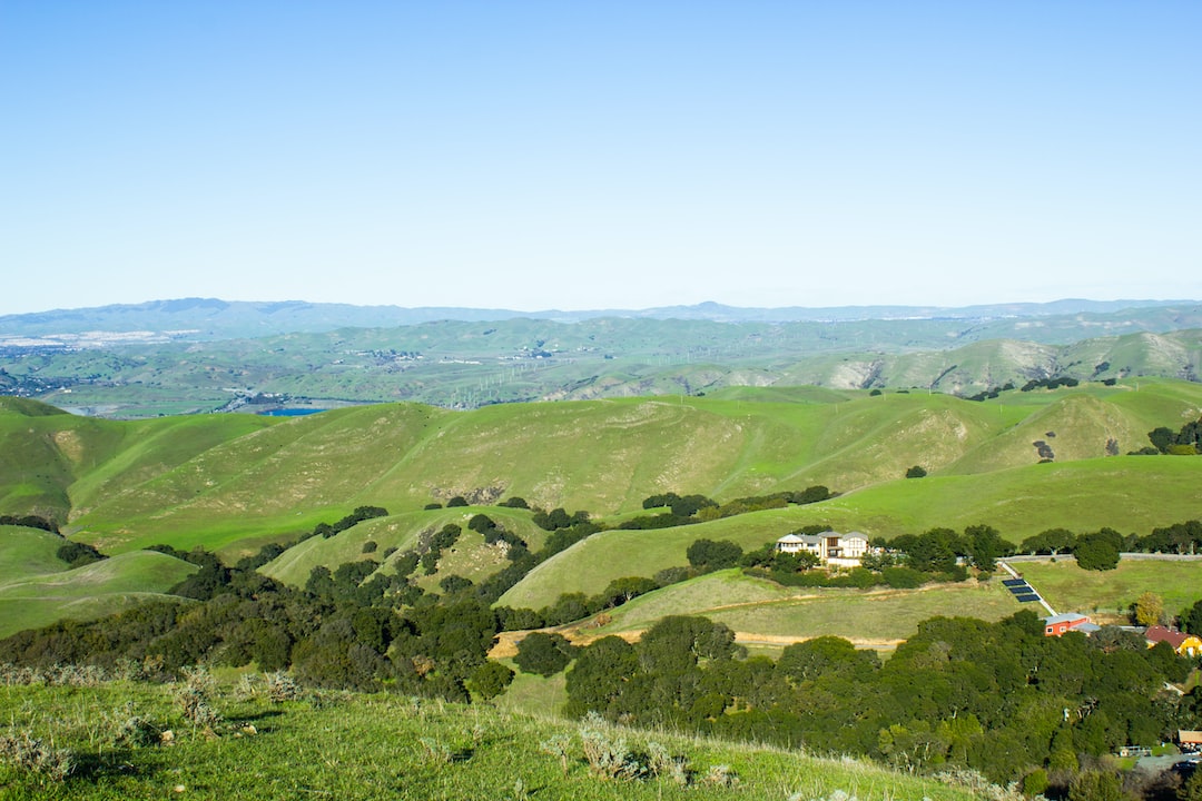
With a trail to suit any hiker’s ability level, is it any wonder why Mission Peak is renowned among avid adventurers?
Hiking Mission Peak takes 2-5 hours, depending on fitness level and resting time. Start early, carry a minimum of 2 liters of water, wear sunscreen and sturdy shoes, and hike at a steady pace. Follow posted signs and be mindful of park hours. Visit on weekdays to avoid crowds and study trail maps beforehand for a successful hike.
How Long Does It Typically Take to Hike Mission Peak?
The answer to this question largely depends on individual fitness levels, hiking experience, and the specific trail chosen. Mission Peak offers several trail options, each with varying difficulty and lengths.
The most popular, and arguably most challenging, trail is the Hidden Valley Trail. This steep ascent stretches approximately 6 miles (round-trip) and typically takes hikers between 3-5 hours to complete. Providing an excellent workout, this trail is ideal for experienced hikers who can maintain a steady pace and don’t mind a challenge.
Another option is the slightly longer Peak Meadow Trail, which spans around 7 miles (round-trip) and takes about 4-6 hours to finish. This trail offers its own set of challenges, with a more moderate gradient and several switchbacks. In my experience, well-prepared hikers of moderate fitness levels can tackle this trail successfully.
Lastly, we have the Eagle and Bay View Trail, which takes the longest to complete at roughly 8 miles (round-trip) and requires 5-7 hours. This path is perfect for those seeking a more leisurely hike with a lesser incline.
What Time Should You Start Your Hike?
When planning to hike Mission Peak, it’s crucial to consider the time of day you’ll be embarking on your adventure. Based on your hiking speed, the trail you choose, and the season, the ideal start time can vary:
For early risers or those who cherish sunrise views, an early morning start is most suitable. During summer months, the temperatures tend to rise considerably after sunrise, so beginning your hike early allows you to avoid the extreme heat. In my experience, a pre-dawn start (somewhere around 5-6 am) also grants you the greatest chance of encountering wildlife.
On the other hand, if you’re not big on waking up before the crack of dawn, a late afternoon hike may be more your speed. This option will reward you with cooler temperatures and the possibility of golden-hour, sunset panoramas. Be mindful of the remaining daylight hours and always bring a headlamp to ensure safe navigation in case your hike takes longer than expected.
What Gear Should You Bring on Your Hike?
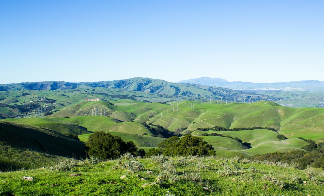
No matter which trail you decide to conquer, it’s essential to be well-prepared with the appropriate gear. The following items are recommended for a safe and enjoyable hike:
1. Sturdy hiking shoes: A pair of durable, supportive shoes with good traction is indispensable for navigating the rocky, steep terrain of Mission Peak.
2. Water: Carrying enough water is crucial for staying hydrated during your hike. A general rule of thumb is to bring about 1 liter per 2 hours of hiking.
3. Snacks: High-energy, portable snacks like energy bars, trail mix, or jerky help sustain energy levels and keep you fueled throughout the hike.
4. Layered clothing: Weather conditions may change rapidly on Mission Peak, so it’s wise to dress in layers that can be added or removed accordingly.
5. Backpack: A comfortable, lightweight pack will help carry your essentials, such as water, snacks, and extra clothing.
6. First aid kit: Accidents can happen, so be prepared with a basic first aid kit, containing items like band-aids, gauze, and antiseptic wipes.
7. Navigation tools: While the trails are well-marked, having access to a map, compass, or GPS device ensures that you stay on track.
Are There Any Hiking Etiquette Tips to Keep in Mind?
Responsible hiking not only guarantees a more pleasant experience for everyone but helps preserve and protect the natural environment. Adhering to these hiking etiquette tips will make your Mission Peak adventure enjoyable while minimizing your impact on the trails:
1. Stay on designated paths: Cutting through switchbacks or wandering off-trail can cause erosion and harm plant and wildlife habitats.
Elevation Gain and Acclimatization

Mission Peak stands at an elevation of 2,517 feet (767 meters). Hikers can expect to ascend roughly 2,100 feet (640 meters) of elevation gain from the trailhead in Fremont to the summit. Although the elevation itself isn’t exceptionally high for most hikers, the sustained steepness of some trails may pose an endurance challenge.
To ensure a successful hike, acclimatize yourself to the elevation and elevation gain beforehand. Practicing hikes with similar inclines or terrain types in your local area will prepare your body and build your endurance for conquering Mission Peak’s slopes.
Preparing for Weather Changes
As with any outdoor adventure, the weather at Mission Peak can be unpredictable. While the park experiences pleasant, sunny weather for most of the year, it’s still vital to check the weather forecast before setting out on your hike.
During hotter months, be prepared for high temperatures and bring sufficient water and sunscreen. On cooler days or in the winter, be sure to dress appropriately to protect yourself from wind and cold, which can be exacerbated at higher elevations.
Rain can make the trails muddy and slippery, and foggy conditions could impact visibility. If you encounter either of these situations, exercise caution while hiking and be ready to turn back if the conditions worsen or if you feel uncomfortable continuing.
Wildlife Encounters and Safety
Mission Peak is home to diverse wildlife, including deer, coyotes, bobcats, and several bird species. While observing them can be a rewarding element of your hike, it’s crucial to maintain a safe distance and respect their habitats.
Avoid feeding animals, as this can cause them to associate humans with food, which could result in subsequent dangerous encounters. Additionally, familiarize yourself with any potential hazards, such as poisonous plants or snakes commonly found in the area. Educating yourself on how to react to or avoid these hazards can help ensure a safe and enjoyable hike.
Hiking with Friends and Family
Mission Peak can be a fun adventure to share with others. Hiking with a group provides encouragement, motivation, and an extra layer of safety in case of emergencies. If you’re planning to hike with friends, family, or even pets, communicate openly about each person’s physical abilities and comfort levels to select an appropriate trail for everyone.
Remember that dogs are allowed on Mission Peak trails but must be leashed at all times and cleaned up after accordingly. Bringing waste bags and extra water for your pets is essential to ensure a safe and enjoyable hike for both you and your four-legged companions.
In conclusion, hiking Mission Peak requires thoughtful planning, appropriate gear, and adherence to hiking etiquettes. By considering the hike’s duration and gathering essential tips, you’ll be well-prepared for an unforgettable experience as you conquer this iconic peak.
Making the Most of Your Hike: Scenic Spots and Photo Opportunities
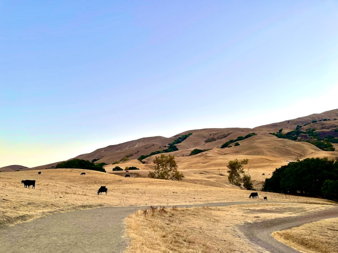
One of the highlights of hiking Mission Peak is the incredible scenery and photo opportunities that await you along the way. As you climb the mountain, be sure to take the time to appreciate the natural beauty and snap some memorable photos. Some noteworthy spots to look out for on your hike include:
1. Hidden Valley: Nestled along the Hidden Valley Trail, this lush valley provides a picturesque backdrop for a rest stop or a quick photo.
2. Grove Overlook: Accessible along the Peak Meadow Trail, this shaded grove offers a tranquil setting with a view of the surrounding hills and valleys.
3. False Summit: Although not the actual peak, this elevated point along the trail is a popular rest stop that boasts panoramic views of the San Francisco Bay and surrounding mountains.
4. Summit: Of course, the true reward of your adventure lies at the Mission Peak summit itself. The 360-degree views of the Bay Area and the triumphant feeling of reaching the top provide an unmatched sense of accomplishment.
Remember, while capturing your memories in photos is wonderful, it’s also essential to truly immerse yourself in the experience by taking moments to appreciate the beauty that surrounds you.
Alternative Hiking Routes for a More Personalized Experience
Although the trails mentioned earlier are among the most popular, Mission Peak Regional Preserve also boasts a network of other paths that can be combined to create more personalized hiking experiences. Whether you’re seeking seclusion, additional challenges, or expanded sightseeing opportunities, these lesser-known paths allow you to customize your hike. Here are a few recommendations:
1. Reverse Peak Meadow Trail: Ascend via the Peak Meadow Trail and descend through Hidden Valley for a longer, more varied hike, offering the best of both terrains.
2. Horse Heaven Trail Loop: This trail begins at Stanford Avenue and connects to the Bay View Trail. It offers a moderate challenge and stunning views while avoiding the usual crowds.
3. Agua Caliente Trail: A lesser-known alternative, the Agua Caliente Trail can be accessed from Ohlone Wilderness Road and presents a longer, more remote hike, perfect for those who yearn for solitude amidst nature.
When venturing off the beaten path, ensure you are well-prepared, have appropriate navigation equipment, and share your plans with friends or family for safety purposes.
Joining a Mission Peak Hiking Group
If you’re interested in meeting like-minded hikers and fostering a sense of community during your Mission Peak adventure, consider joining a hiking group. There are numerous local clubs, online forums, or social media pages dedicated to organizing group hikes in the Bay Area. Participating in these events can facilitate lasting friendships, provide opportunities to learn from experienced hikers, and serve as sources of motivation and support along the way. Just make sure to choose a group with a similar hiking pace, interests, and physical abilities as yours to ensure a harmonious and enjoyable experience.
In conclusion, by thoroughly exploring the various trail options, making the most of the beautiful scenery, customizing your hike, and even potentially joining a hiking group, your Mission Peak hiking experience promises to be both rewarding and memorable. With a mixture of proper preparation and adventure spirit, you’ll leave Mission Peak with a sense of accomplishment and a treasure trove of cherished memories.
Related News
Angels Landing Hike (Beginners Guide)
Discover Louisiana’s 7 Most Breathtaking Hiking Trails
Dehydration Signs While Hiking (Surprising Causes)
How Much Hiking is Too Much? Finding Balance
How to Tackle The Mission Peak Hike
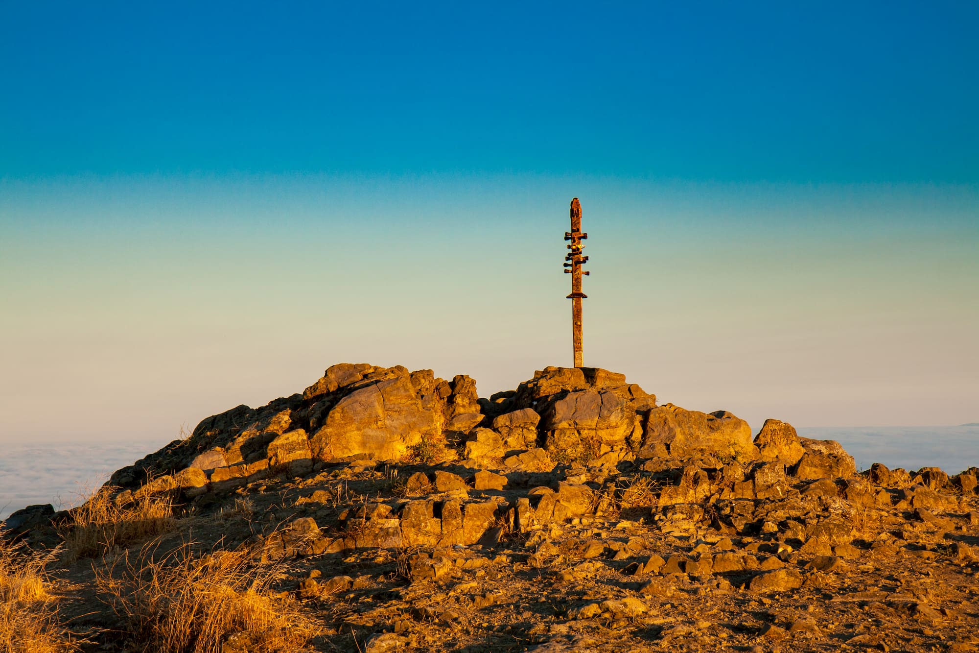
This article was brought to you by Gregory , the makers of small day packs that are just right for carrying your trail essentials.
There’s a lot of incredible hiking in and around San Francisco , from the misty redwoods of Marin County to the eucalyptus lined Presidio and the sun-baked East Bay. The latter is where you’ll find a summit which attracts a steady stream of hikers year after year. Many are motivated by the challenging climb to the top. Others love the opportunity to take a selfie with a symbol for the whole community of Fremont, California.
It’s the Mission Peak hike, one of the most popular climbs in all of the notoriously hilly Bay area.
Climbing 2,500 feet in just three miles, Mission Peak is a gnarly butt buster. Plus a few inches more if you choose to climb the odd wooden mast at the top.
What to Expect From the Mission Peak Hike
If you start hiking from Stanford, you’ll begin by crossing a field shared with placid cows. 2.5 miles in on this route, you’ll run into the junction with the trail from Ohlone College. It’s easier to park here, but beware that it does add a mile to your hike.
The fire road provides a steady incline until you reach about 1,800 feet. Once the Stanford and Ohlone trails merge, the hike picks up the pace.
A quarter-mile from the summit, the trail transitions to a loosely maintained single track. At the top, you’ll be rewarded with some of the best views in the Bay area.
You can expect plenty of company — including both people and dogs— on your way up. Especially if you start from Stanford Avenue rather than parking at Ohlone College. That might mean you need to wait for your turn to snap a selfie with the famous Fremont pole.
Technically, the tubes in the pole were originally meant not as footholds, but to point your eye towards some of the other impressive summits on the horizon surrounding San Francisco, including Mount Diablo, Mount Hamilton, and Mount Tamalpais .
Buried underneath is a time capsule that includes Native American amulets and zinfandel wine. But if you need a liquid reward for your accomplishment, first you’ll need to hike the three miles you just covered all the way back down before you can get something cold and fresh at nearby Faultline Brewing in Sunnyvale.
How to Master the Mission Peak Hike
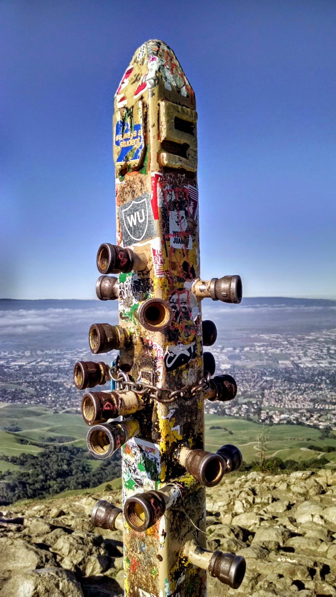
Image from Travis Wise on Wikimedia Commons, (CC BY 2.0)
How to Get to the Mission Peak
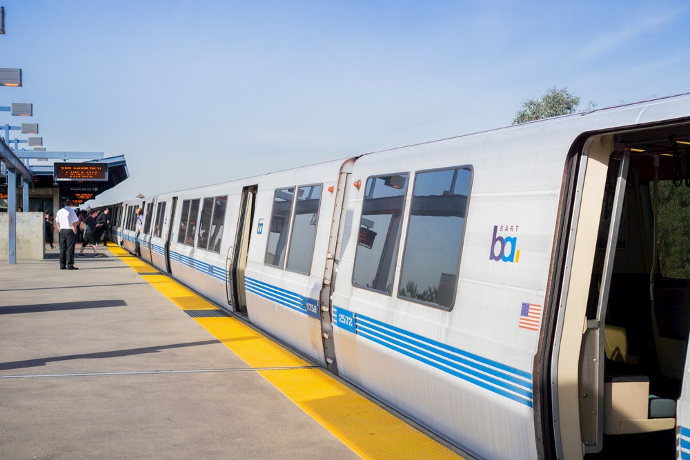
You don’t need a car to get to this hike. In fact, parking is scarce, and available spots fill up quickly, especially on summer weekends. To access Mission Peak, take the BART to the Warm Spring BART station and catch a Lyft or Uber to the Ohlone College parking lot / Peaks & Panorama trailhead.
If you do need to drive, visitors should try to carpool, ride their bikes, or park at Ohlone College. If you can, avoid adding congestion in the Stanford Avenue lot off Mission Blvd, which can affect the surrounding neighborhood.
It’s an easy 45 minute drive from downtown San Francisco, however. Simply follow US-101 south to CA-92 East and I-880 South and take exit 12 to CA-262 N/Mission Blvd in Fremont. Once you arrive at the Stanford Avenue Staging Area at 1997-2099 Stanford Ave, you can park and start your hike!
How to Train for the Mission Peak Hike
Map from Gaiagps.com
Sure, it’s not exactly Everest — or even nearby Mount Whitney , but this is a challenging hike. It is sometimes used as a training route for Yosemite’s popular, but crushing, Half Dome hike . If you are a little nervous about your fitness level being up to the challenge, try giving some other Bay-area hikes a whirl first to warm up and test your ability.
To test your endurance, try Sawyer Camp Trail. The trail a paved 7-miler with a little less than a hundred feet of elevation gain.
Olompali State Historic Park is a three miles, but climbs up 1,000 feet. Overall its about half the length and distance you’ll tackle on the Mission Peak trail. Lastly, Tomales Point is a 10 mile butt-kicker, but provide opportunity to spot some wild elk.
What to Pack for a Mission Peak Hike
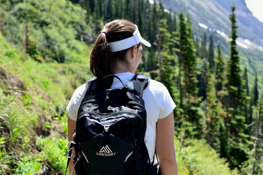
- Bring plenty of water: The Bay Area might have a reputation for chilly fog year round, but Fremont sits further inland. It’s much warmer there than closer to the Pacific, with highs around 80 in the summer and lows around 60. Even in winter, temperatures range from the 40s to 60s. A small day pack with a water reservoir is a great way to drink up while keeping your hands free.
- Dress for a hike: You don’t have to be in the back country to get into trouble. Plenty of folks call emergency services because they underrate the difficulty of the hike. Be sure to wear the right shoes and bring adequate layers. Just remember, you need to get back down after being out for a good chunk of your day!
- Don’t forget sun protection: Sure, Fremont isn’t exactly one of the sunniest places in America . But there isn’t much shade to be found on your Mission Peak hike. Bring a bottle of broad spectrum sunscreen and make sure to reapply regularly.
- A solar charger: Because while the sun may be fierce, you can also put it to good use keeping your phone charged while you hike. Don’t let low battery woes steal that chance for a summit selfie!
Other Mission Peak Hiking Tips
- Mission Peak Regional Preserve is packed with places to hike and mountain bike, but you can’t camp overnight (or leave your car overnight at either Stanford or Ohlone parking lots, either). The nearest spot to pitch a tent is Del Valle Regional Park forty minutes west near Mendenhall Springs. You can cool off from your Mission Peak hike with swimming, kayaking, and paddleboarding on Lake Del Valle, a five mile long reservoir. There are group and tent campsites, as well as cabins.
- Another great camping spot in the East Bay is in Anthony Chabot Regional Park . You can cool off here, too, thanks to proximity to the Upper San Leandro Reservoir. There’s a marina on the reservoir, as well as hiking and biking trails through hilly eucalyptus groves. Campers on The Dyrt recommend site #69 in particular for great views.
- If a six-mile round trip hike isn’t quite enough for you distance hounds, the Mission Peak hike connects to several other trail networks in the Bay Area, including the Ohlone Wilderness Trail, a 29-mile hiking and riding trail through some of southern Alameda County. The other connector is to the Bay Area Ridge Trail, a 300+ mile still-in-progress development that currently links some of the region’s best scenic points.
- Dogs are allowed to come along on your Mission Peak hike, but make sure they have protection for their paws from hot ground surfaces, and that you bring plenty of water for your pup, too. Humans aren’t the only ones who have required medical attention for heat stroke on this trail!
- Don’t forget to practice sustainable travel and Leave No Trace principles when hiking or camping especially popular destinations. All that extra traffic puts a strain on fragile ecosystems, especially when people go off trail. Mission Peak Regional Preserve is working hard to restore parts of the hillside damaged by people blazing their own paths. Do you part to pack out trash, practice good backwoods bathroom etiquette , and generally leave this special place better than you found it.
This article was brought to you by Gregory

Grab your day pack Gregory’s website today!
Related Articles:
- Santa Cruz Camping
Related Campgrounds:
- Gualala Camping , Gualala, CA
- Cottonwood Pass Walk in Campground , Lone Pine, CA
Popular Articles:
- Get the Latest 2023 Camping Travel Trends
- How To Find Free Camping in National Forests
- The Checklist Every First Time RVer Needs
- Find Free Camping With The Dyrt Map Layers
- The Ulimate Boondocking Guide To Free Camping
- Everything You Need To Know About Wifi For Your RV
- 7 of The Best Overland Routes in North America
- 14 Wilderness Survival Tools You Should Have in The Backcountry
- Here's What To Add To Your Primitive Camping Checklist
Meghan O'Dea
Meghan O'Dea is a writer, world traveler, and life-long learner who grew up in the foothills of Appalachia. College led to summer stints in England and Slovenia, grad school to a sojourn Hong Kong, and curiosity to everywhere in between. She has written for the Washington Post, Fortune Magazine, Yoga Journal, Eater Magazine, and Uproxx amongst others. Meghan hopes to visit all seven continents with pen and paper in tow.
More Articles
Pack Your Poncho for These 8 Niagara Falls Camping Spots
This article on is brought to you by Red Ledge makers of the best camping poncho. This lightweight, durable, and packable poncho is a near-perfect item…
7 Reasons to Visit Arabia Mountain, Georgia's Lesser-Known Monadnock
To the east of Atlanta, three broad, gray domes jut out of the flat Georgia forestland. Arabia Mountain, Stone Mountain, and Panola Mountain are impossible…

Switchback to Wild
A resource for hiking, camping, and backpacking the CA Bay Area & beyond!
Mission Peak Hike
Useful info:.
Length: ~6 miles round trip Elevation Gain: ~2000 ft Difficulty: 6/10 Terrain notes: dirt trail, exposed, rocky summit, windy summit Cost – Free Open – Daylight hours. See Park link below for details.
Useful Links:
Mission Peak Regional Preserve park info Bay Area Hiker write-up
A quintessential and popular San Jose hike, Mission Peak’s almost totally exposed trail climbs steadily upward past grazing cows ending in a scramble up a rocky crag with sweeping valley views. It is an out-and-back, which is really an up-and-down, and provides a great challenge and workout. The trail is wide and very sunny with only the occasional tree. It is best hiked in the morning, evening, and during the winter months when the hills are green (the photos in this post were mainly taken in late winter). It is popular year round, however, so expect to see many other people and their dogs on the trail. Mountain bikers and hang gliders can also be seen. Be sure to bring plenty of water anytime you go. There is a water fountain and restroom at the trailhead but no sources after that. Park at the small lot off of Stanford Ave, or when the lot is full, in the allowed portions of the nearby neighborhood.
One nice thing about Mission Peak is that there are always animals to be seen. The land includes grazing cows who are occasionally seen crossing the trail (give them some space). There are also many ground squirrels foraging, and darting in and out of their holes. In the many times I’ve hiked this trail, I’ve also seen wild turkeys, coyotes, and one tarantula. After snaking back and forth on the wide dirt path, the final ascent to the peak becomes very rock and narrower. The trail is also recently redirected by the park to prevent damage, so stay on the intended trail.
Here are the RunKeeper details:
- ← Sequoia and King’s Canyon National Park: Points of Interest
- Bishop Peak →
One thought on “ Mission Peak Hike ”
Pingback: Bishop Peak – Switchback to Wild
Leave a Reply Cancel reply
Your email address will not be published. Required fields are marked *
Save my name, email, and website in this browser for the next time I comment.
- United States
Mission Peak via Hidden Valley Trail
Fremont, California
Elevation Gain
Out-and-Back
Description
Added by The Outbound Collective
Mission Peak via Hidden Valley Trail takes you to scenic views of the bay area and valley to the east. This is an amazing trail to be on at sunset!
Breathtaking views of the Bay Area are your reward for making this climb to the top of Mission Peak. It’s a 3-mile trek to the top of the peak and then back down the same way. This is a moderate hike that provides a nice workout – so be prepared.
Park at the Stanford Avenue entrance gate. There is enough parking for about 20 cars, but if it’s full, there’s plenty of parking available along Stanford Avenue. Keep in mind that there are hours for both the parking area and the park ( Learn More ). Start by taking the Ohlone Wilderness Trail/Hidden Valley Trail (1.5 miles) to the Peak Meadow Trail (0.6 miles). Next, take the Grove Trail (0.2 miles) to a short connector trail (0.2 miles), and then to the Peak Trail (0.5 miles) to the summit. Retrace your steps on your descent.
Start times for this hike vary depending on the time of the year, but it’s best to start this hike a few hours prior to sunset. Once you get to the top, relax with some food and/or your favorite beverage, and enjoy the views. It will probably be a bit breezy and chilly, so dress in layers and be prepared to bundle up.
If you’ll be hiking down close to dark, make sure to bring headlamps or flashlights. This is a unique hike with amazing views – definitely well worth the effort.
Helpful Links: Park Map Park Hours
NOTE: The Stafford Parking hours are 6:30am-8:00pm Dec 31-Mar 31; 6:30am-9pm Apr 1 - Dec 22
Download the Outbound mobile app
Find adventures and camping on the go, share photos, use GPX tracks, and download maps for offline use.
Mission Peak via Hidden Valley Trail Reviews

Diana Melnik
Exceptionally harder than I thought, but rewarding.
10/10 hard 10/10 views. Probably would only do it in the spring time only and avoid summer since it’s just direct sunlight. The views are amazing.

Crowded hike
Iconic for anyone in the east bay. Popular among high school students and gets very crowded. Avoid the line at the top by going earlier in the morning

William Tran
Nice work out.
Expect lots of people and no shade.

Great view, not as interesting trail
This hike is all about the view, which can be seen along almost every part of the trail. The trail itself is not that interesting. Lots of cow, constant uphill, nothing but unshaded switchbacks until you get near the top. Then its a climb over rocks.

Hard, but excellent views
This was a challenging hike. Great views. Hearing and seeing the cows made it more fun. I feel like it's a very iconic East Bay area hike, so I am very glad I did it. Bring layers and plenty of water. Get started early. Lots of hikers. Parking can be a pain, pay close attention to signs as they love to ticket people around here.
Charlene Browne
This was a great hike in late afternoon 50 degree weather! Hot going up, pretty chilly at the peak! Insane views of the bay and eastern hills. Some areas very steep, but very worth it once you reach the top. The cows made this hike extra special! Parking is limited, but the neighborhood next door has parking on the street.
Leave No Trace
Always practice Leave No Trace ethics on your adventures and follow local regulations. Please explore responsibly!

Little Yosemite via Canyon View Trail

Lake Elizabeth Loop

Catch a Sunset at Alviso Marina County Park

Hike the Pleasanton Ridge Trail

North Rim Trail to Eagle Rock

Courdet Trail and Schuhart Trail
- Local Adventures
- Tours and trips
- Camping Nearby
- Outbound PRO Membership
- Add your property
Mobile Apps

© 2024 The Outbound Collective - Terms of Use - Privacy Policy

Hiking to Mission Peak in the East Bay
- November 14, 2017
- Jeff Hester

At 2,517 feet, Mission Peak towers over the southern arm of the San Franciso Bay. It offers a 360-degree panorama that extends from San Jose to Mount Tamalpais . On a clear day, you can even see the Sierra Nevada range to the east.

“Perhaps the denizens of this valley are so accustomed to the sight of Mission Peak that they fail to appreciate the dignity and individuality which it gives to the landscape. Whether the outlines, snow-capped may be, are sharp and distinct on a clear, frosty morning in winter, or overspread with the purple afterglow of a summer sunset; whether rising grim and rugged agains black storm clouds, or emerging into the sunlight from unwinding fog wreaths, the mountain has a majesty of its own.”
Clearly the denizens have long since discovered Mission Peak, as anyone who has been to the Stanford Avenue trailhead can attest. Today, Mission Peak is a popular hiking destination appreciated by hundreds (thousands?) each day.
This guide describes the out-and-back route that climbs 3.1 miles to the summit and descends 3.1 miles back to the trailhead at the end of Stanford Avenue in Fremont.
Getting to the Trailhead
There is a small parking lot with 40 stalls at 680 Stanford Avenue, Fremont, California. The lot is at the very eastern terminus of Stanford Avenue, so you can’t miss it. You’ll pass by the remaining building from the long-gone Leland Stanford Winery on your left. Overflow parking is available on Vineyard Avenue (about 150 spots). Read the street signs and parking rules carefully to avoid a ticket, and keep the noise down; you’re in a residential neighborhood. Get turn-by-turn directions via Google Maps .

Note that the posted trailhead hours (6:30 am to 9:00 pm) agrees with the hours posted on the ebparks.org website, but conflicted with the schedule on the East Bay Regional Parks District map for Mission Peak. What is clear is that they mean business. There were several signs warning that “Hikers in the park and vehicles in the staging area when the park is closed will be cited. Citations cost a minimum of $300.” If in doubt, choose the most conservative times, and note that the closing hour changes depending on the time of year.
Hiking the Trail to Mission Peak
The hike begins through a swinging gate on the Hidden Valley Trail. You are hiking through an area where cows graze. Be sure to give them plenty of room. Don’t attempt to touch or agitate them.

The trail itself is a broad, gravel and dirt fire road. There are six benches along the route to the peak, giving you a chance to rest and enjoy the view along the way.

Keep an eye out for wildlife as you go. We spied a rafter of wild turkeys on our way up.

The Hidden Valley Trail is a small part of the Ohlone Wilderness Regional Trail – a 28-mile route that is popular for backpackers.

At about 2.6 miles, you’ll reach a junction with the trail that heads to Ohlone College . Easily within view and short detour is a pit toilet and a bit beyond that, the hang glider launch area. It’s a worthwhile detour on your way back down if the winds are favorable for hang gliding.
Bear right around the ridge to the final approach to Mission Peak–a steep gravel incline.

The broad fire road finally ends about 0.25 miles from the summit. From here, there is a short, rocky section that requires careful foot placement and a single track trail to the summit.

The views from the summit? Amazing. You can see for miles in every direction.

There is a monument with siting tubes on the summit that is a popular place to pose for a summit selfie. The siting tubes are pointed at other landmarks you can see from Mission Peak.

Few people know that buried within the siting tube are a bottle of Zinfandel wine and five time capsules intended to be opened 100 years after they were placed.
[vr url=”https://socalhiker.net//wp-content/uploads/2017/11/Mission-Peak-360.jpg” view=360]
See how many landmarks you can identify. Wait in line for your selfie at the monument. When you’ve had your fill of epic views, retrace your steps, heading back down the same route you ascended.
Stanford Avenue Staging Area to Mission Peak Trail Map & Elevation Profile
Mission peak tips.
- Top tip: Don’t hike this route! Instead, park at Ohlone College at 43600 Mission Blvd. There is a nominal day-use parking fee (currently $4) but there is ample parking, more shade and fewer crowds. The is a little longer, being just shy of 8 miles round-trip. Plus, this route remains open until 10pm year-round, making it perfect for a sunset hike. Here’s the better route on GaiaGPS.
- Go early and if possible, avoid weekends and holidays. It’s much easier to enjoy this trail when the crowds are lighter.
- Carry at least a liter of water , more if it’s hot. Better yet, save this hike for a day when it’s not hot. This route is almost entirely exposed. Don’t forget water for your dog, too.
- Bring sunscreen and sun protection (i.e. a wide-brimmed hat). Even if it’s hazy or overcast, the UV rays can burn you.
- Wear shoes with good traction. The trail is steep and the gravel can make it slippery in sections. I wore trail runners; my wife wore hiking boots, and we were grateful for the traction.
More Mission Peak Resources
- Mission Peak Regional Preserve Trail Map (PDF) – Always carry a map in addition to whatever technology you use.
- Mission Peak: Silicon Valley’s “Big Hike for Beginners” – AlphaRoaming.com
- Why has Mission Peak Become the Thing to Do? – BayNature.org An thoughtful look at the popularity of Mission Peak, balancing environmental protection and safety.
- Official Mission Peak Regional Preserve website – Get the latest on parking, hours, rules and regulations.
Mission Peak Weather Forecast
[forecast width=”100%” location=”94539″]
Related Posts

Map: Where You Need an Adventure Pass in Southern California
The Forest Service requires you to display an Adventure Pass in your parked car at many of the trailheads used

Map: Where to Buy an Adventure Pass in Southern California
If you’ve been hiking or camping in Southern California, you know about the Adventure Pass. Many trailheads and campgrounds on
You must be logged in to post a comment.

Ohlone Wilderness Trail: Del Valle to Mission Peak (2 days / 47 km)
The Ohlone Wilderness Trail is a 47 km backpacking trail in East Bay, near San Francisco, California. The trail name is pronounced 'Ah-Lone-Ee' (not Ah-Lone, which is how I was throughout it). The route takes you to the top of two peaks, Rose Peak and Mission Peak, and through rolling hills and valleys.
The trail itself is easy to navigate and, although there is no cell service, you're never too far from civilization. What makes the trail difficult to the elevation gain and distance, especially if you're doing it over two days.
The views from Mission and Rose Peak are amazing, but besides that, I don't consider the trail to be particularly beautiful. I don't say that to discourage anyone - I liked the trail a lot - but to set your expectations accordingly. If you're working on your hiking fitness to train for bigger backpacking trips, this is an excellent route - lots of elevation gain spread out over a short distance.
Trip Summary
Starting Point: Del Valle Regional Park
Ending Point: Stanford Avenue Staging Area (Mission Peak Parking Lot)
Total Distance: 29 miles
Elevation Gain: 7700 ft (other accounts claim 8200 ft, but I measured less)
Duration: 2 days
Difficulty: Intermediate
The trail starts in Del Valle Regional Park, which is a 30 minute drive from Dublin. The train ends at the Stanford Ave Staging Center (also known as the Mission Peak parking lot).
Traditional Territory: The Ohlone Wilderness Trail travels through the traditional territory of the Muwekma, Tamien Nation and Ohlone (after which the trail is named) (source).
Maps & Resources
Guidebook: N/A
Map: You can see the official park map here: Ohlone Wilderness Trail Map.
Here is a GPS track for my route when I did the hike.
I didn't capture the detour I made to climb Rose Peak after I'd set up camp at Maggie's Half Acre. There's a great view from the top! Nor do I have the detour to Murietta Falls on the map above.
To continue reading this Trip Report, please login below.
If you aren't a Member yet, please sign up here .
- Good Takeout
- Good Swim Spot
- Thunderbox / Outhouse
- I have read and agree to the Terms of Service
There was a problem reporting this post.
Block Member?
Please confirm you want to block this member.
You will no longer be able to:
- See blocked member's posts
- Mention this member in posts
- Invite this member to groups
- Add this member as a connection
Please note: This action will also remove this member from your connections and send a report to the site admin. Please allow a few minutes for this process to complete.
- International
The latest on the massive solar storm
By Angela Fritz, Elise Hammond and Chris Lau, CNN
Incredible lighthouse picture from Maine
From CNN's Chris Lau
Among a flurry of surreal images capturing the dazzling auroras is one taken by Benjamin Williamson of a lighthouse in Portland, Maine.
"It's one of the most incredible things I've ever seen, the awe and wonder," Williamson told CNN.
He said he used a long-exposure technique to snap the shot, but did not edit it.
Watch the full interview with Williamson here .
Things could be about to ramp up
If you still haven't seen the aurora, hold on for another 30 minutes to an hour, according to CNN meteorologist Chad Myers.
The next wave of coronal mass ejections, or CMEs, which cause the aurora, is about to arrive, he said.
"Just wait a minute because things are going to start to ramp up here," he said, adding that the increase could arrive "anytime now." "When it comes, get outside, get ready, put your coat on."
For those who are too busy to witness the phenomenon tonight, Myers said the aurora is expected to last three nights.
Why does the aurora last for a weekend?
By CNN's Chris Lau
Generally, it takes just eight minutes for light to travel 93 million miles to the Earth from the sun, but astrophysicist Janna Levin said the energized particles causing the current wave of aurora travel a lot slower, causing the phenomenon to last for the weekend.
"Some of these mass ejections are trillions of kilograms," she said. "They're slower. So they're taking longer, but still hours, maybe tens of hours."
Here's how the solar storm looks in the South and on the East Coast
The aurora was visible across the East Coast and in the South Friday.
Here's how it looked in Chester, South Carolina.
Down in Florida, waves of color swam through the sky.
Up north in New Jersey, a purple-ish haze could be seen in the sky.
Will solar storms get more intense and risky in the future?
The answer is probably not in the short term, according to astrophysicist Hakeem Oluseyi.
He said scientists study what is constantly happening on the surface of the sun and have found a pattern.
“Geological data shows us that in the past the sun was way more active than it is today. It has cycles where it goes very quiet ... and you have events that show that the solar activity was much, much greater,” he told CNN. “So there's no evidence that we're going to see those big maxima this cycle."
But the astrophysicist also spoke of a caveat - the limitations of modern science.
“Even though it's predictable in the short term, we still don't quite understand what creates the magnetic fields in the sun,” he said, adding: “That's why NASA has so many satellites looking at the sun.”
In Pictures: Auroras light the sky during rare solar storm
From CNN Digital's Photo Team
A series of solar flares and coronal mass ejections from the sun are creating dazzling auroras across the globe .
The rare solar storm may also disrupt communications. The last time a solar storm of this magnitude reached Earth was in October 2003, according to the National Oceanic and Atmospheric Administration's Space Weather Prediction Center.
See more photos of the aurora from tonight.
Behind dazzling aurora could lie “real danger,” Bill Nye the Science Guy says

The massive solar storm could present “a real danger,” especially with the modern world relying so much on electricity, according to Bill Nye the Science Guy , a science educator and engineer.
Scientists are warning an increase in solar flares and coronal mass ejections from the sun have the potential to disrupt communication on Earth into the weekend. Solar flares can affect communications and GPS almost immediately because they disrupt Earth’s ionosphere, or part of the upper atmosphere. Energetic particles released by the sun can also disrupt electronics on spacecraft and affect astronauts without proper protection within 20 minutes to several hours.
In comparison to tonight's event, Nye drew comparisons with another incident in 1859, known as the Carrington Event, when telegraph communications were severely affected.
“The other thing, everybody, that is a real danger to our technological society, different from 1859, is how much we depend on electricity and our electronics and so on,” Nye said. "None of us really in the developed world could go very long without electricity."
He noted that there are systems in place to minimize the impact, but “stuff might go wrong,” stressing that not all transformers are equipped to withstand such a solar event.
“It depends on the strength of the event and it depends on how much of our infrastructures are prepared for this the sort of thing,” he said.

Bill Nye breaks down significance of the solar storm | CNN
This post has been updated with more details on solar flares' impact on electronics.
Here's where clouds will block the view of the northern lights in the US
From CNN's Angela Fritz
After an incredibly stormy week, most of the Lower 48 has clear skies to see the northern lights. But there are some areas where clouds and rainy weather are spoiling the view.
A deck of clouds is blocking the sky in the Northeast, from parts of Virginia into Maine, as an area of low pressure spins off the East Coast.
In the Midwest, the aurora will be hard to see through thick clouds in parts of Wisconsin, Michigan — including the Upper Peninsula — and Illinois.
A stripe of clouds is tracking across Texas, including Dallas-Forth Worth, and into Louisiana.
And in the Southwest, patchy clouds across the the Four Corners region could make the northern lights difficult to spot.
Aurora seen at least as far south as Georgia
Barely visible to the naked eye, the aurora can be seen in Atlanta in the 10 p.m. ET hour.
It is easier to see through photographs using a long exposure. The photos below, taken by CNN's Eric Zerkel and Emily Smith, used 3- and 10-second exposures.
Please enable JavaScript for a better experience.

IMAGES
VIDEO
COMMENTS
Range of hiking times. The range of hiking times to complete the Mission Peak Trail is typically between 4 and 5 hours. This duration includes both the ascent and descent of the trail, covering a total distance of 6.2 miles round trip. However, it's important to note that individual fitness levels and pace can influence the time taken to hike ...
This is a 6.2 mile round trip trail with elevation gains of 2500 feet. And its just 40 miles from San Francisco. This hike is easily accessible from all over the Bay Area, gives you a great workout, and the views are beyond incredible! The Mission Peak Hike is by far one of the most popular of all Bay Area Hikes.
The total round trip distance to the summit of Mission Peak is about 6 miles, with an elevation gain of around 2,000 feet. ... Nevertheless, we could say that, in general, the average hiking time for Mission Peak is around 3-4 hours for a round trip, with the factors mentioned above affecting your personal time.
How long does it take to hike to Mission Peak. Starting from the bottom, it takes between 2 to 2.5 hours to get to the top of Mission Peak. If you're fitter than average, it may even take just 1.5 hours. It's best to take frequent breaks, maybe every 30 minutes or wherever you find a bench.
This is the Peak Meadow Trail, which loops back to the Stanford parking lot for a 3.7-mile round-trip loop in Mission Peak Regional Preserve. Bring a map with you if you explore this route and others in the preserve. ... Underneath the Mission Peeker pole are time capsules containing a bottle of 1990 zinfandel wine, a replica of an Ohlone ...
Experience this 6.0-mile loop trail near Milpitas, California. Generally considered a challenging route, it takes an average of 3 h 59 min to complete. This is a very popular area for camping, hiking, and horseback riding, so you'll likely encounter other people while exploring. The trail is open year-round and is beautiful to visit anytime.
The Park District continually works to remove bootleg trails and restore the natural beauty of the hillside near the Mission Peak summit, ... Daily, year-round 6:00am-10:00pm Stanford Ave. Entrance/Parking Lot: Dec 23-Mar 31 6:30am-8:00pm, Apr 1-Dec 22 6:30am-9:00pm. Fees. ... Offer water to your dog every time you drink some.
When hiking Mission Peak at a normal pace, it typically takes 2 to 2.5 hours. This is based on average hiking speed and the total distance of the trail, which is approximately 6 miles round trip. The normal pace allows for a comfortable and enjoyable hike, with time to appreciate the scenery and take breaks.
Mission Peak offers several trail options, each with varying difficulty and lengths. The most popular, and arguably most challenging, trail is the Hidden Valley Trail. This steep ascent stretches approximately 6 miles (round-trip) and typically takes hikers between 3-5 hours to complete.
Mission Peak from Ed Levin Park. Head out on this 13.4-mile loop trail near Milpitas, California. Generally considered a challenging route, it takes an average of 7 h 11 min to complete. This is a popular trail for hiking, but you can still enjoy some solitude during quieter times of day. The trail is open year-round and is beautiful to visit ...
It's an easy 45 minute drive from downtown San Francisco, however. Simply follow US-101 south to CA-92 East and I-880 South and take exit 12 to CA-262 N/Mission Blvd in Fremont. Once you arrive at the Stanford Avenue Staging Area at 1997-2099 Stanford Ave, you can park and start your hike!
Useful Info: Length: ~6 miles round trip Elevation Gain: ~2000 ft Difficulty: 6/10 Terrain notes: dirt trail, exposed, rocky summit, windy summit Cost - Free Open - Daylight hours. See Park link below for details. Useful Links: Mission Peak Regional Preserve park info Bay Area Hiker write-up A quintessential and popular San Jose hike,
Description. Mission Peak via Hidden Valley Trail takes you to scenic views of the bay area and valley to the east. This is an amazing trail to be on at sunset! Breathtaking views of the Bay Area are your reward for making this climb to the top of Mission Peak. It's a 3-mile trek to the top of the peak and then back down the same way.
2. 1. 647 reviews. Write review. Enjoy this 5.8-mile out-and-back trail near Fremont, California. Generally considered a challenging route, it takes an average of 3 h 57 min to complete. This is a very popular area for hiking, so you'll likely encounter other people while exploring.
Including and centered around the 2,500 foot plus Mission Peak, this preserve is an extremely popular hiking destination, and a summit of Mission Peak is seen as a hiking right of passage in the South Bay! The preserve contains just over 3,000 acres centered around Mission Peak itself. Many of the trails in the park are centered around and lead ...
Mission Peak is a mountain peak located east of Fremont, ... An ascent up Mission Peak is at least a six-mile-long round trip, and tends to take two to five hours for hikers and one to one-and-a-half hours for bicyclists and runners. ... The time capsules were intended to be opened in a century or more, after 2090, and focus on rainforest ...
Download file: mission-peak.gpx Mission Peak Tips. Top tip: Don't hike this route! Instead, park at Ohlone College at 43600 Mission Blvd. There is a nominal day-use parking fee (currently $4) but there is ample parking, more shade and fewer crowds. The is a little longer, being just shy of 8 miles round-trip.
The Mission Peak Loop Trail is a moderately difficult hiking trail located in Mission Peak Regional Preserve, ... you can be sure that just about any day of the year will be a great time to visit this preserve surrounded by bustling cities. The trail stays open year-round. ... (making it around 4 total miles round trip). The downside here is ...
According to AllTrails.com, there are 5 biking trails in Mission Peak Regional Preserve and the most popular is Mission Peak Loop from Stanford Avenue Staging Area with an average 4.6 star rating from 8,105 community reviews. Mission Peak, one of the most popular East Bay hikes, is a great workout with 2,000 feet of climb in two miles and ...
Mission Peak, although busy, was great. Despite having stood on Rose Peak the day before (which is 1200 ft taller), standing with the famous sign felt like a great way to wrap up the Ohlone Wilderness Trail. Mission Peak to Stanford Staging Area (3.1 miles) Time: 2:30 pm - 3:45 pm. Surprisingly, I found the last section of the trail to be the ...
Length 11.4 miElevation gain 3,674 ftRoute type Loop. Check out this 11.4-mile loop trail near Fremont, California. Generally considered a challenging route, it takes an average of 7 h 9 min to complete. This is a very popular area for hiking, mountain biking, and running, so you'll likely encounter other people while exploring.
A stunning aurora, caused by a severe geomagnetic storm, is painting the sky shades of pink, purple and green as it spreads into locations it rarely reaches Friday night.
Mission Peak gets throngs of hikers but only savvy trekkers take this route to the summit -- an eight-mile out-and-back that stretches out the 2,000-foot ascent to the summit (the most-popular route ascends a similar height in a 5.2-mile out-and-back). This gradual route is a less-strenuous option for hiking to the top of the popular East Bay peak. It starts from the parking lot at Ohlone ...
The start of the trail is across from the Visitor Center (not behind it). This back-door route to Mission Peak is a wilder, quieter alternative to more popular trails. This is one of the longest approaches to the Mission Peak summit and arguably the best. It starts out at the park headquarters of Sunol Regional Wilderness and follows the Ohlone Wilderness Trail westward to the popular East Bay ...