

How to Use Google Maps in London: A Simple Beginner’s Guide
Figuring out how to use Google Maps in London can be confusing, especially if you’re unfamiliar with the city. Fortunately, navigation with Google Maps can be your ultimate companion, helping you travel the sprawling metropolis with ease. You just need to figure out how to use the app first, and it’s easy!
In this blog post, we will walk you through a simple, step-by-step guide on how to use Google Maps effectively in London. So, let’s get started!

How to Travel London Using Google Maps
1. install the google maps app.
Before you figure out how to use Google Maps in London, you have to download it! Before you arrive at the airport , make sure you have the Google Maps app installed on your smartphone. It is available for both iOS and Android devices. Visit your device’s app store, search for “Google Maps,” and download the app to get started.
You can also use Citymapper as a good alternative , if you prefer a different mapping app!
2. Enable Location Services
Trip planning using Google Maps won’t work unless your phone knows where you are. To ensure accurate navigation, ensure that your phone’s location services are turned on. You can do this by going to your device’s settings and granting location access to the Google Maps app.
3. Launch Google Maps
Once installed, open the Google Maps app on your device. The app will display a map of your current location, indicated by a blue dot. This dot represents your real-time position in London.
Check Out My Brand New London Guide
4. How to Use Google Maps in London: First, Search for a Destination
To search for a specific destination in London, tap the search bar at the top of the screen. You can enter the name of a place, an address, or even a general category like “restaurants” or “museums.” Google Maps will display relevant suggestions as you type.
Note that sometimes, if you’re going to a general area and not a specific destination, it may be most accurate to enter a postcode instead of a destination.
5. Trip Planning Using Google Maps

After selecting your desired destination from the search results, tap on it to view its details. To get directions, tap on the blue “Directions” button at the bottom of the screen. You can choose whether you’re traveling by car, public transportation, walking, or cycling. Tap the symbol at the top for which transport option you want directions for.
Keep in mind that depending on where you are and where you’re going, the quickest option may be to walk, and you can see some incredible sights along the way walking the streets of London!
6. Explore Different Routes & The Cheapest Way to Get Around London

Google Maps will provide you with multiple route options to reach your destination. You can view these routes on the map, along with estimated travel times and traffic conditions. Compare the routes and select the one that suits your preferences or requirements.
The cheapest way to get around London depends on where you are and where you’re going. But generally, here are the prices for public transport in 2023:
- Bus Fare: £1.75
- Tube Fare: £2.50-£5, with an Oyster Card or contactless card, depending on how many zones you travel through
- Train Fare: (for leaving London or arriving in London) Prices depend on the train line and route. Book ahead to ensure a seat.
7. How to Use Google Maps in London: Decoding What Different Routes Mean
If it’s your first time in London, you may be overwhelmed at the amount of transport options you get for some destinations. But don’t worry, it’s pretty simple. Here are the symbols that you’ll see and what they mean.

There are 3 general categories for public transportation: tube, bus, and train. What confuses most visitors to London is that there are different symbols and names for different parts of the London Underground. The tube has different branches, including the DLR, the Elizabeth Line, and the Overground. You’ll know it’s part of the tube network because they all have the same roundel symbol, just in different colors.
These branches of the tube work exactly the same as the rest of the underground. You tap in and use them in the same way.
For trains, there will be different names and colors depending on which train line you use . But generally, you buy tickets for trains at the station (or book ahead), and use Google Maps directions just as you normally would.
8. How to Travel London: Use Real-Time Navigation

Once you’ve selected a route, tap the “Start” button to begin navigation. The blue dotted lines are where you need to walk, and the solid lines are your bus or train route.
Google Maps will now guide you with turn-by-turn directions, both visually and audibly. Follow the directions and stay aware of any upcoming turns or instructions.
If you are going underground or to a crowded place where the service will be limited, download the map area so you can use it offline. Here’s how to download google maps directions on iphone and how to download google maps offline on android.
9. Utilize Live Updates

Delays can happen, train lines can occasionally shut down or strike, and major events can wreak havoc on city transport.
It’s beneficial to use Google Maps’ live updates feature. If your route is congested, your train is running late, or your station is closed, google maps will alert you on your journey and offer alternatives.
10. How to Travel London: Don’t Forget to Explore Nearby Places
Google Maps offers a wealth of information about nearby attractions, restaurants, shops, and more. To explore the area around your current location, tap on the map and zoom in. You’ll see icons representing various places of interest. Tap on an icon to view more details and reviews.
You can also add a stop when you’re trip planning using google maps. Add a stop to your route by clicking on “add stop” and enter the location you want to stop at.
11. Save Favorite Places
As you discover interesting locations in London, you can save them as favorites within the Google Maps app. Simply tap on the place you wish to save, and then tap on the “Save” button. This way, you can easily access your favorite spots in the future.
When you’re trip planning using Google Maps, it may be helpful to save all the locations you want to go, then you’ll easily see all the locations on your live map.
How to Use Google Maps in London FAQ
How do i use google maps on london underground.
Follow my instructions above, and make sure to download the area so if you’re stuck without a signal, you can still follow your directions.
What is the best map app to use in London?
Either Google Maps or Citymapper are the most accurate and easiest map apps to use in London. They both offer real-time bus and tube schedules and tell you exactly how to travel London. .
Can I use my phone on the London Underground?
Some stations have Wifi and some don’t. In overground trains, like the DLR or London Overground, having a signal won’t be a problem. But in trains that run deep underground, you won’t have a signal and can only connect to Wifi while you’re stopped at a station.
What app do I need to use the Tube in London?
You only need an app for directions. To tap in and out of the tube, you need a contactless card, an Oyster Card, or a digital wallet like Apple Pay.
What is the cheapest way to get around London?
Public transport is always the cheapest way to get around London. A bus costs £1.75, and the tube runs upwards of £2.50. A black cab or Uber will cost several times what you’d pay for public transport.
Is it cheaper to use contactless on underground?
An Oyster Card and a contactless card cost the same. A single journey (like a single ticket purchased at a kiosk) is the most expensive, so it’s very much worth getting an Oyster Card to save money if you don’t have a contactless payment option.
How do you pay to get on the tube?
Tap in and out at the gates on the yellow circle with your Oyster Card or Contactless payment card. If you need help, there are always TFL employees at the station to assist you!
Is there an app to pay for London Tube?
No. TFL does not offer it’s own app to pay for the tube. There is an Oyster App which you can use to top up and manage your Oyster Card balance, but you cannot tap in and out with the app. I suggest using a digital wallet like Apple Pay or Google Wallet if you want to use your phone to pay for the tube or bus.
Is there AC on the Tube?
Some lines have air conditioning , but most don’t. Bring water and a fan during the summer months to prevent overheating; the underground gets very hot.
How to Use Google Maps in London: Final Tips
Google Maps is an indispensable tool for navigating London’s busy streets. By following these simple steps, you can make the most of this powerful app, ensuring a smooth and enjoyable journey through the vibrant city. Embrace the convenience of Google Maps, and let it guide you through the wonders of London!
More on Visiting London:
Where Can I Charge my Phone in London? Local’s Ultimate Guide (2024)
London 1 Day Itinerary
Itinerary for 3 Epic Days in London: An Insider’s Guide
How to Get Cheap Train Tickets to and From London
Where to Stay your First time in London
15 Things to Buy in London
Best Free Museums in London
London Hotels for Family: 10 Great Values to Book Now
Your Ultimate Guide to a Family Trip to London on a Budget
33 Best Non-Touristy Things to Do in London
Printable London Packing List to Save you Money
Similar Posts

Easy Illustrated Itinerary for 6 Days in London (+ Printable)
Here’s your local’s ultimate guide to 6 days in London. See all the major sights, plus some unique hidden gems!

The Postal Museum London: Everything You Need to Know (2024)
Everything you need to know to visit The Postal Museum London, from tickets to timings to tips.

Family Trip to London on a Budget: Ultimate Guide & 14 Ways to Save
How to take a family trip to London on a budget: the ultimate guide and my very best expert tips on how to save the most money.

41 Incredible Ted Lasso Film Locations You Can Visit Today + Map
The ultimate list of Ted Lasso film locations in London, with an interactive map to guide you.

Easy Illustrated Step-by-Step Guide: How to Use the London Underground for the First Time
Traveling in London and wondering how to use the London Underground for the first time? Here’s a simple step-by-step illustrated guide for how to take the tube.

37 Weird & Wonderful Things London is Famous For: See or Skip?
London is famous for so many things. But which of these things should you see, and which should you skip?
How To Plan A Trip With Google Maps: 7 Easy Steps
This page may contain affiliate links which earn us a commission at no extra cost to you to support the site. Thank you!
Wondering how to plan a trip with Google Maps? Below, we’ll show you how we plan all our trips on Google Maps – get ready for every Google Maps hack you’ll ever need!
There is a lot that goes into planning the perfect trip. What are you going to do? Where will you stay? How are you going to plan your days? How long do you even need to see everything? It’s overwhelming!
I love travel planning. As you can see on this website, I kind of made my career out of it. Because I want to make the most out of my trips (and write the best possible guides about the destinations I visit), I take travel planning pretty seriously.
There is so much research that goes into it, and I couldn’t do it without my favourite travel planning tool: Google Maps. In this guide, I’m sharing how I use Google Maps as a trip planner, along with some handy hacks to help you on your next adventure. Let’s take a look!
Add Directions
Embed your map on your site, 3. it is easy to plan your driving miles/time.
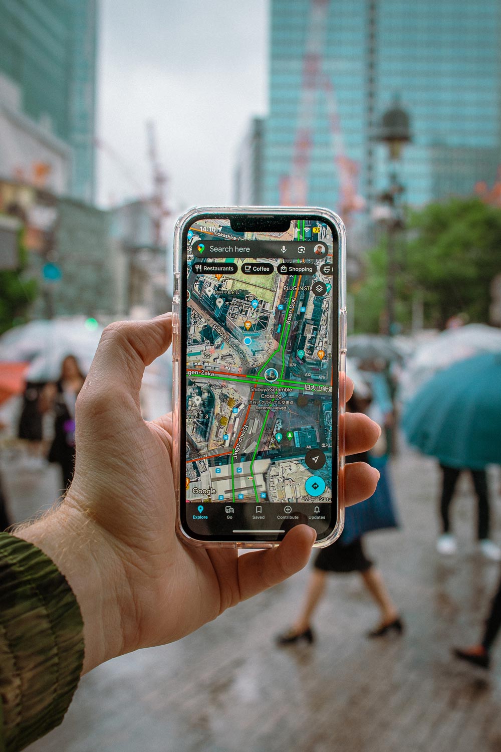
7 Steps to Plan a Trip With Google Maps
Here is how to use Google Maps trip planner:
1. Create a Map
To create a map on Google, you do need a Google account. Once signed up/logged in, go to this page .
Click on “ Saved” >> “My Maps “, which will take you to your maps. If you have created any maps in the past, you will also find them here. As you can see in the screenshots below, I’ve already created quite a few!
Alternatively, you can go to this page , where you see and access your maps in an instant.
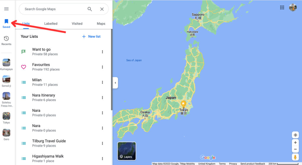
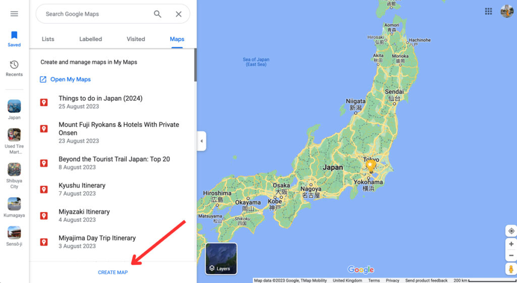
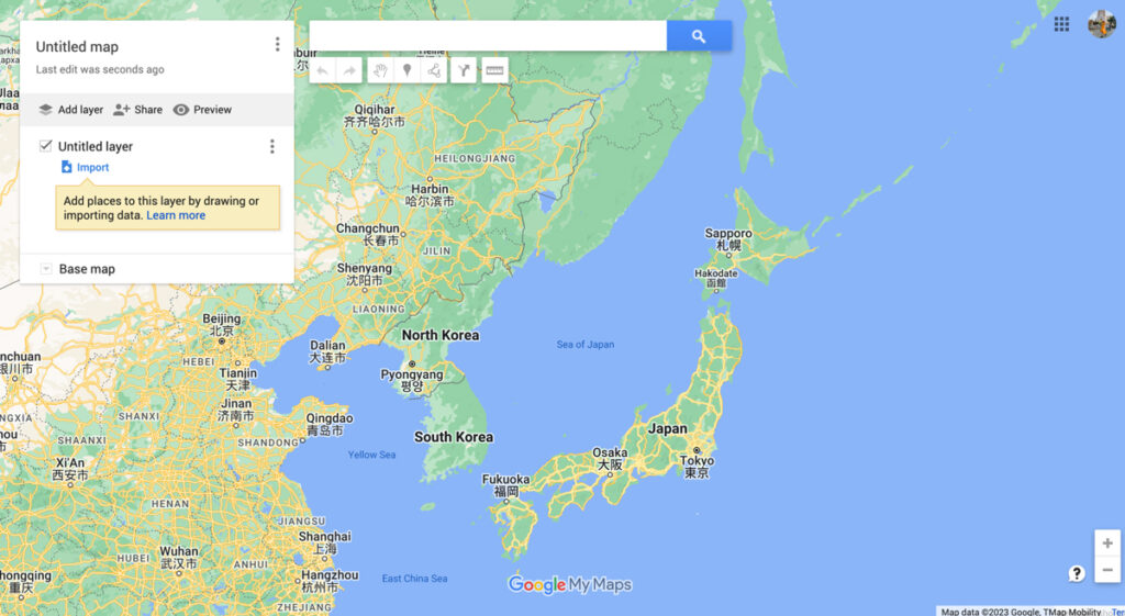
To create a new map, click on “ Create Map ”. This will open a new tab with an empty map.
By clicking on “ Untitled Map ”, you can give your map a name and a description. And ta-da! You’re ready for some travel planning on Google Maps. Time to create the perfect itinerary .
2. Add Locations
Now it’s time to start brainstorming. What do you want to do and see on your trip? There are so many ways to find the best places to visit.
For starters, you can find things to do by reading travel guides, blog posts , and itineraries from other travel bloggers. It’s also a good idea to go through Instagram hashtags and location tags. And, of course, good old printed travel guides (by Lonely Planet and Rough Guides, for example) are always a good shout too.
You don’t have to worry about how to plan out your days in detail. For now, you simply want to get an idea of what you want to do on your trip.
Whenever you find something that seems interesting, you can add these to your map by typing the location into the search bar. This can be the name of the location or the address, or you can use the coordinates. Usually, you’ll see a drop-down menu with suggestions as you type.
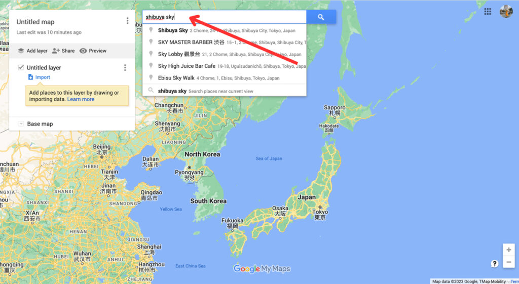
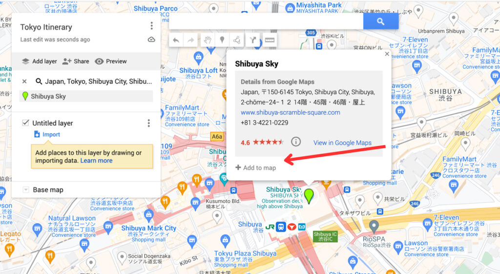
By pressing enter or selecting one of the options, Google Maps will take you to the location. Here, you can add these locations to your maps. Simply click on “ Add to map ”. Afterwards, you’ll see it appear on the Untitled Layer .
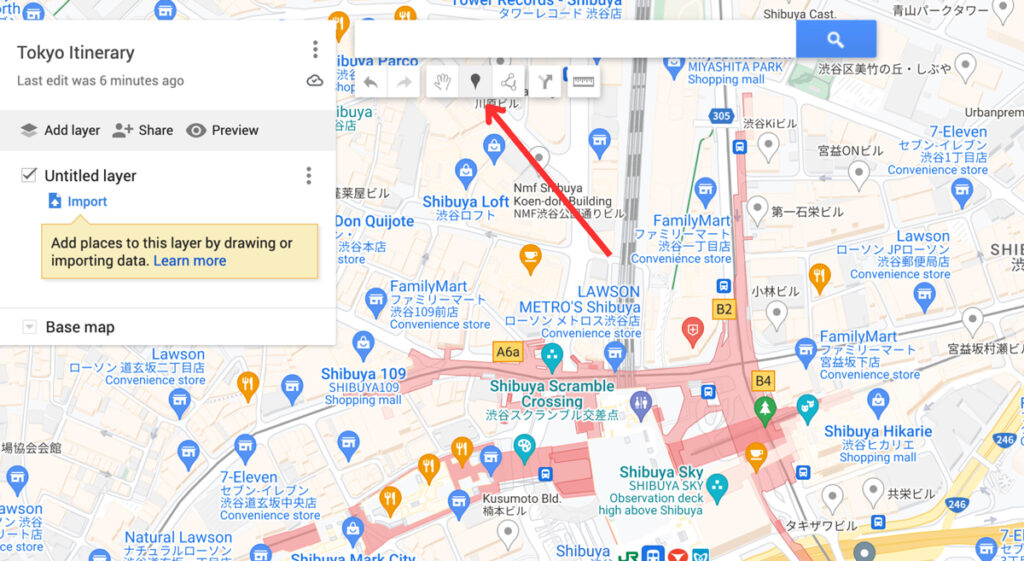
Alternatively, you can use the “ Add Market ” tool (shown in the screenshot below) to add a marker on the map. You can use this when a location isn’t on the map but you don’t have the coordinates, for example.
Before adding all your locations, make sure to read step 3. We explain how to customize your pins on Google Maps, making it much easier to plan your daily itineraries later on.

Planning a road trip on Google Maps? Start by adding the places you want to see/visit. Later on (see step 5), you can add directions to help you find the fastest routes. You can create on Google Maps for the overall road trip, and make another map for daily itineraries of your road trip.
3. Customise Your Categories (Icons and Colours)
The customisation options are another reason why planning trips on Google Maps is one of the best travel planning tools out there. By using colours, icons, pictures and notes, your map will be even easier to navigate.
These options let you break down your locations into categories, such as things to do, photography spots, restaurants, cafes, hotels, shops, etc.
You can change the colour of your pin and add an icon under the “ Style ” option – it looks like a paint bucket. There are hundreds of different icons to choose from.
At this stage, it’s best to stick to changing the icons for now. I normally change the colours to divide the days on my itineraries. Obviously, you can completely style this the way you want.
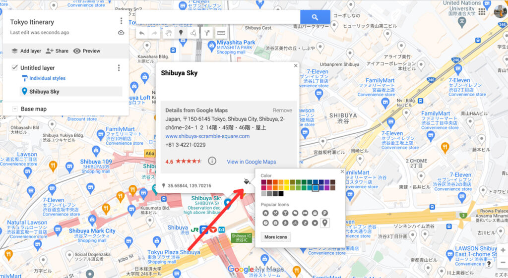
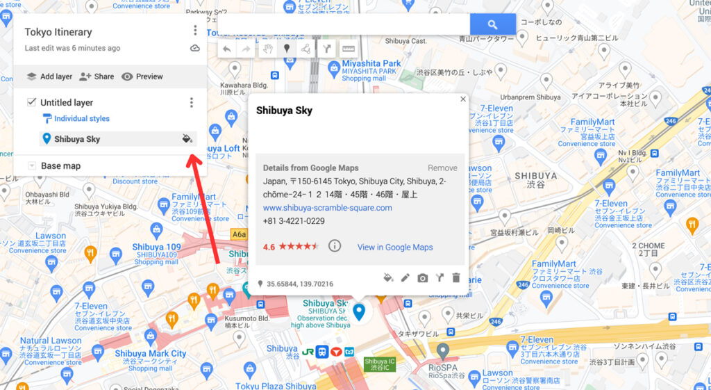
You can also change the colour and icon of your pins in the side menu.
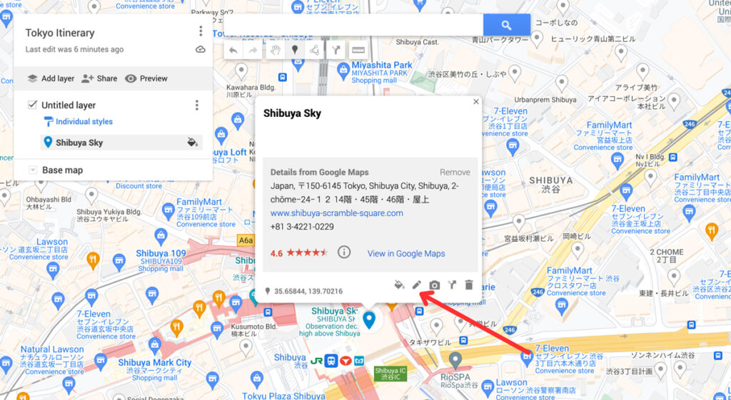
When clicking on the “ Edit ” icon, you can change the title and add a description for your location. This can be handy to help yourself remember any specifics about this place, such as good photography spots, opening times and whether you need to book a ticket in advance or not.
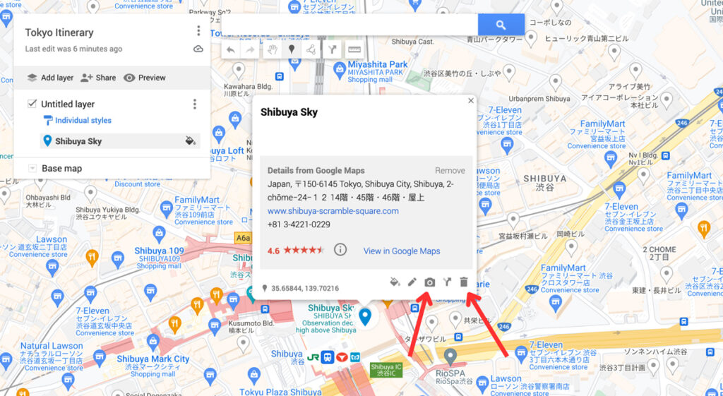
You can add an image or video to your pins, too. And lastly, you can delete the pin by clicking on the trash icon.
4. Create Layers
Now you’ve added all the things you want to do and given them some icons, it’s time to take a look at the layers. You can add a layer by clicking the “Add layer” option in the sidebar. This automatically creates a brand new untitled layer on your map.
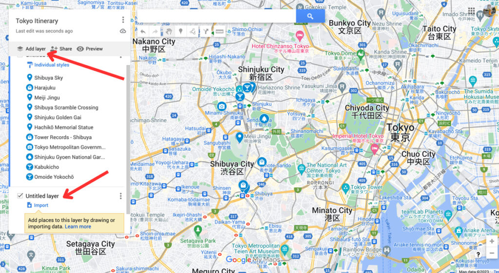
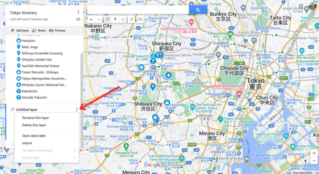
You can rename and delete the layers by clicking on the three dots next to the name of the layer.
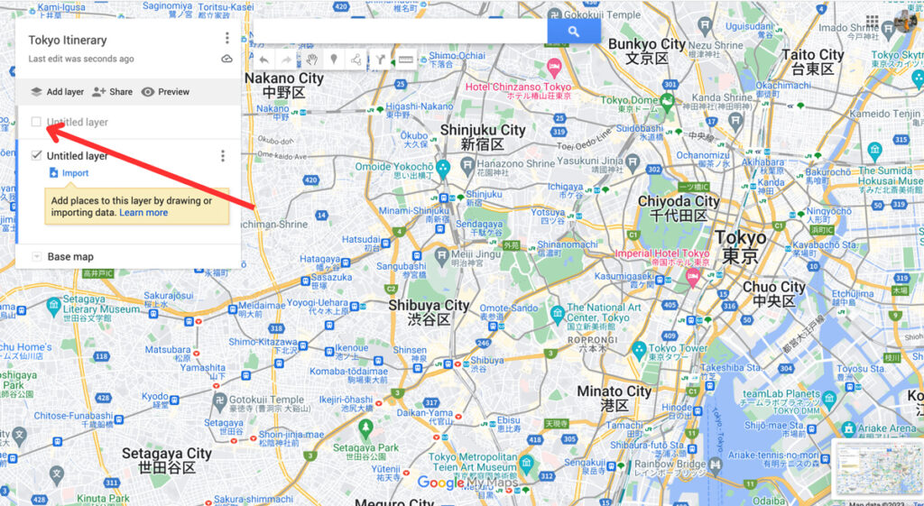
You can make layers invisible by unchecking the box next to the name of your layer.
To move points of interest from one layer to another, you can simply drag them over with your mouse.
Layers are an easy way to categorize and organise the locations on your map. There are multiple ways to do this, and you can choose a way that works best for your trip. For example, you can create one layer for restaurant options in Tokyo, one for sightseeing in Tokyo, one for hotels in Tokyo , etc.
When I’m planning a big trip, I like to use layers to break down my individual days or cities. This way, I can quickly see what I’m doing every day while I’m travelling. To make it even clearer, I change the colours of all my pins to match the different layers.
5. Plan Your Itinerary (with Directions)
After following these steps, we should have a good overview of all the things we want to do and see during our trip. This will make it much easier to break down the trip into days.
For the Tokyo itinerary I’ve been planning as part of this Google Maps tutorial, I’m going to spread it out over two days.
I created two layers to match my time in Tokyo in Google Maps.

Because I can see where all my hotspots are located, I can see which activities and sights I want to pair together. This way, I can efficiently plan what I want to see each day. You can even make squares to group things together with the “ Line Drawing ” tool.
For example, it makes sense to group these pins together per day – this will save me a ton of time travelling from one place to the other.

Always check whether these things actually work together, though. Sometimes, a ton of restaurants are located near each other, but there’s no point in planning to visit four restaurants on the same day.
Sometimes, there are museums that take way too long to visit alongside other sights or you can combine certain parts of the city in one day.
Take a look at your itinerary and plan it accordingly. As mentioned before, I like to use the colour tool to add the same colour per day to make it even easier to spot. My Google Map itinerary turned out like this:

If you’re planning a road trip on Google Maps or want directions for walking from one point to another, you can use the direction tools. Click on one of the locations and select “ Directions to here ”.
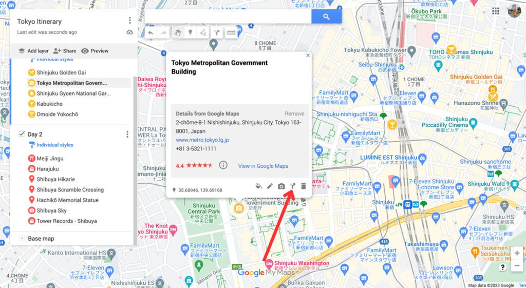
This will create a new layer on your map. From here, you can add different locations to create a route. You can select points of interest on your map to easily add them to your route. Click on “ Add Destination ” to add more stops.
You can also change whether you want directions by car, bike, or on foot by clicking on the car icon. This opens up a small window with a car, bike and pedestrian. Changing the mode of transport will automatically change the directions to find the best route for you.
This tool allows you to create road trip itineraries or city walks with just a few clicks. I find this especially handy to plan a road trip with Google Maps, as it allows me to estimate the driving time and the amount of money I’ll have to spend on petrol.

By clicking on the three dots next to the name of this direction layer, you can click on “ Step-by-step directions ”. This will give you detailed directions, distances, and an estimation of how long it’ll take for you to get there. Super handy!

6. Book Your Hotels
Now you know exactly what your daily plans are for our trip, it makes it much easier to pick the perfect location for your accommodation . Since you know what parts of the city you’ll be visiting, you can pick a spot that’s near these locations. This will save you so much time (and money), as you won’t have to travel too far to go to start your daily itinerary.
I usually book hotels on Booking.com . The website’s map feature makes it perfect for choosing the location. Because I have my itinerary ready on Google Maps, I know exactly what area of the city I prefer to stay in.
Once you’ve booked your accommodation, you can add the location to your map too.
7. Share Your Trip & Access it on Your Phone
Once you’ve finished your map, you can share it with your travel buddies and download it onto your phone. Here is how to do it.
Access Your Map on Your Phone
To view the map on your phone (with an internet connection), simply download the Google Maps app. Log into your account and click on the “ Saved ” button at the bottom.
Then scroll down and click on “ Maps ”. This will take you to all the maps you created. Click on the map you want to access, and all your saved spots will appear.

Share Your Map
To share your map with your travel company or friends, click on the “ Share ” button. Make sure to enable link sharing , which will allow you to copy the shareable link. You can share this link with friends, who can then access your map and download it themselves.

If you’ve read any of my itineraries or travel guides , you have probably noticed some Google Maps. As I always use these maps for my own trips, I try to include them in my articles for you to use. If you want to embed your map onto your site, click on the three dots >> “Embed on site” .

This will give you a code that you can include on any site for an interactive map to appear.
Why Use Google Maps for Trip Planning?
Google Maps is one the best travel tools because it’s so easy to use for both planning your trip and using it during your trip. We use it for planning city trip itineraries and road trip routes, plus it allows us to save our favourite locations and hotspots.
Whenever we come across a location on social media that we’d like to check out, we add it to a bigger map so we can organise it into smaller itineraries when we’re ready to visit.
Here are some of the main reasons to use Google Maps:
1. It Allows You to Access Your Maps Anywhere
You can access Google Maps anywhere you want. After creating a map on your desktop, you can open it on your phone or tablet. Plus, you can download it so you can access it without being connected to the internet. This is especially handy when you’re abroad and internet access isn’t a given.
2. It Makes it Easy to Find the Best Hotel Location
Using Google Maps to plan my city breaks gives me insight on the perfect location for my accommodation. Because I have a visual representation of all the things I plan to do during my holiday, I know exactly what the best hotel spot is. I compare the map from Booking.com and my own map, and ta-da!
When planning road trip routes on Google Maps, you can easily estimate the time it takes to drive from one place to the next. You can use this to properly budget your trip in terms of petrol cost, too. And when on the road, you can use the directions from your own map while driving.
Conclusion: Using Google Maps Trip Planner
That concludes my tutorial on how to plan a trip with Google Maps. I hope this has shown you all the amazing features this tool offers and how easy it is to use when planning a road trip or city break.
Ever since I started using it, I’ve never looked back. It has saved me so much time and always takes away a ton of travel planning stress. I hope it can do the same for you!
Nele (Nay-la) graduated from Manchester Metropolitan University with an English and Creative Writing Degree and has lived in the UK for nearly 10 years. She has had an interest in Japan and its culture for as long as she can remember. Since her first trip in 2018 surpassed all expectations, she has continued to return to Japan to explore more of all it has got to offer. You can read her full story here .
View all posts
10 thoughts on “How To Plan A Trip With Google Maps: 7 Easy Steps”
WOW!! I had no idea this resource existed. Your detailed steps and screenshots make it easy for me to take the plunge and start using this tool. Thank you.
Thank you so much for the lovely comment, Anne! So glad the post was able to teach you a few things – it’s such a great tool to use for planning trips!
Hi, Thank you for sharing this interesting feature. I was looking for a hard copy of a plan for my travel in Malaysia.
Great guide, exactly what I was looking for, Great work, Thank you!
- Pingback: Blogs To Read This September - Bournemouth Girl
This was very helpful. Thank you 🙂
Amazing tutorial! I am so glad you came up in Google search just as I was looking for this kind of resource. And best of all its free and a tool that I am so used to. How did I not know this before about G Maps?!
So glad to hear the tutorial was helpful! It’s been such a useful tool in my travels, hopefully you can use it on your next trip too!
Very detailed explanation and very well explained too. Thanks for making this blog…
Great post! I recently planned a trip to a nearby city using Google Maps, and it was incredibly helpful in navigating unfamiliar roads and finding the best routes. I especially appreciated the feature that allowed me to save my route and share it with friends. Will definitely be using this method for future trips!
Leave a Comment Cancel reply
This site uses Akismet to reduce spam. Learn how your comment data is processed .
Must-Read Articles

50+ Best Things To Do In Japan

Is The Japan Rail Pass Worth it?

The Perfect Three Week Japan Itinerary
Japan Travel Tips Group

The Japan Travel Newsletter
Sign up to get inspired! Receive insider tips, special discounts and more to plan your perfect Japan trip.
You have successfully joined our subscriber list.
japan travel Blog
Tokyo Kyoto Osaka Hiroshima Hakone Kobe Nikko Nara Kyushu All Japan Content
Plan Your Trip
Best Things To Do Japan Rail Pass 2 Week Itinerary 3 Week Itinerary Accommodation Japanese Phrases
About The Navigatio Work With Us
Join our Adventure: Get all my insider tips for motorhoming & road trips

England Road Trip: 50 Unmissable ideas (for every UK itinerary)
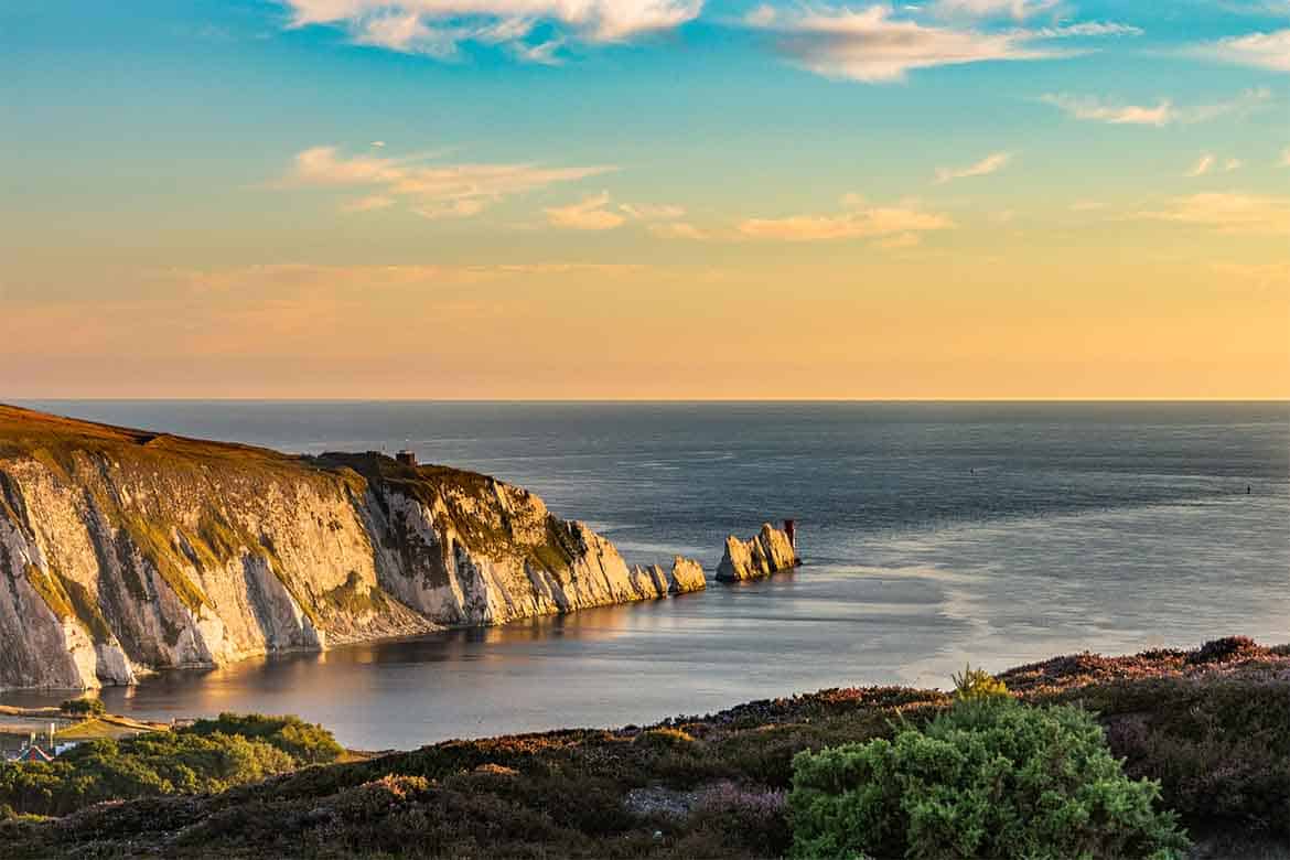
Planning an England road trip? Here are some of the best itinerary ideas for all schedules, including London to Cornwall, the Cotswolds and Kent in southern England, National Parks like the Lake District or Peak District, Northern England and all the way up to the Scottish border.
Whatever your cup of tea, there’s a UK road trip idea here for you. We’ve also provided a helpful map so you can visualise your route.
*We work hard to make this the best motorhome travel blog and road trip website possible, full of helpful content for you. The website is supported by our readers, so if you buy through links on this site we may earn a commission- at no extra cost to you. All opinions remain our own .
If you find this post useful, you can also treat us to a coffee – we promise to enjoy it while creating more useful content like this- we might even indulge in a biscuit (or two!)
JUMP AHEAD TO...
UK Road Trips- How to Plan
Planning a UK road trip to England or elsewhere can be tough.
There are SO MANY places, ideas, options and reviews- how on earth are you supposed to choose the best way or most scenic drives?
Then, you have to factor in how long you have for your UK road trip (remembering that much of rural UK has smaller, slower roads, so it takes a lot longer to get there than you might expect.
So, if you’re planning a road trip around England (and the UK) and feeling overwhelmed, here are some of our favourite road trips and itinerary ideas to help you. We’ll discuss the best bits of each area, why and when you should visit, how far it is from London and where you should allow extra time to explore.
England Road Trip Ideas- Where to Start
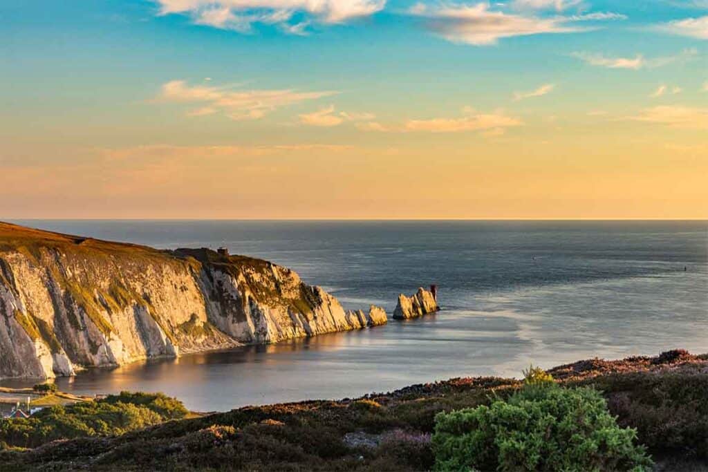
The first thing to decide is where you want to visit on your road trip. Also, remember that England is only one section of the UK- there are several other countries to explore (England, Wales, Scotland and Northern Ireland make up the United Kingdom).
So, if you want to do a full UK road trip, you’ll need more time than if you were just doing an England road trip.
Our biggest tip is not to overface yourself. Whether you only have a long weekend for a quick trip from London or a week to get out on the open road and tour, make sure you leave time to actually get out of your vehicle and explore the places you’re visiting- you’ll find plenty of historic sites, sandy beaches and incredible routes to enjoy.
Roughly speaking, you can split England in half- the South of England and the North (the line roughly goes through Birmingham) or even further into quarters if you only have time for a one-week road trip.
Again, how far you can travel will depend on how much time you have, as well as how you are travelling (rental car, motorhome or public transport), but to do each half ‘properly’ we would recommend at least 2-3 weeks- especially if it’s your first time in England.
Having said that, you can see some of the best sights in less time than that- here’s our one week in England road trip itinerary .
Make planning your next road trip EASY (& fun!)
When you’re planning a road trip, keeping track & organising all your ideas is often the hardest part. Fix that TODAY with our printable pdf road trip planner. Grab yours FREE now
This form subscribes you to our mailing list. We share tips, itineraries, stupid mistakes and guides like this for road trippers and motorhomers.
We never spam (yuck) and you can unsubscribe at any time.
Where to stay during your England road trip
If you’re planning a motorhome or campervan trip , you’ll be able to travel and stop along the way, often without booking in advance, using schemes like Brit Stops or wild camping in your motorhome .
If you’re in a car or motorbike, there are PLENTY of hotels and BnBs to use en route. If you’re travelling in summer we recommend booking at least the first stop in advance- if you use Booking.com for all your accommodation you’ll find you can get a great deal and save a lot of money.
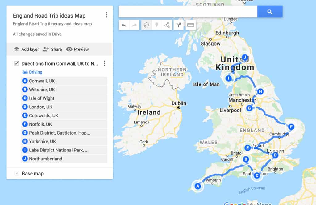
England Road Trip Map
I know how hard it can be to visualise places if you don’t know the country well, so here’s a map of England with several of the road trip destinations shown on it.
Out of interest, if you did this route, it’s about 1056 miles (1700km) long. You could technically do it in a week, but you’d barely have time to get out of the car!
Common England Road Trip Questions
How long does it take to drive the whole of england .
Many people wonder “ How long does it take to drive the whole of England ?” That’s a tough question, as there are so many places to go and depends a lot on your starting point.
Most people allow 2-3 weeks to drive through as much of England as they can, but that will involve a LOT of driving. Of course, you can take a look at the road trip itinerary ideas below and see which scenic route or quaint villages most appeal to you- and then plan your trip around that.
One common UK road trip idea is to drive from Land’s End in Cornwall all the way up to John o’Groats in Scotland, which is about 838miles (1350km). Obviously, this is a road trip which involves England AND Scotland, and that brings me to another important point.
Want to rent a vehicle for your road trip?
These might help:
- Discover incredible deals for motorhome/ camper rentals
- Find the best deals for car rental
READ: 10 essential questions to ask before you rent a motorhome
Can we go to England by road?
This is a common question for anyone who doesn’t live in the UK- and the short answer is yes, you can drive to England from mainland Europe.
Whether you’re enjoying a European road trip (here are some ideas for you ), or want to combine a trip to England with another country, you can drive to England from Europe via either the Eurotunnel or taking one of several car ferries (they also take motorhomes/ campervans on most of the ferry routes.)
If you’re planning a road trip from France to England, which route you take will depend on which part of France and England you want to visit- find out more in our Eurotunnel vs Ferry post.
And if you’re going the other way and will be driving in Europe, make sure you are aware of the new rules for driving in Europe after BREXIT .
If you’re like more help planning your trip, this post about how to plan an epic UK road trip will help.
Is England the UK or Great Britain?
Neither. And part of both 🙂
It’s common for people to confuse an England road trip with a UK road trip. England is just one country within the UK, along with Wales, Scotland and Northern Ireland. If you want to extend your trip and see more of those countries, you might enjoy our post on the best UK road trips and scenic drive ideas.
The UK is short for ‘The United Kingdom of Great Britain and Northern Ireland’.
Great Britain is the LANDMASS of the largest island in the British Isles (the one which makes up England, Wales and Scotland). Northern Ireland, Isle of Man and the Channel Islands are not included in this.
And, to make things even more odd, the British Isles includes ALL the islands, including the whole of Ireland, which isn’t part of the UK at all.
Thoroughly confused? Ok, let’s just stick to England road trip ideas! 🙂
South England Road Trip Ideas
If you’re visiting London and want to explore part of the country for a few days, southern England is a good place to start. Of course, there are a HUGE number of places to explore in ‘South England’ (which is roughly classed as anywhere below Birmingham), so I’m just going to pick a few highlights to inspire you.
Cornwall- South West England

Cornwall is one of my favourite places to road trip in England. I spent 2 years living there whilst I was in the Navy, and have been back many times since. There are plenty of things to do in Cornwall , but there are some important tips you need to know before you arrive!
Why is Cornwall one of the best England road trips?
If you want cute villages, incredible beaches and more history than you can shake a stick at, Cornwall is perfect. Also, they have some of the best ice cream IN THE WORLD (no kidding) and it’s perfectly acceptable to eat a scone with jam and clotted cream EVERY day and no one will judge you.
IMPORTANT NOTE : There is intense rivalry between Devon and Cornwall over whether jam or cream should go first on a scone. In Cornwall, they do jam and THEN cream, which is apparently the way the Queen preferred her scones .
(Don’t worry, they’re used to tourists and won’t stone you if you get it wrong. But be warned if you want to live there…!)
In Devon, they do it the other way. I’ve tried both, and I’m a jam first girl (because you can then put more cream on!)
When should you visit Cornwall?
Cornwall is best anytime between Easter and mid-October.
TOP TIP : Avoid July and August if you possibly can. The schools are on holiday and it feels like EVERYONE in England has travelled to the same small Cornish village as you.
Beaches are overcrowded, parking becomes a struggle and there’s a very real chance of shops running out of ice cream. Don’t do that to yourself. You deserve that ice cream.
Also, many businesses and attractions close after mid-October for the winter, so you might find you can’t do everything you want to outside the season.
Having said that, we find Cornwall one of the best places to enjoy Autumn in Europe – the weather is still warm, but everywhere is quieter and easier to get to.
How long should you spend roadtripping Cornwall?
How long is a piece of string!! But, as you can see on our Cornish road trip itinerary , we recommend 7-10 days minimum to see all the best places.
Where are the best places to visit in Cornwall on a road trip?
Did I mention that I used to live here? I have SO many recommendations for places to visit we could be here all week!!! Some of my absolute favourites (and this is like choosing my favourite child… or chocolate bar) include:
- Tintagel Castle (the home of Arthur and the round table)
- Minack Theatre (built onto the side of a cliff)
- St Michael’s Mount
- Boscastle (where one of the best witchcraft museums in the world is!)
- Newquay beach (and bars!)
READ MORE: Discover our complete Cornwall road trip itinerary (45 places you HAVE to see!)
Recommended by Ben at Driftwood Journals
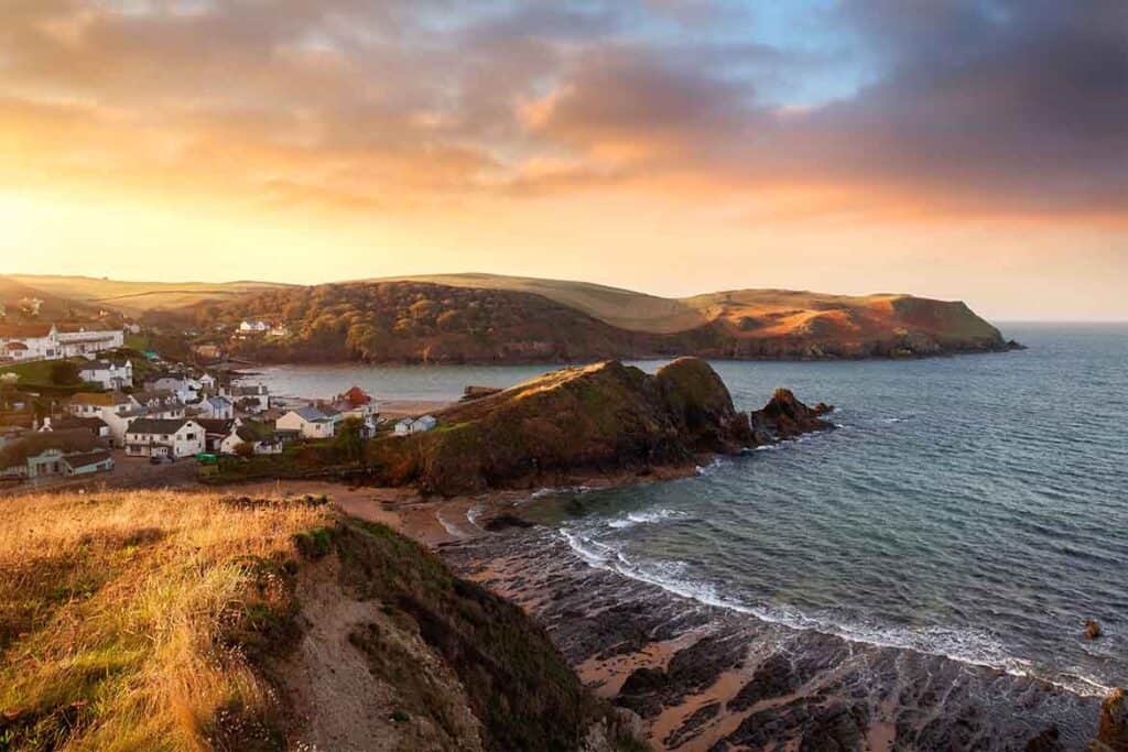
Famed for its endless rolling hills, craggy coastlines and clotted cream delights, Devon is unsurprisingly one of the most popular destinations in the UK – and a dream for rural road-trippers! With wild moors galore, cutesy towns and villages, and bountiful beaches, you don’t have to drive far in Devon to stumble upon scenes of unparalleled beauty.
Highlights and best places to visit in Devon
- Dartmouth- one of the best towns in the county (and home of the Royal Naval Officer training. I spent a year here…running up those bl***y hills!) Hire a boat and explore the river.
- Paignton- the beach with the red sand and is also known as the English Riviera.
- Dartmoor National Park
- Exmoor National Park
- Exmouth with its beautiful painted houses
- Salcombe Harbour – a holiday hotspot for all generations.
- Dulverton- head to the Copper Kettle tearoom; you won’t regret it!
Devon road trip ideas
Pack up your motorhome/ camper (or car with tent) and find a site with views across the Devonshire cow-grazed hillsides of the Lyn Valley, or out over Dartmoor. You can wild camp in Devon, but not on the moors. Find out more about motorhome wild camping in the UK.
For a coastal trip, explore sea towns like Salcombe and Dartmouth (where you can take a boat up to Greenway, Agatha Christie’s summer home) and round to Exmouth, before heading north to Woolacombe, Dawlish and the fishing boat bobbing harbour of Ilfracombe. Enjoy the bustle and culture in the capital of Exeter or discover the notorious prison of Dartmoor.
Alternatively, head to North Devon and enjoy the wilder seas and views of the north coast. This is a great area for surfing and watersports.
If you have more time (and fuel) to burn, take to the A386 between Appledore and Plymouth, traversing through forested valleys to picture-perfect towns like Great Torrington and Tavistock, where you can tour the tearooms and plan the rest of your trip in the park while dangling your toes in the River Tavy.
But the true beauty of road tripping in Devon is that you don’t really need to plan too extensively. You’ll never be far from a cream tea pitstop, and the verdant country roads will offer up some of the most perfect picnic spots you’ll ever see. All you need is is a full tank, and a little patience when stuck behind tractor after tractor!
When is the best time to visit Devon on a road trip?
As with Cornwall, the best time to visit Devon is Spring to Autumn, but avoid the high summer months if you can, especially if you’re on a UK motorhome holiday .
Can you visit Devon on a day trip from London?
You can, but it’s quite a long drive. I’d say you’d need at least 2 or 3 days to really be able to explore anything.
Dorset- One of England’s Best Road Trips
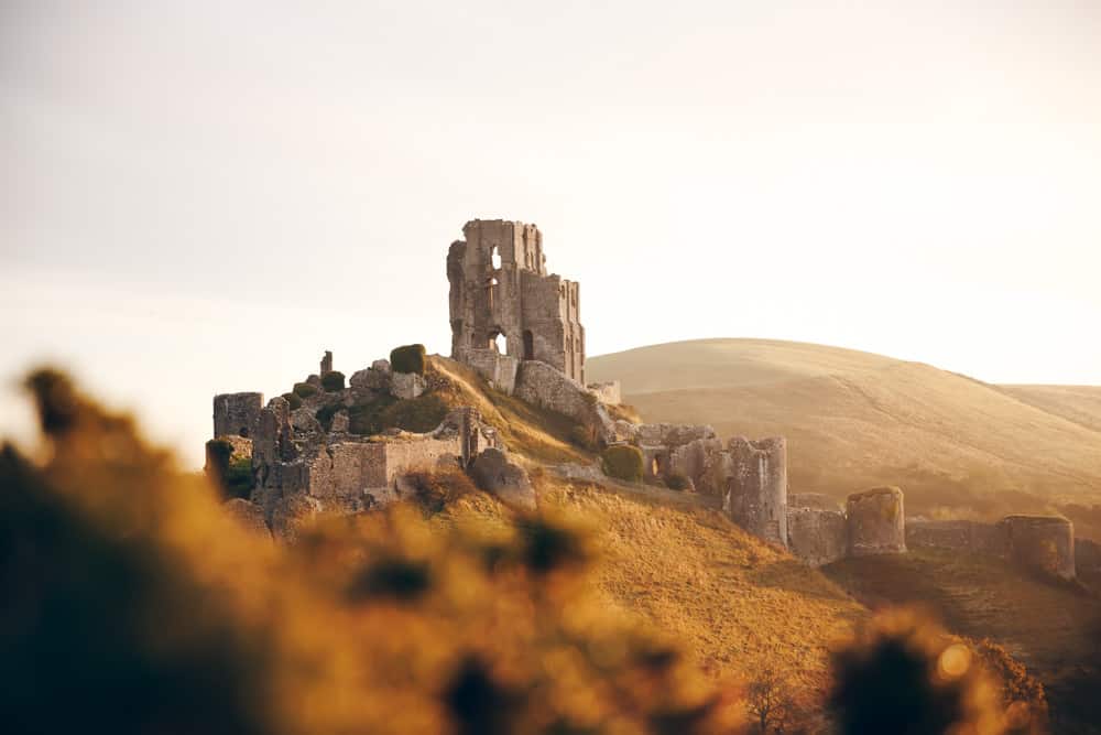
Recommended by Paul | Anywhere We Roam
The Jurassic Coast stretches 95 miles across Dorset in southern England. With an iconic coastline of towering white cliffs, it’s an excellent destination for a classic road trip. Stunning scenery, historical sites and local breweries make the Jurassic Coast one of the best places to experience the beautiful English countryside.
Dorset road trip- best places to visit?
The main highlight of a road trip to Dorset in the area has to be Old Harry Rocks – a collection of white stone monoliths that have been carved out along the coast. It’s one of the most impressive stretches of scenery in the UK with dazzling chalk stacks assembled like a jigsaw puzzle waiting to be completed. If you get time, be sure to enjoy one of the many fabulous Dorset walks- you won’t regret it.
A thirty-minute drive away, Corfe Castle stands as a reminder of England’s 11th-Century past. It was one of the earliest Norman castles built and today it glows in its dilapidated glory overlooking the Dorset hills. It’s a stunning, photogenic inclusion on a UK road trip.
For another natural phenomenon, Durdle Door is possibly one of the most recognisable symbols of the Jurassic Coast. Over time, crashing waves have eroded limestone stacks in the sea leaving a glorious natural arch.
It’s a beautiful stretch of beach, ideal for a long summer stroll. It’s also next to the famous Lulworth Cove, which is a wonderful place to enjoy an ice cream!
Editors note: (I (Kat) actually jumped off the top of Durdle Door on my hen party!)
After soaking up the stunning scenery, head west to Lyme Regis, a quaint town with a vibrant independent retail scene. The historic Cobb Harbour set against moody cliffs is well-preserved and houses some of the best coffee in the area.
When is the best time to visit Dorset on an England road trip?
The best time to visit the Jurassic Coast on a road trip is from May to early July when the surrounding countryside will be verdant green and covered in wildflowers, but there’s not too much traffic!
Hampshire road trip

Hampshire is another county in England we know well, having lived here for 14+ years. There’s plenty to enjoy on a road trip to Hampshire, from beautiful cities to picturesque country houses.
Highlights of a Hampshire road trip
Some of our favourite places to visit in Hampshire include:
- Winchester- be sure to visit the Cathedral where Jane Austen is buried and you can see one of the oldest Bibles in the world. If you’re lucky enough to be visiting in December, don’t miss the famous Winchester Christmas Market , held in the Cathedral grounds each December.
- Highclere Castle (or Downton Abbey, as you might know it!)
- Lymington – for the oldest open sea water baths in the UK – and the New Forest (check out the Wildlife park there and make sure to take some memorable photos).
- Hinton Ampner- 18th century famous manor house known for its gardens.
- Portsmouth (you MUST go to the Mary Rose museum and HMS Victory)
- Isle of Wight (see below)
Isle of Wight road trip
Recommended by Darek | DarekandGosia
The Isle of Wight , famous for its beautiful views, is an island on the south coast of England, just below Southampton. Technically, it’s part of Hampshire, but feels like a different world.
With a motorhome or car, you can reach the island by ferry from either Southampton or Portsmouth – book in advance during summer. There are also a couple of foot passenger ferries and a hovercraft from Southsea.
Why is it one of England’s best road trips?
The Isle of Wight is like going back in time. It’s worth a road trip here for even a weekend, to escape the hustle and bustle of normal life, ride bikes and take a walk on the cliffs.
Also, there are some wonderful places to stay. If you’re on a road trip, check out these amazing Isle of Wight campsites – some with stunning sea views!
What is there to do?
You can start exploring the island in Shanklin – one of the coastal villages famous for its beautiful beaches. On the promenade along the sea you will find many restaurants and hotels – most of the Island is typically tourist-oriented.
From Shanklin drive to the western part of the island. The most characteristic point is The Needles – three chalk rocks emerging from the sea with a small lighthouse built at the end of one of the columns. You can get to Needles by car and then follow the path on foot to the cliff slope. It’s a fabulous place for a picnic.
Next to Needles is Old Battery, a military fortification dating from the nineteenth century. There you can find World War II memorabilia or visit one of the various exhibitions are also taking place.
While driving around the island make sure you get to Carisbrooke Castle near Newport. Its construction began in the 12th century. It is worth taking a moment to walk around the castle, relax in the Edwardian-style garden.
One of my favourite places on the Island is Osborne House- Queen Victoria’s summer home. You can walk around the gardens and the house and even enjoy an ice cream on her private beach. Osborne House is run by English Heritage.
When is the best time to visit the Isle of Wight?
The Isle of Wight is a must-see for anyone who wants to admire the British climate and above all fantastic views. It is worth going here all year round – it’s actually one of the best places to visit in Europe in October , when there are fewer tourists and you can enjoy the views & roads!
Norfolk Broads
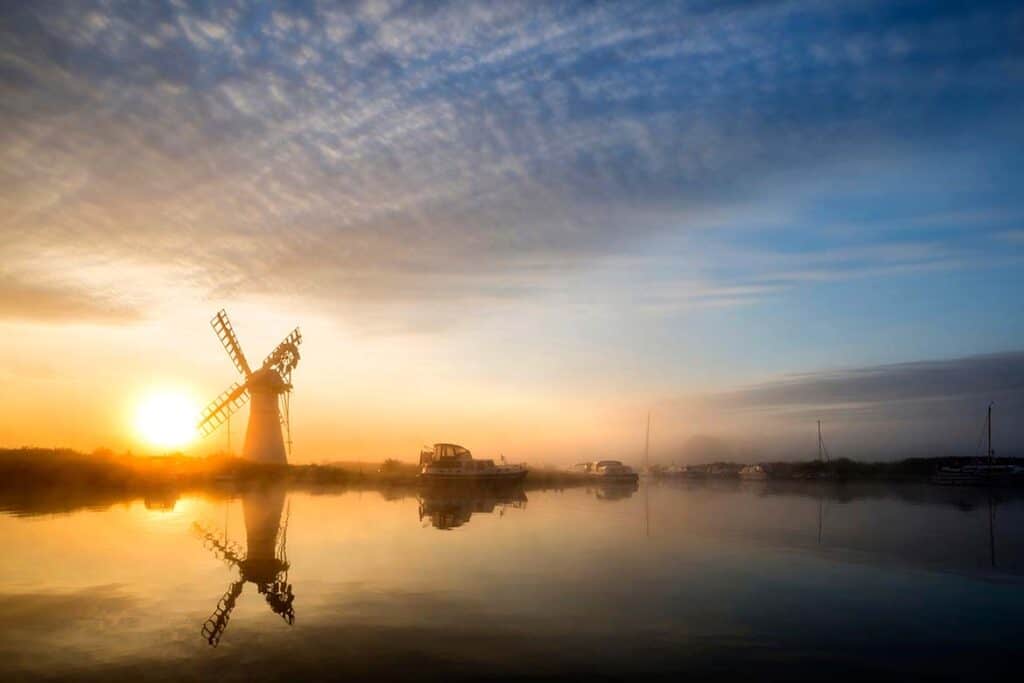
Recommended by Mandi | Big Family, Little Adventures
Sometimes you want nothing more than to escape the hustle and the bustle of everyday life, the noise, the bright lights, the never-ending pace of life. If you want to get away, the Norfolk Broads is pure escapism; big skies, plenty of peace and quiet and an abundance of wildlife.
Best places to visit in Norfolk on a road trip
- The Old Roman Fort at Burgh Castle with an elevated position and commanding views over the marshes – perfect for a walk in both winter morning frost or a hot and hazy mid-summer evening
- If you prefer a bit of activity, Wroxham is a bustling Broads village- home to Roy’s of Wroxham, possibly the largest village shop you have ever seen
- Plenty of riverside pubs and restaurants in Wroxham and all around the Broads- the perfect places to stop for a bite to eat
- St Benet’s Abbey – an 11th century monastery defying time, standing in a stunning green valley.
- If you are an animal lover, you will enjoy a visit to Wroxham Barns to feed the lambs or spot the grey seals on the Norfolk beaches
Norfolk Road Trip- when is the best time to visit?
You can explore Norfolk all year. In summer, if you would like to explore the best Norfolk beaches or Broads up close, why not hire a dayboat; these can be hired at various boatyards throughout the Broads. Waveney River Centre is another stunning place to stop and admire the view, either by boat or car.
The challenge is (as always in England!) the weather. In dry conditions, most paths are excellent, but it can get a bit more challenging in wet weather.
However, over the years, an increasing number of boardwalks have been developed, increasing safe access to the Broads whatever the weather. Also, seeing the windmills and rivers on a crisp winter morning is unforgettable.
Time does not stop in Norfolk, but it really does feel like it slows down. To be able to watch the sunset across the broads any time of year is a magical experience and the perfect place to enjoy a chilled road trip.
Sussex, Kent and Surrey
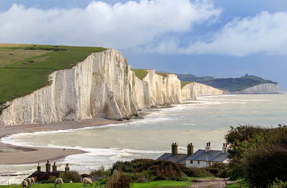
Ahhh, the picturesque south-east corner of England, which includes the Garden of England (that’s the other name for Kent). This area is lush, green and has some many historic buildings and castles you’ll find it impossible to avoid them.
It’s also home to plenty of gorgeous sandy beaches, white cliffs (such as Dover and Beachy Head) and some truly wonderful parks to walk in.
Even better, it’s all easily reached from London by car and train, so it’s easy to get away from the city for a few days if you’d like a countryside break or a trip to the beach.
Best Places to visit in Sussex include:
Sussex is actually split into East and West Sussex, but to make things easy on your road trip I’ve made one list for you. They’re not that far apart from each other!
- Brighton : A vibrant seaside city famous for its pebble beach, iconic pier, and the Royal Pavilion with its distinctive architecture. Explore the Lanes for unique shops and enjoy the city’s lively arts and music scene. See below for more ideas
- Arundel : Home to Arundel Castle, a medieval and Victorian castle that overlooks the River Arun. The town itself is picturesque with cobbled streets and antique shops.
- Chichester : A historic cathedral city with Roman origins, Chichester offers a mix of history, culture, and shopping. The Chichester Cathedral and Pallant House Gallery are notable attractions.
- Lewes : Known for its medieval architecture, Lewes Castle, and historic streets. The Lewes Bonfire Night is a famous annual event.
- Eastbourne : A traditional seaside town with a Victorian pier, beautiful seafront, and the iconic Beachy Head cliffs nearby.
- Rye : A charming medieval town with cobbled streets, half-timbered houses, and views of the surrounding marshland.
- Battle : Famous for the Battle of Hastings in 1066, this town is home to Battle Abbey and the Battlefield. Explore the historic sites and learn about this pivotal event in English history.
- Petworth House and Park : A stately mansion with an impressive art collection set in a vast deer park. The gardens are also worth exploring.
- Seven Sisters Country Park : A stunning coastal area with dramatic chalk cliffs and rolling hills, perfect for hiking and enjoying breathtaking views.
- Bodiam Castle : A 14th-century moated castle surrounded by water and picturesque landscapes.
- Sheffield Park and Garden : A National Trust property known for its stunning gardens, lakes, and vibrant displays of plants.
- Birling Gap and Beachy Head : More stunning chalk cliffs and coastal views, with the added beauty of the natural arch at Birling Gap.
- Glyndebourne Opera House : Known for its world-class opera productions, the opera house is set in beautiful countryside and offers a unique cultural experience.
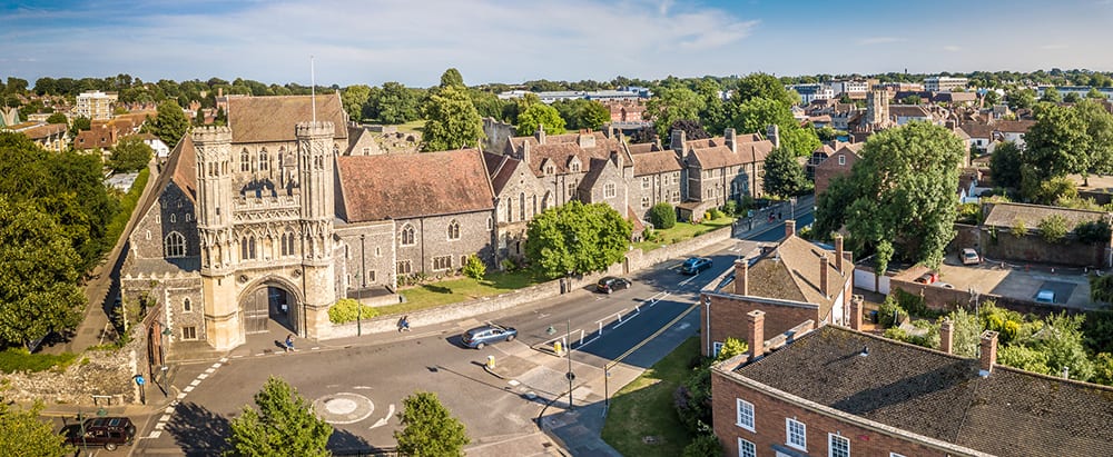
Best places to visit in Kent include:
- Canterbury – home to the UNESCO World Heritage Site of Canterbury Cathedral
- Dover : Known for the iconic White Cliffs of Dover, this coastal town is home to Dover Castle, which boasts a complex history and offers panoramic views of the English Channel.
- Rochester : A charming town with a medieval castle and cathedral. It’s also the birthplace of Charles Dickens, and you can visit the Dickens World theme park.
- Whitstable : This coastal town is famous for its oysters and seafood. Enjoy the quaint streets, beach huts, and seafood restaurants along the coast.
- Margate : A seaside town with a revived artistic scene, featuring the Turner Contemporary art gallery and the scenic Margate Sands.
- Leeds Castle : Often referred to as the “loveliest castle in the world,” Leeds Castle is set on an island in a lake and surrounded by beautiful gardens.
- Hever Castle : The childhood home of Anne Boleyn, with historic architecture, gardens, and a maze.
- Chatham Historic Dockyard : A maritime museum where you can explore historic warships, submarines, and learn about Britain’s naval history.
- Biddenden Vineyards : If you’re a wine enthusiast, Kent has several vineyards. Biddenden is one of the oldest and most well-known.
- Canterbury Tales Visitor Attraction : An interactive museum where you can step back in time to experience Chaucer’s famous tales.
- St. Augustine’s Abbey : A UNESCO World Heritage Site, this abbey in Canterbury dates back to the 6th century and is a significant historical site.
- Chartwell House : The former home of Winston Churchill, now a museum showcasing his life and legacy.
These are just a few highlights of what Kent has to offer. Whether you’re interested in history, nature, or culture, you’re likely to find something appealing in this diverse and beautiful county.
Best Places to Visit in Surrey
- Box Hill : A National Trust site known for its stunning views and walking trails. It’s a popular spot for outdoor enthusiasts and offers panoramic vistas of the surrounding countryside.
- Polesden Lacey : A grand Edwardian estate with beautiful gardens, Polesden Lacey is a National Trust property that offers a glimpse into the lives of the wealthy in the early 20th century.
- Watts Gallery – Artists’ Village : Located in Compton, this unique attraction is dedicated to the works of Victorian artist George Frederic Watts and his wife Mary Watts. The village includes a gallery, chapel, and artist studios.
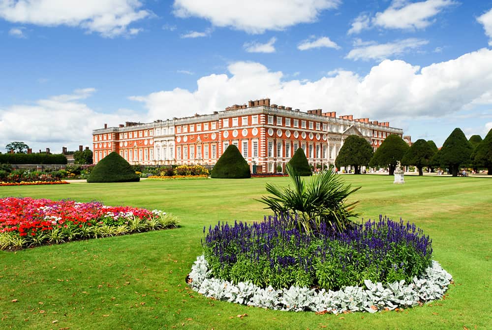
- Hampton Court Palace : While part of the palace is in Greater London, the stunning Hampton Court Palace is right on the border of Surrey. It’s famous for its Tudor history, grand architecture, and beautiful gardens.
- RHS Garden Wisley : A flagship garden of the Royal Horticultural Society, Wisley offers a wide variety of plants, landscapes, and garden designs to explore.
- Brooklands Museum : A museum dedicated to motorsport and aviation history, located on the site of the world’s first purpose-built motor racing circuit.
- Loseley Park : A grand Elizabethan manor house surrounded by beautiful gardens and parkland, open to the public during certain times of the year.
- Denbies Wine Estate : England’s largest vineyard, Denbies offers tours, wine tasting, and beautiful views of the surrounding countryside.
- Newlands Corner : Another viewpoint offering breathtaking views of the Surrey Hills, perfect for picnics and outdoor activities.
- Epsom Downs : Known for Epsom Downs Racecourse and the famous Epsom Derby, this area offers open spaces and walking trails.
- Virginia Water : Part of Windsor Great Park, Virginia Water features a lake, ornamental cascades, and woodland walks.
Surrey’s mix of historic sites, natural beauty, and cultural attractions make it a delightful destination for a variety of interests. Whether you’re into history, outdoor activities, or simply enjoying scenic landscapes, Surrey has something to offer.
Brighton – East Sussex
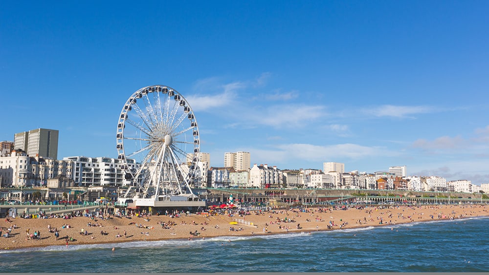
I’ve given Brighton it’s own section because it’s one of my favourite cities in England and you should try to add it to your England road trip itinerary, especially if you’re heading toward East Sussex.
Brighton is a city renowned for its diverse communities and innovation, the quirky shopping areas, its music and art scene, and its large LGBT population. Read more about Brighton in Autum .
Why is Brighton one of the best England road trips?
Brighton is less than an hour away from London (76 km) and on a direct train line. It offers plenty of fun and exciting activities to enjoy (more than just fish and chips at a pier!)
Brighton has been famous as a cultural centre for over a century. It’s home to the world’s oldest operating aquarium (which opened in 1872- now called ‘’Brighton Sea Life’’), and you can even ride the world’s oldest operating electric railway, the Volks Railway, built in 1883.
Other Brighton Highlights include:
- See the Palace Pier
- Catch the latest release in the Duke of York Picturehouse, Britain’s oldest cinema.
- Have a stroll down the North Lane- home to over 400 independent shops
- Discover the Victorian innovations still in operation in the city.
How long should you spend in Brighton?
You will want to spend at least two days in Brighton to truly take in the city, but you can easily make a week of your itinerary if you want to explore more places in Sussex, Kent and Surrey.
What is the best month to visit Brighton?
The sunniest (and therefore warmest!) time of the year in Brighton is from May to September. July and August are peak tourist season, with hotel prices skyrocketing, so be aware of that and plan your stay accordingly.
Cambridgeshire & Cambridge
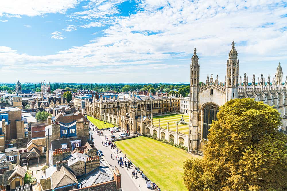
Cambridgeshire is a county in the East of England with plenty to do. The jewel of the county is Cambridge, with a historical, 800-year-old centre you should definitely not skip.
Why should you include Cambridge on your England road trip?
Only 1 hour and 30 minutes away from London via M11, Cambridge offers so much: a rich history of English heritage, a buzzing local community, and a picturesque setting. You’ll even find a gift Henry VIII gave to Anne Boleyn!
Cambridge Highlights
- See the King’s College Chapel
- Enjoy breakfast at Fitzbillies
- Go punting in the River Cam
- Have a picnic by the river.
- Enjoy walking the historic streets
Cambridge Trip Itinerary idea
Leaving London, head up to Cambridge via the M11.
Start the day with drinks and a meal in one of the many deli and brunch places in Market Square before setting off to explore the city. I highly recommend the famous Fitzbillies- the food is delicious.
From there, you can choose from a variety of activities: visiting King’s Chapel, punting in the River Cam (pass under the Bridge of Sighs), hiking on the Cam Towpath (lots of hidden gems if you know how to look for trails!), or taking in the city views from St. Mary’s Tower.
If you’re staying overnight, end the day by attending the Evensong at the King’s College Chapel (select days only)
When is the best (and worst) time to visit Cambridge ?
Cambridge is beautiful all year round. However, the worst time to visit would be spring – the university students sit their finals between April and June, which means many of the college sites are closed to visitors.
What are some of the best places to visit in Cambridge?
The King’s College Chapel in the University of Cambridge is the third-oldest university in operation and the most iconic and instantly-recognisable building in the county.
Don’t miss out on an opportunity to drink at the Eagle, a historic pub in the heart of Cambridge’s city centre famously linked to Watson and Crick’s discovery of DNA.
If you are feeling adventurous and are ready to brave the British winter, visit Cambridge in December. It’s off-peak season and features one of the best UK Christmas markets you should visit. Read all about the Cambridge Christmas market here.

How long should you spend in Cambridge?
One day in Cambridge is usually enough time to visit the majority of the main sights, especially if you are visiting during the summer. You’ll need tickets for most of the chapels and university buildings, so go first to buy those.
Wiltshire & Cotswolds Road Trip – 3 day trip from London

Recommended by Ann | The road is life
The Cotswolds is the largest Area of Outstanding Natural Beauty (AONB) in England and Wales. If you look at a map of England, find Bristol (west coast, just below the indent of southern Wales) and the Cotswolds is the area north-east of Bristol.
There is so much beauty and fascinating history to discover around the Cotswolds region and luckily you don’t have to travel far from London to get there! You can reach Bath or Bristol easily in a day from London, but we recommend at least 3 days to really explore the area by car/ motorhome, plus explore Stonehenge and Salisbury on the way back to London. If you’re travelling with children, don’t worry- there’s plenty of things to do in the Cotswolds with kids.
Highlights & Best Places to Visit in the Cotswolds and Surrounding Area
- Explore the charming stone villages of the Cotswolds
- visit the historic city of Bath
- marvel at the mysterious ancient stones of Stonehenge
- Indulge in some shopping at Daylesford farm
- stop at the magnificent Salisbury Cathedral.
When is the best time for a Cotswolds road trip?
Although the Cotswolds can be visited all year, this road trip is best completed in the spring or summer months to ensure warmer and sunnier sightseeing weather.
The days are also longer- allowing you to see more each day. However, unlike Cornwall and Devon, most places to NOT shut during winter, so feel free to explore whenever suits you!
Wiltshire & Cotswolds road trip itinerary from London
- Departing London, drive out to the Cotswolds. This is where you should spend 3-4 days exploring as many lovely little towns and villages as you wish to.
- A few of the prettiest Cotswolds villages include Bibury, Stow-on-the-Wold, Lower Slaughter, Bourton-on-the-Water, Castle Combe and so many more! The beauty of the Cotswolds region is that the villages are all located in close proximity with minimal driving time in between them.
- Once you have seen your share of lovely English villages , carry on to Bath which is only a 30-minute drive from the village of Castle Combe- well worth a visit.
- Spend a full day and night in Bath visiting the Roman baths.
- From there continue to Stonehenge. A visit to this incredible ancient site can easily take half a day. We camped overnight at Stonehenge and saw the most INCREDIBLE sunrise we’ve EVER seen. (Seriously, watch the video. It’s breathtaking)
- From Stonehenge, it’s only a short 20-minute drive to the medieval town of Salisbury which brings you to the final stop of this road trip.
- The highlight of Salisbury is the stunning Salisbury Cathedral which has the tallest spire in all of Britain! Spend one night in Salisbury before making the final 2-hour road trip back to London.
- Another option is to return to London via the historic city of Oxford. Don’t miss a meal in Sticks and Sushi- one of the best restaurants in Oxford and with incredible views over the city.
North England Road Trips- Why You Should Visit
It’s easy when planning an England road trip to get sucked into famous places like Cornwall, Devon or the Cotswolds- and those are all AMAZING places to visit.
However, I strongly encourage you to visit the north of England as well if you have time. You’ll find villages just as pretty, delicious food (chips, pie and gravy is the best thing in the world) and incredible history.
Again, we were lucky to live up here for 4 years- here are some of our absolute favourite places to road trip, although there are of course many more we have yet to discover! I hope they give you some ideas and inspiration for your next trip.
Don’t forget to Grab your ULTIMATE road trip planner here – it has everything you need to help you pack for your road trip.
Peak District National Park
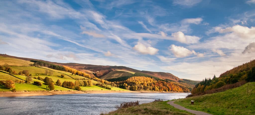
The Peak District is a huge and stunning area in Derbyshire, just to the east of Manchester. It’s a perfect place for a road trip because there are so many things to see!
A car or motorhome makes it easy to travel between the sites and there are plenty of campsites or hotels to use as you explore.
There are a multitude of hikes, walks and tors to climb and the area is famous for its caves, which people still lived in as recently as 1910!
The Peak District was the UK’s first National Park and is also considered the real ale capital of the world! If you’re exploring the Peak District with kids , there are steam trains, tramways, cycle paths and even a cable car taking you up to see some stunning views! There’s also Alton Towers theme park – one of the best in the UK.
Best places to explore in the Peak District
Some of the highlights include:
- Chatsworth House
- Ladybower reservoir
- Alton Towers theme park
- Heights of Abraham cable car
Lake District road trip
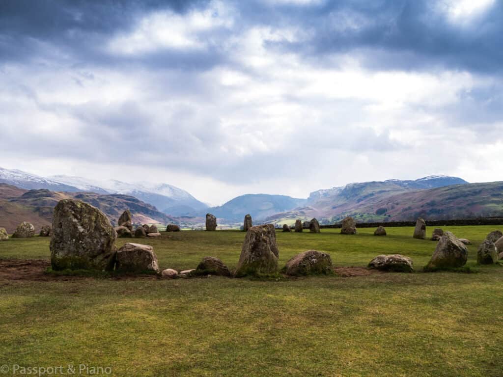
Recommended by Fiona/ Passport & Piano
The Lake District National Park is a UNESCO heritage site that makes for the perfect road trip. Walking around the lakes and fells to see the magnificent scenery is one of the many pleasures of the area.
Quintessential villages are plentiful as are traditional English pubs with real ale and hearty food. Don’t just rush by on your way from England to Scotland; take a few days and enjoy all that the lakes have to offer.
Best places to visit on a Lake District Road Trip
Most people arrive from the south via Windermere, but to explore the areas hidden gems its worth spending at least three days here. The Lake District has some of the worlds best scenic drives and a trip along the Honister Pass and Kirkstone Pass are a must.
In the South Lakes, I’d highly recommend a visit to Grasmere . Here you can visit several homes of the famous poet William Wordsworth and enjoy Sarah Nelson’s delightful gingerbread.
If you love Beatrix Potter, you can follow in her footsteps at Beatrix Potter World in Bowness- on- Windermere. Her home near Hawkshead is open to visitors, and Wray Castle is a beautiful spot where she enjoyed her family holidays.
In the North Lakes, the towns of Keswick and Cockermouth have plenty to explore. The Castlerigg stone circle, with its stunning views across the fells, is worth stopping at, and the “Surprise View” across Derwent Water is spectacular.
If you’re not exploring in a motorhome or campervan, accommodation throughout the area is plentiful. There are boat rides and water-based activities to enjoy on most of the lakes and a plethora of outdoor pursuit centres for the more adventurous.
When is the best time for a Lake District road trip?
In the summer months, the National Park can be rather busy particularly on the main A66 road which runs through the centre. Hence if you want to avoid the crowds, consider visiting in the spring or autumn.
While you’re not guaranteed sunshine at any time of the year, the weather is probably at its best between April and September.
England Road Trip- Yorkshire & The Dales
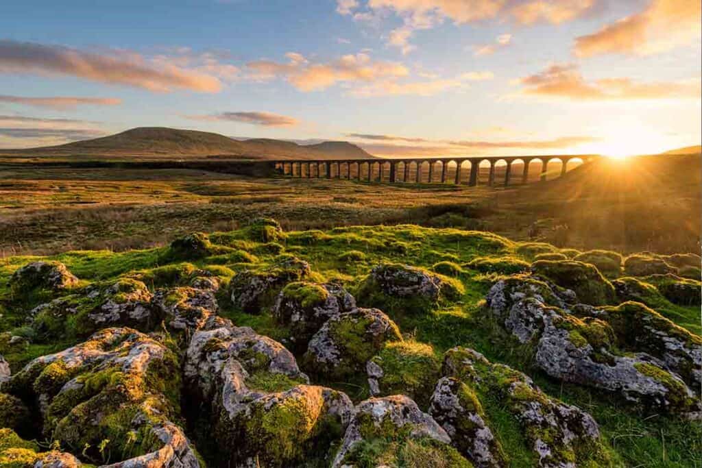
Recommended by Sinead | Map Made Memories
England’s largest county, Yorkshire, is a perfect destination for a road trip. There are so many diverse attractions to see within a relatively short drive of each other.
Highlights and some best places in Yorkshire to visit
- Hardraw Force–England’s highest single-drop waterfall
- White Scar–The longest show cave in England
- Visit the ‘Best Street in Britain’
- Visit the cobbled Shambles, named ‘the Best Street in Britain’.
- Marvel at the Ribblehead Viaduct, the 24 arches that span the Yorkshire Dales, a true masterpiece of Victorian engineering.
- Castles and ruins all over the place
- Stand on Hogsmeade station (or at least the station which played it in Harry Potter!)
Yorkshire Road Trip Itinerary
Start your road trip in the rolling hills and river valleys of the beautiful Yorkshire Dales. Visit the 11th century Skipton Castle or descend underground to marvel at the formations in White Scar Caves, the longest show cave in England.
Clamber over Brimham Rocks or hike the stunning landscape around Malham Cove. Browse the independent shops in the Victorian spa town of Harrogate.
Places to visit on the Yorkshire Dales
The Yorkshire Dales are packed with attractive waterfalls. Choose between the plunging falls around Ingleton, popular Aysgarth Falls or, my favourite waterfall, Hardraw Force which is England’s highest single drop waterfall. Before leaving the Dales, visit the impressive monastic ruins and landscaped gardens of Fountains Abbey.
Continue your road trip by exploring the historic city of York . This compact city is easily navigated on foot and is an ideal location for history buffs. You can visit Viking, Roman, Georgian and Victorian sites all in one day!
See the iconic York Minster, walk the city’s medieval city walls and stroll along the cobbled Shambles, which has been voted the ‘ Best Street in Britain’ and was the inspiration behind Diagon Alley from the movie adaptation of the Harry Potter series!
Road trip over the Yorkshire Moors
End your Yorkshire road trip with a drive across the wild Yorkshire Moors. Take a scenic trip on a steam train across the Moors to visit charming Goathland train station which doubled as Hogsmeade station in the Harry Potter movies. Alternatively, your legs with a hike at the Hole of Horcum, a huge ancient natural amphitheatre.
How long should you spend exploring Yorkshire on a road trip?
You could ‘cover’ Yorkshire in a couple of days but to truly appreciate all it has to offer I would recommend at least one full week.
When is the best time to road trip to Yorkshire?
Yorkshire can be explored all year around- and expect rain at any time! But Spring is incredible on the moors- with the wildflowers blooming and the days getting longer, it’s a perfect time to visit. Autumn also offers spectacular views with the leaves turning colour, providing an incredible backdrop.
England Road Trip Idea – North East Coast
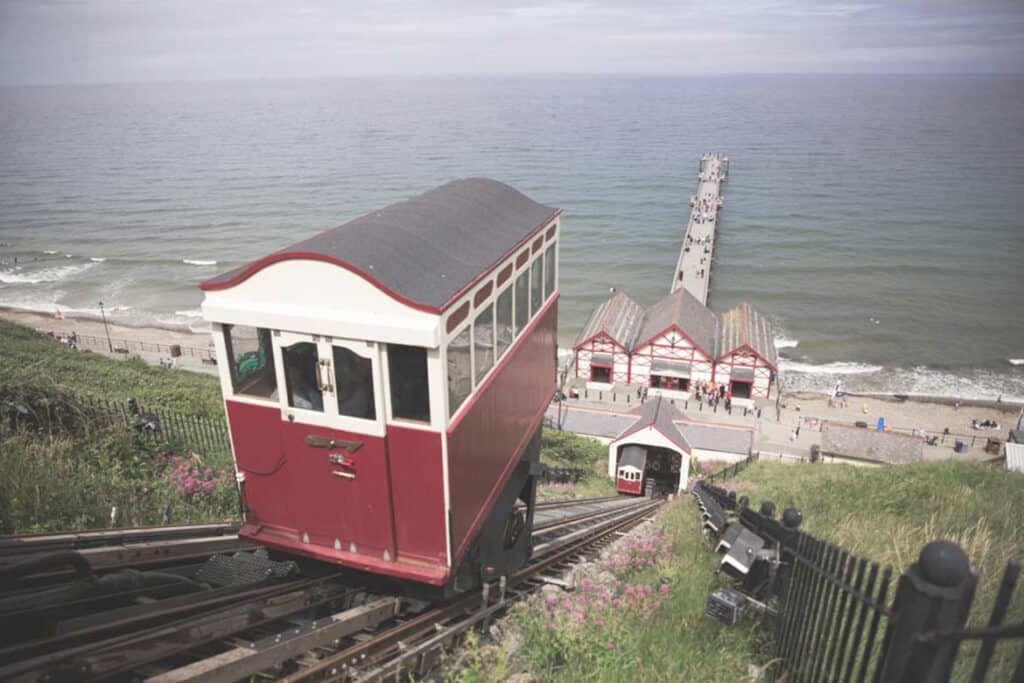
Northern England’s east coast is full of charming towns and villages, and is the perfect destination for a road trip.
Best places to visit on a North East coast England road trip
- Saltburn-by-the-Sea (to search for fossils)
- Lemon top ice-cream – Its legacy goes back over 100 years!)
- Staithes- picturesque fishing village
- Whitby Abbey – the inspiration behind Bram Stoker’s Dracula
- Robin Hood’s Bay (where smuggling was commonplace
- Scarborough Castle
North East England road trip itinerary
Start in Saltburn-by-the-sea. Be sure to search for fossils throughout your visit. I actually found one in Saltburn-by-the-Sea, but you can get lucky in any of the places on this list! Saltburn-by-the-Sea is home to the historic Saltburn Cliff Tramway and affords beautiful views from the bluffs above town.
You can walk along The Cleveland Way, a historic trail that runs through each of the 5 locations mentioned. I’d also recommend trying Lemon Top Ice Cream, or vanilla ice cream with a dollop of lemon sorbet on top.
Staithes is a quaint fishing village laden with narrow pathways and quirky cottages.
The Whitby Abbey towers above the town, giving it an eerie feeling – it’s even credited as the inspiration behind Bram Stoker’s Dracula!
Robin Hood’s Bay has a long history with smugglers, and its red rooftops and crowded buildings conceal hidden routes. In Scarborough, you can enjoy rides at the Luna Park amusement park or visit the historic Scarborough Castle!
When is the best time to road trip England’s north-east coast?
Although you can visit this area all year round, I’d suggest visiting in the summer or fall. It rains much of the year in this region of England, but there’s a higher likelihood of sunshine from July through October.
How long to spend on this England Road trip?
You can complete this road trip in less than 2 hours, but I’d suggest spending at least a few days exploring the region. Each Yorkshire coastal town has its own charm and activities to offer, so you certainly don’t want to rush!
How far is it from the North east coast to London?
Scarborough to London takes about 5 hours by car. Avoid travelling Friday afternoons or Monday morning- those are the peak road traffic times.
Don’t miss Durham
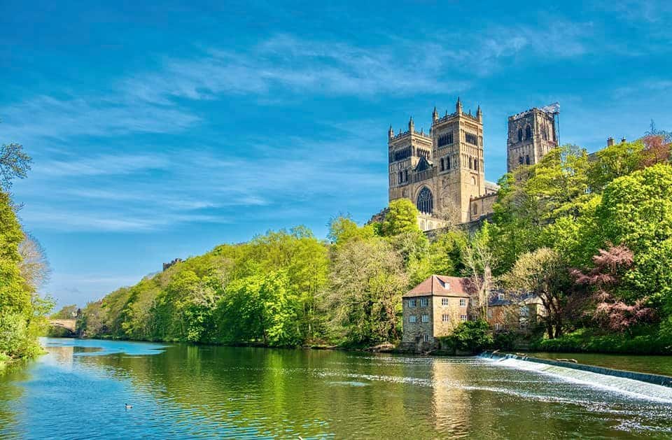
We spent a lovely couple of days exploring the city of Durham. There are so many wonderful places to explore, but one of the highlights for us was Durham Cathedral. This incredible building was built in the 11th Century and is the largest surviving stone vaulted ceiling of its size.
However, if I’m honest, I was more excited by the fact that several scenes in Harry Potter were filmed here, including in the cloisters and many of the covered walkways.
It was also in Durham Cathedral that Harry, Ron and Hermione encounter ‘Fluffy’- the forbidden corridor was also part of the cathedral.
Other fantastic things to see in or near Durham include:
- Durham Castle
- High Force Waterfall (one of the best waterfalls in Europe )
- Finchale Priory
Northumberland Coast
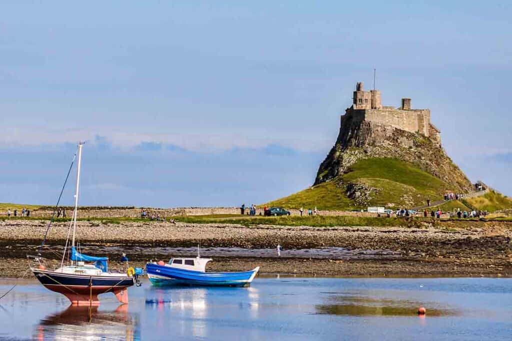
Recommended by Tracy | Travels in Time
The Northumberland Coastal route stretches for over 35 miles from Alnmouth in the south to the Holy Island of Lindisfarne in the north.
The drive takes you through an area of outstanding natural beauty with many beautiful villages and places of interest to visit along the way.
How long to spend on a Northumberland coast road trip
This itinerary covers a day trip but you could spend a few days exploring the area or even walk the Northumberland Coastal Path along the same route if you are feeling up to it!
Northumberland road trip itinerary
The first village to visit is Craster – famous for its kippers and overlooked by Dunstanburgh Castle. If you’re looking for impressive castles in England , Northumberland is the place to go- there are more castles here than any other county in England!
After exploring Craster and the castle, head to Seahouses. A popular seaside town for families with lots of arcades and fish and chip shops this is the place to stop for a bite to eat.
If the weather is good why not hop on a boat over to the Farme Islands? With large colonies of seals and puffins the islands are popular with nature lovers.
Bamburgh Castle dominates the horizon and is worth exploring. It was once the home to the Royal Seat of the Kings of Northumbria and also has a ghost or two!
After Bamburgh head to the Holy Island of Lindisfarne. Make sure you check the tides before you go- the island is tidal and is only accessible during certain times.
Once on the island take a stroll up to the castle. Don’t miss exploring the ruins of Lindisfarne Priory. This is the place famous as the home of Christianity in England until Viking raids eventually led to the abandonment of the priory.
When is the best time for a Northumberland road trip?
The best time to visit Northumberland and places in North East England is in the summer – the days are long and the sun will hopefully be shining! Be aware that on occasions during the summer a sea fret (mist) can hang over the coast and cool temperatures and decrease visibility. Make sure to check the weather forecast before you travel.
Wow- anyone else want to jump in their motorhome/ camper/ car/ bike and head off to start exploring? What a fantastic list of England road trip destinations!
As you can see, it really doesn’t matter where you go or how long you have to explore England- you’ll have plenty of places to enjoy. And who knows- next time we set off for Norfolk, we might even make it there without swinging by Cornwall first!! 🙂
Planning an England road trip? You might find these posts useful:
- How to plan an epic UK road trip
- How to create a road trip itinerary with Google Maps
- 100 best road trip driving songs
- How to plan a motorhome trip to UK or Europe
See all our UK travel ideas and tips
Kat never planned to buy a motorhome. She also never planned to quit her job as an air traffic controller, go touring around Europe in said motorhome, start one of the UK’s largest motorhome travel websites… or get a cocker spaniel.
Find out how she went from stuck in the rat race to being a digital nomad and inspiring thousands of people to have their own epic adventures here.
If you’d like to connect with Kat, send her an email or follow her adventures on social media.
Sharing is caring!
Similar Posts
Autumn in Europe: 30 Best destination ideas
8 Epic FREE Castles to visit in England & the UK
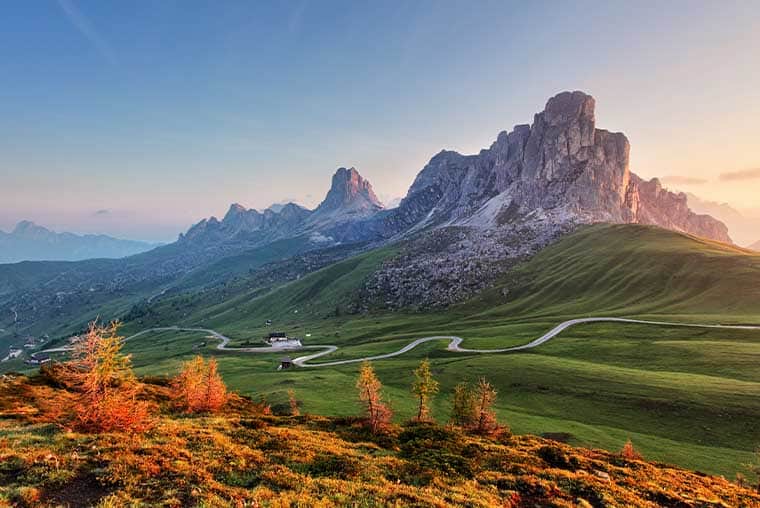
The ULTIMATE Dolomites Itinerary for 1-5 days (with Maps!)
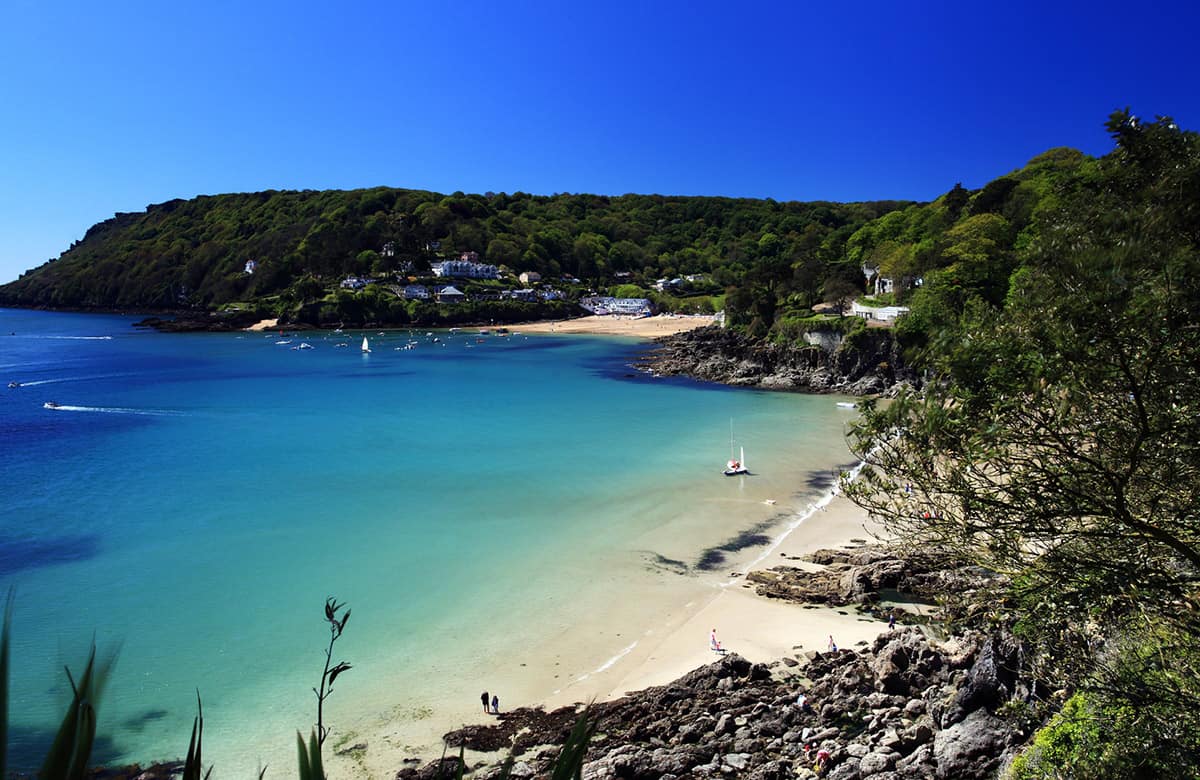
Devon Road Trip itinerary- 19 Beautiful places to Visit
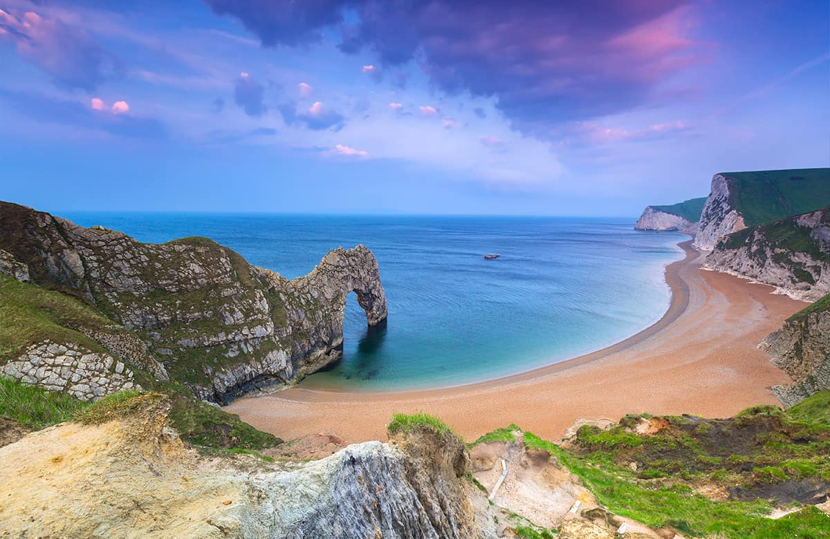
Hampshire & Dorset road trip- 21 beautiful places to visit
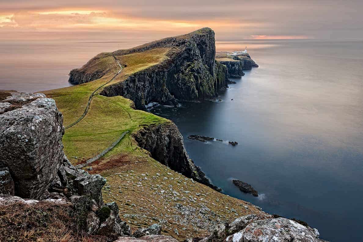
Scotland Road Trip: The ONLY itinerary you need (29 unmissable places)
Cornwall is such a beautiful part of the UK to visit in a motorhome, although it can be a little tight around those country roads.
So true- some of those roads are tiny, but worth it for the incredible views and places to visit.
Have you been on the welsh coast much
Our very first motorhome trip EVER was to the Welsh coast. We’ve put together some of our favourite Welsh road trips here if you want some ideas: https://wandering-bird.com/wales-road-trip/
Although all road trips are lovely, I particularly enjoy traveling in a campervan through Devon in the UK. I appreciate you sharing this list of road trip suggestions.
Fantastic article for anyone travelling England on a road trip
Leave a Reply Cancel reply
Your email address will not be published. Required fields are marked *
Save my name, email, and website in this browser for the next time I comment.
How-To Geek
How to plan a road trip with multiple destinations in google maps.
Map out multiple destinations in Google Maps on the web or in the app.
Quick Links
Add multiple stops using the website, add multiple stops using the mobile app.
Whether you're planning a day out on the town, or want to orchestrate the perfect road trip across the country, Google Maps allows you to add up to nine stops, excluding your starting point, when you make directions from both the website and the Maps app. Here's how you do it.
First, open up your browser and head on over to Google Maps. Click the "Directions" button to the right of the search bar.
By default, Maps will use your device's location for the starting point. If you want this to be a different location, enter it now.
Next, enter the location of your first destination into the field provided, and then hit Enter. Alternatively, you can click any location on the map to get the same results.
Make sure you have either the driving or walking option selected, as Maps only lets you make multiple destinations with these two travel modes.
To add another destination, all you have to do is click either the "+" or the space below your first destination, and then start typing a new location. You can repeat this to add up to nine total stops. If you have more stops than is allowed, you may need to make another map from where you left off.
If at any point you decide you want to change up the order of your destinations, just drag any location up or down on the list using the circles on the left.
And once you've created your map in your web browser, you can click the "Send directions to your phone" link to send it to your mobile device by email or text message. Assuming you've got the Google Maps app installed, you can open it right up.
If you want to optimize your travel, you can also turn a multi-stop Google Maps trip into a round-trip .
Related: How to Find Public Restrooms Near You with Google Maps
You can use the Google Apps mobile app (free for iPhone , iPad , and Android ) to create a map with multiple destinations in much the same way.
Related: How to Download Google Maps Data for Offline Navigation on Android or iPhone
Fire up the Google Maps app on your mobile device, and then tap the blue "Go" button on the bottom right of your screen.
By default, Maps uses your device's location for the starting point. If you want this to be a different location, enter it now.
Start typing in your first destination or tap a location on the map below to start your journey.
Next, open the menu (the three dots at the top right), and then tap the "Add Stop" command.
Enter the location of your next stop, or tap anywhere on the map to add the next destination.
To change the order of your destinations, just drag any of the locations up or down the list using the "Hamburger" (three stacked lines) on the left.
When you've added all the stops to your trip, go ahead and tap "Done" so you can start your journey.
Related: How to View and Delete Your Google Maps History on Android and iPhone
mytouristmaps.com
Travel & Tourist Maps, Utilities and Curiosities from the World
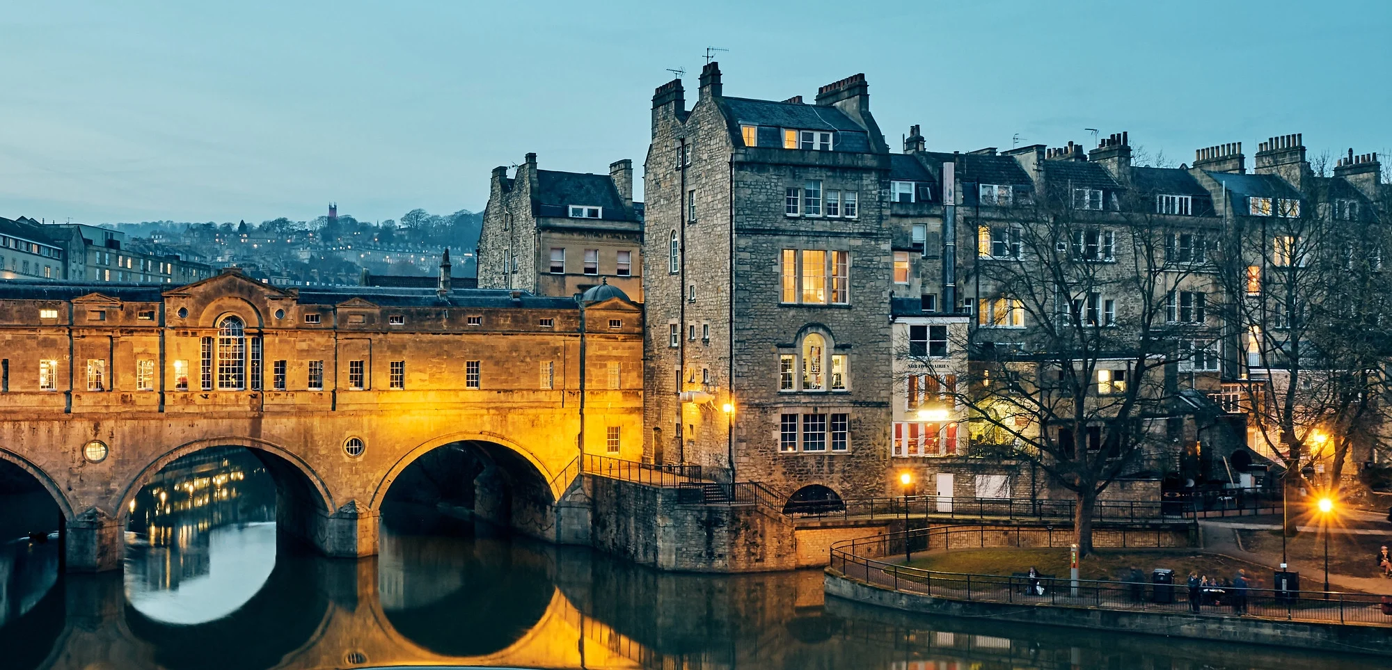
Tourist map of ENGLAND & WALES
Not only the great London… stunning landscapes of Lake District & Cornwall, countless castles and the outstanding Wales coastline.
England (UK) Population: 55.268.500 Area: 130.280 sq.km Official Language: English Currency: Pound Sterling Drivers Lane: Left When to go: from April to September Book Now Climate Rent a Car Flights
Wales (UK) Population: 3.063.700 Area: 20.779 sq.km Official Language: English, Welsh Currency: Pound Sterling Drivers Lane: Left When to go: from April to September Book Now Climate Rent a Car Flights
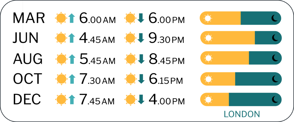
FURTHER LINKS England tourism official website Wales tourism official website COVID-19 info
Discover England and Wales best tourist attractions and top sights through our map! Which are the best places to visit in England and Wales and the best things to do in England and Wales? Simply click on the map’s links to be quickly redirected to images and useful websites for accommodation, activities, transport and much more about UK travel.
photo © Pedro Szekely/Flickr
Privacy Overview

The Ultimate Guide to Using Google Maps for International Travel

- Fabian Cortez
- Jun 24, 2023 | (186) Views

Setting Up Your Google Maps

Navigating the Maps
Google maps features and tools.

Using Google Maps When Traveling
- International edition
- Australia edition
- Europe edition
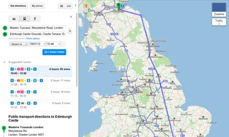
Google Maps adds UK rail travel platform
Google is adding information about train routes and time tables to its existing route planning tool so users can plan the best route from one location to another.
Google Maps is collaborating with thetrainline.com to allow travellers to search for train journeys across mainland Britain by incorporating information about more than 2,500 railway stations and 170,000 routes nationwide, as well as 8,000 bus stops and more than 250 tube stations.
The website also gives users full information on walking directions and some bus timetables for connections, and users can click through to thetrainline to search for and book tickets.
Richard Rowson, product development director at thetrainline.com, said: "We want to make sure consumers are always able to consider rail options when making a journey, and this innovation will help train travellers nationwide to do that by planning their route more easily."
The launch has been timed with an eye on the London Olympics when 31 million tourists are predicted to arrive in the UK. Google Maps is available in more than 50 languages, so tourists will also be able to combine walking with transit directions on Google Maps to help find their way around the country.
VisitBritain chairman Christopher Rodrigues said: "We want to encourage visitors to explore the whole of Britain. With the Olympics less than 200 days away Google's initiative is exciting news. Millions of visitors plan their itinerary using Google Maps and this additional information will act as a catalyst and inspire them to discover all that is wonderful about our great country."
How it works
To access public transport information from a desktop, users should visit maps.google.co.uk , click "Get directions" and enter your origin and destination locations. Then click the train icon for public transport directions and easily viewable train routes on the map. Users can also use the desktop service on their mobiles, but so far there is no word on whether the Google Maps app on smartphones will include the new developements.
Customers will be given the best route by rail and full details including departure and arrival times, journey duration and which train company operates the service. Users can click through to thetrainline.com homepage to search for and book tickets for their journey.
We used the service to compare the route from the Guardian offices in north London to Edinburgh. Google suggests it would take six hours and 52 minutes to drive to our destination, but the same journey by train would take four hours and 29 minutes using an East Coast train from King's Cross. We double-checked the information on thetrainline.com website and it produced the same train from King's Cross.
- Consumer affairs
- Rail travel
- Rail transport
- Mapping technologies
Comments (…)
Most viewed.
Explore and navigate your world
Discover new experiences across the world or around the corner.
Explore your world
With the redesigned Explore tab, find places to eat and things to do around you or when you travel
Just for you
See recommendations for new and trending places based on your interests
Create lists
Easily create lists of places you want to go, and add notes to the places you’ve saved. You can keep these lists private, share them with close friends, or share them publicly. You can also browse through lists created by publishers, Local Guides or Google
Make your plans happen by connecting with the places you’re interested in
Follow your favorites.
Stay on top of offers, updates and more when you follow your favorite businesses
Make a reservation, book an appointment, or get tickets with just a few taps
Get answers fast
Message a business right on Google Maps to find out information
Navigate the world around you
Real time traffic updates.
Find the best route when driving, with real-time updates on traffic jams, accidents, road closures and speed traps. You can also keep fellow drivers in the know by reporting incidents yourself
Hands-free help with the Google Assistant
Your Google Assistant is now integrated into Google Maps so you can message, call, listen to music and get hands-free help while driving. Say “Hey Google” to get started
Real-time updates for public transportation
Get up-to-the-minute updates on busses and trains, like departure times and how crowded the bus is. You can also see where on the map your bus is so you know if you need to walk a little faster to the bus stop
Explore new places confidently
With Live View in Google Maps, see the way you need to go with arrows and directions placed right on top of your world. There’s less second guessing and missing turns
Control your data with confidence
Industry-leading data protection.
Every day you’re Safer with Google. We use the most advanced technology like differential privacy to protect your data and build helpful features - like seeing how busy a place is so you can avoid the crowd.
Easy-to-use privacy controls
You’re in control. With Your data in Maps , you can easily view and manage your Location History and other account settings. Location History is off by default. When you turn on Location History, it can help you with real-time traffic predictions for your commute or reminisce about places you’ve been.
Search with Incognito mode
When you want additional privacy, use Incognito mode in Google Maps. When it’s turned on, you can navigate, search for places, and find business information from your device - all without searches or directions being saved in account.
See how people are using Google Maps to explore what’s around them, put their communities on the map, and help others
Why we map the world.
Map making is an ancient human endeavor, and one that those of us working on Google Maps are honored to continue to pursue
Mountain View, California
More stories
Melbourne, Australia
Mums who map
A group of Local Guides, Mums who Map, dedicated their time to help parents find kid-friendly places in Melbourne, Australia.
Nuku’alofa, Tonga
Mapping Tonga
Tania Wolfgramm and Wikuki Kingi set out to bring Tonga to Street View for all the world to see.
Devon Island, Canada
Together with the Mars Institute and NASA, Google Maps documented the research that goes on Devon Island, the most Mars-like place on Earth.
Norcia, Italy
Mapping Italy’s Recovery
One Local Guide records the aftermath of Italy’s earthquakes to show the world that they still need help recovering.
Kerala, India
Kerala Flood Rescue
Bobby Kurian used Google Maps to tag her parents’ location to help rescue them in the Kerala floods.
Supporting Women’s Rights
With the help of Local Guides and Google Maps, Princess Ilonze got hospitals and police stations on the map to help save lives.
Kids in India
The India Literacy Project teamed up with Google to help students explore the world through photos uploaded by Local Guide.
Bozeman, Montana
Connecting to Bozeman
One Local Guide was inspired to celebrate and show off her hometown in a unique way.
Sao Paulo, Brazil
Mapping Blood Donation Sites
Local Guide Adriano Anjos in Brazil mapped Sao Paulo’s blood donation centers on Google Maps.
London, England
Wheelchair Accessible Routes
Wheelchair-accessible routes on Google Maps has made getting around easier for Meridtyh, Omari, Adam, and Lucy.
Kolkata, India
Plus Codes creates geographical coordinates that provide an address to those who previously had none.
Grand Canyon National Park
Vets Kayak The Grand Canyon
Five blind veterans kayaked through the Grand Canyon and documented their journey on Street View.
Google Maps Blog
Read articles, interviews, and more to learn what’s new on Google Maps

Want the best prices for your trip? Google can help.

Take off to your next destination with Google Maps

Hip-hop dancers show Paris in a new light on Street View
There's more we can help you with.
Check out some related products below
Street View
Explore world landmarks, discover natural wonders, and step inside places with Street View on Google Maps
Google Earth
Explore worldwide satellite imagery, 3D buildings, and terrain for hundreds of cities with Google Earth
Local Guides
Become a Local Guide to help people everywhere find the places worth seeing and things worth doing
Google My Business
Stand out to people searching on Google, and connect with customers with a free business profile
Get Google Maps
MORE SECTIONS
- Dear Deidre
MORE FROM THE SUN
- Newsletters
- Deliver my newspaper
- Sun Vouchers
- The Sun Digital Newspaper

The clever Google Maps hack that’s a game changer for holidaymakers with suitcases
- Karim Camara
- Published : 9:20, 11 May 2024
- Updated : 9:20, 11 May 2024
- Published : Invalid Date,
A TRAVEL expert has revealed a Google Maps hack perfect for holidaymakers who have to drag a suitcase around a new city.
An experienced traveller has shared a new trick that allows people with suitcases to avoid using stairs.

The post went viral and received more than 155,000 likes on Instagram .
In the video, the travel expert said to click the three dots in the top right-hand corner when you open Google Maps .
"Then you're going to want to select options," he added.
This will take you to a page called, Trip Options, where you can either select "avoid ferries" or "wheelchair accessible".
read more on travel

Passengers wait HOURS in queues after airport IT system crashed

I visited a 40-year-old UK attraction - and it was like going to the Alps
The expert recommends selecting "wheelchair accessible as it will avoid all stairs, prefers elevators and will essentially make sure you're on streets you can walk on with suitcases".
For example, if you just arrived in a city and the hotel is 300 metres away, this Google Maps hack will ensure your trip is as flat as possible.
Hundreds of people have reacted to the viral hack online.
One user said: "This is so incredibly helpful when travelling with a baby and you have a stroller."
Most read in Travel

Abandoned UK airport reveals plans for Ryanair and easyJet flights

Abandoned UK theme park reveals plans to become £65m resort with lodges and hotel

Budget airline announces new UK route to seaside city and flights start from £27

New flights from UK airport to Caribbean's largest island have been scrapped
"Considering we had to replace the wheels on our suitcases due to all the stairs and cobblestones, this is a great hack," another added.
A third wrote: "Ooooooooo - no more broken suitcase wheels."
It comes after a travel influencer lifted the lid on five easy hacks everyone should know about.
TIKTOK TRAVEL
Grace Cheng took to TikTok to share her savvy advice with other travellers.
She revealed passengers can take water through security but only if it is frozen.
"All you’ve got to do is freeze the water before you leave for the airport and before you hit security , just drink whatever has melted," Grace added.
"And to me personally, I think that’s the biggest hack ever."
Another travel hack the TikToker shared was how to get your pick from any leftover seats on your flight .
By paying for an aisle seat and then boarding the plane last "you can opt to choose whatever is available and hopefully, you'll get a row all to yourself".
However, Grace's travel hacks have divided opinion on social media .
"These are the best travel hacks omg," one said.
A second weighed in: "Amazing advice!"
However, discussing the content creator's water freeze hack, one user offered: "Or just bring an empty bottle through TSA and use their water refilling stations."
Elsewhere, a flight attendant urged passengers to refrain from picking an unassigned seat.
READ MORE SUN STORIES

Phillip Schofield returns to social media after a year as he eyes comeback

Lisa Armstrong 'will be heartbroken' at new dad Ant McPartlin's tattoo
“This is a pet peeve.
"You can ask if there are empty seats, you can’t just sit anywhere,” they said.
- Google Maps
- Holiday tips tricks and hacks
- Social Media
- Tips tricks and life hacks
- Travel advice
- Help Center
- Google Maps
- Privacy Policy
- Terms of Service
- Submit feedback
Get directions & show routes
You can get directions for driving, public transit, walking, ride sharing, cycling, flight, or motorcycle on Google Maps. If there are multiple routes, the best route to your destination is blue, all other routes are gray. Some directions in Google Maps are in development and may have limited availability.
Important: Stay alert when you use directions on Google Maps. Always be aware of your surroundings to ensure the safety of yourself and others. When in doubt, follow actual traffic regulations and confirm signage from the road or path that you’re on.
- On your computer, open Google Maps .
- Click points on the map, type an address, or add a place name.
Tip: To choose another route in any transportation mode, select it on the map. Each route shows the estimated travel time on the map.
Google Maps transportation modes
You can get directions for different modes of transportation in Google Maps. Learn about the differences in features and availability between each mode:
- If you want to change a driving route, click and hold a spot on the route and drag it to a new spot on the map.
- Not all cities have public transit directions in Google Maps. Before you can get transit directions, your local transit agency needs to add their route info to Google Maps.
- If you want directions in an area with ride or taxi services, you can compare ride services with transit and walking directions. Learn how to request a ride .
- Directions to multiple destinations, or waypoints, aren’t available for public transit or flight searches.
- Learn more about how to search for flights .
- Learn how to get directions for motorcycles .
Add multiple destinations
You can get directions to multiple destinations for all modes of transportation except public transit or flight.
- Add a starting point and a destination.
- You can add up to 9 stops.
- Click on a route to get the directions.
Tip : You can search for places along your route.
To change the order of your stops:
- Find the destination you want to move.
- Drag the destination.
Preview directions in Street View
- On your computer, under the route you want, click Details.
- Point to a step in the directions. If Street View is available, you get a preview photo.
- To get Street View for other steps in the route, in the bottom-left box, click Previous step or Next step.
Customize your route
- Choose Options .
- Check the box next to "Tolls" or "Highways."
- Get directions.
- After you get your directions, click Leave now .
- To change your travel dates or times, select Depart at or Arrive by .
When you enter a destination in Google Maps, we show you how to get there using different travel modes, like driving, cycling, or walking.
Sometimes, the transport options we show you are ranked according to a combination of objective factors designed to help you find relevant and useful information. These factors can include duration, distance, price, your mode preference, or the relevance of a mode to your query. Generally, the most important factors are your mode preference, trip durations, and sometimes price.
Where available, we also show you other mobility services like public transport, scooter or bicycle rentals, and vehicle ride services. These mobility services are provided by third parties who have made their transport data publicly available or who have a partner agreement with us. Any partnerships or business relationships we may have with any transportation service providers do not influence the ranking of these services.
Related resources
- Get traffic or search for places along the way
- Plan your commute or trip
Was this helpful?
Need more help, try these next steps:.
Download Now

IMAGES
VIDEO
COMMENTS
Google Maps is the best way to explore the world and find your way around. Whether you need directions, traffic information, satellite imagery, or indoor maps, Google Maps has it all. You can also create and share your own maps and stories with Google Earth. Try it now and see the difference.
4. How to Use Google Maps in London: First, Search for a Destination. To search for a specific destination in London, tap the search bar at the top of the screen. You can enter the name of a place, an address, or even a general category like "restaurants" or "museums.". Google Maps will display relevant suggestions as you type.
7 Steps to Plan a Trip With Google Maps. Here is how to use Google Maps trip planner: 1. Create a Map. To create a map on Google, you do need a Google account. Once signed up/logged in, go to this page. Click on " Saved" >> "My Maps ", which will take you to your maps. If you have created any maps in the past, you will also find them here.
On your computer, open Google Maps. Click Directions . Click points on the map, type an address or add a place name. Choose your mode of transportation. Tip: To choose another route in any transportation mode, select it on the map. Each route shows the estimated travel time on the map.
On your computer, open Google Maps. Make sure you're signed in. Get directions to relevant places: Click a place in the list. You'll get places based on your Gmail, Calendar and recent travel history. Get directions to saved places: If you saved your work or home address in your Google Account, click Home or Work. You can edit your home or ...
Best places to visit on a North East coast England road trip. Saltburn-by-the-Sea (to search for fossils) Lemon top ice-cream - Its legacy goes back over 100 years!) Staithes- picturesque fishing village. Whitby Abbey - the inspiration behind Bram Stoker's Dracula.
First, open up your browser and head on over to Google Maps. Click the "Directions" button to the right of the search bar. By default, Maps will use your device's location for the starting point. If you want this to be a different location, enter it now. Next, enter the location of your first destination into the field provided, and then hit Enter.
Tourist map of ENGLAND & WALES. Interactive travel and tourist map of England & Wales: click on icons and writings on the map to open web links. Not only the great London… stunning landscapes of Lake District & Cornwall, countless castles and the outstanding Wales coastline. England (UK) Population: 55.268.500. Area: 130.280 sq.km.
This only works for routes with one destination. On your Android phone or tablet, open the Google Maps app . Search for your destination or tap it on the map. In the bottom left, tap Directions. At the top, tap More Set depart and arrive time. To change your travel dates or times, select Depart at or Arrive by.
Travel. Google Maps is an online mapping service developed by Google. It provides satellite imagery, aerial photography, street maps, 360° panoramic views of streets, and route planning for traveling by car or foot. With its innovative features and tools, Google Maps has become an essential tool for international travelers looking to explore ...
Google
Discover the world with Google Maps. Experience Street View, 3D Mapping, turn-by-turn directions, indoor maps and more across your devices.
The RAC map also enables you to display weather information for the UK so you can plan your journey based on the driving conditions. The RAC Route Planner complements our motoring-services products such as our 5 Star Defaqto breakdown cover and car insurance , including temporary car insurance , learner driver insurance and black box car ...
Google Maps adds UK rail travel platform. Google is adding information about train routes and time tables to its existing route planning tool so users can plan the best route from one location to ...
On your Android phone or tablet, open the Google Maps app . Open Google Maps. If you don't yet have the app, download it from the Play Store. Search for your destination or tap it on the map. In the bottom left, tap Directions . Choose your mode of transportation. For Driving Transit you can pin your favorite trips.
Use Google Flights to explore cheap flights to anywhere. Search destinations and track prices to find and book your next flight. Find the best flights fast, track prices, and book with confidence
Search the world's information, including webpages, images, videos and more. Google has many special features to help you find exactly what you're looking for.
This map was created by a user. Learn how to create your own. This is a station accurate representation of the Transport for London Zone layout. Zone information taken from https://web.archive.org ...
Explore world landmarks, discover natural wonders, and step inside places with Street View on Google Maps. Explore worldwide satellite imagery, 3D buildings, and terrain for hundreds of cities with Google Earth. Become a Local Guide to help people everywhere find the places worth seeing and things worth doing.
A TRAVEL expert has revealed a Google Maps hack perfect for holidaymakers who have to drag a suitcase around a new city. An experienced traveller has shared a new trick that allows people with suit…
AA · no-script
Start or stop navigation. On your Android phone or tablet, open the Google Maps app . Search for a place or tap it on the map. At the bottom left, tap Directions. If you touch and hold the button instead, you'll start navigation and can skip steps 4 through 6. Learn how to add more destinations.
On your computer, open Google Maps. Click Directions . Click points on the map, type an address, or add a place name. Choose your mode of transportation. Tip: To choose another route in any transportation mode, select it on the map. Each route shows the estimated travel time on the map.