- icons8-info Visitor Info
- 2hrs from Sydney & Canberra
- Download a travel guide
- icons8-menu MENU
- icons8-heart MY TRIP
- icons8-search
- icons8-sun PLAY
- icons8-dining-room EAT
- icons8-home STAY

Shop Shoalhaven
Tourist drive 8 – nowra, kangaroo valley, robertson, albion park.
- Drives and Roadtrips

This drive takes in Macquarie Pass, Robertson, Fitzroy Falls, Kangaroo Valley, and Bomaderry. The three waterfalls Carrington Falls, Belmore Falls and Fitzroy Falls can be viewed from great vantage points on short detours from the main route. You’ll find picnic, barbeque and toilet facilities at Carrington Falls picnic area, and a variety of walking tracks that take you to a series of magnificent lookouts. Hindmarsh Lookout at Belmore Falls and Mannings Lookout at Fitzroy Falls also offer superb views. Between Barrengarry Mountain and Cambewarra Mountain nestled in the lush pastures is the charming township of Kangaroo Valley. Abundant birdlife, surrounding mountains and beautiful morning mists make for spectacular scenery. The historic village is well geared for visitors, with art and souvenir galleries, several cafés, a delightful old pub, some unique handicraft stores and plenty of holiday accommodation. Hampden Bridge, with its famous stone turrets, provides commanding views over the winding Kangaroo River below. Built in 1898, it is the oldest suspension bridge in Australia and is Kangaroo Valley’s most famous and most photographed landmark. Kangaroo Valley Pioneer Village Museum, near the bridge, is a place of learning, relaxation and fun for the whole family. A series of original and replica buildings house displays of artifacts such as household items and agricultural machinery from 19th century pioneer farm life. There are also historical displays about Kangaroo Valley and the residents. A wheelchair accessible pathway leads through the buildings and displays, and on to bushwalks and picnic facilities. Kangaroo Valley is a great location for activities such as bushwalking, cycling, canoeing (solo or escorted) and horse riding. Another must see on the drive is Cambewarra Lookout, where you can detour along a scenic hillside climb to Cambewarra Mountain and Lookout to view some of the most spectacular scenery of the South Coast. Stop in at The Lookout Cafe where you can enjoy a coffee while your pet laps up a puppyccino. The drive finishes at Bomaderry 4km north of Nowra, the terminus of NSW South Coast railway line. Visit Bomaderry Creek picnic area and bushwalk in the cliff-lined gorge. Attractions nearby are the Shoalhaven Zoo, Tree Tops Adventure, Bundanon, Meroogal Historic Homestead, the Fleet Air Arm Museum at HMAS Albatross, and Shoalhaven River Cruise.View the map below or open it here.
information
- NEARBY EXPERIENCES
- Lake Tabourie
- Local events
Quick links
- 02 4421 0778
- [email protected]
- Shoalhaven Visitors Centre Nowra, Shoalhaven Entertainment Centre 42 Bridge Rd Nowra NSW 2541
- Shoalhaven Visitors Centre Ulladulla, Ulladulla Civic Centre Princes Hwy Ulladulla NSW 2539
- Shoalhaven Tourism 2024
- Privacy Policy
- Shoalhaven Tourism is a business unit of
- Be Inspired
- Eat & Drink
- See & Do
- Walk, Drive, & Ride
- Trip Planner
- Captains Flat
- Hotels & Motels
- B&B & Farmstay
- Camping, Caravans, Holiday Parks
- Contact QPRC Tourism
- Visitor Info
- Maps & Downloads
- Southern Tablelands
Home / Tourist Drive 8: Bungendore to Goulburn
Tourist Drive 8: Bungendore to Goulburn
Start your journey here.
Keen to get a snapshot of the Southern Tablelands in one drive? Head out on Tourist Drive 8 from the Federal Highway next to Lake George to Goulburn, through picturesque countryside and charming villages such as Bungendore and Tarago. Stop by at the mysterious Lake George, treat yourself to a wine tasting in Wamboin or Bywong, and enjoy a spot of shopping in Bungendore, before heading up towards Australia’s first inland city through the quaint villages of Tarago and Lake Bathurst.
Weereewa Lookout
Tourist Drive 8 starts from the Federal Highway near Lake George, nearby Canberra and Queanbeyan. Start your drive by stopping off at the Weereewa Lookout by Lake George and taking in the expansive views of the mysterious lake. From here, you’ll head south on Bungendore Road towards the region’s cool-climate wineries and Bungendore village.

Driving south along Bungendore Road, surrounded by the beautiful country landscape, you’ll come across Lark Hill Winery , one of the area’s fantastic cool-climate wineries. From here, you have the option to take a detour to Wamboin through Norton Road to pay a visit to Norton Road Wines for more wine tasting, a lunch or simply to purchase some of the region’s award-winning wines to take home with you. Alternatively, simply continue on towards Bungendore Village to visit the Sapling Yard cellar door in the heart of the village.

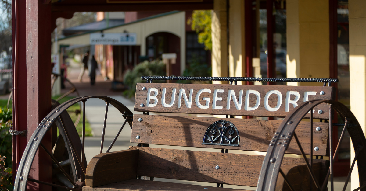
After exploring the wineries of the Queanbeyan-Palerang region, you’ll reach Bungendore Village, boasting a community of incredible craftsmanship and a plethora of fascinating shops to explore.
Spend an afternoon strolling amongst the art galleries and gift shops along Malbon, Ellendon and Gibraltar Streets, and unearth hidden treasures of local art and giftware. Finally, grab a cuppa and a bite to eat at one of the town’s cafés or restaurants before heading back on the road towards your next stop.
About a half an hour drive up Tarago Road lies your next destination, the village of Tarago, best known for the Loaded Dog Hotel. The Loaded Dog is said to be an important part of Australia’s heritage, dating all the way back to about 1848. Since then, the hotel was used as a meeting place and a safe house of sorts to many bushrangers, including the infamous Frank Gardiner and Ben Hall.
Lake Bathurst
After stopping at the Loaded Dog Hotel, continue towards Lake Bathurst on Braidwood Road. The 10-minute drive will lead you to the peaceful village of Lake Bathurst, discovered by the European settlers back in 1818. To this day, several 19 th century buildings can still be found in the village, including the old schoolhouse and the Anglican Church and hall.

Just 30km up Braidwood Road, you will reach the final destination of the tourist drive, Goulburn, Australia’s first inland city. For more information about the city and its attractions, pay a visit to the Goulburn Visitor Information Centre. While you’re in town, don’t forget to check out the Big Merino, a 15.2m high monument and gift shop built in 1985. If you’re interested in local heritage, stop by at the Rail Heritage Centre, which houses heritage locomotives, rolling stock and railway ephemera, or visit Garroorigang Historic Home, the home of the Hume family, descendants of explorer Hamilton Hume.
To head back towards your starting point at Weereewa Lookout, simply head back onto Federal Highway and continue south through Collector towards Lake George.
Explore More
Bungendore history trail, araluen history trail, three days in braidwood & surrounds, bungendore wine trail, the winery road trip, the taste tester road trip, the foodie road trip, the culture & arts road trip, the antiques trail road trip, the heritage trail road trip, the west explorer road trip, the north explorer road trip, the big hole road trip, queanbeyan riverside & public art ride, east kowen forest cycle, need some ideas for what to do while in the area.
- Walk, drive & ride
- Video Gallery
Explorers Tree
Connecting people and places through Australian family and local history.
The Delight of Day Trips
The first day free of lockdown I set off to the South Coast to enjoy the delights of driving more than 5km. My focus was Berrima’s Gumnut Patisserie , my culinary heart of the Southern Highlands, and the Tourist Drive 8 road signs. My journey was like a roller coaster driving up and down the mountains and across bridges from Wollongong to Albion Park up Macquarie Pass to Moss Vale & Berrima village. Then across to Fitzroy Falls and down the Kangaroo Valley to their wonderful 1898 sandstone suspension bridge. From here it was up Cambewarra Mountain, across the Shoalhaven River Bridge to Nowra to pick up some supplies then back to Berry village for a late lunch and a stroll around the lighthouse at Kiama. This seems pretty straight forward until you look for a map of the now antiquated Tourist Drives. Eventually, I found some gems that you might enjoy exploring.

Where to find driving maps
Surprisingly, day trips were not a feature of VisitNSW , the official NSW Tourism website as it featured multi-day trips instead. Eventually, I discovered both Shellharbour & Nowra Visitor Information included some information on Tourist Drive 8 and a simple map . Unfortunately, this did not include Berrima or Berry but it was a start.

Today, the best site for driving routes was the NSW National Parks & Wildlife Service but you have to go into Things to Do and put in the area you want- South Coast – to give you the option to choose Road Trips and car/bus tours . Then you have a useful list of activities with details and maps. These include the Illawarra tourism route from Kiama to Bowral shown below, Budderoo track , Fitzroy Falls picnic area and The Coast to the Highlands scenic drive which covers the section from Nowra through to Moss Vale & onto Goulburn. If you prefer an organised tour there’s a South Coast wildlife, waterfalls and wine tour which includes the Seacliff Bridge on the way to Wollongong.

Best Walks Books
These guide books give a great overview of the area and have detailed maps of the area, towns and the walks and are easy to carry and browse anytime. My favourites are from Australian Geographic and include books on The Illawarra , The Shoalhaven and The Southern Highlands . Older books such as Bruce Elder’s Day Trips Around Sydney published in 1993 have a wealth of information and wonderful hand drawn maps to bring the stories of past journeys to life.
Try a self guided history tour
After a long hard look, I found the NSW Department of Environment’s list of self guided tours with maps, directions and historical notes. These tours were made with the help of the National Trust , Engineers Australia , local councils and historical groups, including the Berrima Districts Historical and Family History Society who compiled the Southern Highlands Heritage Drives brochure. There’s also the The Great South Road from Marulan to Goulburn and others covering various areas of NSW..

This might be a good time to take photos of these tourist drive signs and their simple maps, which were more about enjoying the journey, because that seems to be all that’s left. Now that we can travel further, there’s so many places to explore and with the help of the NPWS and these self guided tours we can explore much further afield. If you can help unravel the maze of tourist or scenic drives or know of others with historical connections, please let us know. Or perhaps there’s an app?
Share this:
Leave a comment cancel reply.

- Already have a WordPress.com account? Log in now.
- Subscribe Subscribed
- Copy shortlink
- Report this content
- View post in Reader
- Manage subscriptions
- Collapse this bar
- Things to Do
- Restaurants
- Holiday Rentals
- Travel Stories
- Rental Cars
- Add a Place
- Travel Forum
- Travellers' Choice
- Help Centre
Challenging drive from Port Macquarie... - Ellenborough Falls
- South Pacific
- Australia
- New South Wales
- Elands
- Elands - Things to Do
- Ellenborough Falls
When travelling check the roads are open as there was road works and access limited to the... read more
Great waterfall esp when it has just rained. The 642 wooden steps down to the bottom of the fall is... read more
Challenging drive from Port Macquarie - Tourist Drive 8
We took Tourist drive 8 from Port Macquarie. The views were beautiful, but most of the road is unsealed, and not in good condition. I would hate to take it when it's wet, or when visibility is poor, because without the views so gloriously laid out it wouldn't be worth it. The falls themselves were lovely. Very impressive even for the not-so-fit who looked from the top. Was it worth the effort for us (the not-so-fit)? probably not. For those who walk down I am sure that it it worth it 10 times over.
Was worth the walk down to the bottom off the falls. Over 600 steps but worth the walk. The falls were in full flow after recent rains. We visited in school holidays so the kiosk was open. But cannot garantee it is all the time.
Drove from Taree not a bad road the last 10k are unsealed would not be suitable in wet weather . The little cafe there served good coffee . The falls were great and there were walks for both the fit and not so fit
Ellenborough is a 200 metre horse tail falls located close to the town of Elands and can be reached from Taree. It has a good sized parking area, picnic area and two walks - one around to the opposite side for a different viewpoint and a steeper one down to the base of the falls in the gorge. Great for photos and if there on a week-end some refreshments at the kiosk. Although the falls lookouts are fenced young children need to be supervised particularly on the walking tracks.
A beautiful natural beauty. At my last visit I walked to the bottom. It was a decent walk but the experience at the bottom was very special.
great place to go and enjoy a bush walk, easy walk to the bottom of the fall, great wild life, and when you come back, if the kiosk is open simple food. Lots of Bbq so it's good to bring your food and relax with a nice lunch.
You are using an outdated browser. Please upgrade your browser to improve your experience.
Grand Pacific Drive & Other Touring
Tourist drive 9.
Heading west and taking in some of the best views and attractions in the region, this drive takes around two hours starting in Kiama and winding its way through to the Southern Highlands via Jamberoo Mountain Road to Robertson. Stops can be made along the way at Jamberoo township, Minnamurra Rainforest & Waterfall, Illawarra Fly Treetop Adventures and Carrington Falls. Continue on to the town of Robertson where they are famous for potatoes and pies, enjoy cheese, coffee and antiques while you are there. Then either return the way you came or back down via Macquarie Pass and through Albion Park.

GRAND PACIFIC DRIVE
The Grand Pacific Drive encompasses some of the most spectacular scenery and coastline in New South Wales and Australia. Starting south of Sydney at the entrance to the Royal National Park, the 140km drive takes you through coastal rainforests, quaint seaside villages and traverses the iconic 665 metre Sea Cliff Bridge (pictured). Grand Pacific Drive then makes its way south into the bustling city of Wollongong and through to the beautiful coastal towns of Shellharbour and Kiama, passing rolling hills, wineries and dairy farms on its way to the Shoalhaven. To experience the Sea Cliff Bridge from Kiama, follow the Grand Pacific Drive north, allowing approx 1 hour driving time (one way).

SADDLEBACK MOUNTAIN LOOKOUT
This quick drive is a simple one to “get your bearings”. From the Kiama Visitor Information Centre, follow Manning Street approx 2km up to the service station. Turn right at the roundabout and then vear right onto Saddleback Mountain Road (next to Kiama High School).
From here it’s approx 1.5km to a junction (turn left) and a further 4km up to the lookout, with impressive views across Kiama, Gerringong and Jamberoo as you climb and from the top (ample parking available). The final 500m is the steepest – take care in wet or icy conditions.

Help keep our coastline unspoilt by joining us to “ take 3 for the sea ” – leaving only footprints and taking 3 pieces of rubbish that you find.

Leave only footprints, take only memories – and some good photos! Please take all rubbish with you or utilise the bins provided.

Even small changes to an ecosystem can upset the fragile balance. When exploring the region please respect the natural environment by taking only photographs and leaving only footprints.

BYO drink bottle and utilise the free water filling stations found along the Kiama Coast Walk and other stations around town.
Kangaroo Valley Downhill Trail
Questions & answers, where is kangaroo valley downhill trail located.
Kangaroo Valley Downhill Trail is located at Tourist Drive 8, Fitzroy Falls NSW 2577, Australia
Similar Businesses Nearby
- The Den Gym | Health Kangaroo Valley NSW 2577, Australia
- KVG Gym | Health Osborne Park, 179 Moss Vale Rd, Kangaroo Valley NSW 2577, Australia
- Moving Rhythms Gym | Health Browns Mountain Rd, Browns Mountain NSW 2540, Australia
- Moss Vale Gymnastics Gym | Health Moss Vale Showground, Robertson Rd, Moss Vale NSW 2577, Australia
- The Shed by BareVitality Gym | Health 7 Broughton St, Moss Vale NSW 2577, Australia
- Moss Vale War Memorial Aquatic Centre Gym | Health 8 Kirkham St, Moss Vale NSW 2577, Australia
Most Recent
- Chastain Buyers Agency [Real estate agency]
- Santosa Furniture Warehouse [Furniture store]
- Capify Australia [Finance]
- Broadford Dental Clinic - Dentist Broadford [Uncategorized]
- Organic Hair and Healing Perth [Hair care]
- Dr J. Aesthetics - Dermal fillers Canberra [Health]
- SOHO Dental - dentist Point Cook [Dentist]
- Cohesive Care Services Pty Ltd [Physiotherapist]
- Path Now- Services for People with Disabilities [Uncategorized]
- Tiles Studio Mart Pty Ltd [Locality]
Sponsored links
- Allstate Corporate Services
- Home Upgrade Specialist
- Fred J. Baumann, LMSW
- Milestones Children & Family Dentistry
- AllerFreeHome
- Colorado Institute of Massage Therapy
- Young Terica MD
- Pits Auto Repair
- WELLCURE PHARMACY
- Metropolitan Orthopedics LLC
Related Searches
- Kangaroo Valley Downhill Trail gym Fitzroy Falls •
- Kangaroo Valley Downhill Trail gym Fitzroy Falls location •
- Kangaroo Valley Downhill Trail gym Fitzroy Falls address •
- Kangaroo Valley Downhill Trail gym Fitzroy Falls 2577 •
- Kangaroo Valley Downhill Trail gym Fitzroy Falls New South Wales •
- Kangaroo Valley Downhill Trail Fitzroy Falls •
- Kangaroo Valley Downhill Trail Fitzroy Falls location •
- Kangaroo Valley Downhill Trail Fitzroy Falls address •
- Kangaroo Valley Downhill Trail Fitzroy Falls 2577 •
- Kangaroo Valley Downhill Trail Fitzroy Falls New South Wales •
Home page . About . Privacy Policy . Terms of Service . Contact Us
© 2024 australia247.info All Rights reserved.
TAKE THE CENTRAL COAST SUSTAINABILITY PLEDGE: We invite you to embrace these simple 'house rules'.

What are you looking for?

46 Marine Parade The Entrance, NSW, 2261
Tourist Drive 33: Official guide for a hinterland adventure

The Central Coast route of Tourist Drive 33 provides the perfect road trip for a day or overnight stay, pit-stopping at hidden gems, artisan estates and embracing the lesser-known lush hinterland.
Breathe deeply and feel yourself unwind as you and the crew meander through national park on foot, tracing the path of the UNESCO World Heritage listed Great North Road and Convict Trail, or follow alongside it via the Old Pacific Highway and Tourist Drive 33. This is a stunning route to enjoy by bike or road trip, with some amazing stops along the way via Mooney Mooney, Mount White, Somersby, Calga, Glenworth Valley, Peats Ridge, Mangrove Mountain, Kulnura, and Yarramalong.
From pecan forests to emerald pools, fine food delis to the destination's ECO-Certified nature retreat, you'll discover a difference side to our region here. Tourist Drive 33 connects you to all that is truly special - and the hidden secrets - of the western edges of the NSW Central Coast. Starting north of Sydney, here's your guide to Tourist Drive 33...

Broken Bay Pearl Farm - tours and jewellery shop
Browse the Shellar Door of Broken Bay Pearl Farm or join a pearl farm experience to discover the story of our locally grown pearls. Explore the incredible local marine wilderness where iconic pelicans and abundant fish are a living display of our thriving waterway ecosystem, and meet the pearling team who will share their knowledge of the intricacies of pearl farming.
Sydney Oyster Farm Tours - Mooney Mooney immersive experiences
Make sure to visit this family-owned and operated oyster farm offering immersive culinary oyster farm tours - take a boat ride out to the oyster leases, learn about the evolution of sustainable farming, and see the current cultivation methods used to bring you the beautiful Sydney Rock and Pacific Oysters loved along the coastline.
Hawkesbury River Oyster Shed - seafood with a view
This small local oyster farm supplies produce right from the source, farming the freshest, highest quality oysters from the Hawkesbury River region and serving them up by the water, an ultimate view, with a glass of BYO bubbly if you choose from the nearby Mooney Mooney Club.
Mooney Mooney Club - lunch stop
Nestled on the shores of the Hawkesbury River, with views across to Brooklyn, you’ll find the tranquil setting of Mooney Mooney Club. The Club boast its own wharf facilities so you can take full advantage and call in by boat for lunch, dinner and drinks or even stock up on takeaway food and beverage supplies.

On the backroads where the dedicated cyclists and motorbikers roam, you'll find a wonderful saddlery-cafe-restaurant-plant nursery all in one on Ashbrookes Road, plus a much more stripped back roadside cafe along the Old Pacific Highway. With this road encased by national park, it is a truly scenic leg of the Tourist Drive 33 journey.
Saddles Mount White - breathtaking cafe, restaurant & plant nursery
A gourmet destination restaurant and bakehouse. The restaurant's philosophy celebrates our wild yet beautiful landscape, and the magical flora and fauna that call our Hinterlands home. Highlights on the dining menu include a selection of house-made charcuterie, savoury pastries, salads inspired by the onsite garden, roast Little Hill farm chicken, local seafood.
The Old Road Cafe - no frills pit-stop cafe
The Old Pacific Highway has a popular pit-stop - The Old Road Cafe - offering all day breakfast and 'Old School' hamburgers. The Old Road Cafe often attracts modern, rare and exotic motorcycles and cars, and is also popular with cycle touring groups braving the hinterland hills.
Greenmans on the Hawkesbury - riverside camping
Self-contained accommodation for groups of up to 14 in 'The House', or caravan and camping plots with river views. Little luxuries of staying here include a pool, wharf for fishing and boat ramp if you're on that kind of trip.

Artisan Estate - glamping & blacksmithing workshops
An experience of a lifetime can be found under the beautiful pecan tree forest at Artisan Estate. Frolic among the natural landscape with a picnic lunch in the orchard. In the afternoon, listen to the birds sing, and watch the glorious sunset as you roast marshmallows over your own firepit. Stars sparkle above as night falls on the estate and your glorious ready-to-go tent awaits. Settle in for the night. Awaken to the majesty of the orchard at sunrise, accompanied by visiting wildlife.
Artisan Estate also offer something completely unique to their guests - Blacksmithing Classes . With no experience needed you can learn the fundamentals of blacksmithing as a heritage craft and make a special souvenir to remember your hinterland adventure.
Australian Reptile Park - conservation education & entertainment
Perhaps one of the more well known stops near Tourist Drive 33 is the Australian Reptile Park, which many will first recognise when driving up from Sydney by sighting the giant yellow dinosaur on the roadside, Ploddy! This animal park is home to exotic reptiles from Australia and around the world (including Komodo Kingdom!), plus a variety of Australian native animals to meet up close including echidnas, wombats and blue-tongue lizards. Enjoy their famously entertaining live educational shows, themed exhibits to tour, and behind the scenes experiences for kids and adults alike.
Triple Two Cafe - roadside pick-me-up
Located just minutes from The Australian Reptile Park, Girrakool Loop Track, Somersby Falls and the M1 exit, Triple Two Cafe is a brilliant place to stop during a road trip for a fresh hot bite to eat with epic wraps, glorious coffee and tempting sweet treats.
Girrakool Picnic Area and walking tracks - hiking adventures
Looking for a place to picnic? Girrakool picnic area is well equipped with free barbecues, picnic tables and plenty of parking. The picnic area is also the starting point for two great walking trails - the easy Girrakool loop walk that takes you past Aboriginal rock engravings, through forest and past waterfalls. Or try the more advanced Piles Creek loop walking trail . This challenging walk passes through diverse landscapes including rainforest, grassy woodlands, waterfalls, casuarina forest and cave-like rocky overhangs for roughly 4km return trip. Climbing steeply, perfectly positioned lookouts offer the chance to rest and take in the exquisite NSW Central Coast bushland, and as you cross the scenic Piles Creek suspension bridge, pause to soak up serene views in all directions, feeling a million miles from the city hum.
Coachwood Nursery - quaint plant shop
If you're lucky enough to be travelling through during one of Coachwood Nursery's public 'Open Days', you'll be treated to a special showcase of their large collection of rare and collectible succulent plants. As a business founded on the Central Coast over 44 years ago, they have unique plants for sale, an extensive range of dried native and exotic flowers and foliage, and even some edible plants!
Somersby Gardens Estate - hinterland stay
This secluded picturesque 50 acre property established in 2005 offers accommodation for up to 10 adults in one group. A reality check in relaxation, explore two acres of award-winning native gardens, and bask in the stunningly presented ambience of this unique place to stay on the Central Coast.
Mt Penang Gardens & Parklands - free entry and sculpture trail
Take a detour onto Central Coast Highway to wander through the diverse curated gardens at Mt Penang, with Waterfall Cafe on site for refreshments or refuelling. 10 individual areas make up the manicured gardens, including Misty Mountains, Aquatic, and the impressive Bottle Trees. Head over the footbridge to explore and tour the sandstone Wondabyne Sculpture Trail that has been relocated to the area.

Calga is a special landscape, with hanging springs and bordered by Popran National Park, within which there are many bushwalks to explore the western edges of the Central Coast. There is also a very special Heritage Listed Aboriginal Cultural Landscape in Calga, accessible only by visiting the wildlife sanctuary, where the staff are more than happy to tell the powerful story of the site.
Australia Walkabout Wildlife Sanctuary
Follow the turnoff to Darkinjung Road and visit this special working wildlife sanctuary, which is extremely family-friendly and cares for and protects hundreds of rescued, orphaned, unreleasable, disabled and retired animals. Meet native Australian locals such as the Koala, Wombat and Echidna, watch as free-roaming Kangaroos, Wallabies and Wallaroos hop around the grounds - you might even spot a Tassie Devil, Sugar Glider or a Bilby. Guests are welcome to bring a picnic and enjoy it within the fenced areas of the sanctuary before venturing out to explore the loop walk and meet resident animals.
As this sanctuary is located on Heritage-listed Aboriginal cultural landscape, bushwalks are available to see some of the important, protected sites for our local Aboriginal communities. Accommodation cabins, night tours (Wild Nights Out), and even virtual tours are also available on request - reach out to the Walkabout team directly to book yours.

Tourist Drive 33 meets the Old Pacific Highway, where you get the chance to descend into this valley hugged by mountains and waterways. Take Cooks Road down a winding dirt road to find Glenworth Valley Outdoor Adventures.
Glenworth Valley Outdoor Adventures
Escape the city for an unforgettable adventure at Glenworth Valley Outdoor Adventures. Choose to do a little or a lot, it’s up to you - take in the Valley's truly spectacular scenery on a guided horse ride along the private trails, zip along bush trails and around the purpose-built circuit on a quad bike, feel the rush of adrenalin as you descend a cliff face on an exciting abseiling adventure, take to the water on a guided kayak tour or go head to head with your mates in a round of laser skirmish amongst the bush. On site accommodation is available with eco cabins, glamping and camping options.
For something special, visit at dusk (4-430pm) when 200 or so horses are herded from the stables into the open valley for the evening. Running all at once, it's a beautiful site to behold and their gentle, happy neighing tops it off.

Travelling along Peats Ridge Road (which is part of Tourist Drive 33), you'll find the hinterland village of Peats Ridge and also entry points to Popran National Park. This produce-rich area has a lovely mix of fancy fine dining alongside casual local farmers markets with produce plucked fresh from surrounding plots.
The Springs - for fine food and golf
Escape and unwind at The Springs. Surrounded by rural properties, Executive Chef Dan Capper sources local produce for his innovative farm to plate experience. "Weekends with Chef Dan" are an experience not to be missed. A changing menu created from what is sourced fresh and what gives Dan the inspiration to share his food with you.
The Bloom Barn - seasonal sunflower picking
As well as selling fresh flowers at the Gosford Farmers Market every Sunday, special events are held throughout the year where you can pick and cut your own bunch of fresh blooms from the gardens themselves. With a wide variety of flowers planted, including the every popular sunflower, it is not only a fantastic treat to take back to your home, but also an experience you'll remember enjoying for a long time.

Following George Downes Drive will connect you to Mangrove Mountain, and Central Mangrove via Wisemans Ferry Road. You can venture to find parts of the convict-built, UNESCO World Heritage Listed, Great North Road, which spans 240km. You will also find yourself driving near entry points to Dharug National Park, such as the Mill Creek campground and picnic area, which is rich in Aboriginal Places and Sites.
Fanelli Organics - farm shop
Owned and managed by Eden Fanelli and his partner Louise, Fanelli Organics is an ACO certified organic farm set on 45 acres of regenerated farmland. Try sunflower picking in summer, or pick your own oranges in winter. If you want to get your hands dirty, join an on-farm workshops , otherwise enjoy the fresh produce at a farm-to-table dinner or take away a certified Organic Fruit & Vegie Box.
Paradise Botanical Gardens - seasonal visits
You don’t have to travel to the busy centre of Sydney to immerse yourself in the beauty of a botanic garden. The sprawling Paradise Botanical Gardens is an eclectic haven of rare plants, ponds, sculptures and scenic meadows, with many plants curated from Sydney’s Royal Botanic Garden. Meet property manager James Lutwyche who will share his passion for this hidden flora sanctuary on the Central Coast. Before turning up, pre-check their website for seasonal opening times and private appointments.
Mangrove Mountain Memorial Club - favourite local pub
A popular pub and rural golf course with a picturesque setting not far from Sydney. A great place for a family outing along the backroads of the Central Coast that holds a stellar reputation for its pub feeds, and is nearby to Mill Creek campground.
The Hub of Mangrove Mountain - community cafe
At the centre of the Mangrove Mountain community, just a 25 minute drive from Gosford, The Hub of Mangrove Mountain is a village store and a cafe to be remembered. Using local farm fresh produce in all the cafe, takeaway and grocery food diners can choose to sit inside or alfresco under the trees.
Mountain Goat Trails - nature tours
This special offer only available during Harvest Festival on the June long weekend, explores a little more of modern agriculture, local farms and harvest trail initiatives. Experience the very best Mangrove Mountain and Wollombi Valley have to offer - from meeting local producers, visiting local farms, exploring convict sites and historic villages, to enjoying a signature Wollombi Valley Semillon or Shiraz.

At the height of the hinterland, sitting at 345m elevation, Kulnura is known for its orange orchards and can get quite chilly in the morning and winter season. As a hinterland border town for the Central Coast, overlooking Yengo National Park, it sits almost as far west as our region stretches, with a humble cafe, general store, park, petrol station - plus a few local gems you can't miss. Follow along George Downes Drive to find them...
Grace Springs Farm - farm life experiences
Grace Springs Farm is a small, sustainably focused, chemical-free farm on the Central Coast Plateau. See a cow being milked, collect the eggs, cuddle a chick or duckling and pat the sheep. This is a working farm (not a petting zoo) so you'll get a first-hand experience of life on a small farm.
East Coast Beverages - orchards
When Salvatore Lentini was picking oranges at his Central Coast farm back in 1965, how could he have known that his citrus fruits would still be providing amazing Australian fruit juice nearly 50 years later? Now into their third generation, this family owned and run farm offers farm gate experiences where you can explore the farm and purchase your own Eastcoast Juice direct from the door.
Noonaweena - ECO Certified nature retreat
This exclusive 100-acre property is a breathtaking blend of luxury and nature nestled in the Central Coast hinterland. Noonaweena has four elegant lodges that fuse seamlessly into the natural surrounds and have a focus on local organic produce giving you a unique taste of the Central Coast.

Leaving out of Wyong or entering via steep Bumble Hill Road, explore Yarramalong. You can follow Yarramlaong Road past turf huts serving coffee and bacon rolls, farmgates, horse-stud farms, fruit barns and village halls. Did you spot the alpacas grazing? The scenery transforms gradually into bushland, where platypus and wombat live elusively. Yarramalong is home to the first sawmill in the area's history (quite photogenic), and worth-a-look St Barnabas Church from 1885, just over Stephensons Bridge.
Regan's Fine Foods & Butchery - roadside deli
Tucked away in the Central Coast's beautiful Hinterland you'll find local provedore, Regan’s Fine Foods & Butchery. Regan's quality products speak for themselves with dry-aged beef, nitrate-free bacon, handcrafted confectionery, and easy, home-cooked takeaway meals.
Angel Sussurri - restaurant and manor house
Surround yourself with good food, good wine and good company at Angel Sussurri Restaurant and Manor House. A cafe, florist, general store, restaurant and antique shop. This once tired old Manor has been revived by local family parents Deborah and Terry, sisters Elizabeth and Aurora, and her husband Mathew. Now restored with love and coupled with a menu inspired by family recipes and fresh seasonal local produce, it is a must stop nearby Tourist Drive 33.
Treetop Adventures - outdoor eco-fun
Where Yarramalong Road meets Ourimbah State Forest find just off Red Hill Road the Central Coast's ECO Certified tree canopy experience - Treetops - ideal for families and couples up for a laugh, there's various safe rope and climbing courses in the eucalypts to tackle.
Share the love
Do you have a fresh suggestion we’ve missed, or want to see your local business featured? We'd love to hear it – simply get in touch here with a few lines about your idea, or jump on our radar by creating a free Central Coast business or event listing here .
Don't forget – when sharing your love for local on the Central Coast, tag #LoveCentralCoast and mention us on Instagram and Facebook .
Tourist Drive 33

- 1.1 History
- 2.1 Climate
- 2.2.1 Payphones
- 2.2.2 Mobile phone signal
- 4.3 By train
- 4.4 By bike
- 5.1 Hornsby to Calga
- 5.2 Calga to Glenworth Valley
- 5.3 Glenworth Valley to Bucketty
- 5.4 Bucketty to Wollombi
- 5.5 Wollombi to Cessnock
- 5.6 Cessnock to Branxton
- 5.7.1 Wineries in Broke
- 5.8 Cessnock Bypass
- 5.9 Big Yango Loop Trail
- 5.10 The Wattagans
- 5.11 Mangrove Dam Trail
- 5.12 Other tracks
- 6.1 Road closures
Tourist Drive 33 is a major tourist drive from Calga in the western part of the Lower Central Coast to Branxton in the Hunter Valley, the second longest tourist drive in New South Wales , the second most promoted tourist drive in New South Wales and the longest interior tourist drive in Australia that's not in Victoria.

Understand [ edit ]
No other place in the Australia continent has long interior tourist routes as well situated as this one - either the views, access, wineries, the length and variety of environments or their historical significance pale in comparison. To travel from either Gosford or Hornsby along this route, even only in sections if restricted by time or budget, is a memorable experience.
Glenworth Valley and the Hunter Valley Gardens are situated along this route, making it one of the most heavily used tourist drives in Australia along with the Grand Pacific Drive or Great Ocean Road (B100) .

For a route to be classified as a Tourist Drive or Tourist Route in New South Wales, each drive must go through nomination process, it could be promoted to a tourist drive. However, in the early 2010s, 12 of around 70 tourist drives in New South Wales were decommissioned - meaning they lose their status, however, Tourist Drive 33 was one of their first tourist drives declared in the 1960s - and it's one of the few Tourist Drives that are still standing today that were declared in the 1960s, better than it originally was with much more side trips and more places to see.
If you wanted to go directly via the Pacific Motorway and B82, then it will take about 2 hours to go from Sydney to the Hunter Valley, but using this route will probably take 2.5 hours non-stop without traffic. However, you'd want to take at least 2 nights to fully explore this drive, into detail and not missing out on the best aspects of this drive and if you want to explore every single aspect of this drive, then it'll take a week.
History [ edit ]
Parts of this route were built by convicts in the early 1800s to connect Sydney to the Hunter Valley. Construction of the Great North Road began in 1826. It was considered one of the greatest engineering records for the early 19th century.
The Great North Road is 240 km long, and parts of it are part of Tourist Drive 33. Most of the road is used today as an alternate way to get to the Hunter Valley, and is also the scenic route.
Much of the 240 km of the Great North Road has been renamed, such as to Wisemans Ferry Road , Old Northern Road or Old Great Northern Road ; however, the original name is still used on the section between Mogo Creek and Wollombi. Meanwhile in Sydney, the Great North Road in Five Dock/Abbotsleigh was also once part of the same road.
The Great North Road was not a continuous road for 240 km. Occasionally, there were ferries and parts of it was split. To this day, some parts of the road are not connected and there are some ferry crossings (e.g. Wisemans).
Regardless, the road was an iconic architecture and engineering feat for the 19th century. Some parts are scenic, too. The sandstone formations, which can still be seen in some parts, are an icon of the drive.

The modern-day Great North Walk had also origins from this route. The 200-km Sydney to Newcastle road passes through some of this route — mainly the route of the Great North Road.
Prepare [ edit ]
There are parts of the drive that have no mobile signal. You will most likely need to carry a satellite phone . It can get mildly windy in parts, especially in those on the higher altitudes of Mangrove Mountains. In some areas, especially in Glenworth Valley, there are so many flies that you will almost certainly want to carry an insect repellent.
The next question is if you want to drive the whole way on the road, or stop and enjoy a kayak or horse ride at Glenworth Valley or see some flora and fauna at Hunter Valley Gardens. This will almost certainly come down to time. A simple trip along the road can be quite time consuming. For example, from the Hornsby city centre to the Hunter Valley Gardens can take up to 3 hours on the road non stop. There are other direct routes you can take to get you there faster without going on the winding scenic road like the M1 Pacific Motorway on the east and the M15 Hunter Expressway to the north.
You can do the road in a long day starting quite early from Hornsby and finishing the loop back quite late. If you do so, make sure you are road tripping with someone, or a group of you who can share the driving. There are also options in staying in one of the villages or Glenworth Valley, Peats Ridge, Wollombi or the Hunter Valley along the road and breaking the trip in multiple days.
Climate [ edit ]
The climate of most of the drive varies from very hot to somewhat cool. In summer, the weather can get to a scorching 40˚C, while in winter temperatures can get very cold compared to the rest of New South Wales and drop to 12˚C. There is also has a wet spring season when the drive can be slick. Autumn is usually the milder, dry season, bringing 30°C highs, blue skies and the bulk of tourists.
Snow can be a problem in Wollombi in the winter, however snow is very rare and only occurs 1 in every 10 years. However, it is always a good idea to check the weather and forecast before going as rain can also affect the journey.
Phone coverage [ edit ]
Payphones [ edit ].
Payphones are scattered throughout the drive, but some on the street side in some towns (particularly Wollombi and Cessnock) suffer from vandalism and may be inoperable. It might be best to try the one at your hostel or at the tourist centre. Phones are coin-operated or use prepaid phonecards, available from most supermarkets or newsagents. International calling cards are also available at these outlets.
There are also emergency phones on the drive, approximately every 10-20 km.
Mobile phone signal [ edit ]
Mobile phone coverage can be sketchy. The Telstra networks have a good signal within towns, becoming variable to non-existent especially on the Mangrove Mountains to Wollombi. Other networks like Optus and Vodafone are hit and miss, but those with 3G/NextG phones might have more luck.
Get in [ edit ]
There are multiple starting points, depending on where you wish to begin the journey.
However, there are 3 commonly used entries on Tourist Drive 33 and these are generally the best ways. One is down south on the M1 near Calga, the second one is the B82/B68 junction at Cessnock and the third one is at the M15 near Branxston, at the very north of the drive. There are other entries too, but these three are the most common ones. Once you're in, just follow the brown Tourist Drive 33 signs.

Get around [ edit ]
By car [ edit ].
This drive can be easily achieved as long as you have a car. Distances are long, steep and without a car, it is virtually impossible to accomplish.
This route is best done in a 4WD or an SUV. Sedans and caravans can't do some of the very steep climb on the side tracks. Make sure the car your bringing is less than 10 years old, as some of these tracks erode quickly after frequent rains in this area. Some sedans and caravans are also not suitable navigating the sharp bends, especially the climb up to Wollombi. If you don't have a car, then car hire is available at the following places:
In Gosford and the Lower Central Coast at the nearest train station
- -33.419876 151.343224 1 Avis Australia (Gosford) , 322 Mann Street, Gosford, 2250 ( This isn't exactly on Tourist Drive 33, but it's in Gosford, at the closest train station to Calga ), ☏ +61243232222 . ( updated May 2021 )
- Thrifty Car & Truck Rental Tuggerah , 144 Pacific Hwy, Tuggerah, 2259 . ( updated May 2021 )
In Cessnock
- -32.840157 151.356165 2 Hertz Car Rental Cessnock , 1A Aberdare Rd, Cessnock, 2325 , ☏ +61249912500 . M-F 9am - 5pm Sa 9am - noon. Su Closed . 200 metres from the route of Tourist Drive 33. ( updated May 2021 )
By bus [ edit ]
Buses only operate from Cessnock to Branxton for non tourism purposes only. The route doesn't even go here but you'll have to go to Maitland and catch a train (Hunter Line), and which is not what you want here or are expecting.
By train [ edit ]
There are no trains that run directly parallel to this route and trains only stop at Branxton.
By bike [ edit ]
While cycling is possible, it is recommended only for those that can endure long mountainous rides while carrying camping and survival equipment. Spare at least 4 days if you wish to bike all the way and exploring the drive at the same time.
During high winds there are only a few shelters where you can rest but there are trees to at least block some of the wind. There is no separation of lanes between bicycles and cars, ride with care and provide right of way to whoever is driving faster. Helmets must be worn by Australian law and headlights must be on at all times. Make sure to have all the necessary equipment in optimal condition throughout the journey, as there are very few repair shops along the way - only in Branxton , Cessnock and Wollombi . Additionally, be prepared to do some of the windy road run up towards Wollombi. Cars often struggle up that stretch, so enjoy if you choose to bring your bike up.
Fancy a bus ride to take a break from cycling? You're on the wrong road. Buses do not operate on most of the drive; where they do run bikes may not be carried onto buses, although this is at the driver's discretion.
Go [ edit ]
Many visitors will wonder how much there is to see in such a short drive. The answer really depends on your interest.
Sunset and sunrise are the best times to get out and look. Not only are the temperatures cooler, but the quality of light ignites the stone with a luminous orange tone. You're also more likely to see animals that have been hiding from the midday heat venturing out to feed and all the pesty insects would not be here, early in the morning. Not only that but you also see a nice beautiful sunrise and sunset, up on the mountains. Some side routes are not possible to access if you do not have an SUV.
Hornsby to Calga [ edit ]
Speed limit: 110 km/h
Although, this part of the journey is not part of the official gazetted Tourist Drive 33, the journey to Calga is a nice, picturesque drive, passing the Hawkesbury River; a great camping spot or a place to explore for a day. While most people who use this drive use the M1 Pacific Motorway, you can also use the B83 Pacific Highway; a more scenic route and a route for those who want to avoid 110 km/h decently high speed roads which also provides a very different view.
Calga to Glenworth Valley [ edit ]

Along the way:
About the road:
- Speed Limit: 100 km/h (40-50 km/h on Cooks Road)
- Distance: 3 km (plus a 3-km-long drive to get to Glenworth Valley Outdoor Adventures)
- Road surface: asphalt (gravel for 1 km of the 3-km-long route to get to Glenworth Valley Outdoor Adventures and Glenworth Valley in general)
- Roads taken Peats Ridge Road (and Cooks/Popran Road to get to Glenworth Valley Outdoor Adventures)
You do not have to go to Glenworth Valley, however most tourists camp for a night or two and do some of the outdoor adventures out there.
As of May 2021, there are no plans to pave the 1 km of unpaved road, as the road is not owned by the NSW government, so it is very advisable to not go in a sedan, caravan or any vehicle that is not a 4WD or an SUV. There may also be potholes on Cooks Road so again, it is very advisable to go in either a 4WD or an SUV. However Peats Ridge Road is fairly straight with few sharp bends or hairpins.

Things to see or have along the way
- -33.400427 151.206152 1 Glenworth Valley Horse Riding ( Glenworth Valley Outdoor Adventures ), Cooks Rd, Glenworth Valley , ☏ +61 2 4375 1222 . Daily 8:30AM–5:00PM, bookings required. Closed on public holidays . Minimum $80 . ( updated Jan 2021 )
- -33.419528 151.188059 2 Glenworth Valley Kayaking ( Glenworth Valley Outdoor Adventures ), Popran Rd, Glenworth Valley , ☏ +61 2 4375 1222 . Daily 9AM-5:30PM, bookings required. Closed on public holidays . ( updated Feb 2021 )
- You can eat or have a coffee at the -33.402974 151.192812 1 Glenworth Valley cafe . ( updated Mar 2021 ) .
- Glenworth Valley also has an outdoor laser tag, a world first; great if you're an outdoorsy person but also love laser lag, these will however, require bookings.
Sleep along the way
- -33.399324 151.194389 1 Glenworth Valley Outdoor Adventures . GVOA is the only place to sleep at this point in time, and new places opening are unlikely. You can go camping, glamping, stay in a cabin, tent or tipi. Tents and tipi's can be hired there. Bookings required. ( updated May 2021 )
Glenworth Valley to Bucketty [ edit ]

- Speed limit: 60-100 km/h
- Distance: 41.3 km
- Road surface: asphalt
- Roads taken Peats Ridge Road and George Downes Drive
The road is a narrow two lane road with only one lane paved on George Downes Drive. Parts on Peats Ridge have 2 lanes. On George Downs Drive there may be a double lane marker, but it is just a guide for other vehicles passing in the opposite direction. If there is a vehicle coming on the opposite direction; you are expected to go slightly off the paved road to let the oncoming vehicle pass by. After the oncoming vehicle has passed, there may be some dust which can block vision. Also avoid overtaking vehicles on sharp bends, black spots and hairpins.
Additionally, for those who brave the heights, take Brieses Road and Old Mooney Dam trail and explore the Mooney Mooney Dam , and for those who enjoy a nice picnic at the lake, there is the same opportunity except the fact it is the Mangrove Creek Dam Picnic Area which requires a 12.8-km drive from Kulnura, the nearest town. Avoid using this route unless you are going on a 4WD. The road may also be closed during rain or storm.

Along the way, it is also home to -33.221533 151.212621 1 Kulnura One Stop Jerry's Cafe . one of the most famous cafes in the region. ( updated Mar 2021 )
- -33.225125 151.222882 1 Kulnura General Store , Greta Road . The only supermarket in the surroundings, and if your stuck, then this would most likely be your nearest supermarket. ( updated Mar 2021 )
- -33.395238 151.242965 1 Mooney Mooney Dam . ( updated Mar 2021 )
- -33.219359 151.121385 2 Mangrove Creek Dam Picnic Area . ( updated Mar 2021 )
- -33.22605 151.179491 2 Waterfall Springs Retreat , 2394A Kyola Road, Kulnura 2250 , ☏ +61243761185 . Has a swimming pool and a coffee and tea maker in all rooms. Free Wi-Fi and hiking trails nearby. ( updated May 2021 )
- Noonaweena , 1442 George Downes Dr, Kulnura 2250 . Offers an outdoor pool and tennis courts, located on 100 acres of countryside. ( updated May 2021 )
Bucketty to Wollombi [ edit ]

- Speed limit: 60-80 km/h
- Distance: 22.7km
- Roads taken Great North Road
The 19th-century road built by convicts merges here. It is still a narrow two-lane road. However, the road here is not suitable for caravans and large vehicles. You can also drive take a side route and drive across the -33.109944 151.135741 3 Great Northern Road . ( updated Feb 2021 ) towards -33.378657 150.990403 4 Wisemans Ferry . ( updated Feb 2021 ) and -33.293266 150.972492 5 St. Albans . ( updated Feb 2021 ) .

Things to see along the way or at Wollombi In Wollombi, you can also explore the Ngurra Bu; one of the historic and culturally significant Aboriginal sites. Not to worry; if you are the person who'd like to see historic churches St Michael the Archangel's Wollombi Church is a really historic, well preserved church built back when the town was founded in the 1800s.
- -32.918656 151.116865 2 Ngurra Bu . ( updated Mar 2021 )
- -32.937652 151.140825 3 Wollombi Valley Arts Council , 2888 Wollombi Road Wollombi , ☏ +61249988347 , [email protected] . M-Su 10am-4pm . A decently sized art gallery that displays all sorts of Aboriginal Art. ( updated May 2021 )
- -32.938476 151.141738 4 St Michael the Archangel's Wollombi Church . Well preserved historic church ( updated Mar 2021 )
Galleries include:
- Yengo Gallery . ( updated May 2021 )
- Roadside Gallery . ( updated May 2021 )
Wollombi to Cessnock [ edit ]

- Speed Limit: 100 km/h
- Distance: 31.1 km
- Roads taken Wollombi Road

Be aware that traffic can be a nightmare and after 1800 during the summer because of the HVG X-mas light show and during the spring holiday season. Road quality can get no better throughout the Hunter Valley. The exact opposite with Cessnock though however this is due to it commonly flooding.
- -32.88751 151.251492 3 The Old Post Office Millfield , 50 Wollombi Rd, Millfield , ☏ +61418967052 . Who said that post offices are only for the mail? An old post office, now a hotel. ( updated May 2021 )
Cessnock to Branxton [ edit ]

- Speed limit: 80-100 km/h
- Distance: 20.5 km
- Roads taken B82 Wine Country Drive,
Although this route is no longer signed at Branxton, the journey through this part is an amazing experience. Passing through this route from Lovedale to Cessnock is an unforgettable experience that most wine tasters will enjoy. Along the way is also home to one of the Hunter Valley's most famous zoos here.
Things to see along the way
Alternate Tourist Drive 33 ( Wollombi to Lovedale via Broke and Pokolbin ) [ edit ]
- Speed limit: 20-100 km/h
- Road surface: asphalt and gravel
- Roads taken: Paynes Crossing Road, Wollombi Road, Cessnock Road and Broke Road
While this route isn't marked physically, the alternate route still appears on the official tourism maps showing this side route. When going northbound, follow the signs to Singleton (until Broke, then head east - follow the signs to Branxton or Cessnock) and when southbound follow the signs to Wollombi (first follow the signs to Broke, then follow Wollombi).
This is the alternate route for those willing to go and see Pokolbin, home of the Hunter Valley Gardens - Australia's biggest display garden. Pokolbin is also home to some of the best wineries in New South Wales; hence the attraction for many.
Along the way is also home to the Hunter Jewellery School, which isn't really a school but a jewellery shop for those keen.
For those who like to go to the bar, at Broke, there is also a famous wine shop called 1813 which features an 1813 style modern pub and for those who like a wine with food, Nightingale Wines & Restaurant and Margan Wines & Restaurant which all three shops sell local wine.
Furthermore, for those who like history and wine, Hermitage Road Cellars, Winery and Hunter Wine Theatre @ Hunter Valley Resort is the place to go.
But for those who have little or no interest in wines, wineries, or gardens, go on a segway at the NSW Segway Tours or go on Hot-air ballooning at Hunter Valley Hot Air Ballooning. Unlike Sweden, Segway's aren't common in Australia - and this place is something that all Aussies can appreciate.
While most NSW road speeds are too low, this one's a bit different. The nominal speed limit is 100 km/h, driving at that speed is dangerous given the road conditions, and most people keep to 80 km/h, less in the bends and the officially recommended speed on bends is 75 km/h, which is considerably safer but still too high.
Bridges here on this road are simply made out of wood, with around the same quality a Year 10 student does for his woodwork project but even worse. Along with this, there are no rails, so you've got to be really cautious with these crossings. Bits of this road is gravel, but still with a speed limit of 80-100 km/h including on bends but it's advisable to not exceed 65km/h on bends and 70km/h in general. Bits of the road are high prone to floods including some that have been hit hard by the 2021 East Australian Flood Season. Avoid overtaking vehicles on this road as the road is only one lane both ways (i.e. both ways have to use the same lane). If an oncoming vehicle comes, slow down to 15km/h slowly pass each other and continue going at the speed limit you were going. NEVER pass a vehicle within 1km proximity to the bridges as these areas are prone to narrow bends and there are steep cliffs on edges too. To know when a bridge is coming, you'll see a "ONE LANE" sign and then you'll know it's time to slow down. You'll be able to see vehicles on the other side of the bend and vehicles that have already gone in the high-crash prone areas.
- -32.778302 151.297464 6 Hunter Valley Gardens , 2090 Broke Rd, Pokolbin , ☏ +61 2 4998 4000 . 9AM-5PM . Australia's biggest display garden ( updated Feb 2021 ) .
- -32.756615 151.105645 2 Hunter Jewellery School . which isn't really a school but a jewellery shop for those keen. ( updated Mar 2021 )
- -32.748932 151.096809 2 1813 , 1273a Milbrodale Rd, Broke , ☏ +61488127321 . An 1813 style modern pub with a great green view. ( updated May 2021 )
- -32.751431 151.09491 3 Nightingale Wines & Restaurant . ( updated Mar 2021 )
- -32.754517 151.094728 4 Margan Wines & Restaurant . ( updated Mar 2021 )
- -32.728607 151.259333 7 Hermitage Road Cellars, Winery and Hunter Wine Theatre @ Hunter Valley Resort . ( updated Mar 2021 )
- -32.725375 151.261761 3 NSW Segway Tours . ( updated Mar 2021 )
- -32.773577 151.364027 4 Hot-air ballooning , 1/26 Lodge Rd, Lovedale , toll-free: 1800 028 568 .
Wineries in Broke [ edit ]
There are a slew of wineries to visit, but keep in mind that many are only open on the weekends and some are only open by appointment. If this is the case, be sure to call or email ahead to confirm a visit so you don't miss out.
- Hope Estate , Cobcroft Rd , ☏ +61 2 6579 1161 , +61 2 6579 1373 .
- Krinklewood Vineyard , ☏ +61 2 9969 1311 , fax : +61 2 9968 3435 .
- Mount Broke Wines , Adams Peak Rd , ☏ +61 2 6579 1314 , fax : +61 2 6579 1313 .
- Nightingale Wines , 1239 Milbrodale Rd , ☏ +61 2 4965 8777 , fax : +61 2 4965 8666 .
- The Little Wine Company , 824 Milbrodale Rd , ☏ +61 2 6579 1111 , fax : +61 2 6579 1440 .
- Cicada's Buzz , 618 Milbrodale Rd, [email protected]
Cessnock Bypass [ edit ]
If you're entering through westbound via B82, the traffic can be a nightmare. With poor roads in Cessnock and it being heavily flood prone, this section covers multiple ways to bypass Cessnock.
From B82 Aberdare Road, turn right onto Quarrybylong Street. There's no clear and obvious signs so an easy way to remember this is after the pedestrian crossings and at the end of Cessnock Public School on the right. On the left, you'll be able to see some tennis courts. Once on Quarry Street, then turn left onto Victoria Street, again, there's no big sign to this so an easy way to remember is the 3rd left. At the end of the road, turn left onto B68 Maitland Road and after a while, follow B82 back again. The route isn't that long, and it takes a lot longer to play the song "My Head and My Heart" even in traffic.
Click here for a set of directions from Google Maps.
Simply use Dufie Drive at Aberdale. Only an extra kilometre away.
Big Yango Loop Trail [ edit ]
- Speed limit: 80km/h
- Distance: 22 km loop
- Road surface: gravel
- Roads taken Big Yango Loop Trail
Access to this track is via a locked gate. To enter, phone NPWS Gosford Office on +61243204203 to arrange access in advance
This 4WD track that explores Yengo National Park is a 22km track that traverses Yengo National Park; part of the greater Blue Mountains heritage area and part of the convict trail built in the early 1800s. The track is still maintained, and is one of the very few roads that remain today that were built in the 1800s.
Please note that you may only access this trail if your camping or staying at the following places:
- -32.967405 150.902096 4 Big Yengo House , 7 Big Yengo Loop Trail, Yengo National Park, NSW, 2325 . Check-in: 2pm , check-out: 10am . Includes picnic tables, barbecue facilities, public phone, showers, toilets and electric power. However, you will need to bring bedsheets, blankets, pillows, towels, food supplies, drinking water and cooking water. Note that this is in a very remote location so it's best to not forget anything here. ( updated May 2021 )
- -32.955122 150.887814 5 Blue Gums Campground ( How to get here can vary: 4WD vehicles are required to access this campground via 32km of unsealed roads and 2km of 4WD-only access. There are three causeway crossings; check the depths before starting to cross, as depths can vary ). While the journey here may be treacherous, the result is one that you'd instantly say, "That was definitely worth it". With picturesque views, you can easily say, that drive was worth it. There aren't any toilets here so you'll have to take a piss or poo in the bush here. This is also not wheelchair accessible. ( updated May 2021 )
- Mountain Arm Campground . ( updated May 2021 )
While accessing these places, make sure you're experienced with 4WD driving and have done at least 1000km as this includes steep uphills and sharp bends, sometimes both simultaneously.
The Wattagans [ edit ]
- Roads taken Wattagan Creek Road
Entry to the Wattagans can be taken by taking a turn facing eastbound near Laguna onto Wattagan Creek Road. Parts of this have well maintained roads while others are for 4WD off-road driving. While for some, the journey may be difficult, some of the lookouts like Monkey Face Lookout and Narrow Place Lookout are definitely worth it. And if you like hiking, then the Great north walk, turners walking track and the circuit walking track are just for you
Mangrove Dam Trail [ edit ]
- Distance: 9.3km
- Roads taken Mangrove Dam Road and Kyola Road
The entry to this route is free and can be accessed during day time. The road isn't difficult to go on, and it's well maintained as this is the one and only way to access half of the Lower Central Coast's water. It starts just north of Kulnura, but it's hard to miss the big "Mangrove Creek Dam" signs. Once you get there, you'll realise that the 4WD drive was definitely worth it.
Other tracks [ edit ]
- Howes Valley Trail/Finchley Track - One of the scenic 4WD trails. A must do when visiting Yengo National Park. Also a must for any motorbikers or mountain bikers.
- Discovery Trail – Great North Road - The discovery trail of the convict built Great North Road
- Great North Road - Convict Trail - Fully done by convict labour
Stay safe [ edit ]
Much of the road is paved. Just watch out for the wildlife on the road, especially at dawn and dusk. The Telstra networks have a good signal within town, becoming variable to non-existent especially on the Mangrove Mountains to Wollombi. Other networks like Optus and Vodafone are hit and miss, but those with 3G/NextG phones might have more luck; bring a satellite phone with you - especially if you're going on the side trails.
Fill up whenever you can, especially if you choose to go through the side routes or the Mangrove Mountains. Firstly, there's no guarantee that the next fuel station has fuel available, moreover the mountainous terrain means higher fuel consumption than you might expect.
All of the route is single carriageway with a 100 km/h speed limit. Do not be tempted to speed - the police have the route well-covered and there are plenty of static cameras. When passing through towns en route, it is necessary to slow down to as little as 20 km/h and as of 2021, 1 km of what's part of TD33/Alt-TD33 is unpaved. Take care on these roads and avoid going there in February or rainy days. Always stick to the 100 km/h limit (speeding is really not welcome here), but it's advisable to go 65 km/h on this section.
Road closures [ edit ]
Respect road closures, even if the road or track appears traffic-able. The road may have been closed due to being damaged or impassable much further down the road. If you proceed you may end up having to turn back or become stranded at a remote location where you shouldn't expect your cell phone to work or anybody to pass soon or even be able to U-turn. Instead, just find as comfortable a place as possible and wait for the conditions to improve and for the road to re-open, or come again another day if available. Roads are sometimes closed to prevent them becoming seriously damaged by vehicles transiting them when the surface is too soft or slippery after rain. Do not be an irresponsible person by causing damage to a road by continuing your journey.
Go next [ edit ]
- Continue north and explore Tourist Drive 2/The Bucketts Way
- Go to the Central Coast and explore some of the beaches or drive the Scenic Highway.
- Go an explore the Pacific Highway , the highway between Sydney and Brisbane.
- Articles without Wikipedia links (via Wikidata)
- Has custom banner
- Has mapframe
- Maps with non-default alignment
- Maps with non-default size
- Has map markers
- Go listing with no coordinates
- Sleep listing with no coordinates
- See listing with no coordinates
- Buy listing with no coordinates
- Has caution box
- Has caution box with no date
- Guide itineraries
- Guide articles
- Oceania itineraries
- Itineraries
- Has Geo parameter
- Pages with maps
Navigation menu
Take a Drive
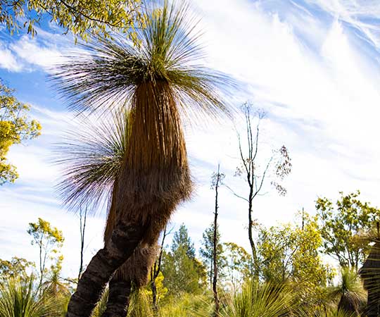
Grass Tree Drive
TOURIST DRIVE 1
If you’re a 4WD enthusiast who loves nothing more than to get out and explore nature, it’s time to buckle up. Enjoy changing landscapes along the drive with views of native flora and fauna, including the prehistoric Grass Trees.
Learn more ➔
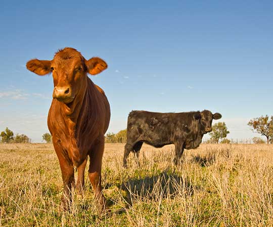
Country Cattle Loop
TOURIST DRIVE 2
Leave the highways behind and take the roads less travelled for a lesson about life on the land. Enjoy a series of historical sites along the way, offering an insight into early settlement of the area.
Country Insights Drive
TOURIST DRIVE 3
If you’re looking to gain an insight into life on the land or the oil and gas industry, this drive promises more than just country scenery.
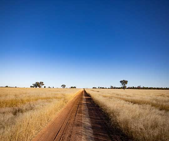
Southern Country Drive
TOURIST DRIVE 4
This easy drive provides insight into some of the region’s most productive agricultural land and heritage sites.
Settlement Drive
TOURIST DRIVE 5
With exceptionally fertile land, it’s no surprise the area surrounding Wallumbilla was once described as the largest wheat and dairy district in the Maranoa.
Following the First World War, the land surrounding this drive was divided into soldier settlement blocks. This easy drive takes you through some of the region’s earliest settlement villages, providing insight into the lifestyle of early settlers to the region.
Outback Landscapes
TOURIST DRIVE 6
Like many of Queensland’s outback towns, the keen sense of community spirit in Dunkeld is both inspiring and humbling.
This easy two-hour drive, from Mitchell, takes in the historic Kenniff Monuments to the south of Mitchell and the community of Dunkeld before continuing through the stunning red soil landscapes and agricultural land of the back road to Muckadilla.
Cobb and Co Way
TOURIST DRIVE 7
You’re invited to relive the history of an Australian icon, with a journey along the Cobb & Co Way. This 76km journey provides a wonderful insight into the lifestyle of early settlers and the journey of passengers using the coach service. The last Cobb & Co mail service in Australia travelled from Surat to Yuleba on 14 August 1924.
The Arcadia Valley Loop
TOURIST DRIVE 8
Get your camera ready as you pass through the Lonesome Section of Expedition National Park taking in the agricultural landscape and vantage points to enjoy the breathtaking views across the Arcadia Valley. The drive continues to the pièce de résistance – Nuga Nuga National Park.
Subscribe to our newsletter for all the latest news
- Phone This field is for validation purposes and should be left unchanged.

- Visitor Information

Queensland Tourist Drives
Tourist drives are in most regions through Queensland. Some routes have a number associated to the tourist drive. The numbers are based on the region they are in, so you will find the same number used in different regions.
Tourist Drives Queensland

Dynamic title for modals
Are you sure.
- Departing from Taiwan
- Outlying islands
- Kaohsiung and Southern Taiwan
- Taichung and Central Taiwan
- Yilan, Hualien and Taitung
- Transportation
- From The Editor
- Guest Column
- Adventure & Sports
- Art & Culture
- Food & Drink
- Hiking & Nature
Social Links

Driving in Taiwan: What Every Visitor Needs to Know
Taiwanscene.
Visitors to Taiwan who only visit the capital Taipei come away with a variety of impressions, but unless their jobs back home fall somewhere between cabbie and professional demolition derby driver , very rarely is this
“Boy, I’d sure like a chance to drive around in this city!”
Though tame by the standards of many Asian cities, Taipei’s traffic can seem a bit chaotic to drivers from the west. Add to this the fact that Taipei has one of the best public transportation systems in the world, and that taxis are affordable and everywhere. So few casual visitors feel inclined to drive themselves around Taipei, which is probably a good thing for all involved.
However, visitors looking to explore Taiwan beyond Taipei will find an eminently drivable landscape. And while Taiwan has one of the best overall public intercity transportation systems in Asia, having a set of wheels at your disposal opens up endless avenues of exploration.
The first thing any short-term visitor looking to drive themselves around the island need to know is how to go about renting a vehicle.
Renting a Car in Taiwan
As a quick Google search of Rental Cars in Taiwan reveals, Taiwan has no shortage of rental car companies, ranging from international chains like AVIS to local mom and pop car rental places. You can choose and reserve your car online, but keep in mind that you’ll need to provide all relevant documentation before they’ll put you in the driver’s seat. Many rental companies have satellite offices at Taiwan’s international airports, and some offer an airport pick-up service for an additional fee.

Once upon a time, Taiwan had a wilder west approach to things like car rental. ( This went double for motorcycle rentals, when all a foreign guest needed to rent a scooter was photo ID, four working limbs and some money.) But those days are long gone. Nowadays, you’ll need to have your paperwork in order. Specifically, any non-Taiwanese citizen looking to rent a car needs to produce the following :
- Driver’s license from their home country;
- An International driver’s permit issued in their home country;
- A valid Visa / MasterCard Card (A Debit card won’t cut it.) Your credit card won’t just be used to pay for the car; it can also be charged weeks or months later for any speeding tickets and traffic infractions caught on camera.

Driving in Taiwan: The Bas ic Rules and Knowledge
- Like North American, Taiwan drives on the right side of the road.
- Distance and speed limits are measured in kilometers, not miles.
- Turning right on red is technically illegal.
- Cameras and speed-measuring radars are fairly ubiquitous, so…just because you didn’t get pulled over for speeding or going through that red light doesn’t mean you got away with it. Most rental companies insist on keeping a credit card imprint to pay for any fines you may have accrued in their cars.
- Gasoline is sold by the liter, not the gallon .
- Whether turning or switching lanes on freeways, Taiwanese drivers tend to use turn signals on a somewhat more “optional” basis than their western counterparts. Be prepared.
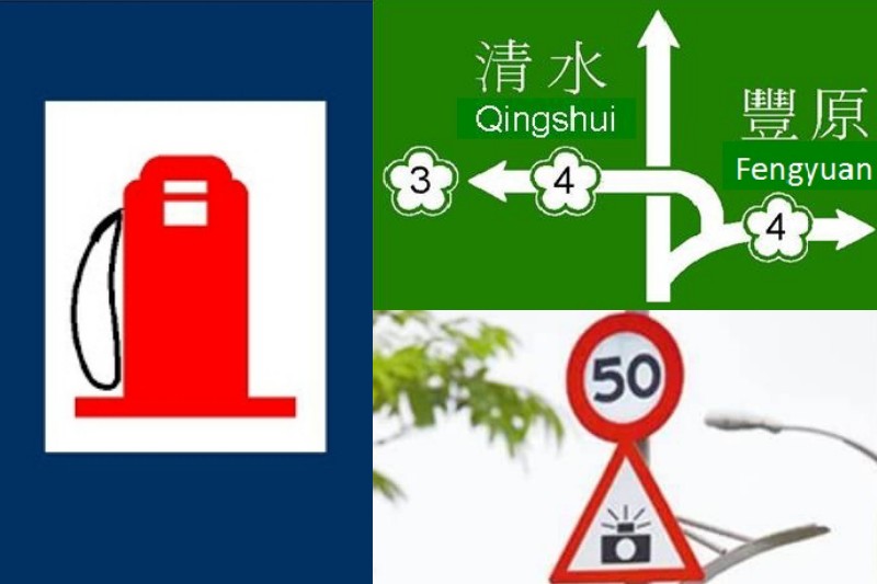
- Most (but not all) road signs and street signs have both English and Chinese. However , English spellings of towns, streets and even cities are amusingly inconsistent from place to place. ( Hsinchu and Shinju , Taitung and Taidong , Zhongshan Road and Chung Shan Road …the list is endless.)
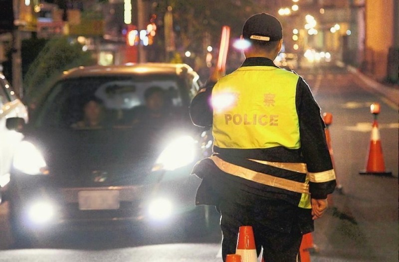
- Fender benders are common. In the event of an accident, don’t move your car. Stay calm, dial 110 and wait for the police to arrive.
And finally, on the subject of Taiwan’s Finest , police roadblocks and random sobriety checks are fairly common, especially in the evenings and around holidays. If the officer suspects you’ve been drinking, they’ll give you a breathalyzer test. Should the test result in a BAC 0.15ml or above, your Taiwan experience will take an interesting turn, one involving a ride in the back of a police car, heavy fines and legal repercussions that you’ll remember for years to come. But unlike the memories of the winding drive to Sun Moon Lake , these memories won’t be quite as happy. So if you’re driving in Taiwan, stick to Mr. Brown Coffee and betel nut.
Hit the Road: from Freeways to Roads
– taiwan’s freeways.
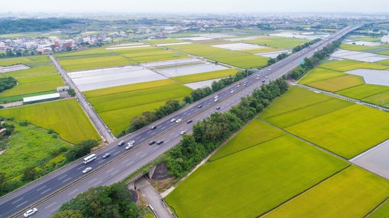
Marked with signs shaped like a green flower, Freeways are the only toll roads in Taiwan (Because freedom isn’t always free). Tolls are collected electronically, so as a visitor you’ll pay when you return your rental car. At 1.2 NT per kilometer (Under 5 cents USD), Taiwan’s freeway tolls are fairly inexpensive.

Freeway 1: Also known as The Sun Yat-Sen Freeway, Route 1 is Taiwan’s major North-south freeway, beginning in Keelung and ending in Kaohsiung . ( Read more: 5 things to do in Kaohsiung )
Freeway 3: Also known as Formosa Freeway, Route three is Taiwan’s second North-South freeway in Taiwan. It begins in Keelung City and ends in Pingtung, running a bit further inland than Route 1. ( Read more: Pingtung: Expect the Unexpected )
Freeway 5: Route 5 begins in Taipei City and ends in Yilan on Taiwan’s Northeast coast. The official name is the Chiang Wei-shui Memorial Freeway, after the early twentieth century Taiwanese political activist and Yilan native Chiang Wei-shui .
– Roads in Taiwan
Taiwan’s road network is relatively dense, particularly around Taipei. Road conditions are generally good, but motorists driving in the mountains should be mindful of the fact that Taiwan’s mountain roads are especially vulnerable to damage from typhoons and earthquakes, and are thus regularly under repair.
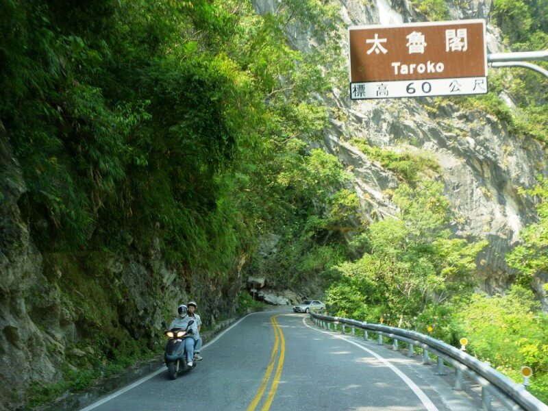
One of the most popular roads in Taiwan (Route 8 from Hualien to Taroko Gorge) is under near-constant repair, so drivers should be prepared to pull over, stretch their legs and enjoy the view as road crews control the flow of traffic on sections currently under repair. Many of the most beautiful roads in Taiwan are in mountainous regions (and hence require frequent maintenance).
As for what roads are worth driving on, well…that subject deserves it’s own article. So watch this space!
Looking to take a Private Guided Taipei Tour with a professional English speaking driver in the style, comfort and convenience of a WIFI equipped luxury sedan? Check out MyTaiwanTour’s Private Guided Taipei Tour or build your own customized Taiwan Tour .
Planning a road trip? Read also:
- Riding a Scooter in Taiwan (Part One): Safety Guide and Rental Instructions
- Riding a Scooter in Taiwan (Part two): Best Places to Explore by Scooter
Related Topics
- Travel tips

Taiwan Scene is an online travel magazine. We publish stories introducing readers to the culture, scenery and travel possibilities of our homeland, articles to help travelers make the most of their time in Taiwan, and occasional interviews with movers and shakers from Taiwan’s ever-expanding creative scene. 一切關於有意思的台灣

A Dialogue Between Ingredients and Cuisine Interview With Taiwanippon Chef, Tatsuya Ono
- traveltaipeimagzine
Indigenous Culture, not Food, is Taiwan’s Top Tourist Attraction
- commonwealthmtt
You May Also Like
- Destination
Spontaneous Symphony: Exploring Improv in Taiwan

Labor Day: Reflections of an Expat Woman in Taiwan
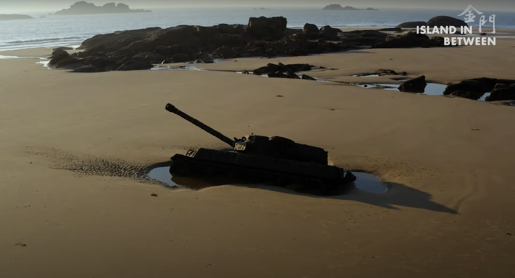
Kinmen at the Oscars

- Hotel & Accommodations
6 Good-Value Hotels in Keelung! Let’s Enjoy Breathtaking Harbor Views!

Humbled but unperturbed – how Taiwan earthquake-proofed itself

Why Taiwan Continues to Be My Chosen Home?
- June-Auguest
2024 TAIPEI 101 Run Up Sign-up to Start

6 Must-See Secret Spots of Bald Cypress
Input your search keywords and press Enter.

IMAGES
VIDEO
COMMENTS
Tourist Drive 8 - Nowra, Kangaroo Valley, Robertson, Albion Park. This drive takes in Macquarie Pass, Robertson, Fitzroy Falls, Kangaroo Valley, and Bomaderry. The three waterfalls Carrington Falls, Belmore Falls and Fitzroy Falls can be viewed from great vantage points on short detours from the main route.
Tourist Drive 8 starts from the Federal Highway near Lake George, nearby Canberra and Queanbeyan. Start your drive by stopping off at the Weereewa Lookout by Lake George and taking in the expansive views of the mysterious lake. From here, you'll head south on Bungendore Road towards the region's cool-climate wineries and Bungendore village.
tourist drive 8. kangaroo valley, robertson and albion park - the waterfalls route. fitzroy falls. albion park to bomaderry moss vale via robertson and kangaroo valley
Don't be put off by the dirt road, it is part of the Tourist Drive Number 8 that is one of the best kept secrets of the Pacific Coast Tour. Have a look at the Manning Valley to Port Macquarie - Tourist Drive 8 on the Legendary Pacific Coast website. The Mid Coast Council and Port Macquarie Council have been spending millions of dollars to ...
Extension of Tourist Drive 8 from Glenlyon Dam to Texas. Signed as : Southern Moreton Bay Tourist Drive: Wynnum: Cleveland: Redlands: 78 km (48.5 mi) Length from reference. Warrego Way through Gatton : Eastern Drive; Railway Street; Western Drive; Gatton Helidon Road; Gatton: Grantham:
2. East Rim Walking Track. Type: Out & Back Distance: 6.3km Time: 1.5-2.5 hours Accumulated elevation gain: 300m Difficulty: Grade 3 (Moderate) Trailhead: Fitzroy Falls Visitor Centre The East Rim Walking Track (AKA the East Rim Track), which also encompasses the East Rim Wildflower Walk, is another exceptional walk to do in the area.Along this walk, you'll enjoy a unique view of Fitzroy ...
TOURIST DRIVE 8. Get your camera ready as you pass through the Lonesome Section of Expedition National Park taking in the agricultural landscape and vantage points to enjoy the breathtaking views across the Arcadia Valley. The drive continues to the pièce de résistance - Nuga Nuga National Park.
The first day free of lockdown I set off to the South Coast to enjoy the delights of driving more than 5km. My focus was Berrima's Gumnut Patisserie, my culinary heart of the Southern Highlands, and the Tourist Drive 8 road signs.My journey was like a roller coaster driving up and down the mountains and across bridges from Wollongong to Albion Park up Macquarie Pass to Moss Vale & Berrima ...
We took Tourist drive 8 from Port Macquarie. The views were beautiful, but most of the road is unsealed, and not in good condition. I would hate to take it when it's wet, or when visibility is poor, because without the views so gloriously laid out it wouldn't be worth it.
Tourist Drive 9. Heading west and taking in some of the best views and attractions in the region, this drive takes around two hours starting in Kiama and winding its way through to the Southern Highlands via Jamberoo Mountain Road to Robertson. Stops can be made along the way at Jamberoo township, Minnamurra Rainforest & Waterfall, Illawarra ...
Kangaroo Valley Downhill Trail is located at Tourist Drive 8, Fitzroy Falls NSW 2577, Australia. Similar Businesses Nearby. The Den . Gym | Health. Kangaroo Valley NSW 2577, Australia. KVG . Gym | Health. Osborne Park, 179 Moss Vale Rd, Kangaroo Valley NSW 2577, Australia. Moving Rhythms .
Loaded Dog Hotel, follow Tourist Drive 8 along the Bungendore Road and just enjoy the scenery. You will soon notice the Capital Wind Farm to your right. This 140 megawatt wind farm was completed in 2009, costing around $220 million, and was designed to produce more than enough energy to offset the power usage of the Kurnell Desalination Plant.
The Mount Nebo Tourist Drive 8 climbs up the mountain range from Brisbane's north-western suburb The Gap. As the name suggests, it heads up Mount Nebo. It continues on to join onto Mount Glorious Tourist Drive 9. The tourist drive is about 28 kilometres one way. From The Gap to Mount Nebo
Tourist Drive 33 meets the Old Pacific Highway, where you get the chance to descend into this valley hugged by mountains and waterways. Take Cooks Road down a winding dirt road to find Glenworth Valley Outdoor Adventures. Glenworth Valley Outdoor Adventures. Escape the city for an unforgettable adventure at Glenworth Valley Outdoor Adventures.
Tourist Drive 33 is a major tourist drive from Calga in the western part of the Lower Central Coast to Branxton in the Hunter Valley, the second longest tourist drive in New South Wales, the second most promoted tourist drive in New South Wales and the longest interior tourist drive in Australia that's not in Victoria.. The brown Tourist Drive 33 markers used to navigate the route.
Grand Pacific Drive is also a great 'appetiser' to the Sydney to Melbourne coastal drive. Tourist Drive 8. Start along Tongarra Road, just off the Princes Highway at Albion Park Rail where you you can explore the history of rail at the Illawarra Light Railway Museum. You can also enjoy a ride on steam and diesel trains and view the railway ...
Australind Bunbury Tourist Drive, designated as Tourist Drive 260, is a 14-kilometre-long (8.7 mi) historic route from Leschenault to Bunbury via Australind, Western Australia. From Forrest Highway (at the point that was the intersection of the former Australind Bypass and Old Coast Road), the route travels south to Australind via Old Coast ...
TOURIST DRIVE 8. Get your camera ready as you pass through the Lonesome Section of Expedition National Park taking in the agricultural landscape and vantage points to enjoy the breathtaking views across the Arcadia Valley. The drive continues to the pièce de résistance - Nuga Nuga National Park. ...
Follow baseball results with FREE box scores, pitch-by-pitch strikezone info, and Statcast data for Tourists vs. Drive at Fluor Field at the West End
11 km (6.8 mi) Tourist Drive 4. Inverell. Warialda Road; Yetman Road; Warialda: Inverell 151 km (94 mi) Tourist Drive 5. Wellington Tourist Drive 6. The Lakes Way - Forster. The Lakes Way Bulahdelah Taree 80 km (50 mi) Tourist Drive 7. Kangaroo Valley. Kangaroo Valley Road; Moss Vale Road; Berry Bomaderry
Queensland Tourist Drives. Tourist drives are in most regions through Queensland. Some routes have a number associated to the tourist drive. The numbers are based on the region they are in, so you will find the same number used in different regions.
Exploring New England High Country along the several Tourist Drives is a great way to have a relaxing adventure. If you find yourself in Armidale or Uralla needing to while away a few hours, Tourist Drive 19 is for you. It comprises 86km of country back roads, including 20km unsealed, and will easily fill half a day or more.
8. Tourist Drive 33. Tourist Drive 33 is a 2-hour drive that showcases some of the most stunning countryside that NSW has to offer, ending at Wollombi Hunter Valley. The route offers a range of activities and attractions, including horse riding, roadside fruit stalls, boutique cellar doors, and country pubs.
Freeway 1: Also known as The Sun Yat-Sen Freeway, Route 1 is Taiwan's major North-south freeway, beginning in Keelung and ending in Kaohsiung.(Read more: 5 things to do in Kaohsiung)Freeway 3: Also known as Formosa Freeway, Route three is Taiwan's second North-South freeway in Taiwan. It begins in Keelung City and ends in Pingtung, running a bit further inland than Route 1.