5 Tools to Take an Auto-Guided Google Street View Tour

Your changes have been saved
Email Is sent
Please verify your email address.
You’ve reached your account maximum for followed topics.

Why Scammers Love Using WhatsApp and Telegram to Slide Into Your DMs
Today's nyt connections hints and solution (saturday, june 22, 2024), dall-e 3 now has integrated editing tools, but they need work.
Hitting the road for a scenic drive can be a surprisingly relaxing experience. Unfortunately, you're not always guaranteed a good trip. The weather can ruin the experience in a moment, not to mention the traffic.
Luckily, with Google Street View, you can comfortably explore the world from your desk. But if you want to take a tour of the streets from your computer, Google Maps doesn't have any tools to support you.
Thankfully, there are tools that can change that. Here are five of the best.
1. Animated Route Maps
First on this list is Animated Route Maps. Animated Route Maps is a web service which allows you to map out a route on Google Maps and then experience the route via Street View.
The interface here is a little outdated and can be somewhat confusing to work with, but the end result is surprisingly robust. First, you'll need to adjust the setting to your liking.
Related: Tricks to Help You Use Google Maps Like a Pro
The most important settings here are the start address and destination address. As you might expect, these will determine where your trip will both start and end.
From there, you can adjust a wide range of other options to your liking. The travel mode and animation update intervals are some of the more interesting ones.
From there, you need to click on the Create Your Directions Map button and navigate down to the View Map button, and you’re good to go.
2. Directions Map
Next up on this list is Directions Map. Directions Map is great if you’re looking for the same virtual tour experience with a little more information.
Getting started with Directions Map is easy. The webpage should load an example route for you, which makes it easy to get an idea of how everything works if you want.
You’ll see the Street View, satellite view, and a closer view as well. When you start the animation, all three will move in tandem to show you the route that you’ve chosen.
You can edit the route by clicking the button near the top, labeled as such. All you need to do is inter a new start and destination address.
3. RouteView
If you’re looking for a more powerful tool to take an auto-guided tour, then RouteView might just be your best bet.
RouteView has very impressive options to set up your route exactly how you want it. You can even adjust the step intervals and speed, the thickness of the route and plenty of others.
More than anything else, though, RouteView looks good when it works. This leads into RouteView’s biggest problem.
Related: How to Create Shared Collaborative Google Maps
RouteView is difficult to set up. Creating a website like this requires a Google Maps API key, and that isn’t something the creator has. Instead, you’ll need to get your own.
Doing so is entirely free unless you end up using the API a lot. But, bear in mind, it is difficult to acquire a key all the same.
4. Google Street View Movie Maker
If you’re happy with a little extra work, or already have your Google Maps API key, then there are other options available to you as well.
Google Street View Movie Maker is a project you can access from GitHub. If you know nothing about programming but have always wanted to learn, this could be an interesting way to do so.
Regardless, you’ll have to set the project up yourself. You’ll also need that pesky Google Maps API Key.
Once you do, though, it’s all worth it. You can tweak and add and adjust the Street View player whenever you want. You’re the one in charge of the code, after all.
5. Frame Synthesis Driving Simulator
Finally, we have Frame Synthesis Driving Simulator. This entry is a bit of a departure from the other options on this list, but is certainly the most unique.
With Frame Synthesis Driving Simulator, you can take a tour of any street on Google Maps. The only difference is that now you’re in the driving seat.
Related: How to Use Google Street View
By default, the camera will place you above the car. For a more immersive tour of the landscape, you can adjust the camera so that you’re looking at it head on.
You can go to any location that Google Maps supports this way, and enjoy the scenery without worrying about traffic or pollution.
Where Are You Going to Travel?
As you see, it doesn't take big bucks to go around the world. The Internet can take you places you never knew existed. And while you're there, why not explore them; it's almost as if you were there for real.
Google Maps is a more powerful tool than it appears on the surface, and there's a lot that you can achieve once you have the right tools.
- Google Maps

How to use Google Street View on Google Maps: Tour unfamiliar areas and use Live View for real time directions
- Google Street View lets you see a 360-degree view of your destination before you get there.
- Google Street View is accessible through Google Maps on both desktop and mobile.
- You can also use Live View in Google Maps for a live view of your route and directions in real time.

Knowing the names of streets and general directions when you're going somewhere new is extremely helpful. But being able to see your destination in advance, and know what the area around it looks like, is even better.
Using the iconic Google Street View cars, which feature cameras mounted on the roofs, Google regularly collects millions of images of streets worldwide to provide users with 360-degree views of locations.
Google officially discontinued its standalone Street View app in 2023, but the Street View feature itself is still accessible via Google Maps.
You can use Street View for a variety of purposes: You can look up exactly what a location looks like before you get there, scout out the layout of entire blocks at a time, or even see your own house.
Here's everything you need to know about how to use Street View:
What is the difference between Google Earth, Google Maps, and Google Street View?
Street View is just one of several navigation tools and mapping softwares by Google — all of which can assist you in finding or viewing locations in different ways.
Google Maps is your standard navigation software, created to provide detailed directions and various routes between locations. Google Street View is a component of Google Maps.
Google Earth, however, uses satellite images and topographical data to help you explore locations from above. Google Earth operates on a larger scale than Google Maps and takes you on an immersive virtual tour.
You can use all three tools to get three vastly different perspectives on a location. For instance, if you're planning a trip to see Ireland's Cliffs of Moher, you might want to use Google Earth to get a preview of the iconic, rugged sea cliffs and check out the surrounding landscape. You might then use Google Maps to plot a route from your bed and breakfast to the Cliffs of Moher car park, and you could then use Street View to do a virtual walk-through of the cliffside paths.
But maybe all these maps still aren't quite visual enough for you. In that case, search up the cliffs on Google Images to see stunning photographs of the area.
Google's mapping tools also don't end with Google Maps and Google Earth. Google also owns Waze , a navigation and traffic app geared specifically to drivers, which offers realtime updates on traffic conditions and route hazards.
Related stories
Like Google Maps, Waze is a GPS tool that can get you from A to B and offer multiple routes. But unlike Google Maps, Waze has a community-based component, allowing drivers to report things like bad weather, accidents, and other traffic conditions to alert other drivers.
How to use Google Street View on desktop
Google Maps works on both your desktop, and mobile device. Here's how to get to Street View on your computer:
- Go to maps.google.com .
- Tap the search bar in the top-left corner of the screen and enter the name or address of the place that you want to view.
Click and hold the person icon in the bottom-right corner of the screen and drag it to the spot you want to view (as you move the cursor over the map, the streets will be highlighted in blue — make sure that you place the icon onto one of those, otherwise you won't be able to see the street view).
- Release the cursor.
- To navigate in street view, click and drag to change the camera angle or tap a location down the street to move closer to it.
- You can also use the curved arrows around the compass icon in the bottom-left corner of the screen to change the direction of the camera.
The images on Google Street View are updated once every one to three years, but well-known places are updated more frequently. You can check the date of a Street View image by looking for the date in the black box at the top left-hand side of the screen, or on the bar on the bottom right-hand side of the screen.
How to get street view on Google Maps on your phone
If you're on the go and need to use your mobile device to check out your destination, here's what you'll need to do:
- Open the Google Maps app on your iPhone or Android.
- Tap the search bar and enter the name or address of the place you want to view.
- Tap the small photo box on the left side of the screen.
To navigate on the mobile version of Google Street View, drag one finger across the screen, starting on the side you want to go toward and ending on the opposite side of the screen.
Can I blur my house on Google Maps?
Google Street View may potentially reveal more than you'd like — maybe your house has distinctive features, or there's a large window with a view directly into your home.
If you have concerns about privacy or safety, there is a solution. You can request Google to blur your house permanently, leaving behind only a vague outline of the building.
Here's how to do it:
- Go to Google Maps and enter your home address.
- Enter into Street View mode by dragging the small yellow human-shaped icon at the bottom-right corner of the screen onto the map in front of your house.
- With your house in view, click "Report a problem" in the bottom-right corner of the screen.
- Center the red box on your home, and select "My home" in the "Request blurring" field.
Once someone has requested to blur your house, it is important to note it is blurred permanently. Google does not offer to reverse this request.
How can I see a live Street View in real time?
Live View in Google Maps is a unique tool that uses augmented reality to provide directions. Live View uses your phone's camera to display your current surroundings in the viewfinder, then projects directions, arrows, and other navigation cues onto the screen to show you where to go.
Live View is still a fairly limited feature — it isn't available in every country or on every type of mobile device, and it only works in areas that are already well-mapped by Street View.
Here's how to use it on Android or Apple devices:
- On your phone or tablet, open the Google Maps app.
- In the search bar, enter a destination and select Walking .
- Once your destination is located on the map, tap the Live View icon .
- Once the Live View is on, point your phone's camera around to determine your exact location.
- Follow the arrows, and once Google Maps has recognized your location you can start your journey.
Google also offers a similar augmented-reality feature called Lens in Maps, which uses Google Lens technology to suggest helpful locations nearby, like coffee shops, ATM machines, parks, transit hubs, and more.
Here's how to use Lens in Maps:
- Open the Google Maps app
- Tap the Lens icon in the search bar, and lift your phone
- Main content
In Spring 2018 Google launched their VR Tour Creator. This free tools lets anyone create their own virtual tour that can be viewed on a computer, tablet, or phone web browser, or using Google Cardboard. When creating a tour, one has the option on utilizing any of the street-view images on Google Maps, or uploading their own images using a 360° camera or iOS apps like "Google Street View" or "Google Cardboard". Creator also allows you to add points of interest as well as audio to your tour locations.
View my first use of Tour Creator using only Google Maps images.
Google Tour Creator has the ability to have a huge impact in teaching and learning. Teachers can create tours that allow students to get a stronger sense of "Setting" when reading a novel or learning about a historical event. Students can create tours showing what they have learned about a place. Google Tour Creator also has templates available so that users do not have to necessarily start from scratch.
Some of the educational uses of this tool may include:
- Virtual Setting Tour of a Novel- Imagine creating a tour following Chris McCandless in "Into the Wild"
- Paul Revere's Ride
- Travels of Marco Polo
- Tour of Paris, Rome, New York City, etc.
- Our Solar System (template)
Watch some of these videos that will show you not only how to create tours, but how they can be used in a classroom.

How to create a Google Street View virtual tour with any 360 video with GoThru StreetBuilder
You can now use the 360 video from any camera to create a virtual tour on Google Street View, using GoThru’s new StreetBuilder .
Here’s the demo and tutorial:
How to work with GoThru StreetBuilder to publish a 360 video to Google Street View from Alin Bugeag GoThru on Vimeo .
Here’s the press release:
GoThru launches StreetBuilder to bring Google Street View up to date
The team behind GoThru – the first professional moderator that allows users to create a constellation out of panoramic images and publish as walk-in tours directly to Google Street View – is set to expand their platform, enabling users to create Blue Lines on Google Maps.
The vast majority of Google Maps users use Street View for prospecting places that they would like to visit. But not all parks, hiking trails or streets are mapped by Google. With the help of StreetBuilder desktop application, people can now update or add new images to Google Street View, by capturing their own panoramic footage using any 360 cameras for a better map and world.
Compatible with all 360° cameras, StreetBuilder allows for the extraction of panoramic images (and GPS data, where available) from videos, pushing them to Street View through the GoThru platform, regardless of whether the camera is GPS-enabled or not.
Alin Bugeag, CEO at GoThru Media Inc, said: “Following the success of our GoThru Moderator, we are pleased to announce the launch of StreetBuilder, an innovative platform to complement GoThru’s functionality.
Access to recent and accurate map data is becoming increasingly pivotal to the digital world, and while Google Maps has changed the future of mapping as we know it, there are still streets, buildings, and points of interest that are missing. StreetBuilder enables anyone to put these places on the map.
The software smartly predicts the optimal distance between panoramas and allows non-GPS footage to have specific frames selected, with easy navigation and visual display of where extracted images will sit on the map. StreetBuilder was developed to enable our community to access even more resources to help to create better maps.
The more traditional process of updating Street View data is notoriously slow and expensive, yet StreetBuilder, along with Google, have partnered to develop an ecosystem that allows anyone with a 360 camera to do that easily.
Locals know better what it is missing from their map and with StreetBuilder they bring Street View up to date! ”
About GoThru
GoThru is a platform developed to offer multiple tools to Google Trusted Photographers and implicit to their customers. GoThru Moderator is the best moderator outside of Google that provides the technology to create a constellation out of panoramic images and be published directly on Google Maps and the Street View Application. Besides this, GoThru offers a multitude of tools that have been created at the request of the photographers or to help them sell the Google Tour better.
You may also like

Top 10 Best 360 photo sharing apps in 2023

Matterport rumor: New hosting fees – here are potential solutions

How to create your own AI Virtual Art Galleries : Full Guide

Affinity Photo 2’s Best New Features: the best 360 photo editor gets even better (and what’s missing)

How to create a virtual tour from shooting to sharing with Trisio (for Google Street View or Theasys)

Enhance Real Estate Virtual Tours with Virtual Host: Simple Guide & Sample
About the author.
Cancel reply
Save my name, email, and website in this browser for the next time I comment.
Notify me of follow-up comments by email.
Notify me of new posts by email.
This site uses Akismet to reduce spam. Learn how your comment data is processed .
Funny how they had to use osm/mapbox for the map view in an app designed to upload to google 🙂
how i can combine gps data white insta 360 one x videos to use this software?
Virtual Tour for Google Street View™
Driving, biking, hiking, or rowing in Google Street View. Go sight-seeing around the world without burning fosil fuel.
To start the journey, you may click a link in the extension menu for a quick start. You may start the journey from a Google Street View page of your choice by clicking "Go!" button on this extension. Features - Travel around the world on Google Street View - Drive the street view continuously without user interaction
4.8 out of 5 13 ratings Google doesn't verify reviews. Learn more about results and reviews.
VIRAT PARASHAR Jul 27, 2017
- Version 0.0.5
- Updated November 7, 2015
- Report a concern
- Size 116KiB
- Languages English (United States)
- Developer Website
- Non-trader This developer has not identified itself as a trader. For consumers in the European Union, please note that consumer rights do not apply to contracts between you and this developer.
Welcome to Outer Space View
Jul 20, 2017
[[read-time]] min read

Editor’s note: Starting today, you can now explore the International Space Station in Street View in Google Maps. Thomas Pesquet , Astronaut at the European Space Agency (ESA), spent six months aboard the International Space Station (ISS) as a flight engineer. He returned to Earth in June 2017, and in this post he tells us about what it’s like to live on the ISS and his experience capturing Street View imagery in zero gravity.
In the six months that I spent on the International Space Station, it was difficult to find the words or take a picture that accurately describes the feeling of being in space. Working with Google on my latest mission, I captured Street View imagery to show what the ISS looks like from the inside, and share what it’s like to look down on Earth from outer space.

For 16 years, astronauts have been working and living on the ISS, a structure made up of 15 connected modules that floats 250 miles above Earth. The ISS acts as a base for space exploration—possible future missions to the Moon,Mars and asteroids—and gives us a unique perspective on Earth itself. We can collect data on the Earth’s oceans, atmosphere, and land surface. We can conduct experiments and studies that we wouldn’t be able to do from Earth, like monitoring how the human body reacts to microgravity, solving mysteries of the immune system , studying cyclones in order to alert populations and governments when a storm is approaching, or monitoring marine litter —the rapidly increasing amount of waste found in our oceans.

There were a few “firsts” on my mission. It was led by Peggy Whitson who, at age 56, became the oldest woman to fly into space and the first woman in history to command two expeditions. The mission was the first time Street View imagery was captured beyond planet Earth, and the first time annotations— helpful little notes that pop up as you explore the ISS—have been added to the imagery. They provide additional information or fun facts like where we work out to stay physically fit, what kind of food we eat, and where we conduct scientific experiments.

Because of the particular constraints of living and working in space, it wasn't possible to collect Street View using Google's usual methods. Instead, the Street View team worked with NASA at the Johnson Space Center in Houston, Texas and Marshall Space Flight Center in Huntsville, Alabama to design a gravity-free method of collecting the imagery using DSLR cameras and equipment already on the ISS. Then I collected still photos in space, that were sent down to Earth where they were stitched together to create panoramic 360 degree imagery of the ISS.

We did a lot of troubleshooting before collecting the final imagery that you see today in Street View. The ISS has technical equipment on all surfaces, with lots of cables and a complicated layout with modules shooting off in all directions—left, right, up, down. And it’s a busy place, with six crew members carrying out research and maintenance activities 12 hours a day. There are a lot of obstacles up there, and we had limited time to capture the imagery, so we had to be confident that our approach would work. Oh, and there’s that whole zero gravity thing.

None of this would have been possible without the work of the team on the ground, my colleagues (turned roommates) on the ISS, and the countries that came together to send us up to space. Looking at Earth from above made me think about my own world a little differently, and I hope that the ISS on Street View changes your view of the world too.
Click here to go behind the scenes with Thomas and the team .
Related stories

Use these 5 AI-powered tools to plan your summer travel

Mapping human activity at sea with AI
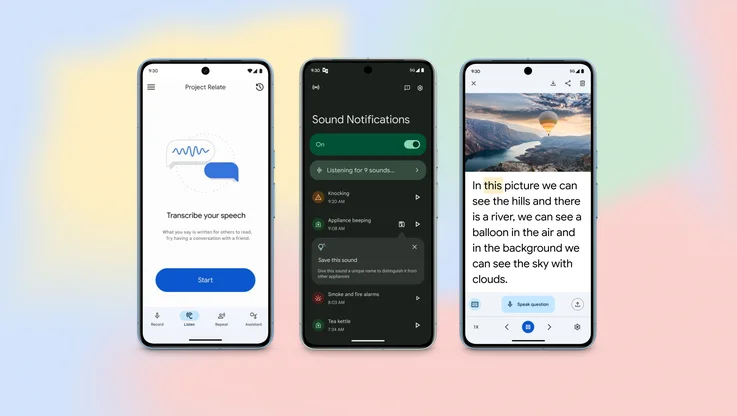
8 new accessibility updates across Lookout, Google Maps and more

5 AI-powered tools to help you get outside more

New ways to power up your electric vehicle adventures with Google Maps

Find more sustainable ways to get around, with new Maps and Search updates
Let’s stay in touch. Get the latest news from Google in your inbox.

The new standard in 360° virtual tour software
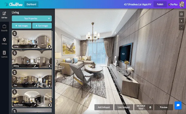
Create Interactive Engaging Content With CloudPano
360° virtual tours.
%20(1).webp)
To create your first 360º virtual tour click below:
360º Photography Services
%20(1).webp)
360º Virtual Tour Photography Services
Interactive 360° Spins
%20(1).webp)
To create a 360º spin click below:
How to Upload Virtual Tours to Google Street View
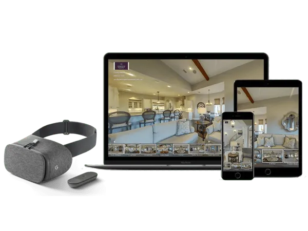
Create And Display Virtual Tours In 360 and VR
CloudPano 360° virtual tour software empowers you to create 360° virtual tours. Quickly create interactive virtual tours hassle-free. With a few clicks, you can upload, connect and publish a 360° immersive experience. No coding required. Get started today, its free. Click here.
How CloudPano Works
Create a 360° virtual tour with our easy three-step process.
.webp)
Capture photos in 360
Upload to CloudPano.com and create your tour
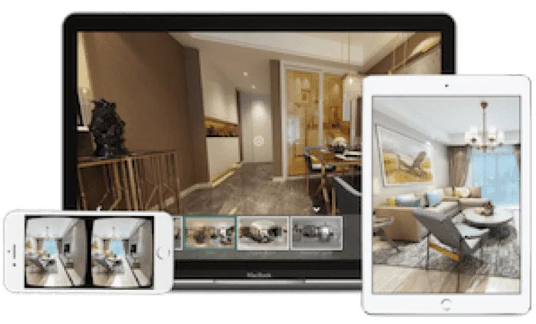
Share your tour with the world
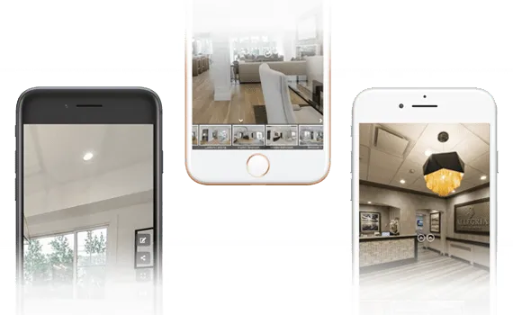
Getting Started
What is a 360 virtual tour.
A 360 virtual tour on CloudPano is a real estate marketing tool to view and share a space in an immersive 360 environment. With a smartphone, the CloudPano viewer responds to your movement. This creates a responsive and immersive view of the property. Create your first 360 virtual tour in 5 minutes or less.
Add or Embed 360 Virtual Tours on any Website
(no app or plugin required).
When you publish a 360 virtual tour on CloudPano.com, you will automatically receive a code based link. You can embed your tour right onto your website. We host the tour, you show it off to the world.
Check out a live example
Cloudpano 360 virtual tour examples.
Explore some of our featured 360 tours from the CloudPano community
%20(1).webp)
Florida Luxury 360 Virtual Tour Click to view this demo
.webp)
New York VR Nursing Home Click to view this demo
.webp)
Auto Dealership Click to view this demo
.webp)
Luxury Residential Click to view this demo
.webp)
AirBnB Rental Click to view this demo
.webp)
Commercial Construction Click to view this demo
Simple 3D Tour Creation
Create your first tour in under five minutes..
Upload photos using a drag-and-drop interface. Click a single button to set an initial view for each scene. Add hotspots to navigate your tour.
Popular Features
Customize your logo
Set initial view
Re-order scenes
%20(1)%20(1)%20(1).webp)
Share In Full 360 and VR
Share and display on any smart device out of the box - no app required.
Give meaningful experiences to your viewers. Built-in motion sensing capabilities and VR-goggle modes work right in the mobile browser. Reach your customer on any platform. Simply share your virtual tour with a single URL link.
Android/iOS
Google Cardboard
No app to download
VR/Motion Navigation
Customize Your Tour Branding
Add logos, hotspot navigation and more.
Use linked hotspots to teleport between scenes. Add your logo and establish your brand.
Customize Your Logo
Contact Information
Share on social media
Keep Your Custom URL
.webp)
White-label your virtual tour
Use your own website domain.
Remove all references of CloudPano.com. Use your own logo and keep your website domain. Easily use your own URL. Add 360 virtual tours into your business and keep our name hidden.
Customize Your URL
Remove CloudPano Branding
The Perfect Software Toolkit For Virtual Tour Entrepreneurs
Start a local 360 virtual tour business, add virtual reality marketing to current business.
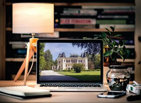
A Simple Software Solution To Power Your Virtual Tour Revenue
Private Label / White Label - Keep Your Website Domain Name and Protect Your Brand
Add or Embed Your Published 360 Virtual Tours Directly To Your Website or Blog (Wordpress Compatible)
Present Your 360 Tours In A Virtual Reality Headset
International Hosting On Local Server Networks (Speed Guaranteed)
CloudPano.com is a Virtual Tour Software built for entrepreneurs, photographers and real estate brokers. You will be empowered to create world class 360/VR virtual tours quickly, market real estate at a high level AND keep your brand on the front of tour. If you are looking for a 360 virtual tour software built for the business owner - you are in the right place.
Simple Pricing
Build a 360 virtual tour for free. Make the tour your own for a few dollars. One time fee, hosted tour for life.
- Unlimited 360 Photos
- Share Anywhere
- Gyroscope-enabled Motion Control
- Add Branding and Logo
- Hotspots and Infospots
- Three Free Tour Limit
- Remove "Made by CloudPano" watermark
- Embed On Your Website
- Complete access to CloudPano's 360 tour creator
- Unlimited tours
- Life-time tours - no expiration
- White-label/Bring your own URL
- 8K/High-def premium photo uploads
- Google Analytics
- Embed HTML and Media
- CloudPano Live Video Chat
- MLS-Compliant Tour Cloning
- Ambient Sounds and Music
- Tour Privacy Settings
- Lead Capture Tool
PRO PLUS BUSINESS
- Enterprise Partnership Access
- Custom Integrations
- Unlock Team Work Flows
- Industry Specific Feature Customization
- Dedicated Account Managment
- CloudPano Live For Sales Teams
- Custom Training
- Hardware Onboarding
- Host Account Bundles
- Branded Experience Management
CloudPano Pro User Testimonials
The technology is pretty amazing and the finished 3d tour is high definition. the tours played well on everything from a desktop to a cellphone. highly recommended., i just pitched a $2.5 million dollar fsbo with the vr headset and cloudpano software. i impressed the client, built rapport and added value with the vr presentation. it's marketing like that this that makes you stick out amongst your competition... and ultimately this moves property at a high level., this technology changes the game. my customers are very excited about it. and i know when my customers are excited about it, i am going to make some more money., 360 tours are an easy way to upsell my clients on location. plus, it only takes a few minutes to create a virtual tour on cloudpano.com., cloudpano has a crisp and clean design. plus the platform hosts the 360 virtual tours for me, so i can create tours quickly and get back to shooting., being able to have a full 360 tour of my listings and show sellers how i can take marketing of their home to the next level is huge i appreciate you and your team helping me out along the way answering any and all questions that i have had so far and i am excited to continue to implement and grow my business with the help of you and your team., common questions.
We are passionate about changing the world through software. Call us or email us anytime.
1301 Fannin St #2440 Houston, TX 77002
+1 (281) 410-8727
Email us at

© CloudPano.com

- PRO Courses Guides New Tech Help Pro Expert Videos About wikiHow Pro Upgrade Sign In
- EDIT Edit this Article
- EXPLORE Tech Help Pro About Us Random Article Quizzes Request a New Article Community Dashboard This Or That Game Popular Categories Arts and Entertainment Artwork Books Movies Computers and Electronics Computers Phone Skills Technology Hacks Health Men's Health Mental Health Women's Health Relationships Dating Love Relationship Issues Hobbies and Crafts Crafts Drawing Games Education & Communication Communication Skills Personal Development Studying Personal Care and Style Fashion Hair Care Personal Hygiene Youth Personal Care School Stuff Dating All Categories Arts and Entertainment Finance and Business Home and Garden Relationship Quizzes Cars & Other Vehicles Food and Entertaining Personal Care and Style Sports and Fitness Computers and Electronics Health Pets and Animals Travel Education & Communication Hobbies and Crafts Philosophy and Religion Work World Family Life Holidays and Traditions Relationships Youth
- Browse Articles
- Learn Something New
- Quizzes Hot
- This Or That Game
- Train Your Brain
- Explore More
- Support wikiHow
- About wikiHow
- Log in / Sign up
- United States Travel
- California Travel
How to Get to the Googleplex and Tour the Campus
Last Updated: June 1, 2024 Fact Checked
Getting to the Googleplex
Exploring google campus, touring with a google employee.
This article was reviewed by Seth Hall and by wikiHow staff writer, Ali Garbacz, B.A. . Seth T. Hall (ICF ACC, CLC, and MNLP) is a Certified Life Coach and Founder of Transformational Solutions, a Los Angeles-based life-coaching company that helps people achieve their toughest goals, find their own voice, and think outside the box. He has been a life coach for over 10 years, specializing in personal development, relationships, career and finance, and wellness. He has helped his clients break the negative cycles in their lives and replace them with a positive, proactive mindset. Seth believes that everyone has the potential to live a fulfilling and rewarding life, and works passionately to help them reach their full potential. With a deep understanding of how our minds work and the power of positive thinking, he encourages his clients to find their unique paths in life and find success on their own terms. He is a certified master practitioner of Neuro-Linguistic Programming, a featured co-author for WikiHow, and co-author of "The Mountain Method”, “The Happy Tiger”, and “The V.I.S.I.O.N.S. Program”. There are 12 references cited in this article, which can be found at the bottom of the page. This article has been fact-checked, ensuring the accuracy of any cited facts and confirming the authority of its sources. This article has been viewed 233,456 times.
Have you ever wanted to explore the place where all of the magic of Google happens? Well, if you happen to be in Silicon Valley, specifically Mountain View, you’ll be able to stop by the infamous Googleplex. While there are no official tours, visitors are more than welcome to walk around the outside of the Google campus. We’re here to give you all the insider information and tips about how to visit the headquarters of one of the world’s biggest tech companies. We’ve also got a lot of suggestions for fun things to do while you’re there, so keep reading!
Things You Should Know
- Get to the Googleplex (1600 Amphitheatre Parkway, Mountain View, CA) via car, bus, or train. Parking is free on the Google campus.
- Explore the outside of the Google campus on foot and look out for famous landmarks, like the giant T-rex statue named Stan.
- Ask a friend or acquaintance who works at Google to give you a tour of the inside of the office buildings.

- The Google campus is open for tourists to walk around 7 days a week. However, most office buildings are closed on weekends.
- To keep with the theme of your trip, use Google maps to plot out your journey efficiently.
- Google has 35 office and retail locations spread throughout the United States. Other U.S. cities that house Google offices include Los Angeles, Miami, Chicago, New York, and Portland.

- Caltrain is a commuter rail service that operates within the San Francisco Bay Area region.
- If you take the Mountain View city buses, the nearest stop to the Googleplex is Charleston & Google. From there, it’s about a 0.2 mile (0.3 km) walk to Google HQ.
- If you’re taking the Caltrain, get off at the Mountain View Caltrain Station and transfer to Mountain View city bus #40. Take this bus to the Charleston & Google stop, then walk the 0.2 miles (0.3 km) to the Googleplex.
- A day pass for the Santa Clara Valley Transportation Authority costs $7.50 while a one-way ticket costs $2.50 (for adults). [3] X Research source
- A day pass for the Caltrain costs $7.50 while a one-way ticket costs $3.75. [4] X Research source

- The parking lots are labeled A, B, C, D, and E.

- If you’re taking the bus and get off at Charleston & Google, you’ll be dropped off on the south end of the Google campus. Simply cross the street behind the bus stop to get to the Googleplex.

- There is no longer a Google Visitor Center for tourists to visit.
- Wear comfortable shoes to help you trek across the campus without hurting your feet.

- Make this the first stop on your Googleplex tour since it’s easy to access from the campus parking lots.
- In addition to the Google head office, Google Buildings 41, 42, and 43 are also in this cluster.
- There is also a volleyball court and a small green area near these buildings.

- If you’re lucky, you might see Stan wearing fun accessories, like pink flamingos.
- The giant T-Rex is also a nod to Silicon Graphics, a Hollywood effects company that worked on the huge dinosaurs that appear in the Jurassic Park movies. [10] X Research source

- You might also be able to see the Google Street View car. This is the car that drives around and takes pictures for the street view option on Google Maps. [12] X Research source

- If you do manage to score a tour, remain respectful and discreet as you tour the buildings. This is a workplace after all, and you wouldn’t want to disturb the hard-working people who are busy revolutionizing the tech industry.

- Green represents maximum healthiness.
- Yellow indicates food that features both healthy and unhealthy ingredients.
- Red signifies that the food is more decadent and not ideal for a healthy diet.

- These "nap pods" were created by a company called MetroNaps. [17] X Research source

- The Google Garden also has vast green spaces and meditation spots for Googlers to use freely.
Community Q&A
You Might Also Like

- ↑ https://about.google/locations/?region=north-america
- ↑ https://chasethehorizon.co/blog/96/visiting-google-and-twitter-headquarters-in-san-francisco
- ↑ https://www.vta.org/go/fares
- ↑ https://www.caltrain.com/fares/farechart
- ↑ https://www.sanjose.org/listings/googleplex-android-statue-garden
- ↑ https://www.siliconvalleyguide.org/
- ↑ https://youtu.be/72zcF1sQWEY?t=65
- ↑ http://business.financialpost.com/business-insider/an-inside-look-at-googles-luxurious-googleplex-campus-in-california
- ↑ https://www.theatlantic.com/health/archive/2011/07/what-googles-famous-cafeterias-can-teach-us-about-health/241876/
- ↑ https://youtu.be/Z-pT0XDYvDM?t=144
- ↑ https://metronaps.com/
- ↑ https://youtu.be/Z-pT0XDYvDM?t=213

About This Article

To visit Google headquarters, plan a trip to Mountain View, California, which is where the Googleplex is located. From there, you can explore the campus on foot and see some of the sights like the life-sized replica of a T-Rex skeleton. Check out the Visitor Center and the gift store for souvenirs, or grab a bite to eat at the Googleplex cafeteria. If you know someone who works at Google, ask them to give you a tour for greater access. For more information on how to visit Google headquarters and what you can do there, keep reading! Did this summary help you? Yes No
- Send fan mail to authors
Reader Success Stories
Joyce Elden
Apr 22, 2022
Did this article help you?

Featured Articles

Trending Articles

Watch Articles

- Terms of Use
- Privacy Policy
- Do Not Sell or Share My Info
- Not Selling Info
Don’t miss out! Sign up for
wikiHow’s newsletter
5 city walking tours you can take right now on Google Maps
May 4, 2020 • 10 min read

Lonely Planet has created five walking tours for Google Maps ©Shutterstock
It’s undeniably one of travel’s greatest pleasures; wandering the streets of a whole new city, soaking up its character and exploring its hidden wonders on foot. When the pavement-pounding wanderlust cannot be satisfied in reality however, we’ve come up with the next best thing. Below are five of our Lonely Planet city walking routes, specially formatted so that you can enjoy them online. Simply load up Google Maps, switch to Street View, and start your virtual adventure…
Map view : This is the default view of Google Maps. Street view : To activate Street View, grab and drag the orange figure icon in the bottom right hand corner of the screen, and release when it is hovering over your desired map point. From here you will be able to move along streets by moving the cursor and clicking in the direction you wish to travel. Photo sphere : These are indicated by small blue dots that appear when you have clicked the orange figure icon. Drag and release onto the dots to get a 360° on-the-ground view of your surroundings.
Havana, Cuba: Old Havana Walking Tour
This walking tour highlights Havana’s unique historical district, built up around four main squares. Start by dropping onto La Catedral de la Virgen María de la Concepción Inmaculada de La Habana , which anchors the Plaza de la Catedral , a complex square with bags of atmosphere and always awash with interesting characters (or, in this case, static images of them). Drop onto a photo sphere on the cathedral to look inside, return to map view and drop again onto the Plaza de la Catedral to explore.

Return to map view, and then drop onto one of the photo spheres on Plaza de Armas , once used for military exercises. The plaza is still guarded by the Castillo de la Real Fuerza , a beautiful 16th century star-shaped fort. Drop onto the castillo’s photo spheres to take a look around its perimeter. If you turn east, you’ll also be treated to a great view across Havana Port.

Just south of the castillo is Palacio de los Capitanes Generales , the former official residence of the city’s governors. Return to map view and drop onto one of the palacio’s photo spheres to take in the building, which is also home to the Museum of the City of Havana . Next, return to map view and drop onto a photo sphere along Calle Obispo , one of the city’s most bustling and lively streets. This is a great street to wander up and down. After returning to map view, drop onto the cluster of photo spheres on Plaza de San Francisco de Asis , a breezy open space watched over by the Iglesia y Monasterio de San Francisco de Asis . Finish your tour by dropping down at the photo sphere just north of the Terminal Sierra Maestra , and gazing out across the port.
Find the map route here
Split, Croatia: Split’s Old Town Walking Tour
Start this virtual tour through Split’s fascinating Old Town by dropping onto the photo sphere at the foot of the Bell Tower and Chapel of the Holy Arnir , once part of St Euphemia’s Church, containing an altar slab and sarcophagus carved by the early renaissance master Juraj Dalmatinac. Using street view, head southeast along Ul. Kralja Tomislava, until you reach the imposing statue of Grgur Ninski , whose toe is said to bring good luck when rubbed (clicked). Return to map view and drop onto the statue’s photo sphere to check it out. Using street view, head south from the statue to the Golden Gate , the grandest portal of Diocletian’s Palace , an ancient palace built for Roman Emperor Diocletian.

Return to map view, and continue south along the palace’s main, bustling street, Dioklecijanova , using street view. At the end, return to map view and drop onto the photo sphere at peristil , the ceremonial court at the approach to the imperial apartments. Spend a second taking in your surroundings. Return to map view, and drop again onto one of the photo spheres next to the imposing St Domnius Cathedral . Return to map view and drop down onto the Ul. Andrije Alješija . Spend a bit of time exploring this area of medieval buildings and narrow alleyways using street view.

Return to map view and drop down somewhere along Narodni Trg , which has been Split’s main civic square since medieval times. Take some time using street view and its many photo spheres to explore. Although the square was once lined with Venetian Gothic buildings, only one remains, the 15th century Stara Gradska Vijećnica (Old Town Hall). Conclude your virtual tour by dropping onto the hall’s photo sphere and checking it out.
Melbourne, Australia: Arcades and Laneways Walking Tour
Central Melbourne is a warren of 19th-century arcades and gritty-turned-hip cobbled blue- stone laneways featuring street art, basement restaurants, boutiques and bars. Start your tour by dropping onto street view at Degraves Place , an archetypal Melbourne lane lined with interesting shops, cafes and street art. Head north from Degraves Place to Flinders Lane, return to map view and explore the nearby Centre Place , a bustling hub of cafes and bars, using its photo spheres. Return to map and drop back onto Flinders Lane, head west, and then make a right hand turn onto Elizabeth Street. Continue north until you reach the Block Arcade . Built in 1892 and featuring ornate plasterwork and mosaic floors, it’s based on Milan’s Galleria Vittorio Emanuele II arcade. Return to map view and drop onto one of the arcades photo spheres to take a look.

Return to Elizabeth Street using street view, and navigate north, turning right at Little Collins Street. Navigating east along the street you’ll find the wonderfully ornate Royal Arcade on your left. Return to map view, and drop down onto the arcades photo sphere to look around. Return to Little Collins Street on street view, and continue east until you find a turning on your left to Union Lane Graffiti . Spend some time on its photo spheres to soak in the urban art. Return to Little Collins Street again on street view, continue east, and turn right onto Swanston Street. Move south, until you reach Melbourne Town Hall on your left. Drop onto a photo sphere in front of the hall and admire its impressive facade.
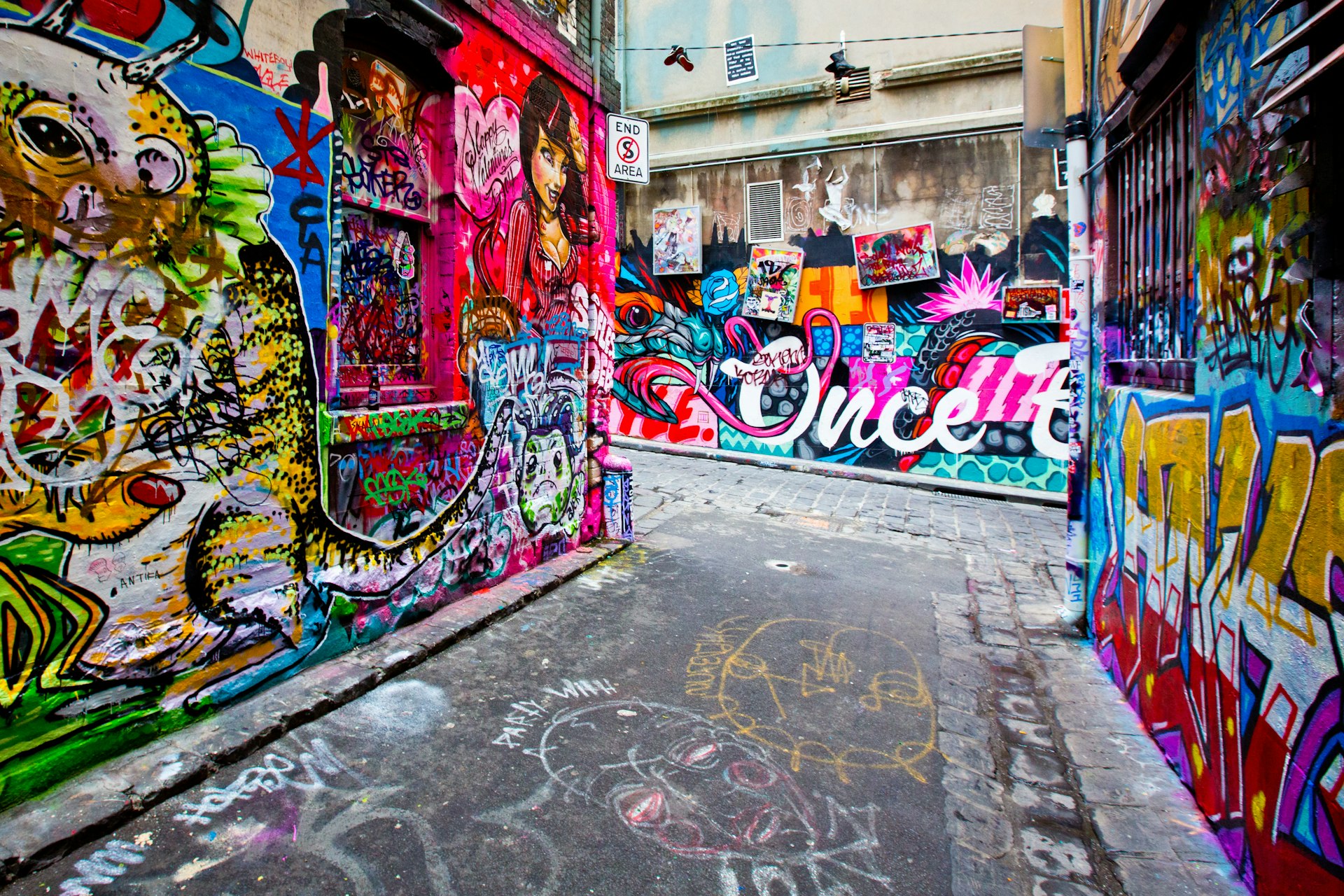
Return to map view, and drop onto Collins Street next to the town hall. Continue east along the street, and then turn right onto Russell Street. Continue south, and then turn left onto Flinders Lane. Continue east along the lane, and you’ll reach Duckboard Place on your right. Wander around using street view, taking in the plentiful urban art. Return to map view, and drop down to end the tour on Hosier Lane ’s photo sphere, one of the city’s most epically decorated alleyways.
Rio de Janeiro, Brazil: Rio Walking Tour
A mélange of historic buildings and skyscrapers, the center of Rio is an intriguing place to discover the essence of the city away from its beaches and mountains. Begin by dropping down onto a street view of the Praça Floriano , a scenic plaza set with several outdoor cafes. Navigate around at street level and take in the views. Proceed north along the Praça Floriano , until you reach the Municipal Theater of Rio de Janeiro , one of the city’s finest buildings, particularly after its $20 million renovation in 2009. Return to map view and drop onto a photo sphere facing the theatre to take in its grandeur.

Return to map view, and drop down onto street view of Largo de Carioca , a bustling area with a small market. Wander around using street view. Facing north, you will be able to see the Igreja São Francisco da Penitência , a 17th‐century church with a jaw‐dropping gilded interior perched up on a hill. Return to map view, and drop onto Rua de Carioca. Navigate west along the road, until you reach a right hand turn onto Praça Tiradentes. Continue north on Av Passos, turning right onto R. Luis de Camores. Along this road on the left you’ll find the Real Gabinete Português de Leitura (Royal Portuguese Reading Room), a historic reading room reminiscent of 19th century Portugal. Return to map view, and drop onto one of its photo spheres to explore the book-lined interior.
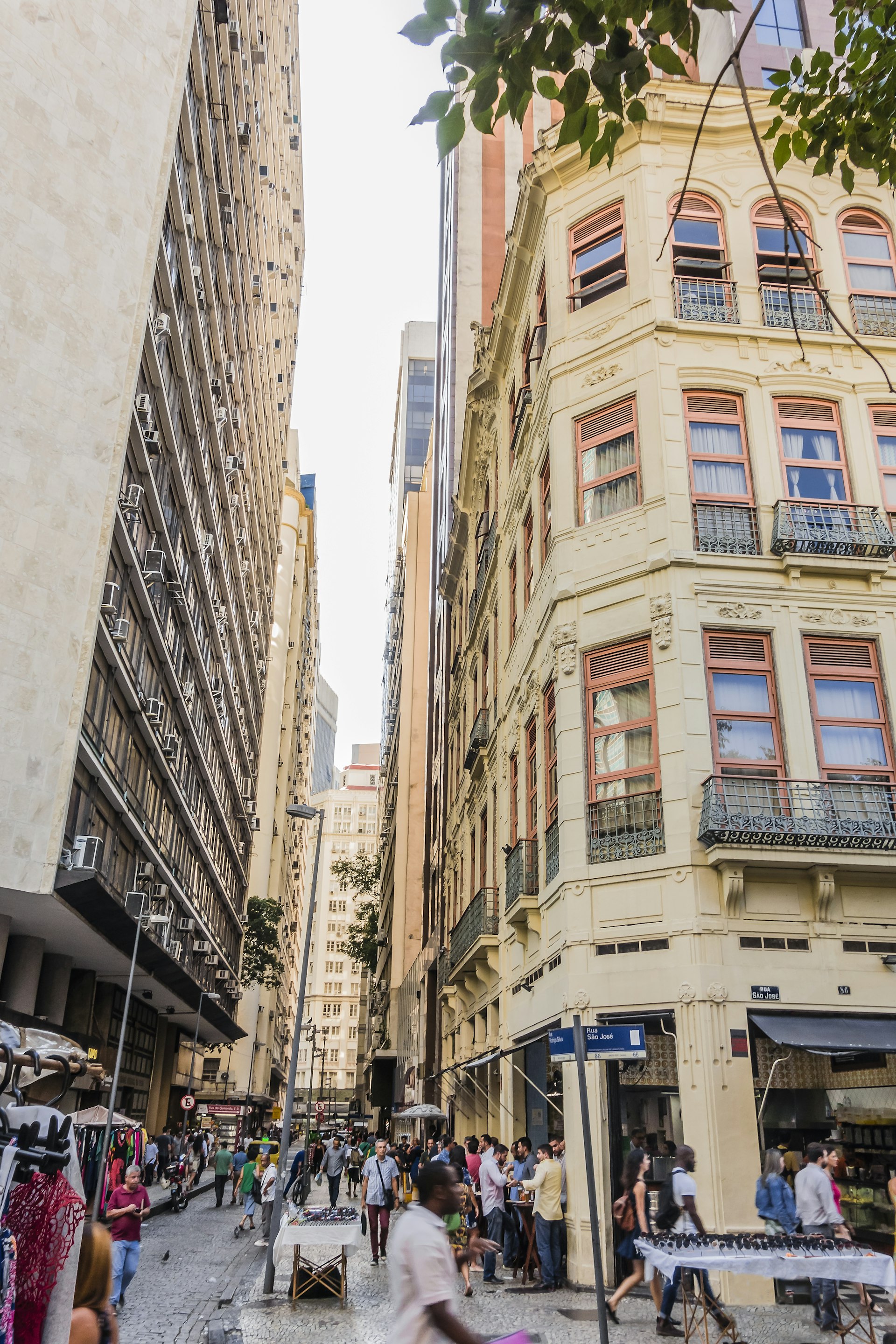
Return to map view, and drop down onto street view by Paço Imperial , once the seat of the Portuguese rulers in Brazil, the building today houses intriguing art exhibitions as well as several cafes. Spend some time exploring using street view. Navigate onto R. Primeiro de Marco, and work your way northwest, until you reach a righthand turn to Largo do Paço. Navigate east until you reach the Arco do Teles . Go through it, and you’ll finish your tour on Travessa do Comercio , one of the centro’s oldest and most charming lanes.
Bangkok, Thailand: Old Bangkok Walking Tour
The bulk of Bangkok ’s ‘must-see’ destinations are in and around the former royal district, Ko Ratanakosin . Start your virtual tour by dropping onto one of the many photo spheres at the Temple of the Emerald Buddha: Wat Phra Si Rattana Satsadaram / Wat Phra Kaew , a vast, fairytale compound that is one of Bangkok’s biggest tourist attractions and a pilgrimage destination for Bhuddists. Have a look around you using the multiple photo spheres on the site. Once you’re done, jump to the Grand Palace , the former resident of the Thai monarch (which is right next door), and do the same.
Return to map view and then drop again at Maha Rat Road. Navigate north until you reach Soi Tha Wang, enjoying the surroundings as you go. Return to map view, and drop down onto the photo sphere spot on Soi Tha Wang, a narrow alleyway holding a hidden classic Bangkok neighbourhood. Return to map view and drop back onto Maha Rat Road. Head north, and find the amulet market on your left, a frenetic handicraft market selling Bhuddist amulets and good luck charms. Return to map view.

Drop again onto Phra Chan Alley, and head east until you reach the gates of Sanam Luang , the ‘Royal Field’, which is an open public square on the edge of Wat Phra Kaew. Return to map view and drop onto the photo sphere on Sanam Luang for a different perspective of the temple. Return to map view and drop again onto Ratchadamnoen Nai Road.
Continue north until you reach the Royal Hotel. Follow the road’s curve east onto Ratchadamnoen Klang Road , considered the Champs Elysees of Bangkok. Continue along it until you reach the 14 October 73 Memorial , commemorating the civilian demonstrators who were killed on 14 October 1973 by the military during a pro-democracy rally. Drop onto a photo sphere to look around. Continue in the same direction and you’ll reach the Democracy Monument on a roundabout, erected in 1932.

Return to map view and drop onto Dinso Road. Continue south and follow the road curve west onto Bamrung Mueang Road. Follow the road until you reach a left hand turn onto Atsadang Road. Continue until you reach a right hand turn to Charoen Krung Road, and head west, stopping to check out Saranrom Palace Park on your right as you go. Return to map view and drop onto any of the park’s photo spheres to look around. Return to map view and drop onto the photo spheres on the tour’s final stop Wat Phra Chetuphon , home of the giant reclining Buddha.
You might also like:
10 of the world’s coolest neighbourhoods , rio de janeiro is named the first-ever world capital of architecture, the best board games for travel lovers, explore related stories.

Tips & Advice
Jun 15, 2024 • 9 min read
Decide where to spend your time in Thailand with this guide to the best places to visit for beaches, wilderness, history, culture and vibrant cities.

May 23, 2024 • 5 min read

Apr 28, 2024 • 6 min read

Apr 25, 2024 • 6 min read

Apr 19, 2024 • 7 min read

Apr 18, 2024 • 12 min read

Apr 16, 2024 • 6 min read

Apr 8, 2024 • 6 min read

Mar 8, 2024 • 10 min read

Feb 23, 2024 • 7 min read
- Social media
- Artificial Intelligence
- Cybersecurity
- Small business
- Software and Apps
- Kim's column
- All shopping
- Kim's Picks
- Find a station

- Kim’s column
- Kim’s Picks
- Get Komando Community – 30 days free!
10 ways to use Google Maps Street View you never thought of before
By Kim Komando
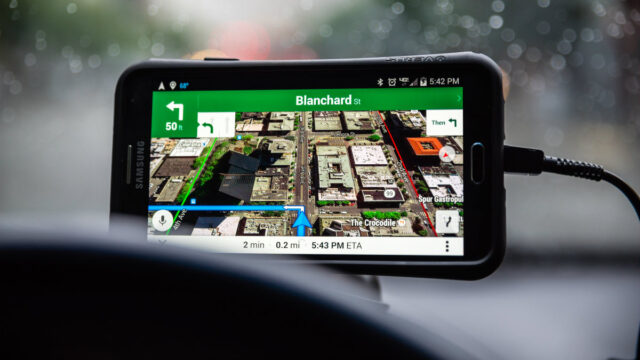
Google Maps and its Street View feature can present some truly interesting sights. Whether you’re exploring an area you want to visit or you’re preparing for a trip, both are invaluable tools.
You never know what you’ll see there, for one thing — and sometimes the sights can be downright shocking. Tap or click here to see how people found shocking pictures on Google Maps.
We’ve compiled 10 very cool things you can do within the confines of Google Maps Street View that you may never have considered. From time traveling to using the app at eye level to explore.
1. Enabling Street View via Pegman
Did you know you can move the tiny yellow figure (also called a Pegman) onto the map to enable Street View? You can access Street View by either searching for an address in Google Maps or Google Search or by dragging the little yellow man to a destination on the map on your computer.
You can do the same on mobile by searching for a place or dropping a pin, then tapping on a place marker. Quick and easy! This takes the guesswork out of looking for a link that prompts you to enter Street View, which can be frustrating to find as it’s not always available.
2. Go time traveling
Did you know you can travel back in time with Google Maps? Using Street View, you can see what a landmark looked like over the years as part of a digital timeline.
To access this feature, look for the clock icon in the upper left-hand portion of any Street View image. Click on it and move the slider that pops up left and right to travel through “time” to see images of a structure in the past and in present. There are various thumbnails you can look through to see how your chosen area looked.
This is done in the same way on your iOS or Android phone. Just look for the clock and use your finger on the slider. Where you’re going, you don’t need roads!
3. Use Street View at eye level
You can pretend to be anywhere you want to be by using Google Street View at eye level with your phone.
This is a phone-only feature, but it’s still very cool to try out. Search on your phone using Google Maps for a location you want to explore. Then tap the image of the location that you see in the lower-left corner of your screen to visit that area.
You’ll be amazed when you bring up the photo and then tap the compass icon in the upper-right corner. If you hold your phone out in front of you and move it around, it’ll be like you have a 360-degree view of the location!
4. Use Live View to explore the real world
If you prefer to feel like you’re right in the middle of the location you’ve pulled up on Google Maps, you’d enjoy Live View . The new augmented reality feature is available for mobile devices that utilize ARKit, so you’ll have to use your phone for this one.
Live View lets you use augmented reality to figure out where you’re going while you walk down the street. It will overlay a compass and signs as you make your way to your next destination and even offer translations.
To use Live View, select your destination in Google Maps and then tap the Directions button. Make sure you’ve selected the Walking directions option, and head outside in a well-lit area. Tap the Live View button next to the Start button and get going. You’ll see icons and other information pop up as you move around in the real world.
5. Create your own Street View stories
You don’t have to rely solely on Google Maps’ Street View images for your own immersive experience. You can actually shoot your very own 360 stories . To do this, however, you need to purchase a 360-degree camera capable of creating these scenes.
Purchase a compatible camera to get started, but keep in mind this can be a pricey venture if you don’t already have pro gear.
6. Look around indoors with Indoor Street View
You don’t have to be outside to use Google Maps Street Maps. You can look around inside buildings as well, but this heavily relies on content creators and businesses having opted into creating maps of their facilities on the inside.
Indoor Google Maps let you zoom in to navigate, tap to switch floors and offer improved location accuracy to know where you’re looking. You can look around the area you’re in, such as a mall, stadium, or airport the same way you would with regular Street View, though this won’t be available with every location.
7. Take a special Street View trek
Not sure where you want to explore with the freedom of Google Maps Street View? Google has already created a variety of trips for you to take online to see some of the coolest areas around the world with Google Treks.
Head over to the official Google Treks website and select the trip you want to take. Click on the area and you’ll be taken to a landing page. Click on the “Discover” button to launch a specially-curated trip you can take from your favorite device.
8. Check out Street View photos
While exploring locations from around the world, you don’t have to stop at choosing what’s available officially from Google. You can rifle through a selection of photos from around the world instead.
Head to the Street View gallery to do this, and you can also look at more 360-degree photos by selecting them in the collection of user-submitted photos. Now you have even more to look at!
9. Explore Google Maps with a keyboard
Did you know you don’t have to rely solely on your mouse or finger to navigate through Google Maps? You can use your keyboard if you’re on a device with one to look around the map.
Use your arrow keys to move around the map, zoom in or out with the plus and minus keys, and press a number associated with the location you want to see to learn more. This won’t work with a mobile device unless you have it connected to a Bluetooth keyboard, but it’s useful on a PC.
10. Turn your Pegman into an alien
You don’t have to use a small little yellow man in Street View. There’s a fun Easter egg that lets you turn your Pegman into a UFO .
Just head to the Area 51 Alien Center in Google Maps and drag your Pegman to the location. It’ll turn into a flying saucer, which is absolutely adorable — and a fun nod to Area 51’s secretive activities.
You can also download a separate Google Street View app in addition to what already comes pre-loaded in the default Google Maps app. This way, you don’t have to switch between modes if you use Street View more often than not. It’s available for both iOS and Android .
While you’re checking out all these cool ways to utilize Google Maps Street View, keep an eye out for interesting finds. You never know when the next thing you see may very well make your day. Tap or click here to see this heartwarming blast from the past a woman discovered while using the service.
Tags: Android , augmented reality , Google Maps , Street View
- Real Estate
- Hospitality
- Architecture
- Factory & Office
- Submit Ticket
- Panoee Features
- Multi-language virtual tour
- Change the Virtual tour Control mode
- Popup Intro
- Publish Google Street View
- Virtual Staging: Day to Dusk effect
- Display Google Map
- Virtual Staging: Add Split Screen Effect
- Delete 360-degree images
- Rename the project
- Share a Project
- Publish Projects
- Set Default View
- Control The Scene View
- Manage Projects
- Create & Manage Scene
- Create new Project
- Add a Form to your virtual tour
- Add Facebook Messenger plugin to your Virtual Tour
- SEO: Title and Meta description
- SEO: Customize SEO thumbnail
- Add a Call to action (CTA)
- Update Favicon
- Setup Brand Logo
- Setup Google Analytics for your virtual tour
- Edit Hotspot Compact
- Customize the Polygon hotspot appearance in bulk
- Hide Title on Preview Box (When Hovering) in bulk
- Hide Preview Box (When Hovering)
- Hide the Title on the top of the hotspot in bulk
- Fix the position of your hotspot in bulk
- Edit hotspot Media Text
- Edit hotspot article
- Edit hotspot Tour Guide (Green screen)
- Use Last Config
- Customize Polygon Color
- Edit hotspot Polygon
- Change the color of your Hotspot in bulk
- Edit hotspot Product
- Edit Hotspot Link
- Edit hotspot sound
- Edit hotspot Video
- Edit hotspot Image
- Edit hotspot Media – Image
- Edit hotspot Media – Video
- Edit Hotspot Street Direction
- Manage Hotspots
- Link Scenes with Navigation Hotspot
- Turn on the Panoee notification on your browser
- Manage Profile
- Change Password
- Forgot Password
- Panoee S3 Hosting Tutorial
- How to Export a virtual tour?
- Author name and Copyright
- Custom slug
- Add a password to your virtual tour
- Embed Virtual Tour to website via iFrame
- Setup Custom Domain
- Integrate Tour 3D in WordPress
- Customize the Control bar interface
- Customize Popup Color
- Select Theme & Customize Color
- Set up Default Projection
- Change the virtual tour location
- Change the virtual tour Category
- Add Background Sound to your virtual tour
- Set up the initial view of your virtual tour
- Make a Virtual Tour Description pop up
- Collaboration mode: Team-working Virtual Tour
- Add Nadir Logo at bottom of Virtual Tour
- Setup Auto Rotate effect
- Setup Auto Change Scene effect
- Manage Floorplans
- Manage Products
- Manage Posts
- Show / Hide Scene from Scene List
Step1: Upload your 360-degree images
Panoee makes it easy to create a virtual tour. You only need 360-degree photos of your location. You can use any 360-degree camera compatible with Google Street View to capture these images. Be sure that your photos are well-lit and clear. They should also cover the entire area you wish to show in your virtual tour.
Click on “Create a new project” in the Studio to upload your images. Click on “Upload Media,” enter a project name and description, then click the button. Upload as many images at once as you like. They will appear as thumbnails within the Studio. You can also drag and drop images from your device or computer.
Step 2: Make the connection
After you upload your images, connect them together to create a seamless virtual tour. Drag the Scene to your Scene by dragging it from the left sidebar.
You can also Drag and drop Scenes to arrange them the way you want on your virtual tour.
Step 3: Add a Heading and Locate
The Scene heading indicates how much it rotates clockwise from north. For example, a heading of 0 degrees means the map points north, while 180 degrees means the map points south. By adding them, you can easily see the orientation of your scene as you rotate it.
Use the map tool in the GSV tab to adjust the position and its direction. Just click on each marker and rotate it.
Step 4: Publish to Google Street View
After you have connected all the scenes and added their headings, you can publish your virtual tour to Google Street View by clicking on the “Publish to GSV” button. Please be patient, as it may take some time.
Whenever it’s done, you can click this link to view it.
Watch the full tutorial here:
--> 651 NBroad St, Suite 201, Middletown, New Castle, Delaware.
--> +84 96-561-5905
- 360 Tour Builder
- 11 Hotspot Types
- Publish 360 Virtual Tour
- Marketing Virtual Tour
- 360 Photography Portfolio
- Customize Design & Brand
- Virtual Staging
- 360 Panorama Cloud Storage
- Collaboration
- Multi-Language

- App Development
- Web Development
- Branding & Design
- Custom Integration
- ESG Reporting & Materiality
- Salesforce & Service Now
- Ranktoday - Marketing
- Case Studies
- Book a Call

Explore topics
Google Street View Inside Your Business: A Guide to Virtual Tours
What is Google Street View?
Google Street View is a feature on Google Maps that allows users to view panoramic images of streets and locations around the world. It was first introduced in 2008 and has since become a popular tool for exploring new places and getting a feel for different neighborhoods. With Street View, users can virtually walk down streets, explore landmarks, and even enter some buildings. In 2012, Google introduced Google Street View Inside, which was later known as Google Business Photos. This feature allows businesses to showcase the inside of their establishments on Google Maps.
Google Street View Inside
Google Street View Inside allows potential customers to take a virtual tour of the inside of your business. This feature is produced by professional Google Trusted Photographers whom Google accredits for uploading quality images of the inside of your location-based business to Google Maps. This imagery allows potential customers to see your displays, products and all the aspects of your business you want people to see. By using Google Street View Inside, you can enhance your business visibility and boost your local search rankings.
Virtual tours, such as Google Maps Street View, can have a big impact on a business. Research shows that those who view a virtual tour are twice as likely to visit the store in person, which can increase foot traffic and ultimately boost sales.
Why Google Street View Inside Your Business is Beneficial?

- Provides an immersive and user-friendly experience for customers
- Increases online visibility and enhances business reputation
- Helps customers plan their visit and find answers to their questions
- Offers a unique perspective of the business location and facilities
- Boosts passive marketing efforts by providing 24/7 access to the business
- Increases customer trust and authenticity of the business
- Encourages customer engagement and interaction with the business.
Show Your Business to Customers
Location is a critical aspect of any business, but it's not always easy to move your physical location closer to your customers. However, with Google Maps Street View, you can show your business to customers virtually. By using the 360 Google video feature within Google Street View, you can create a virtual tour of your business that is linked to Google My Business. This allows customers to get to know your business without ever leaving their home or office. It's a great way to enhance your online presence and attract new customers.
Be More Memorable
Consumers make their buying decisions before they leave home, so it's important to make a lasting impression online. By showcasing your business through virtual tours and Google Street View, you can help potential customers remember your business and increase the likelihood of them visiting.
Here are some ways to be more memorable:
- Provide a virtual tour of your business on Google Maps to give customers a feel for what it's like before they arrive.
- Use Google Street View to show off the exterior of your business and make it easier for customers to find you.
- Utilize high-quality photos and videos to showcase your products or services and create a lasting impression.
By making it easy for customers to find and remember your business online, you can increase the likelihood of them becoming loyal customers.
Your Kind of Customer
By using 360 Google Business View, businesses can attract more visitors who are already interested in their products or services. These visitors are pre-qualified, as they have already seen the indoor maps of the shop/showroom and know exactly what they are looking to buy. This can increase the chances of these visitors becoming paying customers.
Be a Trusted Supplier
Giving customers an inside view of your business can help them develop trust in your brand. By showcasing your business branding and carefully designed displays through virtual tours, customers can experience your space almost as if they were there in person. This can ultimately lead to higher customer satisfaction and loyalty.
Rank on Google
Google Street View Inside can improve website rankings on Google. Websites with Google 360 view photography embedded are more likely to appear higher in search results. Listings with 360 photos and virtual tours are twice as likely to attract potential customers. Therefore, it is recommended to have Google 360 view photography embedded on your website to improve website ranking and generate more interest from potential customers.
How does Street View for Business work?
To get Street View inside your business, you need to follow these steps:
- Contact and book a Google Trusted Photographer to shoot your business.
- Prepare your business and inform your employees about the photo shoot.
Once the photo shoot is complete, the photographer will upload the images to Google Maps. The images will be stitched together to create a 360-degree virtual tour of your business. This tour will be visible on Google Maps, Google Search, and Google+ Local.
Having Street View for Business can help improve your online visibility, boost your SEO, and increase customer trust.
How Long Does the Photography Take?

The time required for photography depends on the size of the business. For small shops, it takes around 2.5 hours to shoot fully. This ensures that all areas are covered by the individual panoramas shot with the specialist 360 photographic equipment. It is also possible to book professional static imagery shots of your business premises or professional headshots at the same time. On the other hand, large offices, depots, hotels, cathedrals, or university campuses might take several days or weeks, depending on their size.
Technical Wizardry
After the professional shoot, the images are processed using specialist software to create a set of panoramas that form a virtual tour. Third-party software is used to connect to Google Maps, joining the individual images to create a continuous navigable Street View virtual tour. Once the processing is complete, a guide is provided on how to embed the virtual tour into a website. Alternatively, the details can be passed directly to the webmaster or IT team. This technical wizardry ensures that the virtual tour is seamlessly integrated into the online presence of the business.
Google Trusted Photographers
Polyuno , a team of experienced professionals, has been awarded Google Trusted Photographer status for their high performance and experience. Polyuno, is dedicated to providing high-quality 360-view images that improve marketing and deliver business results. Clients can trust Polyuno for their expertise in delivering the quality expected from a Google Trusted Photographer.
Polyuno Service
Polyuno offers complete guidance for businesses looking to establish their online presence with Google My Business. They provide assistance with establishing, verifying, optimizing, and publishing your Google My Business page. They schedule photo shoots around your business and process and upload your virtual tour to your Google My Business page. Polyuno is happy to assist with website integration, Facebook embedding, and social media sharing. They also provide fun and interactive Facebook 360s for Facebook posts.
More from the blog

Acumatica Implementation: The Ultimate Guide to Successful Deployment

Salesforce Integration Capabilities: Enhancing Your Business Efficiency

What is Integration in Salesforce: A Clear Explanation


Gogle Maps: How to use the Immersive View feature
When you want to go somewhere, use Google Maps to find your way. Google Maps has become synonymous with navigation, whether you use an Android smartphone or a Wear OS smartwatch . Google continues to add innovative new navigation experiences, one of which is Immersive View.
Immersive View creates 3D renders of buildings, landmarks, and other items of interest to better represent the world around you. This feature started as a way to see sites and places you're going but is now available while navigating. This guide details how to use Google Maps Immersive View to navigate.
What you need to know about Google Maps Immersive View
Immersive View uses computer vision and AI to stitch together billions of Street View and aerial images into a 3D model of the world. This gives you a multidimensional experience, letting you preview bike lanes, sidewalks, intersections, and more.
While Immersive View may sound similar to Google's AR maps feature called Live View, it works differently. Live View uses your phone's camera to keep you on track. Immersive View lets you virtually fly over a location to get a sense of the traffic and how busy it is.
Another difference between Immersive View and Live View is the former's ability to see into the future. Immersive View has a time slider that lets you see how a location looks at different times of day or in various weather conditions.
Immersive View is available while driving, walking, and cycling, but only in 15 cities. The included cities are Amsterdam, Barcelona, Dublin, Florence, Las Vegas, London, Los Angeles, Miami, New York, Paris, San Francisco, San Jose, Seattle, Tokyo, and Venice.
How to use Immersive View in Google Maps
You can explore new places using Immersive View in Google Maps, but only if they are located in one of the 15 supported cities. You can use the feature on Android and iOS devices. We use an Android phone in this tutorial.
- Open Google Maps .
- Tap the search bar at the top and search for a landmark in one of the supported cities. For example, the Eiffel Tower.
- Tap the Immersive View card from the pop-up menu at the bottom of the screen. Close
- Explore the location like you usually do on Google Maps and Street View.
- Tap the Time & Weather icon at the bottom to see how the location looks at different times of day. It also shows the weather forecast for the next few days. Scroll left and right on the slider at the bottom to see the scenery change as the weather changes throughout the day. Close
Immersive View lets you tour an establishment from the inside, although this function is limited to a handful of locations. When you're inside a building, you'll use a joystick to navigate. Pull it up or down to move forward or backward.
Immersive View isn't available on the desktop version of Google Maps. Use the mobile app to take advantage of this feature.
How to use Google Maps Immersive View while driving
Immersive View on Google Maps shows what your route looks like before you start your trip, including bike lanes, sidewalks, intersections, and parking. This feature is available for driving, walking, and biking directions. It also shows you what traffic will be like at different times of day.
- Search for your destination from the search bar at the top.
- Select your destination from the results and tap Directions in the lower-left corner. Close
- Choose the mode of transportation (driving, cycling, or walking).
- If the Immersive View feature is available, you'll see a button to launch it. Tap the button to preview every step of your journey. The preview may take a moment to load because it's streamed from the cloud. If you don't see a button, check later.
Get immersed in Immersive View
Immersive View is a neat feature that can make navigation and planning easier. It lets you preview or explore a new place and makes planning a visit easier. While Immersive View is a great feature, Google Maps has numerous other features that improve your navigation experience .

Google Maps may not offer scenic routes because it could be too 'biased'
Scenic is subjective

UPDATE 6/18: a Google spokesperson said “This person left in 2021 and publicly stated they weren’t a decision maker – their posts don’t reflect the reality of product decisions for Google Maps, back then or now. In fact, we’ve launched many features to help people understand a route or find a scenic area – including Immersive View for routes which lets you explore places along the way, and the ability to search for “scenic spots near me” anywhere in the world. We’ll keep working on these types of features in the future.”
Original story follows:
According to a recently deleted post on X, Google Maps doesn’t offer a scenic route option due the risk of income loss in poor areas.
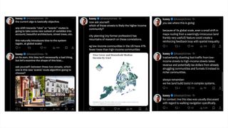
The thread in question comes from Kasey Klimes , who worked as a Senior UX Researcher for Google Maps between 2017 and 2021. He starts by stating that the current Google Maps algorithm is objective, and that any “shift towards “nice” or “scenic” routes is going to take some new subset of variables into account.”
The issue with this is that programming "scenic" variables would add an inherent bias into the system that would likely predominantly direct users through high-income areas due to the prevalence of those variables, for instance beautiful architecture or tree-lined streets.
This bias would then lead to Maps “inadvertently diverting foot traffic from low-income streets takes [and] tax dollars from struggling communities and funnels it instead to richer communities.”
Klimes' thread (screengrabbed below) has now been deleted, and his X account is now locked. This is possibly due to intense attention from other users who disagree with his justifications, or perhaps Google intervened since it doesn't want its development secrets being given away by ex-staffers.
Sign up to get the BEST of Tom’s Guide direct to your inbox.
Upgrade your life with a daily dose of the biggest tech news, lifestyle hacks and our curated analysis. Be the first to know about cutting-edge gadgets and the hottest deals.
Google only recently added generative AI to Maps, with a purpose of learning user preferences and then helping to identify suitable spots, regardless of how complex the request is. This was improved again with a new feature that analyzes EV charging station reviews and uses the information to better direct users.
Google will need to add more new features for walkers soon however, as Apple is working to make its Maps app far more appealing to hiking fans. It was revealed that iOS 18 will let users create and save trail routes with turn-by-turn directions, and download them for offline viewing. It additionally supports popular trails at all 63 U.S. National Parks.
If you happen to be a fan of walking then perhaps have a look at our list of the best smartwatches , a key tool for anyone who likes to wander. With the new features coming to Apple Watches in watchOS 11 there has never been a better time to pick one up.
More from Tom's Guide
- Google is finally working on auto-launch for Play Store downloads
- Force stopping an Android 15 app will also temporarily kill its widgets
- Forget Apple Intelligence — Google’s bringing Gemini AI to Pixel 8 and Pixel 8a
Josh is a staff writer for Tom's Guide and is based in the UK. He has worked for several publications but now works primarily on mobile phones. Outside of phones, he has a passion for video games, novels, and Warhammer.
Stay cool with potential new Pixel feature that prevents overheating
Google Maps may about to drop a feature that connected you to places and businesses
Netflix just got my favorite drama movie of the last five years — and it’s 96% on Rotten Tomatoes
- RufusVS I recall years ago one of the mapping apps was going to show relative crime rates in different areas, and it was cancelled for pretty much the same reason. It is a tough call. New Yorkers know what neighborhoods could be dangerous for a jogger or cyclist, but tourists have no way to know. But it will be a self-fulfilling prophecy if it was allowed. No good solutions. Reply
- View All 1 Comment
Most Popular
- 2 I’ve been using smart appliances for years now — but do I really need them?
- 3 7 prompts to get the most out of Microsoft Copilot
- 4 iOS 18 Notes — 5 biggest changes coming to your iPhone
- 5 Today's NYT Connections hints and answers — Saturday, June 22, #377
Where will the Celtics championship parade travel? See the route map.

The Boston Celtics are once again NBA champions , and the storied duck boat parade is returning to Boston’s streets.
On Friday, the duck boats will ferry the Celtics players, coaches, and staff from TD Garden to Hynes Convention Center beginning at 11 a.m. The route will take them from Causeway Street to Boylston Street, passing by City Hall Plaza and the Boston Common.
Celtics parade 2024 route map
The parade will run from in front of TD Garden on Causeway Street, following Staniford Street to Cambridge Street, which becomes Tremont Street, and then along Boylston Street until the duck boats reach the Hynes Convention Center.
Here’s a look at the route.
Celtics parade in Boston: What you need to know
- Date and time: Friday, June 21 beginning at 11 a.m.
- Location: The parade route will run from in front of TD Garden on Causeway Street, past City Hall Plaza and the Boston Common on Tremont Street, and end on Boylston Street by the Hynes Convention Center.
- Forecast: The temperature is expected to be in the mid-80s. Keep up with the latest forecast here .
- Getting there: Wu urged residents to take public transit on Friday as the MBTA will be increasing service on all transit lines. Parking on certain streets in the West End, Downton, and Back Bay will be closed just after midnight on Friday morning, Wu said.
Road closures and T service during the Celtics parade
Streets along the parade route will be closed starting at 9 a.m. Parking will also be heavily restricted in the areas surrounding the parade route. For a full list of street that will be shutdowns and parking restrictions, visit the city’s website.
Advertisement
Wu urged fans to use public transportation to get downtown. The MBTA will provide increased service and modified Commuter Rail schedules to accommodate the anticipated large crowds. For more information, visit the MBTA’s website.
Read more about the parade in our guide here.
Christina Prignano can be reached at [email protected] . Follow her @cprignano . Emma can be reached at [email protected] or on X @_EmmaHealy_ .

IMAGES
VIDEO
COMMENTS
Bringing your map to life, one image at a time. Street View stitches together billions of panoramic images to provide a virtual representation of our surroundings on Google Maps. Street View's ...
Thankfully, there are tools that can change that. Here are five of the best. 1. Animated Route Maps. First on this list is Animated Route Maps. Animated Route Maps is a web service which allows you to map out a route on Google Maps and then experience the route via Street View.
Explore Tours in Google Earth. ...
Virtual tour. Explore panoramic views of famous sites in 360˚ Street View tours. Explore Mikhail Bulgakov Museum. Explore NATIONAL PALACE OF SINTRA. Explore Château de Vaux le Vicomte. View all. Take a virtual tour of the some of the world's greatest museums and heritage sites.
Create and publish your own Street View imagery. Capturing new neighborhoods, tourist hotspots, and local businesses has never been easier. Simply choose your camera, collect your 360 videos, and ...
Trek the world with Google Maps. Take a Street View journey to sites of cultural, historical, and geographic significance.
Here's how to use it on Android or Apple devices: On your phone or tablet, open the Google Maps app. In the search bar, enter a destination and select Walking . Once your destination is located on ...
Google Tour Creator. In Spring 2018 Google launched their VR Tour Creator. This free tools lets anyone create their own virtual tour that can be viewed on a computer, tablet, or phone web browser, or using Google Cardboard. When creating a tour, one has the option on utilizing any of the street-view images on Google Maps, or uploading their own ...
Take a virtual travel day with Street View. May 19, 2020. 7 min read. V. Valentina Frassi. Program Manager, Street View. Listen to article. As a program manager for Street View, I've had the opportunity to work in more than 20 countries around the world, collecting imagery that transports people to new places and powers Google Maps.
With Tour Creator you can use your own 360 photos, or if you'd prefer, you can choose an image from Google Street View's extensive library. It's super easy to share your tour once you're done by posting it to Poly, Google's library of 3D content. Anyone can experience it with just a URL, so you can embed the Tour to your company's ...
Google Arts & Culture features content from over 2000 leading museums and archives who have partnered with the Google Cultural Institute to bring the world's treasures online.
1. On the Street View app, go to the Profile tab. 2. Select the photos you want to connect and tap on the upper right corner and select "Move and connect photos.". 3. On the next screen, you'll see all the photos on a map. You'll then have to position each node in the correct location vis-a-vis each other. 4.
Google street view virtual tour software is a set of tools that enable you to create and publish immersive 360-degree tours of any place on Google Maps. You can use this software to showcase your business, promote your destination, or share your cultural heritage with the world. You can also use it to help cities monitor road traffic, assess ...
With our updated Street View app on Android, it's now easier than ever to collect your own Street View imagery and put it in the right place on Google Maps. Using our new connected photos tool in the app, you can record a series of connected images as you move down a street or path. These images are captured using ARCore, the same augmented ...
How to work with GoThru StreetBuilder to publish a 360 video to Google Street View from Alin Bugeag GoThru on Vimeo.. Here's the press release: GoThru launches StreetBuilder to bring Google Street View up to date. The team behind GoThru - the first professional moderator that allows users to create a constellation out of panoramic images and publish as walk-in tours directly to Google ...
Driving, biking, hiking, or rowing in Google Street View. Go sight-seeing around the world without burning fosil fuel. To start the journey, you may click a link in the extension menu for a quick start. You may start the journey from a Google Street View page of your choice by clicking "Go!" button on this extension.
6. Bathe in La Sagrada Familia's lights without the crowds. Let your jaw drop as you enter the main chamber of La Sagrada Familia. This might be your only chance to witness the church's famous tree-like columns, shimmering lights and vertigo-inspiring views without having to join a herd of gawking visitors. 7.
Editor's note: Starting today, you can now explore the International Space Station in Street View in Google Maps. Thomas Pesquet, Astronaut at the European Space Agency (ESA), spent six months aboard the International Space Station (ISS) as a flight engineer.He returned to Earth in June 2017, and in this post he tells us about what it's like to live on the ISS and his experience capturing ...
There are several virtual tour software options available, including Matterport, Cupix, and Google Street View for Business. Once you've created your virtual tour, you're ready to move on to the next step. #Step 2: Upload Your Virtual Tour to Google Street View To upload your virtual tour to Google Street View, follow these steps: 1. Open ...
Access Google's headquarters by train and bus instead of driving. Take either the number 32 or number 40 Mountain View city buses to the Googleplex. Both buses also have stops close to the San Antonio Caltrain station, allowing you to get to Google's headquarters from San Francisco, San Jose, or South Bay.
5 city walking tours you can take right now on Google Maps. Emily Frost. May 4, 2020 • 10 min read. Lonely Planet has created five walking tours for Google Maps ©Shutterstock. It's undeniably one of travel's greatest pleasures; wandering the streets of a whole new city, soaking up its character and exploring its hidden wonders on foot.
Google Maps and its Street View feature can present some truly interesting sights. Whether you're exploring an area you want to visit or you're preparing for a trip, both are invaluable tools.
Step1: Upload your 360-degree images. Panoee makes it easy to create a virtual tour. You only need 360-degree photos of your location. You can use any 360-degree camera compatible with Google Street View to capture these images. Be sure that your photos are well-lit and clear. They should also cover the entire area you wish to show in your ...
In 2012, Google introduced Google Street View Inside, which was later known as Google Business Photos. This feature allows businesses to showcase the inside of their establishments on Google Maps. Google Street View Inside. Google Street View Inside allows potential customers to take a virtual tour of the inside of your business.
What you need to know about Google Maps Immersive View . Immersive View uses computer vision and AI to stitch together billions of Street View and aerial images into a 3D model of the world.
#livedrawsydney #sydney #livedrawsdyLIVE DRAW SYDNEY | sydney walk tour with talk - Crazy Gangnam night street walk |🔴 LIVE DRAW SDY🎼 | Listen on Spotify, ...
A recently deleted thread on X has claimed that Google Maps won't offer scenic walking route option due to the bias this could introduce into the app. ... 130 West 42nd Street, New York, NY 10036. ...
Date and time: Friday, June 21 beginning at 11 a.m. Location: The parade route will run from in front of TD Garden on Causeway Street, past City Hall Plaza and the Boston Common on Tremont Street ...