Traffic dashboards
- Auckland (external link)
- Waikato (external link)
- Bay of Plenty (external link)
- Hawkes Bay (external link)
- Taranaki (external link)
- Manawatū-Whanganui (external link)
- Wellington (external link)
- Canterbury (external link)
- Otago (external link)
View the non-mobile page
(C) 2020 Benjamin John Paul
Auckland Traffic Information
Plan ahead and look before you leave at these sites for up-to-the-minute traffic information:
Traffic congestion map
The Auckland Transport congestion map gives you at-a-glance information to help you plan your journey. On the map you can look at different parts of Auckland and zoom in to see congestion on more streets.
Most information on the map refreshes every minute so you'll always have up-to-date information to help you decide if you should hit the road, stay put until traffic is flowing better or choose another transport option .
Click here or on the map to go to the site.
You can also view the traffic webcams , the journey time signs , and the messages on the motorway electronic signs on the map. A separate map shows road works .
Auckland state highway info
Find out the latest conditions of Auckland state highways and those in the rest of the country on the NZTA website. You can check for updates of delays, detours and closures, and check for any general travel warnings that may apply. Please note, NZTA only publish events that they have verified and that are likely to cause a delay of 20 minutes or more.
Click here or on the map to go to the highway info page.
The NZTA website has a dedicated section on Auckland traffic . This shows the conditions on the motorways including traffic flow , the webcams , traffic speed , and the travel time signs . You can also download an up-to-the-minute traffic bulletin for the motorways in pdf format.
You can also receive travel alerts from NZTA by email for your favourite routes or regions. Click here to visit the “On the Move” website and subscribe.
Overnight motorway closures
Repairs and maintenance are done somewhere on the motorway network most nights. They typically start at 9pm and finish at 5am. Work that is delayed by bad weather is completed on the next available date, often the next night.
Weekly lists of closures are published by Auckland Motorways who maintain the network. Click here to see this week’s list.
You can sign up for a weekly list of closures by email. Click here to send an email if you would like to subscribe.
When you are travelling you can get information from the electronic signs on the motorway, the estimated journey time signs before the motorways and on some city streets, and on the radio. Newstalk ZB broadcasts Timesaver traffic reports on 89.4FM and 1080AM. The reports can also be heard on the web - click here to listen now.
Copyright 2014. Inquiries to [email protected]
Public Transport enquiries: (09) 366 6400
Parking enquiries: (09) 355 3553
Contact Numbers
Auckland Transport: General enquiries: (09) 355 3553
Auckland Motorways: Request a repair or maintenance on Auckland’s motorways: (09) 520 0200

The motorways are finished
After seventy years, Auckland’s motorway network is finally finished.
In July 1953 the first section of motorway in Auckland was opened between Ellerslie-Panmure Highway and Mt Wellington Highway. The final stage opens to traffic this week with the completion of the motorway part of the Northern Corridor Improvements project .
Aucklanders are one step closer to a more resilient state highway network as the direct link from State Highway 1 (SH1) to State Highway 18 (SH18) is set to open early next week. One of the final stages of the Northern Corridor Improvements project, the two-kilometre link between SH1 and SH18, including an underpass also officially completes the Western Ring Route, providing a seamless and robust alternative to SH1. “Reliable journey times for people and freight will be a bi-product of the work that has taken place across multiple years and projects to improve the resilience and performance of Auckland’s transport network, protecting our infrastructure against the elements and providing a choice for people who need to get around Auckland” says Stephen Collett, Regional Manager Transport Services Waka Kotahi. “The direct motorway link from SH18 to SH1 which was opened last month has already established a seamless transition for motorists travelling from the west to the north and the opening of this underpass will do the same in the other direction.”

The modern motorway network is thankfully quite different from what was proposed in the 1950’s and 60’s. Back then the plans also included proposals like the Eastern Motorway, a motorway down Dominion Rd, a Henderson motorway, a bridge from Point Chev to Kauri Point then up to around Constellation Dr. Interestingly, the SH18 connection that has just been completed was never on these old plans.

Some of those old plans even called for fully ringing the city centre in motorways, including an elevated motorway down Quay and Fanshawe streets.

The completion of the SH1-18 link is a big achievement and it’s somewhat fitting that the project that delivered this final section of motorway in Auckland was perhaps also the most multi-modal project we’ve seen. Last year it delivered the Northern Busway extension from Constellation Station through to Albany Station and parallel walking and cycling paths are also due to open soon.

If all of our previous motorway projects had also delivered first-class public transport and active mode infrastructure at the same time, our city would have a lot more options in how we all get around. Notably, the need for alternatives was even called out by the original planners of our motorway system .

While there are some other motorway projects around, such as the Puhoi to Warkworth project which is due for completion later this year, this should really be the last motorway project within the urban area and it is critical that the focus shifts to how we deliver the missing public transport and active modes. Only by building complete networks will we truly give people viable, congestion free options.

Given we’ve only really been working on the rapid transit system for the last 15-20 years, let’s hope it doesn’t take another 50 to complete it.
- Click to share on Facebook (Opens in new window)
- Click to share on Twitter (Opens in new window)
83 comments
There is still a plan to have a SH18 to SH1 link southbound. The just completed works are apparently future proofed to allow for this – although I can’t see how.
WK don’t want to complete this until the second Waitemata crossing is in place because they don’t want to slow the Northern motorway down preferring to have the local roads clogged with traffic.
The Western Ring road isn’t actually a ring until they build the missing two ramps. The delay isn’t based on economics or common sense but on a WK idea that they do long distance trips.
Who exactly would the southbound/westbound connection to the Northern motorway serve? Surely any traffic would be better served taking the western motorway into the city? And if the destination is the North Shore then leaving the motorway at constellation seems to be perfectly reasonable
Not everyone wants to go into the CBT. How about someone wanting to go from say Hobsonville to Takapuna, Northcote, or similar. You may think that its perfectly reasonable to leave the motorway at Constellation. Pray tell me whats reasonable about having to travel through suburban roads when a perfectly good SH1 / motorway goes to the same destination.
So far as im aware, the new connection is meant to be an alternative north south route. Not an east west connection. So a southbound connection from the northwestern to the northern is actually not helpful and im not sure what connections its actually meant to serve either. Who transits from Northwest to the city center through the North Shore anyway?
Might be useful for people living in Greenhithe/Beach Haven?
Well more Greenhithe I guess.
Yea before they build the south bound ramps they have to add an extra lane southbound from constellation to northcote including widening a couple bridges, and further I think the 2nd harbour crossing will be prioritised.
they need to widen this section of motorway from constellation to tristam to 3 lanes regardless of the southern ramps as this is a major constriction point. The congestion through this pinch point from 3-2-3 is horriffic and has not been improved by the project at all. Kinda defeats the whole purpose as the southbound traffic gets backed up. Not a huge amount of traffic is heading westbound from the nothern.
I think they rather the congestion there than further down the motorway. However I agree 3 lanes should be the minimum.
Now we just need congestion pricing!
Getting our public transport network working roughly as well as it did back in 2019 would also be nice.
Until that happens (and also until building bike lanes on streets stops being as horribly taboo as it is now), adding congestion pricing amounts to pure cynicism.
No, it doesn’t. Everyone pays the congestion charge price now anyway. Just in the form of time spent waiting in a queue like we’re all waiting in a soviet breadline.
Do you think there are a lot of people in those lines who currently do not need to travel at rush hour?
As far as I understand such schemes overseas work partially because people are able to switch to alternative modes of transport. If we introduce congestion charging here, we should at least stop being so openly hostile to people switching modes.
Congestion pricing makes NZ politicians weak at the knees! A map of Wellington shows an ideal way to do it there, but 10 years later than it would have relieved a lot of congestion woes there LGWM ( Let’s get Wellington Moving) has spent millions of yet more reports, there is virtually nothing to see diferrant when visiting the capital. Could it take 5, 10 or 20 years to get it implemented in Auckland?
The Kumeū-Huapai SH16 bypass will end up being a motorway. Putting my money on it now.
Yup, residents are being notified as we speak, huge earthworks and interchanges planned
Docs are here
https://www.aucklandcouncil.govt.nz/plans-projects-policies-reports-bylaws/our-plans-strategies/unitary-plan/auckland-unitary-plan-modifications/Pages/details.aspx?UnitaryPlanId=183
Detailed plans for a 4 lane motorway here. I wonder how the provision for the rapid transport corridor is coming along
https://www.aucklandcouncil.govt.nz/UnitaryPlanDocuments/08-s1-general-arrangement-plans-alternative-state-highway-part-1-of-2.pdf
https://www.aucklandcouncil.govt.nz/UnitaryPlanDocuments/09-s1-general-arrangement-plans-alternative-state-highway-part-2-of-2.pdf
Good grief, it doesn’t need 4 lanes, just a bypass.
Has more traffic than either Transmission Gully or the Waikato Expressway and more than Puhoi-Warkworth will.
Should’ve been built as the Westgate-Brigham section was nearing completion. That said what a clusterF… it looks like a good 500m section of that motorway will simply be destroyed with the new extension following a different alignment. That’s a good $100m + down the drain right there.
If twe’re going to build a big bypass, at least take the opportunity to produce a masterplan for Kumeū and Hupai, inculding passive provision for rapid transit and a de-tuning of Main Road. There’s a huge opportunity for it to be a better main street when it no longer has a strategic traffic movement function.
Unfortunately, I have never seen a former state highway in NZ be de-tuned following a bypass (e.g. SH1 Huntly, SH1 Porirua) but there has to be a first time for everything.
@Paradise_City Upper Harbour Drive used to be SH18 before the Upper Harbour Motorway was built so I guess that would count as a de-tuning – speed limit reduced to 60 and bike lanes installed.
Manukau Station Road (formerly Wiri Station Road) through Manukau City Centre used to be SH20 before the SH1-SH20 link was built and now has protected bike lanes and bus lanes and a major transport hub (Manukau Station).
Agree with your Huntly and Porirua examples, there is opportunities there for placemaking by redesigning the old SH1.
I guess Orewa has been detuned since the SH1 bypass, a number of crossing and slow speeds in the township now. Bit of a streetscape makeover in fact.
There’s a newly upgraded heavy rail line running right through the middle of Kumeu, Huapai, Waimauku, and Helensville. Yet the powers that be have an irrational myopic mindset that you can’t use it as it would ruin the business case for a some time in the nevernever light rail or a still a long way off busway. The rail is there, the trains are there (ex-Pukekohe DMUs). They have a range of totally BS excuses (no it doesn’t need double tracking anytime soon – save possibly a small cheap passing loop). Also LR/BRT does nothing for Waimauku/Helensville etc if it is ever even built.
I suspect the roads to the eastern suburbs will get widened so many times they will end up as motorways.
“basic importance”
Yup, ie the need for full viable alternative networks is not even up for debate as necessary for the city, and especially, this traffic system, to work efficiently.
Shame then the record of advice from the technocrats and funding decisions by politicians have largely failed to deliver this basic need.
OK, but why aren’t they properly addressing the long ago proposed motorway. Instead of spending money narrowing roadways, and making traffic break the laws in driving habits. It’s about time these decision makers wake up.
“I’ve driven all my life on roads that were constantly being widened and constantly full of traffic. I cannot envisage life could be different. I am grumpy at any proposals to do different, even where these proposals are a drop in a bucket and always get cancelled before being built. I am a 20th century driver, and I will drive to my own cemetery plot and call it natural law, damn you!”
From circa 1960
https://m.youtube.com/watch?v=Ur1ko_bkSgE
We should stop all the cars now and ask the the drivers where they are going and where they have been. That would go down well.
Your phone has already told everyone that. No need to stop and ask these days.
The Steven Joyce special thru onehunga will still be in the national party manifesto no doubt.
Why not dust off the Dom Road motorway proposal, now that Light Rail will not go ahead? If we pour as much money per km into that one as is proposed for East West, why, I’m sure we can win some prize for the “urban-scale, architecturally sensitive” flyovers it would bring.
No, wait, even better, hear me: We build the Dominion Road motorway, but we TUNNEL it. All the advantages, none of the disadvantages!
Maybe just a cut and cover road. Starts near one end. Bypasses all intersections and drops you at the other end.
i hope so, along with a lot other people
Hopefully its not finished. That south eastern MWY would be great. Get traffic from the port to Panmure/Mt Wellington etc. What a great idea to go around the back of Onehunga with a MWY. They seem to have been onto it in the 50’s. A shame we have moved away from some of it. Original section (SH1 Ellersie/Mt Wellington) now needs serious capacity upgrade and its not even on any 10yr plan.
I like cars
It’s not on any plans as it’s a dumb idea, not quite as dumb as a SE motorway but in the same ballpark.
SH16 (along with a RT corridor) and SH1 motorway extensions, plus AWHC (with RT corridor) are the big Auckland region motorway plans. Warkwoth to Wellsford isn’t in an urban area, but the other two arguably are.
Time to start future planning and not looking backwards by at least covering them over at least thru the CMJ, and repurposing lanes for Light rail or surface metro. Use what we have rather than always going multi decade gold plated infra
All NZTA need to do now is re-seal the Auckland Motorways in a 21st century manner !
They are like riverbeds due to the road surface specification not being able to have large truck & trailer units operating on the motorways !
Again short sighted under spec’d work that will in pretty short order reduce us to a third world country
NZTA take plenty of money off road users and Taxpayers and let’s not forget fuel tax and they don’t maintain our roads streets and Motorways Isn’t it time Govt started asking some hard questions of NZTA ???.
Motorways in New Zealand pre-date those in Australia and the United Kingdom.
The first section of motorway in NZ opened near Wellington in 1950; it wasn’t until 1958 that similar roads were built in Australia (Cahill Expressway in Sydney) and the UK (Preston Bypass).
We have a long history of enabling car-dependency and it’s not over.
The Northern Busway can be repurposed to trial Light rail or surface metro.
Not really. They planned for it to be upgradable to one of those modes. Then they did the maths and realised that the disruption by ripping it up is more expensive rather than bringing forward a duplicate line that is already projected to be needed soon. They future proofed, but the Northern Busway is far too successful so they switched plans.
So why would they future proof it then?
If it is not successful, then converting it doesn’t make sense to begin with.
If it is successful, then we would convert it. That for sure was always the point of this future proofing? Road surfaces don’t have infinite lifespans so sooner or later there are going to be major works anyway.
You’re correct, road surfaces Fong last forever, the NEX can be resurfaced with proper hotmix in 100m sections (so as to not be disruptive), 2 days at a time. 6.24km means 120 days give or take each direction. So avoiding wet weather, weekends etc means the whole thing can be done in a year with next to no disruption. Installing light rail and OLE (assuming the busway is already fully ready in other regards for LR) would likely involve several years of disruption and not minimal stuff either.
clearly ‘they’ are very very bad at math.
Easy enough to close some motorway lanes to run buses while the conversion is being done. 2 years of reduced car capacity should see some big change in travel patterns.
I think they should build a separate heavy rail line for freight and passenger. Much of it may need tunnelling. So it will be tremendously expensive. North of Albany can be on the surface and eventually join up to the main trunk to Whangarei. But getting commuter/freight rail to Warkworth via Silverdale and Orewa will help traffic.
Technically completing the motorway network is the worst thing that could be done in 2023. Now is the time to make driving more and more difficult, before we drive our planet of the edge of the cliffs that have been disintegrating along our shorelines. Let us hope that the CRL and other climate positive infrastructure is indeed accelerated to make at least private vehicle movement within Auckland a thing of the past, or exclusively the extremely patient and antisocial!
Evidence please Mat. Not just rambling.
The fact that a bus corridor is the proposed solution to better transport in East Auckland is just pathetic. Either build a proper motorway from Pakuranga to Botany/Howick or build a train line. Nobody wants to sit around for an hour in a bus to get to the city from BTC.
What would a train line do that a separated bus corridor wouldn’t?
Any train line out that way is going to need a transfer (most likely at Panmure) to get to the CBD from BTC. That’s how a “network” operates.
Yeah, pffft, what good are busways. It’s not like the single most successful public transport line in the country is a busway or anything….
It’s also ironic that the Northern Busway has faster end to end trip speeds, averaging 43km/hr, faster than the average speeds on any of Auckland rail lines.
You’d better go out to Sunnynook station tomorrow morning and inform all the commuters that they are silly for sitting around getting a bus to the city.
Evidence please. Academic papers proving what you’re saying. Not just hype
I am still really confused by the NCI layout. It is far from completed; they say September 2023 and price I thought had gone over $750m
And yet there is no onramp for traffic coming from the bridge side the northern motorway to go west? or for traffic coming from the west to go south as stated; with the assumption of course that the second harbour bridge crossing will provide a bunch more general traffic lanes
It seems like vast amounts of money to achieve a minor improvement.
I work in Rosedale/Albany area and the growth out north-west means that traffic gets horribly snarled in the evenings with people trying to get home out west. In the morning it is the same – lots of people coming from the west trying to get to work. And yet despite dropping the thick end of a billion, these two routes are not improved?
It is depressing to see the familiar pattern; lots of cheap land out northwest, so lots of housing pops up with no provision for decent public transport. So you get a steady stream of congestion with cars, requiring expensive road, motorways and onramp improvements. Which then encourages more housing further and further out.
We have to do better
The congestion issue will not improve until there are also high quality rapid transit services on SH18 too, at least shoulder lanes and stations, linking Constellation Station across to SH16 and into the city.
And by improve, i don’t mean empty roads like in car ads, i just mean more people being able to opt out taking part in the madness, as has occurred with the Northern Busway and the rail network (when working).
2 new general traffic lanes from Constellation to Albany and 2 busway lanes from constellation to Albany, redid rosedale road overbridge, extended the Greville road overbridge, added the Greville road busway bridge, rebuilt the McClymonts road bridge, built the albany busway bridge. The lion’s share of the project is not the motorway to motorway connection. And the west to south connection would be the least useful part, hence axed.
Its unlikely the second harbour crossing will provide more general traffic lanes.
Firstly, there is no exit point for it into the city that would not feed directly into city streets. Or require widening the existing motorway in the city – which would be impossible given the bridges, tunnels and junctions that already exist.
Secondly, widening the Northern motorway to accommodate the capacity of two crossings would be ridiculously expensive especially given the busway creating a hard limit for the width of the southbound side.
Thirdly why do we want to be encouraging more traffic taking a less direct route into the city anyway? Whenuapai traffic should be taking the western motorway into the city, or the north western into the north shore.
All in all, the motorway network in the urban area of Auckland has reached its maximum feasible size and capacity. Its now time to deliver mass transit options to reduce peak car traffic on commuter routes. We have clear examples in Sydney and Melbourne for what we should be planning. And it aint motorways.
I assume that those talking about a proposed second harbour crossing are unaware that the Greenhithe SH18 bridges already cross the Waitemata Harbour?
Really they should be calling it the Third Harbour Crossing.
The Urban Room currently has the 1968 city centre model on display at the exhibition space on Quay Street. It shows part of the motorway as planned, but not built, around the city centre.
We’re so lucky that raised motorway on the harbor edge didn’t get built. Circular Quay in Sydney is a dogs breakfast
A Kauri Point bridge would still be a good idea – allow some more north shore to west Auckland transport without onewa road and harbour bridge. Even just a local road type bridge for buses and bike linking to NW cycleway
Extend the Waikato Expressway to Taupo
SH1 from Ātiamuri to Taupo carries about 7000 vehicles a day. The NZTA’s trigger point for an Expressway is generally around 25,000 vehicles per day.
This is the reality for most proposed rural expressway sections that aren’t yet built. The traffic volumes and populations of the connected centers would have to multiple x in order to come close to justifying it. At those kinds of traffic volumes you don’t even reduce the costs of maintenance, you still have to maintain the old route for property access reasons, plus the new route. Let alone cover any of the costs / interest of the borrowing to finance it. Let alone paying back the capital.
Rural highways need median barriers, better intersections, resilience / geotech work like soil nailing, drainage, retaining walls, and new bridges. Rolled out over as much of the network as possible, as fast as possible. Not every highway capex cent dumped into 2 corridors like Hamilton to Taupo, or Wellington to Palmerston North while everywhere else languishes and fights over the scraps.
Something like this: https://willowskeeper.substack.com/p/thinking-about-state-highways
Taupo might be a bit too far, but extending it to at least SH29 would be nice. They need to at least put a roundabout in at SH1/29 like they did at SH1/5.
They are putting in a roundabout at SH1 / SH29
https://www.nzta.govt.nz/projects/sh1-sh29-intersection/
And its planned to the medium term terminus of the expressway, which is why it looks a bit over engineered.
I would also suggest 2 lane bypasses of Tirau, Putaruru. Nearly continuous median barriers, some driveway consolidation onto a few km of new local roads into some bayed turns. And you’d have a highway that would be set up, safe and adequate for cars forever, barring a tripling in population and traffic.
Most days around 2hrs from City to Drury! Seems to be gridlocked most of the day hard to find that lull to make a break down the Southern motorway. Get me out of here! Please.
I hear they are building a train station at Drury. Thats probably going to be faster. Papakura to Britomart is 50 mins, so Drury to Brito is probably 55min
They’re actually building three stations out that way – Drury Central, Drury West and Paerata to cater for all the new developments.
This is 12 days too early.
“Finished”, but now outdated and no long fit for Auckland’s growing population. What is the plans for the Auckland motorway looking forward for the next 10, 20, 50years? As that is how long it will take to “finish” those plans.
Hopefully nothing, hopefully all that road money is spent on proper public transport. Do you want to just keep widening the lanes?
A pity the south eastern mway was not completed.
Regardless of whether we end up scraping the Light Rail Project or plowing ahead with it or we start building out our bus network into a BRT system we need to learn from the shambolic CRL project and the very expensive cost over runs ratepayers and taxpayers are now on the hook for. A key reason we keep stuffing up on large scale taxpayer funded projects in New Zealand is due to using very poorly considered procurement contracts. From what I can see at a quick glance the CRL project is a publicly-funded project that is being procured through a public procurement process rather than a concession contract. A concession contract is an agreement between the government and a private company that allows the private company to finance, design, build, operate, and maintain a public infrastructure project in exchange for the right to collect revenue from the project for a specified period. Under a concession contract, the private company is responsible for financing the project and bearing the costs of any delays or cost overruns. Concession contracts shift the financial risks from the tax payer to the companies that should have control over these risks. Because of this they incentivise the designers/constructors to ensure that the folloiwng risks are not disregarded or underestimated in the feasibiility studies and business cases. – Identify all potential risks during planning and project development. – Develop and implement mitigation measures to reduce risks. – Monitor the project to ensure that mitigation measures are effective. – Develop contingency plans for risks that cannot be fully mitigated. It is easy to make the case that if the CRL project had been offered under a concession contract rather than the procure contract Auckland Rate Payers and the Government (taxpayers) would now not be on the hook for all the cost overuns due to the now very evident poor risk acssessment and project planning of the CRL project. We need to be smarter. “One concession contract option is what Europeans call the long-term concession or build-operatetransfer (BOT) model, under which a private consortium, selected by a competitive process, gains a long-term ownership interest in the project, sufficiently long that it has a reasonable likelihood of making a return on the investment. Because of this long period of responsibility, the consortium will also have strong incentives to build it right in the first place and to minimize lifecycle costs (as opposed to just upfront costs).” [Quotation from Reason Foundation policy brief February 2011]
Your description of a concession contract sounds much like the Tranmission Gully motorway PPP contract , but the taxpayer through Waka Kotahi ended up picking up a lot of type cost overruns so I’m not convinced by your arguments or am I missing something?
Great post.
Thanks good the elevated Quay St motorway has never been built.
It is a pity that automated systems were not implemented earlier, because they could have accelerated the work of highways for at least several years. There are various technologies for creating and implementing an automated highway system in our country, and we need to move to large-scale automation.
Leave a Reply Cancel reply
Your email address will not be published. Required fields are marked *
Notify me of follow-up comments by email.
Notify me of new posts by email.
Thank you for subscribing
Thanks for signing up for news from greater auckland keep an eye on your inbox for regular updates., stay in touch.
We love being able to keep you in the loop - it means we know theres a community of like-minded people who are keen on making Auckland better on bikes. Sign up for updates about what's happening, and how you can be part of it.
Want to receive updates?
Easter travel live updates: Hour-plus journeys across Auckland motorways, three dead in South Island crashes

Share this article
- Truck fire on Southern Motorway blocks lanes near Manukau, creates major delays
- Double-fatal crash closes State Highway 1 in Marlborough, ferry passengers told to prepare for long detour
- Traffic crawling across Auckland motorways with journeys taking three times longer than usual
- Traffic expected to be heavy on motorways out of Auckland and Wellington until later tonight
A person has died after being struck by a vehicle at a property in Christchurch this afternoon.
Emergency services responded to an address on Happy Home Rd in Westmorland about 2.40pm after reports of an incident involving a vehicle and a person.
The person died at the scene and the area has been cordoned off. The Serious Crash Unit is investigating and WorkSafe has been notified.
It comes as holidaymakers heading away early for the Easter break are facing major delays in both the North and South Islands after a spate of crashes and a truck fire in Auckland.
Those leaving Auckland on the Southern Motorway face a slow journey of one hour and 28 minutes, with the journey time worsening in the past hour. In free-flowing conditions the same trip would take 30 minutes.
For travellers heading to the airport from the North Shore, the journey is taking just under 90 minutes, more than triple the usual time.
The travel time from the city to Helensville along the Northwestern Motorway has blown out from the usual 33 minutes to an hour and 26 minutes.
Earlier, motorists travelling on Auckland’s Southern Motorway were asked to consider delaying travel or using an alternate route after a truck caught fire about 11.30am.
The lanes are now clear but NZ Transport Agency Waka Kotahi (NZTA) warned motorists to expect delays.
Meanwhile, drivers travelling between Blenheim and Christchurch can expect lengthy delays following a double fatal crash on SH1 south of Ward just after 11am. Two others were taken to hospital with moderate injuries. The road remained closed at the crash site at 5pm.
Those travelling to Picton to catch the ferry across Cook Strait are being advised to factor this into their travel plans.
Haast Highway in Tasman, SH6, was also closed this afternoon while emergency services responded to a two-vehicle crash at about 2.30pm.
The road re-opened at about 4.30pm and one person was transported to hospital with moderate injuries.
Police earlier warned motorists they are taking a “firm approach” to unsafe driving over the Easter period.
NZTA says those heading south past the Bombay Hills will hit busier-than-usual traffic from 10.30am and this would not ease off until 9pm.
Motorists were likely to encounter the worst gridlock at lunchtime.
Those heading north out of the city were likely to encounter heavy traffic from 3pm until 6pm.
Director of road policing Superintendent Steve Greally said the nation had a disappointing start to the year on our roads, and preventing unsafe behaviour reduces the trauma and devastation road accidents can cause.
“Our officers will be out patrolling roads throughout Aotearoa over Easter weekend and will follow through the appropriate enforcement action if drivers and riders are deemed to be risking the safety of themselves and others.
“It’s a serious stance we are taking to ensure we don’t see more lives lost on our roads.”
There has been an improvement to date in rates of deaths and serious injuries over February and March, but Greally said we can do better.
“It takes a second to either put your seatbelt on, share an Uber home or have a sober driver on hand, decide to leave that text or call alone, and slow down on any road.
“Any of these will improve the chances of you arriving at your destination safely.”
Greally urged drivers to consider the safety of others and their own when getting behind the wheel.
“Those split-second decisions when driving can put a life in the balance that’s why it’s important not to overlook them whenever or wherever you’re travelling.

The stretch of SH1 over the Brynderwyn Hills, which has been closed since late February for critical restoration work, has been reopened until midnight Tuesday to cater for holiday traffic.
Holidaymakers heading out of the capital were also expected to encounter heavy traffic north of Ōtaki and the Remutaka Hill Rd from 4pm.
Those putting off leaving Auckland today would likely encounter even heavier traffic on Auckland’s southern motorways with predictions of heavy traffic starting at 7.30am and not easing off until 3pm.
The worst period of travel southbound between Manukau to Bombay was expected between 9am and 2pm.
It comes as thousands of travellers leave Auckland Airport today bound for holiday destinations in what will be the airport’s busiest day of the break.
Some 54,000 passengers were expected to fly out from Auckland today on Air New Zealand flights.
NZTA encouraged drivers heading away for the long weekend to “take some simple steps to ensure they get where they’re going safely”.
NZTA regional manager Mark Owen warned drivers to be careful over the long weekend.
“Too often, the holiday period is marked by people being killed or seriously injured on our roads. Road crashes are far too frequent, yet they can be prevented.
“No one likes being stuck in traffic, but it is far better to arrive late than not arrive at all.”
He also urged drivers to ensure they’re rested and to take breaks if they’re making a long trip.
“Driver fatigue is a real danger. One small moment of inattention can have devastating consequences. Drive safe, drive alert.”
Owen recommends people time their travel to avoid peak periods.
“That will make your trip more pleasant and help reduce delays during peak travel times. The NZTA holiday journey planner has all the details on when highways are expected to be busy. Please check it out and use it to plan your trip.”
Transport Minister Simeon Brown said enforcement agencies will be taking a zero-tolerance approach to road users putting themselves and others at risk.
“Stick to the speed limit, don’t drink or take drugs and drive, ensure you are well rested, and plan your journey ahead of time.”
SH1 - between Pūhoi and Wellsford
Traffic will be its heaviest in the afternoon on Thursday from 2.30pm until 6pm.
Roads will be busy from 8am until 4.30pm on Friday.
Traffic is expected to be free-flowing for those heading southbound on Thursday and Friday.
SH1 - Manukau to Bombay
Those beginning their travel on Thursday can expect roads to be busy between 3pm and 6pm.
Traffic will be busy for extended periods on Saturday, between 10am and 6pm.
On Thursday traffic will be heaviest between 11am and 1pm, but busy until 9pm.
Those travelling on Friday might want to leave in the afternoon as traffic is heaviest between 9am and 2pm.
SH2 - Remutaka Hill between Wellington and Featherston
Traffic congestion is expected in and out of Wellington in the lead-up to the holiday weekend.
Wellingtonians will be hitting the road in droves between 4pm and 5pm on Thursday.
Friday will be busy with heavy traffic from 9.30am and 1.30pm.
Latest from New Zealand

Afternoon quiz: What was the first fruit to be eaten on the moon?
Test your knowledge with the Herald's afternoon quiz.

New Suzuki NZ boss confident about Whanganui-based business

Has winter come early for Hawke's Bay?

Popular pools win top architecture award

Retirement? What retirement?
There's a problem, but we're fixing it We're having problems with our phones at the moment, so unfortunately you won't be able to get through to us. Don't worry, if you need to make a claim you can still call us but for any other queries check out our FAQs or use our web chat service - it will pop up on your page. Don't forget, you can still get a quote online.
- Broken down?
- Get a Quote

Route planner
Hitting a UK road / French route / German stra ß e?
Wherever the stra ß e takes you, we’ve got you covered .
You’ve got your route covered .
Now, what about your vehicle?
Route? Check .
Passport? Check .
Breakdown cover? Check it out .
If you’ve got a journey ahead, whether it’s small or large, the Green Flag Route Planner can help you get there with minimal fuss.
The route planner isn’t limited to the UK. You can get accurate directions across Europe. Remember that European breakdown is worth considering if you’re heading to the continent, because repairs and getting back can be costly and ruin your trip.
Once you enter your start point and destination the route finder will map out the best routes for your journey, giving you an estimation of time and an accurate mileage count. It’s easy to add waypoints, so if you know you need to take a detour en route then you don’t need to workout separate journeys.
The route planner will give you a list of directions to your destination, and each individual direction has its own mileage, helping you to keep on track and stay clear of wrong turnings.
Before you head out make sure you’re covered with breakdown cover so you can get back on the road if anything should happen on the way.
Up to 40% off our phone prices when you buy online
- International edition
- Australia edition
- Europe edition
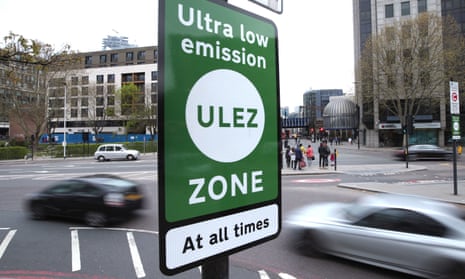
M25 weekend closure: drivers told to stick to diversion to avoid London Ulez charges
Motorway will be shut both ways between junctions nine and 10 from 9pm on Friday until 6am on Monday
Drivers tempted to bypass the official diversion for this weekend’s M25 motorway closure have been warned of potential ultra-low emission zone (Ulez) charges if they stray off course.
The London orbital motorway is having its second ever planned closure , with a busy stretch in the south-west closed in both directions for works, potentially bringing long delays and congestion for thousands of drivers.
National Highways has urged motorists to avoid travel if possible or stick to the official diversions. Drivers of non-Ulez-compliant vehicles entering the clean air zone will not be charged as long as they stay on the marked route, but will otherwise be liable for the £12.50 charge if they follow their satnav for an attempted shortcut.
Only petrol vehicles more than 18 years old or diesels more than nine years old are normally liable for the charge, which was expanded to cover the whole of Greater London last year.
The M25 will be closed in both directions between junctions nine and 10 in Surrey from 9pm on Friday until 6am on Monday while concrete beams for a new bridge and a gantry are lifted into place.
The diversion for those who wish to rejoin the motorway runs for 19 miles along A-roads in Surrey and Greater London .
Jonathan Wade, a National Highways senior project manager, told the PA news agency: “Although the (Ulez) cameras will be active, no enforcement action will be taken. However, if you ignore the diversion signs and do your own thing, then if your vehicle’s not compliant, you do run the risk of getting caught.”
The traffic agency has urged drivers to follow the main route to minimise the risk of rural gridlock, with thousands of cars normally using the stretch of motorway every hour.
This weekend is the second of five planned closures of the M25 in a £317m works scheme, after the first ever planned daytime shutdown in March on the neighbouring stretch from junctions 10 to 11.
Fears that the zigzag diversion routes then used between Cobham and Woking would host epic jams were eventually unrealised, with only a third of the normal volumes of traffic using the roads after a widespread awareness campaign.
However, Wade said there was a “very real” risk that the benign outcome of early March could make motorists complacent about the fresh warnings to reassess journeys.
after newsletter promotion
Other stretches of the M25 will also be disrupted this weekend, with work to retrofit more emergency refuges on its sections designated as smart motorway with no hard shoulder.
The RAC also warned of more congested roads ahead, with this week’s national rail strikes potentially forcing more travellers into cars.
The M25 will close for three more weekends this year, with the next one scheduled for August. The works will increase the number of lanes and improve junction 10, one of Britain’s busiest motorway junctions.
- Infrastructure
- Low emission zones
- Road transport
Easter travel delays forecast for UK due to poor weather and rail disruption
Sadiq Khan rules out bolstering London Ulez scheme if he wins mayoral election
M25 reopens ahead of schedule
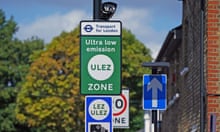
Ulez fines scandal: Italian police ‘illegally accessed’ thousands of EU drivers’ data

London Ulez averts more air pollution than that caused by capital’s airports, report shows
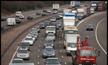
Motorists warned of long delays as M25 to shut for roadworks
Sadiq Khan backs sending 4x4s due for scrappage under Ulez to Ukraine
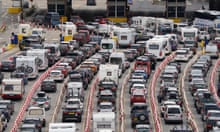
Tourists heading to Europe could face 14-hour queues at Dover from October

Bomb attack on Ulez camera ‘grotesquely irresponsible’, says London mayor
Disbelief at plan to fix London potholes as part of Network North project
Most viewed.

IMAGES
COMMENTS
19°. 10°. Find local traffic information to help you plan your journey in Auckland. See current travel times, traffic updates, information on incidents and roadworks, and traffic cameras on your route.
Contact us; News & events. Media Centre; Events causing delays; Subscribe for updates; Have your say. Regional Public Transport Plan 2023-2031; Draft Katoa, Ka Ora speed management plan 2024 to 2027
Welcome to Auckland Transport. AT is responsible for all the region's transport services, from roads and footpaths, to cycling, parking and public transport. Train line status. Register AT HOP card. Pay a fine. Report a problem. Auckland Transport is responsible for Auckland's transport services excluding state highways.
Waikato. Bay of Plenty. Hawkes Bay. Taranaki. Manawatū-Whanganui. Wellington. Canterbury. Otago. Traffic dashboards provide current travel times for key routes and journeys in a town or city.
Auckland System Management (ASM) is an alliance between Waka Kotahi NZ Transport Agency, Fulton Hogan and HEB Construction. We maintain and manage Auckland's state highway network: SH22 - from SH1 to Adams Dr, Pukekohe. If you're unsure if the state highway in your area is maintained by Auckland System Management, please email us at info ...
When the new motorway opens, you'll be able to use the Waka Kotahi Journey Planner to plan your journey before you drive. Waka Kotahi Journey Planner ... There is no travel on Auckland motorways for loads exceeding 3.1m width or 4.3m height and the same applies for the new motorway. Over dimension vehicles will not permitted to use the new ...
Google Maps is the best way to explore the world and find your way around. Whether you need directions, traffic information, satellite imagery, or indoor maps, Google Maps has it all. You can also create and share your own maps and stories with Google Earth. Try it now and see the difference.
Northern Motorway Cameras. North Western Cameras. South Western & Airport Cameras. Upper Harbour Cameras. Find the current traffic status with live traffic cameras from Auckland's Motorways, on your mobile device.
The Auckland Transport congestion map gives you at-a-glance information to help you plan your journey. On the map you can look at different parts of Auckland and zoom in to see congestion on more streets. ... Request a repair or maintenance on Auckland's motorways: (09) 520 0200 ...
which route(s) will get you to your destination. This map covers Central Auckland - other AT Metro guides for East, Northern, Western and Southern suburbs may also be of interest. Plan your journey In three easy steps the online Journey Planner will help you plan your travel. All you need to do is type
After seventy years, Auckland's motorway network is finally finished. In July 1953 the first section of motorway in Auckland was opened between Ellerslie-Panmure Highway and Mt Wellington Highway. The final stage opens to traffic this week with the completion of the motorway part of the Northern Corridor Improvements project. Aucklanders are ...
Those leaving Auckland on the Southern Motorway face a slow journey of one hour and 28 minutes, with the journey time worsening in the past hour. In free-flowing conditions the same trip would ...
Use the drop down to shorten the walk time to 5 minutes. This lets the journey planner know that you don't really mind if this bus takes a little longer as long as you don't have to walk very far to get it. Geek Fact: The walking time calculation is based on a walk speed of 4km per hour. Default walk time is 15 minutes in journey planner.
Plan route. If you've got a journey ahead, whether it's small or large, the Green Flag Route Planner can help you get there with minimal fuss. The route planner isn't limited to the UK. You can get accurate directions across Europe. Remember that European breakdown is worth considering if you're heading to the continent, because repairs ...
© Automobile Association Developments Ltd. 2018 . uk breakdown; european breakdown; motorbike breakdown; report a breakdown; insurance; car insurance; home insurance ...
Register above for a personalised journey plan and one of our Auckland Transport reps will get in touch with travel options that could help you and your household save time, money, or improve your health and fitness. Register online and go into the draw for one of three $25 movie passes. Read the Unsworth Heights / Totara Vale personal journey ...
The RAC map also enables you to display weather information for the UK so you can plan your journey based on the driving conditions. The RAC Route Planner complements our motoring-services products such as our 5 Star Defaqto breakdown cover and car insurance, including temporary car insurance, learner driver insurance and black box car insurance.
Motorway will be shut both ways between junctions nine and 10 from 9pm on Friday until 6am on Monday Drivers tempted to bypass the official diversion for this weekend's M25 motorway closure have ...
NZ Transport Agency Waka Kotahi advises of the following closures for motorway improvements. Work delayed by bad weather will be completed at the next available date, prior to Friday, 3 May 2024. Check daily updated closure information: Journey Planner - Auckland updates (external link) Unless otherwise stated, closures start at 9pm and finish ...
identify which route(s) will get you to your destination. This map covers East Auckland - other AT Metro guides for Central, Northern, Western and Southern suburbs may also be of interest. Plan your journey In three easy steps the online Journey Planner will help you plan your travel. All you need to do is type