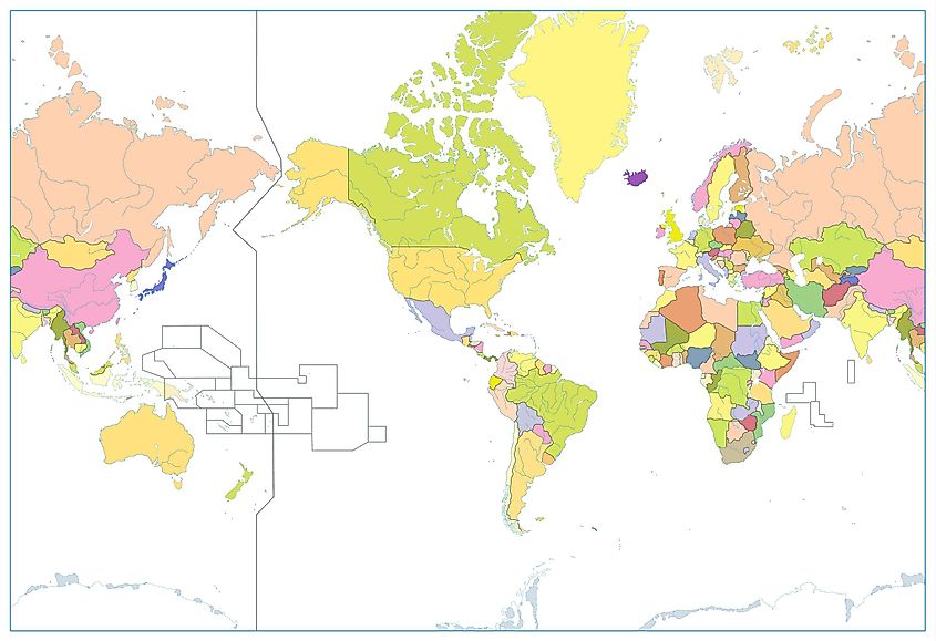
What Is the International Date Line?
By Anne Buckle
The International Date Line (IDL) is an imaginary line on Earth's surface defining the boundary between one day and the next.
 drawn down the image. The Midway Islands, Kiribati, Tonga, and Chatham Islands are labelled on the map.")
The International Date Line zigzags through the Pacific Ocean at around 180° longitude.
©timeanddate.com

Where Is the International Date Line?
The International Date Line (IDL) is located at about 180° east (or west). It is halfway around the world from the prime meridian (0° longitude ), the reference point of time zones , which runs through Greenwich , UK.
The date line runs from the North Pole to the South Pole and marks the Western and Eastern Hemisphere divide. It is not straight but curves around landmasses and national borders. For example, it leans towards the east at the Bering Strait between Asia and North America, leaving Cape Dezhnev in Russia a day ahead of Cape Prince of Wales in Alaska even though they are only 80 km (50 mi) apart.
The Northern and Southern Hemispheres
Different Days on Either Side
The International Date Line is the boundary where each calendar day starts and is also known as the “Line of Demarcation” because it separates two calendar dates: When you cross the date line traveling east , you subtract a day , and if you cross the line traveling west , you add a day .
For example, Kiribati and Hawaii are on different sides of the date line. If you traveled from Kiribati's capital Tarawa to Hawaii's state capital Honolulu , you would have to turn the clock back 22 hours , effectively traveling back in time, at least on the calendar.
See the date line on our Time Zone Map
Not Always 24 Hours
Depending on which time zone the country follows, the time difference on either side of the line is not always 24 hours. For example, if you travel the 1061 km (659 mi) across the date line from Baker Island to Tokelau , you must add 25 hours, or 1 day and 1 hour.
Three Dates at the Same Time
Every day between 10:00 and 10:59 UTC , three different calendar dates are in use simultaneously on Earth.
For example, May 2 at 10:30 UTC , is 23:30 (11:30 pm) on May 1 in American Samoa (UTC−11), 06:30 (6:30 am) on May 2 in New York (UTC-4), and 00:30 (12:30 am) on May 3 in Kiritimati (UTC+14).
Changes in the Date Line
The International Date Line is not defined by international law, and it is up to the different countries to choose the date and time zone they want to observe.
In 1994, the Republic of Kiribati aligned the country's time zones by skipping January 1, 1995 in the portion of the country that was east of the date line. By adding 24 hours to the the clocks in the Phoenix and Line Islands , they put a dent in the date line, moving it all the way to the 150° east longitude.
In 2011, Samoa changed its time zone from UTC-11 to UTC+13 by shifting the date line to the west and removing December 30, 2011 from the calendar. They did this to facilitate trade with Australia and New Zealand , and Tokelau followed Samoa for the same reasons.
The Nautical Date Line
The International Date Line is de facto , which means that it is not based on international law and should not be confused with the Nautical Date Line, which follows the 180° meridian from the North to the South Pole . Unlike the International Date Line, whose course is determined by the countries bordering it, the Nautical Date Line is defined by international agreements.
Drawn up in 1884
The 180° meridian was selected as the basis for the International Date Line because it mostly runs through the sparsely populated Central Pacific Ocean. This was decided at the International Meridian Conference in 1884 in Washington, D.C.
Topics: Timekeeping , Time Zone , Geography
What is the international date line?
The international date line serves as the " line of demarcation " between two consecutive calendar dates..

The international date line, shown here as a yellow line, defines the boundary between calendar dates.
The international date line, established in 1884, passes through the mid-Pacific Ocean and roughly follows a 180 degrees longitude north-south line on the Earth. It is located halfway around the world from the prime meridian — the 0 degrees longitude line in Greenwich, England.
The international date line functions as a “ line of demarcation ” separating two consecutive calendar dates. When you cross the date line, you become a time traveler of sorts! Cross to the west and it’s one day later; cross back and you’ve “gone back in time."
Despite its name, the international date line has no legal international status and countries are free to choose the dates that they observe. While the date line generally runs north to south from pole to pole, it zigzags around political borders such as eastern Russia and Alaska’s Aleutian Islands.
More Information
- Z-time (Coordinated Universal Time)
- Time and Frequency Division, Physical Measurement Laboratory, National Institute of Standards and Technology
- National Geodetic Survey
Last updated: 01/18/24 Author: NOAA How to cite this article
What Is the International Date Line and How Does it Work?
D'Arco Editori / Getty Images
- Physical Geography
- Political Geography
- Country Information
- Key Figures & Milestones
- Urban Geography
- M.A., Geography, California State University - Northridge
- B.A., Geography, University of California - Davis
The world is divided into 24 time zones, planned so that noon is basically when the sun is crossing the meridian, or line of longitude, of any given location.
But there has to be a place where there is a difference in days, somewhere a day truly "starts" on the planet. Thus, the 180-degree line of longitude , exactly one-half way around the planet from Greenwich, England (at 0 degrees longitude ), is approximately where the international date line is located.
Cross the line from the east to the west, and you gain a day. Cross from west to the east, and you lose a day.
An Extra Day?
Without the international date line, people who travel west around the planet would discover that when they returned home, it would seem as though an extra day had passed. This is what happened to Ferdinand Magellan's crew when they returned home after their circumnavigation of the Earth in 1522.
Here's how the international date line works: Let's say you fly from the United States to Japan, and suppose you leave the United States on Tuesday morning. Because you're traveling west, the time advances slowly thanks to time zones and the speed at which your airplane flies. But as soon as you cross the international date line, it's suddenly Wednesday.
On the reverse trip home, you fly from Japan to the United States. You leave Japan on Monday morning, but as you cross the Pacific Ocean, the day gets later quickly as you cross time zones moving eastward. However, as soon as you cross the international date line, the day changes to Sunday.
But let's say you traveled around the entire world like Magellan's crew did. Then you would have to reset your watch every time you entered a new time zone. If you had traveled westward, as they did, when you got all the way around the planet back to your house, you'd find your watch had moved forward 24 hours.
If you had one of those analog watches with a built-in date, it would have moved up one day when you arrived home. The problem is, all your friends who never left could point to their own analog watches — or just to the calendar — and let you know you are wrong: It's the 24th, not the 25th.
The international date line prevents such confusion by having you roll the date back on that analog watch — or, more likely, just in your mind — as you cross its imaginary boundary.
The whole process works the opposite for someone circling the planet eastward.
3 Dates at Once
Technically, it is three separate dates at once for two hours per day between 10 and 11:59 UTC or Greenwich Mean Time.
For example, at 10:30 UTC on January 2, it is:
- 11:30 p.m. January 1 in American Samoa (UTC−11)
- 6:30 a.m. January 2 in New York (UTC-4)
- 12:30 a.m. January 3 in Kiritimati (UTC+14)
The Date Line Takes a Jog
The international date line is not a perfectly straight line. Since its beginning, it has zigzagged to avoid splitting apart countries into two days. It bends through the Bering Strait to avoid placing far northeastern Russia in a different day than the rest of the country.
Unfortunately, tiny Kiribati, a group of 33 widely spread islands (20 inhabited) in the central Pacific Ocean, was split by the date line's placement. In 1995, the country decided to move the international date line.
Because the line is simply established by international agreement and there are no treaties or formal regulations associated with the line, most of the rest of the world's nations followed Kiribati and moved the line on their maps.
When you review a changed map, you'll see a big panhandle zigzag, which keeps Kiribati all within the same day. Now eastern Kiribati and Hawaii, which are located in the same area of longitude , are a whole day apart.
- The Distance Between Degrees of Latitude and Longitude
- The 5 Themes of Geography
- What Are Latitude and Longitude Lines on Maps?
- The Prime Meridian: Establishing Global Time and Space
- The History and Use of Time Zones
- Major Lines of Latitude and Longitude on a World Map
- Geography of Kiribati
- Understanding the Earth's Two North Poles
- Great Circles in Geography
- Greenwich Mean Time vs. Coordinated Universal Time
- Date and Time Vocabulary in German
- The Geography of Earth's Equator
- Understanding Zulu Time and Coordinated Universal Time
- Where Does the Word 'Hurricane' Come From?
- Offset Time Zones
The international date line, explained
The international date line is an imaginary line that runs north-south across the Pacific Ocean from the North Pole to the South Pole.

- Why the IDL is important
- What happens when you cross it?
How the IDL began
- Why isn't it straight?
Universal Coordinated Time
Additional resources.
The international date line (IDL) is an imaginary line that runs along the Earth's surface from the North Pole to the South Pole in the middle of the Pacific Ocean. When you cross it, you either gain or lose a day depending on which way you are traveling. If you are traveling westward, you gain a day, and if you are traveling eastward, you lose a day.
For example, if a traveler moves eastward across the Pacific Ocean from Wake Island to the Hawaiian Islands on June 25, they will jump backward to June 24 as soon as they cross the IDL. If, however, they are traveling in the opposite direction, they will arrive at Wake Island on June 26.
Although the traveler seems to move backward or forward in time, there's no physics-defying magic going on here. The international date line is based on a rational, practical system of universal timekeeping that takes into account the movement of Earth around the sun.
Related: How can Samoa hop over the international date line?
Why do we need the international date line?
Earth rotates counterclockwise (from west to east) on its axis as it travels around the sun. This means that different parts of the planet receive the sun's direct rays at different times, so when it is noon on one part of Earth — the period when the sun is at its highest in the sky — another part of the planet may be completely in shadow or experiencing sunrise or sunset. It also means that, theoretically at least, if you were somehow able to outrun Earth's rotation, which is a speed of roughly 1,000 mph (1,600 km/h), you could experience perpetual daylight and never see darkness.
But humans don't travel at such speeds (unless you are on the International Space Station), and when not traveling people generally stay in one place. So, to allow people to experience daylight hours in roughly the same amount — that is, to experience a normal day from sunrise to sunset — time zones are in use around the world.
The first system of time zones was proposed by Sir Sandford Fleming in 1876, according to an article in Globe and Mail , a Canadian news publication. Fleming was a Scottish engineer who helped design the Canadian railway system. He wanted to make the railroad more efficient and avoid any complications resulting from the different schedules set by the different train stations, which set the time according to their local astronomical conditions, according to Encyclopedia Britannica . Accordingly, he proposed a system of 24 standard time zones that would span the circumference of the Earth. Within each time zone, all clocks would be set to an average time that best represented where the sun was located in the sky. The practicality of his system soon caught on, so that by 1900 most of the industrialized nations of the world had adopted it.

Today, with a number of significant modifications, we still use the 24-time-zone system originally proposed by Fleming. The logic of dividing Earth into 24 zones is derived from the fact that the planet is a sphere, and like any sphere it can be divided into 360 equal sections, or 360 degrees. Each time zone is measured as 15 degrees wide, and 360 divided by 15 is 24.
All of these zones are numbered consecutively eastward from what is called the prime meridian, which is a line of longitude that runs directly through the British Royal Observatory in Greenwich, in the United Kingdom. The prime meridian was established in 1851 at a time when the U.K. was one of the most powerful and technologically advanced nations on Earth. With a powerful navy, the British were well advanced in navigation and timekeeping and were using the most sophisticated devices available to reckon global position and time. The prime meridian, at 0 degrees longitude, is the point from which all other measurements of longitude are taken. The prime meridian is also where the system of 24-hour timekeeping that is called Greenwich Mean Time (GMT) originated.
As you go east from the prime meridian, the time zones increase consecutively by one hour, or conversely, decrease consecutively by one hour as you go west. But Earth, of course, does not go on indefinitely; eventually, a point is reached when you have to start over — or jump backward or forward in time depending on your direction of travel.
What happens when you cross the international date line?
Here's an example of how time zones and the international date line works.
London, U.K. is eight time zones away from San Francisco, California. Going eastward from San Francisco to London, you move ahead eight time zones, which really means you skip forward eight hours. So, when the time in San Francisco is 1 p.m, the time in London is 9:00 p.m. on the same day.
However, if you were to move eight time zones in the opposite direction from San Francisco at 1 p.m. — that is, west across the Pacific Ocean to the Siberian city of Yakutsk, for example, things get complicated. It's not simply a matter of subtracting eight hours from the San Francisco time. You start by subtracting an hour for each time zone moving west, making it to 9:00 a.m., but at that point you'll hit the IDL, where everything changes. Now you have to add a full 24 hours to your calculations and jump a full day ahead, making it 9 a.m. the next day.
But you're not done yet. Because all the time calculations are taken from Greenwich, you must subtract four more hours from that time because Yakutsk sits four time zones west of the IDL. So, when the time in San Francisco is 1:00 p.m. on Wednesday, it is 5:00 a.m. on Thursday in Yakutsk.

The IDL was established in 1884 during the International Meridian Conference held in Washington, D.C., according to Post Card History . President Chester A. Arthur convened the conference, which included representatives of 26 nations. The president, like other world leaders, saw the necessity of establishing standards for an international agreement on time and longitude. By the end of the 19th century, as global commerce progressed, communication technologies grew more sophisticated and nations grew increasingly interdependent, it was imperative that all clocks be set to a world standard.
With this in mind, the point of the conference, as summed up in the Protocols of the Proceedings , was "for the purpose of fixing upon a meridian proper to be employed as a common zero of longitude and standard of time-reckoning throughout the globe."
The conference resulted in the recognition of the prime meridian in Greenwich, which had already been in use for several decades, as the world's single " initial meridian ." Although other prime meridians were in existence at the time, such as ones in Rome, Paris, Jerusalem, St. Petersburg and Oslo, for example, the Greenwich meridian was adopted primarily because over two-thirds of ships already used it for zero longitude.
In all, seven resolutions were passed at the end of the conference. These ranged from adopting a universal solar day (beginning at midnight in Greenwich and counted on a 24-hour clock) to the proposal that all nautical and astronomical days everywhere would begin at 12:00 a.m.
The IDL was established as a result of the conference's Third Resolution , which stated: "That from this meridian longitude shall be counted in two directions up to 180 degrees, east longitude being plus and west longitude minus."
The logic behind this is that on a discrete sphere, the day and date have to be separated at two locations — you can't split a sphere into two parts with a single "cut" on one side. You need a starting and an ending point.
None of the resolutions, however, were binding. It was up to each country to enforce these proposals. Even today, for example, the IDL is not a matter of international law, nor is it enforced by the dictates of an international governing board. It is accepted by all nations and has been adopted because it is crucial for global interconnectivity, instantaneous communication, time measurement and consistent international databases.
Why is the international date line not straight?
An excellent way of visualizing the IDL is to think of it in terms similar to a line of longitude. In fact, it roughly follows the 180-degree meridian, which is located halfway round the world from the prime meridian. But the IDL, unlike a meridian line, does not run in a straight path. Since its inception, the IDL has undergone several major deviations, and it now swerves, zig-zags and jogs in a seemingly arbitrary pattern around prominent landmasses and certain Pacific islands. Most of these deviations are the result of practical considerations, such as to avoid splitting a country into two time zones, or for political and economic reasons.
The IDL runs south from the North Pole, following the 180-degree meridian until it swerves east to pass through the Bering Strait, keeping Big Diomede Island, a part of Russia, west of the IDL, and Little Diomede Island, which is part of the United States, to the east. Although the islands are only separated by the narrowest of margins — just 2 miles (3.2 kilometers) — they experience different days, with Big Diomede Island always one day ahead of Little Diomede Island. The IDL then jogs back west to skirt around the United States’ Aleutian Islands, keeping Russia and Alaska on opposite sides.

It then tracks back, following the 180-degree meridian south again for several thousand miles, passing west of the Hawaiian Islands and east of the independent nation of the Marshall Islands, until reaching the Pacific island nation of Kiribati. Here, the IDL makes a major deviation east to encompass the Kiribati and Line Islands, the latter of which is also known as the Teraina or Equatorial Islands. This deviation reaches nearly as far east as the 150-degree meridian and forms a very large and noticeable hammerhead-looking configuration.
Kiribati, which received its independence from the United Kingdom in 1979, is a group of 33 mostly uninhabited islands and atolls that span a vast area encompassing no less than 1.9 million square miles (5 million square kilometers). Prior to the 1990s, the IDL bisected the island nation, throwing its western half a day ahead of its eastern half, according to the CIA's World Fact Book . This caused considerable political and economic hardships as the nation tried to conduct normal everyday business with one half of its nation a day ahead and the other a day behind. In 1995, Kiribati decided it had had enough of this arrangement, and seeking greater economic ties with Australia and New Zealand, extended the IDL eastward to encompass the nation's far-flung eastern islands, thus creating the odd configuration.
Shifting the date line is a relatively easy matter, the BBC reported . It doesn’t require the agreement of other countries or the sanction of an international governing body. The country can decide for itself. It’s simply a matter of publicizing the event and informing the international community and map-makers.

Leaving Kiribati, the IDL passes between Samoa and American Samoa, keeping the former west and the latter east of the IDL. It then swerves back sharply toward the 180-degree meridian, but does not follow the meridian's exact path. Instead, it stays parallel to the meridian, keeping to the east of the line so that Tonga, the Kermadec Islands and New Zealand are all east of the IDL.
South of New Zealand, in the vicinity of the Chatham Islands, which are part of New Zealand, the IDL jogs back and connects up again with the 180-degree meridian. It follows this path until reaching Antarctica, which has multiple time zones. The IDL is not drawn into Antarctica on most maps.
Today, a method known as Universal Coordinated Time, abbreviated as UTC, has become the timekeeping standard. In essence, it is a more sophisticated version of GMT because it is still based on the zero degrees of latitude that passes through Greenwich but relies on atomic clocks. These devices, invented in the 1950s, are incredibly accurate and are based solely on Earth's rotation. The clocks take into account slight variations in the Earth's rotation rate that can cause timekeeping to vary.
- Further reading: " Plotting the Globe: Stories of Meridians, Parallels, and the International Date Line (Explorations in World Maritime History) " (Praeger, 2005) by Avraham Ariel and Nora Ariel Berger
- Read more about the International Meridian Conference .
- Don't feel like doing math? Here's a helpful time zone converter that will do it for you.
This article has been updated from a previous version written by Dan Helm in 2018.
Sign up for the Live Science daily newsletter now
Get the world’s most fascinating discoveries delivered straight to your inbox.
Tom Garlinghouse is a journalist specializing in general science stories. He has a Ph.D. in archaeology from the University of California, Davis, and was a practicing archaeologist prior to receiving his MA in science journalism from the University of California, Santa Cruz. His work has appeared in an eclectic array of print and online publications, including the Monterey Herald, the San Jose Mercury News, History Today, Sapiens.org, Science.com, Current World Archaeology and many others. He is also a novelist whose first novel Mind Fields , was recently published by Open-Books.com .
Alaska's rivers are turning bright orange and as acidic as vinegar as toxic metal escapes from melting permafrost
Scientists just discovered an enormous lithium reservoir under Pennsylvania
This year's hurricane season could see 25 named storms, NOAA says in record-breaking forecast
Most Popular
- 2 The mystery of the disappearing Neanderthal Y chromosome
- 3 The same genetic mutations behind gorillas' small penises may hinder fertility in men
- 4 Scientists grow diamonds from scratch in 15 minutes thanks to groundbreaking new process
- 5 Lost photos suggest Mars' mysterious moon Phobos may be a trapped comet in disguise
- 2 Lost photos suggest Mars' mysterious moon Phobos may be a trapped comet in disguise
- 3 Euclid space telescope reveals more than 300,000 new objects in 1st 24 hours of observations (photos)
- 4 Scientists just discovered an enormous lithium reservoir under Pennsylvania
- 5 Alaska's rivers are turning bright orange and as acidic as vinegar as toxic metal escapes from melting permafrost
ENCYCLOPEDIC ENTRY
Encyclopedic entry. The date line, also called the International Date Line, is a boundary from which each calendar day starts. Areas to the west of the date line are one calendar day ahead of areas to the east.
Geography, Physical Geography
Loading ...
The date line , also called the International Date Line , is a boundary from which each calendar day starts. Areas to the west of the date line are one calendar day ahead of areas to the east . The date line runs from the North Pole to the South Pole through the Pacific Ocean. It is not a straight line, however. The date line curves around several landmasses. For example, it curves around the islands that make up the nation of Kiribati, so that all regions of the country remain on the same day. The date line makes a big detour between Asia and North America in the Bering Strait . Cape Dezhnev, Russia, is always a day ahead of Cape Prince of Wales, Alaska, even though the landmasses are less than 80 kilometers (50 miles) apart. The date line , which roughly follows the 180-degree meridian , is about halfway around the globe from the prime meridian , which measures 0-degrees longitude .
Hawai'i and Kiribati The islands of the U.S. state of Hawai'i lie almost directly north of the islands of the nation of Kiribati in the Pacific Ocean. They fall within the same lines of longitude. However, because of a curve the date line makes around Kiribati, they are a day apart.
Media Credits
The audio, illustrations, photos, and videos are credited beneath the media asset, except for promotional images, which generally link to another page that contains the media credit. The Rights Holder for media is the person or group credited.
Illustrators
Educator reviewer, last updated.
October 19, 2023
User Permissions
For information on user permissions, please read our Terms of Service. If you have questions about how to cite anything on our website in your project or classroom presentation, please contact your teacher. They will best know the preferred format. When you reach out to them, you will need the page title, URL, and the date you accessed the resource.
If a media asset is downloadable, a download button appears in the corner of the media viewer. If no button appears, you cannot download or save the media.
Text on this page is printable and can be used according to our Terms of Service .
Interactives
Any interactives on this page can only be played while you are visiting our website. You cannot download interactives.
Related Resources

The Only Way to Time Travel
Crossing the International Date Line is one of the rare thrills of travel. Pass over the Pacific Ocean in the right direction (eastward) and you can relive the same day twice. We left Guam on Thursday and arrived in Hawaii on Wednesday, the night before.
The date line actually used to be in Europe. About 150 years ago, days were measured from noon to noon, starting and ending at the Prime Meridian. When an international conference of leaders changed it to midnight, the date line moved to the middle of the Pacific.
The result creates some fascinating time realities. Even though they’re just 40 miles apart, American Samoa and the independent state of Samoa are constantly separated on the calendar. With two days unfolding simultaneously at any moment, a day on earth actually lasts a full 48 hours. In fact, if you were to fly westward, you could hypothetically remain in the same day for about 35 hours straight. No flux capacitor required.
Related Topics
- DATING METHOD
You May Also Like

There’s a better way to wake up. Here’s what experts advise.

Why daylight saving time exists—at least for now

This Saturday, 99% of people on Earth will get sun at the same time

A master of the grandfather clock reveals time's hidden history

Why College Students Are Sending a Time Capsule to Mars
- Paid Content
- Environment
- Photography
- Perpetual Planet
History & Culture
- History & Culture
- History Magazine
- Mind, Body, Wonder
- Terms of Use
- Privacy Policy
- Your US State Privacy Rights
- Children's Online Privacy Policy
- Interest-Based Ads
- About Nielsen Measurement
- Do Not Sell or Share My Personal Information
- Nat Geo Home
- Attend a Live Event
- Book a Trip
- Inspire Your Kids
- Shop Nat Geo
- Visit the D.C. Museum
- Learn About Our Impact
- Support Our Mission
- Advertise With Us
- Customer Service
- Renew Subscription
- Manage Your Subscription
- Work at Nat Geo
- Sign Up for Our Newsletters
- Contribute to Protect the Planet
Copyright © 1996-2015 National Geographic Society Copyright © 2015-2024 National Geographic Partners, LLC. All rights reserved

International Date Line
It is common knowledge that the Earth is round, and navigational information is obtained by drawing imaginary lines to determine latitude, longitude, prime meridian, and the equator. The South Pole and the North Pole are Earth’s main reference points, located at the northern and southern extremes of the world. An imaginary line drawn halfway between these two points is the equator, while lines drawn above or below the equator are latitudes. Parallel lines, running from the North to the South Poles, are known as longitudes. The International Date Line (IDL) is also an imaginary line that runs from the North to the South Pole and separates two calendar days. The IDL is important in measuring time and is crucial for instantaneous communication, politics, and commerce.
What Is The International Date Line?

The IDL is an imaginary line that roughly follows the 180° line of longitude and passes through the Pacific Ocean . However, this line is not straight and strays from the 180° meridian at certain points. In some places, it appears as zig-zag, deviating to the meridian’s east or west. The deviations enable places of the same economic and political affiliations to share the same date or time. Otherwise, if the IDL were a straight line, it would divide certain landmasses into two parts with two different dates on the same day.
From the North Pole, the IDL first bends to the east to pass near the Chukchi Peninsula ( Russia ) and Wrangel Island’s east, then proceeds through the Bering Strait before bending towards the west of St. Matthew and St. Lawrence Islands. From there, the line runs between the Commander Islands and the Aleutian Islands and returns to the 180° meridian until it passes the equator. Below the equator, the line swings far to the east, near the 150° meridian, and circumscribes Kiribati . It then returns westward but remains to the 180° longitude’s east, passing through American Samoa and Samoa . Finally, the line bends southwestwards and follows the 180° meridian until it reaches Antarctica.
Why The 180° Meridian?
The IDL was established in 1884 by the International Meridian Conference as an imaginary line roughly following the 180° meridian and not any other meridian (including the Prime Meridian ). The conference, attended by 26 nations, settled on 180° longitude because it runs through an open ocean (Pacific Ocean) and zig-zagged it to keep the surrounding nations, especially island countries, within the same day and date.
An Extra Day And Three Dates at Once

People traveling westward from the IDL gain one hour every 15° of longitude crossed, while those traveling eastward lose one hour. Therefore, people traveling westwards without adjusting their time back by an hour for every 15° meridian will discover that they have gained an extra day when they return home. This happened to Ferdinand Magellan ’s crew after their 1522 expedition. However, one loses 24 hours or one day if they travel eastwards around the globe.
For two hours a day, between 10:00 and 11:59 UTC, there are three separate calendar dates. For example, at 10:30 UTC on Friday, it is 11:30 PM Thursday in American Samoa, 12:30 AM UTC Saturday in Kiritimati and 6:30 AM UTC Friday in New York. Baker Island and Howland Island have the Earth’s latest time at UTC-12, while Kiritimati (Kiribati) is among the first places to see a new day at UTC+14.
More in Geography

Countries That Start With The Letter W

Countries That Start With The Letter V

Countries That Start With The Letter U

Countries That Start With The Letter S

Countries That Start With The Letter R

What Is A Constituent Nation?

Countries That Start With The Letter Q

Countries That Start With The Letter P
Simple Flying
What's it like crossing the international date line on a flight.
The grand journey across the Pacific Ocean.
- Traveling across the International Date Line can result in “gaining” or “losing” a whole day.
- Airlines adhere to local times when scheduling, but it’s important to take careful note of the shown arrival time.
- Morning arrivals typically facilitate an easier adjustment process than evening arrivals.
If you travel far enough eastward or westward, you will eventually start crossing time zones. Most people who have driven or flown a considerable distance have encountered this, adjusting phones and watches to match the local time of their destinations. But, at one specific point (or line, rather) over the Pacific Ocean, the entire day changes, forcing people to plan a little more critically than simply turning the clocks back or forward a couple of hours.
An interesting phenomenon
As those who have traveled transpacific before know, flying between the Americas and Asia or Oceania will force air passengers to gain or lose a whole day. For example, Qantas Flight QF12 is scheduled to take off from Los Angeles at 23:40 on September 26th and land in Sydney at 07:45 on the 28th, traveling about 32 hours despite flying only 15 (you’ll get the extra day back upon returning). More personally, last week, I flew from Taipei to Chicago aboard EVA Air Flight BR56, which took off just a few minutes past 20:30 on September 7th, landing essentially at the same time locally after flying shy of 14 hours.
As First Light Travel puts it nicely, the International Date Line is a “conceptual necessity” in our world consisting of many different time zones. You can go as far as UTC - 12 or +14, but any further, you more-or-less reset. Situated about 40 miles apart are the Independent State of Samoa and American Samoa. Yet, as they are on opposite sides of the International Date Line, the latter is a full 24 hours behind the former. As such, there can be several challenges that come with travel that puts you on the other side of this line, notably the need for careful planning before you fly and dealing with potentially intense jet lag on the other side.
Things to keep in mind
Fortunately, airlines almost always do everything according to the local time. Using the Qantas example from above, the estimated departure time listed on their website is based on UTC - 8, and the arrival time is based on UTC +10, so they’ve already done the work to help you better plan what you do after passing through immigration and customs. That said, whether you land at night and plan to book a hotel before flying the next day or craft a few-hour layover, allowing enough time for long immigration lines before a connecting flight, it’s worth writing down and referring back to that arrival time so you don’t accidentally finalize something a day early or late.
Regarding jet lag, it can depend on how the airlines have scheduled their trips. During a trip last year between Taiwan and the United States, I flew with United Airlines. The first leg entering the US was a morning flight, which let me sleep (as well as one can in long-haul economy) and arrive in the morning of the same day. As a result, on schedules like these, jet lag tends not to be a big issue; at first, you might feel suddenly fatigued in the early afternoon, but it goes away after a few days. On my way back home, United’s flight arrived at 18:30, and getting a decent chunk of sleep on this leg had me waking up at night, and thus, there was a much more challenging process of re-adjusting to the time in Taiwan.
Want answers to more key questions in aviation? Check out the rest of our guides here .
It’s worth looking around at the different daily options from multiple carriers so you can be selective when you arrive at the destination. Of course, with better-served cities such as Tokyo, you have more options from the US compared to those directly going to Taipei. But if the only way to plan travel will ensure you get a bad case of jet lag, perhaps you might find Simple Flying’s tips on how to overcome it useful.
Do you frequently travel over the International Date Line? Let us know your experiences in the comments below.
Sources: Personal Experience, National Geographic , First Light Travel
- Election 2024
- Entertainment
- Newsletters
- Photography
- Personal Finance
- AP Investigations
- AP Buyline Personal Finance
- AP Buyline Shopping
- Press Releases
- Israel-Hamas War
- Russia-Ukraine War
- Global elections
- Asia Pacific
- Latin America
- Middle East
- Election Results
- Delegate Tracker
- AP & Elections
- Auto Racing
- 2024 Paris Olympic Games
- Movie reviews
- Book reviews
- Personal finance
- Financial Markets
- Business Highlights
- Financial wellness
- Artificial Intelligence
- Social Media
International date line that splits US, Russia, explained

- Copy Link copied
THE ARCTIC CIRCLE (AP) — The international date line is an imaginary border that runs through the middle of the Pacific Ocean and marks the boundary between calendar dates, effectively making it the zero-line for the planet’s time zones.
While such a concept had existed for centuries, it wasn’t until 1884 that the line was formally agreed upon at an international conference in Washington, D.C. The international date line is on the opposite side of the planet from the Greenwich — or prime — meridian that marks zero degrees longitude.
Crossing the line from east to west, people would need to set their clocks forward by a day. Crossing from west to east, they would need to set it back by a day.
This type of “time travel” relates purely to the conventions of the 24-hour clock. It wouldn’t involve actual travel backward or forward through time of the kind seen in science fiction movies.
Although the international date line runs from the North and South poles, it isn’t straight. Like time zones, it zig-zags to follow political boundaries. This means the island nation of Kiribati is a day ahead of American Samoa, despite being hundreds of miles farther east.
The international dateline also marks the border between Russia and the United States off Alaska’s west coast. The islands of Big Diomede in Russia and Little Diomede in the United States are separated by 2.4 miles (3.8 kilometers) of water, with the international date line running midway between them.
Follow a team of AP journalists as they travel through the Arctic Circle’s fabled Northwest Passage: https://www.apnews.com/tag/NewArctic

Where Is the International Date Line?

The International Date Line (IDL) is an imaginary boundary, running from the North Pole to the South Pole. It lies mainly along the 180° longitude in the Pacific Ocean.
While this line is not straight, it bends to accommodate international borders and territories. For example, it zigzags around nations like Fiji and Samoa, so travelers can keep consistent time zones.
The International Date Line is an invisible line that splits two days. It shows where one day changes to the next, helping us keep track of calendar days.
What Happens When You Cross the International Date Line?

Imagine you’re sailing across the vast, blue Pacific Ocean . As your ship glides through the waves, you approach an invisible marker, the International Date Line.
If you travel westward, it feels as if you’ve been given the gift of time, adding a whole day to your calendar. Conversely, heading eastward, you flip the calendar backward .
This happens because the Earth is divided into time zones, with the Date Line acting as a reset point. While your watch might not change, the calendar date does.
Which Countries Are Close to the International Date Line?
Several countries lie close to the International Date Line. Here’s a list of them and their proximity.
Which Country Starts Their Day First?
The country that greets the new day first, thanks to the International Date Line, is Kiribati . Specifically, its Line Islands, where Kiritimati Island (Christmas Island) is located.
Kiribati made a strategic move by shifting the Date Line eastward for these islands in 1995. This change was aimed at ensuring the entire country could celebrate the same day together .
Before this adjustment, Kiribati was split by the Date Line. This caused a lot of confusion. Now, when it’s still yesterday in most of the world, it’s already tomorrow in Kiribati.

What Is the International Date Line?
The International Date Line is like an invisible line that splits two days. It shows where one day changes to the next, keeping track of the calendar days . We use it when we’re traveling because it’s important to know what day it is.
Do you have any questions about the International Date Line? Please send us your feedback and comments below and we’ll get back to you as soon as possible.

What is the Goldilocks Zone?

7 Red-Hot Planet Mercury Facts [Infographic]

How Fast Does the Earth Spin? Earth vs The Engineered

Earth Statistics: Straight-Up Stats of Earth

Neptune Facts: The Big Blue Planet [Infographic]

Earth Age: How Old Is the Earth?

How to Measure the Distance to the Moon

Mars Atmosphere Compared to Earth

How Big Is the Moon?

5 Facts of Ice-Cold Planet Uranus [Infographic]

Chandler Wobble: Why Earth Wobbles Like a Toy Top

Solar Radiation: How Sunlight Heats the Planet

Facts About Asteroids and Our Asteroid Belt

100 Earth Facts: A Scientific List of Facts About Earth
Leave a reply.
Your email address will not be published. Required fields are marked *
See reviews Enquire now
Email: [email protected]

- A Short Lesson in Time Travel

- New Zealand Travel Blog
The International Date Line has confused navigators, explorers, and the everyday traveler for nearly five centuries since humans first began circumnavigating the globe – don’t let it baffle you!

Portuguese explorer Ferdinand Magellan (1480-1521) was the leader of the first expedition to circumnavigate the world. When his men arrived at the Cape Verde Islands near Africa at the end of the journey in 1522, to their surprise, they were one day later than they had worked out in their logs.

The International Date Line is not, of course, a real thing. It is a conceptual necessity when accounting for multiple time zones around the world. It is an imaginary line, running down the Pacific Ocean from North to South, which determines where a calendar day ends and the next day begins.
This imaginary line runs roughly along the 180° meridian - with a few slight diversions here and there, intended to ensure that no country in this region is split into two. If you cross the International Date Line on a journey towards the east, then 24 hours are subtracted from your time. If you cross it when going west, then 24 hours are added to your time. Similarly, for every 15° crossed when heading east, you earn an hour and for every 15° crossed when heading west, you lose one.
Welcome to the future...
New Zealand is one of the first places on earth to see the sun - the inspiration for the First Light Travel name. When you travel from North America, you travel across the International Date Line which means you journey forward in time to get here. So when you leave San Francisco on Friday night you land in Auckland on Sunday morning. Of course, you may feel like you’ve lost a day but you’ll gain that back on your return journey. If you’re traveling from Europe you’ll have to move forward in time when you arrive, but you’ll get that time back when you return home.
Confused? Try this........
Because flights to New Zealand cross the international dateline, the arrival dates can be confusing. For instance, a flight leaving Los Angeles on Saturday evening will not arrive in New Zealand until Monday morning/afternoon. Conversely, flights back to the US from New Zealand often arrive on the same date as they left - so it's possible to fly out of Auckland at 9 pm on a Friday, for instance, and arrive in Los Angeles at 2 pm on that same Friday.
This phenomenon allows you to do a full 14-day trip in New Zealand, leaving North America on Saturday afternoon, spending the 14 days from Saturday to Sunday on one of our trips, and be back at work on Monday morning. This phenomenon applies for those departing from Europe and other areas that cross the international dateline on the way to New Zealand.

Read what Bill Bryson says...The experience of travelling across the International Date Line in “In a Sunburned Country”.
“Each time you fly from North America to Australia, and without anyone asking how you feel about it, a day is taken away from you when you cross the international date line. I left Los Angeles on January 3 and arrived in Sydney fourteen hours later on January 5. For me, there was no January 4. None at all. Where it went exactly I couldn’t tell you. All I know is that for one twenty-four-hour period in the history of the earth, it appears I had no being.
I find it a little uncanny, to say the least. I mean to say, if you were browsing through your ticket folder and you saw a notice that said, “Passengers are advised that on some crossings twenty-four-hour loss of existence may occur” (which is, of course, how they would phrase it, as if it happened from time to time), you would probably get up and make inquiries, grab a sleeve, and say, “Excuse me.” There is, it must be said, a certain metaphysical comfort in knowing that you can cease to have material form and it doesn’t hurt at all, and, to be fair, they do give you back the day on the return journey when you cross the date line in the opposite direction and thereby manage somehow to arrive in Los Angeles before you left Sydney, which in its way, of course, is an even neater trick.”
Interested in starting to plan your New Zealand adventure?
Talk to our team today to help find the right trip for you. Browse our self drive holidays now for inspiration.

- Travel Preparation
- New Zealand
- and South Pacific Islands
- And Cook Islands
- And Australia

RELATED TOURS
Download Our Free NZ Travel Guide
Get our free guide which is full of actionable tips and information about how to make the most of your time in New Zealand.
Recent Posts
Blog categories.
- May 2024 (5)
- April 2024 (1)
- March 2024 (2)
- January 2024 (2)
- November 2023 (9)
- October 2023 (2)
- August 2023 (1)
- June 2023 (1)
- May 2023 (2)
- April 2023 (1)
- March 2023 (17)
- February 2023 (4)
- January 2023 (2)
- December 2022 (11)
- November 2022 (7)
- October 2022 (1)
- May 2022 (1)
- March 2022 (3)
- February 2022 (3)
- January 2022 (1)
- December 2021 (1)
- August 2021 (1)
- June 2021 (1)
- May 2021 (2)
- February 2021 (1)
- August 2020 (1)
- July 2020 (1)
- May 2020 (1)
- April 2020 (1)
- March 2020 (1)
- January 2020 (1)
- December 2019 (1)
- November 2019 (1)
- October 2019 (1)
- September 2019 (1)
- August 2019 (5)
- July 2019 (2)
- June 2019 (1)
- May 2019 (3)
- April 2019 (1)
- March 2019 (1)
- February 2019 (1)
- January 2019 (1)
- December 2018 (1)
- November 2018 (1)
- September 2018 (1)
- August 2018 (1)
- July 2018 (1)
- June 2018 (1)
- May 2018 (1)
- April 2018 (1)
- March 2018 (1)
- February 2018 (1)
- January 2018 (1)
- December 2017 (1)
- October 2017 (1)
- September 2017 (1)
- August 2017 (1)
- July 2017 (1)
- June 2017 (1)
- May 2017 (1)
- April 2017 (1)
- March 2017 (1)
- February 2017 (1)
- January 2017 (1)
- December 2016 (1)
- November 2016 (1)
- October 2016 (1)
- September 2016 (1)
- August 2016 (1)
- July 2016 (1)
- June 2016 (1)
- May 2016 (1)
- April 2016 (1)
- March 2016 (1)
- February 2016 (1)
- January 2016 (1)
- December 2015 (1)
- November 2015 (1)
- October 2015 (1)
- September 2015 (1)
- August 2015 (1)
- July 2015 (1)
- June 2015 (1)
- May 2015 (1)
- April 2015 (1)
- March 2015 (1)
- February 2015 (1)
- January 2015 (1)
- December 2014 (1)
- November 2014 (1)
- October 2014 (1)
- September 2014 (1)
- July 2014 (1)
- June 2014 (3)
- May 2014 (1)
- April 2014 (1)
- March 2014 (1)
- February 2014 (1)
- January 2014 (1)
- November 2013 (15)
- October 2013 (1)
- September 2013 (1)
- August 2013 (1)
- July 2013 (1)
- May 2013 (1)
- April 2013 (1)
- March 2013 (1)
- February 2013 (1)
- January 2013 (1)
- December 2012 (1)
- November 2012 (2)
- October 2012 (2)
- September 2012 (2)
- August 2012 (2)
- July 2012 (2)
- June 2012 (2)
- May 2012 (2)
- April 2012 (3)
- March 2012 (2)
- February 2012 (2)
- January 2012 (2)
- December 2011 (2)
- November 2011 (1)
- October 2011 (2)
- September 2011 (1)
- August 2011 (1)
- July 2011 (1)
- June 2011 (1)
- May 2011 (1)
- April 2011 (1)
- March 2011 (1)
- February 2011 (1)
- January 2011 (1)
- December 2010 (1)
- November 2010 (1)
- October 2010 (1)
- September 2010 (1)
- August 2010 (1)
- July 2010 (1)
- June 2010 (1)
- May 2010 (1)
- March 2010 (1)
- February 2010 (1)
- January 2010 (1)
- December 2009 (1)
- November 2009 (1)
- October 2009 (1)
- September 2009 (1)
- August 2009 (1)
- July 2009 (1)
- June 2009 (1)
- May 2009 (1)
- April 2009 (1)
- March 2009 (1)
- February 2009 (1)
- January 2009 (1)
- December 2008 (1)
Related Tours

Easy Going Kiwi Self Drive Adventure
An Easygoing New Zealand Self Drive Adventure. Enjoy a touch of hiking, cycling and glacier walking. Get the best views from trains, boats and automobiles - we will make sure you have time to enjoy a drop of Marlborough Sauvignon Blanc on the way.

Inspiring Journeys - The Long White Cloud Tour
A Maximum of 20 Guests to Share your Journey.. . Experience some of the best scenic delights New Zealand has to offer. From the hot pools of Franz Josef, an exclusive TreadRight experience in Rotorua, to the brave depths of Queenstown, the adventure capital. Explore extraordinary landscapes and ancient heritage, as you encounter exhilarating New Zealand as few have seen it before.
Pricing terms
The price is based on current exchange rates but is only an approximation. Please contact us for a final price
FREE SHIPPING ON U.S ORDERS $150+ • SEE ALL SHIPPING HERE
- RFID Passport & Money Wallets
- Faraday Bags
- Your Cart is Empty
Understanding Time Zones When Traveling Internationally
March 10, 2015

The Rolling Stones sing, “Time is on my side, yes, it is” – and, since they’ve been around for what seems like 125 years, they just might be right about that! But if reaching your vacation destination involves crossing the International Date Line and flying through several Time Zones, you might end up feeling that time is definitely not on your side!
If you do any international travel, you should take the ‘time’ to familiarize yourself with these very important terms: Time Zones, Greenwich Mean Time (GMT) / Prime Meridian, the International Date Line (IDL), and the 24-hour clock. Following is an extremely simplified explanation of these terms:
Simply put, there are 24 Time Zones (based loosely on our 24 hour day) around the globe and each is separated by a one-hour time difference. The earth is a sphere which is divided into 360 degrees by lines of longitude running north to south. The earth rotates 360 degrees over a 24 hour period. Dividing 360 degrees by 24 hours, it follows that the earth turns 15 degrees each hour; therefore, each time zone is 15 degrees wide. In reality, of course, there is more to it than that. Factor in Daylight Savings Time and Time Zones that extend beyond that 15 degrees to accommodate country borders or the need for uniformity and the words of the band Chicago may buzz in your head! “Does anybody really know what time it is? Does anybody really care?”.
Here’s an example of why you need to care! If it’s 9:30 PM on May 1 when you and your travel gear take off on XYZ Airlines from the west coast of the U.S. or Canada for a 12-15 hour flight to various destinations in Asia, such as Japan or Hong Kong, you might arrive there in the morning 2 calendar days later (May 3). If you aren’t aware that you’ll be ‘missing’ one entire day (May 2), and you have scheduled a tour for May 2, you’ll be out of luck.
GMT/Prime Meridian (also known as UTC – Universal Time Coordinated)
One of those ‘lines of longitude’, mentioned above, passes through Greenwich, England and is known as the Prime Meridian. The Time Zone at the Prime Meridian is zero (0 degrees) and each Time Zone around the globe is plus or minus the number of hours from Greenwich time, or Greenwich Mean Time (GMT).
International Date Line
The International Date Line (IDL) is an arbitrary line that runs down the opposite side of the globe from the Prime Meridian. The date changes at the International Date Line (IDL) so that when it is noon in Greenwich, it is midnight at the International Date Line. And, vice versa, when it is midnight in Greenwich at the Prime Meridian (0 degrees), it is noon at the International Date Line. Or…in plain English….when it is Tuesday 2:00 PM in Honolulu, Hawaii; it is Wednesday 10:00 AM in Sydney, Australia as these cities are situated on either side of the IDL.
24-Hour Clock
The times of travel between or within foreign countries are generally displayed on airport arrival & departure boards, schedule displays, boarding passes, etc. using the 24-Hour Clock. The 24-Hour Clock eliminates the AM/PM distinction and provides a different figure for each hour of the day. Starting with 0000 (Midnight), a 24-hour day progresses from 0100 (1:00 AM) to 2300 (11:00 PM). Minutes are indicated in a conventional way so that 0645 is 6:45 AM, 1845 is 6:45 PM and 2319 is 11:19 PM.
It’s easy enough to convert to the 24-Hour Clock by using the following tips:
- 2:00 AM becomes 0200
- 5:00 AM becomes 0500
- 2:00 PM becomes 1400 (2 + 12 = 14)
- 5:00 PM becomes 1700 (5 + 12 = 17)
Tip: If you wear a watch..er…’timepiece’, as soon as you are settled on the airplane, set it to the current time at your holiday destination. This helps a little with ‘tricking’ your brain to adjust to the local time it will be when you arrive. Your phone, computer, tablet, etc. should automatically switch to the local time at your destination.
By familiarizing yourself with these terms, examining your vacation timetable to ensure you know what day/date it will be when you arrive, and adjusting your destination plans accordingly…you and your luggage will be well on your way to a restful and enjoyable holiday! And…isn’t it about ‘time’ for that??
Written by Emma Ghattas
+ Insider's Guide to Traveling Through Airports

+ Recent Articles
- 12 Awesome Travel Accessories for the Aging Traveler January 15, 2020
- 14 Travel Gift Ideas for the ‘Hard to Buy For’ Traveler November 26, 2019
- 25 Travel Tips to Survive Holiday Travel November 18, 2019
- 10 Things You Must Include When Packing for a Weekend in Las Vegas October 09, 2019
- 15 Awesome Stocking Stuffers That Any Traveler Would Love November 28, 2018
- 10 Gifts to Get the Safety Conscious Traveler November 21, 2018
- How to Overcome Flying Anxiety [Infographic] August 08, 2018
- Know Before You Go – Top Airlines Weights & Rates for Baggage Fees May 01, 2018
- Why Your Luggage Scale Reading May Differ From the Airline Scales July 11, 2017
- What Travelers Should Know About Entering the United States May 16, 2017
Need Help? [email protected]
- Privacy Policy
- Terms and Conditions
© 2024 Tarriss . A division of Barking Turtle Media Inc.

- SOUTH DAKOTA
Crossing the international date line on a cruise ship from the US ⚓ This was my international date line cruise sailing west
I crossed the international date line on a cruise ship going west, which is the direction of going from the US to Asia.

What is it like to cross the international date line on a cruise ship?!
Well, it is really more about the anticipation that you build up yourself.
Like, here is how Celebrity Cruises builds up the excitement of crossing the international date line by cruise ship:
A cruise across the International Date Line is a once-in-a-lifetime event, particularly when you celebrate the time change from a luxurious cruise ship. Itineraries on Celebrity Solstice or Celebrity Eclipse to the South Pacific, Japan and the Bering Sea, or Hawaii, Tahiti and Bora Bora all spend a day at sea cruising past the International Date Line. Cross “time travel” off your bucket list when you embark on a transpacific cruise which takes you across the famous International Date Line. This imaginary marker runs between the North and South Poles and is located in the center of the Bering Sea. When you travel east across it, you’ll “travel” backward in time by 24 hours. When you’re traveling west, crossing the International Date Line means you’ll set your clock exactly 24 hours ahead.
You can search for international date line cruises with Celebrity Cruises .
If you don’t care about it, then it’s like nothing happened.
Depending on which direction you’re going, you’ll either skip a day, or you’ll repeat a day.
If you’re crossing the international date line on a cruise ship, it means that you’re already at sea for days on it, so you will hardly notice that you suddenly skipped a day or that you have an extra day at sea.
I was on a Princess cruise, and I looked in the cruise activities schedule and even walked around the cruise ship (a few times) the evening before we were going to be skipping a day, and I did not see anything special going on.
I was thinking maybe they would be handing out a free glass of champagne or something, NYE-style!
But no, there was nothing.
I got my excitement from constantly look at google maps and the GPS location!
Yes, you can follow along on google maps to know when you’re getting close to the international date line!
I found that I did have to be out on the open deck in order for the GPS to work.
It didn’t work in my cabin. I even had a balcony and tried to get outside but it still didn’t really work for me.
So really, if you want to follow along on google maps, you’ll want to be somewhere on the cruise ship with open skies.

What happens when a cruise ship crosses the international date line from east to west?!
So if you are on an international date line cruise, as the days go on, you will be adjusting an hour on a sea day here and an hour a sea day there.
Sailing from California to the international date line, there were several days over the course of the cruise in which the clock was set one hour back overnight.
In the same way that happens every fall when the clocks “fall back” for daylight savings time.
So basically, if you are on a cruise ship from California that includes crossing the international date line from east to west, you have several 25-hour days!
On the flip side, if you’re going in the opposite direction, if you are on a cruise ship crossing the international date line from west to east, you will have several 23-hour days .
Skipping a day on a cruise that crosses the international date line
I did a transpacific cruise from California to Japan on the Princess cruise ship called the Diamond Princess.

Since this is a cruise ship sailing from east to west, it means that it skips a day!

This cruise crossed the international date line overnight.
On the cruise itineraries, it seems like they just put in a certain time as a filler. That is not necessarily when you will actually cross the international date line.

It seemed like we would be actually crossing the international date line in the overnight hours so I went to sleep.

Then, when I woke up the next morning, we were on the other side of the international date line!

How can you go on an international date line cruise from the United States?
From the US, the most common cruises that cross the international date line are cruises from California to the South Pacific, Australia, and/or New Zealand. These cruises will also stop by Hawaii.
Search: Princess cruises
For example, you can filter the search results so that the “destination” will include Tahiti, the South Pacific, Australia, and New Zealand. You can then further filter so that the “start/end port” will include all west coast cities. Choose Hawaii, all California ports, Seattle, and Vancouver in Canada, if they are there! You also might find it helpful to sort by “date.” (The default is the lowest price cruises show up first.)
Look through the cruises and look out for “international date line” on the cruise itinerary!

You are more likely to find one-way cruises, although you may also find the rare round trip cruise to the South Pacific from California.
A cruise that crosses the international date line will be long cruises with a lot of sea days!
Expect international date line cruises from the US to be over 20 days long.

Certificate for crossing the international date line by cruise ship
While there were no specific cruise activities around crossing the international date line, we did get a certificate to “certify” that we crossed the international date line! 😂
The certificate was titled “Crossing the International Date Line” and had the following text:
This is to certify that on 24 February 2023, [name] was aboard the mv Diamond Princess when the vessel crossed the International Dateline at the following position: Latitude 18° 42′ N and Longitude 180° 00′ W/E
The certificate was made official by being signed by the captain of the ship (Stefano Ravera) and the Cruise Director of the ship (Sophie Gideon). 😂
It was a fun certificate to receive!
HAPPY CRUISING ACROSS THE INTERNATIONAL DATE LINE!
NEXT: Watch the sea days from my 25-day transpacific cruise on youtube !

Travel Time Calculator
Quick links, travel duration calculator.
Travelmath provides an online travel time calculator to help you figure out flight and driving times. You can compare the results to see the effect on the total duration of your trip. Usually, the flight time will be shorter, but if the destination is close, the driving time can still be reasonable.
Another popular tool is the time difference calculator, which can be used to check the time zone change anywhere in the world. This is especially useful if you're making international calls, since you can find the best time to schedule your phone call.
Home · About · Terms · Privacy

Advertisement
Supported by
5 Takeaways From the First Week of Robert Menendez’s Corruption Trial
A lawyer for the New Jersey senator pinned much of the blame on his wife. A government official explained halal meat certification.
- Share full article

By Maia Coleman , Tracey Tully and Benjamin Weiser
Senator Robert Menendez’s bribery trial got underway this week in a Manhattan courtroom eight months after he was first indicted on corruption charges. Jurors received a photographic tour of the New Jersey senator’s home, touched the gold bars at the heart of the case and heard a lawyer for Mr. Menendez pin much of the blame on the senator’s wife.
The government has brought a complicated set of accusations against Mr. Menendez, 70. He is charged with accepting cash, gold and other gifts in exchange for doing favors for the governments of Egypt and Qatar and for several allies in New Jersey.
But this week, prosecutors started simply. “This case is about a public official who put greed first,” said Lara Pomerantz, an assistant U.S. attorney. “A public official who put his own interests above his duty to the people. Who put his power up for sale.”
Two businessmen, Fred Daibes and Wael Hana, are on trial with Mr. Menendez, accused of plying him with bribes. The senator’s wife, Nadine Menendez, is also charged; her trial has been delayed. All four have pleaded not guilty.
Here are five takeaways from Mr. Menendez’s first week of trial:
Jurors get to hold one kilogram of gold.
The government’s first witness, Aristotelis Kougemitros, an F.B.I. special agent, took the stand on Thursday to testify about the gold, jewelry and cash seized during a June 2022 search of the Menendezes’ home in New Jersey, giving jurors their first look — and feel — at what prosecutors have called some of the “fruits” of the bribery scheme, including several gold bars.
But Mr. Menendez’s lawyers seemed to score a point when they got Agent Kougemitros to admit that part of his testimony was inaccurate. During a cross-examination of the agent, one of Mr. Menendez’s lawyers, Adam Fee, attempted to show that gold had not been recovered from rooms clearly utilized by the senator, echoing what is emerging as a defense strategy to pin blame on Ms. Menendez.
Mr. Fee focused on the location of a blue blazer containing Senate stationery that Agent Kougemitros said had been found inside a locked closet where gold was discovered. Mr. Fee displayed magnified photos that he said showed that the blazer was hanging not inside the closet but on an adjacent door outside.
“Do you want to change that testimony?” he asked the agent.
When trial resumed on Friday morning, Agent Kougemitros did: The blazer — and Senate papers — had not been inside the closet, he said.

Who Are Key Players in the Menendez Case?
Senator Robert Menendez, Democrat of New Jersey, and his wife, Nadine Menendez, are accused of taking part in a wide-ranging, international bribery scheme that lasted five years. Take a closer look at central figures related to the case.
A jury is seated.
Twelve jurors and six alternates were sworn in by Judge Sidney H. Stein on Wednesday, capping two and half days of jury selection that saw many would-be jurors giving unconventional excuses for why they could not serve. (One man described a fear of heights that would keep him from easily attending the trial in a 23rd-floor courtroom.)
The seated jury comprises six men and six women across a range of age groups and ethnicities. The jurors live in Manhattan, the Bronx and Westchester County, and several have advanced degrees.
The group includes a retired economist, an entertainment consultant and an investment banker, as well as four people who work in the health care industry. Their news media tastes skew toward traditional newspapers and mainstream outlets like The New York Times, CNN and NPR. Some rely on social media for their news, and one, on John Oliver’s satirical show.
Only about a third of the jurors live with spouses, while the others live alone or with immediate family members. The group is also big on exercise; among them are a marathon runner, a skier, a swimmer and a jogger.
Ms. Menendez has breast cancer.
On the first day of witness testimony on Thursday, Mr. Menendez, a Democrat, made big news that had nothing to do with the bribery charges that he and his wife are facing. Mr. Menendez’s Senate office released a statement — with a Jersey City, N.J., dateline — while he was in Federal District Court in Manhattan.
Ms. Menendez, he revealed, had breast cancer and was preparing to undergo a mastectomy. For the first time, it became clear that this was the reason that her trial had been postponed for at least two months.
But the timing of the disclosure punctuated an already remarkable first few days of trial. Notably, it came a day after another of Mr. Menendez’s lawyers, Avi Weitzman, had laid much of the blame for the bribery charges on Ms. Menendez, 57.
Defendants’ strategies emerge.
In pinning responsibility for the senator’s legal troubles on his wife, Mr. Weitzman told the jury that Ms. Menendez had hid her financial challenges from her husband. “She kept him in the dark on what she was asking others to give her,” Mr. Weitzman said. “She tried to get cash and assets any which way she could.”
Lawyers for the senator’s co-defendants, Mr. Hana and Mr. Daibes, both New Jersey businessmen accused in the bribery scheme, have emphasized their clients’ friendships with the couple and said the men were being unfairly prosecuted for their generosity.
Mr. Hana’s lawyer, Lawrence S. Lustberg, accused the government of taking “innocent, even good, positive acts, and trying to make them appear sinister and criminal.”
“It’s about criminalizing friendships,” Mr. Lustberg said.
Mr. Dabies’s lawyer, César de Castro, echoed that view, saying the evidence would show the case was about “deep and long-lasting friendships, not corrupt relationships.”
A halal meat monopoly takes center stage.
On Friday morning, a witness, Bret Tate, took the stand and spent hours taking jurors on a behind-the-scenes tour of halal meat slaughterhouses and the U.S. Department of Agriculture’s role in the global import-export market.
Mr. Tate’s testimony shifted the spotlight away from Mr. Menendez for the first time in days, and toward one of his co-defendants, Mr. Hana, a U.S. citizen who emigrated from Egypt in 2006. In 2019, the government of Egypt gave Mr. Hana’s business, IS EG Halal, a lucrative monopoly to certify that meat imported to the country had been prepared according to Islamic law. (Until then, four U.S. companies had divided the certification work.)
Mr. Tate, a foreign service officer who in 2019 was stationed at the U.S. Embassy in Egypt, explained that the U.S.D.A. opposed the monopoly, and that the sudden change increased the cost of meat certification and the price of meat for Egyptian consumers.
The monopoly made Mr. Hana a wealthy man and prosecutors say his business was used to funnel bribes to Mr. Menendez in exchange for the senator’s willingness to steer aid and weapons to Egypt.
Tracey Tully is a reporter for The Times who covers New Jersey, where she has lived for more than 20 years. More about Tracey Tully
Benjamin Weiser is a Times reporter covering the federal courts and U.S. attorney’s office in Manhattan, and the justice system more broadly. More about Benjamin Weiser
State Department warns of terrorist attacks at Pride events abroad

The State Department has issued a global security alert warning Americans abroad that terrorists could target lesbian, gay, bisexual, transgender and queer people and LGBTQ-related events during Pride Month in June.
“Due to the potential for terrorist attacks, demonstrations, or violent actions against U.S. citizens and interests, the Department of State advises United States citizens overseas to exercise increased caution,” the warning , issued on Friday, reads. “The Department of State is aware of the increased potential for foreign terrorist organization-inspired violence against LGBTQI+ persons and events and advises U.S. citizens overseas to exercise increased caution.”
Officials advised Americans abroad to stay alert in tourism districts, at Pride events and in venues frequented by LGBTQ people. They added that before traveling overseas, Americans should enroll in the State Department’s Smart Traveler Enrollment Program to receive alerts from the department and to make it easier for officials to locate Americans in emergency scenarios.
Authorities did not specify if there are any countries or regions of the world that are of particular concern. They also did not name any foreign terrorist organizations suspected of potentially planning attacks.
A spokesperson for the State Department said in a statement Monday that the department is committed “to provide U.S. citizens with clear, timely, and reliable information about every country in the world so they can make informed travel decisions” but did not specify if the officials know where the potential threat is more pronounced.
The State Department issued a similar warning in October about extremist attacks against Americans overseas, shortly after the Oct. 7 Hamas terrorist attack on Israel. That alert did not mention potential threats against LGBTQ people or events specifically. In Monday’s statement, the spokesperson said the department issued Friday’s alert “in anticipation of the many Pride celebrations held every year in June.”
Neela Ghosal, the senior director of law, policy and research at the LGBTQ human rights group Outright International, criticized the State Department for not providing further information.
“I understand that the State Department feels that they do have an obligation to let people know about these types of threats, and I think it’s important to take that seriously,” she said. “But without a level of specificity, it just creates a bit of stress and panic without anybody having valuable information on how they might change their behavior to avoid a risk.”
Ghosal added that terrorism is one of several ways LGBTQ people are targeted when they organize publicly. Research from an upcoming Outright International report shows that Pride events were attacked by far-right actors or were circumvented by governments in Turkey, Georgia and Mongolia last year.
“Given the state of the world right now, LGBTQ activists everywhere, unfortunately, know that we are potential targets,” she said. “And so in some ways, this was just a reflection of one of the many ways in which we are targets, whether it’s from terrorism or from hostile governments or from ordinary members of the public.”
The State Department’s warning Friday follows a similar alert issued jointly by the FBI and Department of Homeland Security this month regarding threats of terrorist attacks at upcoming Pride events in the U.S. The agencies similarly did not name any cities, states or venues suspected of potential threats.
The FBI and DHS did, however, cite anti-LGBTQ messaging from the Islamic State terror group and an attempted knife attack by three alleged ISIS sympathizers in Vienna last year as reasons for concern. The federal agencies also mentioned an increase in potential violence due to the eighth anniversary next month of the Pulse nightclub mass shooting in Orlando, Florida. The 2016 massacre left 49 people dead and 53 wounded.
The LGBTQ media advocacy group GLAAD recorded at least 145 incidents of harassment, vandalism and assault directed at LGBTQ people and events during Pride Month in the U.S. last year.
For more from NBC Out, sign up for our weekly newsletter.
Reporter, NBC OUT
COMMENTS
The International Date Line (IDL) is located at about 180° east (or west). It is halfway around the world from the prime meridian (0° longitude ), the reference point of time zones, which runs through Greenwich, UK. The date line runs from the North Pole to the South Pole and marks the Western and Eastern Hemisphere divide.
The International Date Line is a consequence of the worldwide use of timekeeping systems arranged so that local noon corresponds approximately to the time at which the sun crosses the local meridian of longitude (see Standard Time).A traveler going completely around the world while carrying a clock that he advanced or set back by one hour whenever he entered a new time zone and a calendar that ...
The International Date Line around the antimeridian (180° longitude). The International Date Line ( IDL) is the line between the South and North Poles that is the boundary between one calendar day and the next. It passes through the Pacific Ocean, roughly following the 180.0° line of longitude and deviating to pass around some territories and ...
The international date line, established in 1884, passes through the mid-Pacific Ocean and roughly follows a 180 degrees longitude north-south line on the Earth. It is located halfway around the world from the prime meridian — the 0 degrees longitude line in Greenwich, England. The international date line functions as a " line of ...
Thus, the 180-degree line of longitude, exactly one-half way around the planet from Greenwich, England (at 0 degrees longitude ), is approximately where the international date line is located. Cross the line from the east to the west, and you gain a day. Cross from west to the east, and you lose a day.
The international date line is a concept often fraught with misunderstanding and confusion. ... or jump backward or forward in time depending on your direction of travel. ... of how time zones and ...
The date line, also called the International Date Line, is a boundary from which each calendar day starts. Areas to the west of the date line are one calendar day ahead of areas to the east. The date line runs from the North Pole to the South Pole through the Pacific Ocean. It is not a straight line, however. The date line curves around several landmasses. For example, it curves around the ...
The Only Way to Time Travel. By Daniel Stone. November 25, 2013. Crossing the International Date Line is one of the rare thrills of travel. Pass over the Pacific Ocean in the right direction ...
The IDL is important in measuring time and is crucial for instantaneous communication, politics, and commerce. What Is The International Date Line? ... one loses 24 hours or one day if they travel eastwards around the globe. For two hours a day, between 10:00 and 11:59 UTC, there are three separate calendar dates. For example, at 10:30 UTC on ...
The International Date Line around 180°. The International Date Line (IDL), also known as just the Date Line, is an imaginary line on the surface of the Earth, going from north to south in the Pacific Ocean. The date becomes one day later as one travels across it in western direction, and one day earlier as one travels across it in eastern ...
As First Light Travel puts it nicely, the International Date Line is a "conceptual necessity" in our world consisting of many different time zones. You can go as far as UTC - 12 or +14, but any further, you more-or-less reset. Situated about 40 miles apart are the Independent State of Samoa and American Samoa.
The international date line is an imaginary border that runs through the middle of the Pacific Ocean and marks the boundary between calendar dates, effectively making it the zero-line for the planet's time zones. ... This type of "time travel" relates purely to the conventions of the 24-hour clock. It wouldn't involve actual travel ...
The International Date Line (IDL) is an imaginary boundary, running from the North Pole to the South Pole. It lies mainly along the 180° longitude in the Pacific Ocean.. While this line is not straight, it bends to accommodate international borders and territories. For example, it zigzags around nations like Fiji and Samoa, so travelers can keep consistent time zones.
The International Date Line, also called the Date Line, is an imaginary line extending between the North Pole and the South Pole. ... When people travel eastward, they move away from the sun faster than they would if they just stood still while the Earth turned around the sun. ... By this system a new date is born every hour when the time at ...
Before worldwide travel by ship, and now by plane, there wasn't much need for different time zones and the International Date Line. Now, they are incredibly important. In 1884, the International ...
The International Date Line has confused navigators, explorers, and the everyday traveler for nearly five centuries since humans first began circumnavigating the globe - don't let it baffle you! Portuguese explorer Ferdinand Magellan (1480-1521) was the leader of the first expedition to circumnavigate the world.
Computing Per Diem when Crossing the International Date Line (IDL) and traveling in a Westward Direction without a Lost Day (020314) Non-Work Day (Civilian Employee) Civilian Employee Returns to a PDS or Place of Abode on a Non-Workday; ... PCS Travel Time Computation when Travel Is by Mixed Modes-1,500 mi ;
Crossing the International Date Line Introduction This guide provides the specifics about the itinerary and daily calculations when flying over the International Date Line (IDL). Important No matter what time of day you leave a destination and travel over the date line, you lose a day traveling west and gain a day traveling east. Information
If you do any international travel, you should take the 'time' to familiarize yourself with these very important terms: Time Zones, Greenwich Mean Time (GMT) / Prime Meridian, the International Date Line (IDL), and the 24-hour clock. Following is an extremely simplified explanation of these terms: Time Zones. Simply put, there are 24 Time ...
Yes that little dot in the middle is Hawaii. Most international date line cruises from the US will include a stop in Hawaii. Explore the map. 👆 Spot the Hawaiian islands! Spot the international date line! ... When you travel east across it, you'll "travel" backward in time by 24 hours. When you're traveling west, crossing the ...
When crossing the International Date Line (IDL) in a westward direction, the dates August 18 through August 19 are treated as 1 day for per diem computation purposes because the traveler did not arrive at the TDY location until August 20. Upon return (west to east) when traveler crosses the IDL, the traveler is paid M&IE for two August 25 dates.
Travelmath provides an online travel time calculator to help you figure out flight and driving times. You can compare the results to see the effect on the total duration of your trip. Usually, the flight time will be shorter, but if the destination is close, the driving time can still be reasonable. Another popular tool is the time difference ...
At least seven people were killed in the Houston area on Thursday as a destructive complex of storms with winds up to 100 mph tore through the area, triggering power outages that could stretch on ...
It costs the airline between $30 and $35 each time a customer requests a wheelchair, Biffle said, and abuse of the service leads to delays for travelers with genuine need for assistance ...
In a 2016 indictment from the U.S. District Court in Washington, D.C., unsealed late 2022, prosecutors say Duggan conspired with others to provide training to Chinese military pilots in 2010 and ...
The news came as CIA Director William Burns was headed to Europe in a bid to revive cease-fire talks and as the top United Nations court ordered Israel to halt its Rafah assault.
The Trial Transfixing Boston. Karen Read has been accused of murdering her boyfriend, Officer John O'Keefe. But her lawyers say she's innocent, alleging a cover-up to hide the truth about his ...
Here are five takeaways from Mr. Menendez's first week of trial: Jurors get to hold one kilogram of gold. The government's first witness, Aristotelis Kougemitros, an F.B.I. special agent, took ...
May 20, 2024, 8:19 PM UTC. By Matt Lavietes. The State Department has issued a global security alert warning Americans abroad that terrorists could target lesbian, gay, bisexual, transgender and ...