Where Your Travel Memories Come to Life

The Better Way to Share Your Travel Memories
Wow your friends with an animated travel map .
Check out one of our animated travel maps created with PictraMap®!
Why is this the tool that you've been waiting for ...
No credit card required, create your first animated travel map within minutes.
It's different
WOW your friends and get them talking about you and your travels.
It's all you want
Free online tool to create animated maps from travel photos. Ain't that right?
No wait time
The tool is entirely web-based - you register and get instant access to the system. Create your first animated travel map within minutes!
Beautiful maps
It is not yet another tool with Google maps, offering the same old same old map layout. Find the map that matches your taste and type of trip.
Customization
No other online tool offers so many customization options - you choose the map, pins, intro, ending, music theme, not to mention the color options.
Easy to use
You don't need any tutorial because of the super-easy interface - register and within minutes, you can have your first animated travel map.
Easy to share
Because it's all online, you can always share your animated travel maps with the world - on Facebook, via email, even embed it on your blog.
It just is ...
Passionate travelers badly needed such a tool (we know, they told us so). Be among the first to create an animated travel map with PictraMap®!
Are you ready to be a pioneer? Dare to be different?
What passionate travelers say about pictramap®.

I was pleasantly surprised of what I saw when a friend shared the link to PictraMap. The unique way I can create and share my albums there lets my friends and family enjoy the fun moments of my trips. I like the flexibility and variety of the maps, the transitions between locations, and the music scores I can choose from – all in a very quick and intuitive way. Thank you, guys!

What a great way to give life to my countless otherwise boring photos! The maps, the music, the colors make every album special and help add an emotion to it. It's easy to use and the result is a fun adventure I could share with all my friends and family! I know they will love it too!!
Busy? No problem - we'll remind you!
If you're too busy to create your first animated travel map right now, or you think your friends can wait being WOW-ed by your last amazing trip, join our community. We'll remind you later that your travel photos can still get the attention they deserve 😉
Browse Site
- Start Here!
- Plans & Pricing
- Log in to PictraMap
- Create an account
From The Blog
- Convert PictraMap Animations to Videos: Built-in Feature Released
- Search by GPS Coordinates, Full HD Pics and New Maps Released
- New Customization Options Now Available in the ‘Extras’ Tab
Get in Touch
Want updates via email.
Animated travel infographics
Zero-config animated maps
Visualize your journey with beautiful animated maps. Perfect for adventurers, travelers, and explorers wanting to showcase their routes and destinations.
Johnatan Cook
Hey mate, this site is awesome! As a s/w product mgr myself, this is very well-done! I was googling for something exactly like this for a while, I've used relive.cc for cycling before but it doesn't support non-sports activities.
David Osterholt
For years I've been looking for something this simple. I've been doing it i powerpoint and it takes forever to do something that looks presentable. This is really great.
Superb Quality and great animation, maybe it would be nice to have more parameters to play with during the animation. Will recommend though to other doing trips to create awesome content ! Thanks to the support as well from the team it was incredibly helpful for my case
Create Memorable Animated Travel Videos
Travel Animator is your perfect travel companion, making your trips even more exciting. With our app, you can effortlessly create captivating videos to share on your social media. Take the art of storytelling to the next level by tracing your journey and transforming it into a dynamic video.
Embark on a Cinematic Journey
Have you ever wished to relive your travel memories in a way that's as thrilling as the adventure itself? Introducing Travel Animator, the premier travel software that transforms your travel memories into captivating Instagram videos. Dive into a world where every journey is a story waiting to be told.
Indiana Jones Inspired Maps
Navigate your adventures with our unique map interface, reminiscent of the iconic Indiana Jones. Watch as your route unfolds, leading you from one destination to the next, complete with animated transitions.
High-Quality Video Production
Our advanced algorithms ensure that your videos are of the highest quality, capturing the essence of your travels in cinematic brilliance.
Easy-to-Use Interface
Whether you're a tech-savvy traveler or a newbie, our user-friendly platform ensures that creating your travel video is as simple as a few clicks.
Share & Inspire
With seamless Instagram integration, share your adventures with the world and inspire others to embark on their own journeys.
What Sets Us Apart?
While other platforms, like TravelBoast, offer ways to record and reminisce about your journeys, Travel Animator takes it a step further. We don't just let you note down cities or add photos; we animate your entire experience, creating a visual masterpiece that resonates with the thrill of the journey.
I've traveled to over 50 countries, and capturing those memories has always been a challenge. With Travel Animator, not only do I get to relive my adventures, but I also get to share them in the most cinematic way possible. The Indiana Jones-themed map is the cherry on top!
Every time I use Travel Animator, I'm transported back to the winding streets of Rome, the serene beaches of Bali, and the bustling markets of Bangkok. The animated map feature makes my travels feel like a blockbuster movie. Absolutely in love.
Travel Animator is a game-changer! I used to spend hours editing my travel videos, but now, with just a few clicks, I have a masterpiece ready to share. The animated map journey adds a touch of nostalgia and adventure to every video.
As a travel blogger, I'm always on the lookout for innovative ways to showcase my journeys. Travel Animator does just that and more. The Indiana Jones-inspired map animation has my followers constantly asking how I create such captivating videos!
From the snowy peaks of the Alps to the deserts of Sahara, Travel Animator has been my trusty companion. The quality of videos and the ease of use are unmatched. Plus, the animated map adds a whimsical touch that my audience adores.
Ready to Begin Your Cinematic Adventure?
Join the community of travelers who've chosen Travel Animator to immortalize their adventures. Let's turn your travel memories into cinematic gold.
Travel Animator - Where Every Journey Becomes a Blockbuster.
© Travel Animator - 2023
Animated Maps
Start creating your animated maps for FREE and enjoy a 25% discount on our commercial GEOLayers.app plans for early birds.
Become an Early Adopter
Create stunning animated maps direcly in your Browser!
Design, Create, Animate and Share Maps - All in one place! GEOlayers.app lets you create animated maps in a breeze!
Unlock your imagination: effortlessly select colors, design harmonious basemaps, create outstanding labels, and more! Seamlessly animate with our item-based timeline - Say goodbye to fiddly keyframes and value graphs.
GEOlayers.app offers all the tools you need to tell your story with a map!
Try GEOLayers.app now for free!
Adjust colors, basemaps, labels and styles.
Design Maps
GEOlayers.app helps you with colors, basemaps, labels and styles to highlight features on your animated maps.
Design your first animated map
Create animated maps directly in your browser!
Create Maps
Create animated maps of any place in the world, highlight features, add Labels, place Icon Markers or even draw directly to your map. Possibilities are endless!
Create your first animated map
Item based timeline - no keyframes needed!
Animate Maps
Our item based timeline lets you create smooth animated maps and transitions in no time. It can handle automatic animations like flashing features or rotating 3D viewports while giving you all the control you need.
Animate your first map
Render presets for different use-cases availbale
Render Images and Videos of your animated maps in all formats and resolutions you need! Export the same animation as an easy to share MP4 file for social media or lossless 4K image sequence for further editing, all with one click!
Render and Share your first animated map
If you need more...
... please have a look at our Adobe After Effects Extension GEOLayers 3. It gives you even more control and creative freedom to animate maps leveraging the power of Adobe After Effects. Check it out on aescripts.com
follow us on social media

How to make an animated travel map?
How to Make Travel Map Animation Step by Step
Had a wonderful trip and now want to recap your travel memories and share them with your friends, family, and subscribers? Or, perhaps, you want to map out all the locations you plan to visit during your upcoming journey? Whatever the case, there is a creative solution to put your vacation photos to use - create an animated travel map!
In this article, we’ll show you how to make travel map animation on your PC using a convenient slideshow maker. Also, you will watch a sample video for inspiration. Finally, you’ll learn alternative ways of creating travel animations to map out your remarkable journeys.
The first software we’re going to use to create a travel animation video is SmartSHOW 3D. It’s equipped with a special Travel Map effect suite that helps create interactive maps with photos from every location. Also, the program helps add voice comments and accompany your video with music. Besides, it offers 700+ effects and slideshow templates to make a memorable animation video. SmartSHOW 3D comes with a free trial, so you can check whether it’s suitable for you paying nothing. Let’s see what the program offers you in terms of travel map animation!
Step 1. Download and Run the Program
First, install SmartSHOW 3D on your computer. Click the button below and start your free trial.
Step 2. Create Your Travel Project
Once you open the program, click New Project. Switch to the Effect tab and in the Motion section, pick the Travel Map animation effect. Hit Create Map in the preview window to design your trip project. In the inclusive library of this animated maps software, you will discover a lot of stylish map designs - from retro pirate to modern illustrated. If you don’t find the map of the location you need, you can look it up on the Internet and upload it into the program. What’s more, you can resize the chosen map if you want a closeup of a particular place on it.
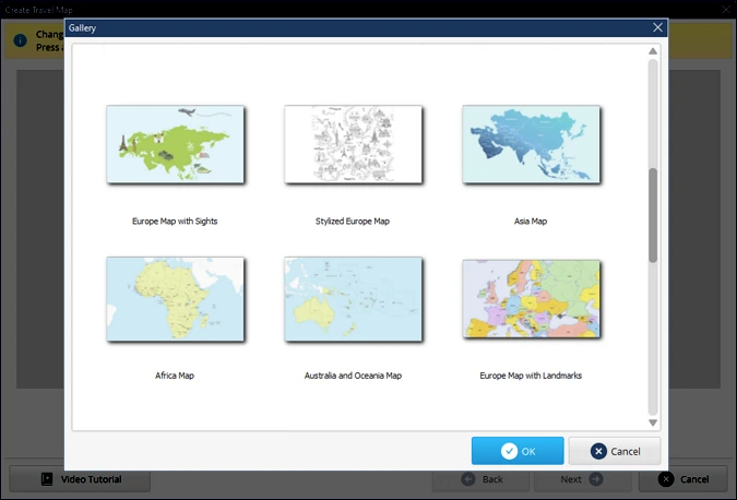
Step 3. Draw Your Route
Now it’s time to create the route of your trip. Think about the places you have visited and double-click on the locations to add map markers in the corresponding order. You can add as many of them as you want. Hit Next to move on to map customization.
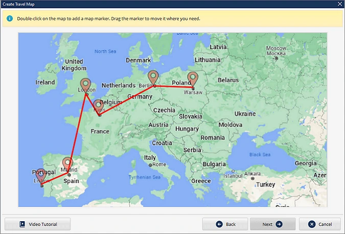
Step 4. Create Your Animated Travel Map
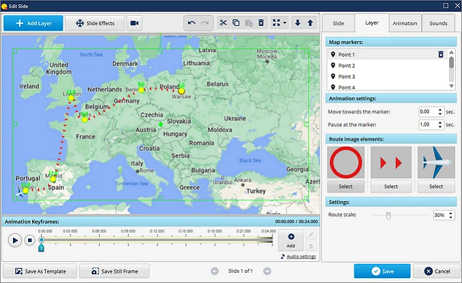
At this stage, you’re going to work on animation. Select map markers individually and clip the corresponding photos from your trip to them. Adjust the Animation settings for each of the destination points to provide the viewer with sufficient time to observe your photos. Choose the marker image that suits the map style. Hit Next and select the vehicle and the route images. Hit Done to generate your travel animation.
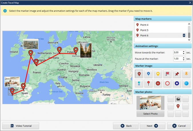
Step 5. Review Your Animation and Edit It
Click the Play button on the preview window to watch your travel map video. If you want to make adjustments, click the Edit Slide button and double-click the Travel Map layer. Here you can work on your animated map further - for instance, rescale the animated elements of the map. Want to make your video more interactive? Use the Sounds tab of the Edit Slide menu to accompany your map with music from the built-in library of 250+ royalty-free soundtracks of the animated map creator. Alternatively, upload a tune from your PC.
Step 6. Save Your Travel Map
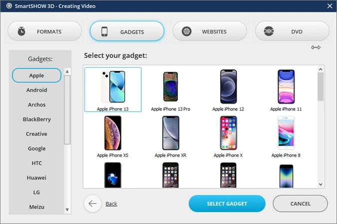
When you’re done with the editing process, export your animated travel map for a video project or use it solely. Just click the Create Video button in the upper right corner of your play screen. The program has over 15 export options to choose from, whether you are planning to watch your animation on a smartphone, PC, or a bigger screen.
It takes just a few clicks and your imagination to make a fascinating animation of your trip with SmartSHOW 3D. Prefer watching videos for learning new techniques? Check out our video guide on how to make an animated travel map with little effort and see what results you can achieve.
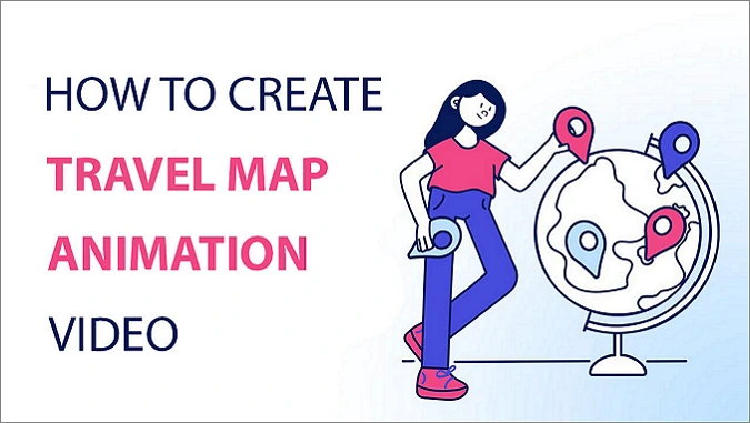
Looks cool, doesn’t it? Just imagine, you can create similar animated maps and it won’t take you hours of work. Just pack your photos and a joyful mood and put together all your travel memories with SmartSHOW 3D. Why not start now? Just click the button below and get a free trial version.
Now you can recap your travel memories and make your own travel map with ease!
Create Travel Map Animation: 3 Alternative Ways
SmartSHOW 3D is suitable for users of any skill level in slideshow making. If for some reason it’s not what you’re looking for, or the software is not compatible with your device, we’ve prepared 3 alternative animated map makers worthy of your attention.
Whether you don’t want to download extra programs, Travellerspoint will be a brilliant solution. This web-based app allows you to add photos and dates to each location on the map and shows how many kilometers you’ve traveled from destination to destination. But you have to become a supporting member to save your maps as PNGs and block ads within the editor. In the free plan, you’ll only be able to map out your journey.
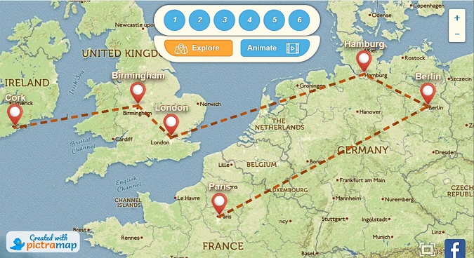
If you’re looking for more options available for free, then PictraMap is the right choice. This is an online tool that helps make detailed animated road maps. It offers diverse customization options: music themes, pins, and maps. However, unless you buy a subscription, you can add only 10 locations and make only 2 projects inside this editor. Still, you can change the map style and the marker images for free.
Prefer using your smartphone to create travel content? There is an interactive travel map animation creator for you - Tripline . This app is available for both Apple and Android smartphones and has simple yet efficient features to draw routes of your trips. With this editor, you can add your photos to every destination marker and make your map more interactive. Then, you can easily share your memorable travel animation online. But this app is not as inclusive - you can’t change the marker and map designs. It’s suitable for planning your next trips or making minimalistic Insta stories rather than creating travel movies for big projects.
Now you know how to make an animated travel map in 4 different ways and can design your own in a couple of clicks. There are various online options that can help you share your travel memories. But if you want the process to be fun and easy, consider SmartSHOW 3D. This program is packed with dedicated tools and features to help you create live images, make exciting presentations, and design animated slideshows with photos. So building your new traveling animation and completing many other tasks related to producing slideshows and videos won’t take much time and effort if you use this software.

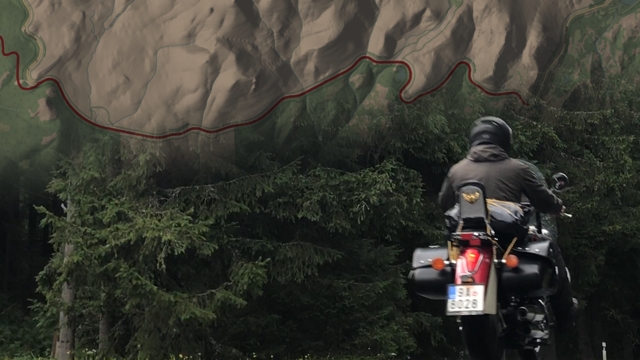
Turn maps into videos
From your web browser.
Keep your memories alive with animated maps.
Geofoobar is web application for travellers, video creators, runners, cyclists, motorcyclists or hikers. All who move from one place to another and create maps for their videos or social media posts.
Record your journey with any GPS device, smartphone or smartwatch, and then use Geofoobar to create GIFs and MP4 videos for social media, travel films or documentaries. Sign up and start creating now.

Use the free mobile app to record your trips. You can create videos right on your phone using default template or sync the trips to your account and create videos with custom style using the web application in your laptop browser.
If you don't have your own GPX files recorded yet, you can find plenty of existing GPX and KML files to import on the internet. Following are some free resources for cycling, running and hiking enthusiasts or even historians.
Tour de France 2023 stages
Walking routes in the United Kingdom
Pacific Crest Trail sections
Columbus first voyage
Monaco F1 circuit
Czech velvet revolution march on 17.th November 1989
- Geofoobar logo
- Free for everyone
- Additional features
comming soon
- Multiple users
- Monthly subscription
Compare plans
Get in touch.
Have a question or suggestion? Great! Send us an email or join us on Facebook or Instagram.
info graphics @ my geofoobar.com
Facebook page
Facebook group
Instagram profile
- Google Earth
- Earth Engine
- Earth Outreach

Let the world tell your story
Earth Studio is an animation tool for Google Earth’s satellite and 3D imagery.
Inside Earth Studio
Powerful motion design, all in the browser. Earth Studio gives you the tools you need to create professional content with Google Earth imagery. Read more in the Documentation .
Keyframe Animation
Earth Studio uses keyframes, just like other industry-standard animation tools. Move the globe, set a keyframe, rinse and repeat. It’s that easy.
Quick-Start Projects
Create an orbit, or fly from point to point. Select from up to five templates to get started - no animation experience needed.
Animatable Effects
Animate custom attributes such as the sun's position, the camera's field of view and more.
3D Camera Export
Easily add map labels and pins in post production. Earth Studio supports camera export to Adobe After Effects.
Try the Earth Studio preview
Earth Studio is free to use and works with the desktop version of Google Chrome. Sign in with your Google account to request access. Learn more
Earth Studio works with the desktop version of Google Chrome. Sign in with your Google account to request access. Learn more .
More than 10 million iOS and Android users worldwide have used TravelBoast since its release. It’s been the most popular mobile app in more than 30 countries.
Our users are very inventive! In 2022, they blew up TikTok with their fun distance map trend and educational Guess the Empire videos.
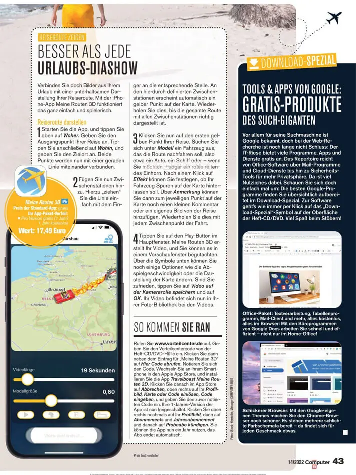
Over time, memories of even the most exciting trips start to fade. TravelBoast lets you record every detail of your journey, note the cities you visited, and add your best photos.
It’s lovely to reminisce about past journeys or share them with your friends.
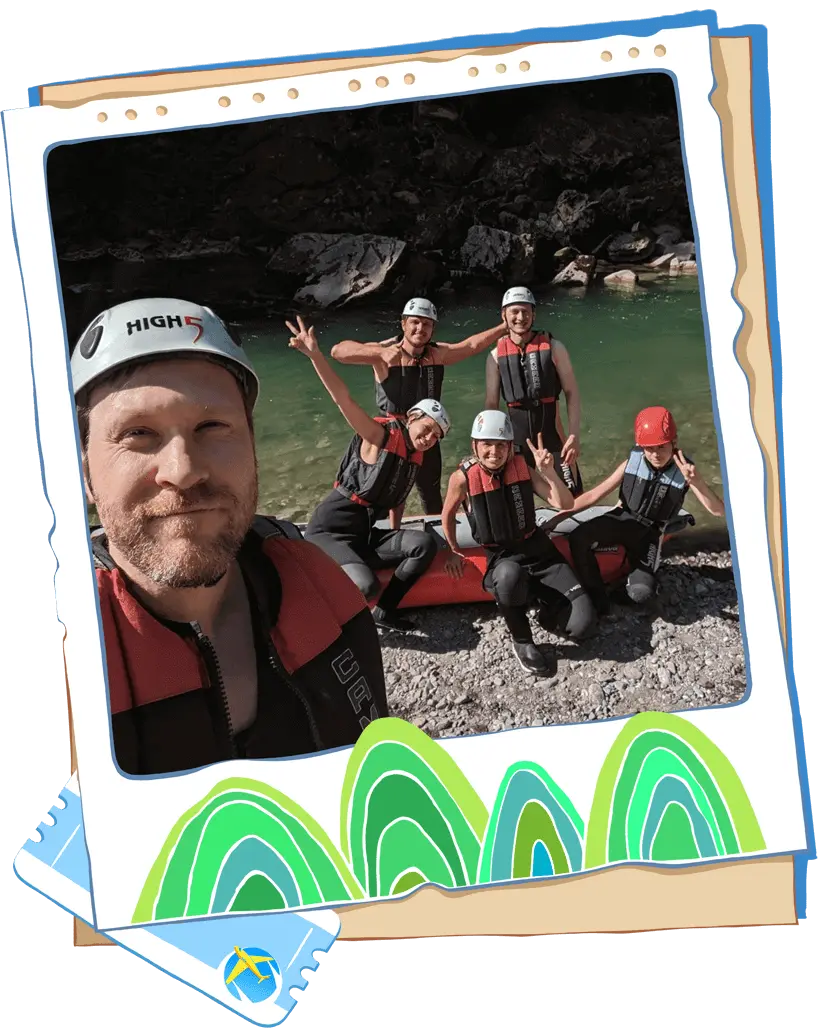
Getting to grips with the app takes just 5–10 minutes. We’re always happy to answer questions and help you if you’re struggling with something.
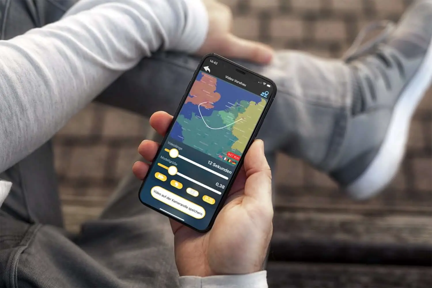
With almost 100 different modes of transport to choose from, you’ll almost certainly be able to find the one you need.
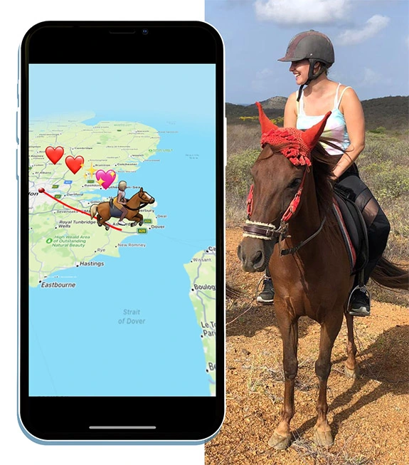
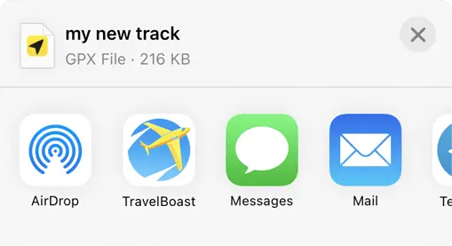
Our app lets you import GPX tracks from almost any tracker. Record your route and send the track to TravelBoast to get a beautiful map.
Privacy Overview
Free animated travel map
Enhance your trip route with photos and notes.
Experience your journey like never before by adding stunning photos and personalized notes to your trip route. With our innovative feature, you have the power to create a truly immersive travel experience. But that's not all – we also offer the flexibility to customize the animation style of your photos and notes, giving your trip a unique touch of creativity. Start documenting your adventures in a visually captivating way today!

Route Animation
With roadtripplaner, a versatile travel map generator, you have the ability to personalize your route animation. Customize the color of your route to match your preferences or branding. Choose from a variety of vehicle icons to represent your mode of transportation, making your map even more engaging. Create a visually stunning and unique travel experience with our route animation feature.
Export Animated Route to Video
Once you've completed creating your travel map, roadtripplaner allows you to export it as a video. Easily share your captivating animated route with friends and loved ones. Whether it's reliving your memorable journey or showcasing your travel adventures on social media, exporting your travel map to video format ensures you can share your experiences in a dynamic and visually appealing way.

Embed Animated Travel Map to Your Site
Easily enhance your website with an animated travel map by embedding it within seconds. With roadtripplaner, you can generate a personalized travel map and then seamlessly integrate it into your website using an iframe. In just 30 seconds, you can enrich your site with an interactive visual representation of your travel adventures, captivating your visitors and adding a unique touch to your online presence.


Tools for Creating Interactive Travel Maps
In travel, a map is your most important piece of gear. It will get you from where you are, to where you want to be and back again. With the advent of the internet, maps are a lot easier to use and to get your hands on.
The one problem is, Google Maps and Google Earth can be a bit boring, especially when you want some fun and memorable maps on your site. The best solution? Make colorful, customized, and interactive maps yourself.

Travellerspoint
Travellerspoint brings exciting differences to the travel map game. Using their platform, you can map out a recent trip that you’ve gone on, adding images and short blog posts to each destination marker as well.
With these maps, you can also plan out an itinerary map. Once you have created your map, it’s really simple to copy the embed code onto your own blog. The platform is open and free for anyone to use, all you have to do is sign up. It’s a fantastic opportunity for travel bloggers to incorporate an interactive way for their readers to follow them on their adventures.
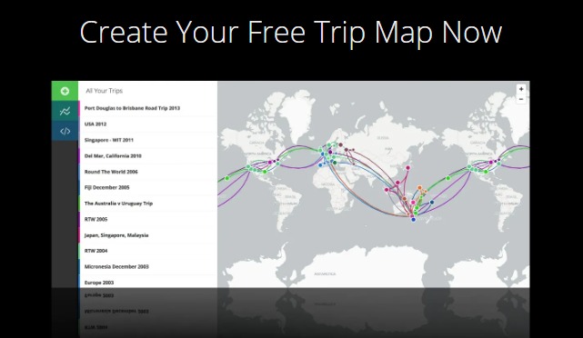
If you are someone who is looking for the dramatics of animation, as well as the information of a regular map, Animaps is the platform for you. Create maps with markers that move, shapes that change over time as well as info bubbles that pop-up on cue.
If you send these Animaps out, they will appear as a video, and the people watching can play, pause, speed up and slow down as they please. All this may seem complicated at first, but going through the tutorials will turn you into a pro in no time.

Scribble Maps
Scribble Maps allows you to get creative and draw and share maps simply. Using Scribble Maps, you can add custom images, place any amount of text and markers, draw different shapes, add distances, save the maps as PDF, and a whole lot more.
You are also able to send maps to your friends as well as embed them into your website or your blog. The basic service is free while paying for Pro Scribble enables you to import KML files, spreadsheets, and SHP files for a certain price.

Click2Map is a great platform for creating maps that serve a specific purpose or fulfill a particular need. Click2Map allows you to place built-in markers from their massive library to ensure your maps are more informative and interactive.
You are also able to add lines and polygons to your maps to serve various purposes, such as marking out particular geographical features. When you are done making your map, you can download it and embed it to your website free of charge.

The unique aspect of ZeeMaps is that you are able to use their service without having to sign up. You are able to place customizable markers, as well as highlight countries, states, cities, and towns.
Another really cool feature is that you are able to add video or sound clips to the markers, enabling you to have an explanatory video or tour of a particular marked location. You are also able to have customizable search fields.

MapTiler is definitely one of the more advanced map makers on our list and is definitely one with more features. It is used by NASA, Google, and Apple. You can effectually render the geodata into the map tiles which are suitable for Google Maps API mashups, Google Earth, and many others.
You are able to use MapTiler on Windows, Linux, and Mac, which makes this tool incredibly versatile. There is a free version that you can try out, as well as paid versions that offer different bundles and features.

Want to increase traffic to your pages? Click here to view our on-page optimization packages
TargetMap is another very handy tool for creating and publishing maps. It has a large community, and the sense of community is encouraged as when your map is published, you are able to compare it to others.
You can obviously embed your maps into your website or blog. To use the service for free, you will need to share your maps. If you do not want to share, you will need to pay for the premium service which will then keep your maps private.

HeatmapTool
HeatmapTool is a handy and easy tool that allows you to make heatmaps out of a CVS file. They can scale the heatmap as you please, and also update it in real-time. You can cool the map by dimming it, and sharpen or soften the edges as you like.
Another very cool feature of this site is that you are able to make heat maps that can overlay the Google Maps API. The basic version of this site is once again free, and you will need to pay for the premium version which offers more features.

GmapGIS is a very simple tool that allows mapping for specific purposes. You are able to draw lines, shapes, add labels, add markers, as well as to measure distance on maps, all without needing a Google account.
Once you are finished labeling and marking your map, an automated link is generated for you to then share or put on your website or blog. With this tool, you can choose to save the map in KML format or view it on Google Earth.

geoCommons allows you to create, use, and share deeply data-rich maps regardless of your skill and knowledge level. It lets you map real-time social data using over 50, 000 available open-source data sets.
You are also able to filter the data and maps on the geoCommons database using any number, string or attribute of data available. Once finished, you are able to share your map or embed it on your website or blog.

Looking for expertly-written, SEO content? Click here to view our affordable content writing packages
Interactive World Maps
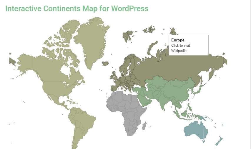
As the name suggests, the Interactive World Maps plugin enables users to create an interactive map of the world on their site. These maps are generated using the Geochart API in SVG format, meaning they are mobile-friendly across all devices.
You can segment the map into continents, countries, and even states. This allows travel websites to group their content accordingly. You have control over colors and click actions for each segment of the map as well. Although this is a paid plugin, the features are well worth the cost.
These map-making tools are incredibly useful if maps are an important factor in your blog. Even if they aren’t, maybe discovering these tools will give you the inspiration you need to make some interactive maps for your blog.
More to explorer

SEO Vocabulary | 75+ Words You Should Know

The Importance of Authoritative Content for SEO in 2024

ChatGPT vs Jasper AI | The Pros & Cons of Each AI Writing Tool
Book a call with an digital strategist.

New NASA Black Hole Visualization Takes Viewers Beyond the Brink
Ever wonder what happens when you fall into a black hole? Now, thanks to a new, immersive visualization produced on a NASA supercomputer, viewers can plunge into the event horizon, a black hole’s point of no return.
“People often ask about this, and simulating these difficult-to-imagine processes helps me connect the mathematics of relativity to actual consequences in the real universe,” said Jeremy Schnittman, an astrophysicist at NASA’s Goddard Space Flight Center in Greenbelt, Maryland, who created the visualizations. “So I simulated two different scenarios, one where a camera — a stand-in for a daring astronaut — just misses the event horizon and slingshots back out, and one where it crosses the boundary, sealing its fate.”
The visualizations are available in multiple forms. Explainer videos act as sightseeing guides, illuminating the bizarre effects of Einstein’s general theory of relativity. Versions rendered as 360-degree videos let viewers look all around during the trip, while others play as flat all-sky maps.
To create the visualizations, Schnittman teamed up with fellow Goddard scientist Brian Powell and used the Discover supercomputer at the NASA Center for Climate Simulation . The project generated about 10 terabytes of data — equivalent to roughly half of the estimated text content in the Library of Congress — and took about 5 days running on just 0.3% of Discover’s 129,000 processors. The same feat would take more than a decade on a typical laptop.
The destination is a supermassive black hole with 4.3 million times the mass of our Sun, equivalent to the monster located at the center of our Milky Way galaxy.
“If you have the choice, you want to fall into a supermassive black hole,” Schnittman explained. “Stellar-mass black holes, which contain up to about 30 solar masses, possess much smaller event horizons and stronger tidal forces, which can rip apart approaching objects before they get to the horizon.”
This occurs because the gravitational pull on the end of an object nearer the black hole is much stronger than that on the other end. Infalling objects stretch out like noodles, a process astrophysicists call spaghettification .
The simulated black hole’s event horizon spans about 16 million miles (25 million kilometers), or about 17% of the distance from Earth to the Sun. A flat, swirling cloud of hot, glowing gas called an accretion disk surrounds it and serves as a visual reference during the fall. So do glowing structures called photon rings, which form closer to the black hole from light that has orbited it one or more times. A backdrop of the starry sky as seen from Earth completes the scene.
As the camera approaches the black hole, reaching speeds ever closer to that of light itself, the glow from the accretion disk and background stars becomes amplified in much the same way as the sound of an oncoming racecar rises in pitch. Their light appears brighter and whiter when looking into the direction of travel.
The movies begin with the camera located nearly 400 million miles (640 million kilometers) away, with the black hole quickly filling the view. Along the way, the black hole’s disk, photon rings, and the night sky become increasingly distorted — and even form multiple images as their light traverses the increasingly warped space-time.
In real time, the camera takes about 3 hours to fall to the event horizon, executing almost two complete 30-minute orbits along the way. But to anyone observing from afar, it would never quite get there. As space-time becomes ever more distorted closer to the horizon, the image of the camera would slow and then seem to freeze just shy of it. This is why astronomers originally referred to black holes as “frozen stars.”
At the event horizon, even space-time itself flows inward at the speed of light, the cosmic speed limit. Once inside it, both the camera and the space-time in which it's moving rush toward the black hole's center — a one-dimensional point called a singularity , where the laws of physics as we know them cease to operate.
“Once the camera crosses the horizon, its destruction by spaghettification is just 12.8 seconds away,” Schnittman said. From there, it’s only 79,500 miles (128,000 kilometers) to the singularity. This final leg of the voyage is over in the blink of an eye.
In the alternative scenario, the camera orbits close to the event horizon but it never crosses over and escapes to safety. If an astronaut flew a spacecraft on this 6-hour round trip while her colleagues on a mothership remained far from the black hole, she’d return 36 minutes younger than her colleagues. That’s because time passes more slowly near a strong gravitational source and when moving near the speed of light.
“This situation can be even more extreme,” Schnittman noted. “If the black hole were rapidly rotating, like the one shown in the 2014 movie ‘Interstellar,’ she would return many years younger than her shipmates.”
By Francis Reddy NASA’s Goddard Space Flight Center , Greenbelt, Md. Media Contact: Claire Andreoli 301-286-1940 [email protected] NASA’s Goddard Space Flight Center, Greenbelt, Md.
Related Terms
- Astrophysics
- Black Holes
- Galaxies, Stars, & Black Holes
- Galaxies, Stars, & Black Holes Research
- Goddard Space Flight Center
- Supermassive Black Holes
- The Universe
Explore More

Hubble Views Cosmic Dust Lanes

How NASA Tracked the Most Intense Solar Storm in Decades

Discovery Alert: An Earth-sized World and Its Ultra-cool Star

- Rivers and Lakes
- Severe Weather
- Fire Weather
- Long Range Forecasts
- Climate Prediction
- Space Weather
- Past Weather
- Heating/Cooling Days
- Monthly Temperatures
- Astronomical Data
- Beach Hazards
- Air Quality
- Safe Boating
- Rip Currents
- Thunderstorms
- Sun (Ultraviolet Radiation)
- Safety Campaigns
- Winter Weather
- Wireless Emergency Alerts
- Weather-Ready Nation
- Cooperative Observers
- Daily Briefing
- Damage/Fatality/Injury Statistics
- Forecast Models
- GIS Data Portal
- NOAA Weather Radio
- Publications
- SKYWARN Storm Spotters
- TsunamiReady
- Service Change Notices
- Be A Force of Nature
- NWS Education Home
- Pubs/Brochures/Booklets
- NWS Media Contacts
NWS All NOAA
- Organization
- Strategic Plan
- Commitment to Diversity
- For NWS Employees
- International
- National Centers
- Social Media
Privacy Policy
National Weather Service
National Headquarters
National Forecast Maps
National forecast chart.
High Resolution Version | Previous Days Weather Maps Animated Forecast Maps | Alaska Maps | Pacific Islands Map Ocean Maps | Legend | About These Maps

National Temperature
Alaska | Hawaii | Guam | Puerto Rico/Virgin Islands More from the National Digital Forecast Database
Short Range Forecasts
Short range forecast products depicting pressure patterns, circulation centers and fronts, and types and extent of precipitation.
12 Hour | 24 Hour | 36 Hour | 48 Hour
Medium Range Forecasts
Medium range forecast products depicting pressure patterns and circulation centers and fronts
Day 3 | Day 4 | Day 5 | Day 6
Precipitation Amounts
Quantitative precipitation forecasts.
Day 1 | Day 2 | Day 3
Surface Analysis
Highs, lows, fronts, troughs, outflow boundaries, squall lines, drylines for much of North America, the Western Atlantic and Eastern Pacific oceans, and the Gulf of Mexico.
Standard Size | High Resolution

Temperature
Maximum daytime or minimum overnight temperature in degrees Fahrenheit.
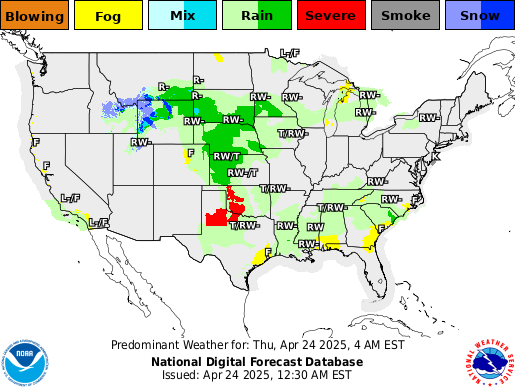
Predominant Weather
Expected weather (precipitating or non-precipitating) valid at the indicated hour. The weather element includes type, probability, and intensity information.
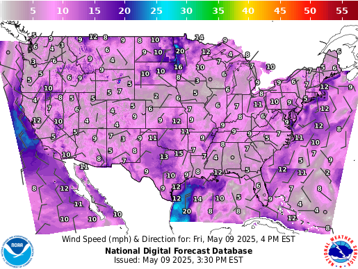
Wind Speed and Direction
Sustained wind speed (in knots) and expected wind direction (using 36 points of a compass) forecasts.
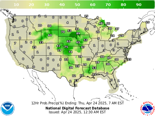
Chance of Precipitation
Likelihood, expressed as a percent, of a measurable precipitation event (1/100th of an inch).
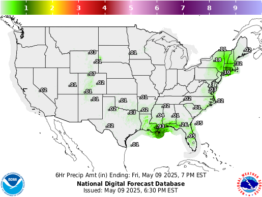
Precipitation Amount
Total amount of expected liquid precipitation.
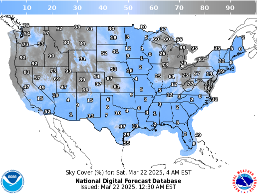
Expected amount of opaque clouds (in percent) covering the sky.
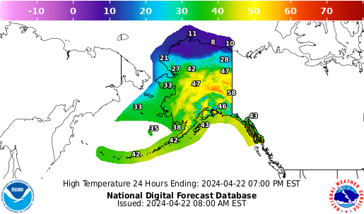
Alaska Graphical Forecasts
Graphical forecasts from the National Digital Forecast Database for Alaska.
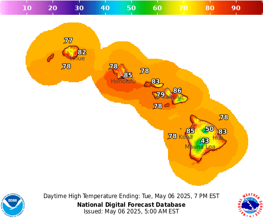
Hawaii Graphical Forecasts
Graphical forecasts from the National Digital Forecast Database for Hawaii.
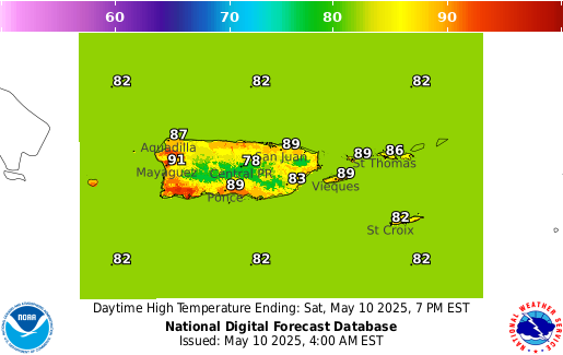
Puerto Rico Graphical Forecasts
Graphical forecasts from the National Digital Forecast Database for Puerto Rico and Virgin Islands.
ACTIVE ALERTS Warnings By State Excessive Rainfall and Winter Weather Forecasts River Flooding Latest Warnings Thunderstorm/Tornado Outlook Hurricanes Fire Weather Outlooks UV Alerts Drought Space Weather NOAA Weather Radio NWS CAP Feeds
PAST WEATHER Climate Monitoring Past Weather Monthly Temps Records Astronomical Data Certified Weather Data
CURRENT CONDITIONS Radar Climate Monitoring River Levels Observed Precipitation Surface Weather Upper Air Marine and Buoy Reports Snow Cover Satellite Space Weather International Observations
FORECAST Local Forecast International Forecasts Severe Weather Current Outlook Maps Drought Fire Weather Fronts/Precipitation Maps Current Graphical Forecast Maps Rivers Marine Offshore and High Seas Hurricanes Aviation Weather Climatic Outlook
INFORMATION CENTER Space Weather Daily Briefing Marine Climate Fire Weather Aviation Forecast Models Water GIS Cooperative Observers Storm Spotters Tsunami Warning System National Water Center International Weather
WEATHER SAFETY NOAA Weather Radio StormReady Heat Lightning Hurricanes Thunderstorms Tornadoes Rip Currents Floods Tsunamis TsunamiReady Winter Weather Ultra Violet Radiation Air Quality Damage/Fatality/Injury Statistics Red Cross Federal Emergency Management Agency (FEMA) Brochures Safe Boating
NEWS Newsroom Events Pubs/Brochures/Booklets
EDUCATION NWS Education Home Be A Force of Nature NOAA Education Resources Glossary JetStream NWS Training Portal NOAA Library For Students, Parents and Teachers Brochures
ABOUT Organization NWS Transformation Strategic Plan For NWS Employees International National Centers Products and Services Careers Glossary Contact Us Social Media
US Dept of Commerce National Oceanic and Atmospheric Administration National Weather Service 1325 East West Highway Silver Spring, MD 20910 Comments? Questions? Please Contact Us.
How-To Geek
Psa: you can temporarily share your google maps road trip, here's how.
Let friends or family see your location progress and ETA during a trip.
Using Google Maps to share your real-time location with others is a great feature, but it's understandable if you don't want to let someone see your every move 24/7. Did you know you could temporarily share your phone's location during a vacation road trip or other travel?
Apple's location sharing and Find My are well-known at this point, and Google offers something similar on Google Maps that works with Android , iPhone , or iPad . However, during setup, most people choose to share their location indefinitely or select the option to share "until you turn this off," which isn't ideal.
Thankfully, Google Maps has a nifty feature where you can temporarily share navigation progress and location data with friends or family. Once the drive ends, location sharing ends. Here's how to use it:
Fire up Google Maps for an upcoming road trip or while heading to someone's house. Choose a destination, then hit "Start" navigation. While navigation is running, swipe up from the bottom of the screen and tap "Share Trip Progress" to get started.
You'll see a row of icons showing some of your most frequent contacts. Choose or search for the name you'd like to share your location with, tap the person's icon, and hit the blue "Share" button. The screen will briefly say, "Sharing your location until you arrive." Once you reach the destination, navigation and location sharing will both end.
Depending on the contact selected, that person will receive a text or email with a link to Google Maps, which will then start giving them complete location data of your road trip. Additionally, if you'd like to stop sharing or select the wrong person, swipe up from the Maps navigation screen and hit "Stop Sharing."
Note: While sharing, the person will see your route, destination, arrival time, and how you're traveling. They'll also see your device's current location, battery power, and if it's charging.
It's that easy! As long as you're actively using Google Maps navigation, you can quickly share your location with someone. Use this helpful feature for summer road trips, friends and family to see when you'll arrive during the holidays, and more.
Other Ways to Share Your Location on Google Maps
Not only is this feature great for privacy, but it's one of several useful Google Maps features to know about . Others include the option to share your location in a text message , zoom out with a single finger , or Android owners can share their location with iPhone users . Google Maps works great in tunnels now, and you can even use Maps to save and find a parked car .

IMAGES
VIDEO
COMMENTS
If you're too busy to create your first animated travel map right now, or you think your friends can wait being WOW-ed by your last amazing trip, join our community. We'll remind you later that your travel photos can still get the attention they deserve. Keep me posted. Create your animated travel map within minutes with PictraMap - a free ...
Create animated maps for video. Free animated map maker. Create animated maps for video. Free animated map maker. We use cookies to improve our service. Learn more → . Export. It may take few seconds to render ...
TravelAnimator - The best of the lot. TravelAnimator gets your job of creating fun animated travel maps pretty easily. It is a highly-rated app on the Play Store and App Store. It allows you to ...
Animated travel infographics. Visualize your journey with beautiful animated maps. Perfect for adventurers, travelers, and explorers wanting to showcase their routes and destinations. Hey mate, this site is awesome! As a s/w product mgr myself, this is very well-done! I was googling for something exactly like this for a while, I've used relive ...
Free Animated Travel Map Maker to show your Road trips, Flight paths and Routes with interactive Custom pins. Download Now! ... and the bustling markets of Bangkok. The animated map feature makes my travels feel like a blockbuster movie. Absolutely in love. - Sophia L. Travel Animator is a game-changer! I used to spend hours editing my travel ...
In this tutorial, we'll show you how to create a dynamic, interactive, and animated travel map for your travel and other videos using free tools. This power...
Animated Travel Maps: Visualize your journey with beautiful animated maps. Perfect for adventurers, travelers, and explorers wanting to showcase their routes and destinations. Travel Infographics: Turn your travel data into compelling infographics. Ideal for bloggers, journalists, and educators looking to present information in an engaging ...
Buy me a coffee for personal tips & advice (link above)My Videos using travel map animations:https://youtu.be/ktaOmecRwlY - The #1 Adventure Ride Rulehttps:/...
In this Canva Tutorial, we'll show you how to create stunning and dynamic travel map animation using Canva. 🚀 Whether you're a travel vlogger, content creat...
GEOlayers.app lets you create animated maps in a breeze! Unlock your imagination: effortlessly select colors, design harmonious basemaps, create outstanding labels, and more! Seamlessly animate with our item-based timeline - Say goodbye to fiddly keyframes and value graphs. GEOlayers.app offers all the tools you need to tell your story with a map!
Share your animated travel route map with your friends & families. With Travel Animator, your travel experiences come to life like never before. Create stunning animations of your travel mapping, turning static photos into animated masterpieces that capture the essence of your wanderlust. Plot your journey on interactive travel maps to give ...
Tips for Creating an Engaging Animated Travel Map: 1. Incorporate Real-Time Movements. Animated travel map videos should showcase real-time movements, providing an interactive experience for viewers. This feature allows the audience to follow the routes from the source to the destination locations, making the map more engaging and informative. 2.
First, install SmartSHOW 3D on your computer. Click the button below and start your free trial. Download free. For Windows 11, 10, 8, 7. Step 2. Create Your Travel Project. Once you open the program, click New Project. Switch to the Effect tab and in the Motion section, pick the Travel Map animation effect.
Keep your memories alive with animated maps. Geofoobar is web application for travellers, video creators, runners, cyclists, motorcyclists or hikers. All who move from one place to another and create maps for their videos or social media posts. Record your journey with any GPS device, smartphone or smartwatch, and then use Geofoobar to create ...
Earth Studio works with the desktop version of Google Chrome. Sign in with your Google account to request access. Learn more. A web-based animation tool for Google Earth's satellite and 3D imagery.
Show your route on an animated Indiana Jones style map! IT'S POPULAR. More than 10 million iOS and Android users worldwide have used TravelBoast since its release. It's been the most popular mobile app in more than 30 countries. Our users are very inventive! In 2022, they blew up TikTok with their fun distance map trend and educational ...
Create Awesome Travel Animation on Google Map using TravelBoast Android / iPhone / iOS app.Android URL: https://play.google.com/store/apps/details?id=io.urob...
Route Animation. With roadtripplaner, a versatile travel map generator, you have the ability to personalize your route animation. Customize the color of your route to match your preferences or branding. Choose from a variety of vehicle icons to represent your mode of transportation, making your map even more engaging. Create a visually stunning ...
Click2Map is a great platform for creating maps that serve a specific purpose or fulfill a particular need. Click2Map allows you to place built-in markers from their massive library to ensure your maps are more informative and interactive. You are also able to add lines and polygons to your maps to serve various purposes, such as marking out ...
Free Online Travel Animation Video Maker. Elevate your travel storytelling with travel animation videos made on FlexClip's free online travel animation video maker, a game-changer in video production that saves you time and money. Be it captivating travel map animation, dynamic travel logo animation, or engaging travel video intro animation ...
The visualizations are available in multiple forms. Explainer videos act as sightseeing guides, illuminating the bizarre effects of Einstein's general theory of relativity. Versions rendered as 360-degree videos let viewers look all around during the trip, while others play as flat all-sky maps.
Create without limits with a subscription to https://elements.envato.com/?utm_campaign=elements_social_eyt_E2cb0-7bpJg&utm_medium=social&utm_source=YouTube&u...
National Weather Maps. Surface Analysis. Highs, lows, fronts, troughs, outflow boundaries, squall lines, drylines for much of North America, the Western Atlantic and Eastern Pacific oceans, and the Gulf of Mexico.
Fire up Google Maps for an upcoming road trip or while heading to someone's house. Choose a destination, then hit "Start" navigation. While navigation is running, swipe up from the bottom of the screen and tap "Share Trip Progress" to get started. You'll see a row of icons showing some of your most frequent contacts. ...