Lake Huron Circle Tour Camping Itinerary
By: Author Diana Hansen
Posted on Last updated: January 10, 2024
Categories Camping Destinations
Camping Destinations » Lake Huron Circle Tour Camping Itinerary
Embark on a camping adventure around Lake Huron, the second largest of the Great Lakes. With various state and provincial parks, this route offers a unique blend of nature, wildlife, and outdoor activities. Our suggested Lake Huron Circle Tour Itinerary includes a shortcut and a way to divide the route into US (Michigan) and Canadian (Ontario) trips.

We love the Great Lakes and hope to camp along the perimeter of each one. We have Circled Lake Michigan and done much of the Lake Superior Circle Tour . It took us a few trips to complete Lake Huron, which we now present to you.

Lake Huron Circle Tour Map
This Circle Tour of Lake Huron goes in a counter-clockwise direction, starting at the southernmost park in Canada. Reverse the itinerary or do parts of it as you see fit.
Things to Note: Reservations are strongly encouraged on both sides of the lake! Many parks in Canada require reservations for day visits in addition to camping. Provincial Park reservations can be made 5 months in advance. Canadian National Park reservations in Ontario open on February 5, 2024. The Michigan State Park reservation window is 6 months in advance. Also, the electrical poles at many parks are often a distance from parking pads, so pack a long cord.
Lake Huron Camping Trip Itinerary
Enjoy the following stays along the coast of crystal-clear Lake Huron.
Lake Huron Circle Tour Camping in Canada
We recommend Americans on the Lake Huron Circle Tour cross the border into Canada at Port Huron/Point Edward. If you have time, stop and visit the park at the base of the bridge on the Canadian side for beautiful views of the blue water. Check out these travel tips for RVers crossing into Canada . Nearby, Sarnia has several grocery stores right off the highway where you can stock up on fresh ingredients.

Pinery Provincial Park
Pinery Provincial Park is a popular park along the lake in the southernmost part of Canada. The park features three campgrounds with a total of 1000 campsites. The campsites are spacious and have foliage separation, providing privacy for campers. Among the campgrounds, Riverside is situated at the park’s center, while Dunes and Burley are near the beach. Electric hookups are only available in Riverside.
Enjoy biking, hiking, paddling, fishing, and relaxing on the beach. The park has a visitor center that offers interactive exhibits, a theater, a nature store, and free Wi-Fi. Additionally, there is a store where visitors can purchase souvenirs, snacks, and camping items, and a restaurant, bike rentals, canoe rentals, and ice cream.
Pinery Provincial Park 9526 Lakeshore Rd, Grand Bend, ON N0M 1T0

Visit the Beach at Grand Bend
The town of Grand Bend lies to the north of Pinery. A touristy district with shopping, restaurants, and a large beach is on Main Street West. It is a great place to get souvenirs.
Inverhuron Provincial Park
Midway up the peninsula is Inverhuron Provincial Park. The park has 351 campsites within three campgrounds that have easy access to Lake Huron. Sites are level, spacious, and private.
The shoreline is mostly rocky, but you will find a sandy beach on the park’s south end. Either is great for watching the sunset. Walk or bike around the park on the Chain Trail.
Inverhuron Provincial Park 19 Jordon Rd, Kincardine, ON N0G 2T0
Roadside Water Falls
Just north of Sauble Beach is Sauble Falls Provincial Park . The north side of the bridge has the Falls Viewing Day Use parking area on the west side of the road. Sauble Falls is a great stop to have a picnic lunch or swim in the cascading falls.

Bruce Peninsula National Park
Bruce Peninsula National Park is a beautiful park located just south of Tobermory. One of the park’s most popular attractions is The Grotto (pictured at the top of this post), a natural area with sea caves and towering rock formations. The crystal-clear waters are perfect for swimming.
We stayed at the Cypress Lake Campground along its namesake’s shores. Each site has a picnic table and fire ring (must get a permit to use). There are no hookups, but a dump station is located near the exit. The campground shower building has electrical outlets on the outside so you can charge your devices.

Walk from Cypress Lake to The Grotto. If you want to drive to get closer to the trail, you will have to make a separate parking reservation.
Bruce Peninsula National Park Tobermory, ON N0H 2R0

Visit the Largest Fresh Water Beach in the World
Wasaga Beach, which is located along the southernmost edge of the Georgian Bay of Lake Huron, is the largest freshwater beach in the world. This huge beach has eight distinct beach areas . Dogs are allowed in a small portion of Beach Area 3.
Six Mile Lake Provincial Park
This park is along the east side of the Georgian Bay on Six Mile Lake. It has seven campgrounds, of which two offer electrical hookups. The park also offers a park store, hiking, biking, canoeing, kayaking, and fishing. Swim or relaxing on the sand at one of the three beaches along Six Mile Lake. The beaches have lifeguards on duty during summer, making the park ideal for families.
We picked this park due to its proximity to Honey Harbour, where you catch a boat to visit the national park in the Georgian Bay.
Six Mile Lake Provincial Park 2024 Joe King’s Road, Port Severn, ON L0K 1S0
Georgian Bay Islands National Park
Georgian Bay Islands National Park, located in the world’s largest freshwater island group, covers an area of 13.5 square kilometers (3335 acres) and features over 60 islands and islets. The park is known for its rugged terrain, clear waters, and stunning views of Georgian Bay. Reservations are required to visit the park.

The park can only be accessed by boat where visitors can enjoy hiking, camping, boating, swimming, and fishing. The park accommodations include rustic cabins, waterfront campsites, and canvas tents. The Day Tripper boat shuttles visitors from Honey Harbour to Beausoleil Island, where they can rent a bicycle to tour the island.
Day Tripper Dock at Honey Harbour 2384 Honey Harbour Road, Honey Harbour, ON L0K 1S0
Killbear Provincial Park
Killbear features a shoreline of rugged rocks mixed with sand beaches along the Georgian Bay. It has seven campgrounds, three of which have electric hookups. There is a visitor center, hiking, biking, canoeing, kayaking, and fishing. The park also features a recreational trail that is 6 km long and passes by several islands, waterfalls, and rock formations. The trail offers views of windswept pines, wildlife, and Georgian Bay sunsets.
Killbear Provincial Park 35 Killbear Park Road, Nobel, ON P0G 1G0
Killarney Provincial Park
Killarney Provincial Park is located on the north shore of the Georgian Bay. It covers an area of 645 square kilometers (159,383 acres) of wilderness landscape. The park is named after the Killarney Range, a series of white quartzite hills contrasting with the pink granite cliffs and sapphire lakes. The park is home to over 100 species of birds, as well as moose, deer, black bears, wolves, lynx, bobcats, martens, and beavers.
Camping options in the park include backcountry sites that are accessible by paddling or hiking, rustic cabins, yurts, and drive-in camping at George Lake Campground.
The park offers hiking, biking, and fishing. Bring your own canoe or kayak to paddle or rent from a nearby outfitter. The area reminds me of the Boundary Water Canoe Area Wilderness .

Visit the nearby historic village of Killarney, which was founded in 1820 as a fur trading post on Georgian Bay, and enjoy some world-famous fish and chips at Herbert Fisheries.
Killarney Provincial Park 960 ON-637, Killarney, ON P0M 2A0
Sudbury, Ontario
As you continue to circle the lake, you will pass through the city of Sudbury, which is a great place to pick up groceries and do laundry. We enjoyed a fantastic meal at Tucos Taco Lounge.
Chutes Provincial Park
Chutes is a basic park with a decent campground along the Aux Sables River. We opted to stay at this small park due to its proximity to Manitoulin Island. The park has the standard Ontario Provincial Park bathroom with showers and a six-kilometer hiking trail with great views of scenic waterfalls and river gorges.
Chutes Provincial Park 650 Imperial St N, Massey, ON P0P 1P0
Alternate Canadian Route Around Lake Huron
The stops in this itinerary were completed over three separate family trips. On a trip in 2017, we visited the first two campgrounds listed below as part of our Circle Lake Michigan and Upper Peninsula trip. The rest of the Michigan stops were completed on our Circle the Mitten of Michigan trip in 2021.
In 2023, we visited the Canadian locations on one trip. After visiting the Bruce Peninsula, we took the Chi-Cheemaun Ferry across Lake Huron to Manitoulin Island. After spending the day exploring Manitoulin, which is the world’s largest freshwater island, we stayed at Chutes PP before finishing a clockwise loop around the Georgian Bay.
Chi-Cheemaun Ferry across Lake Huron
This ferry crossing is a great experience. The Chi-Cheemaun is capable of transporting 600 passengers and 150 vehicles. It is so cool that the bow opens up for vehicles to enter from the Tobermory port and exit via the stern onto Manitoulin Island. They really pack you in with vehicles inches apart. Our video:
After crawling out, we took the stairs up to the decks, spending most of the time on the top deck enjoying the view of the lake. Reservations are highly encouraged. Exact measurements of your vehicle(s) at the time of booking.

Manitoulin Island
Manitoulin Island is an island in the northern part of Lake Huron. With an area of 2,766 square kilometers (1,068 sq mi), it is the largest freshwater lake island in the world. It is so big that it contains 108 lakes and 4 major rivers. Six Indigenous communities call the island home.
We disembarked the ferry in South Baymouth and spent the day touring the island. Driving north on Highway 6 to 542 to 542A, where we stopped to visit the Blue Jay Creek Fish Culture before stopping to enjoy lunch along the shore of Lake Mindemoya.
We continued on to Providence Bay Beach, which is one of the best beaches in Ontario. It has sandy beaches, a boardwalk, and The Discovery Centre, an interactive space highlighting the natural and cultural heritage of the area.

Our next stop was the harbor at Gore Bay, where we enjoyed walking around the docks. Finally, we visited Bridal Veil Falls. This waterfall can be viewed a few steps from the parking lot. Go down the stairs to access a swimming area or walk behind the falls.
Manitoulin Island can be fit in between Killarney and Chutes if you do not cross the lake on the ferry.

Lake Huron Circle Tour USA Portion
On a counter-clockwise direction, you cross into the US in Sault Ste. Marie. Passengers can enjoy a view of the Soo Locks as they cross the international bridge.
Aune-Osborn Campground
Aune Osborn Campground may not have much shade but offers great views. The main attraction of this municipal campground is the opportunity to watch the Great Lakes freighters travel up and down the St. Mary’s River. While some sites may be quite close together, the stunning views make up for it.
If you are unable to secure a waterfront site, there’s no need to worry. A large grassy area and benches along the river provide a clear view of the freighters as they pass by.
Aune Osborn Campground 1225 Riverside Dr, Sault Ste. Marie, MI 49783

Things to do near Aune Osborn
The Soo Locks are the most well-known tourist attraction in the region. Take in the locks from the viewing platform or take a boat tour to experience the 21-foot difference in water level between Lake Huron and Lake Superior.
There are several other tourist attractions in the vicinity to explore, such as the Valley Camp, the Tower of History, and the Cloverland Electric Cooperative Hydroelectric Plant.

Straits State Park, St. Ignace
Straits State Park is situated at the northern base of the Mackinac Bridge, providing an incredible view of the Mighty Mac and the Straits of Mackinac. Additionally, visitors can enjoy a lovely small beach along Lake Huron.
The campground is divided into three areas, with a total of 270 campsites available. These sites come equipped with standard fire rings, picnic tables, and electrical hookups.
The ferry dock for Mackinaw Island is less than a mile from the park.
Straits State Park 720 Church St, St Ignace, MI 49781

Visit Mackinac Island
A visit to Mackinac Island is highly recommended. This charming island, which does not allow cars, is home to great shopping, beautiful sights and views, and great restaurants and fudge.
Biking around the island is a popular activity. Pay to bring your own bike on the ferry or rent one when you arrive. We rode our bikes clockwise and enjoyed many great views, including our favorite, Arch Rock.

Other St. Ignace sites include Father Marquette National Memorial, Bay View Park, Wooden Observation Tower, and Castle Rock. Eat a pastie at Lehto’s or Bessie’s.
Mackinaw City
When you cross the Mighty Mackinac Bridge from the Upper Peninsula of Michigan, you arrive in Mackinaw City . This tourist town has a lot of restaurants and shopping, in addition to the historic Fort Mackinac at the base of the bridge.
RVs can park in extra-long parking spaces along Central Avenue, just east of I-75.

Lake Huron Campgrounds in Michigan
Please note: Several state parks on the Lake Huron side of Michigan only provide 20 amps of electricity.
A one-night stay is sufficient for each campground along the Michigan side of the lake. The coastline is dotted with state harbors, where you stop for a picnic lunch or a bathroom. A Michigan Recreation Passport is required for all state parks, harbors, and forests.

Cheboygan State Park
Cheboygan State Park, 30 miles southeast of Mackinaw City, offers 75 campsites, scenic views, and water activities like kayaking and paddleboarding. Hike the trails to the east, where you can see Great Lake freighters go by. On Fridays, watch fireworks over Mackinaw City from the campground beach.
An alternate to Cheboygan is Hoeft State Park.
Cheboygan State Park 4490 Beach Rd, Cheboygan, MI 49721

Things to do in NE Lower Michigan
Here are a few spots to check out as you travel between Cheboygan and Harrisville
Ocqueoc Falls
We highly recommend taking a detour inland to Ocqueoc Falls State Park, which boasts the most spectacular waterfalls in Lower Peninsula Michigan. The main attraction is the falls, which are perfect for swimming, but the park also offers excellent hiking and mountain biking trails. It tends to get very crowded on weekends, so an early start is advised.

Seagull Point Park
Seagull Point Park in Rogers is a picturesque spot to stop for a picnic lunch. We parked at the tip of the eastern lot and watched kayakers fight the wind on the crystal-clear lake.

Presque Isle Lighthouses
A trip to Presque Isle is worth the detour. There are two lighthouses to explore. The old lighthouse was built in 1840 and boasts a giant bell on its grounds for kids to ring. Climbing up both lighthouses requires a nominal fee, but each offers a unique and stunning view.
The new lighthouse, built in 1870, is the tallest public-accessible lighthouse in the Great Lakes. Though it’s a long climb, it is undoubtedly worth the effort!

Harrisville State Park
Harrisville State Park campground boasts 195 campsites, some of which are lakeside. The park’s main attraction is its stunning beach. Visitors can enjoy playing volleyball, using the playground, or launching a boat. This park is located near the shoreline of the charming resort town of Harrisville. Campers frequent the ice cream and fudge shop across from the park entrance.
Harrisville State Park 248 State Park Rd, Harrisville, MI 48740
Tawas Point State Park
Tawas Point is located on a narrow strip of land that forms a bay to the west of the park. The bay provides a spectacular view of the sunset from the beach of the campground. The park has a total of 193 campsites, which are relatively large, but the electric pole spacing makes them close together.
The campground is mostly grassy, with a few trees scattered throughout. The top activities at this park include paddling, bird watching, walking out to the point, and visiting the lighthouse. The campground will be closed for updates beginning 9/3/24.
Tawas Point State Park 686 Tawas Beach Rd, East Tawas, MI 48730

Bay City State Park
Bay City State Park is located within the city, but once you step inside, you feel like you have escaped the hustle and bustle of city life. The park has a spacious campground with 189 well-spaced campsites. The beach is beautiful and perfect for leisurely strolls. The park also has excellent biking trails, and we enjoyed riding our bikes through Tobico Marsh, which boasts two marsh observation towers.
Bay City State Park 3582 State Park Dr, Bay City, MI 48706
Port Cresent State Park
Port Crescent is a narrow park located between the lake and M-23. The campground is quite hilly, and some of the campsites are close together and unlevel. However, the campground has a fun and relaxing beach vacation vibe. Enjoy stargazing in the Dark Sky Preserve. Accommodations include 142 campsites, cottages, camper cabins, and two Geodomes .
Port Crescent will be closed in 2024 for campground improvement. Sleeper State Park is nearby.
Port Cresent State Park 1775 Port Austin Rd, Port Austin, MI 48467

Visit Turnip Rock
Stop in the nearby town of Port Austin and take a boat to see Turnip Rock. This unique rock next to the shoreline looks like a massive turnip, with the trees on top as the greenery.
You can rent a kayak for a 4-hour paddle or take a tour boat. We did the latter and got a private tour, which was well worth the expense. Park at the state harbor while you explore this cute little town.

Sanilac Petroglyphs Historic State Park
We highly recommend taking a short trek inland to visit the Sanilac Petroglyphs. This historic park boasts a large collection of early Native American teachings carved in stone. Ranger-led tours are available during the summer season. Additionally, we enjoyed walking around the beautiful park.
Lakeport State Park
The state park furthest south along Lake Huron is Lakeport. It’s a vast park with two campgrounds and 250 campsites. We camped in a spot that overlooked the lake in the north campground. The beach is mostly covered with small rocks, so we watched freighters pass by from the ridge above the beach.
Lakeport State Park 7605 Lakeshore Rd, Lakeport, MI 48059
That completes the path around the lake. We hope this Lake Huron Circle Tour itinerary is helpful with your planning.

DISCOVER HERITAGE ROUTE 23
Home Plan Your Trip Lake Huron Circle Tour
Lake Huron Circle Tour
One of four great lakes circle tours.
The Lake Huron Circle Tour is one of four Great Lakes Circle Tours, each of which run through portions of Michigan. What sets the LHCT apart, though, is this route is the only one touching just two jurisdictions—Michigan and Ontario. The LHCT was officially designated soon after the debut of the Lake Michigan and Lake Superior Circle Tours. It joins the LMCT as one of the two which traverse both of Michigan's peninsulas as well as crossing the Mackinac Bridge .
Northeast Michigan Council of Governments
Win a Free Northern Ontario Gift Cooler
Share your thoughts on travel and enter to win a Northern Ontario gift cooler valued at over $2000!
- About Northern Ontario
- Canadian Canoe Culture
- Explore Indigenous Culture
- Group of Seven
- How to Fish
- Plan A Road Trip
- Plan Your Fall Trip
- Plan Your Summer Trip
- Plan Your Winter Trip
- Where to Eat
- Algoma Country
- Northeastern Ontario
- Sault Ste. Marie
- Sunset Country
- Superior Country
- Thunder Bay
- Motorcycle Touring
- Outdoor Adventures
- Snowmobiling

Lake Huron's North Channel: A Road Trip

The summer road trip below is one you can plan quickly and change on the fly if needed.
This route follows the Canadian part of the Lake Huron Circle Tour from Sault Ste. Marie to Spanish. You'll experience scenic views of Lake Huron, sandy beaches, interesting stops, hikes to lookouts, great places to eat, festivals and events along the way. It’s a nice little getaway for couples or friends.
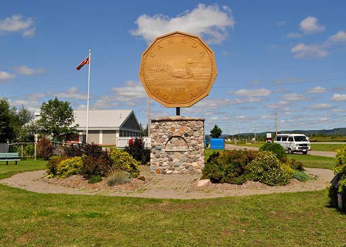
Head east from Sault Ste. Marie on Hwy 17 then turn onto Hwy 638 (Church Street) into Echo Bay to see the Loon Dollar Monument. Affectionately called a “loonie,” the loon image on Canada’s One Dollar coin was designed by local artist Mr. Robert R. Carmichael. The Loon Dollar Monument was created to recognize him. You can also visit the nature boardwalk and the EKOBA Historical Site and Museum.
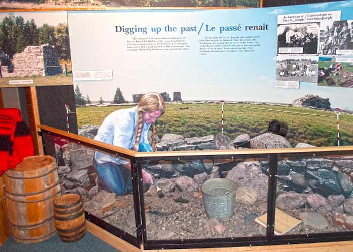
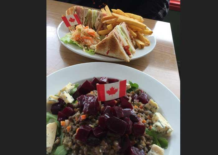
Continue east on Hwy 17 to St. Joseph Island , situated in the North Channel of Lake Huron, accessible by a toll-free bridge. Visit Fort St. Joseph National Historic Site , Adcocks Woodland Gardens or the St. Joseph Island Museum . Have lunch on the Island, stop for ice cream, visit shops or participate in events and festivals. Lunch: Black Bear Cafe (Richards Landing) or MadJacks Cafe (Hilton Beach)
The final destination of Day One is Bruce Mines (a nice place to stop for a hike is the Kensington Conservancy in Desbarats ).
The Bruce Mines Museum has lots of interesting artifacts like the 1876 Slot Machine and the Yakaboo Canoe. Bruce Mines was Canada’s first hard-rock copper mine; visit the Simpson Mine Shaft to walk in the footsteps of the miners in the actual sloop mine. Find fun vintage, retro and antiques, or pick up some artisan pieces and locally made products in the local shops.
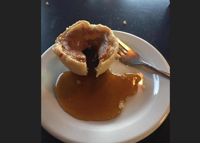
Dinner: Bobbers Restaurant for a Bobber Burger, Wing Night (Fridays) and save room for ooey-gooey homemade butter tarts. Go for ice cream at the Red House Ice Cream Parlour.
Stay: Bruce Bay Cottages & Lighthouse or St. Joseph Island ( Fred’s Trailer Park )
After breakfast at Bobbers (and butter tarts for the road) continue east on Hwy 17 through rolling farmland and views of Lake Huron. Head towards Thessalon . Must Stop Selfie: big Algomy Red Muskoka Chair on Hwy 17 before Thessalon.
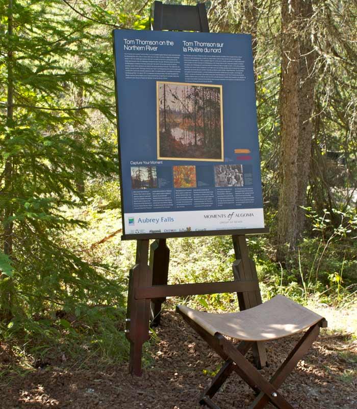
To hike to Aubrey Falls , a remote waterfall, turn onto Hwy 129 and drive along one of the most scenic highways in Ontario: Mississagi Valley . An interpretive panel tells the story of painter Tom Thomson and the area’s connection to the Group of Seven .
Trading Posts were where the trading of goods took place and a meeting place for people to exchange news of the world long before newspapers, television and the internet. Buy fuel, snacks, and souvenirs and perhaps get news of the world at the Tunnel Lake Trading Post.
Don’t want to hike? Visit the Heritage Park Museum on Hwy 129 which offers a glimpse of life over 100 years ago with authentic displays.
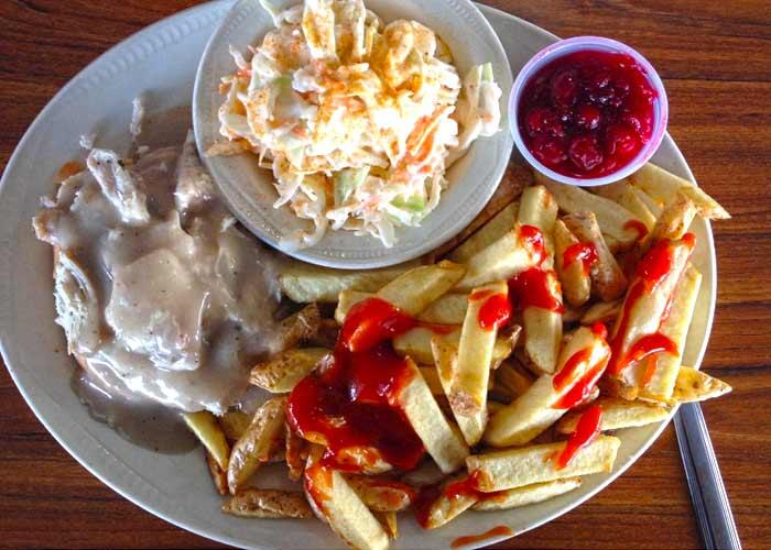
Lunch in Thessalon: Carolyn Beach Inn & Restaurant
The final destination is Iron Bridge . There are three 12-sided barns in Canada, two of which are located in Algoma and along this route. The Cordukes/Weber Barn is located in Sowerby. Both are architecturally stunning -- great for photos!
Best Kept Dinner Secret: Red Top Motor Inn Stay: Red Top Motor Inn
After breakfast, visit the Iron Bridge Historical Museum to learn about early pioneering and farming in the area. Highway 17 winds along the Mississagi River to Blind River . Visit the Timber Village Museum and the Art Gallery. Enjoy a nature walk on the Boom Camp Trails . Grab a takeaway from the chip wagon or restaurant and relax on a secluded beach.

Takeaway: The Pier Sports Bar, JR’s Pizza, 17 Restaurant, get a Tim Horton’s fix Beaches: Fourth Sand Beach (Blind River) or Lauzon Beach (Algoma Mills)
The final stop is the city of Elliot Lake . Visit the Fire Tower Lookout , a replica fire rangers station with a 360-degree panoramic view of the area that includes the North Channel and Manitoulin Island.

Dinner: Fireside Classic Grill Stay: Laurentian Lodge or Dunlop Lake Lodge
Have breakfast and enjoy a nature walk at the Sheriff Creek Wildlife Sanctuary , visit the Nuclear and Mining Museum, the Gallery at the Centre and the Miners’ Memorial Park. Return to Hwy 17 eEastast and stop at Kennebec Falls, a roadside waterfall across the road from the Serpent River Parkette.

Stop at the Serpent River Trading Post to visit the gift shop to buy First Nations arts and crafts, or souvenirs. The onsite art gallery features works by local First Nation artists.
Stop at the town of Spanish and end your trip with an outstanding view of the Spanish River Delta when you hike the Shoreline Discovery Trail .

Lunch: Lucky’s Snack Bar for a great Canadian poutine
Road Trip Tips
- Make sure to bring a small cooler to hold snacks and drinks, sunscreen, a beach blanket, and bug spray (it’s Northern Ontario, you'll need this)
- 18 Road Trip Hacks
- Points of Entry into Canada - If travelling from the US: International Bridge at Sault Ste. Marie, or enter at Port Huron, Michigan drive up into the Bruce Peninsula and take the MS Chi-Cheemaun Ferry at Tobermory to South Baymouth on Manitoulin Island

Plan a Driving Tour in Algoma
Showing 'edited body' is no longer supported..
I'm a staff writer for Algoma Country and I hope my articles entice you to plan your next vacation in Algoma. Our beautiful area has everything you need for a true outdoor adventure: fishing and hunting, epic touring routes and breathtaking outdoors. We are home to many awesome places to eat, cool places to shop, museums and galleries, festivals and events.
Recommended Articles
Lake superior, bringing home fish, 10 secluded beaches, early season pike, old woman bay, the wawa goose, facts about lake huron, you gotta eat here: 5 must try restaurants in sault ste. marie, the butter tart, attractor trolling for lake trout, fishing knots 101, experience crown land camping, pike & dead bait, pike and muskie leaders, the ultimate group of seven road trip, drop shot walleye, pukaskwa national park, family fishing at lodges & resorts, northern superior brewing and tap room, penokean hills farms.
Lake Huron Circle Tour

Florian Neuhauser
Sarah and I planned this trip for many months. It was a very romantic idea: two lovebirds in their mid-20s on a camping trip around Lake Huron, keeping traveling costs down and excitement up. Sarah had been camping quite a bit with her family, so Ms. Camping had all the answers. I, on the other hand, am a textbook novice when it comes to motorcycle camping. The fun started when we picked up the KTM 990 Adventure.
As we arrive at KTM headquarters near Cleveland, OH, and try to load all of our equipment onto the bike, it becomes clear that we brought too much. We scramble through our stuff and downsize to fit everything into our hard cases and a Wolfman dry duffel. The hard cases contain our clothes and some cooking utensils, and on the back we strap the dry duffel containing two sub-zero sleeping bags, the tent, rain gear, motorcycle cover, tripod, and more cooking items. We bungee our tennis shoes and some other loose items around the tower of equipment that's already taking over half of Sarah's back seat. To top it all off I mount a tankbag containing my camera, water, and every kind of electronic hardware we brought along and were so sure we needed. By the time everything is on the Adventure it looks more like an Austrian-Mexican donkey. Now all we need are some ponchos and sombreros. I'm sure the KTM staff gets a good laugh out of this. Once we squeeze onto what's left of the seat we're off to Port Huron, MI, the starting point of our adventure.

Day 1 - 250 miles Port Huron to East Tawas
We leave Port Huron at 7 a.m., eager to hit the road. After a quick cruise into downtown, and chasing after a huge ship headed out under the bridge to take a picture, we head north on Highway 25. We ride near the shore of Lake Huron, and we do see the lake at times, but big parcels of land with nice houses and large trees obstruct the view. The road is flat, straight and long, which makes it easy to check out the scenery. We don't make it far before our first coffee break. Our 6:30 a.m. breakfast is long gone, so we stop at iCrave, a whimsical cafe in Lexington. Some locals sit inside staring at their laptops, and I realize, "I don't have to do that today!" Our fully packed KTM is parked right in front of the cafe, and as usual our space suits catch people's attention and they want to know where we're headed. I tell the owner, Theresa, about our plan, and she quickly warms up to us. She and her husband just moved from North Carolina, our home state, and they also ride.
Motorcycle & Gear
2010 KTM 990 Adventure Helmet : AGV K3 Jacket & Pants : Olympia X Moto Boots : Alpinestars Supertech Touring GORE-TEX Gloves : Dainese Profile X-Trafit
After a quick RoadRUNNER pitch we saddle up fully caffeinated. Many farms, and especially cornfields, line the road. Once in a while there's a roadside pull off with picnic tables that overlook the lake. We stop, just idling and staring at this massive body of water. It's difficult to believe it's a lake. If you don't taste the water you might mistake it for an ocean. As a landlocked Austrian it's hard to wrap my mind around such a sight. In Port Austin we look for a lunch spot, and ideally it will be one that overlooks the lake. It takes a while to find such a place, but our prayers are answered and orders taken at the Riverside Roadhouse in Caseville, a good spot for great seafood. Lunch gives Sarah and I time to share our impressions so far. Yes, the roads are long and straight as an arrow, but the outdoor spirit is easy to witness. We see many bicyclists pedaling on the shoulder, trucks hauling their boats to go out fishing, wake boarding, and swimming. This part of the trip is quite touristy. Every other property on the shore is a cottage, motel or campground, which raises our hopes because we have no set plans other than circling the lake. We have no reservations and no idea of where we can camp.

In Bay City the road turns into a heavily trafficked four lanes all the way to East Tawas. I twist the throttle a bit harder to get moving, and it's about time to start looking for a campground. The first three so-called campgrounds we stop at tell us "Sorry, no tents". Now is it me or does this not make sense? Campgrounds cater to campers sleeping in tents, but maybe have some RV sites available. And RV parks cater to only RVs. Now that makes sense to me! We finally find a tent site in East Tawas State Park, squeezed in among RVs. By the time we set up our tent everybody's campfire, grill and stove are in high gear. There is so much smoke in the air it looks like the whole place is on fire. The combination of the smoke, the smell of food, and the fires creates an interesting odor, which lingers well into the morning. All I can think is, "I love the smell of napalm in the morning!"
Michigan Highways: Since 1997.

- Introduction
- Michigan's Route Systems
- Michigan's Route Markers
- Master List 1913-Present
- Historical Overview
- The History of Roads in Michigan
- Act 51 of 1951
- Who Maintains the Highways?
- Related Links
- Individual Route Listings
- Routes 10-19
- Routes 20-29
- Routes 30-39
- Routes 40-49
- Routes 50-59
- Routes 60-69
- Routes 70-79
- Routes 80-89
- Routes 90-99
- Routes 100-119
- Routes 120-139
- Routes 140-159
- Routes 160-179
- Routes 180-199
- Routes 200-229
- Routes 230-249
- Routes 250-696
- Business 2-31
- Business 32-94
- Business 96-496
- County Route Systems
- Intercounty Highways
- Intercounty A-2 - C-81
- Intercounty D-19 - H-15
- Intercounty H-16 - H-63
- Unsigned Trunklines
Great Lakes Circle Tours
- Forest Highways
- Pure Michigan Byways (Heritage Routes)
- Polar-Equator Trail
- Other Routes
- All In-Depth Articles
- Michigan Left
- Diagonal Highways
- Controlled-Access Highways?
- Memorial Highways
- M-35 & Henry Ford
- National Highway System
- Historic Auto Trails
- Zilwaukee Bridge
- US-31: Berrien County
- US-31: Ottawa County
- What's New?
- Site Map & Search
- Sources & Credits
- Site History
- Corrections & Feedback
- Other Sites

Michigan Highways > Other Routes > Great Lakes Circle Tours
The links below lead to specific information and precise routings for each of the Circle Tours:
Lake Erie Circle Tour
With the shortest length of any of the Great Lakes Circle Tours in Michigan, the Lake Erie Circle Tour runs through only two counties in Southeast Michigan. The LECT enters from Ohio and departs for Ontario only fifty miles later.
Lake Huron Circle Tour
From Port Huron to Sault Ste Marie, the Lake Huron Circle Tour enters both of Michigan's peninsulas and crosses the Mackinac Bridge. This Circle Tour is the only one of the four which only enters two jurisdictions—Michigan and Ontario.
Lake Michigan Circle Tour
The Lake Michigan Circle Tour enters both peninsulas and crosses the Mackinac Bridge, like its cousin the LHCT. However, the LMCT is also the longest of the the Circle Tour routes within Michigan and is also the only one which, in its entire distance, does not leave the US.
Lake Superior Circle Tour
The first official Great Lake Circle Tour, the Lake Superior Circle Tour has roots which stretch back decades when tourism associations in Michigan, Wisconsin, Minnesota and Ontario promoted the route.
Additional Information
- Great Lakes Circle Tour – new website (under cosntruction) from the author of MichiganHighways.org.
- Great Lakes Circle Tour: Project Archive – project archive from the Great Lakes Commission . It was the GLC who originally helped establishe the Great Lakes Circle Tours, however as of the early 2020s, the Commission has seemed to have abandoned the concept and no longer supports the Circle Tours in an active manner.
- History of the Lake Michigan Circle Tour (link now dead) – from the West Michigan Tourist Association (WMTA). The WMTA helped to coordinate the first of the Great Lakes Circle Tours in the 1980s.
- The 6,500-mile Great Lakes Circle Tour (archived) – an overview article from The Fishwrapper.
IMAGES
VIDEO
COMMENTS
Explore Lake Huron's natural beauty with our Circle Tour. Camp, enjoy wildlife, and outdoor activities at state and provincial parks. Choose from a shortcut or divide the route into US and Canadian trips. Plan your adventure now!
The Lake Huron Circle Tour near Sault Ste. Marie, Ontario. The Lake Huron Circle Tour (LHCT) progresses clockwise from a starting point at the Blue Water Bridge in Port Huron, Michigan-Sarnia, Ontario. The LHCT continues around Lake Huron, touching on locations including the following: Michigan. Bay City, Michigan; Au Gres, Michigan
One of Four Great Lakes Circle Tours. Add to Itinerary. The Lake Huron Circle Tour is one of four Great Lakes Circle Tours, each of which run through portions of Michigan. What sets the LHCT apart, though, is this route is the only one touching just two jurisdictions—Michigan and Ontario.
January 25, 2024. The summer road trip below is one you can plan quickly and change on the fly if needed. This route follows the Canadian part of the Lake Huron Circle Tour from Sault Ste. Marie to Spanish. You'll experience scenic views of Lake Huron, sandy beaches, interesting stops, hikes to lookouts, great places to eat, festivals and ...
Lake Huron Circle Tour. The Lake Huron Circle Tour (LHCT) is one of four Great Lakes Circle Tours, each of which run through portions of Michigan. What sets the LHCT apart, though, is this route is the only one touching just two jurisdictions—Michigan and Ontario. The LHCT was officially designated soon after the debut of the Lake Michigan ...
Day 1 - 250 milesPort Huron to East Tawas. We leave Port Huron at 7 a.m., eager to hit the road. After a quick cruise into downtown, and chasing after a huge ship headed out under the bridge to take a picture, we head north on Highway 25. We ride near the shore of Lake Huron, and we do see the lake at times, but big parcels of land with nice ...
The Great Lakes tour is a circle road trip route through the United States and Canada to scenic destinations along Lakes Superior, Michigan, Huron, Ontario, and Erie. This guide will help you map the perfect itinerary with suggested food, lodging, hikes, waterfalls, cruises, lighthouses, and more outdoor activities. Guest Post by Kristi Schultz.
Lake Huron Circle Tour. From Port Huron to Sault Ste Marie, the Lake Huron Circle Tour enters both of Michigan's peninsulas and crosses the Mackinac Bridge. This Circle Tour is the only one of the four which only enters two jurisdictions—Michigan and Ontario. Lake Michigan Circle Tour.