

The Better Way to Share Your Travel Memories
Wow your friends with an animated travel map .
Check out one of our animated travel maps created with PictraMap®!
Why is this the tool that you've been waiting for ...
No credit card required, create your first animated travel map within minutes.
It's different
WOW your friends and get them talking about you and your travels.
It's all you want
Free online tool to create animated maps from travel photos. Ain't that right?
No wait time
The tool is entirely web-based - you register and get instant access to the system. Create your first animated travel map within minutes!
Beautiful maps
It is not yet another tool with Google maps, offering the same old same old map layout. Find the map that matches your taste and type of trip.
Customization
No other online tool offers so many customization options - you choose the map, pins, intro, ending, music theme, not to mention the color options.
Easy to use
You don't need any tutorial because of the super-easy interface - register and within minutes, you can have your first animated travel map.
Easy to share
Because it's all online, you can always share your animated travel maps with the world - on Facebook, via email, even embed it on your blog.
It just is ...
Passionate travelers badly needed such a tool (we know, they told us so). Be among the first to create an animated travel map with PictraMap®!
Are you ready to be a pioneer? Dare to be different?
What passionate travelers say about pictramap®.

I was pleasantly surprised of what I saw when a friend shared the link to PictraMap. The unique way I can create and share my albums there lets my friends and family enjoy the fun moments of my trips. I like the flexibility and variety of the maps, the transitions between locations, and the music scores I can choose from – all in a very quick and intuitive way. Thank you, guys!
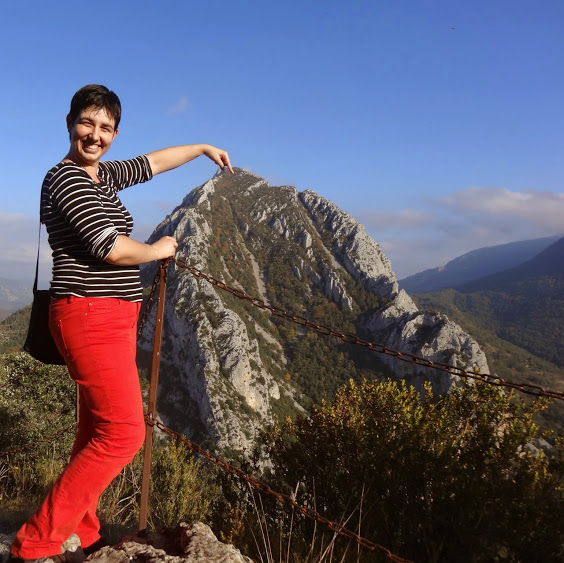
What a great way to give life to my countless otherwise boring photos! The maps, the music, the colors make every album special and help add an emotion to it. It's easy to use and the result is a fun adventure I could share with all my friends and family! I know they will love it too!!
Busy? No problem - we'll remind you!
If you're too busy to create your first animated travel map right now, or you think your friends can wait being WOW-ed by your last amazing trip, join our community. We'll remind you later that your travel photos can still get the attention they deserve 😉
Browse Site
- Start Here!
- Plans & Pricing
- Log in to PictraMap
- Create an account
From The Blog
- Convert PictraMap Animations to Videos: Built-in Feature Released
- Search by GPS Coordinates, Full HD Pics and New Maps Released
- New Customization Options Now Available in the ‘Extras’ Tab
Get in Touch
Want updates via email.
- Images home
- Editorial home
- Editorial video
- Premium collections
- Entertainment
- Premium images
- AI generated images
- Curated collections
- Animals/Wildlife
- Backgrounds/Textures
- Beauty/Fashion
- Buildings/Landmarks
- Business/Finance
- Celebrities
- Food and Drink
- Healthcare/Medical
- Illustrations/Clip-Art
- Miscellaneous
- Parks/Outdoor
- Signs/Symbols
- Sports/Recreation
- Transportation
- All categories
- Shutterstock Select
- Shutterstock Elements
- Health Care
- Sound effects
PremiumBeat
- PixelSquid 3D objects
- Templates Home
- Instagram all
- Highlight covers
- Facebook all
- Carousel ads
- Cover photos
- Event covers
- Youtube all
- Channel Art
- Etsy big banner
- Etsy mini banner
- Etsy shop icon
- Pinterest all
- Pinterest pins
- Twitter All
- Twitter Banner
- Infographics
- Zoom backgrounds
- Announcements
- Certificates
- Gift Certificates
- Real Estate Flyer
- Travel Brochures
- Anniversary
- Baby Shower
- Mother's Day
- Thanksgiving
- All Invitations
- Party invitations
- Wedding invitations
- Book Covers
- About Creative Flow
- Start a design
AI image generator
- Photo editor
- Background remover
- Collage maker
- Resize image
- Color palettes
Color palette generator
- Image converter
- Creative AI
- Design tips
- Custom plans
- Request quote
- Shutterstock Studios
- Data licensing
You currently have 0 credits
See all plans

Image plans
With access to 400M+ photos, vectors, illustrations, and more. Includes AI generated images!

Video plans
A library of 28 million high quality video clips. Choose between packs and subscription.

Music plans
Download tracks one at a time, or get a subscription with unlimited downloads.
Editorial plans
Instant access to over 50 million images and videos for news, sports, and entertainment.
Includes templates, design tools, AI-powered recommendations, and much more.
Moscow Clip Art royalty-free images
797 moscow clip art stock photos, vectors, and illustrations are available royalty-free for download..

Our company
Press/Media
Investor relations
Shutterstock Blog
Popular searches
Stock Photos and Videos
Stock photos
Stock videos
Stock vectors
Editorial images
Featured photo collections
Sell your content
Affiliate/Reseller
International reseller
Live assignments
Rights and clearance
Website Terms of Use
Terms of Service
Privacy policy
Modern Slavery Statement
Cookie Preferences
Shutterstock.AI
AI style types
Shutterstock mobile app
Android app
© 2003-2024 Shutterstock, Inc.
Moscow - Interactive map
Information about the map.
Check out the main monuments, museums, squares, churches and attractions in our map of Moscow. Click on each icon to see what it is.
To help you find your way once you get to your destination, the map you print out will have numbers on the various icons that correspond to a list with the most interesting tourist attractions. This way, you’ll be able to see where each attraction is.
Icons on the Moscow interactive map
The map is very easy to use:
- Check out information about the destination: click on the color indicators.
- Move across the map: shift your mouse across the map.
- Zoom in: double click on the left-hand side of the mouse on the map or move the scroll wheel upwards.
- Zoom out: double click on the right-hand side of the mouse on the map or move the scroll wheel downwards.
You may also be interested in

Where to eat
Vodka, caviar, borscht... the list of Russian delicacies goes on! Discover where, when and what to eat during your trip to Moscow.
General Information
Learn everything you need to know for your trip to Moscow, from visa requirements and currency to language tips and which plugs to bring! We'll try and answer all of your most frequently asked questions.

All Mars Resources
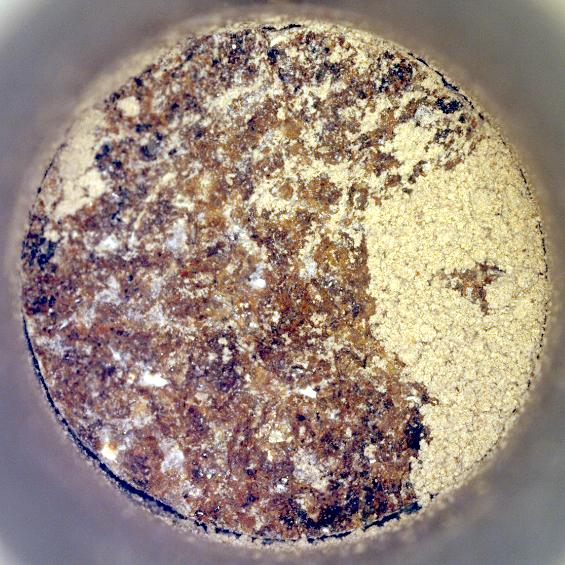
Perseverance’s ‘Bunsen Peak’ Sample
NASA’s Perseverance Mars rover captured this image of a sample cored from a rock called “Bunsen Peak” on March 11,…
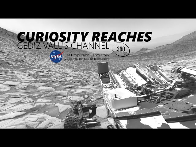

NASA’s Curiosity Rover Reaches Gediz Vallis Channel (360 View)
360-degree panorama provided by NASA’s Curiosity Mars rover. This view was captured at Gediz Vallis channel, a feature that formed…
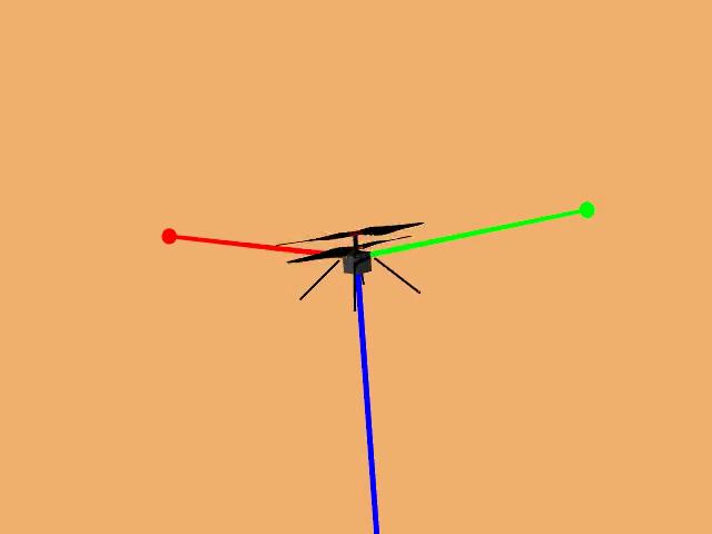
Animation of Mars Helicopter Flight Test
This animation shows a simulation of the response of NASA’s Ingenuity Mars Helicopter to the system identification, or “Sys-ID,” process.…
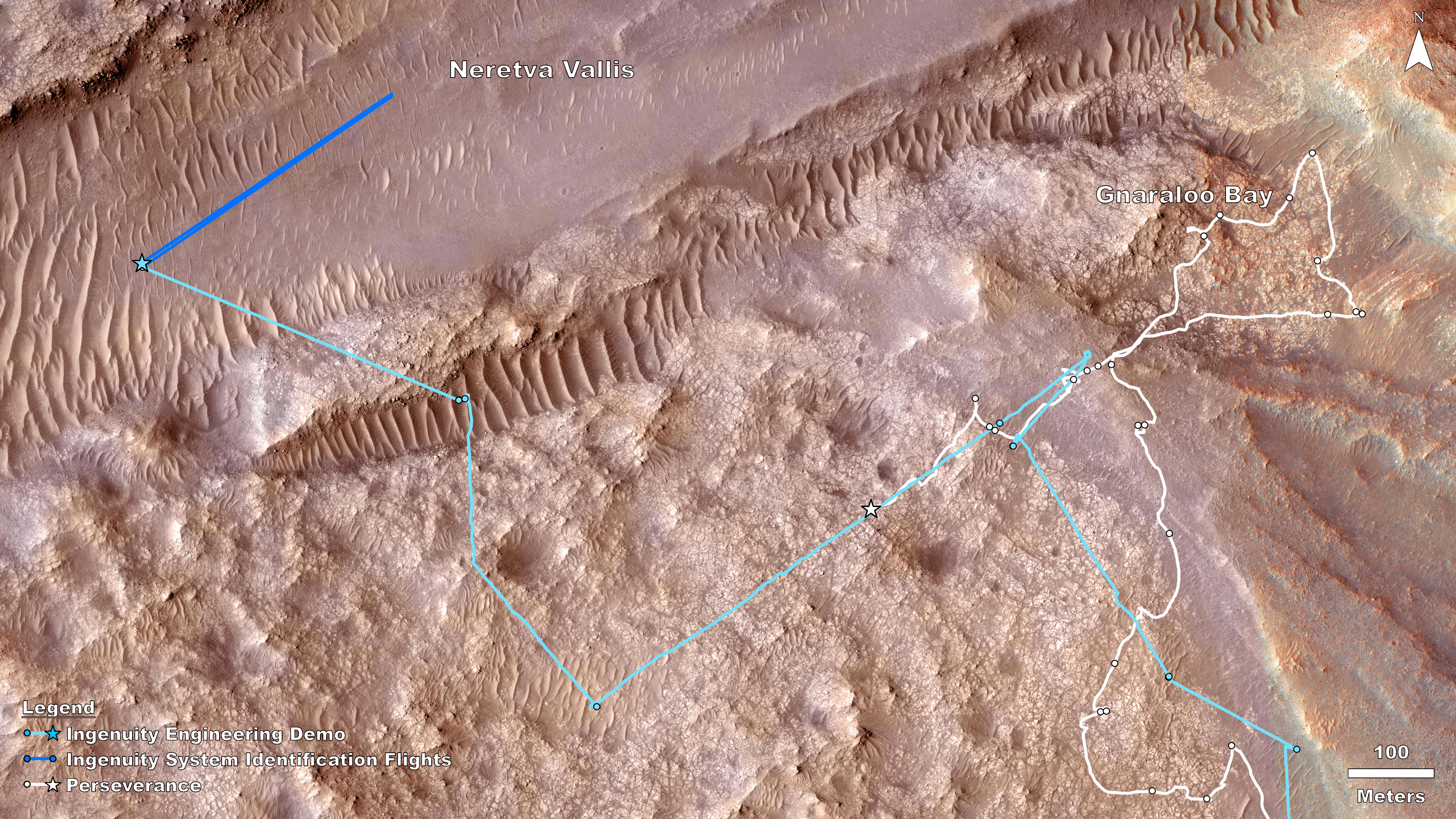
Rover, Helicopter Locations in Jezero Crater
This map shows the locations of NASA’ Perseverance rover (white star) and Ingenuity Mars Helicopter (cyan star) on Dec. 19,…

Sol 4132: Right Navigation Camera, Cylindrical Projection
NASA’s Mars rover Curiosity took 31 images in Gale Crater using its mast-mounted Right Navigation Camera (Navcam) to create this…

Sol 4130: Right Navigation Camera, Cylindrical Projection
NASA's Mars rover Curiosity took 31 images in Gale Crater using its mast-mounted Right Navigation Camera (Navcam) to create this…
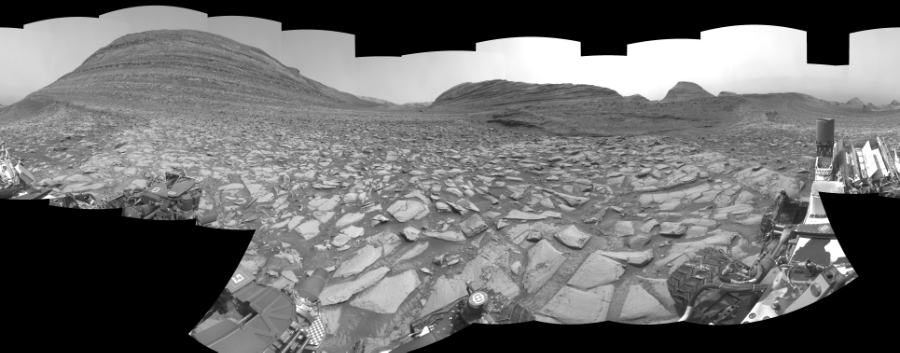
Sol 4128: Right Navigation Camera, Cylindrical Perspective
NASA's Mars rover Curiosity took 30 images in Gale Crater using its mast-mounted Right Navigation Camera (Navcam) to create this…
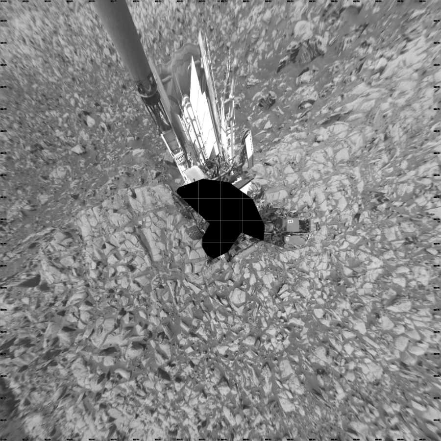
Sol 4128: Left Navigation Camera, Vertical Projection
NASA's Mars rover Curiosity took 30 images in Gale Crater using its mast-mounted Left Navigation Camera (Navcam) to create this…
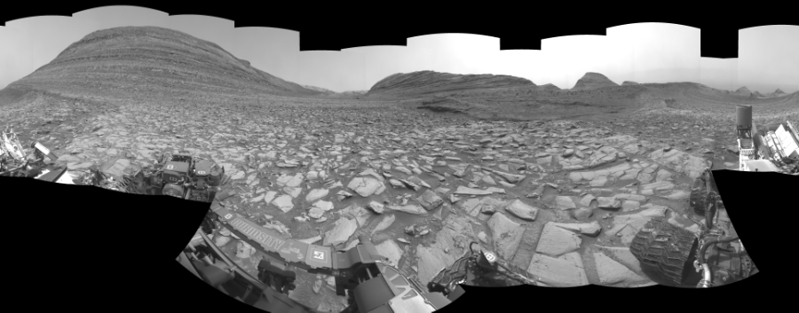
Sol 4128: Left Navigation Camera, Cylindrical Perspective

Sol 4128: Left Navigation Camera, Cylindrical Projection
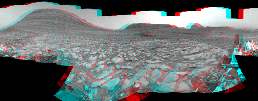
Sol 4128: Mast-Mounted Navigation Camera, Cylindrical Perspective
NASA's Mars rover Curiosity took 30 image pairs in Gale Crater using its mast-mounted Navigation Camera (Navcam) to create this…

Sol 4128: Right Navigation Camera, Cylindrical Projection

Sol 4125: Right Navigation Camera, Cylindrical Projection
NASA's Mars rover Curiosity took 52 images in Gale Crater using its mast-mounted Right Navigation Camera (Navcam) to create this…

Sol 4123: Right Navigation Camera, Cylindrical Projection
NASA's Mars rover Curiosity took 51 images in Gale Crater using its mast-mounted Right Navigation Camera (Navcam) to create this…

Sol 4118: Right Navigation Camera, Cylindrical Projection
NASA's Mars rover Curiosity took 49 images in Gale Crater using its mast-mounted Right Navigation Camera (Navcam) to create this…

- About Chandra
- Field Guide
- Photo Album
- Resources & Multimedia
- Video Series

We’re sorry, but Freepik doesn’t work properly without JavaScript enabled. FAQ Contact
- Notifications
- Go back Remove
- No notifications to show yet You’ll see useful information here soon. Stay tuned!
- Downloads 0/60 What is this?
- My collections
- My subscription
Find out what’s new on Freepik and get notified about the latest content updates and feature releases.
- Passport cartoon
- Travel symbols
- Travel cartoon
- Welcome thailand
- Opened luggage
- Luggage and passport
- Realistic travel
- Flight travel
- Travel collection
Travel Clipart Vectors

- Add to collection
- Save to Pinterest
- travel elements
- watercolor travel
- world travel

- tourism traveling

- luggage bag

- holiday travel

- travel suitcase
- travel luggage

- travel globe

- summer sunglasses
- summer elements

- Tree clip art
- tree drawing

- travel stickers

- world tourism

- travel sketch

- travel quotes
- travel text
- explore the world

- world map travel

- vacation background

- tourism day

- Cartoon map

- Cartoon doodle
- doodle sketch
- hand drawn doodle

- world tourism day

- traveling background

- travel illustration
- travel passport

- Cartoon people
- animated people
- flat character

- happy travel

- Election 2024
- Entertainment
- Newsletters
- Photography
- Personal Finance
- AP Investigations
- AP Buyline Personal Finance
- AP Buyline Shopping
- Press Releases
- Israel-Hamas War
- Russia-Ukraine War
- Global elections
- Asia Pacific
- Latin America
- Middle East
- Election Results
- Delegate Tracker
- AP & Elections
- Auto Racing
- 2024 Paris Olympic Games
- Movie reviews
- Book reviews
- Personal finance
- Financial Markets
- Business Highlights
- Financial wellness
- Artificial Intelligence
- Social Media
Midwest tornadoes flatten homes in Nebraska suburbs and leave trails of damage in Iowa
A tornado plowed through suburban Omaha, Nebraska, on Friday afternoon. (AP video by Margery Beck)
Two women help carry a friend’s belongings out of their damaged home after a tornado passed through the area in Bennington, Neb., Friday, April 26, 2024. (AP Photo/Josh Funk)
- Copy Link copied
Gopala Penmetsa walks past his house after it was leveled by a tornado near Omaha, Neb., on Friday, April 26, 2024. (Chris Machian/Omaha World-Herald via AP)
A tornado is seen near north of Waverly, Neb., on Friday, April 26, 2024. (Chris Machian/Omaha World-Herald via AP)
Homeowners assess damage after a tornado caused extensive damage in their neighborhood northwest of Omaha in Bennington, Neb., Friday, April 26, 2024. (AP Photo/Josh Funk)
Damaged houses are seen after a tornado passed through the area near Omaha, Neb., on Friday, April 26, 2024. (Chris Machian/Omaha World-Herald via AP)
Damage is seen to houses after a tornado passed through the area near Omaha, Neb., on Friday, April 26, 2024. (Chris Machian/Omaha World-Herald via AP)
From left; Ally Mercer, Gabe Sedlacek Kaleb Andersen and Austin Young watch a tornado from a seventh floor parking garage on Friday, April 26, 2024, in Lincoln, Neb. (Kenneth Ferriera/Lincoln Journal Star via AP)
Firefighters work to clear a home damaged by a tornado northwest of Omaha, Neb., on Friday, April 26, 2024. (AP Photo/Margery A. Beck)
A tornado begings touch down near U.S. Route 275 near the Platte river near Omaha, Neb., on Friday, April 26, 2024. (Chris Machian/Omaha World-Herald via AP)
Debris is seen from a destroyed home northwest of Omaha, Neb., after a storm tore through the area on Friday, April 26, 2024. (AP Photo/Margery A. Beck)
A tornado touches down on Friday, April 26, 2024, in Lincoln, Neb. (Kenneth Ferriera/Lincoln Journal Star via AP)
A destroyed home is seen northwest of Omaha, Neb., after a storm tore through the area on Friday, April 26, 2024. (AP Photo/Margery A. Beck)
A tornado moves through suburbs northwest of Omaha on Friday, April 26, 2024, as seen from Bennington, Neb. (Chris Gannon via AP)
Severe weather damage to Eppley Airfield in Omaha, Neb., can be seen from the Lewis and Clark Monument in Council Bluffs, Iowa, Friday, April 26, 2024. (Anna Reed/Omaha World-Herald via AP)
A tornado touches down north of Lincoln, Neb., on Friday, April 26, 2024. (Kenneth Ferriera/Lincoln Journal Star via AP)
A destroyed house is seen northwest of Omaha, Neb., after storms swept through the area on Friday, April 26, 2024. (AP Photo/Margery A. Beck)
A piece of wood is embedded in the ground as firefighters assess the damages to houses after a tornado passed through the area near Omaha, Neb., on Friday, April 26, 2024. (Chris Machian/Omaha World-Herald via AP)
Damage is seen to a home after a tornado passed through the area near Bennington, Neb., Friday, April 26, 2024. (AP Photo/Josh Funk)
Gopala Penmetsa walks past a damaged house after a tornado passed through the area near Omaha, Neb., on Friday, April 26, 2024. His house was leveled by the tornado. (Chris Machian/Omaha World-Herald via AP)
Firefighters assess the damage to houses after a tornado passed through the area near Omaha, Neb., on Friday, April 26, 2024. (Chris Machian/Omaha World-Herald via AP)
Linda Kolhof, 66, looks over damage outside her home after a severe storm in Council Bluffs, Iowa, on Friday, April 26, 2024. (Anna Reed/Omaha World-Herald via AP)
Robert Keesee helps his father, Randy Keesee, up a ladder to access roof damage to their home after a severe storm hit the neighborhood in Council Bluffs, Iowa, on Friday, April 26, 2024. (Anna Reed/Omaha World-Herald via AP)
Harold Huff, 83, looks over damage after a severe storm in Council Bluffs, Iowa, on Friday, April 26, 2024. (Anna Reed/Omaha World-Herald via AP)
Jim Huff, 53, breaks down fallen trees after a severe storm hit his neighborhood in Council Bluffs, Iowa, on Friday, April 26, 2024. (Anna Reed/Omaha World-Herald via AP)
Damage is seen to Justin and Amanda Putnam’s bedroom after a severe storm damaged their neighborhood in Council Bluffs, Iowa, on Friday, April 26, 2024. (Anna Reed/Omaha World-Herald via AP)
Neighbors help clean up Justin and Amanda Putnam’s home after a severe storm blew through the area in Council Bluffs, Iowa, on Friday, April 26, 2024. (Anna Reed/Omaha World-Herald via AP)
OMAHA, Neb. (AP) — A tornado plowed through suburban Omaha, Nebraska, on Friday, damaging hundreds of homes and other structures as it tore for miles along farmland and into subdivisions. Some injuries were reported but there were no immediate reports that anyone was killed.
Multiple tornadoes were reported in Nebraska and Iowa on Friday, but the most destructive storm moved from a largely rural area into suburbs northwest of Omaha, a city of 485,000 people. Photos on social media showed the small city of Minden, Iowa, about 30 miles (48.3 kilometers) northeast of Omaha also sustained heavy damage.
Three people were injured in Nebraska’s Lancaster County when a tornado hit an industrial building, causing it to collapse with 70 people inside. Several were trapped, but everyone was evacuated and the injuries were not life-threatening, authorities said.
Hundreds of houses sustained damage in Omaha, mostly in the Elkhorn area in the western part of the city, Omaha police Lt. Neal Bonacci said. Police and firefighters moved door-to-door to help people. Crews went to the “hardest hit area” and had a plan to search anywhere someone could be trapped, Omaha Fire Chief Kathy Bossman said.
“They’re going to be putting together a strategic plan for a detailed search of the area, starting with the properties with most damage,” Bossman said. “We’ll be looking throughout properties in debris piles, we’ll be looking in basements, trying to find any victims and make sure everybody is rescued who needs assistance.”
Bonacci said many homes were destroyed or severely damaged.
“You definitely see the path of the tornado,” Bonacci said.
AP AUDIO: Midwest tornadoes flatten homes in Nebraska suburbs and leave trails of damage in Iowa.
Omaha resident Pat Woods says they saw the tornado and took cover.
In one area of Elkhorn, dozens of newly built, large homes were damaged. At least six were wrecked, including one that was leveled, while others had the top half ripped off. There were dozens of emergency vehicles in the area.
“We watched it touch down like 200 yards over there and then we took shelter,” said Pat Woods, who lives in Elkhorn. “We could hear it coming through. When we came up our fence was gone and we looked to the northwest and the whole neighborhood’s gone.”
His wife, Kim Woods added, “The whole neighborhood just to the north of us is pretty flattened.”
Three people, including a child, were in the basement of the leveled home when the tornado hit but got out safely, according to Dhaval Naik, who said he works with home’s owner.
KETV-TV video showed one woman being removed from a wrecked home on a stretcher in Blair, a city just north of Omaha.
Bonacci said only two people have been transported for treatment, both with minor injuries.
He said crews are now doing a second search of homes. He said fire crews would work throughout the night to check all the unsafe structures and make sure no one is inside.
“People had warnings of this and that saved lives,” Omaha Police Chief Todd Schmaderer said, of the few serious injuries.
The tornado warning was issued in the Omaha area on Friday afternoon just as children were due to be released from school. Many schools had students shelter in place until the storm passed. Hours later, buses were still transporting students home.
“Was it one long track tornado or was it several tornadoes?” said Becky Kern, the warning coordination meteorologist in the National Weather Service’s Omaha office.
She said the agency planned to send out multiple crews over the next several days to determine the number of tornadoes and their strength, and that it could take up to two weeks to finish the evaluation.
“Some appeared to be violent tornadoes,” she continued. “There were tornadoes in different areas. And so it’s like forensic meteorology, we call it, like piecing together, all the damage indicators.”
Another tornado hit an area on the eastern edge of Omaha, passing directly through parts of Eppley Airfield, the city’s airport. Officials closed the airport to aircraft operations to access damage but then reopened the facility, Omaha Airport Authority Chief Strategy Officer Steve McCoy said.
The passenger terminal wasn’t hit by the tornado but people rushed to storm shelters until the twister passed, McCoy said.
After passing through the airport, the tornado crossed the Missouri River and into Iowa, north of Council Bluffs.
Nebraska Emergency Management Agency spokesperson Katrina Sperl said damage reports were just starting to come in. Taylor Wilson, a spokesperson for the University of Nebraska Medical Center, said they hadn’t seen any injuries yet.
In Lancaster County, where three people were injured when an industrial building collapsed, sheriff’s officials also said they had reports of a tipped-over train near Waverly.
Two people who were injured in the county were being treated at the trauma center at Bryan Medical Center West Campus in Lincoln, the facility said in a news release. The hospital said the patients were in triage and no details were released on their condition.
The Omaha Public Power District reported that nearly 10,000 customers were without power in the Omaha area.
Daniel Fienhold, manager of the Pink Poodle Steakhouse in Crescent, Iowa, said he was outside watching the weather with his daughter and restaurant employees. He said “it looked like a pretty big tornado was forming” northeast of town.
“It started raining, and then it started hailing, and then all the clouds started to kind of swirl and come together, and as soon as the wind started to pick up, that’s when I headed for the basement, but we never saw it,” Fienhold said.
The forecast for Saturday was ominous. The Weather Service also issued tornado watches across parts of Iowa, Kansas, Missouri, Oklahoma and Texas. And forecasters warned that large hail and strong wind gusts were possible.
“It does look like a big outbreak again tomorrow,” Kern said. “Maybe slightly farther south.”
Hollingsworth reported from Mission, Kansas. Associated Press writers Hannah Fingerhut in Des Moines, Iowa, Jack Dura in Bismarck, North Dakota, and Jeff Martin in Atlanta contributed to this report.

Advertisement
Supported by
Hot Oceans Worsened Dubai’s Dramatic Flooding, Scientists Say
An international team of researchers found that heavy rains had intensified in the region, though they couldn’t say for sure how much climate change was responsible.
- Share full article

By Raymond Zhong
Scenes of flood-ravaged neighborhoods in one of the planet’s driest regions stunned the world this month. Heavy rains in the United Arab Emirates and Oman submerged cars, clogged highways and killed at least 21 people. Flights out of Dubai’s airport, a major global hub, were severely disrupted.
The downpours weren’t a total surprise — forecasters had anticipated the storms several days earlier and issued warnings. But they were certainly unusual.
Here’s what to know.
Heavy rain there is rare, but not unheard-of.
On average, the Arabian Peninsula receives a scant few inches of rain a year, although scientists have found that a sizable chunk of that precipitation falls in infrequent but severe bursts, not as periodic showers. These rains often come during El Niño conditions like the ones the world is experiencing now.
U.A.E. officials said the 24-hour rain total on April 16 was the country’s largest since records there began in 1949 . And parts of the nation had already experienced an earlier round of thunderstorms in March.
Oman, with its coastline on the Arabian Sea, is also vulnerable to tropical cyclones. Past storms there have brought torrential rain, powerful winds and mudslides, causing extensive damage.
Global warming is projected to intensify downpours.
Stronger storms are a key consequence of human-caused global warming. As the atmosphere gets hotter, it can hold more moisture, which can eventually make its way down to the earth as rain or snow.
But that doesn’t mean rainfall patterns are changing in precisely the same way across every part of the globe.
In their latest assessment of climate research , scientists convened by the United Nations found there wasn’t enough data to have firm conclusions about rainfall trends in the Arabian Peninsula and how climate change was affecting them. The researchers said, however, that if global warming were to be allowed to continue worsening in the coming decades, extreme downpours in the region would quite likely become more intense and more frequent.
Hot oceans are a big factor.
An international team of scientists has made a first attempt at estimating the extent to which climate change may have contributed to April’s storms. The researchers didn’t manage to pin down the connection precisely, though in their analysis, they did highlight one known driver of heavy rain in the region: above-normal ocean temperatures.
Large parts of the Indian, Pacific and Atlantic Oceans have been hotter than usual recently, in part because of El Niño and other natural weather cycles, and in part because of human-induced warming .
When looking only at El Niño years, the scientists estimated that storm events as infrequent as this month’s delivered 10 percent to 40 percent more rain to the region than they would in a world that hadn’t been warmed by human activities. They cautioned, however, that these estimates were highly uncertain.
“Rainfall, in general, is getting more extreme,” said Mansour Almazroui, a climate scientist at King Abdulaziz University in Jeddah, Saudi Arabia, and one of the researchers who contributed to the analysis.
The analysis was conducted by scientists affiliated with World Weather Attribution, a research collaboration that studies extreme weather events shortly after they occur. Their findings about this month’s rains haven’t yet been peer reviewed, but are based on standardized methods .
The role of cloud seeding isn’t clear.
The U.A.E. has for decades worked to increase rainfall and boost water supplies by seeding clouds. Essentially, this involves shooting particles into clouds to encourage the moisture to gather into larger, heavier droplets, ones that are more likely to fall as rain or snow.
Cloud seeding and other rain-enhancement methods have been tried around the world, including in Australia, China, India, Israel, South Africa and the United States. Studies have found that these operations can, at best, affect precipitation modestly — enough to turn a downpour into a bigger downpour, but probably not a drizzle into a deluge.
Still, experts said pinning down how much seeding might have contributed to this month’s storms would require detailed study.
“In general, it is quite a challenge to assess the impact of seeding,” said Luca Delle Monache, a climate scientist at the Scripps Institution of Oceanography in La Jolla, Calif. Dr. Delle Monache has been leading efforts to use artificial intelligence to improve the U.A.E.’s rain-enhancement program.
An official with the U.A.E.’s National Center of Meteorology, Omar Al Yazeedi, told news outlets that the agency didn’t conduct any seeding during the latest storms. His statements didn’t make clear, however, whether that was also true in the hours or days before.
Mr. Al Yazeedi didn’t respond to emailed questions from The New York Times, and Adel Kamal, a spokesman for the center, didn’t have further comment.
Cities in dry places just aren’t designed for floods.
Wherever it happens, flooding isn’t just a matter of how much rain comes down. It’s also about what happens to all that water once it’s on the ground — most critically, in the places people live.
Cities in arid regions often aren’t designed to drain very effectively. In these areas, paved surfaces block rain from seeping into the earth below, forcing it into drainage systems that can easily become overwhelmed.
One recent study of Sharjah , the capital of the third-largest emirate in the U.A.E., found that the city’s rapid growth over the past half-century had made it vulnerable to flooding at far lower levels of rain than before.
Omnia Al Desoukie contributed reporting.
Raymond Zhong reports on climate and environmental issues for The Times. More about Raymond Zhong

IMAGES
VIDEO
COMMENTS
Find & Download Free Graphic Resources for Travel Map Clipart. 99,000+ Vectors, Stock Photos & PSD files. Free for commercial use High Quality Images
Find & Download the most popular Travel Map Clipart Vectors on Freepik Free for commercial use High Quality Images Made for Creative Projects. #freepik #vector
Download stunning royalty-free images about Travel Map. Royalty-free No attribution required ... 335+ Free Travel Map Illustrations. Free travel map illustrations to use in your next project. Browse illustration graphics uploaded by the Pixabay community. Royalty-free illustrations. compass nautical. location earth map.
Find Travel Map Clipart stock images in HD and millions of other royalty-free stock photos, illustrations and vectors in the Shutterstock collection. Thousands of new, high-quality pictures added every day.
ADS. Page 1 of 100. Find & Download Free Graphic Resources for Road Trip Clipart. 99,000+ Vectors, Stock Photos & PSD files. Free for commercial use High Quality Images.
Watercolor World Map Clipart, Travel, Winter Blue World Map, Continents clip art, Wedding invitation, instant download, Commercial Use, PNG (1.4k) Sale Price $2.67 $ 2.67 $ 5.33 Original Price $5.33 (50% off) Digital Download Add to Favorites ...
Watercolor World Map Clipart Set - 18 PNG Images - Bonus 5 Popular PNGs - Travel Decor & Crafts - Printable Art. (19) $5.57. Cute Baby Animals City Map Creator Clipart, Transport and Houses Clipart, for Boy and Girl, Seamless Patterns, Nursery clipart. Kids Prints.
Conceptual illustration of a trip to suriname with travel gear. world map with compass, passport, tickets, cell phone, plane and glass. Download travel map stock vectors. Affordable and search from millions of royalty free images, photos and vectors.
View & Download. Available For: Browse 35,839 incredible Road Trip vectors, icons, clipart graphics, and backgrounds for royalty-free download from the creative contributors at Vecteezy!
200+ Free Road Trip Illustrations. Free road trip illustrations to use in your next project. Browse illustration graphics uploaded by the Pixabay community. carsroadstreet. travelmovingroad trip. road tripcouplevan. webmapflatdesign. ai generatedbicycle. streetroadcountryside.
Maps and Navigation Editable Stroke Icon Set. A set of editable stroke thin line icons. File is built in the CMYK color space for optimal printing. The strokes are 2pt and fully editable: Make sure that you set your preferences to 'Scale strokes and effects' if you plan on resizing! Choose from 4,142 Road Trip Clip Art stock illustrations ...
Browse 252,100+ travel clipart stock illustrations and vector graphics available royalty-free, or start a new search to explore more great stock images and vector art. ... travel destination trip point, city street navigator image Map icon with pin gps vector flat and location marker pointer place in isometric design, concept of road trip ...
9,054+ Free Travel Illustrations. Browse travel illustrations and find your perfect illustration graphics to use in your next project. Download stunning royalty-free images about Travel. Royalty-free No attribution required .
Road Surfaces and Highways. School bus. Road trip. Hiking. Asphalt concrete. Recreational vehicle. of 41. Find Road Trip Clipart stock images in HD and millions of other royalty-free stock photos, illustrations and vectors in the Shutterstock collection. Thousands of new, high-quality pictures added every day.
Search from thousands of royalty-free Travel Clipart stock images and video for your next project. Download royalty-free stock photos, vectors, HD footage and more on Adobe Stock.
Browse 38,500+ road trip stock illustrations and vector graphics available royalty-free, or search for family road trip or driving to find more great stock images and vector art.
If you're too busy to create your first animated travel map right now, or you think your friends can wait being WOW-ed by your last amazing trip, join our community. We'll remind you later that your travel photos can still get the attention they deserve. Keep me posted. Create your animated travel map within minutes with PictraMap - a free ...
Find local businesses, view maps and get driving directions in Google Maps.
Find Moscow Clip Art stock images in HD and millions of other royalty-free stock photos, 3D objects, illustrations and vectors in the Shutterstock collection. Thousands of new, high-quality pictures added every day.
Icons on the Moscow interactive map. The map is very easy to use: Check out information about the destination: click on the color indicators. Move across the map: shift your mouse across the map. Zoom in: double click on the left-hand side of the mouse on the map or move the scroll wheel upwards. Zoom out: double click on the right-hand side of ...
Moscow is the capital and largest city of Russia.The city stands on the Moskva River in Central Russia, with a population estimated at 13.0 million residents within the city limits, over 18.8 million residents in the urban area, and over 21.5 million residents in the metropolitan area. The city covers an area of 2,511 square kilometers (970 sq mi), while the urban area covers 5,891 square ...
This map shows the locations of NASA' Perseverance rover (white star) and Ingenuity Mars Helicopter (cyan star) on Dec. 19,… Sol 4132: Right Navigation Camera, Cylindrical Projection NASA's Mars rover Curiosity took 31 images in Gale Crater using its mast-mounted Right Navigation Camera (Navcam) to create this…
Barcelona Locals Wipe Bus Route Off The Map To Combat Overtourism. Residents living in La Salut often have to contend with tourists ramming the 116 bus route as it heads towards Antoni Gaudí's ...
These four images showcase the 2D captured views of the cosmic objects included in the new augmented reality 3D release. Presenting multiwavelength images of the Vela Pulsar, Tycho's Supernova Remnant, Helix Nebula, and Cat's Eye Nebula that include Chandra X-ray data as well as optical data in each, and for the Helix, additional infrared and ultraviolet data.
Images 44.61k Collections 40. ADS. New. ADS. ADS. Page 1 of 100. Find & Download the most popular Travel Clipart Vectors on Freepik Free for commercial use High Quality Images Made for Creative Projects.
Updated 4:31 PM PDT, April 26, 2024. OMAHA, Neb. (AP) — A tornado plowed through suburban Omaha, Nebraska, on Friday afternoon, damaging hundreds of homes and other structures as the twister tore for miles along farmland and into subdivisions. Injuries were reported but it wasn't yet clear if anyone was killed in the storm.
Heavy rains hammered southern China on the weekend, flooding homes, streets and farmland and threatening to upend the lives of tens of millions of people as rescuers rushed to evacuate residents ...
Heavy rains in the United Arab Emirates and Oman submerged cars, clogged highways and killed at least 21 people. Flights out of Dubai's airport, a major global hub, were severely disrupted. The ...