- 14 Cool Places to Explore on Google Earth
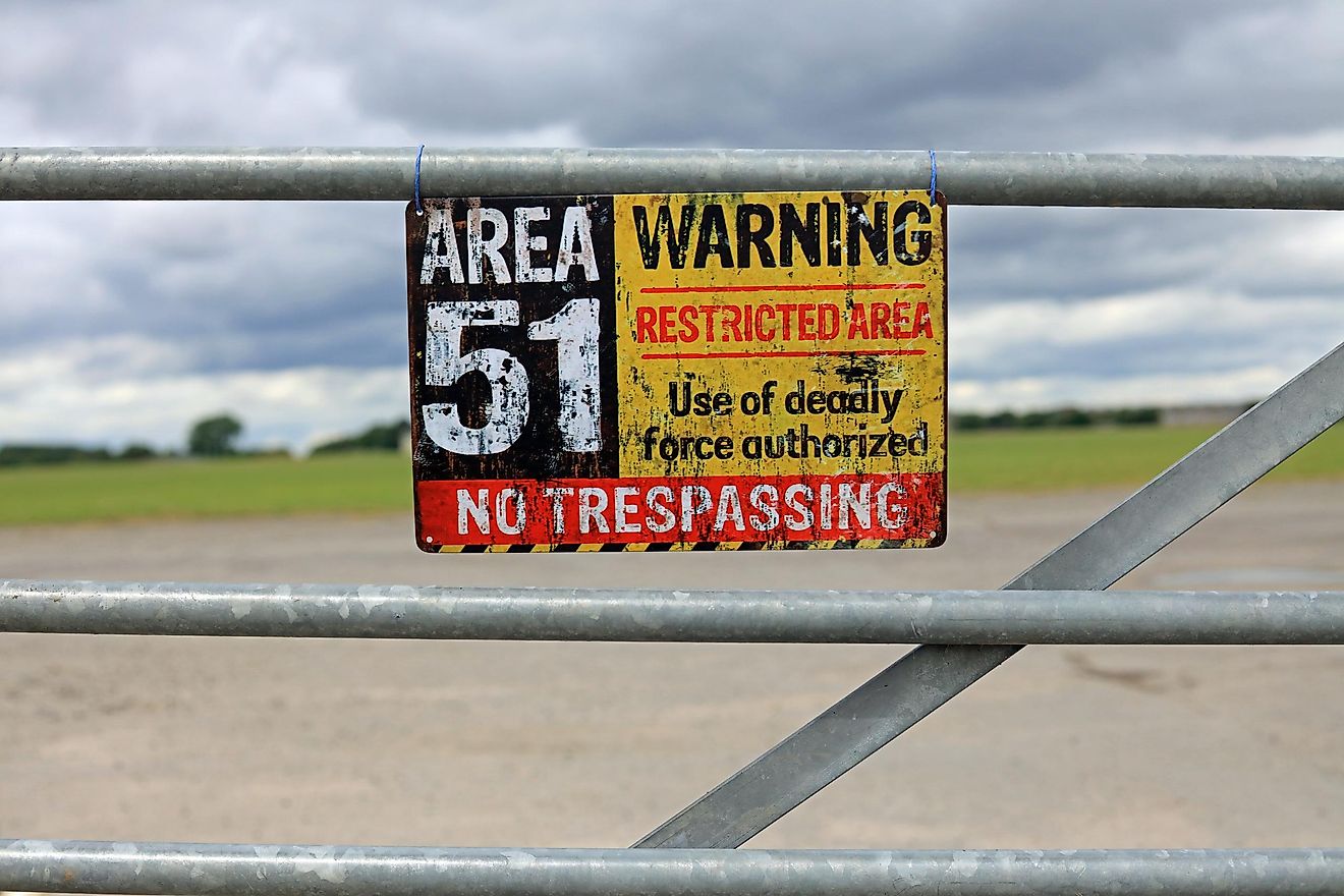
The view from far above grants us an entirely different outlook on the Earth's features. Google Earth offers a safe peek at the sites of mysterious disappearances, nuclear disasters, unapproachable or distant locations, secret government bases, diamond mines, and even the outlines of the past crater strikes. The unique perspective offered by the satellite imaging has inspired artists (and, possibly, aliens) to create new landmarks that could never be appreciated from any other angle.

Desert Breath Pattern Art
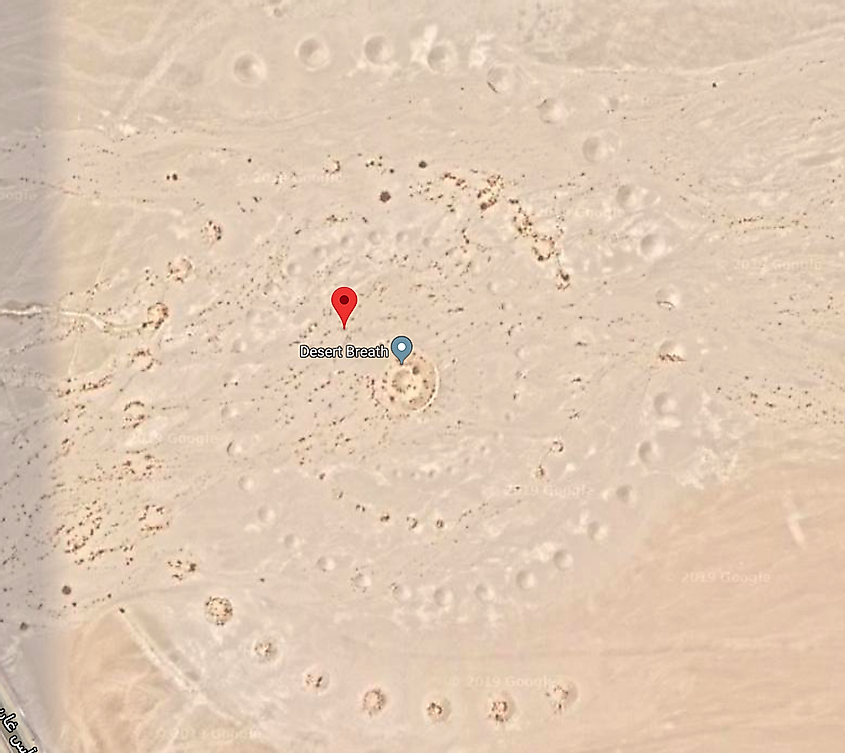
27.380583, 33.631839
Red Sea Governorate, Egypt
Located in a desolate Egyptian desert, not far from the shores of the Red Sea, this 1 million square foot spiral design is, in fact, an art project called Desert Breath. In March 2007, Danae Stratou, Alexandra Stratou, and Stella Constantinides created this artwork meant to celebrate the desert landscape. Since the first pictures you can find on their site, the grand art has significantly eroded and no longer looks quite as prominent.
The Badlands Guardian
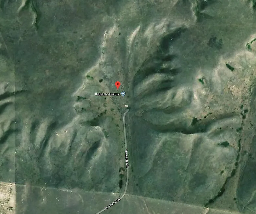
50.010611, -110.113422
Walsh, Alberta, Canada
The Badlands Guardian is a geomorphological feature situated in the southeast corner of Alberta, Canada. Viewed from the air, it resembles a westward-facing human head wearing a full Indigenous headdress. This area has been traditionally the home of the Siska First Nation, also known as the Blackfoot tribes. The location of the geological feature is very remote and not readily accessible: the Badlands is a deserted and often unfriendly terrain of ravines, hills, and sinkholes. The Earth folds shaping the contour of a giant were formed by the end of the last Ice Age when melting glaciers dissolved clays and light sedimentary soils. These landscapes keep changing even these days, being carved and eroded under the pressure of the wind and heavy rains, forming unique geomorphic features and intriguing topographies.
Airplane Boneyard
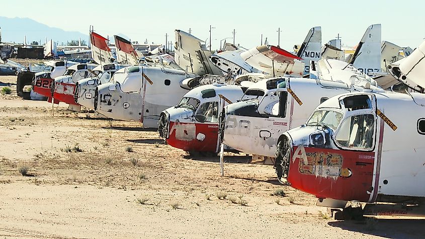
32.149989, -110.835842
Tucson, Arizona
The Davis Monthan Air Force Base is where US military planes go to retire. Named "the boneyard," this 4 square mile cemetery of skyborne steel is not accessible for the general public. Still, Google Earth provides a convenient curiosity tour: practically every plane the military has used since World War II, from the B-52 Stratofortress to the F-14 Tomcat. The airplanes from different times have various degrees of decay. Did you know that a retired airplane can make for an innovative and extravagant house? There have been several architectural projects repurposing elements or even entire retired planes as homes.
Guitar-Shaped Forest
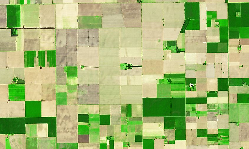
-33.867886, -63.987
Córdoba, Argentina
This 2/3 mile long guitar forest was nurtured in the fertile agricultural region of Argentina's pampas. At this size and on the backdrop of plain cultured fields, the guitar-shaped forest is noticeable from both planes and satellites. The guitar forest is a creation of a local farmer Pedro Martin Ureta and his four kids: that planted every tree by hand decades ago. The guitar-shaped forest was intended as a memorial for Pedro's wife, Graciela Yraizoz, who died of an aneurism in 1977. A couple of years later, Pedro remembered his wife's idea to shape the farm after her favorite instrument and decided to honor her memory. With the help of their children, he planted and nurtured roughly 7,000 cypress and eucalyptus trees.
Networked Oil Fields
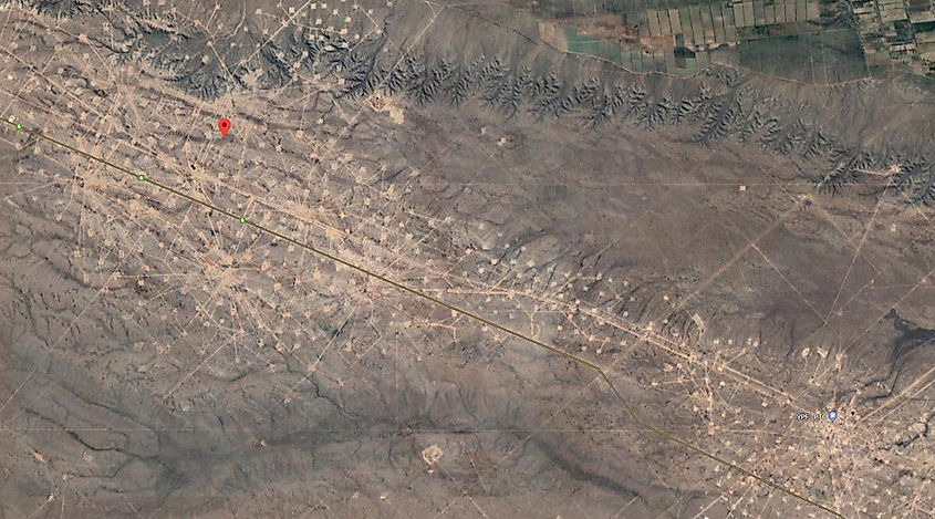
-37.654461, -68.171228
Rio Negro, Argentina
Not much to be said: it is an oil field being actively developed by YPF. But quite a beautiful sight from above, looking like an elaborate network of nodes and lines.
The White Lion
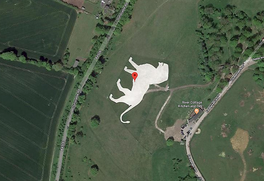
51.848637, -0.55462
Dunstable LU6 2LD, UK
Coined by some as a "Lion King," this geoglyph, known initially as Whipsnade White Lion, was built in 1933 for an unusual reason. The colossal feline was dug into a chalk hill within the Dunstable downs near the Whipsnade Zoo. Initially, only the outline of the lion could be seen, but it was eventually completed to become the largest geoglyph in the country. The Zoological Society of London conceived the lion project as a landmark to warn passing pilots not to fly low over the zoo to avoid scaring animals. The second purpose of the zoo carving was, of course, advertising for the zoo. Over the years, the lion deteriorated and became overgrown; luckily, in March of 2018, a neighbor donated 50 truckloads of chalk so the zoo could make the lion shine white again.
Electric Blue Potash Mine Bonds
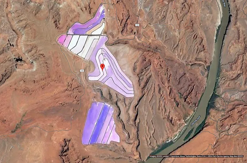
38.483378, -109.681333
Moab, Utah, USA
These ponds are maintained to extract potassium chloride, also known as potash, from the desert landscapes of Utah. Potash is mainly required in the production of potent fertilizers. Most potash forms in areas when inland seas or lakes dry out: as their waters evaporated, they left behind potassium salt deposits. Why does the water have such an unusually vibrant color? The water is dyed bright blue purposely to help it absorb more sunlight and heat and decrease the time it takes for the water to evaporate. As it happens, potash and other salts crystallize out. The evaporation process takes approximately 300 days. At the different stages of evaporation, the ponds can take different colors. Most of the "new" ponds are a bright electric blue. As time passes, ponds display different stages of evaporation as an array of colors, from various hues of blue and turquoise to orange, yellow, and white.
Groom Lake Base, known as Area 51
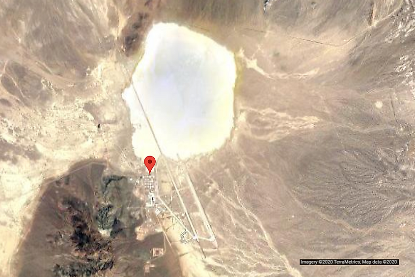
37.242457, -115.815044
Nevada, USA
Until recently, satellite imagery of this US Air Force military installation was censored. Area 51 became visible on Google Maps only since 2018. But is it the real image or just a cover-up? Who would tell? Area 51 is an active military installation: it is not accessible to the public and is under 24-hour surveillance. Area 51 employees reach the facility by air. They fly in and out via a restricted terminal at McCarran International Airport on one of several unmarked planes allowed to fly through the airspace R-4808N above Area 51. The only officially confirmed use of the base is as a flight-testing facility. Since the 50s, the base was used to develop and test the most advanced aircraft, including stealth and various other innovative technologies. In 1989, Robert Lazar claimed that Area 51 discovered an extraterrestrial technology. Lazar told the reporters that the US government used the facility to examine an alien spacecraft and the remains of an alien pilot; his story was since discredited, but Area 51 remains a symbolic name for every extraterrestrial enthusiast.
Bermuda Triangle
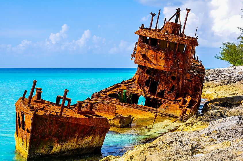
25.001283, -71.000000
Atlantic Ocean
The Bermuda Triangle, an expanse of the ocean known as a Devil's Triangle or Hurricane Alley, is located in the western part of the North Atlantic Ocean. Several aircraft and ships are said to have disappeared under mysterious circumstances or succumbed to an unknown danger. One of the most famous stories happened in 1945: five Navy planes set off from Fort Lauderdale, Florida, in order to conduct training bombing over some nearby shoals. The leading aircraft of the group, known as Flight 19, got helplessly lost; apparently, due to his compass malfunction. All five bombers kept circling aimlessly until they ran low on fuel and were forced to drop into the sea. A rescue plane with its 13-man crew disappeared the same day.
Atacama Giant
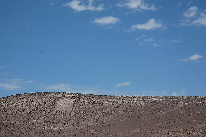
-19.949156, -69.633842
Atacama Desert, Chile
The Atacama Giant is an anthropomorphic geoglyph on Cerro Unitas in the Atacama Desert, Chile. It is the largest anthropomorphic figure in the world dated at prehistoric times, from AD 1000 to 1400. It appears to represent a deity; there is also a hypothesis suggesting that the figure was an early astronomical for observing and marking the moon movement; by knowing where the Moon sat, the day and the season could be determined with the precision required for the effective crop cycle. The landscape of Atacama is incredibly rich in unique geoglyphs: nearly 5,000 of these ancient artworks have been discovered to date.
Former Solar Field (now A Lot Of Circles)
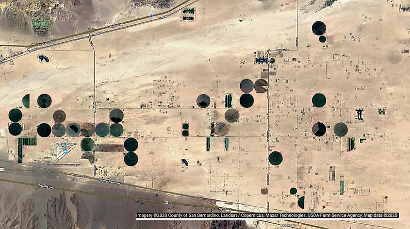
34.871778, -116.834192
Daggett, California
The SOLAR Project is, in fact, three consecutive experiments: Solar One, Solar Two, and Solar Tres. They are (now former) solar thermal power plants based in the Mojave Desert, United States, and Andalucía, Spain (the Tres one). Solar One and Solar Two have been discarded since 2009. Solar One was a pilot solar-thermal project: the first test of a large-scale thermal solar power tower plant. In 1995, Solar One was upgraded to become Solar Two: the second ring of 108 larger heliostats was added, totaling 1926. The upgrade gave Solar Two the ability to produce 10 megawatts: enough to power an estimated 7,500 homes. Solar Two was decommissioned in 1999, but the project was considered a success, so the Solar Tres was built in Spain.
Batman Symbol
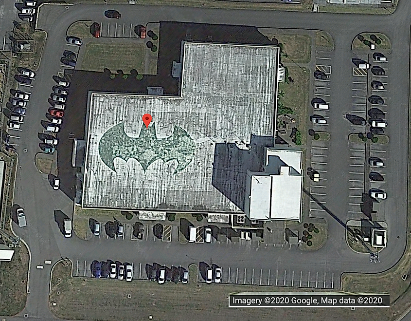
26.357896, 127.783809
Okinawa, Japan
Batman symbol in Okinawa Japan is real. The iconic white bat marks the home of the Air Force's 44th Fighter Squadron, which is known as the Vampire Bats, according to Kadena spokesman Ed Gulick, but it was unclear who painted it on the roof. It was believed to have been done in the 1980s. A similar painting of a fighting cock can is drawn on the roof of a Kadena building used by the 67th Fighter Squadron.
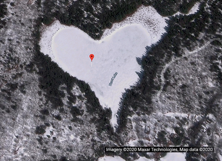
45.019120, -76.898557
North Frontenac, Canadá
There are over 30 famous heart-shaped lakes that can be seen all over the world. This particular one has especially charming features: not only its shape is natural yet almost perfect, but it can be seen in a variety of colors depending on the season. If you visit Google Maps right now (at the moment of writing this article, it is January) you will see it in white, in a dark green rapport of trees. In autumn, it appears deep blue in the golden ornament of the fall leaves. The lake is surrounded by the Heart Lake Conservation Area in which trees are planted every year by students from the local elementary schools.
Island in a Lake in an Island in a Lake
69.793000, -108.241000
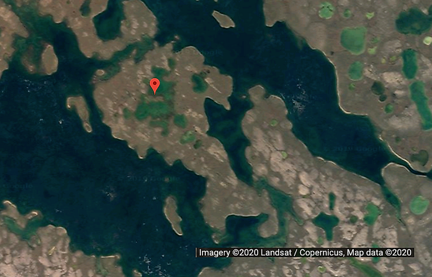
Northern Canada
The world's largest island-in-a-lake-on-an-island-in-a-lake-on-an-island is a small piece of land in Canada. The nameless island lays across the center of a small lake, which is itself encapsulated by a slightly larger island. That resides inside one of a few long elliptical lakes located 75 miles southward from the coast of Victoria Island. In all likelihood, no human has ever stepped on that island.
Do not forget to check out the second part of this collection here!
More in Travel
Four Satiating Towns in Southwestern Michigan
The 9 Best Towns Along Lake Michigan

Lambton Shores, Ontario: Exploring Nature and Community
11 Most Underrated Towns In Pennsylvania To Take A Trip To
Indiana Dunes vs Warren Dunes: Comparing Two Lake Michigan Parks

13 Most Underrated Towns In New York To Take A Trip To

Tales in Transit: The Twists & Turns of World Travel
13 Most Underrated Towns In Massachusetts To Take A Trip To

TwistedSifter
The best of the visual web, sifted, sorted and summarized.
- NATURE/SPACE
- ARCHITECTURE
- SHIRK REPORT
- INFORMATIVE
50 Amazing Finds on Google Earth
by twistedsifter
Google Earth is a virtual globe, map and geographical information program. It maps the Earth by the superimposition of images obtained from satellite imagery, aerial photography and geographic information system (GIS) 3D globe. Just like their data-rich Maps and Street View offerings, Google Earth is a treasure trove of oddities.
You’ve no doubt already come across some interesting finds on Google Earth. The post below attempts to compile the most fascinating sites other have stumbled upon browsing Google Earth. From natural formations to human structures, the world is a different place when viewed from above.
If you’re interested in seeing any of the places yourself, I’ve included the coordinates for every image shown below. Just copy and paste into Google Earth/Maps and explore for yourself!
1. Airplane Boneyard 32 08’59.96″ N, 110 50’09.03″W Tucson, Arizona

2. Mysterious Desert Pattern 27°22’50.10″N, 33°37’54.62″E Red Sea Governorate, Egypt

*Update* This is a land art project called Desert Breath by the D.A.ST. Arteam. The Sifter did an entire post on the piece here .
3. Swastika-Shaped Building Complex 32°40’34.19″N 117° 9’27.58″W Coronado, California, USA

4. Buffalo Herd 4°17’21.49″ S 31°23’46.46″ E Kigosi Game Reserve, Tanzania

5. Giant Triangle 33.747252, -112.633853 Wittmann, Arizona, USA

6. Shipwrecked SS Ayrfield with Trees -33.836379, 151.080506 Homebush Bay, Sydney, Australia

7. The Badlands Guardian 50° 0’38.20″N 110° 6’48.32″W Walsh, Alberta, Canada

8. Parking Lot for Fighter Jets 33.927911, -118.38069 El Segundo, California, USA

9. Firefox Logo 45° 7’25.87″N 123° 6’48.97″W Dayton, Oregon, USA

10. Guitar-Shaped Forest -33.867886, -63.987 Córdoba, Argentina

Located in the fertile agricultural region of Argentina’s ‘Pampas’ is a guitar-shaped forest made up of over 7,000 cypress and eucalyptus trees. A farmer named Pedro Martin Ureta planted the forest in memory of his wife. You can read about the touching story here .
11. Heart-Shaped Lake 41.303921, -81.901693 Columbia Station, Ohio, USA

12. Mysterious Desert Pattern 40.452107, 93.742118 China

13. Giant Target 37.563936, -116.85123 Nevada, USA

*Update* The Sifter did an entire post on strange markings in the USA. Some are ‘eye charts’ for airplanes, better known as aerial photo calibration targets . The Sifter did an entire post on them here .
14. World’s Biggest Pool -33.350534, -71.653268 Algarrobo, Valparaíso, Chile

At 1,013 meters (3,324 ft) in length with a total area of 8 hectares (19.77 acres), the swimming pool at the San Alfonso del Mar resort in Algarrobo, Chile is the largest in the world. You can read all about it here .
15. Jesus Loves You 43.645074, -115.993081 Boise National Forest, Boise, Idaho, USA

16. Lion King 51.848637, -0.55462 Dunstable LU6 2LD, UK

17. Northern Cyprus Flag 35.282902, 33.376891 Kyrenia, Cyprus

18. Star Fort Schansdijk 5, 4655 De Heen, The Netherlands

19. Potash Ponds 38°29’0.16″N 109°40’52.80″W Moab, Utah, USA

20. Mysterious Pattern 37.629562, -116.849556 Nevada, USA

21. The Whampoa Boat-Shaped Shopping Centre 22°18’14.15″N, 114°11’24.66″E Hung Hom, Kowloon, Hong Kong

22. Russell Square Bloomsbury, London, United Kingdom

23. Coca Cola Logo -18.529211, -70.249941 Arica, Arica y Parinacota, Chile

24. Concentric Cirlces 39.623119, -107.635353 New Castle, Colorado, USA

25. Island in a Lake in an Island in a Lake 69.793° N, 108.241° W Northern Canada

26. Flipped Car 51°19’18.13″N, 6°34’35.64″E Krefeld, Germany

27. Strange Symbol 37.401573, -116.867808 Nevada, USA

28. Monkey Face 65.476721, -173.511416 Russia

29. Big Swimming Pool 52°29’52.24″N 13°27’13.67″E Berlin, Germany

30. A Most Phallic Buliding 41.84201, -89.485937 Dixon, Illinois, USA

31. Big Friendly Giant 19°56’56.96″S 69°38’1.83″W Huara, Tarapacá, Chile

32. Another Jet in a Parking Lot 48.825183, 2.1985795 92410 Ville-d’Avray, France

33. More Mysterious Desert Patterns 40.458148, 93.393145 China

34. Shipwreck 30.541634, 47.825445 Basrah, Iraq

35. Multiple Landing Strips in the Desert 32.663367, -111.487618 Eloy, Arizona, USA

36. Oil Fields 37°39’16.06″S 68°10’16.42″W Rio Negro, Argentina

37. Mattel Logo 33.921277, -118.391674 El Segundo, California

38. Uluru / Ayers Rock -25.344375, 131.034401 Northern Territory, Austrlia

39. 1:20 Scale Model of Disputed Border Region between India and China 38.265652, 105.9517 Yong Ning Xian, Yinchuan, Ningxia, China

40. UTA Flight 772 Desert Memorial 16.864841, 11.953808 Sahara Desert, southern Ténéré of Niger

41. Heart-Shaped Land Formation 20°56’15.47″S, 164°39’30.56″E New Caledonia

42. Rainbow Plane Cathy Terrace Englewood Cliffs, New Jersey , USA

43. Barringer Meteor Crater 35.027185, -111.022388 Winslow, Arizona

44. Come Downtown and Play 35.141533, -90.052695 Memphis, Tennessee, USA

45. Hippo Pool 6°53’53.00″ S 31°11’15.40″ E Katavi National Park, Tanzania

46. Solar Field 34.871778, -116.834192 Daggett, California

47. Giant US Flag 7300 Airport Blvd, Houston, TX 77061, USA

48. Big Red Lips in the Desert 12°22’13.32″N, 23°19’20.18″E Sudan

49. Grand Prismatic Spring 44.525049, -110.83819 Yellowstone National Park, Wyoming, USA

50. Batman Symbol 26.357896, 127.783809 Okinawa, Japan

– Google Earth – Weird Google Earth – Strangest Sights in Google Earth, Part II – Why Is China Building These Gigantic Structures In the Middle of Nowhere? – The Google Earth Secret Coordinates – MASTER COLLECTION
If you enjoyed this post, the Sifter highly recommends:

Categories: ANIMALS , ARCHITECTURE , BEST OF , LISTS , NATURE/SPACE , STORIES , TRAVEL Tags: · aerial , google , maps , satellite , world tour
Trending on TwistedSifter

He Told His Dad He Doesn’t View His Step-Siblings As Family, So His Dad And Stepmom Discuss Kicking Him Out Of The House

HOA President Demands A Resident Help Out At A Neighborhood BBQ, But He Refuses And Says He Can Kick Him Out If He Doesn’t Like It

After Being Forced To Form An HOA, His Dad Paused The Rules For 16 Years. But When An Entitled Woman Finally Gets Named HOA President, The Neighborhood Votes Her Out After Just Six Months.
Would you like some more.
Sign up for our daily email and receive the Sifter's newest posts!
- PRIVACY POLICY
- Write For Us
- AFFILIATE DISCLOSURE
Coffee Shop Guest Buys Free Coffee For Everyone In Line Behind Them, But One Person Barged In, Cut The Line, And Acted Like An Entitled Brat.

They Moved Into A New Neighborhood, But Were Shunned By The Residents. When They Asked Why They Were Told It Was Because Their House Was Too Big.

Husband Demands Money Back From A Purchase Their Daughter Accidentally Made, But She Won’t Do It Because He Should Have Been More Careful

Mom Reveals How to Meal Prep For Her Whole Family For Only $55 At Whole Foods
His cousin chopped down trees on his property without his permission, so he got cops and lawyers involved.

Young Parents Took Advantage Of Her And Her Roommate’s Babysitting, So She Told Them They Need To Get Some Different Help

Copyright © 2024 · All Rights Reserved · TwistedSifter
Powered by WordPress VIP · RSS Feed · Log in
- Services & Software
Google Maps: 15 Fascinating Places to Explore From Home
Find some new travel ideas or take a free virtual trip with Google Maps.

- She received the Renau Writing Scholarship in 2016 from the University of Louisville's communication department.
Where would you go if you could go anywhere?
Whether you're not quite keen to get on a plane just yet, wanting to get a look at some locations before booking a trip or your lust for travel exceeds your budget, you can take a mini-trip from home quite easily. Just pull up Google Maps on your PC or phone and start your search. While you can check out maps from everywhere on Earth, the Street View and Photo Sphere tools let you digitally roam virtually anywhere.
To explore on your PC, first make sure you're in satellite mode. Click and drag the little yellow person in the bottom right of the screen to any blue highlighted spot on the map. On your phone, just tap the photo in the bottom left and Maps will "drop" you into your chosen location.
Here are 15 places to explore in Google Maps.
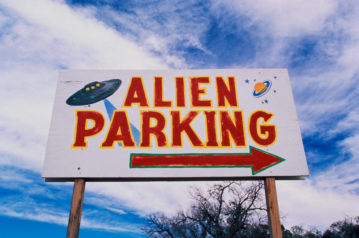
We can't promise you'll see aliens if you digitally visit Roswell.
It's unlikely you'll spot any little green men if you drop into Roswell, New Mexico , but who knows? Roswell looks more residential than Area 51 (the actual site, not the tourist spots ). Unfortunately, you can only zoom in so far on Area 51, and you can't drop the little yellow person anywhere. It does turn into a UFO when you try, though.
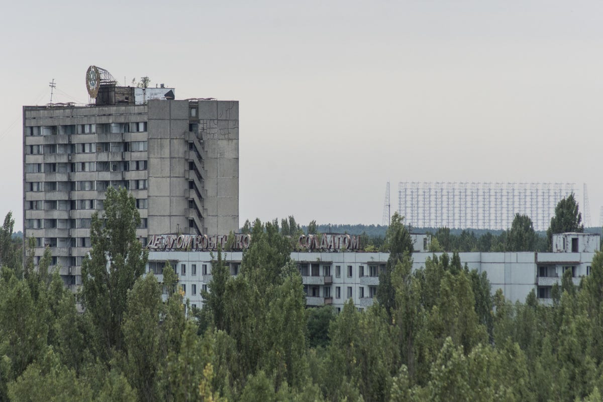
Pripyat, Ukraine.
Pripyat, Ukraine
The tragic events that occurred at Chernobyl have had a lot of attention in the last couple years. In 2019, the HBO's miniseries Chernobyl, starring Jared Harris , detailed the 1986 nuclear disaster. After the show premiered, Ukraine made plans to accommodate an influx of tourists , while Craig Mazin, the show's creator, asked tourists visiting the exclusion zone to show respect for the lives lost . The war in Ukraine, which also affected the site of the disaster, has made real-life tourism impossible, but you can digitally roam the deserted town as it appeared before the war.
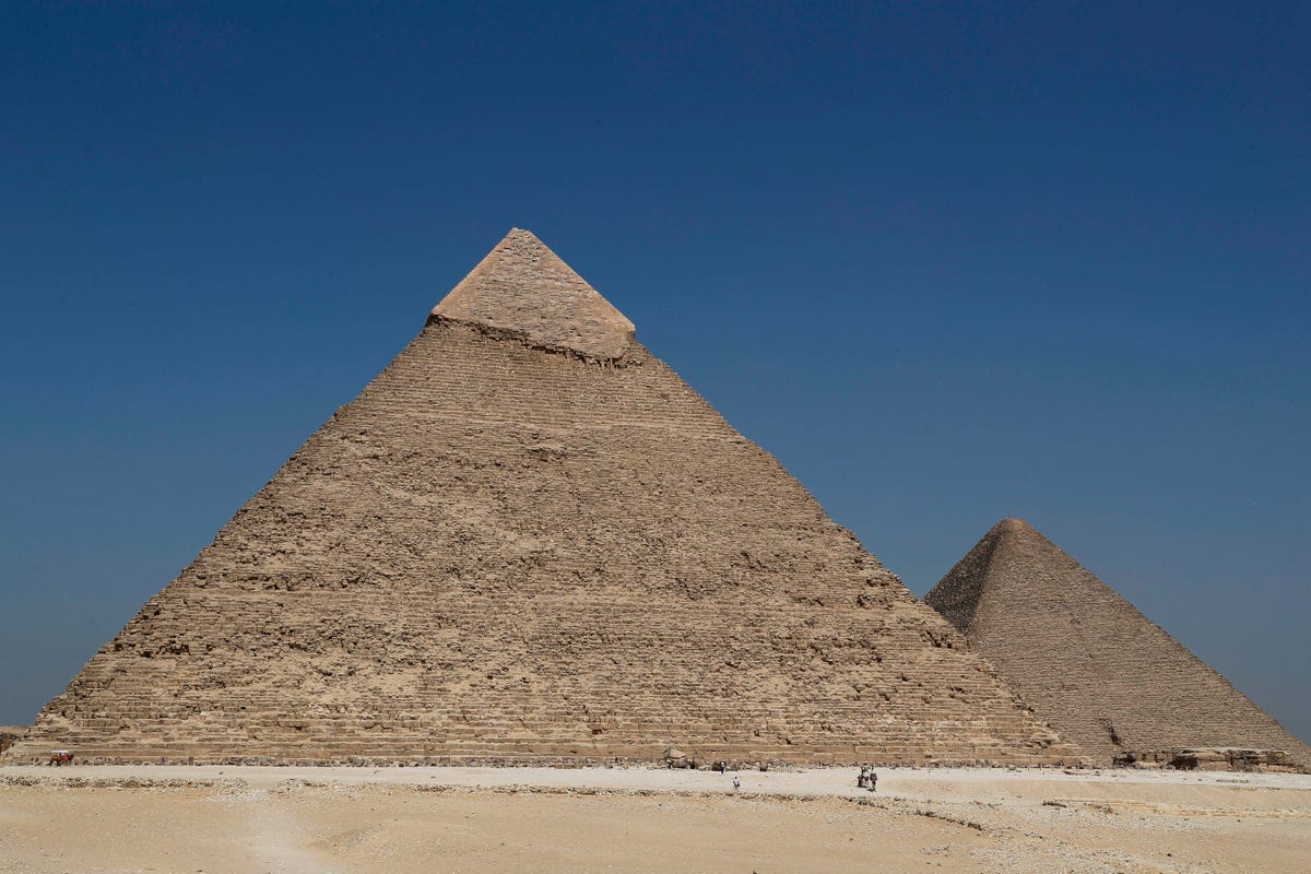
Egyptian pyramids.
Pyramids of Egypt
Google Maps has dozens of spots you can drop in to view Egypt's pyramids . You can take Street View to walk amongst caravans or gaze up at the Pyramid of Menkaure and Giza. There is an endless amount of history to learn about these massive structures. For example, the Pyramid of Menkaure is the smallest of the three pyramids , but defined as a "true pyramid" due to its smooth sides. Most of the pyramids were built as tombs for the country's pharaohs. King Tutankhamun's tomb, for example, is said to be cursed . Tutankhamun's resting place is almost seven hours from the Giza Necropolis, but on Google Maps, you can tour both far more quickly.
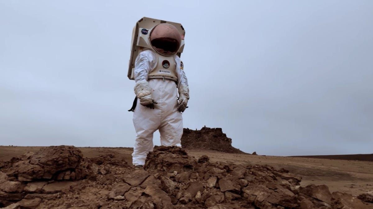
To date, Devon Island is the most similar terrain on Earth to that of Mars.
Devon Island, Canada
Devon Island might look like a vast, barren, rocky wasteland in the Canadian Arctic… because it is. But don't write it off just yet. In 2019, Google singled out Devon Island and talked to scientists who are using the area as a training ground for future missions to Mars . According to the researchers, Devon Island's terrain is as close to Mars as you can find on Earth.
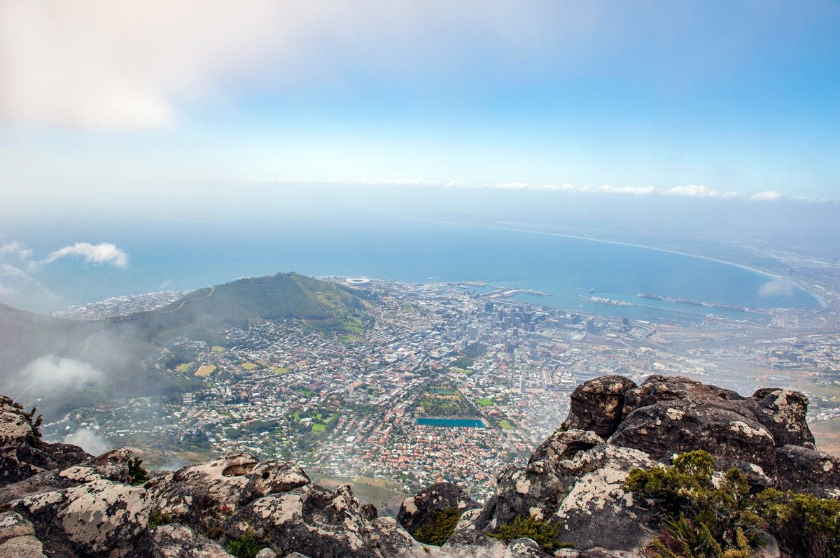
Table Mountain, Cape Town.
Table Mountain, South Africa
If you're in need of a breathtaking view, start with Table Mountain in South Africa. The flat-topped mountain looks over the stunning rocky terrain of Table Mountain Nature Reserve all the way out to Cape Town. An 18th-century French astronomer Nicolas Louis de Lacaille named a constellation Mons Mensae, which translates to Table Mountain , after the landmark. Lacaille reportedly did so because he spotted the constellation from this location.
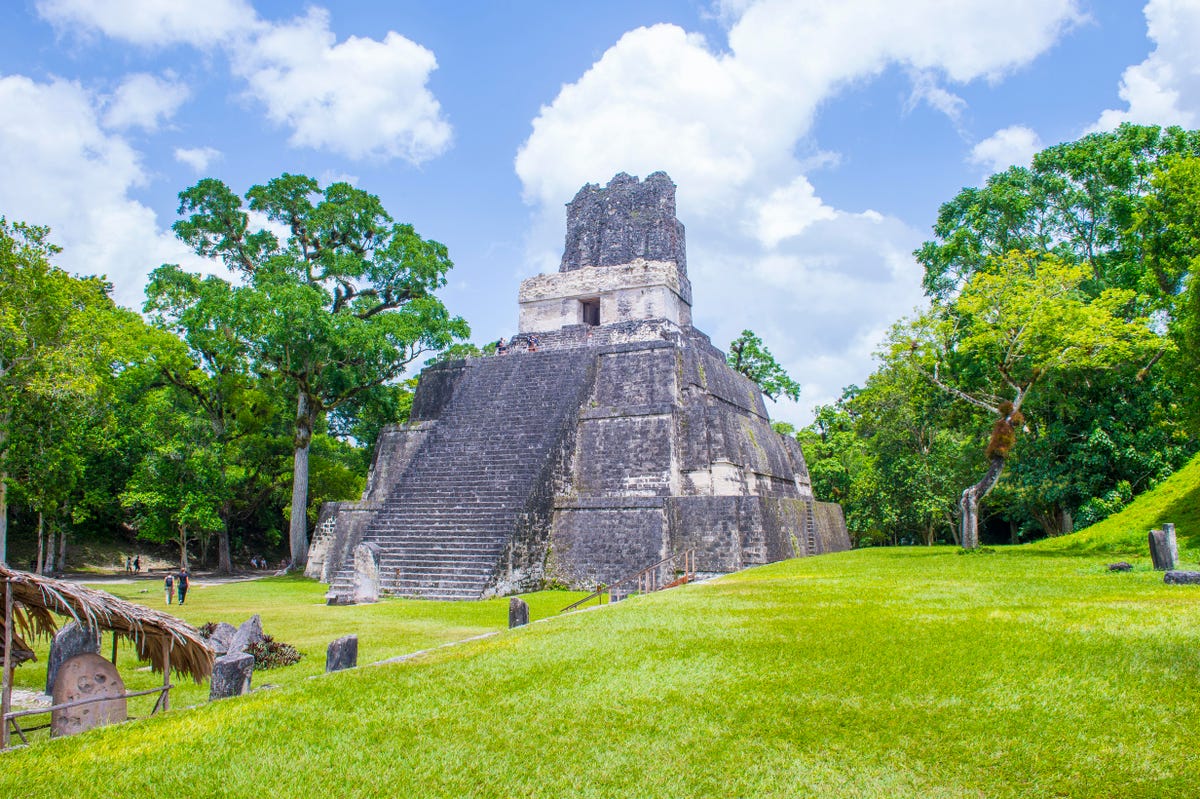
Tikal National Park.
Tikal National Park, Guatemala
Tucked deep in Guatemala's jungles is Tikal National Park . There you'll find Mayan temples and ceremonial ruins dating back to 900 B.C. Tikal is one of the most important complexes left behind by the Maya civilization , according to the United Nations Educational, Scientific and Cultural Organization. The site includes remnants of palaces, temples, ceremonial platforms, living quarters, game courts, terraces, roads and town squares. The monuments are also still decorated with carvings and mural paintings with hieroglyphic inscriptions that detail the people's history.
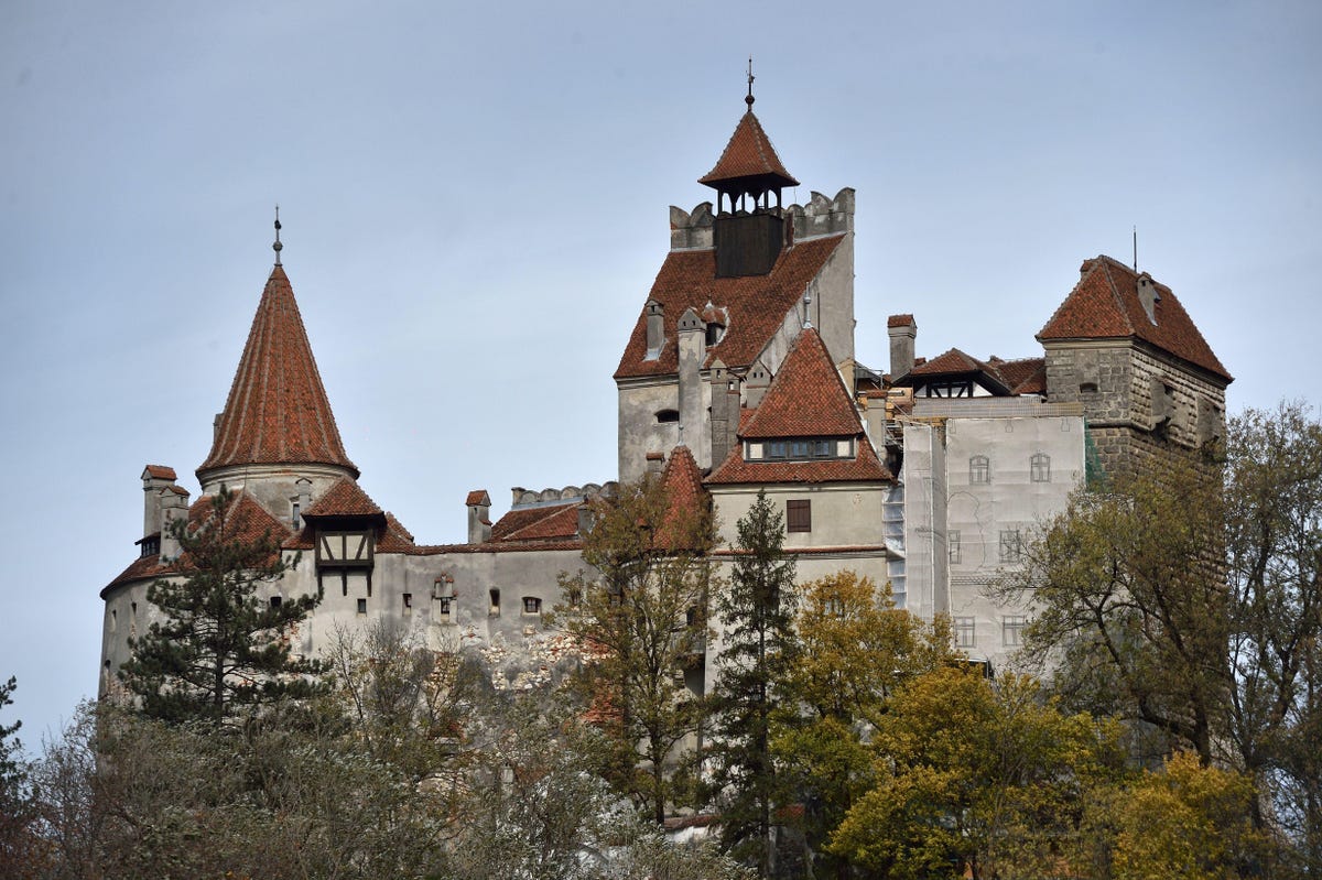
No vampires at Bran Castle, sorry.
Bran Castle, Romania
Calling all horror movie fans: Not only can you digitally traipse the grounds around this 14th-century castle that allegedly inspired Bram Stoker's Dracula , but you can also peek inside a few rooms. I can't guarantee you'll see a vampire (sparkly or otherwise), but the Transylvanian castle has a lot of history. Its stone walls have housed numerous royals, most notably Vlad the Impaler , aka Vlad Tepes, aka Vlad Dracul. Bran Castle was the only castle at the time that matched the description Stoker gave in his book. Dracula, the character, and Vlad Tepes aren't meant to be the same though.
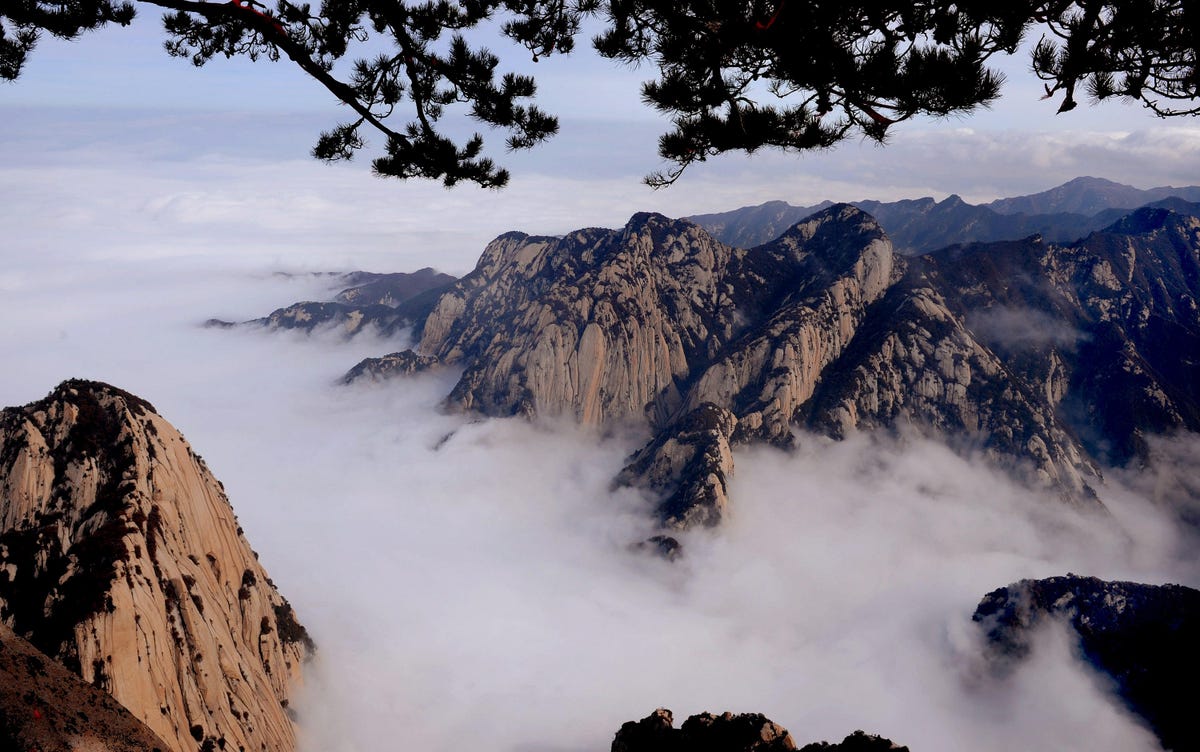
Huashan Mountain.
Huashan Mountain, China
Those with a fear of heights, be warned. You can essentially hike this incredible mountain without leaving your seat. The trail starts out simple enough -- it's high up, but the path is relatively wide, with interesting temples to stop at along the way. On your journey, you'll also encounter narrow stone stairs and a few vertigo-inducing paths . In some places it looks like unstable planks of wood were hammered into the mountainside for people to cross. Gulp!

Cat Island sounds like a purr-fectly good time.
Cat Island, Japan
Aoshima, Ehime, is an island in Japan that's home to more cats than people . In 2016, the fishing village had just over a dozen residents and more than 160 cats, according to CBS News. The cats were originally introduced on the island to solve a mouse problem several decades ago. Drop onto one of the streets and you'll be surrounded by felines, which honestly is a dream come true. Almost anywhere you click, you'll find a cat (or several cats) lounging in the sun, aggressively ignoring the camera. Perusing Cat Island is like a grown-up, extra adorable version of Where's Waldo.
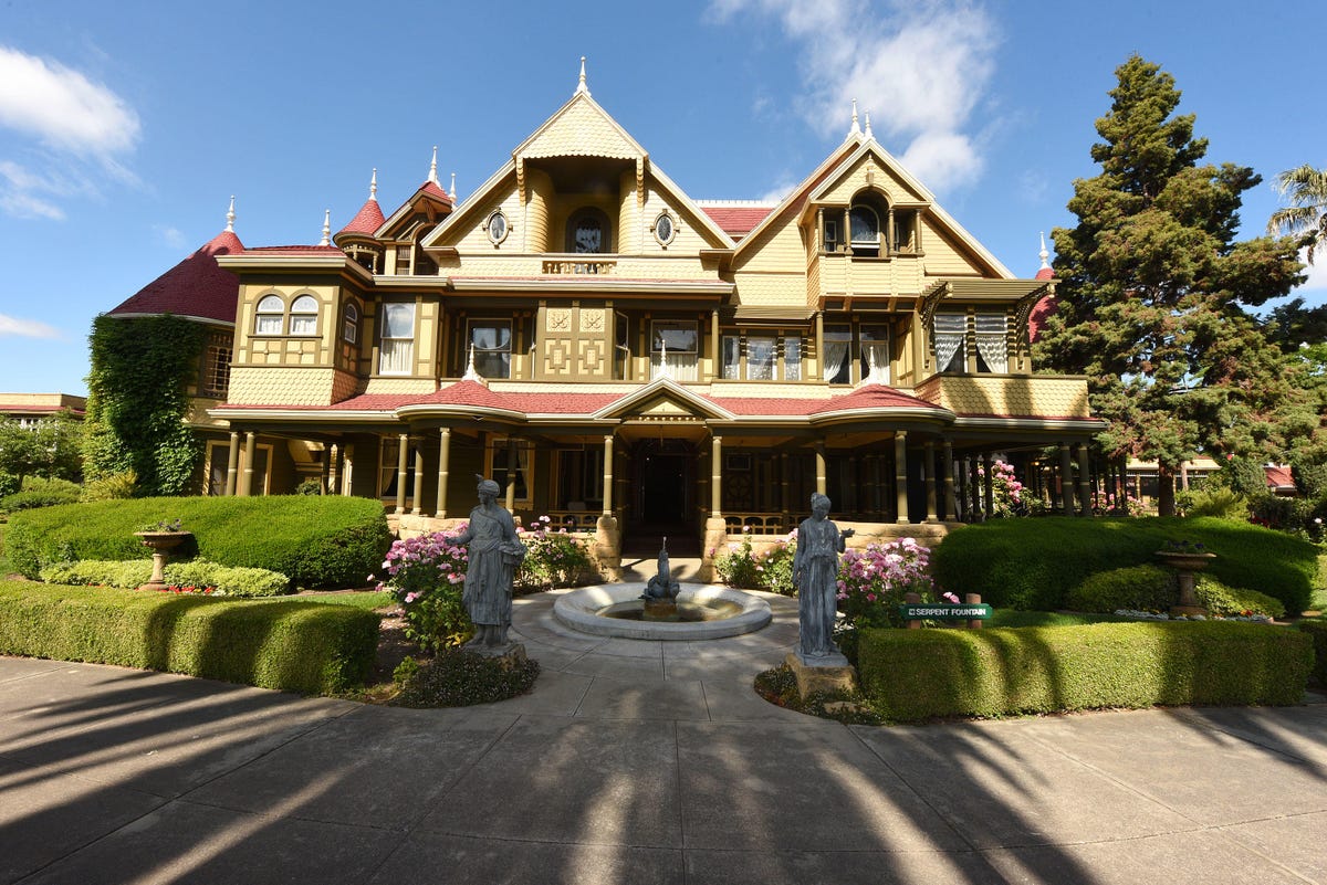
Winchester Mansion.
Winchester Mansion, California
And now we get spooky again… or architectural, depending on how you look at it. The Winchester Mansion is located in San Jose, California and it's more than a bit of a mystery. Consumed with grief after losing her husband and son, Sarah Winchester moved to California and bought a farmhouse. Over 10 years, she transformed the property from a simple farmhouse into a towering seven-story mansion. The great San Francisco earthquake of 1906 did quite a bit of damage to the structure before Sarah passed away in 1922. It was later found out that Sarah had the house built with stairways and doors that went nowhere, windows looking into other rooms and more oddities. The house is said to be haunted. If you don't have any plans to visit California (and don't scare easily), you can take a look around the Winchester Mansion on Google Maps.
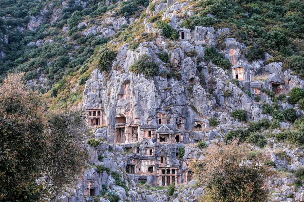
The ancient city of Myra.
The ancient city of Myra, Turkey
The ancient Lycian ruins in Myra are said to date back before the 5th century B.C. , according to the Turkish Cultural Foundation . Among the ruins are tombs of rulers and their family members cut into a steep cliff. A few clicks away is a 35-row amphitheater. The structure's former glory is evident in the carved designs you see throughout, even though it is still breathtaking. If you liked Tikal National Park, it's worth a digital trip to the Lycian ruins as well.
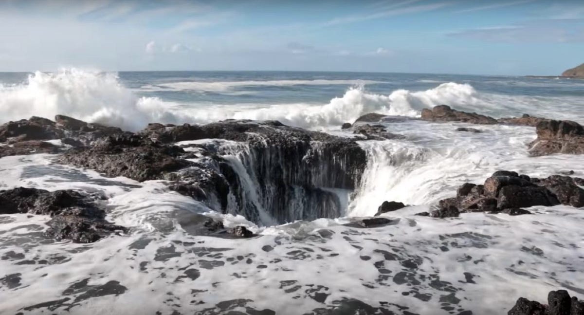
Thor's Well.
Thor's Well, Oregon
The lovable, hammer-wielding, lightning-summoning Avenger didn't have anything to do with this tourist attraction near Cook's Chasm in Oregon. Thor's Well is a sizable hole in the basalt shoreline that Gary Hayes, publisher of Coast Explorer Magazine , theorizes began as a sea cave, but was dug out by waves. The roof eventually collapsed and left openings at the top and bottom for the ocean to surge through.
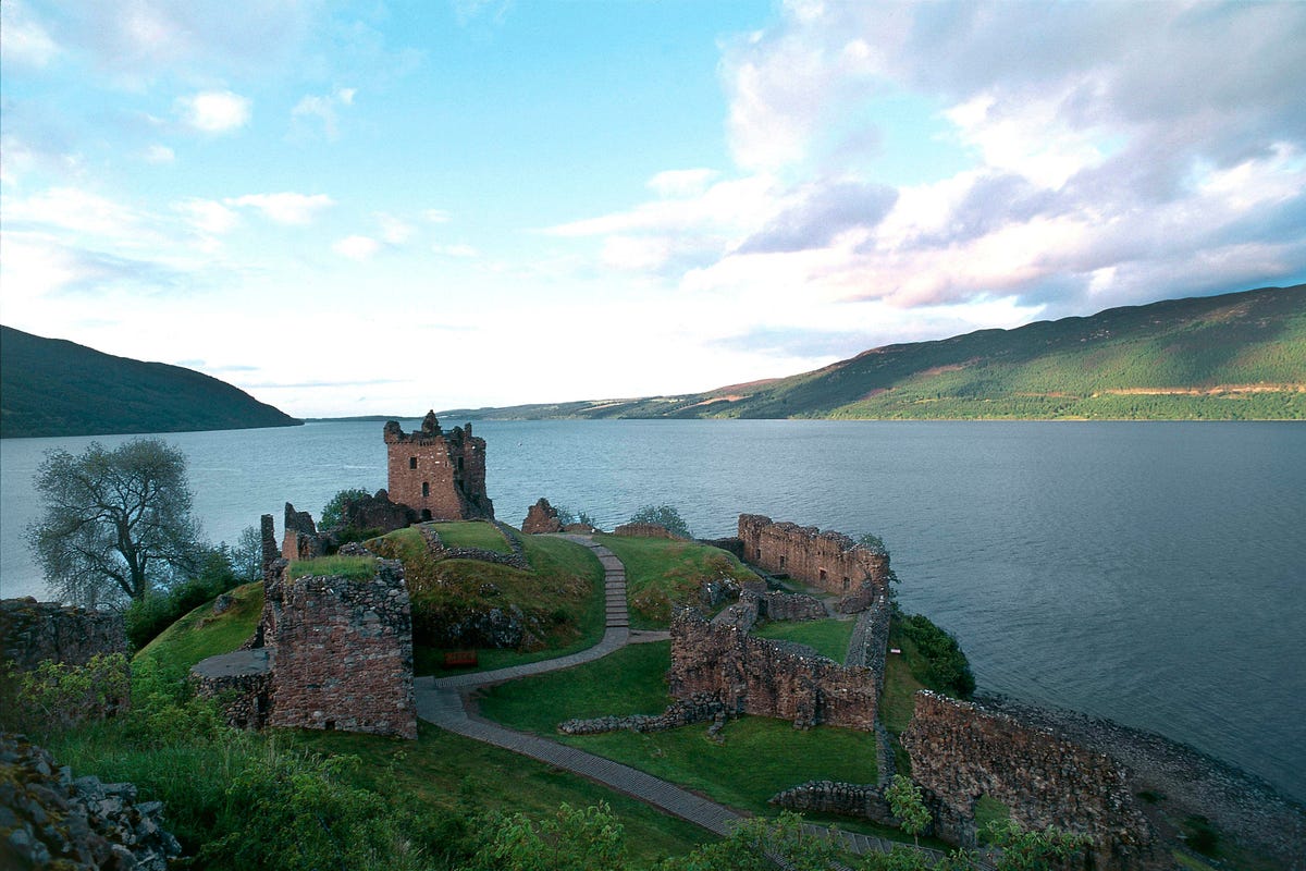
We can't promise you'll spot the Loch Ness Monster whether you visit digitally or in-person.
Urquhart Castle, Loch Ness, Scotland
Loch Ness is a freshwater lake that spans 23 miles in Scotland's highlands. Along with the ruins of Urquhart Castle , people flock to Loch Ness to try to catch a glimpse of the long sought-after Loch Ness Monster . Depending on where you click, you can see images from a boat tour on the lake . I didn't see "Nessie" in the images, but other people claimed they did a few years ago . After the hype around the Area 51 raid event on Facebook in 2019, another event, "Storm Loch Ness" appeared .
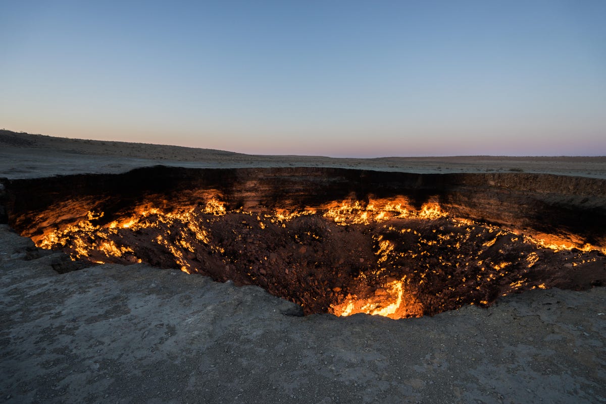
Darvaza Gas Crater.
Darvaza Gas Crater, Turkmenistan
The Darvaza Gas Crater is also known as the Door to Hell and the Gates of Hell (not intimidating at all, right?). If you can't handle the heat, you can get up close and personal with this fiery pit on Google Maps. The images almost make it seem like the world's biggest fire pit (imagine the s'mores!). The pit's glow, varying between sinister and cozy, depending on your point of view, emanates from an underground cavern in Derweze. The crater came to be in the 1970s when Soviet geologists began drilling for oil in Karakum. While they found oil, they were also drilling on top of an unstable cavernous pocket of natural gas, according to Smithsonian Magazine . The site collapsed and several craters subsequently opened up. The crater has reportedly been burning for more than 40 years.
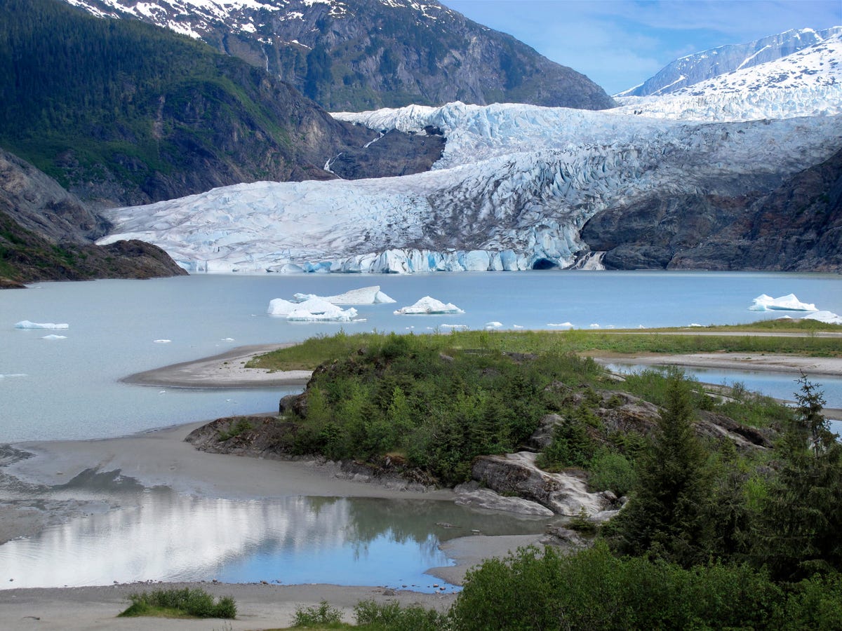
Mendenhall Ice Caves.
Mendenhall Ice Caves, Alaska
Did it get chilly all of a sudden? That's because we're talking about Alaska's ice caves. The Mendenhall Ice Caves in Juneau, to be exact. The first thing I noticed as I panned around the cavern was how many striking shades of blue there were. Alaska Shore Tour's travel experts describe their excursions into the 12-mile Mendenhall Ice Caves as "dreamlike." It might be as close as you can get to Superman's fortress of solitude in real life. The cave, which is actually a glacier, is also pretty tricky to get to outside of a Google Maps tour. You have to kayak to the edge of the ice and climb over the glacier, Atlas Obscura says .

Services and Software Guides
- Best iPhone VPN
- Best Free VPN
- Best Android VPN
- Best Mac VPN
- Best Mobile VPN
- Best VPN for Firestick
- Best VPN for Windows
- Fastest VPN
- Best Cheap VPN
- Best Password Manager
- Best Antivirus
- Best Identity Theft Protection
- Best LastPass Alternative
- Best Live TV Streaming Service
- Best Streaming Service
- Best Free TV Streaming Service
- Best Music Streaming Services
- Best Web Hosting
- Best Minecraft Server Hosting
- Best Website Builder
- Best Dating Sites
- Best Language Learning Apps
- Best Weather App
- Best Stargazing Apps
- Best Cloud Storage
- Best Resume Writing Services
- New Coverage on Operating Systems
0, text: error()">
0, text: error(), css: errorCssClass">
Reset your password
Enter your email address or username and we’ll send you a link to reset your password
Check your inbox
An email with a link to reset your password was sent to the email address associated with your account
Provide email
Please enter your email to complete registration
Activate to continue
Your account isn't active yet. We've emailed you an activation link. Please check your inbox and click the link to activate your account
0, text: error" style="display: none;">
0, text: success" style="display: none;">
- Relationships
The Bored Panda iOS app is live! Fight boredom with iPhones and iPads here .
- Partnership
- Success stories
- --> -->