- National Parks
- Tiny Houses

6 Phenomenal Backpacking Trails in Joshua Tree National Park
Posted by Emily Pennington February 24, 2022 Updated September 06, 2023
We research, evaluate and select travel destinations based on a number of factors, including our writers’ experience, user reviews and more. We may earn a commission when you book or purchase through our links. See our editorial policy to learn more.
A wonderland of boulders, cacti, and spiny, Seussian trees, Joshua Tree National Park is a haven for desert lovers and backpackers of all ages.
If you fancy yourself a desert aficionado (or just really, really love scrambling around on big rocks), a simple day trip through this storied park probably isn’t going to cut it.
For one thing, you’ll miss out on the incredible night skies and their sweeping views of the Milky Way — Joshua Tree is certified as an International Dark Sky Park . It’s also a fact that sipping your morning coffee while watching the sun rise over far-flung peaks is a hell of a lot better than waking up inside a dingy motel room.
Though the park has crawled its way onto the top-ten most visited list in recent years, few visitors explore more than a mile or two from their vehicles, and even then, it’s generally in high-use frontcountry areas. Backpacking into Joshua Tree’s 792,623 acres is a fantastic way for hikers of all experience levels to escape the crowds and have their cup filled by the soul-stirring wonders of nature.
Related Read: When is the Best Time to Visit Joshua Tree National Park?
Backpacking in Joshua Tree: Need to Know
Unlike many national parks, Joshua Tree allows for backpacking pretty much anywhere that meets these three requirements: 1 mile or more from roads, 500 feet from trails and water sources, and not a day-use only area. So yes, in theory, you could wander out exactly one mile from a road and pitch your tent anywhere in this gorgeous desert expanse, provided you are following Leave No Trace principals.
No fires are allowed outside of designated, government provided fire rings in Joshua Tree, and, yes, that means that there’s no collecting of “dead and downed” wood. The arid desert ecosystem is fragile, and travelers here are required to leave what they find, pack out all trash, and cook and camp on durable surfaces, such as flat rocks and boulders.
Many popular overnight hiking routes have sections that are off trail, so carry a map and compass (or a GPS device with downloaded directions) on all treks.
Lastly, this is the desert! Water is scarce, and the park notes that water sources should be reserved for wildlife only. Pack in all the water that you’ll need for your entire trip (typically 4L per person, per day), as no potable water is made available to campers once in the wilderness.
When in doubt, call the visitor center or ranger station to check current conditions.
The Best Time for Backpacking in Joshua Tree
Due to its warm, dry desert climate, fall, winter, and spring are going to be your best bet for a fun, successful, and non-110 degree backpacking trip. Fall (44 to 94 degrees) is when temperatures begin to drop and hiking becomes pleasant again. October and November are great months for climbing, hiking, and backpacking. Winter (38 to 66 degrees) is an ideal season to visit, especially when other California locales are still covered in snow.
Lastly, spring (43 to 86 degrees) is temperate, warmer, and features near-perfect weather for an overnight camping trip. Plus, if you’re lucky, you might catch the annual wildflower bloom from February through April.
Related read : Your Guide to Visiting Joshua Tree National Park in the Winter
Joshua Tree Permits and Reservations
Unlike most popular national parks, Joshua Tree does not require any permits or reservations for entry or overnight trips.
The park only requires that all backpackers sign in at one of 13 backcountry registration boards scattered throughout the park, so that they have a general idea of where hikers are and which vehicles they shouldn’t tow.
These boards are typically located at the most popular backpacker trailheads, and visitors should be prepared to list their name, car info, trip length, and general planned route.
Best Backpacking Routes in Joshua Tree
1. boy scout trail.

Why you should go: Perhaps the most quintessential wilderness trail in Joshua Tree, the Boy Scout Trail is a great beginner backpacking trip, full of epic boulders and thousands of the park’s namesake yuccas.
- Distance: 8 miles (point-to-point)
- Elevation gain: 219 feet
- Difficulty: Easy
Aptly named for its lack of hardcore elevation change and its family-friendliness, the Boy Scout Trail is one of the most popular backpacking routes in all of Joshua Tree National Park. For starters, hikers have the option of beginning at the Indian Cove Trailhead or the Keys Ranch Registration Board, and after just one mile of walking, a bevy of dispersed, high desert campsites emerge.
Pitch your tent right next to a pile of scramble-worthy monzogranite boulders or amidst a grove of spiny, green Joshua Trees — just make sure you’re at least 500 feet from the trail when you park it for the night.
If you’ve got two vehicles, you could park one at either end and complete the trail as a point-to-point hike, or you could simply saunter to the trail’s center point, set up a base camp, then return the way you came in the morning. Militant mile-crushers might want to cache water at one end of the trek, pick it up, and double their mileage to a cool 16 on the return journey. It’s a choose-your-own adventure trail. And that, we love.
Related Read: The 10 Best Hikes in Joshua Tree National Park
2. California Riding and Hiking Trail

Why you should go: This 37.6-mile point-to-point stretch of one of California’s iconic long trails traverses a huge swath of the park, is horse-friendly, and is big on mountain vistas.
- Distance: 37.6 miles (point-to-point)
- Elevation gain: 3,175 feet
- Difficulty: Moderate
For intermediate backpackers who love the desert and want to try their hand at a longer, 2-4 day journey, there’s no better place to start than the California Riding and Hiking Trail . First off, you’re never more than a few miles from a road, meaning that water caching and bailing in case of emergency are easier than they might be on a less-trammeled, more remote path.
To plan a successful excursion along this route, you’ll need two cars, as the trail spans 37.6 miles, point-to-point. Park one at the North Entrance Station, then steer the other to Black Rock Campground, where you’ll start. Along the drive, cache your water. The park allows visitors to cache water and food for up to 14 days if it is labeled with your name, phone number, and the date you intend to pick it up. Ryan Campground and Belle Campground are where most people elect to store their H2O.
Though it may look like a beast at first glance, the elevation gain on this trail is incredibly moderate for the number of miles you’ll be hiking. Choose your route with careful consideration of the heat, your water caches, and knowledge of how many miles you can safely walk each day.
Here’s a sample itinerary: Black Rock Campground — four miles past Upper Covington Flats – one mile past Ryan Campground — one mile past Belle Campground — North Entrance Trailhead. A plan like this ensures that you’re never camping without water more than 1 night in a row and that you’re hiking 7-11 miles per day.
Related Read: 11 Backpacking Trips in the U.S. That Should be on Your Bucket List
3. Quail Mountain via Juniper Flats

Why you should go: This lollipop loop serves up breathtaking mountain views from the highest point in Joshua Tree National Park.
- Distance: 12.8 miles
- Elevation gain: 1,679 feet
- Difficulty: Challenging
If you’re looking to sleep under the stars in Joshua Tree and want to peak bag while you’re at it, this trek up to the summit of Quail Mountain (elevation 5,816 feet) can’t be beat. Start off by registering your name and vehicle at the Juniper Flats registration board, then load up your water (at least 4 liters per person, per day) and get ready to climb.
The first 4 miles of this hike are along the California Riding and Hiking Trail. And, since camping here will be in dispersed sites that you’ll need to locate yourself, like most backpacking in Joshua Tree, it may be a good idea to drop your heavy gear and set up a base camp roughly 5 miles in, at the end of an old Jeep road called Stubby Springs Trail.
From there, you could opt to circle up and around the summit for a glorious sunset view (the trail will be spotty, at best) or tag the peak in the cooler morning hours after bedding down among the boulders and spiky Joshua Trees below. Either way, you’ll gaze out at incredible views of Mount San Gorgonio and Mount San Jacinto.
Related Read: The 20 Best Places to Camp in Southern California
4. Conejo Well and Eagle Mountains

Why you should go: Check out a historic desert miners’ well and panoramic mountain views on this moderate trek, fit for solitude-seekers.
- Distance: 13.5 miles
- Elevation gain: 1,122 feet
- Difficulty: Moderate
Beginning at the Cottonwood Springs, on the less touristed south side of the national park, register at the backcountry registration board, then head northeast, towards the campground and away from the trail to Lost Palms Oasis.
Keep your eyes peeled for coyotes and roadrunners as you amble around the western flank of Eagle Mountain. Few adventurers embark on this trek each year, and it’s a wonderful overnighter for anyone looking to enjoy the park’s peaceful wilderness in solitude. Bring a map or a GPS device with you — this trail mostly follows old Jeep tracks left by miners.
To keep the mileage simple, look for a durable campsite on a large, flat boulder when you near Conejo Well at the end. Go February through April to get the best wildflower show in town all to yourself.
5. Black Rock Canyon to Panorama Loop

Why you should go: Hike clockwise and stare slackjawed at desert peaks in every direction on this easy backpacking trip, fit for all ages.
- Distance: 6.7 miles
- Elevation gain: 1,223 feet
Joshua Tree’s Black Rock Wilderness is so popular that it has its own website for visitors to plan their overnight adventures. It’s filled with so many of the things that make this desert park so memorable – crumbling, rolling hills, thorny green Joshua Trees, and flowering cholla cacti.
Though the hike is rated as a moderate day excursion, we’ve downgraded it to easy for a two-day overnighter, since travelers will be able to split the elevation between the days. First register at the trailhead, then set off on the Black Rock Canyon Trail , heading south. Once you reach the junction with the Panorama Loop Trail (2 miles in), you can either set up camp 500 feet off the trail or continue uphill to look for a dispersed site with better views of far-off Mt. San Jacinto.
We recommend going clockwise around the loop section of the trail and tacking on a side journey up to Warren View if your legs are feeling strong. Then, return to your base camp and celebrate under a canopy of twinkling stars.
Related Read: 14 Epic Campgrounds Near Los Angeles, California
6. Mastodon Peak and Lost Palms Oasis

Why you should go: Explore the ghostly remains of Mastodon Mine and see the largest stand of California fan palms in Joshua Tree National Park on this moderate trek.
- Distance: 8 miles
- Elevation gain: 1,276 feet
Every once in a while, you come across a desert hike that really packs a punch. This 8-mile excursion to a hidden oasis, surrounded by boulders, is one such trail.
Register at the Cottonwood backcountry registration board, then hold onto your sunhat and get ready for an adventure. After a brief, .7-mile stroll along a mostly flat path, turn left and begin ascending towards Mastodon Peak . Drop your pack below the steepest section of the scramble, and be sure to enjoy the sweeping views from the top. Then carefully climb down, grab your pack, and meander through the ruins of abandoned Mastodon Mine, a former gold mine once owned by the George Hulsey family that dates back to the 1930s.
When you’ve had enough spooky mining history, backtrack to the main trail for Lost Palms Oasis and follow this well-worn track for roughly three miles as it undulates along boulder-strewn hills until you see the rippling tips of fan palms down below. Veer right and slowly scramble down to the sandy wash below, setting up your tent amidst the towering palm trees (do not attempt this overnight trip if there are flash flood warnings).
In the morning, quietly sip on your coffee or tea while trying to spot an elusive bighorn sheep, hopping between the craggy rocks all around. When you’ve had enough of this lush pocket of Joshua Tree, simply turn around and retrace your steps back to the car.
Explore More
10 Best Glamping Spots Near Joshua Tree National Park
20 Incredible Hikes in Southern California
10 Vintage Airbnbs in Joshua Tree, California
11 Epic Winter Camping Spots in California
11 Best Scenic Drives in Southern California
Get epic travel ideas delivered to your inbox with Weekend Wanderer, our newsletter inspiring more than 10,000 readers every week.
Seen in: Backpacking , Backpacking in California , California , Joshua Tree National Park

Posted by Emily Pennington
Emily Pennington is a national parks and travel columnist at Outside. Her work has appeared in The New York Times, The Guardian, Condé Nast Traveler, Lonely Planet, Adventure Journal, REI Journal, and Backpacker, to name a few.
Her memoir about visiting every national park, Feral , launched in February 2023, and now that it’s finished, you can find her backpacking in the Sierras and drooling over Colorado real estate.

7 Amazing Glamping Spots Near Los Angeles, California
Find your next adventure.
Sign up for Weekend Wanderer and join thousands of readers getting epic travel ideas weekly.
Related Posts

An Epic Guide to California’s 14ers: Hiking & Climbing the High Peaks
Summiting a peak higher than 14,000 feet (a 14er, if you will), is a bucket list accomplishment for any savvy hiker.

Flagstaff Hut: A Hiker’s Paradise in Maine’s Backcountry
Situated in the scenic remote wilderness of northwestern Maine, the…

12 Unique Places to Stay in California for an Epic Escape
California has no shortage of wild, wonderful, and downright weird places to stay on your next vacation, so check out these 12 unique rentals.

14 Unforgettable Hikes in Northern California
From the ever cloud-capped Mount Shasta to the mist-laden coastal redwood forests, NorCal has plenty of epic hiking.

How To Hike Half Dome In A Day
Tackle the picturesque Half Dome with this burly, full-day hike. …

12 Epic Hiking Camps & Summer Backpacking Trips
There's no better way to appreciate nature than being fully immersed in it for days and weeks on end. Here's where the best summer memories often begin.

6 Stunning National Parks near Los Angeles, California
Los Angeles is close to a handful of world-class National Parks like the boulder-filled Joshua Tree and the redwood-covered Sequoia National Park, among others.

11 Backpacking Trips in the U.S. That Should be on Your Bucket List
Forget the crowded viewpoints and roadways — experience the wonder and solitude (most of the time) of the nation’s most epic trails!
You are using an outdated browser. Please upgrade your browser or activate Google Chrome Frame to improve your experience.

- Trip Styles
- Destinations

- Trip Destinations
- California Hikes & Tours
- Joshua Tree Hiking Tours
Joshua Tree Backpacking Trip
Las vegas, nv, trip highlights.
- Point to Point Thru-hike
- Wonderful Winter Trip
- Desert Wildlife
- Amazing Desert Landscapes
- Dramatic Rock Formations
- Fascinating History
- Beautiful Views
Description
Experience Joshua Tree like few do. Our 4-day Joshua Tree National Park Backpacking trip traverses the most stunning parts of the park. Starting in the famous Wonderland Of Rocks, we’ll hike through these surreal rock formations, and travel overland to the western edge of the park. On our final day, we’ll summit 5501-foot Eureka Peak to enjoy 360-degree views surrounding San Bernardino Mountains and the Coachella Valley before descending to our waiting vehicle.
Throughout the journey, we’ll enjoy delicious, guide-prepared meals and rest easy in secluded backcountry camping spots. Join us for the ultimate Joshua Tree backpacking adventure.
$1665 Per Person
DIFFICULTY LEVEL 4
Scale of 1-5. 1 is least difficult; 5 is most difficult
Hiking Distances:
Backpack Weight:
Moderately Rugged
Max Daily Elev. ↑↓:
Heights Exposure:
Please Note: Terrain, Elevation Gain and Heights Exposure ratings reflect the section or day of the trip with the maximum difficulty of each. Much of the trip is at easier levels. See the trip itinerary for more detailed information. Backpack Weight ratings are estimates that account for Wildland-provided gear, guest clothing, personal items and a share of group food. By packing light it’s often possible to stay on the lower end of the weight range. Pack weights also decrease during the trip.
PHYSICAL DEMANDS OF THIS TRIP
- Hiking uphill or downhill with a 45+ lb backpack for 6-8 hours
- Maintaining balance and footing on moderately rugged terrain
SOLITUDE LEVEL 3
1 least solitude, 5 most solitude
We rate this Joshua Tree hike a solitude 4. You can expect to see zero to a couple of other groups per day in the backcountry.
- Minimum 2 Guests
- Taxes & Fees
If a trip does not reach the minimum number of guests, you may choose to transfer to another trip date or another trip, be refunded your payments in full, or you may have the choice to pay a supplemental fee to run the trip with fewer guests. We make the final determination for these trips 4-6 weeks before the departure date, and notify guests of changes and options immediately.
UTAH SALES TAX
Utah is the only state we are based in that charges sales tax to outfitters and guides. The sales tax is based on the St. George, UT municipality rates, which are adjusted occasionally but are in the 6-7% range. For all of our hiking and backpacking tours that originate from our St. George, Utah base (Utah, Joshua Tree and Death Valley trips), the sales tax will be applied automatically to your payments. Feel free to call us at 1-800-715-HIKE (4453) with any questions!
Private Trips

Travel in perfect company by booking a private trip exclusively for your group!
Our sliding scale for private trips is based on the final number of guests in your group. Rates are per person and do not include sales tax, national park fees or guide gratuity. The final rate is based on the actual number of guests on the trip and may adjust based on cancellations or additions.
Please Note: you can also enjoy a private trip at our normal scheduled rates by filling any empty tour to capacity. However, if group members drop from the tour those spots will automatically become available on our website for instant booking. By purchasing a private trip at the rates listed below, your trip will remain exclusive to your group regardless of cancellations.
Private Rates FOr This Trip
- 2 People: Rate x 2.5
- 3 People: Rate x 1.75
- 4 People: Rate x 1.25
- 5+ People: Rate x 1.15
*all rates are per person
" * " indicates required fields
Learn About Our Private Trips
- Shuttle to Joshua Tree: 4 hours
- Hiking Mileage: 4.3 miles
- Elevation Gain: 1500 feet
- Elevation Loss: 280 feet
Our four-day trek into the backcountry of Joshua Tree National Park begins with a desolate drive deep into North America’s driest desert: the Mojave. Following your pick up at the Tuscany Inn and Suites in Las Vegas, we’ll head south through a series of arid basins and abrupt ranges, bisecting Mojave National Preserve and getting our first elegant glimpses of Joshua tree groves as we proceed to our trailhead. After fueling up with a delectable lunch and readying our packs, we’ll embark on our hike. We will start with 6-8 liters of water each, which covers the first 1.5 days of the trip (all natural water sources in Joshua Tree are reserved for wildlife), and we will rely on water caches for the final 2.5 days.
Ascending through sprawling fields of creosote, Mojave yucca and other high desert shrubs, we’ll disappear into a canyon of towering boulders, winding our way into the infamous Wonderland of Rocks. Twisting and turning among the cretaceous plutons, at last we’ll end our day of ascent by setting up camp amidst the boulders and Joshua trees. We’ll soak in the desert sky and listen for the howls of coyotes as we fill our bellies and settle in for a good night of rest.

- Hiking Mileage: 8.5 miles
- Elevation Gain: 1100 feet
- Elevation Loss: 1500 feet
Today’s hike will delve us further into the heart of the park. After hot drinks and breakfast, we’ll break camp and set off along a series of crests and furrows yielding stunning views into the surrounding countryside. Descending from the maze of monzogranite formations, we’ll pause to refill our water supply and then disappear again into the remote wilds of the park.
Skirting our way along rolling foothills and slanted bajadas, we’ll descend gradually into a vast sea of Joshua trees. Just before the end of our day’s miles, we’ll stop to investigate a handful of evocative historical remnants dating back to the 1800’s. At last, we’ll sneak our way down a wash and into grassy quail territory to rest our weary legs for the evening, nestled in against the rocky outskirts of what will be tomorrow’s adventure.

- Hiking Mileage: 6 miles
- Elevation Gain: 1600 feet
- Elevation Loss: 150 feet
While shorter in miles, today’s terrain will put the challenge level on par with the previous day. We’ll fill up with a delicious breakfast before endeavoring up our charming backcountry canyon, littered with sandy washes, marbled slickrock chutes, riparian thickets and boulders galore. Emerging from the canyon, we’ll make our way to the next water cache and replenish our lifegiving stores in the midst of this xeric land.
We’ll then follow a series of trails and gradual washes, witnessing a welcome transition into a lush high elevation flat, where we’ll find ourselves surrounded by craggy knolls spotted with some of the largest Joshua trees in the park. This grassy expanse will host us for our third and final night as we eat well and rest up for our exciting day tomorrow.

- Hiking Mileage: 7.5 miles
- Elevation Gain: 1400 feet
- Elevation Loss: 2500 feet
- Shuttle to Las Vegas: 4 hours
Our final day brings with it a substantial amount of descent, but not before a heart-pounding summit of Eureka Peak. Right at the brink of the San Andreas Fault, we’ll follow a series of twists and turns before climbing to soak in panoramic views of Coachella Valley and the surrounding San Bernardino Mountains.
Descending steeply into the labyrinth of ravines that make up the Little San Bernardino Mountains, we’ll snake our way between canyon walls, over open slopes, and through pinyon-juniper woodlands, dropping at last down sandy gullies into Black Rock Canyon Campground. After a celebratory lunch at the trailhead, we’ll make the return drive to Las Vegas for a a well-deserved shower and bed.
Please Note : We always do everything in our power to follow the set itinerary, however it can change occasionally based on temporary access restrictions, weather, lodging/campground availability, guest ability/injury, natural events like fires and flooding, and other potential causes. Normal terms and conditions apply to trips with itinerary changes.
Trip Dates & Booking
Trip dates & booking.
Click on a date to register. You can also click here to request new dates or book through customer service.
AVAILABLE TO BOOK
This trip is available and bookable online! Click on the date to register now or contact us online to book through our award-winning customer service team!
This trip has 1 or 2 spots remaining and is bookable online! Click on the date to book now or contact us online to book through customer service.
REQUEST A RESERVATION
This trip is exclusively booked through customer service due to logistics with lodging, permits, staffing, availability, or something else. Please contact us online or call us at 800-715-HIKE (4453) to request a reservation.

Don't see your dates? Call us! We may be able to add new trip dates.
Trip details, what's included.
- Top-of-the-line tent, backcountry sleeping pad and multi-day backpack
- High quality, synthetic sleeping bag (professionally laundered after every use) – or bring your own .
- Use of trekking poles
- All meals are included from breakfast the first day through lunch on the last day
- Trained hiking guide(s) with years of personal wilderness and hiking experience, medical certifications, and a passion for leading people into breathtaking landscapes. See Guide Bios .
- Comprehensive, roundtrip transportation from your hotel in Las Vegas and back
- All necessary entrance fees and permits
- Emergency equipment including a company-issued first-aid kit and communication device (InReach Explorer or satellite phone)
- Mandatory 5% national park fee that passes through directly to Joshua Tree National Park
What's Not Included
- Clothes, raingear, and footwear ( see recommendations )
- Sunscreen, toiletries and personal items
- Water bottles and a headlamp or flashlight
- Guide gratuity (industry recommendation is 10-20% of trip cost)
Click here to see a printable, downloadable trip information packet with more detailed guidance about what to pack.
Meals: What To Expect
All of our hiking and backpacking tours include a diversity of tasty meals packed full of critical carbohydrates, proteins and fats. We carry foods that travel well in the backcountry – rice, pastas, lentils, beans, couscous, packaged meats, nuts, breads, oatmeal, granola, and more.
For optimal taste and energy, we supplement all our meals with spices, herbs, oils, cheeses, butter, sugar, and fruits and vegetables (fresh and dried). In addition, we provide you with with an assortment of trail mix, snacks, and dried fruits to eat at your own discretion.
We regularly accommodate vegan, vegetarian, kosher and non-gluten diets and will make adjustments for food allergies. These and other special dietary requests may require an additional fee.
Gear We Provide
We provide all group gear which includes the following:
- Deuter or Osprey backpacks
- Sierra Designs, Kelty or Big Agnes tents
- Sierra Designs, Big Agnes and Mountain Hardware synthetic-fill sleeping bags (or bring your own )
- Thermarest or Big Agnes sleeping pads
- Leki trekking poles
- Cooking stoves and cookware
- Company-issued first-aid kit
- Emergency communication device(s)
Guest Packing List
When you register for this tour you’ll receive access to a printable, downloadable trip information packet with a detailed packing list specific to this trip ( click here to see it now.) All trips require a sturdy pair of hiking shoes or hiking boots, rain gear, a recommended clothing system, a headlamp or flashlight, a hydration system (water bottles and/or bladder) and other items specific to each trip.
Additionally, some guests choose to bring their own sleeping bag. We supply high quality, synthetic fill bags that are professionally laundered after every trip. Synthetic fill is non-allergenic, insulates when damp and stands up well to repeated washings, but is heavier and bulkier than down. If you’re able to bring your own down sleeping bag, there are multiple benefits . If not, we’ve got you covered!
Trip Logistics
How do i register.
Reserve your spot today! In the Trip Dates & Booking section of this page, the green and red dates are bookable online by simply clicking on the date, and blue dates must be booked through our customer service team for a variety of possible reasons. To email our customer service team, you can click here to get the ball rolling. Our adventure consultants will confirm availability, and if you’re ready to register we’ll email you a link to a registration profile. You’ll have 72 hours to complete your profile (and that of any dependents) and pay the deposit.
Feel free to call us for more info – we’re here 7 days a week!
Where Do We Meet?
This trip originates in Las Vegas, Nevada. Your guide will be in contact approximately 10 days before the trip start date to coordinate the pre-trip orientation, which will be at 5:00 PM at Tuscany Suites and Casino in Las Vegas. Your guide will then pick you up at the Tuscany the next morning for transport to the trailhead. For Private Death Valley Tours your guide will meet you at your hotel in Las Vegas at an agreed upon time.
Click here to see a printable, downloadable trip information packet with more detailed guidance about flights, shuttles, recommended lodging and more.
Travel to Las Vegas
Las Vegas’ McCarran Airport is one of the most easily accessed destinations in the country. Many major cities in the United States and internationally offer direct flights into Las Vegas. A company named Airline Shuttle (1-888-554-1156) can help you with economic transport to most hotels. Taxi cabs run about $40 to downtown, and the city is also Uber- and Lyft-friendly.
Start/End Times
Your guide will inform you of the first day’s pick-up time at the orientation meeting. Generally, you can expect it to be between 5 and 8 am, although the exact time will depend on current weather and road conditions. We will drop you off at your hotel on the final day normally before 5 PM (this time is not guaranteed, as a variety of circumstances can influence our exact return time).
Safety Precautions
Your safety is our top priority. Our hiking tours are led by professional hiking guides, all of whom are wilderness-certified first responders or EMT’s, each with years of guiding and wilderness experience. Guides adhere to standardized risk management protocols in case of any potential or actual incident, and all tours carry an emergency communication device and comprehensive first-aid kit. Additionally we have a “24/7” system through which guides or guests can reach Wildland support personnel at any time.
If you have any further questions about safety, please contact us at 1-800-715-HIKE (4453) for more information.
Essential Eligibility Criteria
Essential Eligibility Criteria (“EEC”) have been specifically identified to help you understand the skills and abilities necessary to participate on each Wildland trip, and they apply uniformly to all potential trip participants, irrespective of the presence or absence of any disability.
Once you identify a trip in which you may be interested, please carefully review the EEC and itinerary details. If after reviewing the EEC that apply to your desired trip, you determine you need an accommodation in order to meet the EEC, please contact us prior to registering to discuss your requested accommodation.
The EEC exist for your own safety and the safety and enjoyment of all participants. If you are unable to meet the EEC for the trip, with or without an accommodation, you are not eligible for that trip. If you register and arrive for a trip for which you do not meet the EEC, you will be disqualified from participation on the trip and will be dismissed or evacuated from the trip without a refund.
Guide Working Parameters
Guides are required to take 8 hours off each 24-hour period to sleep, recuperate, take personal/down time…etc. In addition, as part of the 8 hours off they must sleep/rest or be in their tents/rooms uninterrupted for a minimum of 5 hours each night. We ask guests to respect these requirements and to not interrupt guides’ off time and sleep time unless there is a true emergency.
Age Restrictions
Age restrictions on this trip are as follows:
- 12 and older to join scheduled tours (mixed groups)
- 5 and older to join private tours, with final approval and specific logistical requirements (such as porter or stock assist) determined on a case by case basis
Weather in Joshua Tree
- Accommodations

Backcountry Sleeping
Tent camping.
Sleeping on backpacking trips is in premier 1-person, 2-person or 4-person backcountry tents. Solo travelers, and anyone else who requests it, are issued single tents. Top-of-the-line self-inflating sleeping pads and synthetic-fill sleeping bags (professionally laundered after every trip) are also provided.

Backcountry Cuisine
Fresh & delicious.
Meals from breakfast Day 1 through lunch the last day are fully included and prepared by your guide. We never use dehydrated backpacking meals, instead serving freshly prepared, delicious backcountry cuisine made with a variety of common and specialty ingredients that travel well in the wilderness.

Amazing Campsites
In the action.
Of course campsites vary tremendously by destination, trip and even by the individual day of a trip. However, you can expect to camp in beautiful areas that put you right in the action to make the most of your backpacking adventure. We carefully design our itineraries with campsites in mind.
Trip Reviews
Average customer ratings:.
- 5.0 (15 reviews)
- Most recent
Most memorable and wonderful time
This backpacking trip is absolutely the best way to see the backcountry of Joshua tree national Park. It was a wonderful adventure, and we really got to see some special and unique vistas because we were often off trail .It was so memorable to sleep underneath the stars in the Desert. We were all exhausted at the end of each day having hiked a very challenging route while carrying the heavy backpack. Bob Clark is an excellent guide with so much experience and he took care of us from start to finish with Delicious meals, education about the local fauna and Flora as well as keeping us on track and on schedule. He is a very kind soul, and you can clearly see. He loves his job and takes care of his guests.
I recommend this company to any outdoor loving soul wanting to travel.
This was my third trip with Wildland and I'm registered for a fourth! I love the guides, the routes, the food, and the company's ethos. I've had wonderful conversation and comradery with the teams I've been on. I recommend this company to any outdoor loving soul wanting to travel.
Absolutely Fantastic Time
Our Joshua Tree backpacking tour was fantastic. From incredibly rugged terrain and scenery, lots of laughs on the trail, to the delicious meals to end the day, this trip did not disappoint!
See All Guest Reviews!
Related trips, you might also like....

Knife Ridge Traverse on the Pacific Crest Trail

Classic Alaska Backpacking Adventure
Hermit Loop
- Similar Trips
- day by day itinerary
- logistical and travel information
- gear and clothing lists and more
Leave a Reply Cancel reply
Your email address will not be published. Required fields are marked *
First Name & Last Initial *
Save my name and email in this browser for the next time I comment.
wildland Wires
Sign up to receive our exclusive Wildland Wire emails and stay up to date with Wildland Trekking's promotions, discounts, contests, outdoor tips and tricks, trip reports and more!
Joshua Tree Backpacking: The California Hiking & Riding Trail
Joshua Tree isn’t just for climbers! Learn about the 37-mile California hiking and riding trail – an awesome backpacking trip to spot spring wildflowers, stargaze, and get those legs ready for summer.

While most people visit Joshua Tree National Park for day hiking , bouldering, and climbing, a Joshua Tree backpacking trip is an incredible experience as well.
The 37-mile California Hiking and Riding Trail runs through the national park from west to east and offers hikers an unforgettable desert backpacking experience. From starry night skies to blooming fields of wildflowers to unique rock formations, and, of course, plenty of Joshua Tree photo ops, this is a great one to add to your backpacking bucket list.
In this post, I share all of the details you need to know to make this Joshua Tree adventure happen including what gear to pack, what to wear, how to plan water caches, and more.
This post may contain affiliate links.
About the California Hiking & Riding Trail
The California Hiking and Riding Trail was originally envisioned in 1945 as a 3,000+ mile trek from the Mexico/US border to Oregon. Although the trail was never completed, 1,000 miles were finalized and 36.5 of those miles are in Joshua Tree National Park. I hiked this trail in February of 2016 in preparation for my Pacific Crest Trail thru-hike .
California Hiking and Riding Trail Map

Why do a Joshua Tree Backpacking Trip?
Here are just a few reasons to put the California Hiking and Riding Trail on your calendar:
- It is a great backpacking trip for first time backpackers as the terrain is fairly flat. It’s also a great introduction to backpacking in the desert .
- The 36.5 mile strech that traverses Joshua Tree can easily be done in a single weeked (2-4 days)
- Joshua Tree National Park’s wildflowers bloom from February to April, making this trail the perfect winter/spring desert backpacking getaway
Save this post!
Enter your email & I'll send this post to your inbox! You'll also receive my weekly newsletter full of helpful advice for planning your adventures.
Best Time for Backpacking in Joshua Tree
Temperatures in Joshua Tree National Park are most comfortable in the Fall and Spring with a daily average high of 85F and nightly lows around 50F. February to April is when wildflowers typically bloom in Joshua Tree and it is a very popular time to visit for this reason.
The average Winter temps in Joshua Tree are in the 60s during the day and 30s at night while the average summer temps can exceed 100F during the day and be in the low 70s at night. We do not recommend backpacking in the Joshua Tree desert summer heat.

How to Get to Joshua Tree
Joshua Tree National Park is located 2 hours from Los Angeles, 3 hours from Las Vegas, 2.5 hours from San Diego, and 4 hours from Phoenix. There are three official entrances to the park – the West Entrance, the North Entrance, and the South Entrance.
For the California Hiking and Riding Trail, you’ll start near the west entrance and end near the north entrance. There is a Visitor Center at both of those entry points.
How to prepare for your Joshua Tree Backpacking Trip

National Park Entrance Fees
There is a $30 per car entrance fee to visit Joshua Tree National Park. This pass is good for 7 days. Get the America the Beautiful Annual Park pass and save on entrance fees!
The California Hiking and Riding Trail passes by several established paid campgrounds that are both first-come, first-served (Belle, Hidden Valley, and White Tank), and reservations required (Jumbo Rocks and Ryan).
If you would rather disperse camp, backcountry camping is permitted in areas that are:
- 1 mile (1.6 km) from roads
- 500 feet from trails and water sources
- Not day-use only areas
If you do choose to camp in any of the designated campgrounds there is a fee and reservations are highly recommended. Campfires are prohibited outside of government-provided fire rings. Portable cooking stoves are fine, though.
Backcountry Registration
Before setting out into the Joshua Tree National Park backcountry, you are required to register at one of the backcountry boards. If you’re starting from the West Entrance, this would most likely be at Black Rock Campground and Nature Center.
If you’re starting from the North Entrance, you’ll want to register at the North Entrance Visitor Center. You can park your car at either starting point.
Transportation
The California Hiking and Riding Trail is not a loop. Unless you plan to hike out and back you’ll need two vehicles. Park one vehicle at the North Entrance Station, your final destination, and use the second vehicle to drive West back to the Black Rock campground where you’ll start the trail. Don’t forget to pack your keys for the car at the end!
Water and water caches
You’ll need to carry at least six liters of water per person per day . In Joshua Tree, even if you find water you can’t legally drink it as it is preserved for desert wildlife. You’ll need to either carry enough water for the entire trail (not recommended) or drop water caches BEFORE you start hiking.
A water cache is water that you hide in a strategic location to be picked up later on in your hike. In Joshua Tree National Park, you are allowed to cache food and water for up to 14 days . It is important to tag your cache with the date you plan to use it along with your name and email/telephone number so that park rangers can contact you if they need to remove your cache.
When I hiked the California Hiking and Riding Trail, I hid one 5 gallon water jug at two different water caches I created. It is important you remember exactly where you hide your cache so you can easily find it later. You can mark a nearby shrub with a string (remember to pick up the string with your water), take a photo of the area, write directions, or take a GPS waypoint of your cache.
I recommend dropping caches at the following locations: Ryan Campground & Belle Campground. If you are concerned about water, you can also drop at Geology Tour Road. All of these locations are accessible by vehicle.
You’ll want to drop your water either the morning you plan to start or the day before.
Joshua Tree Backpacking Gear List
This 3-day Backpacking Gear Checklist has all of the essential backpacking gear to take on a Joshua Tree backpacking trip. Here are a few additional recommendations for desert backpacking:
- Hiking boots or trail runners – since the terrain is fairly flat you don’t need heavy duty hiking boots for this trail , lightweight, breathable ones are preferred.
- Layers that provide sun protection – check out this post on what to wear hiking in the desert for some solid recommendations.
- A sun hat for keeping the sun off your face.
- Trekking poles – optional for this trail since the terrain is flat and not rocky.
- Gaiters – optional, but good for keeping sand and dirt out of your shoes.
- Sunscreen – the desert sun can be brutal even if it doesn’t seem super hot.
- Joshua Tree National Park map – The trail is well-marked along with frequent backcountry boards with information
- Water – You’ll need to carry extra water and prepare water caches as there are no water sources along the trail.
California Hiking and Riding Trail Itinerary
The California Hiking and Riding Trail in Joshua Tree is divided into 4 sections and most people hike the trail in 2-4 days. If you want to hike the trail in 2 days you would need to hike Section 1 and 2 on Day 1 then Section 3 and 4 on Day 2 and you’d average about 18 miles a day.
I chose to hike the trail in 3 days, which is an average of 12 miles a day. Here is how I broke the trail into 3 days:
- Day 1: Hike from Black Rock Canyon trailhead to 4 miles past Upper Covington Flats and camp without water.
- Day 2: Hike roughly 8 miles to Ryan Campground. Pick up your water cache and then continue on 4 more miles to just before Geology tour road.
- Day 3: Hike 4.4 miles to Pinto Basin Road to pick up a water cache at Belle Campground. Then hike 7.3 miles to the North Entrance trailhead.

The starting trailhead for the California Hiking and Riding Trail section that traverses Joshua Tree National Park is located in Black Rock campground. The road to Black Rock Canyon dead-ends at the campground where there is parking for backpackers at the backcountry registration board.
Backpackers are required to register at the backcountry board for overnight wilderness trips. Additionally, there is a visitor and nature center in the center of Black Rock Canyon campground where staff can help with last-minute questions.
Below, you’ll find a description of each of the four sections the National Park Service commonly breaks the Joshua Tree section of the California Hiking & Riding Trail into.
Section One
- Route: Black Rock Canyon Trailhead to Upper Covington Flats Trailhead
- Mileage: 7.75 miles
- Elevation gain: 1,200 ft
From the Black Rock Canyon trailhead, you’ll hike 7.75 miles through scrubland and a large wash to the Upper Covington Flats trailhead. This section includes a 1,000-foot uphill climb, which is the steepest elevation gain for the entire trail. After reaching the high point at 5,130 feet, you’ll have a downhill stretch for 2 miles to the Upper Covington Flats trailhead, parking area, and backcountry board.
Keep in mind, it is possible to drive directly to Upper Covington Flats so if you are short on time or don’t want to hike the first section this could be an option.

Section Two
- Route: Upper Covington Flats to Keys View Trailhead
- Mileage: 10.8 miles
- Starting gain: 1,230 ft
Section 2 from Upper Covington Flats to Keys View is the most remote section of the California Hiking and Riding Trail. This section begins rather flat then has a slight loss of elevation as you drop into a valley and cross several dry washes.
Next, you’ll climb again to above 5,000 feet with views over Juniper Flats. Once you start descending, you’ll enter Juniper Flats where you will start to see the infamous Joshua Trees that the park is named for. The trail continues traveling downhill from Lost Horse Valley to Keys View trailhead.
This was my favorite part of the California Hiking and Riding Trail as unique rock formations will begin appearing along the trail.

It is possible in this section to take a side trail to summit Quail Mountain, the highest mountain in Joshua Tree National Park at 5,813 feet. We didn’t see a sign for the side trail to Quail Mountain so I recommend you ask a Park Ranger before leaving or carry a good map if interested.
Section Three
- Route: Keys View Road to Pinto Basin Road
- Mileage: 11 miles
- Elevation gain: 470 ft
Keys View Road marks your halfway point. Just 0.8 miles from the trail is Ryan Campground where we camped our first night. We chose to pay to camp at Ryan Campground since I had hidden our first water cache here. I’m really happy we camped at Ryan Campground as numerous car and RV campers offered us beers that evening!
From Keys View trailhead, the trail is incredibly flat and it’s 6.5 miles to Geology Tour Rd. Don’t miss Jumbo Rocks which are tons of rocks stacked on one another almost like a building. Once you hit the Geology Tour Rd. it’s another 4.4 miles to Pinto Basin Road. Cherish these last two miles which offer spectacular views of Pinto Basin. Pinto Basin is geographically famous as it connects the Sonoran and Mojave Deserts.

Section Four
- Route: Pinto Basin Road to North Entrance
- Mileage: 7.3 miles
- Elevation gain: 75 ft
From Pinto Basin Road, you’ll begin traveling north. You will find a short side trail to Belle Campground. My friend and I camped here so that in the morning we’d be done before lunch. This is the only section of the trail where we did struggle a bit in finding and following the trail.
Make sure to use your compass and keep traveling due north. Towards the end, you’ll see a small hill which you summit. From the top, you’ll have a great view of the town of Twentynine Palms where the North Entrance and Oasis Visitor Center are located.
Joshua Tree Town Guide
The town of Joshua Tree itself is way cool and I highly recommend including a pre-trip final planning session or post-trip celebration in town! Here are a few highlights not to miss:
- Joshua Tree Coffee Company – On 29 Palms HWY, Joshua Tree Coffee Company, is a little hidden behind Pie for the People. They have the best vanilla latte I’ve ever had! Their nitro cold brew is also not to be missed.
- Pie for the People – This is arguably the most unique pizza joint I’ve ever been too. You have to check out their menu, which includes red sauce, white sauce and pesto sauce based pizzas and pizza names like “David Bowie”, “HWY 62 Revisited”, “The Chip”, and “Barry White.” And what better way to re-enter into society after 3 days hiking than pizza?
- The Natural Sister’s Cafe – A vegetarian cafe that is open 7-2 daily with vegan options available, tons of great smoothies, and juices too!
- Nomad Ventures – In case you forgot any gear or food for the trail, Nomad Ventures has you covered. It is by far one of the best gear shops I’ve ever been to outside of a large city and their prices are competitive. Honestly, I stop every time I am in town just to check out the sale racks!
What questions do you have about Joshua Tree backpacking or the California Hiking and Riding Trail? If you’ve already done this trip, what advice or tips do you have to give? Let us know in the comments below!

Kim is a former principal who quit her job to solo hike all 2,650 miles of the Pacific Crest Trail. In other words…she’s a badass. She currently lives in Santa Barbara where she practices yoga, whips up tasty vegetarian food, and works as a guide leading kayaking, hiking, and biking tours.
Leave a Reply Cancel reply
Your email address will not be published. Required fields are marked *
Save my name, email, and website in this browser for the next time I comment.
16 Comments
This writeup is appreciated but confusing because the points mentioned don’t align with the points listed on the NPS map that is shown.
Hi John, the map provided is a copy of the Joshua Tree National Park map, you can see the CRHT in green but unfortunately they don’t denote enough on the NPS route the individual stops. Drop us an email @ [email protected] if you need further clarification. We provide that map as a general outline of where the trail is in the park. If you visit the NP visitor center before starting they can give you a slightly more detailed map or you can purchase a guidebook.
How do you cache food and water so that critters don’t get into it and you don’t add weight from containers? Do you leave containers and drive back after to pick things up?
Hi Alicia, we didn’t cache any food. We only cached water & we just tired the empty water bottles to our bags to carry out. Please make sure to pick up your containers and not leave them–it can get windy in JTree so you need to pack them out with you when you are hiking.
Tremendous advice. I haven’t been to Joshua Tree in 18 years and am taking my boy and two nephews and this hike is perfect. Any suggestions on supporting maps? I created a customized topo map but it doesn’t really jive with this route. Any suggestions? Again, thanks for putting this together, we’re going in 12 days and couldn’t be more excited.
Hi Dean, you can stop at the visitor’s center and they have really great maps–some available for free & some available for a small fee.
Additionally, is it possible to make this a three NIGHT trek and the last day we scoot out of the backcountry and to the Palm Springs airport? Where would you suggest camping to get maximal “alone” or “wilderness” time.
Hi Dean! Great question. You could definitely make this a three-night trek. To be more remote stay just off the trail and not in the campgrounds.
Hi! Just had to post that I just finished this hike last week using all the info from this site (including all the town/food recs (hit them all). Thanks for all of the detailed information. My hike was fantastic, and I owe much of that to you (and the current super bloom;). For those asking about more detailed maps, I used Alltrails app (they have the CHRT specifically) in addition to the NatGeo paper map. Cheers. –Jetpack
Can you explain more about caching water? I live a couple of hundred miles away. Is the only option to drive there, do the hike without a backpack stashing water along the way, and get out again? Then do the actual hike? Sorry if this is a dumb question, but I just don’t understand the process of caching and would appreciate more clarification. The hike sounds amazing! Thanks!
Hi Steve, thanks for the question. Yes, caching water does mean stashing water along the trail beforehand so that it’s available during your hike. If possible, you can stash water near drive-in access roads that cross the trail or vehicle-accessed campsites so that you don’t need to hike far to cache water.
I’m planning a 3 day trip in the beginning of April and just recently found out that my backpack is way too small so I need to get a new backpack on a very tight budget. Considering I’m new to backpacking so my equipment, though it’s compact enough for backpacking, it’s on the bulkier side. What would be the minimum recommended size in liters for a men’s backpack?
For a three-day backpacking trip, a 30-50L pack is a good size. It really depends on how much gear you need to carry and how compact/lightweight everything is. Check out our Where to Find Discounted Gear post for budget options.
So I just completed this hike on April 3rd and here are some suggestions for new hikers… In no particular order.
1. I went just before Easter Sunday (Thursday-Saturday hike) and could NOT get an Uber, Lyft, or taxi. At all. I was planning on the standard west entrance to north entrance. Since I was stuck at the north entrance with no ride, I decided to walk from North to West. Lesson 1 – don’t assume you’ll get a ride the day of. Plan that ahead no matter how often you hear that it’s easy to get an Uber.
2. Ran into some snags because I didn’t plan on walking North to West… The most important one being in Covington Flats. From West to North there are 2 CRHTs that merge. If you start at Black Rock campground you don’t have to pay attention to this. Heading west, I managed to take the Lower Covington Flats trail instead of the intended Upper Covington Flats trail. Difference: LCF has a backcountry board but you likely didn’t leave water there. You can take an access road to get back to the UCF trail, but who wants to hike on a road when you came to see the desert, plus you’d miss the beauty of UCF. Lesson #2: don’t just rely on trail markers and your map… Use your brain, too (I failed to do that and it cost me an extra 4 miles due to backtracking). Also, make a plan for walking both directions just in case.
3. Make 3 water drops and carry less water (weight). I did 2 water drops and carried 5 liters. If I did it again I’d carry 4 liters and make 3 drops… One at Covington Flats, one at Keys View Rd, and one at Twin Tanks. The backcountry unpaved roads to Covington Flats is totally accessible without 4 wheel drive. It’s very well maintained dirt. I had temps in the 50s at night and low 80s during the day. Adjust your water to your needs. I would have been totally fine had I not needed to give mine away. Lesson: carry less and fill more.
4. Pack extra food and water, if you can, to give to those in need. I came across three guys who got in over their head. 5 miles from their water drop, out of water, and clearly done (they pushed the emergency button on their GPS). I have them 2 of my own liters to hold them over until help arrived.
5. Weather forecast is a general guideline. First day I had cloud cover and some sprinkles despite the forecast saying clear skies (this is not a complaint). I ran into a guy who has been hiking Joshua Tree for 35 years and he said just the week before he had snow then suddenly clear skies. He said you can get anything in March and April.
6. Though it’s all beautiful, you can’t camp just anywhere. Some places are just not suitable for sleeping bags and tents. Look for boulders. Also, I didn’t even set up my tent. I felt totally safe cowboy camping… Just in case you’re considering it.
7 (last one). Give yourself plenty of time. Because I didn’t start walking into 2:45 (Uber issues) on Thursday, I was rushed and so couldn’t sit back and enjoy it all.
Sorry this is so long.
I want to hike this solo and will not have the option of a second vehicle. Are there shuttle services to take me back to my car?
Hi Caitlin, while we haven’t personally tried this, we’ve heard you can take Uber/Lyft/taxi. Most people leave a car at the end of the hike (easier to arrange a drop off rather than a pick up), at the North Entrance Backcountry Lot, and then get a ride to the beginning of the hike at Black Rock Campground. Cell reception from the North Entrance can be bad, so it’s best to pre-book a ride. Good luck!
2012-2023 Traveler’s Choice on Trip Advisor – Over 1,200 5 Star Client Reviews!
Add Your Heading Text Here
Olympic national park, sequoia-kings canyon national park, joshua tree national park, lassen volcanic national park, trips by type, backpacking trips, youth programs, guided day hikes, specialty adventures, camping programs, lodge-based programs.
Click Here To Shop Adventure Deals!
Outdoor Summer Camps
Yosemite national park, outdoor education & group trips, specialty programs, joshua tree np winter camps, national park resources.
YOSEMITE NATIONAL PARK
OLYMPIC NATIONAL PARK
LASSEN VOLCANIC NATIONAL PARK
General Resources
1-800-513-8651, [email protected], p.o. box 1078, groveland, ca 95321.
4-Day Joshua Tree Backpacking
4-day joshua tree backpacking.
Trip Highlights:
Desert Sunsets
Tasty meals, wilderness navigation, rocky canyons, expert guides, wildflowers, desert and mountain scenery.
While mountain ranges all over the American West succumb to cold winds and deep snow in the fall through spring, Joshua Tree’s desert climate remains relatively temperate, making the area a backpacking paradise for these typically colder months. This park straddles the border of the Colorado and Mojave Deserts. As a result, an amazing array of plants and animals find their home in this seemingly barren landscape. For thousands of years, wind and water from the powerful but brief desert storms have carved away at the earth here, resulting in bizarre rock pile formations strewn across the desert floor. Just a short drive from Los Angeles, Joshua Tree has a real wilderness character and a variety of challenging adventures for every skill level.
Mileage & Difficulty
Departure Info
Black Rock Canyon Trailhead
2025 Departure Dates by Month
January departure dates .
- Thu, Jan 9th – Sun, Jan 12th
4-Day Joshua Tree National Park Backpacking Trip
This is a sample itinerary only. Joshua Tree offers many terrific itineraries and specific itineraries will be dependent on permits received with final changes made in the weeks preeceding departure date. Typical daily milage ranges from 5-8 miles.
Day 1: Meet your guide at 2pm in Black Rock Campground. After a quick orientation to your trip, you’ll do a gear sort where you will decide what items to bring, and what can be left behind. Enjoy a hearty fresh meal prepared by your guide and settle in for your last night in the frontcountry before starting your adventure.
Day 2: Embark on your first hiking day in the vast Mojave desert. Your hike will begin surrounded by open desert with views in all directions as you will make your way towards a distant rock outcropping. Enjoy lunch on a high overlook before descending through rocky canyons towards your camp for the night. The desert sunset will illuminate the rocks near your camp and off in the distance to make you feel as if you are on a different planet.
Day 3: Another full day of hiking brings you past more interesting geologic phenomena and many wildflower clusters hiding amongst the cacti and rocks. Take another lunch break with meals provided by your guide and trail games to pass the time. After making your final camp, wait out of the tent for a magical star show in this designated international dark sky park.
Day 4: Savor the cool morning air as you pack up your final camp and hike towards your finishing point. A filling lunch and cold beverages awaits your arrival at the trailhead. We aim to be wrapping up lunch and have our guests on their way by around 2-4pm to allow for travel time.
Note: All trips are subject to Lasting Adventures obtaining the necessary wilderness permits. Although our success rate is very good, should we not obtain the exact trail-head, a trip of equal quality will be obtained. Should weather, fire, and/or delayed seasonal openings affect the chosen itinerary, a different itinerary will be offered. Lasting Adventures is recognized for its commitment to safety and risk management.
*All trips are pending permit availability which we typically gain 5-6 months in advance. Please refrain from making travel arrangements until we have confirmed dates.
REQUIRED FORMS
In addition to full payment, the final acceptance of any participant is subject to receipt and review of all the Required Forms . These forms are also attached to your confirmation email once you register online.
We will require an additional medical release for any guests on multi-day trips, any “Half Dome in a Day” hiker, or any guest who is currently under the care of a physician for any ongoing disease, illness, or any other condition/factor that may be a concern on the trip.
DIETARY CONSTRAINTS
Although we are able to accommodate many specific dietary constraints and choices, we prepare foods in a facility with peanuts, gluten, soy, and other major allergens and are not certified as an ‘allergen-free’ facility. We take steps to limit the risk of cross-contamination, but we cannot guarantee that the foods we prepare will be fully free of major allergens.
We have experience in accommodating a variety of dietary choices and concerns, including, but not limited to:
- Vegan and Vegetarian
- Peanut and/or Tree Nut Allergy
- Lactose Intolerant
- Celiac or Gluten-Free
If we have questions or concerns about the information on your medical form, we will call you the day before your trip to ensure we are packing foods you are able to eat without issue.
TRADITIONAL BACKPACKING
Lasting Adventures runs “traditional backpacking” trips. This is done without using porters, stock, or other outside assistance. For this trip, you will be expected to carry your personal gear, a share of the group gear, and food in a backpack. The weight can be expected to be 30-50 lb. and no more than the recommended ⅓ of your body weight.
As needed, it is recommended that participants discuss their ability to fully participate in a backpacking trip with their doctor, including (but not limited to) the ability to carry heavy loads over long distances and strenuous and uneven terrain. Levels of difficulty listed on our website are relative and in no way an objective declaration of difficulty. A regular physical exercise program is recommended before going on your adventure.
TRIP ITINERARIES
All trips are subject to itinerary changes for various reasons, including, but not limited to permitting, weather, forest fires, park or public land closures, and/or road closures. In most situations, we will offer an alternative itinerary of equal value and quality or a credit equal to the total amount paid through the end of the following season. Payments are non-refundable for itinerary changes. If a trip is canceled before its start date due to circumstances beyond our control, a credit equal to the total amount paid will be issued.
STAFF SCHEDULES
Due to the nature of backpacking, our guides work long hours. To provide the best possible experience to our guests and guides, we limit the number of hours our guides work to 15 hours per day. Guides will not be required to be available from 9 pm to 6 am unless the group agrees to a different period before this standard break.
During time off, our guides will be available for emergencies but should be allowed to rest and not be considered available for other purposes outside of working hours. Please don’t request non-time-sensitive assistance from guides during this period. Our guides are also entitled to take 10 minutes every four hours and 30-minute meal breaks every 5 hours, between 6 am and 9 pm. We appreciate your cooperation with these scheduling requirements.
See our Coupon Use Terms and Conditions .
Additional Trip Details:
Pack extra water bottles for the drive in. There is no potable water in the park past the entrance gates.
TRAVEL INSURANCE
For your protection and ours, we strongly recommend the purchase of Travel Insurance , which can provide you with coverage for trip cancellation/interruption (including COVID-19) , travel delay, medical expenses, emergency assistance, airfare, and baggage loss/delay to protect your financial investment. We recommend those with “cancel for any reason” clauses included. See reviews of some of the best Cancel For Any Reason Travel Insurance Options presented by Forbes or Squaremouth . Othe r good student options include InsureMyTrip and Allianz Travel Insurance for Students.
Travel Insurance is the easiest and best way to protect yourself and our smaller non-profit organization against last-minute cancellations. We are happy to provide timely and accurate documentation for any insurance claim related to our trips when requested. Please remember that when canceling a reservation, you must first contact the company responsible for ensuring your reservation.
PAYMENT SCHEDULE
Full payment is preferred for all backpacking trips and youth programs/summer camps. During check-out, you may pay a 50% deposit at the time of booking and the remaining 50% at least 30 days from departure. If choosing this option, you can either complete payment on your own with the self-service link in the confirmation email, or you will be billed automatically at or shortly after the 30-day interval for the remaining amount. Final Lodging/Hiking package payments are due 45 days in advance. Any new multi-day booking made at/within 45 days in advance must be paid in full. Feel free to contact us directly to set up any other payment plan.
When registering online, expect to pay a booking fee of 3.0% (which is capped at $30) and a processing fee of 2.7% (no cap). These fees can be avoided when paying by check. For detailed information, see our Payment Options page.
CANCELLATION AND REFUND POLICIES
Lasting Adventures reserves the right to cancel trips. If a trip is canceled due to circumstances beyond our control, a credit equal to the total amount paid will be issued. Lasting Adventures is not responsible for additional expenses incurred while preparing for the trip.
The following cancellation policy is only for trips booked directly through our official website, lastingadventures.com . If you have booked via a third-party website (such as TripAdvisor/Viator, bookyogaretreats.com, or 57Hours), the below policy does not apply, and you are held to the third-party’s cancellation policy.
Multi-Day Adventures/Summer Camps Cancellation Policy
- More than 90 days before the start date, we will grant a full refund minus a 2.7% processing fee for credit card transactions.
- Between 90 and 61 days before the start date, we will grant a full refund minus $50/person and a 2.7% processing fee for credit card transactions.
- Between 60 and 46 days before the start date, we will retain 25% of the total trip cost. You may also take a non-refundable credit of the total value paid.
- Between 45 and 31 days before the start date, we will retain 50% of the total trip cost. You may also take a non-refundable credit of the total value paid.
- Less than 31 days before the start date, or once the trip has begun, no refunds or credits will be issued .
48-Hour Risk-Free Cancellation Policy
Any reservation can be canceled within 48 hours of the initial booking, and we will grant you a full refund minus a 2.7% processing fee for credit card transactions. After 48 hours, our standard terms and conditions apply. To cancel, please email us at [email protected] or leave a voicemail at 800-513-8651. This policy does not apply if the booked trip occurs within 96 hours of the initial booking.
Fire/Smoke Cancellation Policy
Fire/smoke cancellations are considered circumstances beyond our control. If your chosen travel insurance does not cover fire/smoke cancellations , a credit equal to the total amount paid will be issued. If we cancel during your adventure with us, we will issue a non-refundable credit equal to the dollar amount associated with the number of days not used. In both cases, these credits will be lifetime/transferable but non-refundable.
Other Considerations
Departing From a Trip: Once a participant has joined a trip and the trip has begun, no refunds or credits will be issued, regardless of the reason for departure. Costs associated with assisting a participant with evacuating from the wilderness will be passed on to the participant. Travel Insurance is strongly recommended.
Minimum Participants: Our Guide Service multi-day trips have a two-person minimum. (Yoga trips have a three-person minimum.) Our Summer Camps have a four-person minimum. Should we fall short on these minimums, we will contact you 30 days before your scheduled start date with options that may include switching to another trip/date and/or a single-participant surcharge.
Infectious Illness Policy (including COVID) : Any participant on any program/trip with any sign/symptom of a potential illness will not be able to participate, and no refund or credits will be given. Many forms of Travel Insurance cover these circumstances. We ask that you screen yourself and/or your child before participating and contact us to cancel if any sign of illness is present. Health screenings can be expected in all youth programs.
Half Dome & Other Summits: Reaching the top of a summit, such as Half Dome, is risky and can be made far worse by inclement weather. While we aim to get everyone to the top, summiting is not guaranteed. Lightning and rain can be deadly on exposed summits, and our experienced guides may have to call off a summit bid if weather conditions are unfavorable. You will not be allowed to summit using a Lasting Adventures permit should the experienced guide decide the conditions are not favorable.
TRIP CHANGE/CREDIT POLICY
Once you book a trip with Lasting Adventures, the value you paid is valid towards switching to another trip in the current or the coming year, pending available spaces on the new trip. Changes to your booking and conversion to credit must occur more than 30 days before your original start date. Changes within 30 days are subject to fees. Once changed to a lifetime/transferrable credit, credits are non-refundable and are a dollar-for-dollar value.

#1 Rated Guide Service in the West
Similar Trips

Subscribe to Our Mailing List:
P.o. box 1078 groveland, ca 95321, guide service.
SEQUOIA-KINGS CANYON NATIONAL PARK
SPECIALTY ADVENTURES
Youth Trips
SCHOOLS & GROUPS
ABOUT OUR PROGRAMS
©2024 Lasting Adventures | All Rights Reserved | Privacy Policy | Terms & Conditions | Cookie Policy
Adventure Deals
Trips by destination, sequoia-kings canyon, lassen volcanic, sequoia national park, joshua tree winter camps, lassen national park, trip finder.

Get My PNW Presets!
This preset collection can enhance your photos and will help you define your style and save you time.
The Ultimate Day Trip to Joshua Tree National Park
If you’re exploring Southern California’s vast desert landscape, a day trip to Joshua Tree National Park is just what you need. Just a short drive from Palm Springs and Los Angeles, this unique destination calls to the intrepid adventurer with its striking Joshua trees, rugged rock formations, and expansive vistas.
Are you an avid hiker, a photography enthusiast, or simply seeking a tranquil retreat from city life? Whatever you’re into, a Joshua Tree day trip has something for everyone. The park’s trails, hidden oases, and the desert’s surreal beauty are waiting to be discovered — captured by your lens.
As the day unfolds, you’ll find yourself immersed in a world where the Mojave Desert and the Colorado Desert collide, creating a habitat like no other. Ready to experience all Joshua Tree has to offer? Let’s get it!

Disclosure: This post contains affiliate links. If you click one of them, I may receive a small commission (for which I am very grateful for) at no extra cost to you.
Joshua Tree National Park
Related posts.
- The Perfect 2-Day Joshua Tree Itinerary
- Glamping in Joshua Tree, California | 13 Amazing Tents, Igloos & More
- Best Hikes in Joshua Tree National Park | 15 Hiking Trails to Try
- 19 Best Things to Do in Joshua Tree National Park, California
- Where to Stay in Joshua Tree | 8 Stunning Places to Stay
- Best Time To Visit Joshua Tree National Park
The Ultimate Joshua Tree One-Day Itinerary
Joshua Tree National Park is an exciting place where two different desert ecosystems converge — the Mojave and Colorado. This creates an otherworldly landscape filled with unique flora, an iconic rock formation or two, and expansive views.
With so many things to do in Joshua Tree , one day might not seem like enough, but with careful planning, you can experience some of the park’s most iconic sights. This itinerary will guide you through a perfect day in Joshua Tree, from watching the sunrise over the Cholla Cactus Garden to stargazing under one of the darkest skies in California.
Watch the Sun Rise at Cholla Cactus Garden

Catching the sunrise at Cholla Cactus Garden is a must-do when visiting Joshua Tree. Imagine arriving just before dawn, with the desert still cloaked in cool, quiet darkness. As the first light peeks over the horizon, the entire garden comes alive.
The cholla cacti — nicknamed “teddy bear” cholla, though they’re anything but cuddly — start to glow with a golden hue, their spiky outlines sharp and surreal. It’s like stepping into a dreamscape. The long shadows create a dramatic effect, perfect for some stunning photos.

Plus, being out there early means you’ll have the place mostly to yourself, making it even more special. The peacefulness of the desert at sunrise is something you have to experience to truly appreciate. So, grab a warm jacket, charge your camera batteries, and set that alarm—you won’t regret starting your day with this incredible view.
Top Tip: Use time and date to help you keep track of the sunrise times for the park so you don’t miss out.
Download my free Outdoor Photography Guide
Trek arch rock trail and see heart rock.
- Mileage: 1.4 miles (out-and-back)
- Elevation Gain: 108 feet
- Difficulty: Easy
- Trail Guide: Link

Next, make your way to one of the best hikes in Joshua Tree , the Heart/Arch Rock Trail, for your first hike of the day. This short, easy trail is just a 1.4-mile round trip and offers a fantastic opportunity to explore some of Joshua Tree’s famous rock formations.
The rock formations in Joshua Tree are fascinating due to their unique origins. The granite rocks were formed millions of years ago by the cooling and solidification of magma beneath the Earth’s surface. Over time, the elements sculpted these formations into the rounded, surreal shapes you see today.

The trail winds through a desert landscape filled with Joshua trees and leads to Arch Rock, a natural arch that’s a popular photo spot. Along the way, keep an eye out for the “Heart Rock,” a boulder with a heart-shaped indentation.
Explore Skull Rock
- Mileage: 1.7 miles (loop)
- Elevation Gain: 147 feet

After your hike, drive to Skull Rock, one of the park’s most famous landmarks. Located right off Park Blvd, this iconic rock formation is impossible to miss.
The large granite boulder, shaped eerily like a human skull, draws visitors in with its unique appearance, complete with “eye sockets”; it was formed by years of erosion. It’s one of the park’s most photographed spots, and for good reason—the rock’s quirky, almost spooky look makes for some fun and memorable photos.
But there’s more to do here than just snapping a picture. Take a short stroll around the area, and you’ll find plenty of other interesting rock formations to explore. The terrain is relatively easy to trek, making it perfect for families or those looking for a quick, scenic stop.
The surrounding area offers plenty of Joshua trees and desert plants, adding to the unique atmosphere. Whether you’re a geology fan, photographer, or just looking to soak in more of the park’s surreal landscape, Skull Rock is a fantastic, accessible stop on your Joshua Tree adventure.
Remember: The desert can be deceivingly dry, so drink water regularly, even if you don’t feel thirsty.
Take a Lunch Break: Pack a Picnic Bag
By now, you’ll likely be ready for a lunch break. Since dining options inside the park are nonexistent, packing a picnic bag is a great idea. Find a shaded spot at one of the picnic areas, such as those near Hidden Valley or Cap Rock, and enjoy your meal surrounded by the stunning desert landscape.
Wander Through the Hall of Horrors
- Mileage: 0.6 miles (loop)
- Elevation Gain: 26 feet

The Hall of Horrors in Joshua Tree is a must-see for anyone looking to add a little thrill to their desert adventure. Despite its ominous name, it’s not a haunted house but rather a series of narrow rock corridors that are super fun to explore.
Imagine squeezing through tight spaces between towering rock walls, discovering hidden alcoves, and maybe even finding a spot to climb a bit higher for a better view. It’s the kind of place that gets your heart racing in the best way, especially if you’re up for a little bit of scrambling.

The Hall of Horrors is also a favorite spot for climbers, but you don’t need any gear to enjoy it. Just bring your sense of adventure and a good pair of shoes. The surrounding area is filled with unique rock formations and iconic Joshua trees, making it a great place for a leisurely hike and some epic photos.

Claim your FREE Hiking Checklist
Ready to start hiking? Grab my free hiking checklist and never forget anything at home!
Hidden Valley Nature Trail
- Mileage: 1-mile (loop)
- Elevation Gain: 118 feet

Next, head to the Hidden Valley Nature Trail, one of the park’s most popular hikes. This loop trail takes you through a stunning rock-enclosed valley that was once rumored to be a hideout for cattle rustlers.
It’s a relatively short hike, making it accessible to most visitors. It offers fantastic views of the park’s signature Joshua trees and various rock formations.
Hidden Valley is a great place to learn about the unusual flora and fauna of Joshua Tree. As you walk, you’ll notice the diverse plant life, including pinyon pines, junipers, and, of course, the iconic Joshua tree.
These trees are especially unique to the Mojave Desert and can live for hundreds of years. Their unusual, spiky shapes have made them a symbol of the park and a favorite subject for photographers.
Tip: Joshua Tree is a protected area, so be sure to follow Leave No Trace principles . Stay on marked trails, don’t disturb wildlife, and pack out all your trash.
Bask in the Sunset at Keys View

Catching the sunset at Keys View is the perfect way to wrap up a day in Joshua Tree. This spot is famous for its breathtaking panoramic views, and when the sun starts to dip below the horizon, it’s pure magic.
From up here, you can see for miles across the Coachella Valley, with the Salton Sea shimmering in the distance. On a clear day, you may even see all the way to Mexico.
As the sky shifts through shades of orange, pink, and purple, the desert below transforms into a beautiful tapestry of colors. It’s the kind of view that makes you want to pause, take a deep breath, and just soak it all in. If you’re into photography, this is the golden hour you’ve been waiting for, with the perfect light to capture the raw beauty of Joshua Tree.
Whether you’re with friends or family or enjoying a solo moment, Keys View at sunset is a must-see. It’s the ideal spot to reflect on your day, snap a few last photos, and appreciate the wild beauty of the desert as it transitions into the night.
End Off Your Day With Some Stargazing

As night falls, it’s time for one of the most magical experiences Joshua Tree has to offer — stargazing. The park has been designated as an International Dark Sky Park , which means it has some of the clearest and darkest night skies in the country. With little to no light pollution, the stars shine brightly, creating a mesmerizing display.
The best spots for stargazing are away from the main roads and developed areas. Consider heading to locations like Pinto Basin Road, where you’ll find wide-open spaces and unobstructed views of the sky. On a clear night, you can see the Milky Way stretching across the horizon, along with countless stars and constellations.
If you have a telescope or binoculars , bring them along for an even closer look at the night sky. An evening staring at the stars will provide an enchanting conclusion to your day trip to Joshua Tree National Park.
Extra Activities for an Extended Joshua Tree Visit
If you plan on extending your day trip or have some extra time left over, consider adding these activities to your itinerary.
Stop to See Split Rock and Face Rock
Don’t miss the chance to check out Split Rock and Face Rock in Joshua Tree. These are two of the many intriguing formations in the park that add some extra adventure to your route.
Split Rock is exactly what you think it is: a massive boulder that looks like it’s been cleanly split down the middle. It’s one of those things that cause you to do a double-take and wonder just how it happened.
A little further along, you’ll spot Face Rock. With a bit of imagination, it really does look like a giant face emerging from the desert landscape.
These quirky rock formations are part of what makes Joshua Tree so special — there’s always something new and unexpected around every corner. They’re not just cool to look at but also make for great photo ops, adding a little extra flavor to your trek from Arch Rock to Skull Rock.
See Intersection Rock
This natural rock formation is one of those spots in Joshua Tree that you can’t miss, whether you’re a rock climber or not. Nestled near Hidden Valley Campground, this massive granite formation has earned its name because it’s literally at the intersection of several popular trails.
It’s like a natural meeting point, both for climbers looking to test their skills and for visitors wanting to take a peek at some epic views. If you’re into climbing, Intersection Rock is a dream come true, offering routes that cater to both beginners and seasoned pros.
Even if you’re just there to watch, it’s pretty mesmerizing to see climbers scaling the rock face. The texture and sheer size of the rock are impressive up close, and the views from the base are nothing short of spectacular.
Hike the Trail to Barker Dam
- Mileage: 1.3 miles (loop)
- Elevation Gain: 59 feet

A one-day Joshua Tree itinerary isn’t complete without a stop at Barker Dam. Barker Dam offers a tranquil oasis in the middle of the desert. This spot is a historic site built by early cattle ranchers to store water, and it’s a fantastic place to slow down and take in the quieter side of Joshua Tree.

The hike to Barker Dam is an easy, scenic loop, perfect for stretching your legs after the more intense Hall of Horrors. Along the trail, you’ll see not only the dam but also some fascinating petroglyphs and, if you’re lucky, a bit of wildlife — especially birds that are drawn to the water.

The dam itself is often surrounded by stunning reflections of the rocks and trees, making it a great spot for photos. It’s a great place to catch your breath, enjoy the serene desert landscape, and reflect on the incredible mix of history and natural beauty that makes Joshua Tree so unique.
Climb Ryan Mountain
- Mileage: 2.9 miles (out-and-back)
- Elevation Gain: 1,062 feet
- Difficulty: Moderate

After soaking in the peaceful vibes at Barker Dam, it’s time to amp things up with a climb up Ryan Mountain. This hike is a bit more challenging, but the breathtaking panoramic views from the summit are well worth the effort. On a clear day, you can see for miles, including landmarks like San Gorgonio Mountain and the Salton Sea.
The trail is about three miles round trip, with a steady ascent that will get your heart pumping. Along the way, you’ll be treated to incredible vistas of the signature Joshua Tree terrain. Think endless stretches of desert dotted with Joshua trees, rugged rock formations, and distant mountain ranges.
As you climb higher, the views just keep getting better. Once you reach the summit, at 5,457 feet above sea level, you’ll be rewarded with 360-degree views of the entire park. It’s the perfect spot to take a break, snap some photos, and just soak in the sheer vastness of the desert.
After conquering Ryan Mountain, you’ll be ready for the more leisurely Hidden Valley Trail, where you can explore another side of Joshua Tree’s diverse landscape.
Make a Stop at Joshua Tree Visitor Center

After the serene experience at Cholla Cactus Garden, head to the Joshua Tree Visitor Center . Located just outside the North Entrance in the town of Joshua Tree, this visitor center is packed with everything you need to make the most of your adventure. Whether you’re a first-time visitor or a seasoned explorer, stopping here is a great idea.
Inside, you’ll find helpful park rangers ready to offer advice on the best trails, current conditions, and any must-see spots. You can get maps and guidebooks and even get some tips on where to catch the perfect sunrise or sunset (don’t worry, I’ve got the inside scoop on this).
The visitor center also has fascinating exhibits that give you a quick crash course on the park’s unique geology, wildlife, and history.
If you’re looking for a souvenir, the gift shop has you covered with Joshua Tree-themed goodies, from T-shirts and hats to local art and eco-friendly products. Plus, you can stock up on essentials like sunscreen, snacks, and extra water—things you definitely don’t want to forget in the desert.
So, before you head into the wild, make a quick stop at the Joshua Tree Visitor Center. It’s the perfect place to get oriented and ensure your day is as smooth as possible.
How to Get to Joshua Tree National Park

Getting to Joshua Tree is easy, with a few options depending on where you’re coming from. If you’re flying in, the closest airport is Palm Springs International (PSP), just 45 minutes away. From there, rent a car and take CA-62 north, leading you directly to the park’s West Entrance.
Note: Renting a car is essential if you’re flying in, as the park is huge and public transport is limited.
Coming from Los Angeles? It’s about a two and a half hour drive. Take I-10 East, then merge onto CA-62. You’ll pass through the towns of Yucca Valley and Joshua Tree before reaching the West Entrance.
San Diego is a bit farther, around two and a half hours. You’ll head north on I-15, then east on I-10, and finally connect to CA-62. This route also takes you to the West Entrance.
Whether you’re coming from the city or the airport, the road to Joshua Tree is straightforward and scenic, making the journey part of the adventure.
Top Tip: If you’ve had a long drive from LA or San Diego, consider spending the night at Twentynine Palms. Also remember to fill up your car at the West Entrance station as there aren’t loads of amenities in the park.
Best Time to Go to Joshua Tree National Park

Deciding on the best time to visit Joshua Tree depends on what you’re looking for in your desert adventure.
Spring (March to May) is arguably the best season, with pleasant temperatures ranging from the 70s to the low 80s. The desert comes alive with blooming wildflowers among the Joshua trees, making it ideal for hiking and photography.
Fall (October to November) is another great option. The cooler temperatures are lovely for exploring the park’s unique rock formations or enjoying a sunset at Keys View. It’s a great time for rock climbing, as the weather is just right for some outdoor activities.
Summer (June to September) is the least popular due to the extreme heat, often soaring above 100°F. Nighttime is magical, though—perfect for stargazing under some of the darkest skies in Southern California.
Winter (December to February) offers cooler days and chilly nights, but it’s a peaceful time to visit. You might even catch a dusting of snow on the higher peaks, so don’t forget your camera gear .
Read More: Best Time To Visit Joshua Tree National Park
What to Pack for One Day in Joshua Tree

Before you head out, it’s essential to pack wisely. Hiking in the desert can be harsh, so bring plenty of water — at least one gallon per person is recommended. Pack sunscreen , a wide-brimmed hat , sunglasses , and lightweight, breathable clothing to protect yourself from the sun.
Comfortable hiking shoes are a must, as you’ll be exploring various trails throughout the day. Don’t forget high-energy snacks , a packed lunch, and a full tank of gas, as services are limited within the park.
new on the shop
The ultimate camping trip planner.
Our camping trip planner helps you stay organized and plan all aspects of your adventure so that you can conquer new territories with ease.
Where to Stay When Visiting Joshua Tree
You’ll need a place to put your feet up after your day in Joshua tree. There aren’t any hotels or lodges in the park, so unless you plan on camping, the surrounding towns will provide you with the best places to stay near Joshua Tree National Park .
Budget | Best Western Plus Desert View Inn & Suites
The Best Western Plus Desert View Inn & Suites offers comfortable and modern accommodations just off I-10, making it a convenient base for exploring the Coachella Valley.
The hotel features spacious suites, an outdoor pool, a fitness center, and complimentary breakfast to start your day in the best way. It’s close to Joshua Tree National Park and Palm Springs, with plenty of dining options nearby.
A welcome haven for families, road trippers, and business travelers, this hotel provides all the essentials for a relaxing stay, plus easy access to the desert’s best sights. If you’re looking for convenience, comfort, and great value in a prime location, Best Western is for you. >>>Check rates and availability
Mid-range | Holiday Inn Express & Suites Palm Desert
The Holiday Inn Express & Suites Palm Desert – Millennium is a conveniently comfortable choice for travelers heading through the Coachella Valley. Located just a little over 30 minutes from Joshua Tree National Park, this hotel offers modern amenities, including a pool, fitness center, and complimentary breakfast.
The rooms are generous and airy, perfect for families, couples, or solo travelers. With its central location, you’re close to dining, shopping, and popular attractions like the El Paseo shopping district.
This hotel provides a great spot to rest and recover with all the essentials to ensure a pleasant and hassle-free stay. >>>Check rates and availability
Luxury | Sands Hotel and Spa
The Sands Hotel and Spa in Indian Wells is a chic, boutique oasis in the heart of the desert. This stylish property features elegant rooms, a serene pool, and a luxurious spa offering personalized treatments.
The on-site restaurant, The Pink Cabana , serves delicious Mediterranean-inspired cuisine in a glamorous setting. Located near top golf courses and upscale shopping, it’s a perfect getaway for couples, design lovers, and anyone seeking a sophisticated retreat.
A stay here is ideal for an intimate, Instagram-worthy atmosphere and impeccable service. This hotel is a great escape after your day in Joshua Tree or just a relaxing weekend in the Valley. >>>Check rates and availability
Read More: Where to Stay in Joshua Tree | 8 Stunning Places to Stay
Camping | Joshua Tree and Surrounds

Camping in and near Joshua Tree National Park is a fantastic way to fully immerse yourself in the desert’s rugged beauty. No matter where you camp, you’re never far from an iconic Joshua tree or two and some pretty epic hiking trails, making it a perfect spot for stargazing and outdoor adventures.
Inside the park, Hidden Valley Campground and Jumbo Rocks Campground are two of the most popular options. Both offer stunning natural rock formations and are perfect for tent camping and smaller vehicles. Black Rock and Cottonwood Campgrounds are great options for RVs, with facilities like restrooms, potable water, and a picnic area with convenient tables.
Just outside the park, Joshua Tree Lake RV & Campground is a solid choice, offering more amenities and spacious sites for larger RVs. >>>Check rates and availability
Tip: Keep in mind that during fire season, there may be fire bans, so always check current regulations .
Glamping | The Kosmic Tortoise
Looking for the perfect spot for glamping in Joshua Tree ? The Kosmic Tortoise in Twentynine Palms is a funky, laid-back retreat just 20 minutes from Joshua Tree’s North Entrance. This charming property features cozy, art-filled rooms, a shared kitchen, and an outdoor patio perfect for stargazing.
With its unique desert vibe, it’s an ideal stay for creative souls, solo travelers, or couples seeking something offbeat. Nearby, you’ll find local dining gems, including cozy cafes and the tasty Mexican spot Edchadas .
Stay here for its cool, artistic atmosphere and easy access to the park—perfect for those looking to immerse themselves in Joshua Tree’s natural and cultural beauty. >>>Check rates and availability

Join my Newsletter to receive my free Backpacking Checklist!
Subscribe to have posts delivered straight to your inbox!! PLUS, get my FREE backpacking checklist!
FAQs About Visiting Joshua Tree National Park

If you still have some thoughts about your Joshua Tree day trip, these commonly asked questions and their answers should put your mind at ease.
How Many Days Do You Need in Joshua Tree?
A complete day trip is perfect for experiencing Joshua Tree’s highlights, but if you want to explore more trails, do some rock climbing, or stargaze, two to three days are ideal. This gives you time to enjoy the park’s diverse landscapes at a relaxed pace without feeling rushed.
Is Joshua Tree National Park Accessible for All Visitors?
Joshua Tree offers several accessible facilities, including visitor centers, picnic areas, and some trails like the Oasis of Mara. While the rugged terrain can be challenging, the park has made efforts to accommodate all visitors. Check the park’s website for detailed accessibility information before your trip.
Is There Cell Service in Joshua Tree National Park?
Cell service can be spotty in Joshua Tree National Park, especially in remote areas. Don’t rely on your phone for navigation or emergencies. It’s a good idea to download maps off Google Maps ahead of time or carry a physical map. Always let someone know your plans before heading into the park.
Are Pets Allowed in Joshua Tree National Park?
Yes, pets are allowed, but with restrictions. They must be on a leash at all times and are only permitted in developed areas, like campgrounds and picnic spots. Pets aren’t allowed on hiking trails, so it’s best to plan accordingly if you’re bringing your furry friend.
Wrapping Up Your Joshua Tree Day Trip

There you have it, a jam-packed one-day Joshua Tree itinerary. A day in Joshua Tree National Park is an adventure filled with breathtaking landscapes, unique rock formations, and a deep sense of tranquility.
Whether you’re hiking among the iconic Joshua trees, climbing boulders, or simply enjoying the vast desert views, the park offers something for everyone. With careful planning and an early-bird start, you can experience the best of Joshua Tree in just one day, creating memories that will last a lifetime.
Remember, while one day gives you a lasting taste of what Joshua Tree has to offer, there’s always more to explore. So, if you find yourself captivated by the park’s rugged beauty, consider returning for a longer visit to dive even deeper into this desert wonderland.
Read next: Ready for your next adventure? This 3-day Death Valley itinerary is the perfect next stop on your bucket list.

Get my free National Park Checklist
When you join the newsletter, pin for later: day trip to joshua tree.

Similar Posts

The 9 Best Hikes In North Cascades National Park From A Local

20 Best Hikes in Glacier National Park: Trails You’ll Love

Where to Stay in Yellowstone National Park | 9 Amazing Lodging & Yellowstone Hotels

Where to Stay in Olympic National Park – 10 Best Cabins & Rentals

15 Best Things to Do in Oahu | Top Tours, Attractions + Tips

An Amazing Guide to Irazu Volcano National Park in Costa Rica
Leave a reply cancel reply.
Your email address will not be published. Required fields are marked *
Save my name, email, and website in this browser for the next time I comment.
This site uses Akismet to reduce spam. Learn how your comment data is processed .
CELL COVERAGE LAYER
See where you can dial 911 and scope out data for (really) remote work with Gaia GPS.
BEST WEEK EVER
Try out unlimited access with 7 days of Outside+ for free.
Start Your Free Trial
Powered by Outside
Joshua Tree’s Best Backpacking Route: The California Riding and Hiking Trail
Clocking in at 36.5 miles, this trail is a fine choice for hikers to see high desert landscapes, mind-blowing rock formations, and absolutely no one..
- Share on Facebook
- Share on Reddit
Heading out the door? Read this article on the new Outside+ app available now on iOS devices for members! >","name":"in-content-cta","type":"link"}}'>Download the app .
The California Riding and Hiking Trail (CHRT) is the premier backpacking route in Joshua Tree National Park , stringing together lonely cacti and pinyon landscapes with iconic Joshua trees, incredible desert overlooks, and rock formations that defy Newton’s Law. Backpackers can thru-hike this trail in three days or choose from several accessible trailheads for shorter day-hike or overnight options.
Trail Facts
- Distance: 36.6 one way
- Elevation Gain: 3,060 feet
- Difficulty: Challenging
The Hike: California Riding and Hiking Trail
Section 1: black rock canyon trailhead to upper covington flats trailhead.

The California Riding and Hiking Trail is best thru-hiked from west to east. Start at the Black Rock Canyon trailhead located five miles south of the town of Yucca Valley at the Black Rock Canyon campground. This 7.5-mile section begins by weaving through low scrubland and past several side trails to a wide sandy wash. Next is a 1,000-foot uphill march and the steepest elevation gain of the whole hike. From the highpoint at 5,130 feet, it’s two mostly downhill miles to the Upper Covington Flats trailhead.
Section 2: Upper Covington Flats Trailhead to Keys View Trailhead

The 10.8-mile section from Upper Covington Flats to Keys View is the longest and most remote section of the CRHT. The trail is often overgrown so wear long pants or the woody and thorny underbrush will cheese grate your legs into a scratchy mess. Trace a desert plateau for .9 mile before descending into a sunburnt valley. The trail crosses several dry washes in Covington Flats and climbs again to a panoramic ridge just below 5,000 feet with views over Juniper Flats. Look north to Quail Mountain, the highest mountain in the park at 5,813 feet. Now, descend into Juniper Flats where you’ll see groves of bushy armed Joshua Trees. Many unique rock formations dot the topography as the trail turns downhill into Lost Horse Valley to Keys View trailhead.
Section 3: Keys View Trailhead to Geology Tour Trailhead

Since it’s near the halfway point, Keys View trailhead is a good place to stash extra water. From the road, head east .8 mile to Ryan Campground. Next, begin a short climb. Near the top, you’ll pass junk left by gold miners, including old building foundations, wagon parts, and a mine shaft just south of Ryan Mountain . The trail quickly climbs again and continues to Geology Tour trailhead to end this 6.5-mile leg.
Section 4: Geology Tour Trailhead to Pinto Basin Road

It’s only 4.4 miles from Geology Tour Road to the next major trailhead on Pinto Basin Road. This is a great option for day-hikers and has little elevation gain. Head east across dry washes and high spots with views into a geological wonder called Jumbled Rocks. The trail flows in and out of various washes so navigate with caution. The last two miles offer spectacular views of Pinto Basin, a parched zone of sunken rocks that connects the Sonoran and Mojave deserts.
Section 5: Pinto Basin Road to North Entrance Trailhead

From Pinto Basin Road the trail swings north and in 1.3 miles passes a side trail on the left to Belle Campground. Stay on the CRHT. You’ll cross a dirt road 1.4 miles later. From here to the trail’s end the path becomes faint in spots, so when in doubt, bear due north. You’ll climb a small hill with views over the town of Twentynine Palms. To finish this 7.3-mile stretch, continue north-northwest to the North Entrance trailhead.
Why You’ll Love the California Riding and Hiking Trail

This 35-plus-miler is filled with beautiful views, historic finds, geologic wonders, and incredible camping. Here’s what you can look forward to along this hike:
- Ryan Mountain
- Quail Mountain—the highest in the park.
- San Gorgonio—Southern California’s highest point.
- Mount San Jacinto
- Juniper Flats
- Joshua Trees (obviously!)
- Twenty-nine Palms Valley
Geologic Wonders
- Jumbled Rocks—think Legoland for rocks.
- Pinto Basin
- Unique rock formations
- Gold miner buildings and paraphanelia.
Permits and Logistics
Temperatures are ideal from fall through spring, and wildflowers bloom from February to April, depending on elevation.
Drop water caches before you start and carry at least six liters of water per person per day, more if daytime temperatures rise above 85 degrees.
There is no fee for backcountry camping in Joshua Tree. Backpackers are required to park and register at designated backcountry registration boards. Learn more .
The Map: The California Riding and Hiking Trail
–Mapped by Ben Fullerton, fullertonimages.com
Popular on Backpacker
The 30-mile thru-hike was the ideal trip for putting our backpacking and hiking candidates through the wringer.
Related content from the Outside Network
Navigation – desert, what’s it like to go on a 200-person hike better than you think., how to pack for backcountry skiing, the original yosemite firefall.
- United States
- Joshua Tree
- Backpacking
Joshua Tree, California
Looking for the best backpacking in Joshua Tree? We've got you covered with the top trails, trips, hiking, backpacking, camping and more around Joshua Tree. The detailed guides, photos, and reviews are all submitted by the Outbound community.
Top Backpacking Spots in and near Joshua Tree

Backpack the California Riding and Hiking Trail in Joshua Tree

Boy Scout's Trail in Joshua Tree

Tour Keys Desert Queen Ranch in Joshua Tree National Park

Big Morongo Canyon Trail

Backcountry Camp in Joshua Tree

Whitewater Ranger Station to Cottonwood TH via PCT
")
San Gorgonio Overlook via Pacific Crest Trail (Whitewater)

Pacific Crest Trail: Whitewater Preserve to Stone House

Palm Canyon Trail

South Fork to Dollar Lake Trail

Tahquitz Peak via Devils Slide Trail

Vivian Creek Trail to San Gorgonio Peak

San Bernardino Peak

Summit Mt. San Bernardino from Angelus Oaks
Top activities.
- Mountain Biking
- Photography
- Rock Climbing
- Local Adventures
- Tours and trips
- Camping Nearby
- Outbound PRO Membership
- Add your property
Mobile Apps

© 2024 The Outbound Collective - Terms of Use - Privacy Policy
Home » Blog3 » Hiking Trails » United States Hiking Trails » Hiking in California » Hiking in Joshua Tree
Boy Scout Trail Joshua Tree: The Ultimate Hiking Guide

Boy Scout Trail is one of the most popular hikes in Joshua Tree National Park that travels deep into the park’s Wonderland of Rocks area. The hike begins near the West Entrance in a stunning Mojave Desert landscape dotted with Joshua Trees. After traveling through miles of rocky terrain, Boy Scout Trail Joshua Tree descends over 1000 feet in elevation and ends near the Indian Cove Campground.
At roughly 8 miles in length, Boy Scout Trail Joshua Tree is a popular point-to-point hike for visitors who can arrange transportation on both ends. For more adventurous souls, it’s a 16-mile roundtrip hike back to the same trailhead. Boy Scout Trail is also an excellent choice for hikers who want to try their hand at backcountry camping. The trail is moderately difficult – but not too hard in case things go wrong and the hiker needs to bail out early.
I backpacked Boy Scout Trail Joshua Tree in February 2021 to train for backpacking the longer California Riding & Hiking Trail . It was my first solo camping experience in a long time, which was both exhilarating and challenging. Stay tuned for some of my learnings and backpacking tips at the end of this hiking guide.
Please note: This trail is not suitable for wheelchairs or strollers. Dogs are not allowed. Overnight camping is not allowed anywhere east of the Boy Scout Trail so as not to disturb the Bighorn Sheep population.
Table of Contents
Trailhead and Parking for Boy Scout Trail Joshua Tree
The trailhead for Boy Scout Trail Joshua Tree is located at the Keys West Backcountry Camping Registration parking area near the park’s West Entrance. This is the same trailhead that is used for the Willow Hole Trail . The parking area is fairly large and I’ve never seen it completely filled (although I imagine that it could fill up during the high season on weekends). A vault toilet and dumpsters are available at the trailhead.
Driving directions from Highway 62 : turn south onto Park Boulevard in the town of Joshua Tree. The Joshua Tree Visitor Center is located one block ahead on the right if you’d like to stop and get a map or additional information. From there continue straight, past the West Entrance, and into the park for 11 miles. Turn left at the sign for the Boy Scout Trailhead.
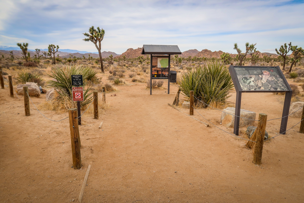
To hike Boy Scout Trail Joshua Tree, start at the Keys West Backcountry Registration parking area.
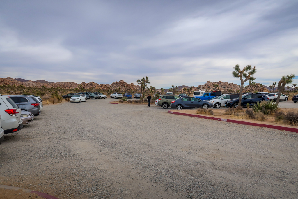
Parking lot at the Keys West Backcountry registration area
Hiking Boy Scout Trail Joshua Tree
Note: before starting out on this or any desert hike, be sure to bring plenty of water and sun protection, wear sturdy footwear, pack the 10 essentials , and leave no trace of your visit behind. Refer to my Backpacking in Joshua Tree Guide for more tips on wilderness camping in Joshua Tree National Park.
Part 1: The first three miles
The trail begins in a typical Mojave Desert landscape dotted with Joshua Trees and creosote bushes. The first three miles are fairly flat and easy to hike. This area is popular with rock climbers and several trails split off to various rock climbing formations. These are fun to explore if you have the time.
After heading northeast for the first 1.2 miles, the Boy Scout Trail veers in a northwest direction at the junction with the Willow Hole Trail. From here on out I saw very few other hikers on my backpacking trip.

The trail begins in a typical Mojave Desert landscape

A spur trail leads to a rocking outcropping that is popular with climbers
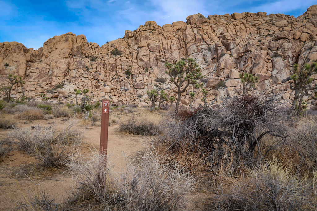
Another popular rock climbing area accessible from the Boy Scout Trail
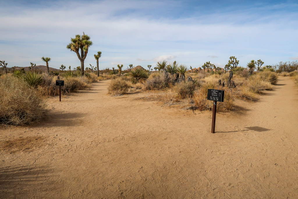
Junction with Willow Hole Trail. Boy Scout Trail bears to the left.
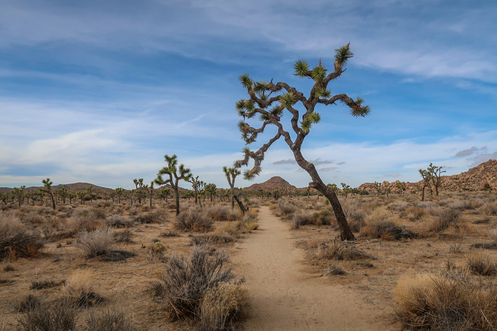
The Mojave Desert landscape continues as the trail heads northwest
Part 2: Entering the Wonderland of Rocks area
At around the 3.2 mile point, the trail leaves the flat Mojave Desert landscape behind and enters a rocky section. This area is part of Joshua Tree’s famous Wonderland of Rocks area with rock piles and granite boulders everywhere. While the trail is well marked, it can be easy to get turned around so be sure to pay attention to the path (and your map).
If you’re backpacking, I recommend camping before venturing too far into the Wonderland of Rocks area. I camped around the 3.5 mile point and it would have been difficult to find a flat space had I gone much further. Be sure to find a campsite to the west side of the trail rather than the east side which is designated as a day use area.
The trail intersects with Big Pine Trail at mile 3.8. By this point, the path has turned into a sandy gully. I had to scramble over a few rocks blocking along the trail in this area. From here, the terrain is even more rocky and rugged as the trail climbs to vista point.

The rocky section begins around mile 3.2
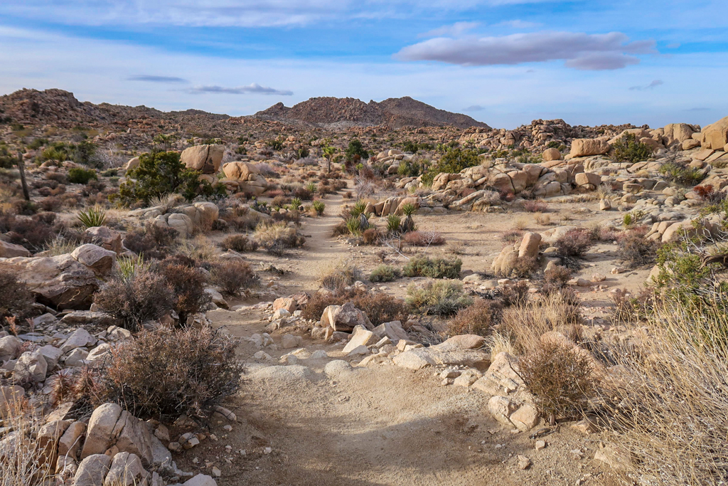
Welcome to Joshua Tree’s Wonderland of Rocks!
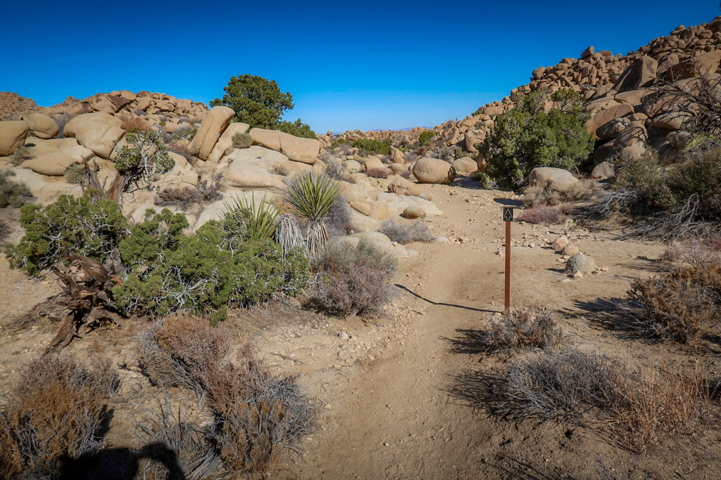
Follow the trail signs through the rocky area
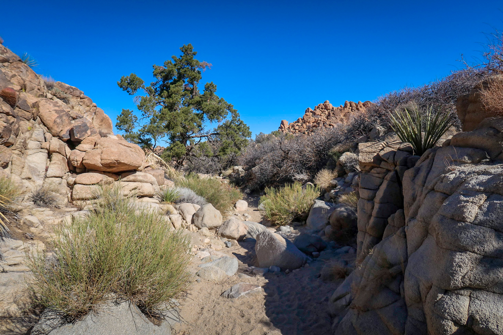
The path follows a sandy gully here
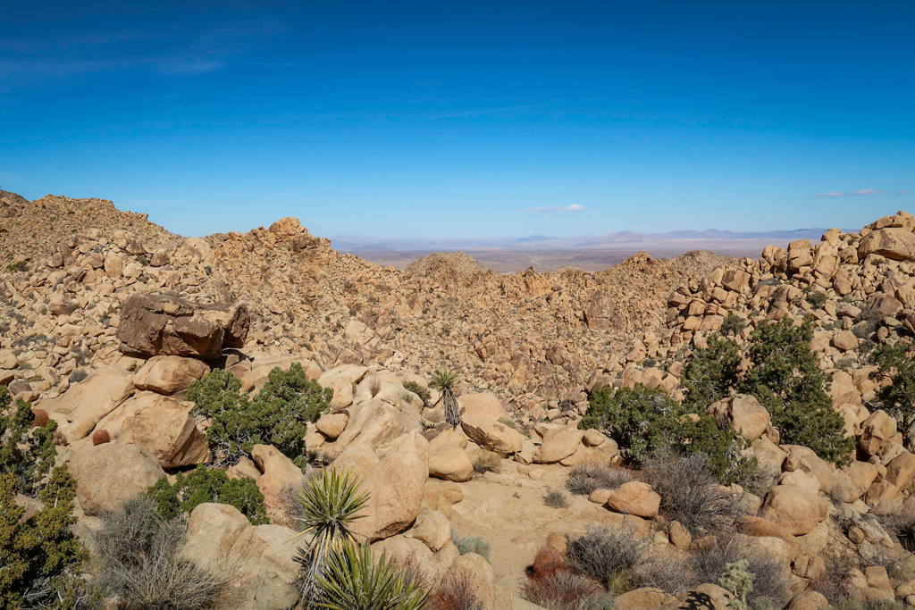
The trail gets *really* rocky around mile 4. Forget trying to find a campsite in this area!
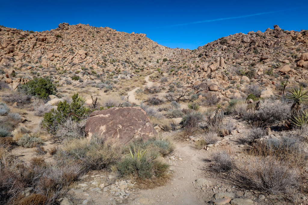
Hiking up to the vista point
Part 3: Long descent through a rocky canyon
After climbing to a vista point at mile 4.4, the Boy Scout Trail rapidly loses elevation as it descends down a canyon towards Indian Cove. This is a good place to turn around for those planning a shorter there-and-back day hike on the trail. The vista provides lovely views all the way to the city of 29 Palms in the valley below.
The trail quickly loses elevation here as it heads downhill (400 feet in half a mile). The descent is made easier through a series switchbacks, however I recommend trekking poles to make it easier on the knees.
After half a mile, the trail reaches the bottom of a hill and heads east. From here, it follows a series of dry washes and canyons until it reaches the valley floor.
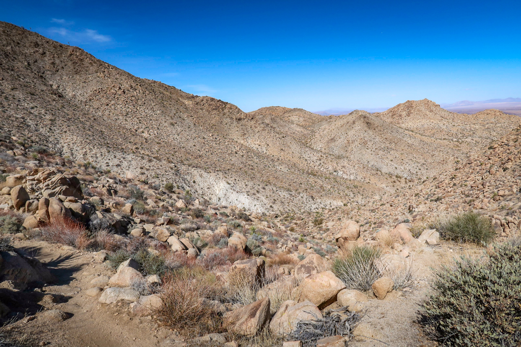
View from the vista at mile 4.4
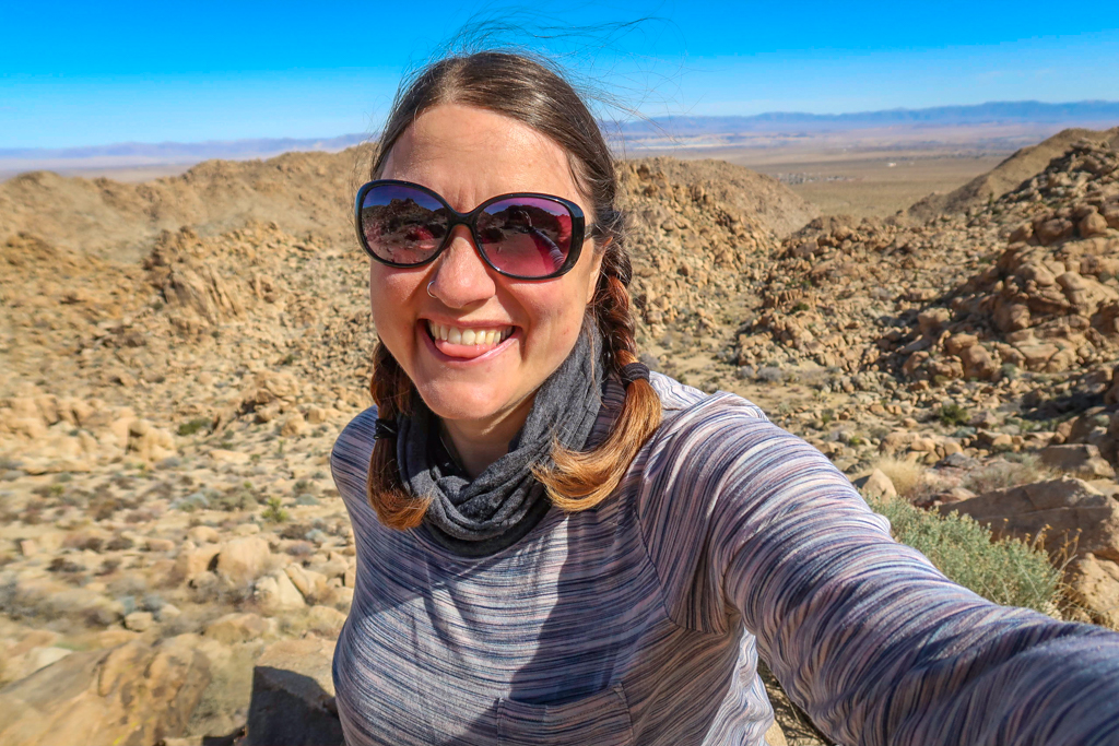
The obligatory vista selfie
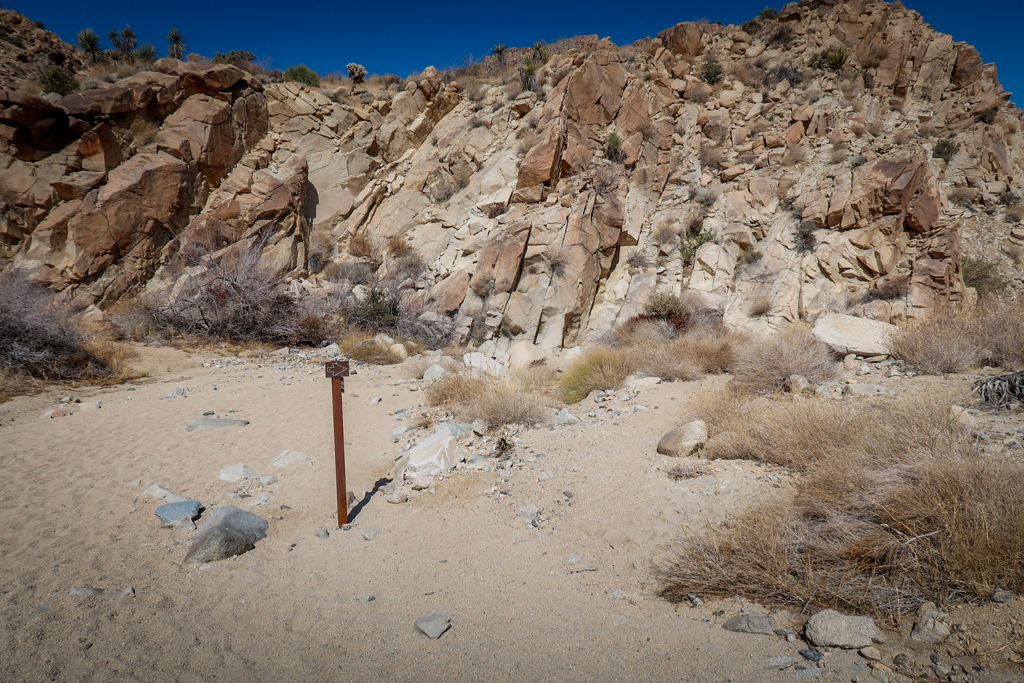
Follow the signs!
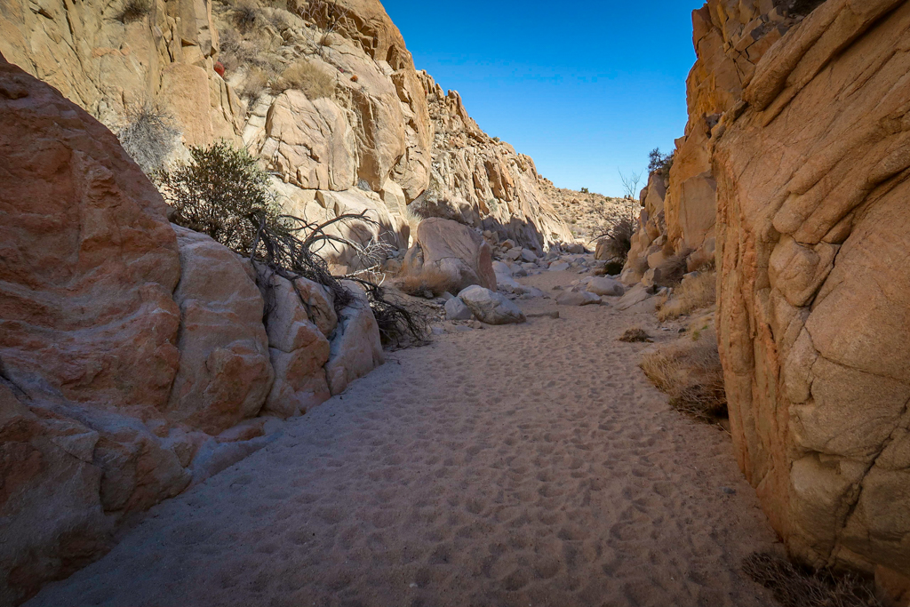
Hiking through a canyon
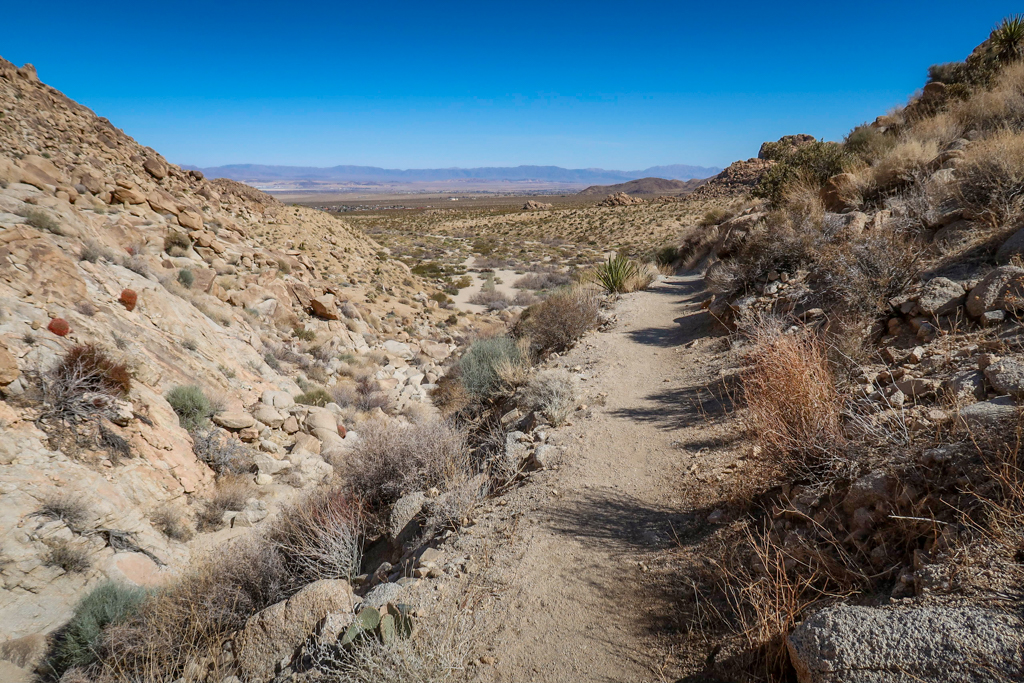
Approaching the end of the descent on the other side of the canyon
Part 4: The final stretch to Indian Cove
The Boy Scout Trail finally flattens out around the 6 mile point. The last two miles are fairly flat as the trail makes its way towards Indian Cove. The trail has left the Mojave Desert ecosystem and its Joshua Trees behind. Here, the Colorado Desert ecosystem is king with yucca, creosote and cholla cactus.
The northern terminus for Boy Scout Joshua Tree Trail is located at the Indian Cove trailhead and parking area. It’s located about a half mile north of the Indian Cove Campground. My husband Daniel and I drove over to check out the campground after he picked me up after my hike. The campground is nestled at the base of some giant piles of boulders and looks like a great place to camp if you can get a reservation.
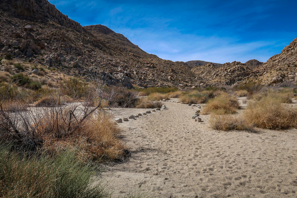
A look back at the climb into the Wonderland of Rocks.

The trail is fairly flat for the last couple of miles
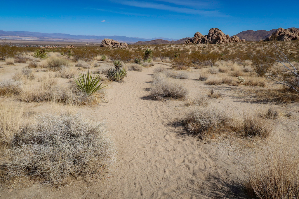
Large rock formations in the distance mark the location of Indian Cove Campground
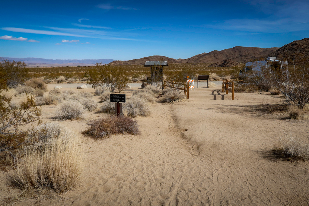
Welcome to the Indian Cove trailhead and parking area! The Campground is a half mile up the road to the right.

Indian Cove Backcountry Camping Registration board.
My Experience Backpacking Boy Scout Trail Joshua Tree
I’m no stranger to wilderness camping and have done most of my backpacking alone. In 2017, I solo hiked over 1800 miles on the Pacific Crest Trail . I’ve also hiked the 97-mile Wonderland Trail around Mt. Rainier by myself. But its been years since I’ve gone on a solo backpacking trip. In fact, the last time I tried camping alone I ended up having a panic attack. Luckily, I wasn’t too far from the trailhead on that particular trip and it was relatively easy for me to pack up and drive home.
So I was a little nervous about venturing out by myself for the first time after so many years. I set up camp just before sunset and climbed a rock jumble to watch the sunset. The sun sets around 6:00 pm in February at Joshua Tree National Park and after that it gets cold. Really cold. The only way for me to stay warm was to get into my sleeping bag so I cuddled up in my quilt for a few hours, listening to an audiobook.
I woke up a few hours later in the middle of the night, absolutely certain that mountain lions were outside of my tent. I was groggy with sleep and wide awake with terror at the same time. I could definitely hear something outside but I was too afraid to look. I was also *really* cold.
Needless to say it wasn’t a restful night. The next morning, I took stock of the situation and determined that of course there were no mountain lions prowling around my tent the previous night. I hadn’t set up the tent properly and the wind was flapping the rain fly around. I had mountain lions on the brain because I had been listening to the audiobook version of Track of the Cat – a mystery involving some mountain lions and an intrepid Park Ranger at Guadalupe Mountains National Park. I thought it would be inspiring to read a book about a National Park while I was *in* a National Park, but in hindsight I probably shouldn’t have picked one that involved murder and mountain lions.
Despite my rough night, I really enjoyed the backpacking trip overall. Joshua Tree is incredible and I loved experiencing it all by myself. It felt good to finally conquer my fears and camp solo after so many years. If I did it once, I could do it again! Although, next time I’ll bring some ear plugs so I don’t jump wide awake every time my tent rustles in the wind.

Sunset as viewed from my tent.
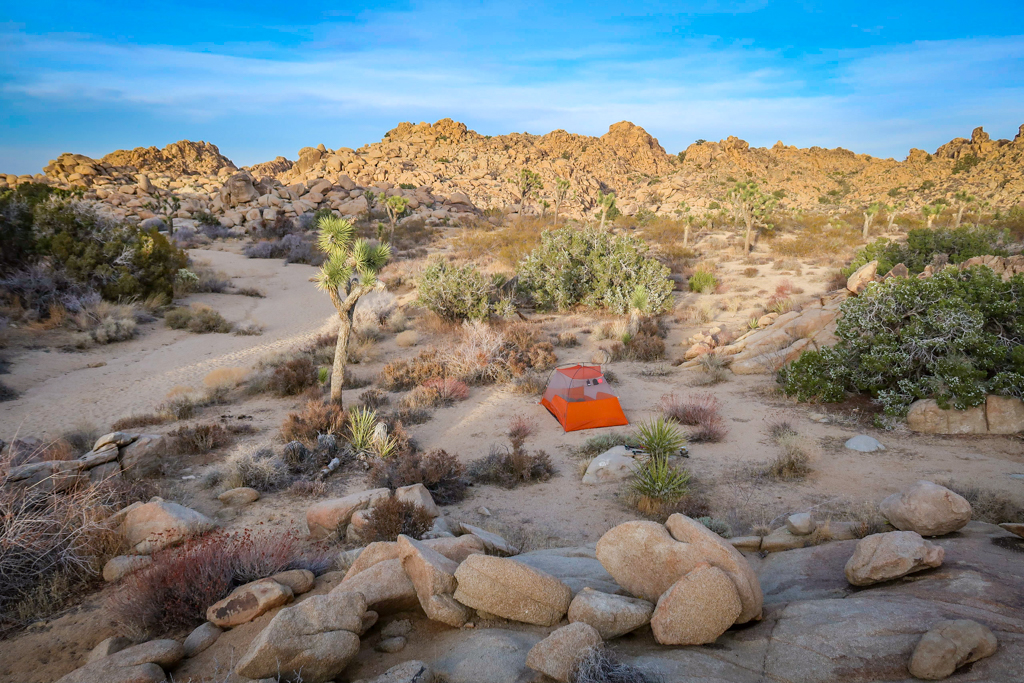
My tent setup.
Backpacking in Joshua Tree
If you’re considering a backpacking trip in Joshua Tree, take a look at my Backpacking in Joshua Tree Guide as it has all the information you need for a successful trip in the back country. You should also familiarize yourself with the Joshua Tree National Park Wilderness Backpacking Page . You’ll need to self-register for a permit before heading out and camp at least one mile from any road and 500 feet away from any trail.
If you’re camping in the off season, be prepared for the sun to set early. It gets super cold after dark so have an audiobook or some music downloaded onto your phone to listen to. I wouldn’t recommend trying to read a book unless you have really warm gloves (I kept my hands inside my sleeping bag to keep them warm).
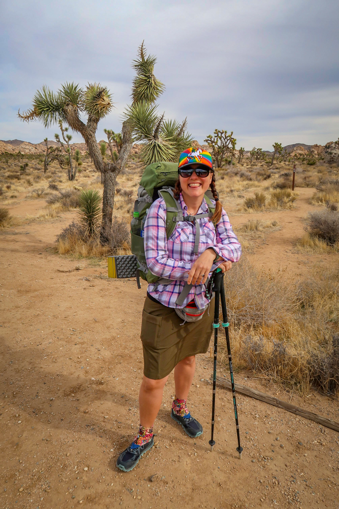
This Unicorn is ready to hit the trail for a solo backpacking trip!
Backpacking Gear
This list includes some of my favorite backpacking gear. Refer to my Backpacking in Joshua Tree guide for a more comprehensive list.
- Hiking Shoes – Sturdy hiking or walking shoes are a must. Personally, I’m a big fan of Altra Lone Peak Trail Running Shoes . I pair them with Dirty Girl Gaiters to keep sand and rocks from getting into my shoes.
- Socks – Good thick socks are also important. For long hikes, I prefer Injinji Midweight socks to prevent toe blisters.
- Backpack – A comfortable and well-fitting backpack is essential. I love Ospreys because I tend to get a sweaty back and the design promotes good airflow. My go-to bag is the Osprey Exos 58  because it’s super lightweight.
- Tent – I’m a big fan of the Big Agnes Copper Spur Tent . I used the 1-person version when I hiked the PCT in 2017  and now my husband and I use the 2-person version.
- Sleeping System – I use an ultra-lightweight 10 degree Enlightened Equipment Enigma custom quilt which I absolutely adore. For a sleeping pad, I prefer the Exped Synmat Winterlite  air mattress because I find the vertical baffles more comfortable than pads with horizontal baffles.
- Hiking Poles – Hiking poles reduce pressure on your joints and help maintain your balance if you trip. My current favorites are the LEKI Micro Vario Carbon Trekking Poles because they are super lightweight and fold down to easily fit into my suitcase.
- Sun Hat – Protect your face (and scalp) with a broad sun hat. This sun hat is great because it has a wide brim and no back so it doesn’t bump into my backpack.
- Camera – I love taking photos and always bring a camera along on my hiking trips. I use the Canon PowerShot G7X Mark II because it is lightweight yet has many advanced features.
- Electronics – if you are using your phone for navigation, bring a portable battery such as the Anker portable battery charger . For longer hikes or backpacking trips, consider bringing a Garmin InReach Explorer. This is a Personal Locator Device (PLB) that enables you to trigger a SOS call to search and rescue and 2-way texting over satellite.
Boy Scout Trail Joshua Tree Information and Map
- Distance – 7.8 miles point to point
- Elevation Gain/Loss – 173 feet gain/ 1347 feet loss
- Starting/Ending Elevation – 4049 feet starting / 2848 feet ending
- Highest Elevation Point – 4195 feet
Joshua Tree National Park Fee Information
The fee to enter Joshua Tree National Park is $30 per vehicle which is good for seven days. I recommend buying the America the Beautiful Interagency Pass , however, which costs $80. This allows entry to all National Parks for an entire year, as well as most federal lands (including National Forests, Bureau of Land Management and more). Buy your pass online before arriving at the park to shorten the wait in line.
Be sure to check the Joshua Tree National Park web site for current conditions before heading to the park.
While you’re in the area, don’t forget to explore outside of the national park as well. There are lots of fun fun and quirky Things to Do Near Joshua Tree besides hiking and camping.
Further Reading
If you enjoyed this trail guide, be sure to check out my other articles about Joshua Tree National Park!
- Joshua Tree Day Trip: The Ultimate One-Day Itinerary
- Best Hikes in Joshua Tree: The Ultimate Hiking Guide
- Backpacking in Joshua Tree: Tips for Successful Wilderness Camping
- California Riding and Hiking Trail: An Epic Joshua Tree Backpacking Adventure
- 10 Fun and Quirky Things to Do Near Joshua Tree
Have you hiked the Boy Scout Trail in Joshua Tree National Park? I’d love to hear from you! Share your experience in the comments below.
Like this blog post? Pin it!
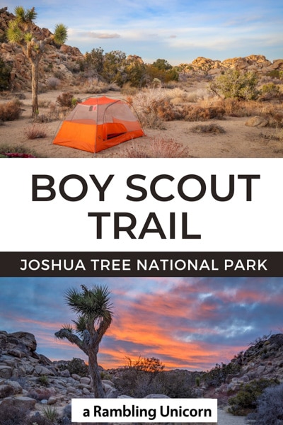
Note: This post contains affiliate links, which means I may receive a commission if you click a link and purchase something. While clicking these links won’t cost you anything, they will help me to keep this site up and running!
Share this:
- Click to share on Twitter (Opens in new window)
- Click to share on Facebook (Opens in new window)
- Click to share on Pinterest (Opens in new window)
- Click to email a link to a friend (Opens in new window)
Recent Posts
- Welcome Back to the PCT! Sisters Wilderness Hike Day 1
- 25 Fun Things to do in Huntington WV for 2022 (with a map!)
- Long Term Travel Packing List: Tips and Hacks for Digital Nomads
- Belvedere Murgia Timone: A Hike with Spectacular Views in Matera, Italy
- Winchester Walks: 10 Scenic Hikes and Walking Paths in Hampshire
Archive of Previous Posts
Hi, i'm unicorn.

I am an avid hiker, traveler, and adventurer who is on the mission to explore hiking trails around the world.  I’m also obsessed with National Parks, long-distance trails and other outdoorsy things.
I hope to share this knowledge with you and inspire you to explore new hiking trails too!
You may also like… Twin Tanks: Day 3 on the California Riding and Hiking Trail

Juniper Flats Joshua Tree: Day 2 on the California Riding and Hiking Trail

Upper Covington Flats: Day 1 on the California Riding and Hiking Trail

California Riding and Hiking Trail: An Epic Joshua Tree Adventure

Love it! I’m inspired

Thanks Chris!

Your experience with that panic attack while solo hiking sounds pretty upsetting. And then of course our imaginations are so fantastic that they conjure up mountain lions from the wind. Every time I camp in Northern California, I think there’s a bear outside the tent at night. But the closest I’ve gotten to nocturnal snooping wildlife is a wombat trying to get into my pack on the Overland Track in Tasmania one night. Weirdly, I feel safer camping in Australia.
I want to hear from you! Leave your comment below: Cancel reply
- Skip to global NPS navigation
- Skip to this park navigation
- Skip to the main content
- Skip to this park information section
- Skip to the footer section
Exiting nps.gov
Alerts in effect, where two deserts meet.
Two distinct desert ecosystems, the Mojave and the Colorado, come together in Joshua Tree National Park. A fascinating variety of plants and animals make their homes in a land sculpted by strong winds and occasional torrents of rain. Dark night skies, a rich cultural history, and surreal geologic features add to the wonder of this vast wilderness in southern California. Come explore for yourself!
A summer visit to the desert requires extra preparations and considerations. Here are a few ways to prepare for desert heat.
Start preparing for your adventure!
Find out the answers to the most common questions about visiting the park.
Hiking. Sightseeing. Stargazing. Rock Climbing. 4x4-ing and more!
Experience camping in an International Dark Sky Park.
Get an overview of the park and learn the lay of the land.
First trip to Joshua Tree? Start here with the need-to-know information.
Purchase a digital entrance pass at no extra cost. Buying your pass ahead of time can help expedite your trip into the park!
Download the NPS App and have 400+ parks at your fingertips. Get off-line maps, virtual tours, and info on things to do & trip planning.
Park footer
Contact info, mailing address:.
74485 National Park Drive Twentynine Palms, CA 92277-3597
760 367-5500
Stay Connected
Explore subjects and stories related to this park.
10 Nov Boy Scout Trail, Joshua Tree National Park

guides // backpacking // southern california
Boy Scout Trail, Joshua Tree National Park, California
Joshua Tree National Park is perfect for beginner backpackers because all you have to do is grab a backcountry permit at the trailhead and walk a measly 1 mile to all the dispersed camping you can imagine. You can even camp right next to the park’s signature Joshua Trees and giant rock piles. This trail was great for backcountry bouldering because you can pitch your tent right next to some pretty elaborate and giant rock piles. The night sky is also beautiful out here and it’s usually warm enough to stay outside to watch the stars to come out.
Quick Notes
Pictures taken July 2019
Total Distance: 2+ miles
Elevation Gain: Negligible
Difficulty: Easy
Days: 1 Night
Hike Type: Out-and-Back
Trailhead: Boy Scout Trail
Seasons: All, Summer is HOT
Permit Requirement: Yes, Year-Round
Camping: Dispersed Camping
Map: National Geographic Joshua Tree National Park
Water: Pack in all water

In typical desert fashion, Joshua Tree National Park is really hot in the summer and temperate the rest of the year. We’ve visited the park in February and July and it’s definitely easier to backpack and climb in February, because the sun’s not out to fry you. Summers are also a lot drier, so there’s absolutely no moisture in the ground to keep the dust at bay.
That said, the crowds in February are much larger than in July. Joshua Tree is only two hours from Los Angeles so you’ll see a lot of tourists coming up here to do some day hiking or car camping. In July, we were easily able to get a last-minute car camping spot in one of the most popular campgrounds, whereas in February, it was filled to the brim.
Current Conditions
Conditions can change pretty drastically in Joshua Tree. It can be super-hot all day and then drop 40 degrees at night. The most reliable way to check current conditions is through your typical, everyday weather app or website.
Park Entrance Fee*
Wilderness Permit Fee
*If you know that you’re going to be going to a national park more than three times in a year, it’s worth it to buy a National Parks Pass. They’re $80 and sold online , at all REI locations, and National Park Visitor Centers.
Before You Go
Backcountry permits are required for all overnight travel within the park. You can get a permit at one of the thirteen backcountry boards spread throughout the park. All permits are first-come-first-serve and there’s no limit to how many people can be camped in a particular area. If you can find a parking spot at the trailhead (harder than you might think – more on that later), you can camp in the backcountry. The permit station for this trailhead is called the Keys Ranch Backcountry Registration Board.
Before heading out, it may be time to brush up on what kinds of features to walk and camp on in the desert. The biggest “no” is walking and camping on biological crusts where lichen, bacteria and mosses grow. Biological crusts look like darker patches on the ground and help nourish desert life and absorb rainwater. Try to camp only on durable surfaces like sand or large rocks. If there’s no rain in the forecast, you can camp in a sandy wash or dried up creek bed. However, if a surprise rainstorm rolls in at night, you might get soaked.
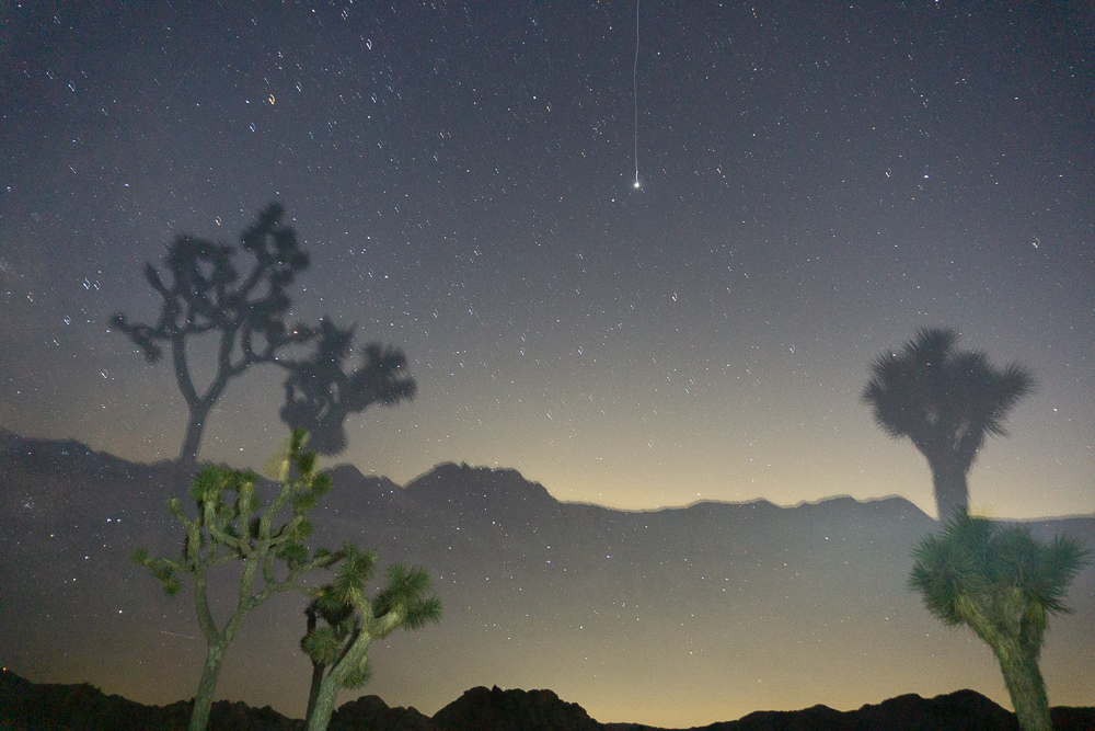
My attempt at night photography went wild.
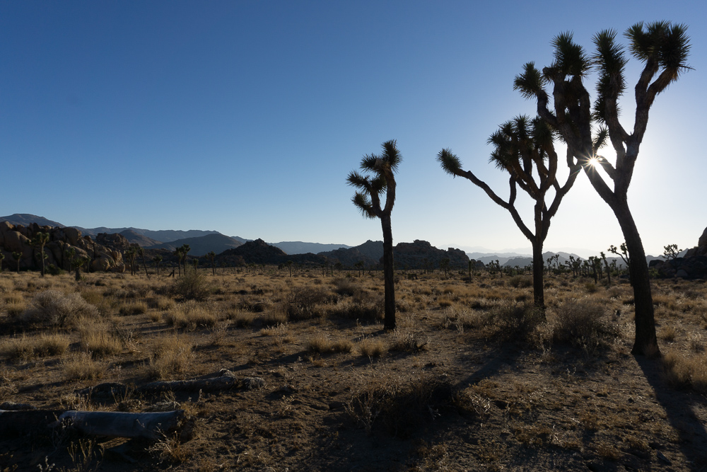
Joshua Trees around our campsite.
Getting there.
During fall, winter or spring, you can start your hike anytime during the day because it doesn’t really get too hot to hike and it’s a fairly short amount of distance to cover before camping. During the summer, it’s best to start your hike in the late afternoon so you don’t have to be out there at the hottest time during the day.
You can get to the Boy Scout Trail from two different trailheads in the park: the Boy Scout trailhead (sometimes called the Keys Ranch Backcountry Registration Board) on the south side or the Indian Cove trailhead to the north. The naming of the south trailhead is confusing because there’s another area of the park near the southern trailhead called Keys Ranch – this is not the backcountry trailhead and there’s no registration board here. To convince Google Maps or other map apps to take you to the southern trailhead, you have to type in “Keys Ranch Backcountry Registration Board” or “Boy Scout Trailhead.” We hiked this trail from the southern trailhead because we were already in the park and didn’t want to drive all the way around to the northern trailhead.
The southern trailhead is one of the first stops you’ll see when you enter the park from the West Park Entrance. It’s on the left side of Park Boulevard, about twenty minutes from the entrance. The Indian Cove trailhead is just north of the Indian Cove Campground on the right side of Indian Cove Road.
There aren’t any camp stores in the park, so stock up on water and snacks in the town of Joshua Tree or at the Ranger Stations near the West and the Indian Cove entrances. If you’re coming into the park from the southern entrances, there are a couple towns down there but they’re a lot smaller than the towns north of the park.
If you go during peak season like we did, the trailheads are busy – like, no parking spots, busy. So even though getting a backpacking permit is easy, it’s still an ordeal at the trailheads because they don’t have designated overnight spots. We arrived at the Boy Scout trailhead parking lot around 3 pm and it was completely packed (mostly with day-hikers). On the other hand, parking is less of an issue at the Indian Cove trailhead because you can park on the side of the road.
You can do one of two things at the Boy Scout parking lot: you can wait until someone leaves and take their spot or you can try a little known trick – you can park overnight at one of the nearby turnouts on Park Boulevard and walk to the trailhead. As long as you are legally parked and you display your wilderness permit on the dashboard of your car, your car won’t get towed. The hike gets a little bit longer with the added travel to the trailhead, but ultimately, you only have to walk a mile past the trailhead to pitch your tent. I wish we had known this before we panic-waited in a line of six cars for a parking spot, all the while thinking that we’d never be able to start our hike.
During the summer, parking at the trailhead is a lot less of a fiasco because the parking lot is almost completely empty. It was so empty that I think we saw a tumbleweed roll by all cartoon-like.
After parking, you’ll fill out a permit at the backcountry registration board, leave the tear-off portion on your car, and you’re good to go.
On the Trail
The trail is super well marked, especially for a desert. In places where the signage is farther apart, the trail is pretty obvious because it’s so well-traveled. You just have to hike in one mile and then you can set up camp anywhere you like (as long as you’re at least 500 ft from the trail and water sources).
We wanted to camp near some of Joshua Tree’s signature bouldering rocks so we hiked in about 1.5 miles and then headed off trail towards one of the bigger rock piles. If you’re heading far off trail like we did, remember to look behind you and locate a landmark to guide your way back to the trail. Luckily, there are plenty of distinct rock formations that are easy to remember.
Backpacking into this area made bouldering all the more fun because we felt like we had the whole place to ourselves. We even made it to the top of our neighborhood rock pile. Night time out here is also amazing. It cools off a bit at night, but you can comfortably stay outside of your tent to watch the stars come out.
After the Hike
The town of Joshua Tree, just outside of the park’s west entrance, is full of places to eat and shop after a backpacking trip. We stopped at Crossroads Café for breakfast and it was very tasty. There portions are giant and their pancakes are fluffy and great. The whole place also has an old-western look that matches the desert scenery.
Supply List
The usual list.
Sleeping Bag
Sleeping Pad
Sleeping Bag Liner
Lighter or Matches
Cooking Pot
Water Vessel
Water Filter
Trip Specific Things
Wide Brimmed Hat
The sun is a cruel-cruel ball in the sky. To protect my head from the sun, I like to wear my wide-brimmed hat in the desert. Also, I like the way it makes me feel like a true explorer. Bonus points for preventing premature aging caused by the sun – you know you miss spots with that sunscreen.
There’s absolutely zero water on this trail. You have to pack in all of your water, so make sure to parcel out the right amount for drinking and cooking (if you decide to cook out there). The park recommends carrying one gallon per person per day; however, we always end up bringing more for cooking.
Long-Sleeve Cotton Shirt
I call it my “desert shirt.” You’ll want the long sleeves to protect your arms from the searing sun and you’ll want the cotton because it’s actually the perfect material for desert roaming. The cotton absorbs your sweat and keeps it in the fabric to cool you off later. You won’t smell great, but you’ll be nice and cool.
*Sleeping Bag
This is an item you may be able to leave behind. In February, we definitely needed the sleeping bags, but in July, it was so hot that we just slept in sleeping bag liners.
Thinking about doing this trip? Have any questions? Comment down below!
More Happy Packers

Redwoods Splendor Loop – Redwoods National Park
This loop is a tour through the many wonders of Redwood National including the famous big trees, a moody beach, and the mystical Fern Canyon.

Crater Lakes Trail – James Peak Wilderness
This is the perfect any-season beginner trip for anyone wanting to dip their toes in backpacking.

How to Get Over Fear of Wildlife
Animals in the wilderness can be scary, but they don’t have to be. Here’s how to feel perfectly at home with the bears and mountain lions.
Leave a Reply

Share ×

Scan the QR code and open PeakVisor on your phone
❤ Wishlist ×
See all region register, peakvisor app.
The Perm Territory lies in the north-eastern part of the East-European Plain and on the western slopes of the Middle and North Urals in Russia . It is situated at the junction of Europe and Asia with 98% of the territory being in Europe and only 2% belonging to Asia.
Flora and Fauna
Water resources, landmarks and tourism, the basegi ridge, kolpaki mountain, mount oslyanka, ski and sports facilities, the divya cave, the kungur cave, the orda (ordinskaya) cave, the miracle cave, protected sites (reserves, national and natural parks), water resources, the vizhay river, the vilva river, the koiva river, the usva river, alexandrovsk blue lakes, the white sea in berezniki, zoo nurseries, major cities.
In the distant past, this territory was called Perm the Great. The name came from the word ‘Permaa’, which meant ‘a distant land’. The capital of Perm the Great was Cherdyn which was considered the oldest city of the Kama Region. The first province was formed in 1792 and in 2005, two big regions merged to form a huge federal land called the Perm Territory. In spite of the fact that it is geographically closely connected with the Urals when the Russian federal districts were created in the 2000s, the Perm Territory was administratively assigned to the Volga Region thus becoming a part of the Volga Federal District. Its administrative centre is the city of Perm.

The borders of the region follow the natural terrain and are very erratic. The Perm Territory borders the Komi Republic in the north, the Sverdlovsk Region in the east, Bashkiria in the south, the Kirov Region and Udmurtia in the west.
Its territory is 160,237 sq.km., from north to south the region stretches for 645 km, from west to east – 420 km, the population is 2 599 301 people (as of 2020), most of them live in the 22 cities.
The main feature is the Ural Mountains . The western and central parts of the Territory are dominated by low and flat terrain, while in the east start large hills and lowland mountainous terrain. In the west of the plain part, there is the Verkhnekamsk Upland (with heights up to 335 m) and the Okhansk Upland continuing in the centre of the region. In the north-west, there are loosely separated hills of the Northern Urals (up to 270 m high). In the south rises the Tulva Upland (up to 446 m high) and in the south-east, there is the Sylva Ridge at the edge of the Ufa Plateau (up to 403 m high).

The Perm Territory is rich in karst phenomena, especially in the south-east. The highest mountains are situated in the north (the Northern Urals), there is Tulymsky Stone (1,469.8 m, the highest peak of the Perm Territory), Isherim (1,331 m), HuSoik (1,350 m), Molebny aka Prayer Stone (1,240 m), Martai (1,132 m). The usual name for mountains in the Urals is ‘stones’, they tower over the rest of the area. Among the mountains of the Middle Urals , the highest are located in the Basegi Range (993 m).
Over two-thirds of the territory is occupied by forests mainly represented by dark coniferous taiga. There are two subzones: the middle and the southern taiga. The forests in these zones differ. The middle taiga is dominated by conifers, predominantly by spruce and fir. There are two types of spruce in the territory of the region: the European and the Siberian spruce. The southern taiga features broad-leaved tree species, e.g. linden, maple, elm. Among other tree species, you can find cedar (or rather cedar pine), juniper, three species of birch (silver, downy, and drooping or nodding birch), ground cherry, bird cherry, mountain ash, and aspen. More than 60 plant species are included in the Red Book of the Perm Territory. There are a lot of endemic and relict species, most of them can be found in the many reserves located in the Perm Territory.

The animal world is astounding, there are 62 mammal species, 270 bird species, 42 fish species, 6 reptiles, and 9 amphibians. The most common predator is forest marten. By the number of martens, this region occupies one of the first places in Russia. There are ermine, weasel, badger, otter, wolverine living peacefully in the local forests. Bears and lynx can be found all over the territory, except the very south, but their numbers are small. Wolves and elks can also be spotted occasionally. When winters are not very snowy, roe deer can come to the eastern parts of the region from the neighbouring Sverdlovsk Region . And in the northern regions, there come deer from the Komi Republic . Hunting some animals (sable, otter, marten, moose) is possible only under special permits (licenses). Roe deer and reindeer are under protection and hunting them is prohibited.
The river network is the densest in the country, there are 29,179 named rivers. The region ranks first in Russia in terms of the rivers’ length and water capacity. The largest rivers of the region are the Kama with its tributaries of the first and second-order: the Vishera, the Chusovaya, the Kosa (Kama tributaries), the Kolva (the Vishera tributary), the Sylva (the Chusovaya tributary) and others.

The rivers originate in the Urals. In their upper reaches, the rivers flow down the valleys between mountain ranges and have quite a measured and slow current. Yet once they approach the foothills, rivers acquire more rapid character, typical of mountain rivers, but not for long. When they reach the plains, the currents quieten down and you can enjoy a perfectly calm boat ride. The rivers are characterised by mixed feeding with a predominance of snowmelt (50-60%). Local rivers have plenty of spring floods when water levels rise dramatically and very rapidly, whereas summer and autumn seasons enjoy low water sometimes interrupted by rainfall floods. Winter is defined by low water as well. Rivers get frozen in the second half of November and open in late April – early May.
As to the lakes, the figure is mind-blowing over 5.8 thousand. Those lakes and artificial reservoirs include about 690 lakes with the area of more than 0.01 sq.km. and a huge number of smaller lakes. Most of them are located in river floodplains, mainly as meander lakes. Among the boggy massifs of the north of the Territory, there are relict lakes, and in the central areas, there are mainly karst lakes. The largest lake in the Perm Territory is Lake Chusovskoye with 18 sq.km of area. The largest reservoirs are the Kama and the Votkinskoye reservoirs on the Kama River, they were created during the construction of the hydroelectric station and the Shirokovskoye reservoir on the Kosva River.

Among the federal regions of Russia, the Perm Territory is second only to Tatarstan in terms of the area of lakes and artificial reservoirs. Swamps and marshlands occupy about 2.31% of the territory which makes it number one in the country if counted by the area of marshes, marshlands and swamps of the territory as a whole. The area and the number of lakes, artificial reservoirs, swamps and marshlands are unstable and depend on natural and anthropogenic factors viz. drainage, watering of territories, etc.
The climate is moderately continental. The Basegi Ridge as well as the Urals Mountains in general are on the way to the western air mass transfer. Thus, despite the relatively low altitude, they significantly limit the spread of air blown in from the Atlantic to the east. As a result, the climate of the Perm Territory has a pronounced continental character. The seasons are distinct, you can surely tell winter from spring and summer from autumn. Winters are long, snowy, and summers are moderately warm. Winter usually starts in November, with snow cover remaining until April and in the north even until May. By March snow thickness reaches about 80-90 cm in the north and 60-70 cm in the south. In the valleys, the snow depth can reach 1.5-2 m, while at the mountain tops it does not exceed 50-70 cm.
The average temperature in January is -17 C (+1 F). There quite often occur severe cold winters with strong winds when the temperature drops to -53 C (-63 F) in the north of the region. Spring comes in early April and brings about unstable weather with extremely sharp fluctuations in temperature. In May, there is a return of cold weather with harsh frosts. The warmest summer month is July. The average temperature of July in the northeast of the region is +15 C (+59 F), and in the southwest, it is +18.5 C (+65 F). On the hottest summer days, maximum temperatures can reach +38 C (+100 F).

The Perm Territory is blessed with rich deposits of minerals. The world's largest reserves of potassium and magnesium salts, as well as rock salt, are concentrated here. Some time back, this region was called the Salt Capital of Russia. At the end of the 17th century, the city of Solikamsk was the centre of Russian salt production. Currently, salt making in the city has been stopped.
In earlier times, the Kama region massively mined coal. Now all coal mines are closed due to unprofitability. The first Russian diamonds were found in this region as well. The main well-developed industries of the region are oil, chemical and petrochemical, timber, ferrous and non-ferrous metallurgy, machine engineering. As to the chemical industry, mineral fertilizers are dominating the market. The main industrial centres of the Perm Territory are Perm, Berezniki, Solikamsk, Chusovoy, and Lysva. The southern parts of the Territory are agricultural.
The Perm Territory is a major cultural centre. There are many theatres, museums, numerous festivals. At the same time, natural tourism is also developed here due to great natural landmarks. These include beautiful rivers with rocky shores, mountains with wonderful panoramas, and caves with spectacular mazes and grottoes.
The most famous and popular peaks and ranges are the main Ural Mountain Range, the Tulym Range (the Tulymsky Stone), the Chuval Range (the Chuval Stone), the Kvarkush Range, the Basegi Range , the Munin-Tump Mountain, Kruglytsya Mountain, Vetlan Rock and Polyud Rock, Molebny (Prayer) Stone, Kolpaki Mountain, Oslyanka Mountain , Stone City Rocks, Usvinskie Stones and others. Some of these ridges and mountains are located in the reserves of the Perm Territory.
The Main Ural mountain range is the natural border between the Perm Territory and the Sverdlovsk Region , between Europe and Asia.

The Basegi Ridge is located in the western spurs of the Ural Mountains . The total length of the ridge is about 30 km. The Basegi name comes from an old Russian word ‘baski’, i.e. beautiful. The ridge features low mountains with gentle green slopes. The peaks are covered with stone placers (or boulder streams), with bizarre rocks, stony idols, arêtes and pillars. In some places, loose rocks form vast stone rivers.
There are relict plants of mountain-forest, subalpine and forest belts as well as subalpine meadows and mountain tundra. The ridge consists of three peaks – Northern, Middle and Southern Basegi . The highest point of the range is Mount Middle Baseg (994 m). In 1982, the territory of the ridge became a protected area of the Basegi Natural Reserve and only Northern Baseg (951 m) is officially open for tourists. There is a trail from the cordon Northern Baseg to the top of the mountain. When you go up, all the high-altitude belts show their secret treasures, animals feel free in the forests and not that afraid of a human. You can even meet a bear.
On a good clear day, you can see Middle Baseg and Southern Baseg , Oslyanka Mountain , the Kharius mountain range, Kachkanar, and provided the visibility is good, even the massif of the Konzhakov Stone.
In summer, the most common activities are hiking, cycling and hiking combined with some rafting on the Vilva or Usva rivers. In winter, there are ski and snowmobile expeditions.

Kolpaki Mountain (614 m) is a hill with an almost perfectly rounded peak. Rumour has it, the name was given because of this round shape as it means ‘a cupola’ in Russian. The main landmark of the hill is the jagged array of stone pillars on the top, the so-called weathering columns of fanciful forms (up to 20 m high). The second name of the mountain is Long Fingers. The most famous of these rocks is the Devil’s Finger. A wooden staircase leads to the observation deck on one of the pillars, you can also have a picnic there. From the top, there is a magnificent panorama over Kachkanar Mountain, the Basegi Ridge, and some gold mines. A pine forest densely covers the slopes. There are a lot of tourists here at any time of the year, mountaineers often have training.

Mount Oslyanka (1,119 m) is somewhat reminiscent of a ridge shape since it stretches from north to south for almost 16 km. The mountain has stone placers, steep slopes and a plateau with stone pillars. It has several peaks, the main is located in the central part of the so-called ‘ridge’ and has a conical shape. In the olden days, the mountain was surrounded by prison camps. Now they are gone giving a way to tourists and outdoor enthusiasts who are lured by the strange shape of this mountain.
Every year in late February or early March a ski marathon is held on Mount Oslyanka . At the end of spring and in summer, you can hike to the top and combine it with good rafting on the Kosva River. From the top, you can see the Basegi Ridge and Konzhakov Stone. Oslyanka is a disputed territory because some researchers attribute it to the Northern Urals whereas others claim it to belong to the Southern Urals, especially since the border between them is quite conventional. But the climate and the nature of the mountain is typical for the Northern Urals. In winter, there is much snow and frequent severe frosts; there are avalanches on the slopes. In summer the weather is very changeable and you can experience massive heat waves alternating with heavy rainfalls.

There is a real Stone Town situated near the village of Usva on the top of the Rudyan Spoy Ridge (526 m). This rocky town is also called a Fortress, a Devil's Hillfort or Turtles. When you look at the rocks here, they give an impression of a perfectly organized settlement. You can see narrow streets, corridors, arches and stone gates, houses and squares. This site reminds not of the ruins of a man-made ancient city, but of a kind of a rock labyrinth made of huge boulders. It can also be said that there are townspeople or representatives of the ancient settlement: the stones of the Small and Big Turtle, the Feathered Guardian, the Seal, various stone idols, etc. These rocks have a variety of different colors ranging from white and yellow to red and black, which is due to the sandstones encrusted on the surface of boulders. The Stone Town is divided into a Big Town and a Small Town standing somewhat 200-300 meters apart. There are only four stone idols in the Small Town. Many tourists, including rock climbers, come here at any time of year.

In recent years, the Perm Territory has created quite a few skiing bases, the largest and most famous of which is Gubakha located on Mount Krestovaya (471.3 m). The mountain is the symbol of the town of Gubakha nestled at the northern end of the Rudyan Spoy Ridge.
The List of ski centers in order of their remoteness from Perm City:
- Ivan-Gora (Gamovo village, 20 km from Perm)
- Zhebrei (Zhebrei village, 30 km from Perm)
- Glushata and Mountain (village Glushata, 30-32 km from Perm)
- Polazna (Konstantinovka village, 45 km from Perm)
- Yelniki (Dobryanskiy region, Yelniki village, 50 km from Perm)
- Uval and May Mountain (Krasnokamsk, 50 km from Perm)
- South Kamskie Gorky (South Kamskiy village, 65 km from Perm)
- Firefly and Stalagmite (near Kungur, 95 km from Perm)
- Kalinino (Kungur district, Kalinino village, 100 km from Perm)
- Aleksandrovka (Osinsky district, Novaya Aleksandrovka village, 130 km from Perm)
- Tacman and Ogonyok (Chusovoy, 135 km from Perm)
- Myshchelka (Osinsky district, Podgorodishche village, 150 km from Perm)
- Ashatli-Tulva (between Barda and Chernushka, 180 km from Perm)
- Gubakha (Pervomaisky settlement, 200 km from Perm)
- Sports school (Lysva town, 210 km from Perm)
- Snowflake and New Wave (Tchaikovsky, 260 km from Perm)

Due to abundant karst phenomena in the region, caves are found aplenty here. Nature was generous and gave the region such gems as the Divya Cave, the Kungurskaya Ice Cave, the Orda Cave, the Miracle Cave and many others. Some of them are equipped for excursions while others preserve their natural pristine state. Each of them is unique.
The Divya Cave is one of the longest caves in the Urals, and the top league the Perm Territory. The name Divya comes from the word ‘divo’, or ‘miracle’ and speaks for itself – it is one of the most beautiful caves in the Urals. The cave is located on the bank of the Kolva River, 12 km from Nyrob village. The total length of all its passages reaches 10 km. A small (about 1.5 m) horizontal entrance to the cave is located in a steep, forested coastal slope of Mount Diviy Kamen at an altitude of 90 m. A very narrow and low corridor leads to a series of grottoes and galleries. You will have to creep on your stomach in some places. In the cave, there is an amazing variety of calcite formations, it feels as if you are in a speleological museum. The cave is quite dry and clean despite a small stream and several lakes. On the surface of the lakes, you can observe an unusual phenomenon – the so-called calcite ice particles. The water temperature in the lakes is +4 degrees Celsius (+39 F) at any time of year. The air temperature in the cave varies from +4 to +8 degrees Celsius (+39 to +46 F).
The Kungur Cave is the oldest tour-guided gypsum cave in the world, the first excursions were here back in 1914. It is known and famous far beyond Russia for its ice grottoes. It is a real underground museum which has paths and lighting allowing you to see the cave in full splendor. There are about a dozen of the caves well-equipped so well in the whole world, thanks to which the Kungur cave is widely known outside the Urals. The entrance to the cave is located on Ice Mountain (Ledyanaya) on the right bank of the Sylva River, on the outskirts of Kungur in the village of Filippovka.

Ice Mountain is strewn with karst sites, there are funnels, sinkholes, karst trenches and many more. One of these is the Kungur ice cave which is about 5700-meter long. About 1300 m is available for tourists. This underground realm has 48 grottoes, 70 lakes, 146 organ pipes. It is called an ice cave for a reason. In most grottoes the temperature is around 0 degrees Celsius (+32F), and in some places it drops to - 15 degrees Celsius (+5F). From February to April, the cave is the most spectacular because then you can observe magnificent snow crystals of the Diamond grotto, as well as ice stalagmites and stalactites of the grottoes Polar, Cross, Vyshka. They create an interesting contrast with the unfrozen lakes in the Friendship of the Peoples Grotto and the Long Grotto. In summer, there is a grand laser show held in the cave. When you are in the cave, try to hear the "music" of the underground organ.
Visiting is possible only with a tour, groups are formed on site and enter the cave according to a schedule. There is a Karst Museum in the cave, where you can spend time waiting for the beginning of your visit. In winter, the Ice Mountain offers skiing and bagel riding (Firefly and Stalagmite Ski Centres).
The Orda (Ordinskaya) Cave is located 35 km from the Kungur Cave, near the village of Orda. It is a rather wild rustic cave, not equipped with any facilities, yet it is also quite famous. It is the longest underwater cave in the world in gypsum, which is a real paradise for cave diving (diving with scuba in caves).
It has 4 km of undersea and underwater passages and the longest siphon in Russia (935 m). You can go 15 meters down a good staircase and see only 300 meters of dry passages and halls. And then there are 1250 m of underground lakes which are an irresistible temptation for speleo-divers. At the entrance of the cave, there are beautiful banks of the Kungur River. In the village Orda, there is a local history museum exhibiting a nice collection of coins, watches, samovars, and there is the Prophet-and-Elijah's Church.

The Miracle or Wonderworker Cave got its name thanks to a lot of bizarre natural creations collected here. It is located on the right bank of the Ponysh River, not far from the place where it flows into the Chusovaya River. The entrance to it is located in a crevice on the slope of Mount Kladovoy Stone (at an altitude of about 50 m). The length of the cave is only 512 m, but the amount of wonderful things is mind-blowing. The walls of grottoes and passages are covered with picturesque limestone formations. Here you can find stalagmites, stalactites, dripstones, small lakes, stone waterfalls, cave pearls, etc. The cave is not equipped, thus you must have some speleological experience or an experienced guide to visit it. The easiest way to go is while rafting on the Chusovaya River. The best time for a hike is July or August. In winter, it is possible to go skiing or snowmobile hiking in the vicinity of the cave.
There are two specially protected natural areas of federal significance in the Perm Territory: The Vishersky Nature Reserve The Basegi Nature Reserve

Besides, there are about 300 territories of regional importance and about 130 territories of local importance such as natural landmarks, reserves, protected sites, historical sites, etc.
The richest in natural landmarks is the Cherdyn district of the Perm Territory. There are many specially protected areas here. The following regions are the runners-up: the Krasnovishersky, Solikamsky, Bolshesosnovsky, Chusovskoy.
There is also a private park of the Valley of Waterfalls. Its creator and owner is Anatoly Vasilyev or just Egorych (a local witch doctor, healer, herbalist, author of many books). This park includes a man-made area with many springs and streams, sacred pagan places and an anomalous zone. The Valley of Waterfalls has already become famous as a place of UFO concentration, fluorescent glows of unknown origin and other mysterious phenomena. The visit season is from May to October. You can come here as a tourist or a volunteer.
The Perm Territory is rich in picturesque rivers with beautiful rocky banks, which will be interesting for water tourists and fishing enthusiasts. The most popular places are the Chusovaya, the Vishera, the Usva, the Vilva and the Koiva Rivers.
Most attractive for tourists is surely the Vishera which upper reaches are located in the Vishersky State Nature Reserve.
Apart from its pretty banks and splendid tall rocks towering over it, the Chusovaya River has many caves, Blue Lake, and Small Blue Lake.

In spring, the Vizhay River, a left tributary of the Vilva River, is one of the most technically challenging rivers for rafting. In summer, it grows shallow and turns into a quiet brook. It starts on the slopes of the Vizhay Mountains . The best time for rafting is late April to late May. The water route starts from the village of Sarany which is 6 km away from the railway station Lucky. The water will not let you relax – sharp underwater and surface rocks are generously strewn along the way. In the coastal rocks, there are plenty of yet unexplored caves. When approaching the village of Pasha, rafting becomes easier, the river expands and forms some islands. However, it is here that the main obstacle of the Vizhay River, the Pashiya Cliff, is located. At the bridge after it, many tourist groups finish their rafting. However, if the rafting continues until Chusovoe village (another 70 km), you can see two more signature phenomena of the Vizhay River: the Big Funnel Rocks and the Great Pasha Cave located in the mountain nicknamed the Alpinist by tourists. The entrance to the cave is 30 m above the river. The 500-meter-long cave has 15 grottoes and a 12-meter waterfall that turns into a stream flowing into the underground lake.

Rafting the Vilva River is a real test of your rafting skills as it is a truly mountain river. The river is located in the north-east of the Perm Territory and flows down the western slopes of the Ural Range. In springtime, right after the ice drift, the river becomes one of the fastest and most fertile in the region. In summer, the river shoals heavily in the upper reaches. Only well-trained rafters or those with an experienced guide can go down it. The river bed is full of turbulent places, rapids, rolls and swifts.
The main obstacle is a series of rapids called Nyrky. There is a dangerous artificial threshold created on the site of the gas pipeline crossing, there is a reinforced concrete pole and the difference in height reaches 1.5 m, which is better to bypass by land in case you are not sure you can master it safely. You can start rafting from Novovilvensky or a bit farther away from the mouth of the Korostelevka River. After the Nyrky rapids and before the Koldovaty (Sorcerer’s if translated poetically) brook, the Vilva flows past the Kosaya Plate Rocks. Beware of those since the riverbed in their vicinity features many rocks, boulders and rapids. Once you pass the mouth of the Koldovaty brook, you come into the Koldovaty rapids. Farther down the stream, there are more rocks in the river, e.g. the Upper Baran and the three Morozovsky islands after the confluence with the Izbnaya River.

There is a picturesque bridge near the uninhabited village called Palace, and just in front of the village there is a picturesque Falcon (Sokolnaya) Mountain. It is an ancient volcano of about 600 million years old. Such geological formation is a rarity for the Urals. One can climb the mountain and admire the views of the Basegi Ridge and the river. The trails are heavily covered with shrubs and plants, hardly anybody gets here. After the Palace village, the Vilva River features fewer obstacles and islands. In the lower reaches and especially after Gremyachinsk town, the river is heavily polluted and becomes almost lifeless due to rampant industrial activities. The Vilva finally flows into the Usva and further into the Chusovaya River.
The Koiva River is considered the most picturesque tributary of the Chusovaya River. It enjoys crystal clear waters and is mainly mountainous, winding and narrow in its upper reaches. The Koiva has many rapids and a fast current. It is rafted mainly during the spring floods (in the first half of May). In summer, the river is shallow, but despite the fact that the speed of the current is dropping, it still remains passable for both kayaks and catamarans. However, during dry weather there may not be enough water for rafting (above the Biser village). Rafting the Koiva is technically more complex and interesting in spring, whereas in summer, even families with kids can do it. The route can be combined with the Chusovaya River rafting.

The trickiest part of the route is from the village of Old Biser to the village of Kusya -Alexandrovsky. It features the Fedotovsky threshold (heaps of boulders across the river that allow only for a very narrow gentle water drain in the middle; the threshold is not dangerous in summer), the Kalistratovskaya Shivera (it is a 500-meter long rapid, but not dangerous). Once you pass Ust-Tyrym village, there are several beautiful rocks some of which can be easily climbed (Strelny, Arochny, Dyrovaty). The Shaitan rock is fascinating as well. Near Kusya-Alexandrovsky settlement, there is a waterfall formed by the dam of the Kusya river that dumps excess water into the Koiva river. In spring, extreme sports lovers conquer the waterfall on catamarans. There is a road bridge downstream where many rafters finish their joy rides. Further downstream, before the Koiva flows into the Chusovaya River, there is a section with many artificial islands. There are quite a few stops along the banks of the Koiva River, and the river is popular with both rafters and fishing enthusiasts.
The Usva River is the largest tributary of the Chusovaya River. It originates on the eastern slope of Mount Khariusny Stone. The valley of the river is winding, but at the same time the river is quite calm. There are about 200 rapids which probably prompted the Komi people to call it ‘noisy water’. There are rocks along its banks. Rafting is done with catamarans and kayaks. The optimum time for a ride is when the water is still high and that is in the beginning of May, but you can go rafting all summer. It is necessary to keep in mind that in summer the river grows very shallow and only the lower section from the village of Usva to the Chusovaya river is available for boating.
There are several options of routes along the Usva. You can start rafting from the station Usva or from the village Srednaya Usva. You can finish rafting in different spots depending on the desired length and time of the route. At first, the river is narrow, only up to 5 m wide, heavily looped, and the current is fast. However, once the right tributary called the Bolshoi Yaz flows into the Usva, the river straightens and becomes calmer.

Close to the next right tributary called the Persha and after the destroyed bridge, there is a beautiful view of the North Baseg Mountain. Not far from this place is the border of the Basegi Nature Reserve . When you do downstream, there are rocks with equipped observation platforms from which you can admire the beauty of the mountains and panoramic views of the river. Then begins the most difficult part of the rafting – the Dry Rapids. For several kilometers, the riverbed features rocks and boulders occupying most part of the river. In summer during a drought, they turn into piles of stones, hence the word "dry" in the name of the rapids.
The section from the village of Srednaya Usva to Bezgodovo (about 130 km) lacks housing and roads, all you see is solid taiga and pristine nature. Several purest rivers flow into the Usva, i.e. the Big Khariusnaya, the Little Khariusnaya, the Big Baseg, the Little Baseg. This span of the route is a paradise for fishing enthusiasts. While rafting, drop to Gromovaya village and see some stone pillars (all lonely rocks along the river Usva are called pillars). There are 4 easy rapids from Shumikhinsky settlement to the station Usva. Three kilometres away from the village of Usva, the river has majestic rocks that stretch for several kilometers – this is the Usva Columns Massive; these rocks are up to 120 meters tall and you can see traces of corals in them, which proves there used to be a sea here a million years ago.

Once you pass those columns, the wonders don’t stop. There are mountains and rocks on the banks of the Usva, i.e. Overhanging Stone, Small and Big Log Stones (famous for their echos), Panorama Rock, Goat Stone (aka Strelny), Omutnaya Stone (aka Big Whirlpool). At Omutnaya Stone, the river depth reaches 6 meters, the water here is very cold even in summer because of the abundance of underwater springs. Then there are the Bastion cliffs and the Arch. You can finish the route in Chusovaya village where there is a railway station and access to automobile roads.
Another attraction of the Perm Territory is the Ice Falls called the Icicle. In spring and summer, 12 km from Usva railway station, on the right bank of the river Usva, streams and brooks flow down from Omutnaya Stone forming mini waterfalls about 5 m high. However, at this time of the year they are not very remarkable among dozens more similar cascading streams in the Urals. Quite a different thing happens in winter. The water freezes and turns those smallish waterfalls into a giant icicle 15 to 27 meters high. Every winter its size and shape is unique. The Perm people call this icefall very simply – the Icicle. The Icicle is not the only frozen waterfall here, there are a couple of smaller cascading icefalls in the region as well.
Alexandrovsk Blue Lakes are located in the north of the Perm Territory near the town of Alexandrovsk. These amazing man-made lakes have deep turquoise water. They were formed in the old abandoned quarries used for limestone mining (the Shavrinsky and Morozovsky quarries). It is the limestone dredge in the water that gives it such a beautiful color. You can get to the quarries by bus from Perm.

The White Sea in Berezniki is another unusual place in the Perm Territory that exhibits a striking contrast of landscapes. Just imagine walking in the forest, looking at giant trees and catching a glimpse of the Kama River now and then. But suddenly you step into a place when you see a turquoise surface of water resembling some tropical sea with a snow-white shore around it. In the background, you can see the factory buildings. This is Berezniki Soda Plant. The city of Berezniki is home to the soda industry in Russia. When soda is produced, the generated waste is a kind of pulp that is stored in a special storage facility. The White Sea is nothing but a pulp storage reservoir filled with water. The white color of the pulp gives the shores this whitish hues of a true tropical sea shore, and the azure color of the water is produced by various chemical compounds. You can get to the White Sea by bus from Perm to Berezniki. From the center of Berezniki, you should take a bus to the town of Usolie or Usolie district (go to the Boat Base station).
The following zoological nurseries operate in the region: The Cossack equestrian school, which includes a mini zoo and a horse farm. It is situated 140 km from Perm. An ostrich farm called The Strauss Park (50 km from Perm).
The best place to start your acquaintance with the Perm Territory is its capital – the city of Perm. The transport network here is well-developed. There is the Perm branch of the Sverdlovsk Railway, the Kama River Shipping Company, the Bolshoye Savino International Airport, and major roads connecting Perm to Moscow.

It is most convenient to get to the city of Perm by rail or by air.
Perm was founded in 1723 by Vasily Tatishchev, the man who laid foundations for many cities in the Urals. The city began as a small settlement at Yegoshikhinsky Copper Smelting Plant. Take a 2-hour walking route called The Green Line to acquaint with the city. Along the route, there is a green line on the road, and information boards near interesting sites.
Perm is located at a large waterway. Walk along the embankment of the river Kama, go to the Kommunalny bridge which is especially beautiful in the evening lights, and ride a river tram.

There are several museums in the city, e.g. Perm Art Gallery, Regional Museum, Museum-diorama December 1905 armed uprising in Motovilikha, PERMM Museum of Modern Art.
During the theatre season, you can go to one of the theaters: Perm Academic Theatre of Opera and Ballet named after P.I. Tchaikovsky, Theatre Ballet of Evgeny Panfilov, Perm Academic Theatre called Theatre-Theatre, and Perm Municipal Theatre At the Bridge.
There are many other interesting sights in the vicinity of Perm City. The most famous of them are
- The Architectural and Ethnographic Open Air Museum Khokhlovka (46 km from Perm)
- PERM-36 Memorial Museum (112 km from Perm). The only museum of political repressions in Russia. It is a former colony for political prisoners who served their sentence here during Stalin’s times.
- The Chusovaya River History Ethnographic Park (120 km from Perm). It is a fairy-tale place at the foot of Arinina Mountain. The park has kids’ skiing school of the Olympic reserve.
- Molebskaya anomaly zone, the locals call it Molebka (170 km from Perm). It is a local Bermuda Triangle, a kind of a mysterious place where you can observe unusual phenomena, including UFOs, various airglows and other interesting and strange phenomena.
- The Museum of Salt History in Solikamsk (213 km from Perm) which shows how salt was produced from the 17th to the 20th century in Russia. There is the only fully preserved salt plant in Russia which houses a museum as well.
Explore Perm Krai with the PeakVisor 3D Map and identify its summits .
PeakVisor Hiking Maps
Be a superhero of outdoor navigation with state-of-the-art 3D maps and mountain identification in the palm of your hand!

- Skip to global NPS navigation
- Skip to this park navigation
- Skip to the main content
- Skip to this park information section
- Skip to the footer section
Exiting nps.gov
Alerts in effect, backpacking, embed video.
Learn about the rules, regulations, and best practices for backpacking in Joshua Tree National Park.
Rules and Regulations

Food and Water
Bring all your own water. We recommend at least one gallon per person per day; more if you're hiking on hot days or strenuous trails. Natural water sources are rare and delicate biological resources and should not be taken from. You are welcome to cache water. If you do, please write your name, number, and the dates of your trip. Do not leave any containers behind. Use a thick animal-resistant container. Ravens can peck into and drain thin plastic water jugs. If caching food, it must be in a car or hard-sided container able to withstand access from wildlife. Though we don't have bears, bear cans work well for caching food. Secure your food at night. If you leave it out in the open, rodents, ravens, and coyotes are likely to get into it.
Campfires are illegal in the backcountry. Joshua Tree is susceptible to destructive wildfires. Most Joshua trees do not survive fires and have a hard time repopulating in burned areas. You are welcome to use backpacking camp stoves.
Travel and Camp on Durable Surfaces
Good campsites are found, not made. Do not set up your tent on vegetation. Look for previously established campsites or durable surfaces like rock slabs, hardened soils, and sandy washes. Washes (dry sandy stream beds) are great leave-no-trace spots and tend to have fewer spiky things. However, if it's summer monsoon season or there is a chance of significant rain, do not camp in washes, because they can flow with water. For more information, view our Flash Flooding webpage. Camping in historic sites, rock shelters, and alcoves is prohibited. Do not camp near water sources (seeps, springs, or oases). Avoid camping near animal burrows or nesting sites. Do not tie tents or hammocks to vegetation or Joshua trees. If hiking off-trail, it is best to hike in washes, on game trails, and on rock slabs. Avoid stepping on plants, animal burrows, and cryptobiotic soil crusts. Cryptobiotic soil is a living soil composed of algae, fungi, and bacteria. It may appear bumpy and dark-colored. It helps prevent soil erosion and promotes nutrient rich soil and plant growth. A misplaced footstep can take years to heal.
Dispose of waste properly
Pack out all trash and left-over food. The most leave-no-trace choice is to use a wag bag and pack out any human excrement. Alternatively, you may bury it at least 6 inches deep and at least 200 feet away from water, backcountry campsites, rock shelters, and climbing/bouldering routes. Do not leave it under a rock or simply kick sand over it. Pack out your toilet paper. Animals may dig it up and toilet paper breaks down very slowly in the desert.
Leave What You Find
Collecting natural and cultural objects is strictly prohibited. All plants, rocks, wildlife, and historic and prehistoric materials are protected in the park including wildflowers. Leave everything just as you find it. This helps scientists and archeologist better understand the park's ecosystems and history and allows other visitors to share in the experience of discovery. Let photos, drawings, and memories be your souvenirs.
Group Size and Camping Limit
The maximum group size is limited to 12 people. If groups larger than this are separated into multiple, smaller groups, then groups must hike at least 10 minutes apart and camp at least 1 mile apart. The designated campsites in the Boy Scout zone have different capacity limits: 1-4 people, 5-8 people, and 9-12 people. You are allowed to backpack up to 14 consecutive nights in one trip.
Proof of Permit
You must carry your permit with you. It may be a printed copy or an electronic copy on your phone.
Dogs and pets are not allowed in the backcountry. This is for the protection of our animals and yours. The presence of carnivores, such as domestic dogs, impairs the feeding, travel, and reproductive cycles of animals struggling to survive in the wild. Even leashed dogs cause extra stress on wild animals and are only allowed in campgrounds and within 100 feet of designated roads.
Be Considerate of Others
Because we share park lands with people who have different recreational pursuits, a cooperative spirit is required. Loud music, excessive noise, and bright lights disturb those recreationists who wish to enjoy the dark night sky and listen to nature’s sounds. Please minimize their use in the backcountry. Please maintain a low profile when hiking and camping in groups. Taking rest breaks a short distance from the trail and breaking up into smaller camping groups will minimize the impact of your group. Moving off-trail when you encounter horse riders (they have the right-of-way) and talking quietly will reduce the likelihood that the horses will be frightened by your presence. Look for campsites that are out of view of trails and roads. To learn more about low-impact backcountry travel, check out the Leave No Trace guide to deserts and canyons .
Your Safety is Your Responsibility
Arrive prepared.
Joshua Tree weather can range from blistering hot to freezing cold and can include gale-force winds, heavy rain, and snow. On hot days, avoid hiking during the hottest part of the day, take shade breaks, and carry plenty of water. In the summertime, extreme heat poses a very serious safety risk. The sun and its ultraviolet radiation can be very intense in Joshua Tree. Pack sun protection: hat, sunglasses, sunscreen, lip balm, and light, loose-fitting clothing that covers the skin.
Hiking Apps
Many visitors use hiking apps with crowd-generated information. Please know that apps and blogs can give misleading or false information. They can incorrectly label the difficulty level or present user-generated routes as "trails." These routes are often not designated trails, can involve rock scrambling in remote areas, and require advanced route-finding and off-trail navigation skills. This has led to search and rescue calls involving lost or injured hikers. They can also instruct visitors to camp in illegal day-use areas. You are responsible for knowing where you can legally camp.
The Essentials
We recommend carrying a first aid kit, map, compass, and satellite communication device with you and know how to use them. Check out our maps webpage for links to USGS topographical maps. Also, download the official NPS app . On the app, you can download detailed "offline" maps to use in the park when there's no cell phone signal.
Communication
Tell someone your plan before heading out into the backcountry. There is very little cell phone service if there’s an emergency. When you register for a permit, please provide a detailed itinerary. This will help us located you in the event of an emergency.
A Rescue is Not Guaranteed
A search and rescue team may take hours or days to reach you. Plan ahead and prepare, make sound decisions, and know what to do in case of an emergency.
Email us at [email protected] or call 760-367-5554 .
Last updated: March 19, 2024
Park footer
Contact info, mailing address:.
74485 National Park Drive Twentynine Palms, CA 92277-3597
760 367-5500
Stay Connected
IMAGES
VIDEO
COMMENTS
1. Visit Recreation.gov and book a permit online. 2. Call 1-877-444-6777 and book a permit through a Recreation.gov agent. 3. Visit the permit office at our headquarters located at 74485 National Park Dr, Twentynine Palms, CA. It is located in office building 100 near the flag pole. The permit office is open 8 am-4 pm.
1. Boy Scout Trail. Photo: Natalie Jean. Why you should go: Perhaps the most quintessential wilderness trail in Joshua Tree, the Boy Scout Trail is a great beginner backpacking trip, full of epic boulders and thousands of the park's namesake yuccas. Distance: 8 miles (point-to-point) Elevation gain: 219 feet.
LOAR Loop boasts the most elevation gain for backpacking trails with 5,357 ft of total ascent. The park's runner-up is California Riding and Hiking Trail 2, which will get you 4,235 ft of elevation gain. Explore the most popular backpacking trails in Joshua Tree National Park with hand-curated trail maps and driving directions as well as ...
Experience Joshua Tree like few do. Our 4-day Joshua Tree National Park Backpacking trip traverses the most stunning parts of the park. Starting in the famous Wonderland Of Rocks, we'll hike through these surreal rock formations, and travel overland to the western edge of the park. On our final day, we'll summit 5501-foot Eureka Peak to ...
Whether you're looking for a quick hike or a multiday adventure, you won't be disappointed with a trip to Joshua Tree. Best Dayhikes in Joshua Tree. Day hike through groves of Joshua trees, beautiful rock formations, and sweeping views of the park's classic Mojave desert landscape. Panorama Loop. Length: 6.6 miles; Elevation Gain: 1,194 feet
The California Hiking and Riding Trail was originally envisioned in 1945 as a 3,000+ mile trek from the Mexico/US border to Oregon. Although the trail was never completed, 1,000 miles were finalized and 36.5 of those miles are in Joshua Tree National Park. I hiked this trail in February of 2016 in preparation for my Pacific Crest Trail thru-hike.
Joshua Tree National Park [1] is an incredible place to visit. With a moon-like landscape, seemingly amorphous rock outcrops, and the bewildering Joshua Trees, the park is, without a doubt, visually stunning. ... The Lost Palm Oasis route is a great overnight backpacking trip and leads to a beautiful spot in the southern hills. From the parking ...
When considering where to go for your backpacking trip, be aware that Joshua Tree only allows overnight parking for wilderness camping at 13 backcountry parking lots. These are: Black Rock Canyon, Cottonwood Spring, Covington, Geology Tour, Indian Cove, Juniper Flats, Keys West, North Entrance, Pine City, Pleasant Valley, Porcupine Wash, Turkey ...
4-Day Joshua Tree National Park Backpacking Trip. This is a sample itinerary only. Joshua Tree offers many terrific itineraries and specific itineraries will be dependent on permits received with final changes made in the weeks preeceding departure date. Typical daily milage ranges from 5-8 miles.
Joshua Tree National Park is a mecca for desert backpackers. This southeast California park is rich in natural beauty and dry, arid land. It features portions of the Colorado and Mojave Deserts, and has a sprawling wilderness area that stretches across more than half the park. The best backpacking in Joshua Tree is found within these isolated ...
Next, make your way to one of the best hikes in Joshua Tree, the Heart/Arch Rock Trail, for your first hike of the day.This short, easy trail is just a 1.4-mile round trip and offers a fantastic opportunity to explore some of Joshua Tree's famous rock formations.
The California Riding and Hiking Trail (CHRT) is the premier backpacking route in Joshua Tree National Park, stringing together lonely cacti and pinyon landscapes with iconic Joshua trees, incredible desert overlooks, and rock formations that defy Newton's Law.Backpackers can thru-hike this trail in three days or choose from several accessible trailheads for shorter day-hike or overnight ...
Backpack the California Riding and Hiking Trail in Joshua Tree. 36.97 mi / 2792 ft gain. The starting point for this hike is at the Black Rock campground, 5 miles from the town of Yucca Valley. You'll need to self register for a free backcountry permit before starting. The first section of the trail follows a wash then the trail narrows and ...
At roughly 8 miles in length, Boy Scout Trail Joshua Tree is a popular point-to-point hike for visitors who can arrange transportation on both ends. For more adventurous souls, it’s a 16-mile roundtrip hike back to the same trailhead. Boy Scout Trail is also an excellent choice for hikers who want to try their hand at backcountry camping.
Preparedness is critical for your safety. Please remember the following when planning your trip. There are no gas stations, restaurants, grocery stores, or hotels. Bring all your own food, water, and supplies. There is no water available in the interior of the park. Cell phone reception is very limited. The park is open 24 hours a day, 7 days a ...
A Joshua Tree silhouetted against the daytime sky in Joshua Tree National Park. Joshua Tree is a playground not only for the chemically refreshed, but also for rock climbers, history buffs, and hikers alike. This is in part because of its modest size. Get your hands on a vehicle — preferably one you have a legal right to — and much of the ...
Two distinct desert ecosystems, the Mojave and the Colorado, come together in Joshua Tree National Park. A fascinating variety of plants and animals make their homes in a land sculpted by strong winds and occasional torrents of rain. Dark night skies, a rich cultural history, and surreal geologic features add to the wonder of this vast wilderness in southern California. Come explore for yourself!
The town of Joshua Tree, just outside of the park's west entrance, is full of places to eat and shop after a backpacking trip. We stopped at Crossroads Café for breakfast and it was very tasty. There portions are giant and their pancakes are fluffy and great. The whole place also has an old-western look that matches the desert scenery.
Answered: Starting from November 14, some departures of the trains #83/#84 (Северный Урал) and #11/#12 (Ямал) will skip all stops from Perm-2 to Chusovskaya. These trains offer the best times to arrive in Perm from Nizhny Novgorod. May I ask what are the...
Looking for the best hiking trails in Perm? Whether you're getting ready to hike, bike, trail run, or explore other outdoor activities, AllTrails has 4 scenic trails in the Perm area. Enjoy hand-curated trail maps, along with reviews and photos from nature lovers like you. Explore one of 3 easy hiking trails in Perm or discover kid-friendly routes for your next family trip.
Top Perm Krai Hiking Trails: See reviews and photos of Hiking Trails in Perm Krai, Russia on Tripadvisor.
The Tulym Ridge (The Tulymsky Stone Ridge) The Perm Territory is rich in karst phenomena, especially in the south-east. The highest mountains are situated in the north (the Northern Urals), there is Tulymsky Stone (1,469.8 m, the highest peak of the Perm Territory), Isherim (1,331 m), HuSoik (1,350 m), Molebny aka Prayer Stone (1,240 m), Martai ...
1. Visit Recreation.gov and book a permit online. 2. Call 1-877-444-6777 and book a permit through a Recreation.gov agent. 3. Visit the permit office at our headquarters located at 74485 National Park Dr, Twentynine Palms, CA. It is located in office building 100 near the flag pole. The permit office is open 8 am-4 pm.